
Scan the QR code and open PeakVisor on your phone
Danda Major Wildlife Habitat has 123 named peaks. The highest is Dongjunda Shan at 3,619 m. Other notable peaks include Qilai Shan, Wudapeishan and Kelekeleanshan.
Danda Major Wildlife Habitat (丹大野生動物重要棲息環境) is a sanctuary for protected animal species located in the center of Taiwan. The rugged landscape contains a total of 123 named mountains, the highest of which is Dongjudashan (東郡大山) at 3,619 metres (11,873 ft) in elevation, and the most prominent of which is Zhuoshe Dashan (卓社大山) at 3,369 metres (11,053 ft) in elevation.
Danda Major Wildlife Habitat is a reserve in Taiwan that aims to protect threatened riparian and old growth forest habitats in the central part of the country.
Danda Major Wildlife Habitat covers a vast area of 109,952 ha (271,697 acres) that stretches across the counties of Nantou (南投縣) and Hualien (信義鄉). In particular, the reserve is located in the Nantou County townships of Ren’ai (仁愛鄉) and Xinyi (信義鄉) and the Wanrong (萬榮鄉) and Xiulin (秀林鄉) townships of Hualien County.
In addition, Danda Major Wildlife Habitat wedges itself between two highly popular national parks: Taroko National Park (太魯閣國家公園) in the north and Yushan National Park (玉山國家公園) in the south.
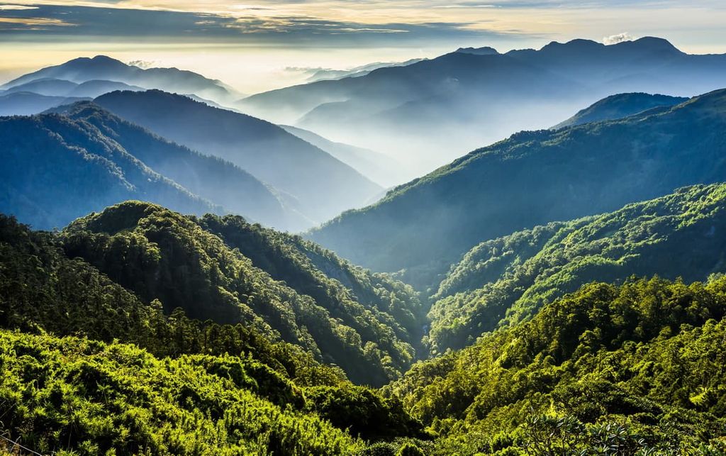
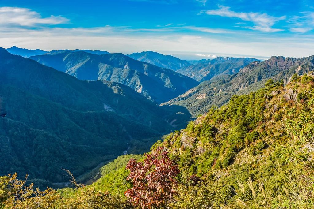
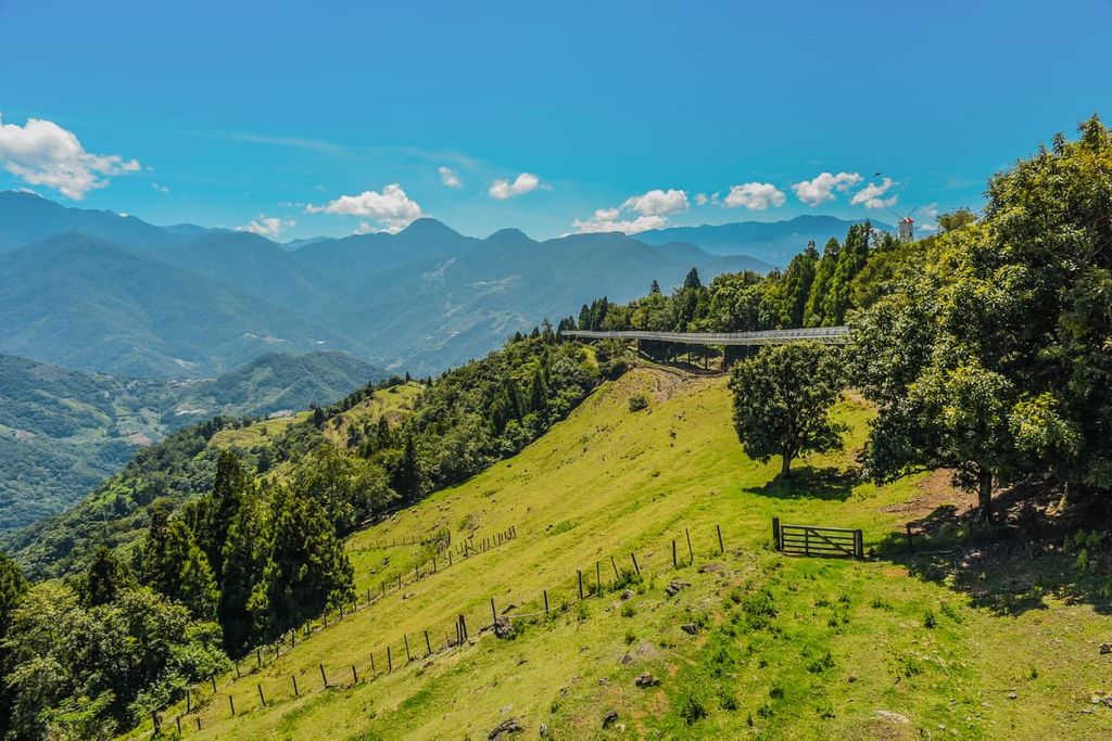
The Central Mountain Range (中央山脈) is the primary feature of the Danda Major Wildlife Habitat, as gigantic mountains with sheer cliffs, narrow ridges, and rocky terrain dominate the landscape in this region. The towering range boasts 19 of Taiwan’s top 100 mountains (also referred to as Baiyue) within the reserve’s border.
Dongjudashan, Zhuoshe Dashan, and Nenggao Shan Nanfeng (能高山南峰) are all some of the tallest peaks in Taiwan. Some other mountains of Danda Major Wildlife Reserve that are included in Taiwan’s top 100 peaks are:
The elevation of Danda Major Wildlife Habitat varies significantly from 521 metres to 3,619 metres (1,709 ft to 11,873 ft), resulting in three distinct climates ranging from subtropical and warm-temperate to cold-temperate. While the peaks in the reserve form steep ridgelines that extend from north to south, the river terrain is relatively flat.
Notable areas of interest surrounding Danda Major Wildlife Habitat are Fuyuan National Forest Recreation Area (富源國家森林遊樂區) to the east and Taiwan’s highest mountain, Yushan (玉山), in the south. Huisan Forest Area (惠蓀林場) is also located to the west, and the midway mark of the Central Mountain Range, Zhongyang Jianshan (中央尖山), lies to the north.
The formation of Taiwan occurred as a result of widespread tectonic activity when the Eurasian and Philippine Sea tectonic plates collided.
The resulting upward pressure from these colliding plates uplifted what are now the sharp peaks of the Central Mountain Range. The topography of the Central Mountain Range extends from east to west, with the east bearing the lofty mountains that stretch along the backbone of Taiwan.
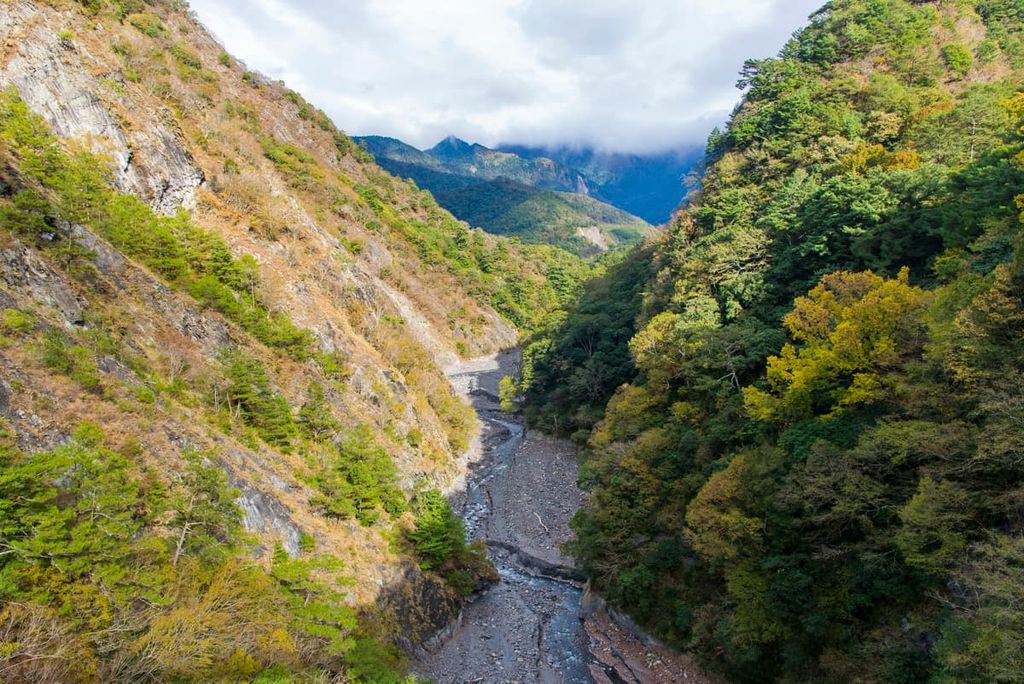
Danda Major Wildlife Habitat mountains comprise hard clay-slate and dark sandstone from the Eocene to the Oligocene. The sheer cliffs in the reserve are mainly composed of shales and an assortment of poorly compacted soils. The fertility of soil varies from different locations. Forests thrive in the wet valley where more fertile soil supports the growth of plant life.
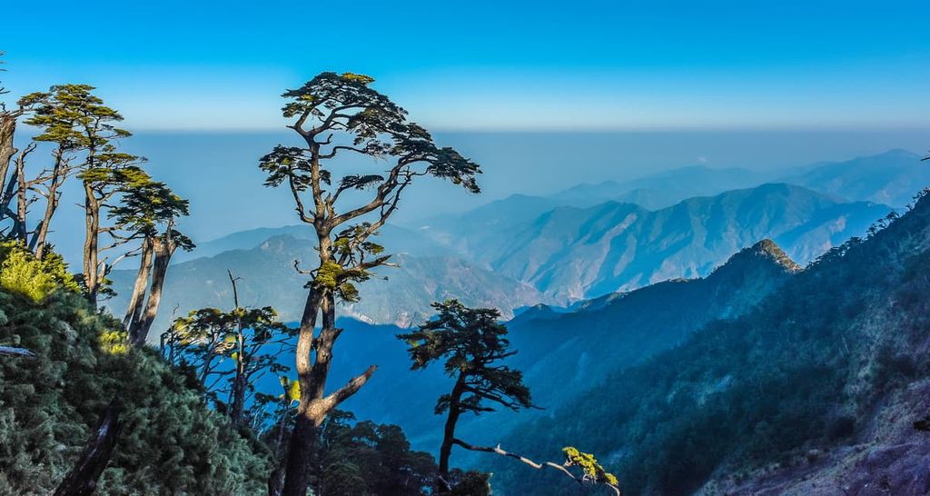
Lush forests adorn the gigantic mountains of Danda Major Wildlife Habitat. However, there are actually four different ecosystems within the reserve, including tropical, warm, temperate, and alpine zones.
Below 1,800 metres (5,905 ft), a broadleaf forest covers the lower region of the landscape with camphor trees, phoebe trees and oaks dominating the region. Next, at 1,800 to 2,400 metres (5,905 to 7,874 ft), there is a mixed broadleaf and coniferous forest of Taiwan cypress, Taiwan red cypress, Taiwan cedar, Taiwan hemlock, and Taiwan white pine.
Finally, from 2,400 metres (7,874 ft) and above, a coniferous forest of Taiwan hemlock, Taiwan fir, Taiwan spruce and Yushan juniper spread throughout the high elevation belt.
A wide selection of 831 species of vascular plants is found in the vegetation of Danda Major Wildlife Habitat. Out of these, 167 kinds of vascular plants are native species, such as winged stem prosthesis vein fern (Crepidomanes latealatum) and scale buds in white (Diplopterygium laevissimum).
In terms of wildlife, Danda Major Wildlife Habitat is home to 36 species of mammals. This includes the Taiwan black bear, Taiwan clouded leopard, civet cat, and pangolin.
Additionally, 87 species of birds have been recorded in the vicinity of Danda Major Wildlife Habitat. A total of 39 types are protected such as the blue-bellied pheasant, Taiwan blue magpie, bamboo bird, red-headed tit, and Formosan whistling thrush.
Other protected species of Danda Major Wildlife Habitat include the reptilian Taiwan red snake and Kikuchi’s tortoiseshell flower.
Danda Major Wildlife Habitat is on the traditional hunting grounds of the Truku and Seediq tribes of Wushe Village in what is now Nantou County. These tribes have long co-existed peacefully in the mountains, forging their own paths along the current Nenggao Yueling Guard Road, through high elevations to catch food and attend social gatherings.
During the Japanese Occupation Era, due to the Japanese’s desire for complete control of the camphor and cypress forests of Taiwan, armed Japanese troops ambushed and attacked the Truku and Seediq people in their communities.
A three-month battle with 20,000 armed Japanese fighters against 2,300 Truku and Seediq people ensued. With limited weapons and being severely outnumbered, the Truku and Seediq people surrendered. This bloodshed is now known as the Battle of Taroko.
The Japanese then forcibly removed the Truku and Seediq people from their homes in the mountains to an area known as Nenggoa Yueling Guard Road. This stretch is the longest surveillance road in Taiwan, spanning 26.5 km (16 mi) from Wushe Village (霧社村) of Nantou County to Tongmen Village (銅門村) of Hualien County, intersecting the Central Mountain Range between Nenggao Shan and Qilai Shan (奇萊山). It now forms part of a hiking trail where hikers can witness this guard road's abandoned surveillance posts and other remaining ruins.
Danda Major Wildlife Habitat is a popular place to hike and adventure in central Taiwan. Popular hiking trails include:
The broad base of Dongjudashan forms a heavy mound with a primarily flat pinnacle featuring a single-pointed peak extending from the gently curved surface. This greatly resembles the shape of a crown.
The summit of Dongjudashan is covered with an alpine grassland of shallow Pseudosasa japonica bamboo. Hikers flock to this mountain for its sweeping views of the Yushan peaks in the south and the ridge from Nenngoa Shan to Andong Junshan in the north.
The trail starts on Dong Forest Road, ascending the peaks of Wangya Shan (望崖山), Tiannankelan Shan (天南可蘭山), Kelekele Anshan (可樂可樂安山), Jundong Shan (郡東山), and finally, Dongjudashan. Hikers traverse a ridge of 3,000 metres (9,842 ft) in elevation that connects the peaks. As the trail turns towards Dongjudashan, hikers will pass a large meadow as they amble through the alpine.
The first mountain of Wangya Shan is a gentle, mostly flat field of short Pseudosasa japonica bamboo. Here, one can easily forget that they have scaled a mountain as the summit plain is devoid of any markings. However, this is the prime spot to see the cliffs of Dongjudashan descending into the Majiaying Valley.
Moving northward, hikers head to Tiannankelan Shan, following the moderate mountain road to the tufted peak of Tiannankelan Shan, which is both comprehensive and flat.
Kekele Anshan is situated northwest of Tiannankelan Shan, and the terrain changes from expansive grasslands to narrow paths of brittle and disintegrated shale. There is a 500-metre (164 ft) drop that hikers scale to reach the summit; however, the grass-covered peak displays the finest views of the showpiece crown-shaped mountain of Dongjudashan.
The terrain of Judongshan is similar to Kekele Anshan, as hikers encounter undulating rocky terrain as they ascend the penultimate peak of this trek. Clusters of Taiwan fir woods dapple the scenery as the elevation increases. A narrow ridgeline, with a sheer cliff down one side and a verdant forest down the other side, leads to the summit.
As hikers head to Dongjudashan, an accumulation of rugged rock pinnacles speckles the mountain's east side, where a sheer 800-metre (2,624 ft) cliff brazenly stands, eroded by the Majiaying River. A wide-open grassland then leads to the summit, where a 360 degree view of the Yushan peaks is visible in the south with the Baiyue of the North Third Section Hiking Trail in the north.
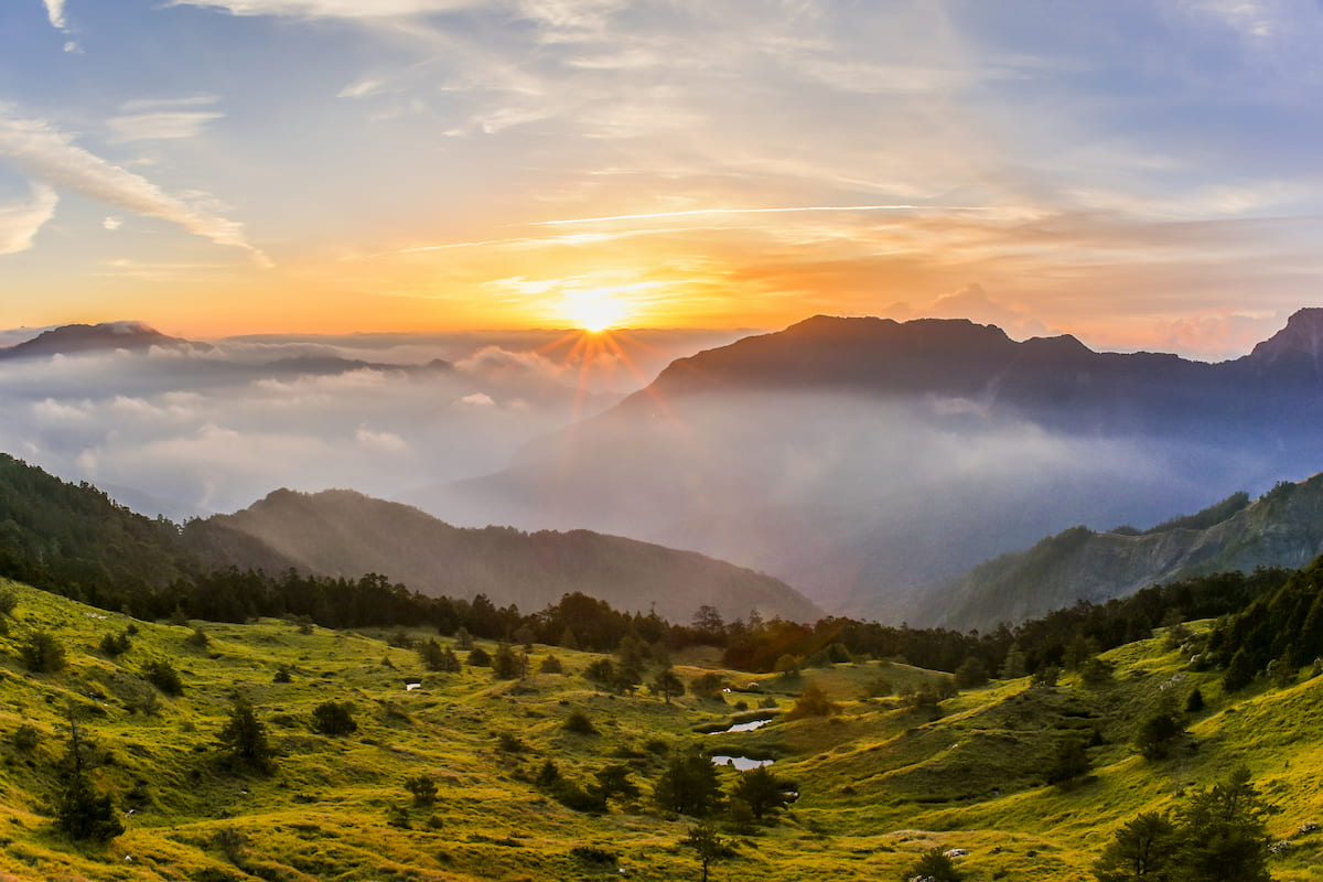
Five Baiyue lie in a north-south formation in the reserve, granting pristine views of alpine lakes, grassy meadows, and the surrounding mountains. Thus, the North Third Section Hiking Trail is considered the most beautiful section of the Central Mountain Range.
The loop trail takes six days; however, hikers only need five days if they do not plan to return to their initial trailhead. Hikers first ascend Nenggao Shan where they will find a trail of high and unruly Pseudosasa japonica bamboo. Loose stones are hidden beneath the bamboo, too, which further complicates the complexity of the track, as hikers can slip and fall if they are not careful.
As hikers progress to Nenggao Shan Nanfeng, the highest mountain of the trek, the challenging trail continues to test their endurance. Hikers need to climb their way up steep slopes to reach the summit of Nenggao Shan Nanfeng.
While the climb is challenging, the scenery is flawless. From the summit, Nenggoa Shan proudly displays its unruly cloak of Pseudosasa japonica bamboo. Taiwan sambar populates this area due to the frequency of alpine lakes and prairies.
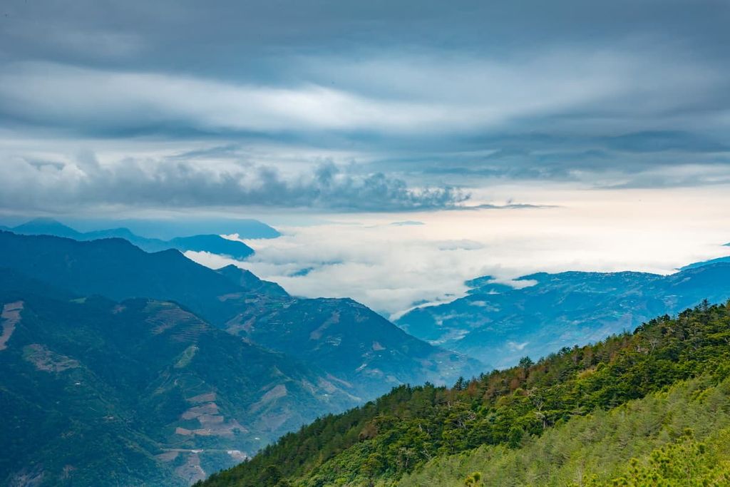
Heading further onward, hikers progress to the third Baiyue, Guangtou Shan, where a sea of clouds awaits them, showing only the jagged mountain cliffs penetrating through the soft fluffy clouds. Once again, the terrain is littered with a heavy barrage of Pseudosasa japonica bamboo.
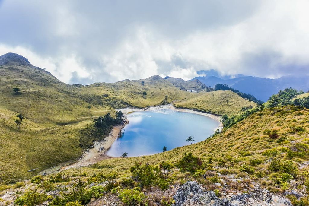
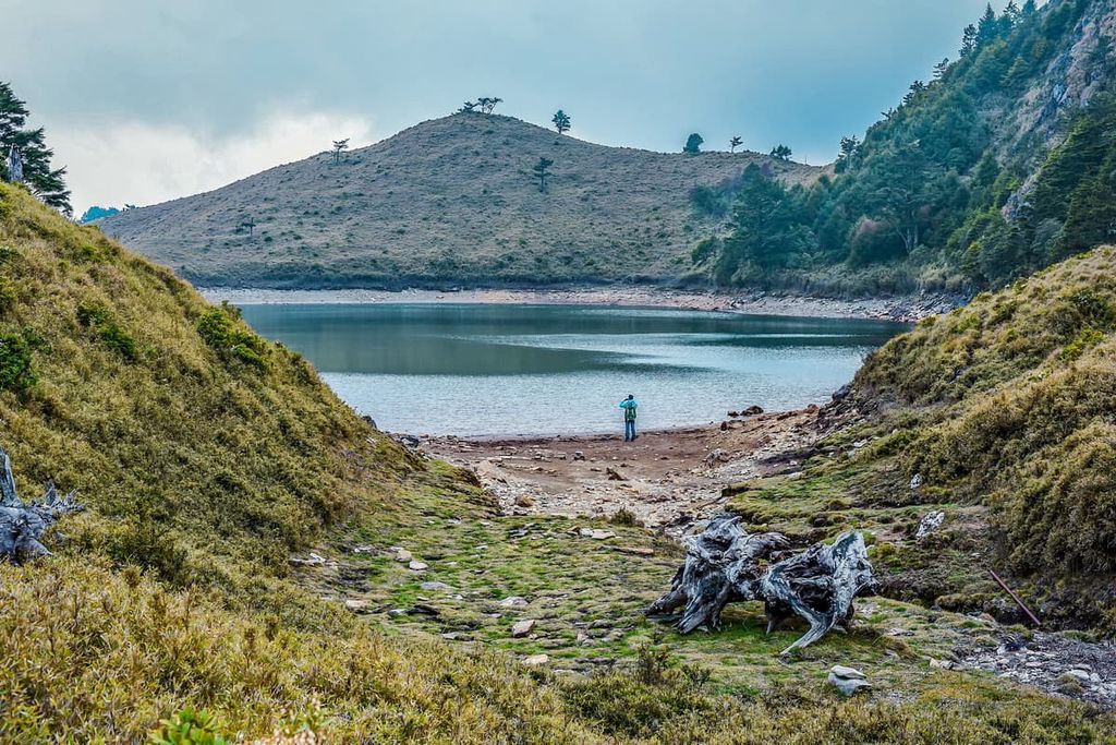
The journey from Guangtou Shan is where hikers are rewarded with the stunning presence of alpine lakes. Baishi Lake (白石池) rests at an elevation of 2,770 metres (9,088 ft) and 0.6 ha (1.5 acres) in area. Taiwan sambar deer frequent this alpine waterhole, and the sight of the deer grazing by this still blue alpine lake adds to the scenic view of the flat and raw, open wild.
The mountain trail to Baishi Shan leads through grasslands, and the path gently lifts to reach the summit. Along the way, the vegetation transforms from luscious emerald to dusty scarlet due to the red soil fertilising the plant life. Moving further ahead, hikers will explore the two alpine lakes of Wanlichi and Tunluchi. As hikers descend Baishi Shan, the sparkling blue lake of Wanlichi is unveiled, looking like a cerulean oasis nestled in front of wavy ridges.
The high mountain lake of Wanlichi (萬里池) is 2,790 metres (9,153 ft) above sea level and covers 2.8 ha (6.9 acres of land). The vast lake mirrors the illuminating sky, creating a spotlight on the remote mountain slope.
Tunluchi (屯鹿池) lies further afield at 2,850 metres (9,350 ft) and occupies a smaller area than Wanlichi at 1 ha (2.5 acres). Like Baishi Lake, sambar deer roam in the vicinity of the lake with meadows of mountain grass bordering its edge. The afternoon clouds are reflected in the still waters, adding depth to the dramatic blue and verdant green scenery display on the water's surface.
Hikers then head to the final peak of Andong Junshan. Like Baishi Shan, the mountain road leads hikers to the summit without encountering steep sections, impossibly thick Pseudosasa japonica bamboo, and slippery, muddy paths. Dongjudashan and Danda Shan can be seen in the distance, too.
The Baiyue, Liushun Shan (六順山) is situated on the east side in the deepest section of the Central Mountain Range. Colourful Lake lies 3 km (1.8 mi) north of Liushun Shan and was named after the iridescent glow of sunrise that reflected on the water. Interestingly, Colourful Lake is the second largest alpine lake in Taiwan, after Cuifeng Lake (翠峰湖) of Taipingshan National Forest Recreation Area (太平山國家森林遊樂區). It measures 2 ha (4.9 acres) in area and it has a maximum depth of 10 metres (33 ft).
As Liushun Shan and Colourful Lake lie in a remote location, the journey to the region takes five days, covering a total distance of 53 km (33 mi). Hikers begin the journey from Sun Haiqiao off Dadalin Road, which was built in 1958 by a logger to fell and transport timber from the mountains.
Due to the inaccessibility of the journey to Liushun Shan and Colourful Lake, the ecology is pristine and untouched. The mountain path is sprinkled with alpine roses and pockets of Taiwan white pine and Taiwan fir. A blanket of snow descends on the mountain in winter, creating a winter wonderland as Taiwan fir are draped in an opulent cloak of thick snow. Sika deer create a heavy presence around Colourful Lake as they graze on the high mountain grassland and drink from the alpine lake.
Hikers revel in the scenic beauty of the path to Liushun Shan and Colourful Lake. However, note that the journey to the mountain is a maze of hardy Pseudosasa japonica bamboo that wears down the feet after trudging through the impenetrable grass for five days.
This ancient mountain road traverses the ridge between Qilai Shan and Nenggao Shan over the course of 26.5 km (16 mi). Hikers can start this two-day trek in Ren’ai Township of Nantou County or Tongmen Village of Hualien County; however, this course is usually crossed from west to east. In addition, hikers can either attack the entire trail or hike half of the track, divided into eastern and western sections.
Ranging between an elevation of 1,860 to 2,860 metres (6,102 to 9,383 ft), the highlight of the Neggoa Yueling Road is the varied landscape of subtropical grasslands and old-growth forests. Hikers are constantly surrounded by the grand mountain scenery of the Central Mountain Range and the stunning Nenggao Falls.
Starting from Ren’ai Township, hikers ascend Tunyuan Mountain Pass to reach Tianchi Villa. The path up the mountain is pleasant, and the climb is comfortable; however, the uphill journey is lengthy at 13 km (8 mi).
A pine needle forest shields hikers from the penetrating rays of the Taiwan sun as most of the trail is sheltered. A suspension bridge stretches across the Tularwan River, connecting to Nenngao Falls, a vibrant three-tiered 150-metre (492 ft) cascade in the forest. The mist from the waterfall hangs in the air like a veil.
The following day, hikers head east, passing a dense Taiwan hinoki forest to reach Qilai Mountain Pass. As hikers progress westwards, the elevation increases, and the forest scenery changes from Taiwan white pine to Taiwan cypress, Taiwan hemlock, Taiwan fir, to fields of alpine Pseudosasa japonica bamboo. Towering Taiwan hemlock as high as 50 metres (164 ft) decorate the forest as the mountains of Nenggao Shan and Nenggao Shan Nanfeng are visible in the distance. In addition to this, dilapidated structures of old Japanese guard posts line the extensive trail.
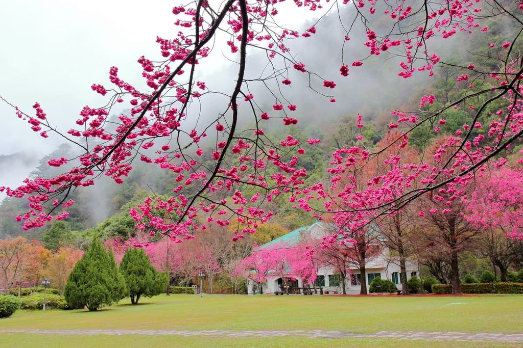
The most elevated hot spring in Taiwan at 1,091 metres (3,579 ft), Lushan Hot Spring is also one of Taiwan’s largest thermal springs. Once known as Cherry Hot Springs during the Japanese Occupation Era, Lushan Hot Spring is bordered by romantic soft pink cherry blossom trees that bloom in the early spring months.
The clear bicarbonate water temperature ranges between 75 to 90°F (23 to 32°C). Visitors enjoy the remote location of the hot spring, as the quietness adds to the tranquil setting, while fresh mountain air rolls in keeping the temperature cool.
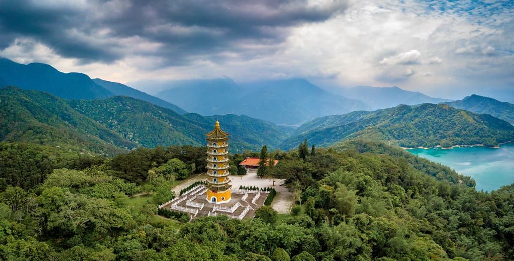
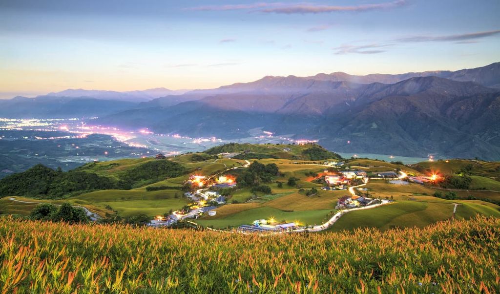
Hualien City (花蓮市) is the closest city in the north of the expansive area occupied by Danda Major Wildlife Habitat. Meanwhile, Sun Moon Lake (日月潭) is situated nearby the central region of the reserve, which is a top-rated scenic travel destination in Taiwan.
Portuguese sailors first arrived along the eastern coast of Taiwan, near what is now Hualien, in 1590. They were so astounded by the natural beauty of Taiwan that they named it ‘Ihla Formosa’, meaning the beautiful island. Hualien boasts an abundance of gorgeous natural settings, from the nearby marble cliffs of Taroko National Park to elegant gardens, lush forests, coastal rocks, and endless fields of tea plantations.
Once a Japanese Naval command centre, Pine Garden is situated on the highest point of Hualien. Visitors can admire the views of Hualien City, where the sandy shores meet the Pacific Ocean. A well-preserved two-storey structure built in 1942 that once hosted sending-off parties for kamikaze pilots has been transformed into an art gallery. Clusters of pinewoods decorate this well-manicured garden, adding a serene touch of beauty to the haunted history of the building.
Set in the rural rice fields of Hualien City, Liancheng Lotus Flower Garden is the largest rose growing farm in eastern Taiwan, with a cultivation area of over 1 ha (2.4 acres). In addition to growing roses, the conditions nurture the growth of lotus. A wooden deck flanks the edge of the lotus pond, where visitors can sip lotus tea while admiring the lily pads and the fragranced aquatic flower field before them.
Wuhe Tea Plantation is situated in Ruisui Township of Hualien County and has been in operation for more than 50 years. The farm is known for growing organic tea without the use of pesticides. Honey Black Tea is the best-selling tea from this tea plantation and won a gold award at the First World Tea Award in 2006. Set against the dramatic backdrop of the Central Mountain Range, the vast fields of neatly planted rows of tea plants creates a peaceful atmosphere.
Shitiping lines the coast with a 1 km (0.6 mi) stretch of eroded white and grey volcanic rock of various formations. What makes this unique place even more interesting is its biodiverse marine ecosystem. Here, topical fish swim in the clear tidal waters of the Pacific Ocean, and visitors can partake in various activities, such as scuba diving and dolphin watching.
Danongdafu Forest Park covers a vast space of 1,250 ha (3,088 ac) and is the prime spot to view endless pastures of flowers in spring. On summer nights, the sparkling glow of fireflies illuminates the night sky. In autumn, a crimson wash of amber maple trees embellishes the landscape. Danongdafu Forest Park is also host to the hugely popular Hualien Hot Air Balloon Festival.
One of Taiwan’s top tourist destinations, Sun Moon Lake, is situated in Yuchi Township of Nantou County, flanking the foothills of the Central Mountain Range. Idyllic and serene, this 793 ha (1,959 ac) deep aquamarine lake evokes a zen ambience as the quiet valley is enriched with cascading strips of Chinese red lanterns extending towards the lake’s edge.
The surrounding peaks are emulated in the still and calm surface of the water, while the ornately decorated temples delightfully contrast the cerulean lake and shaded blue mountains. A 33 km (20 mi) walkway surrounds the lake, where visitors can walk or cycle while appreciating the picturesque views on display.

A cable car transports visitors from Sun Moon Lake to the Formosan Aboriginal Culture Village (九族文化村) set in the mountains. On the journey, visitors can admire the view of the lake as they ascend to lofty heights, appreciating the rampant forest below as they make their way up the mountain.
Once at the Formosan Aboriginal Culture Village, visitors can learn about the traditions and lifestyles of Taiwan’s Indigenous peoples. In addition, the Formosan Aboriginal Culture Village features three theme parks that offer rides, adding to the entertainment and excitement of this educational mountain village.
Renting a car or scooter is the best option to access the remote beauty of Danda Major Wildlife Habitat. As the reserve is spread over an expansive stretch of land, the closest cities to reach the wildlife habitat are Hualien City, Taichung City, and Chiayi City.
Hualien City is the closest city from which to access the northern mountains of Danda Major Wildlife Habitat. Meanwhile, Taichung City is an ideal place to stay if you’re looking to go to the central part of the reserve. Additionally, Chiayi City is a better basecamp for visitors to the southern peaks of the wildlife habitat.
To access Taichung City and Chiayi City, visitors can board the Taiwan High-Speed Rail (HSR) or local express train (TRA) from Taipei, Taoyuan, Hsinchu, Miaoli, Tainan and Kaohsiung. To reach Hualien, visitors should start their journey at Taipei Main Station and board the local express train (TRA) to Hualien.
Once at either of these cities, visitors can make their way to the Danda Major Wildlife Habitat. From Hualien City to the northern gateway of Danda Major Wildlife Habitat is a 111 km (69 mi) journey. To access the remote centre of the reserve is a 116 km drive from Taichung City (72 mi), while from Chiayi to the southern gateway to Danda Major Wildlife Habitat, it is a 118 km (73 mi) road trip.


The highest peak in Danda Major Wildlife Habitat is Dongjunda Shan, at 3,619 m.
Notable peaks in Danda Major Wildlife Habitat include Dongjunda Shan, Qilai Shan, Wudapeishan, Kelekeleanshan and Jundongshan.


