Scan the QR code and open PeakVisor on your phone
Taroko National Park (太魯閣國家公園) is Taiwan’s precious gem. It boasts a beautiful array of marbleised canyons, deep rocky gorges, and clear turquoise rivers that wind through narrow cliff faces. Taroko National Park has a total of 143 named mountains, the highest of which is Nanhudashun (南湖大山) at 3,742 metres (12,277 ft) in elevation.
Taroko National Park is located in the east of Taiwan, in the Xuilin Township of Hualien County. It is situated within parts of three counties: Hualien County (花蓮縣), Taichung County (台中縣), and Nantou County (南投縣).
To the east of the park lies the shores of the Pacific Ocean, while Shei-Pa National Park (雪霸國家公園) is a stone throw away to the west. Taipingshan National Forest Recreation (太平山國家森林遊樂區) is located to the north of the park while Aowanda National Forest Recreation Area (奧萬大國家森林遊樂區) is situated to the south.
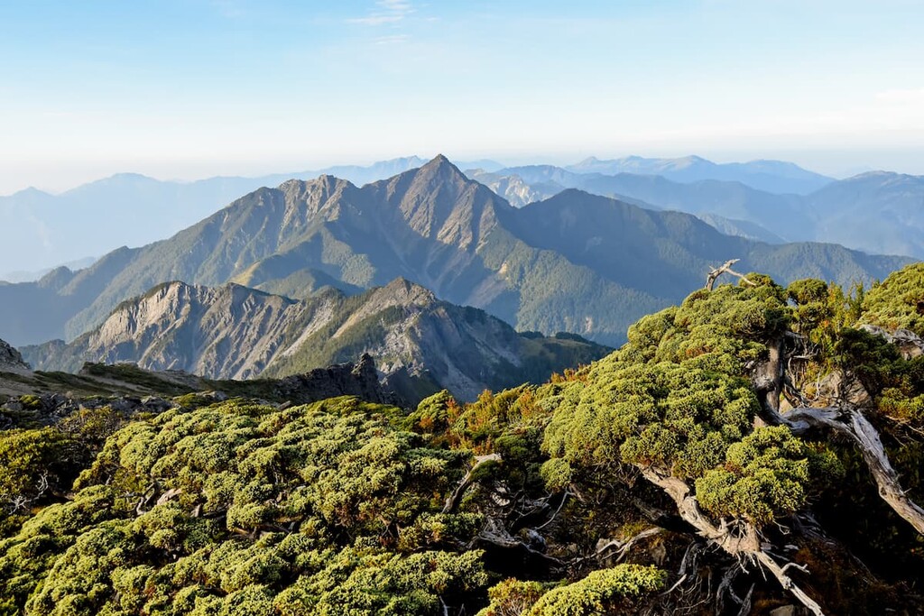
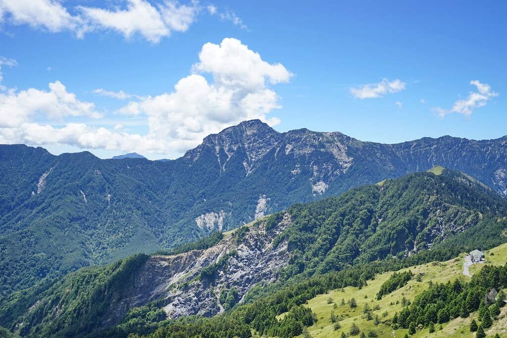
Taroko National Park covers a total area of 92,000 hectares (227,300 acres) and holds 27 Baiyue, which are Taiwan’s Top 100 Peaks. The most significant of these peaks are Nanhudashun, Hehuanshan (合歡山合歡山), and Qilaishan (奇萊山).
Nanhudashan sits imposingly in the north-western area of Taroko National Park along the northern ridge of the Central Mountain Range (中央山脈). It is one of the Baiyue top 5 in terms of overall elevation, sitting just behind Yushan (玉山) at a whopping 3,952 metres (12,966 ft), Xueshan (雪山) at a solid 3,886 metres (12,749 ft), the steep 3,092-metre (10,144 ft) Beidawushan (北大武山), and Baigu Dashan (白姑大山) taking the 5th spot at 3,342 metres (10,965 ft).
Nanhudashan also forms part of the Ecological Protection Area that was created to preserve the threatened ecosystem of the park, including endangered plant species such as the Nanhu epilobium and Qilai cypripedium. Thus, hikers need to apply for a park access permit to enter the park, and a mountain access permit to climb Nanhudashan.
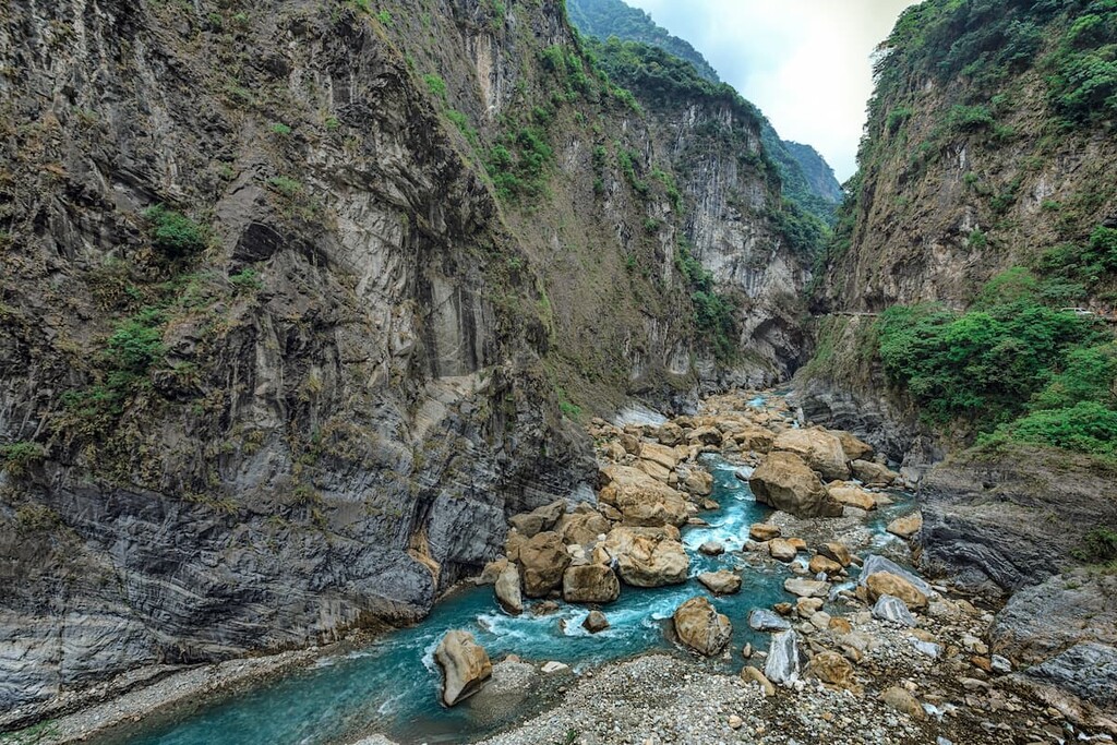
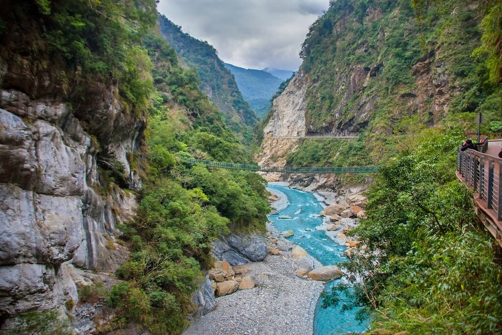
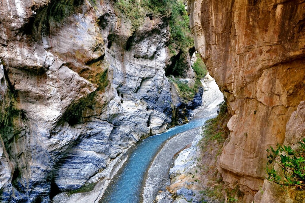
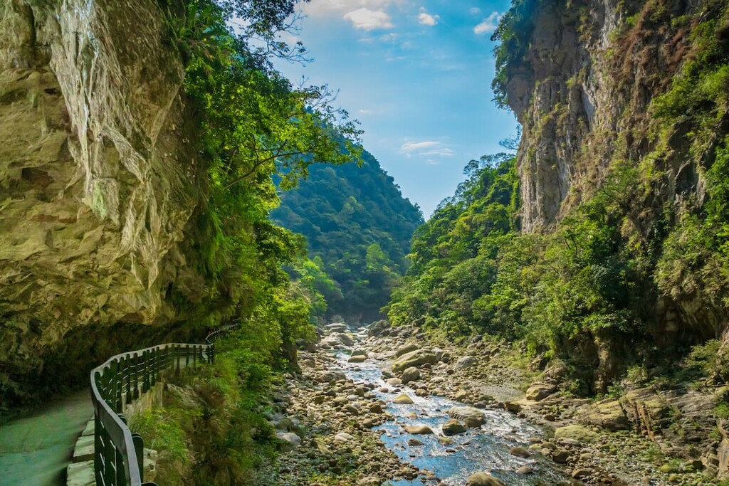
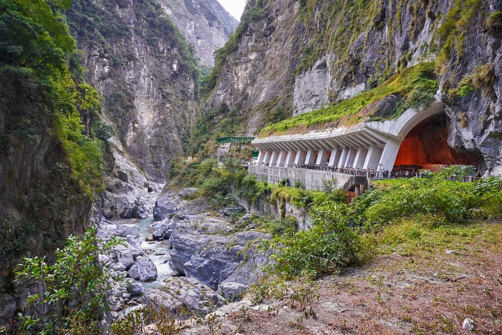
The ever-popular and picturesque 18 km (11 mi) long Taroko Gorge (太魯閣峽谷) is a draw for many tourists that visit Taroko National Park. Within the gorge, there are aquamarine river waters that gently sashay against the solid, great marble walls while the nearby soaring green mountains watch over this display. This stunning gorge can be viewed from the Central Cross-Island Highway, giving hikers a small taste of their delightful journey ahead.
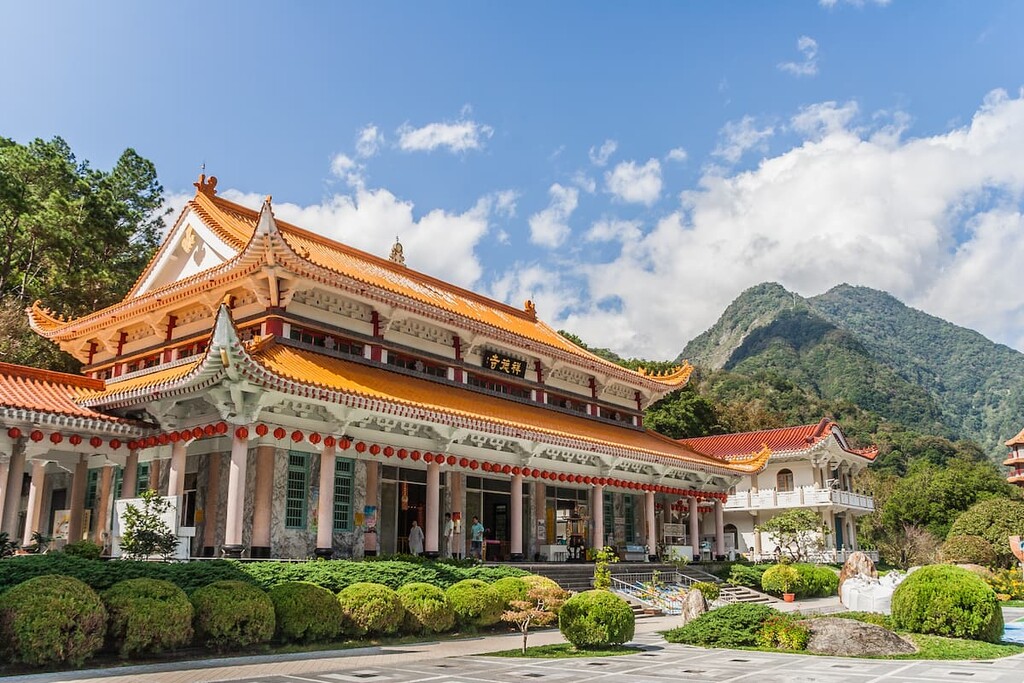
Taroko National Park also offers spectacular displays of marble caves, cascading waterfalls, and a diverse selection of plant and animal life. It also has a wonderful variety of peaceful, short trails as well as some more adventurous, extreme mountain climbs. Furthermore, the land in and around the park boasts a rich cultural history that dates back countless generations.
The geology of Taroko National Park is linked to the formation of the island of Taiwan. The shifting tectonic plates that were responsible for the formation of Taiwan, also created the steep mountains of the Central Mountain Range. These plates sift continuously and, thus, the mountains continue to rise a few millimetres every year.
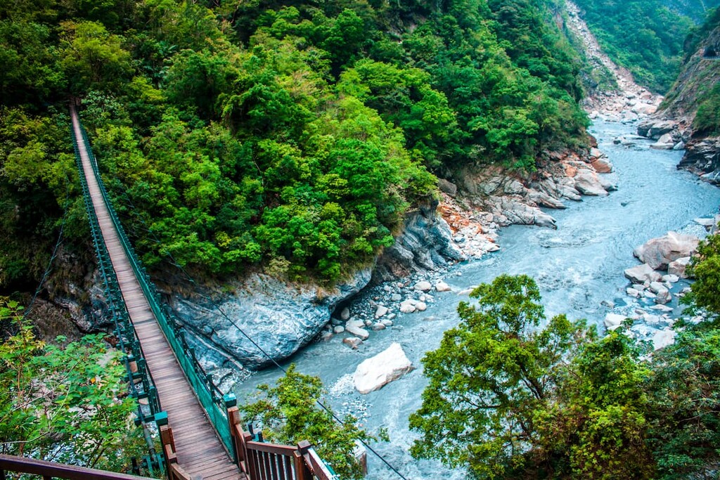
The marble walls lining the gorges and valleys in Taroko National Park were formed after millions of years of build up from erosion and increasing upliftment.
This process of marbleisation involved a few steps: First, the calcareous residue in the ocean kept accumulating and over time transformed into limestone. This limestone was subsequently buried by other materials over the course of millennia. Extreme pressure and subterranean heat eventually caused the limestone to metamorphose into marble.
Then, as the region’s tectonic plates collided, this collision forced the rock strata upward to form mountains. Meanwhile, marble strata were also uplifted from the sea. Over the years, erosion from monsoons and streams has worn away the usually solid marbleised rock, shaping the landscape of Taroko Gorge into what we see today with its sharp, narrow canyons and vertical drop valleys.
Taroko National Park resembles a mini ecosystem of the whole island as it embodies all types of vegetation found in Taiwan.
Alpine juniper forest, dwarf bamboo formation, fir, hemlock, spruce, pine, Taroko oak, and Chinese photinia all bloom within the park. A selection of more than 2,093 species of native vascular plants found in Taiwan exist within the boundaries of Taroko National Park, of which some 132 species are categorised as either rare or endangered.

Many of the high peaks boast a selection of flowers. The Nakotaizan epilobium, Hypericum nagaswia, Rhododendron noriakianum, and the Leontopodium microphyllum populate the mountain tops.
Taroko National Park is home to many species of large mammals, birds, butterflies, fish and amphibians, and reptiles. In particular, there are 46 species of mammals, namely the Formosan black bear, Formosan rock macaque, Formosan serow, Formosan wild boar, and the Formosan sambar deer.
The park is also home to 152 species of birds, of which 14 are endemic to Taiwan, such as Swinhoe’s pheasant, Formosan blue magpie, and the fire-breasted flowerpecker. A staggering 302 species of butterflies also inhabit the park, while 21 species of freshwater fish populate the streams and rivers, sharing their home with 15 species of amphibians. Finally, 35 species of reptiles also occupy the areas of the park.
In the lower elevation areas of Taroko National Park is where butterflies can be found, especially in the Shakadang area and near to Lianhua Pond and Taosai River Valley.
Meanwhile, bird species are best located at low to medium altitudes of Taroko National Park, in between the mixed and broad-leaved forest trees. In the lower forested areas is where the Formosan black bear and other large mammals are found traversing around the park land.
Finally, the upper forest area at higher altitudes is home to fritters such as flying squirrels and the Formosan rock macaque, the latter of which can often be seen climbing cliffs to towering heights.
Taroko National Park was first established under Japanese rule in 1937 as Tsugitaka-Taroko National Park but was abolished in 1945 after Japan’s defeat in World War 2 and the commencement of Chinese rule. Taroko National Park was reinstated as a national park on 28 November 1986.
There is evidence of activity in the area of Taroko National Park dating back thousands of years. The most famous prehistoric spot is Taroko Site, which parades a formation of 85 vertically mounted stones.
The lateral stone coffin is reminiscent of Shi San Hang culture from northern Taiwan which dates back about 2,000 to 3,000 years. Other examples of cultural artefacts are pieces of pottery, stone axes, stone spinning wheels and iron found in areas of Buluowan, Xidagan, Batagan, Bulexengan, Tura-Sag, and Xibao.
The Truku people are one of sixteen tribes that are Indigenous to Taiwan. The Truku are descendants of the Atayal who have traditional territory in the adjacent mountains of Shei-Pa National Park. Between 1680 and 1740, the Truku people migrated eastwards towards what is now Taroko National Park upon finding vast lands of wilderness beyond the Central Mountain Range.
The Truku people then settled in the valley of the Liwu River where there were traditionally a number of Truku villages. The Truku people are renowned for their impeccable weaving skills and wooden crafting, and farming millet, corn, sweet potato and hill rice.
Known for its extensive trail length of 22.9 km (14 mi) one way, longer than the trek to summit Yushan or Xueshan, the journey to Mount Nanhu takes 4 days to complete. Along this trail, hikers at least will climb the four Baiyue summits of Shenmazhenshan (審馬陣山), Nanhudashan North Peak, Nanhudashan Main Peak, and Nanhudashan East Peak.
Hikers start their journey from the Nanhu Trail Head. Siyuan Yakou is the closest bus stop to the Nanhu Trail Head, which is serviced by Koukong Bus 1751 (Yilan to Lishan) and 1764 (Luodong to Lishan). From here, they will enter an evergreen forest through which they steadily trek uphill for a firm four hours as they pass by the 2,795-metre (9,170 ft) Duojiatunshan, which parades views of the Lanyang River Valley, and find their way to New Yunleng Cabin, the overnight accommodation.
The next morning, hikers will set off on a gruelling 9 hour journey to Nanhu Cottage. The first 4 hours are spent clambering uphill towards Shenmazhenshan (審馬陣山). Standing at 3,141 metres (10,305 ft), Shenmazhenshan is the first of four Baiyue featured along this trail.
A further one hour trek leads to Shenmazhen Hut where hikers usually stop for refreshments before they continue to clamber through meadowy woodlands on a four hour journey until they reach the second Baiyue, and incredibly high Nanhudashan North Peak at 3,592 metres (11,601 ft).
Hikers can spot the legendary Holy Ridge connecting Xueshan and Dabajianshan in the nearby Shei-Pa National Park on the summit of Nanhudashan North Peak. Nanhu Cottage, the overnight rest stop, will be reached after a 30-minute descent with rope assists down a gravel hill.
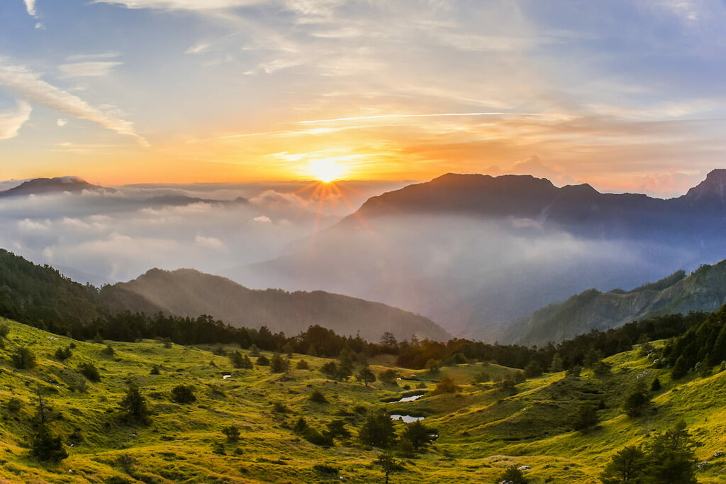
On the third day of the Mount Nanhu Trail, hikers will want to rise early to witness the golden sunrise over Nanhudashan Main Peak. A further 2 hour trek leads to Nanhudashan East Peak, from which hikers will descend the mountain to return to Nanhu Cottage, and then retracing their journey for 6 hours back to New Yunleng Cabin, where they will rest overnight.
The following morning, hikers will move back down the trail for four hours back to the Nanhu Trailhead.
Qilaishan is sometimes referred to as ‘Black Qilai’ denoting the many accidents that have occurred along this treacherous trail. Not only does it have a solemn reverence, but the local Truku people feared the mountain due to its clouded and hidden western face that can only be viewed from Hehuanshan.
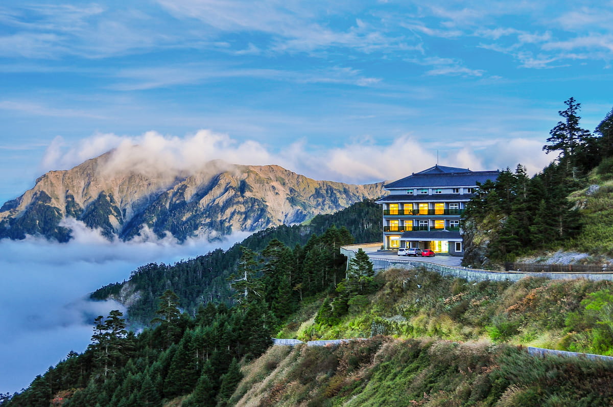
This 3 day round trip trail of 18 km (11 mi) is a favourite among adventurous hikers that venture into the mountains of Taroko National Park. Beginning at trailhead placed near to an old ski lodge, Song Xue Lou Lodge in the Hehuan Mountain Region, hikers set off to their chosen location for an overnight rest.
Hikers can either stay at Chenggong Cabin 1, Chenggong Cabin 2, or camp at the grounds of Qilai Cabin if all the beds in the small cabin have been booked. There is also an option to stay at Black Water Shack, however this refuge is situated both very close to the trailhead and a bit far from the mountains, so many people opt not to stay there.
Upon passing the trailhead and beginning the early ascent to one’s overnight accommodation, the trail begins to rise through bamboo grass and forested areas. The trail is clearly signposted so chances of getting lost and wandering astray are low. It is advisable to begin hiking on the trail early in the morning as thick fog often starts to roll in from the afternoon, which is not a favourable condition for a journey up the steep mountain.
After a three hour trek from the trail head, Chenggong Mountain Hut is within reach. To stay here and at the nearby Chenggong Cabin 2, you need to organise a permit beforehand. You will find that the Chenggong Cabin 2 and another cabin which situates 45 minute upstream journey upon, the Chenggong Cabin 1, which resemble yurt huts among the tall bamboo grass, are both known as ‘The Haunted One’. Legends were told that pictures in memory of the students disappearing in the area more than 50 years ago were hung up in these yurt huts, and the huts have never been empty of haunted stories ever since.
If ghostly encounters atop a mountainside is not your ideal overnight rest stop, then the option of camping at Qilai Cabin is another two hour journey ahead, traipsing across treacherous terrain involving scaling boulders, shale, and rope assists. At 3,100 metres (10,170 ft) straddled next to a ridge, sits the campsite of Qilai Cabin, offering sweeping vistas and a flat grassy area to pitch one’s overnight camping tent.
Rising early the following morning, hikers have a long day ahead of them if they want to reach both Qilaishan Main Peak and Qilaishan North Peak. The walk to Qilaishan Main Peak is a two hour trek along a moderately easy trail most of the way, however the final ascent to the summit involves scaling up ropes on the steep terrain to reach Qilaishan Main Peak. Hikers will trudge back to the camping area for two hours from which they will need to trek 1.7 km (1 mi) to Qilaishan North Peak.
Ascending Qilaishan North Peak is compared with climbing up a pointed rock, as the incline is very steep and the terrain rugged. After summiting the mountain, hikers will reroute to Qilai Cabin camping grounds where they will either camp to spend the night or head towards Chenggong Cabin 1 or Chenggong Cabin 2, from where they will descend the mountain the following morning and head back to the trail head near Song Xue Lou, the old ski lodge.
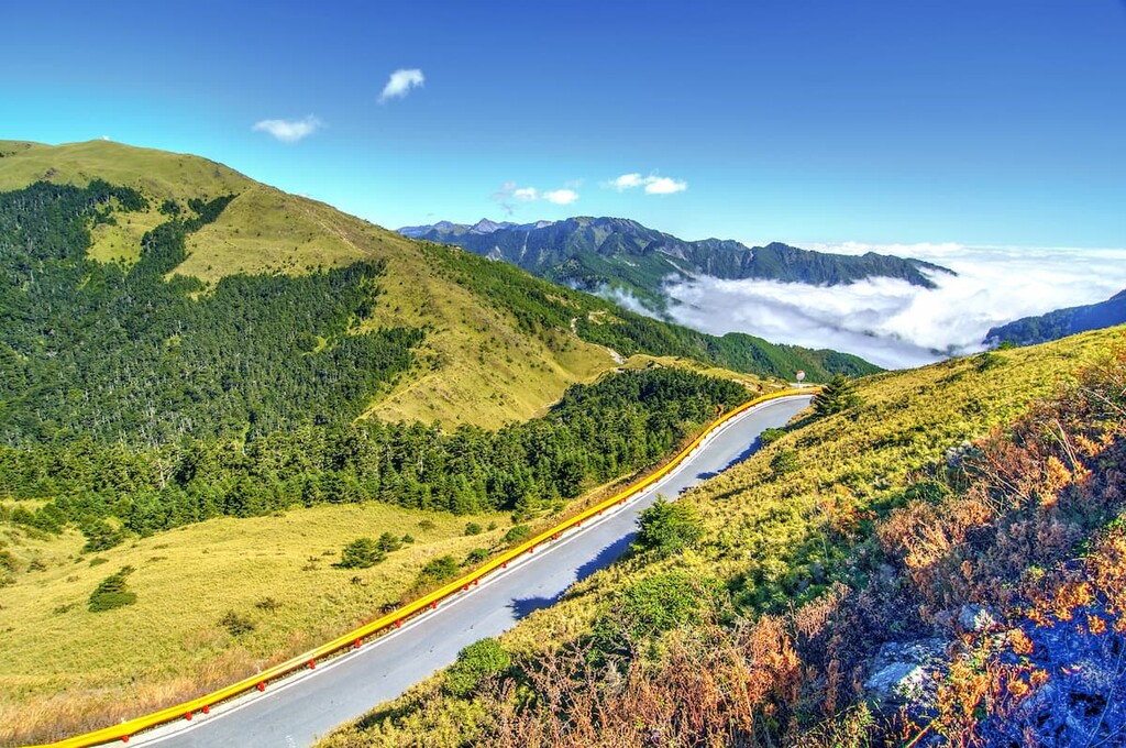
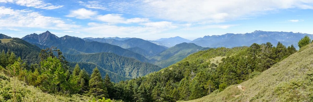
Unlike the challenging journey to Mount Nanhu and Mount Qilai, Mount Hehuan Main Peak Trail only takes about two hours to hike as it’s just a short distance of around 1.8 km (1.1 mi). The beautiful views of the park’s topography along this trail are a great draw as you work your way to summit the third highest mountain in Taroko National Park.
Starting from the trailhead located between Wuling and Kunyang at 30.8 km (19.1 mi) mark on Highway 18, hikers will shortly be rewarded with mesmerising views along the Wuling Saddle of the dense green Hehuan Mountains.
At 3,417 metres (11,211 ft), the summit of Hehuanshan offers compelling panoramic views that showcase the natural glory of the park’s ecosystem. As there are no nearby mountains blocking the view from the summit of Hehuanshan, the great mountains of Qilaishan, Nenggaoshan, Nanhudashan, Zongyang Jianshan and even Yushan, can be seen peeking out in the distance.
Hikers are also rewarded with sweeping views of the land below, taking in the eroded landscape of the Liwu River and Zhuoshui River snaking their way through the park.
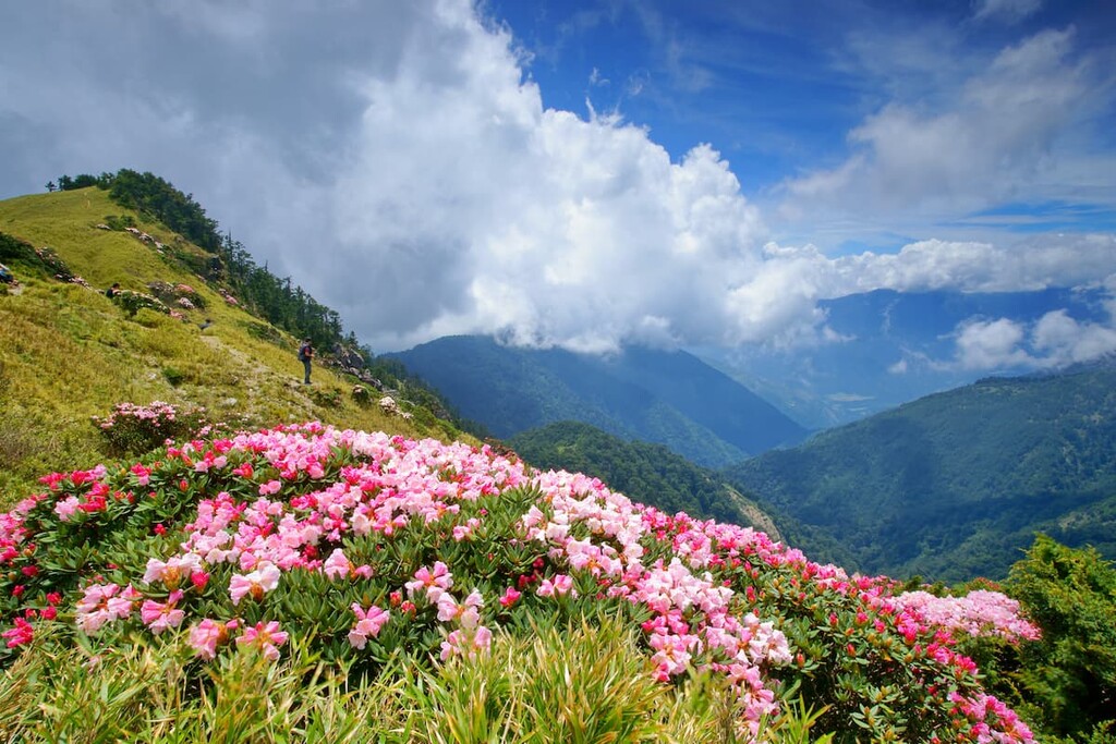
Hehuanshan not only offers commanding views, but the environment of the mountain is equally magnificent, especially during the summer months. Yushan rose, high mountain juniper flowers, and Yushan rhododendron paint the landscape with pastel shades of soft pink.
In July, there’s even more colour in the mountains, courtesy of the blossoms of bright blue Alishan gentian flowers and lilac Taiwan ladybells. Alpine birds, like the Taiwan laughing thrush and Eurasian wren, also flutter around Hehuanshan in the summer months, adding a peaceful and calming atmosphere with their sweet sounding birdsong.
This 10.3 km (6.4 mi) trail holds historical significance as it was the only trail linking two mountain ranges during Japanese rule. Currently, it forms the remains of the old Cross-Hehuan Mountain Old Road that was an important connection between Truku villages in earlier times.
Due to the history of the trail, it was originally a 30 cm (12 in) wide path, which was expanded under Japanese rule to a width of 1.5 metres (5 ft) by exploiting the local Truku men as part of forced labour. Extreme and inhumane methods were used to widen the width of the trail and create tunnels in the rock, such as fastening a rope around the Truku men’s waist while they held explosives and threw them onto the cliff walls with their bare hands.
The trail begins at the Zhuilu Suspension Bridge, which leads hikers on a path towards the Cliff Outpost. From here, hikers turn around and retrace their route back to the trail head. The trail takes around 3 to 5 hours to complete, and due to the uneven terrain close to the steep precipice, the trail is limited to 96 people on weekdays and 156 people on weekends and holidays to avoid overcrowding.
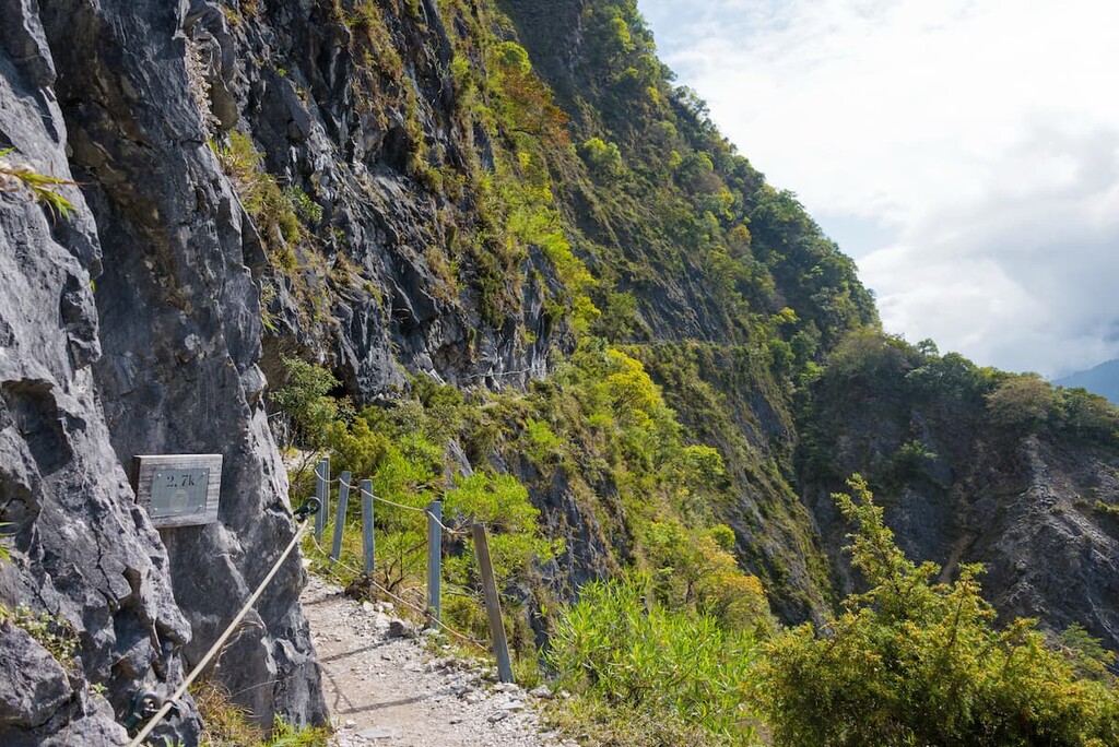
Past the Jinheng Bridge, hikers can witness spectacular cliffs on both sides of the gorge. These dramatic cliffs become increasingly steeper and draw closer together at the 178 km (111 mi) mark on the Central Cross-Island Highway, where the rock gradually becomes one solid marble cliff spanning over 1,200 metres (3,937 ft) wide and 1,100 metres (3,609 ft) in height.
The astonishing beauty of this trail is displayed from the highway as the imposing Zhuilu Cliffs stand below, while the grand Fuji Cliffs loom above a slight 20 metres (66 ft) away while the Liwu River flows steadily between them, cutting through Sanjiaozhushan.
The Swallow Grotto Trail, also known as Yanzikou, is renowned for its picturesque beauty. While the trail is short at 1.4 km (0.9 mi) in length, the spectacular views are far from lacking.
Starting at Swallow Grotto on the Central Cross-Island Highway, hikers gradually make their way to Jinheng Bridge, taking in majestic views of the sparkling cobalt blue Liwu River flowing below against the intertwining white, grey, and black marble cliffs.
The geological attraction of Chieftain Profile Rock displays pockmarked shapes in the rock face which has formed over millions of years. These hollow potholes are said to resemble a swallow’s nest, thus serving as inspiration for the name of the trail.
This trail is an old disused road that was cordoned off for safety reasons, such as falling rocks. Therefore it is strongly recommended to wear a hard hat when hiking this trail to ensure utmost safety in the event of loose boulders.
This 8.8km(5.5 mi) round trip trail is a tranquil route that hikers of all ages and abilities visit to witness the turquoise splendour of the Liwu River snaking below. Being a very popular trail that’s easily accessible from the finish of the Shakadang Trail, it is heavily monitored to prevent overcrowding.
Starting from beneath of the east side of the Shakadang Road Bridge on Highway 8, hikers begin their journey along the river cliffs of the Liwu River, with the rock folds visible on the marble canyons and the plant ecosystem in the valley below creating an alluring scene. Wisps of soft white Tung tree flowers bloom in the month of May, adding to the enchanting beauty of the trail.
In some areas, the path winds down towards the river as it slows to small pools of water. The Shakadang Trail also passes through a Truku village, although entry is prohibited to non-residents. There is a small store selling Indigenous crafts and food, such as moji, which is a hugely popular sticky rice-based cake with a texture very similar to powdered jelly.
Upon reaching 3D Cabin, also known as Wujianwu, hikers need to head back to the start of the trail at Shakadang Road Bridge. The round trip will take about 3-4 hours, so if your time is limited, you can hike 1.5 km until 5D Cabin, also known as Wujianwu, which will take an hour and 15 minutes for a round trip
With only a total of 1.4 km (0.9 mi) roundtrip trail length, the Tunnel of Nine Turns Trail (also known as Juiqudong) takes a minimum of 30 minutes to complete.
Deemed as one of the most picturesque sights in Taroko National Park, this trail offers exceptional views of running waters meandering its course through narrow passageways of marble gorges draped with verdant leafy shrubbery. While sharing a similar landscape of steep precipices with the Swallow Grotto, this trail is more tapered and the hike takes slightly longer.
It is not only the charming views that attracts hikers to this trail, but it is also the geological displays of rock formations and folds, and marble layering of the canyon walls, together with the flora growing on sheer vertical cliff walls that hold immense interest.
This 2 km (1.2mi) steep trail features the mightily majestic Changchun Shrine (長春祠), also known as the Eternal Spring Shrine, which was built to memorialise the 226 builders who lost their lives while constructing the Central Cross-Island Highway. The shrine is located only 300 metres (984 ft) from the trail head on Old Changchun Bridge.
A winding climb up the vertical terrain past the ‘Stairway to Heaven’ steep set of stairs leads you to Kuanyin Cave from where you can locate the Taroko Entrance Gate on the road down below. A short walk lands you at Bell Tower, the highest elevation of the trail, where you can ring the bell three times to make a wish. Plus, Bell Tower offers astounding views of the marble gorge and deep drop cliffs.
From the Bell Tower, you descend through a thick shaded forest arriving at the suspension bridge which heads past Changuang Temple (禪光寺), and towards the Central Cross-Island Highway which will lead you back to the trailhead on Old Changchun Bridge. The route from Changchun Shine (長春祠) to Bell Tower might be closed due to safety reasons like rockfall. Please check the official website before setting off.

Looking for a place to stay near Taroko National Park? Here are some of the best places to check out:
Being the closest city to Taroko National Park, many visitors opt to stay in Hualien due to its abundance of hotels, restaurants and interesting city attractions.
The highly acclaimed Hualien WOW Hostel is a firm favourite for visitors on a budget. The hostel is conveniently located close to the train station. The Dongdamen Night Market is a short walk from the hostel offering local delicacies and everything else imaginable. Hualien WOW Hostel houses a bar and lounge area, and a multilingual staff.
The four-star Arsma Hotel is situated in the same area as the Hualien WOW Hostel as it prides itself on its favourable location. This mid-range hotel has free bicycles on site and its facilities include a restaurant, gym, arcade and games rooms.
For those seeking the utmost luxury, Parkview Hotel is a five-star resort that is highly rated for its peaceful atmosphere as it is situated near the Hualien Forest. The facilities offered at this resort are an outdoor swimming pool, an indoor swimming pool, a gym, and a restaurant, and it also provides ecotours in the nearby Hualien Forest.
While Hualien is the closest city to Taroko National Park, Xincheng is the closest town. Miaoko Hostel boasts a stylish interior, giving the place a modern, sleek feel, and it's rated favourably for its helpful staff. This hostel is also situated near Qixingtan Beach, which adds to the relaxing environment of the hostel.
Seven Stars Homestay is an excellent choice for a mid-range accommodation. While also enjoying close proximity to the beach, it is known for its great location and comfortable rooms that ensure a good night's sleep. It also provides a free breakfast and an indoor swimming pool.
At the higher end of the price scale is Taroko Yan Hai Bo Villa, whose location can’t be beat. Manbo Beach is just a 91 metre (300 ft) stroll away, while Chongde Beach is only 2.6 km (1.6 mi) away. This peaceful villa has an open-air bath, a hot tub in every room, a sun terrace, private pool, and free bikes for hire.
While Hualien and Xincheng are situated close to the park, Tianxang is actually located within the park. The Dai Yi Shia B&B is an excellent option for budget travellers as it offers the important basics of clean yet simple accommodation, free Wifi, a shared lounge, and an option of a la carte or Asian breakfast every morning.
The mid-range Taroko Village Hotel is situated 0.6 km (0.4 mi) to Swallow Grotto Trail and it offers picturesque views of the park’s greenery. Traditional Taroko meals are served in the restaurant, which also offers a sun terrace, garden, and an airport shuttle.
Silks Place Taroko Hotel exudes comfort, offering an indoor and outdoor pool, a wellness centre, a bar and restaurant as well as room service, a sun terrace and a garden.
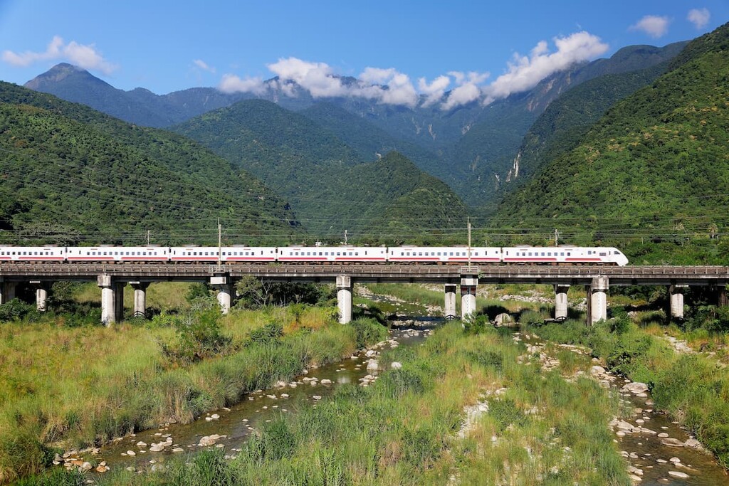
Coming from the major cities of Kaohsiung, Tainan, Chiayi, Taichung, or Hsinchu, take the train to Taipei Main Station. There are many options available to get to Taroko National Park from Taipei.
There is the option of taking the bus from Taipei to Xincheng, the closest town to Taroko National Park. Taipei Bus 1071 and U Bus 1663 both leave from Taipei Nangang Bus Station (West), while Capital Bus 1580 departs from Banqiao Bus Station. Both of these bus stations are closely located near the MRT stops of Nangang and Banqiao MRT Stations.
Once in Xincheng, hop on the Taroko Bus 302 operated by Taroko Bus Company, the Taiwan Trip Bus - Taroko Route 310 bus, or the 1133A bus belonging to Hualien Bus Company which shall transport you to the Taroko National Park Headquarters. The Taiwan Trip Bus 310 begins from Hualien Train Station, stopping at Xincheng Train Station, and drives all the way to Tianxang. Alternatively, you can catch a train to Xincheng from Taipei, and take the above mentioned buses to the park.
There is the option of taking a train to Hualien, but it is better to alight at Xincheng as it is located closer to the park. However, if you decide to base yourself in Hualien, then catch the Taiwan Trip Bus - Taroko Route 310 to Taroko National Park.
If coming from the nearby Shei-Pa National Park, it is best to transfer to Xincheng via Ludong. There are many express, semi-express and local trains that run between Ludong and Xincheng. Once in Xincheng, hop on a bus to Taroko National Park Headquarters.
Public transport is offered in Taroko National Park by two bus companies. The Hualien Bus Company runs the 1133A, 1126 and 1141 buses, while the Taroko Bus Company runs the 302 bus. These hourly buses stop at the many trails of the park, allowing hikers easy access around the park.
Driving to Taroko National Park is possible from Taipei, Hualien, and Xincheng. It is a 159 km(99 mi) journey from Taipei which takes around two hours and forty minutes. Hualien lies only 41.8 km (26 mi) away with a 56 minute drive, while Xincheng is the closest at 36 km (22 mi) covering a 48 minute commute.