
Scan the QR code and open PeakVisor on your phone
Shei-Pa National Park has 104 named peaks. The highest is Xueshan / Snow Mountain at 3,886 m. Other notable peaks include BeiLingJiao Mountain, Kailantekunshan and Kailantekunshan North Peak.
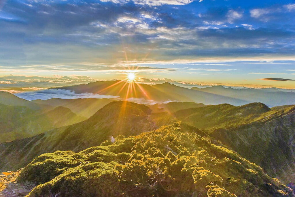
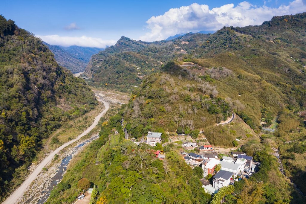
Shei-Pa National Park (雪霸國家公園) in north-central Taiwan is renowned for its ecological diversity and geologic formations. Known for its rugged mix of steep mountains and deep valleys, Shei-Pa National Park contains 104 named peaks, including the second tallest mountain in Taiwan, Xueshan (雪山) at 3,886 m (12,749 ft) in elevation.
Shei-Pa National Park spans across three different counties in central Taiwan: Hsinchu County (新竹縣), Miaoli County (苗栗縣), and Taichung County (台中市). The name of Shei-Pa National Park comes from a blend of the names of two prominent mountains in the park: Xueshan and Dabajianshan.
The total area of the park is 76,850 hectares (297 sq mi). The park’s tallest peak, Xueshan sits at an elevation of 3,886 metres (12,749 ft), followed by Xueshan North Peak ( 雪山北峰) at 3,703 metres (12,149 ft).
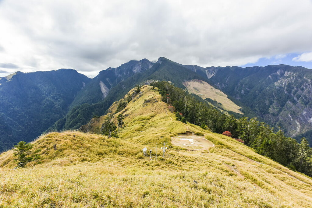
The Xueshan Range (雪山山脈), which consists of 54 peaks above 3,000 m (9,842 ft) stretches from northeast to southwest Taiwan. It is located to the north of Taiwan’s Central Mountain Range (中央山脈).
A number of peaks in the Xueshan Range are located within the boundaries of Shei-Pa National Park include Dabajianshan (大霸尖山), Pintianshan (品田山), Chryoushan (池有山), Taoshan (桃山), Kalayeshan (喀拉業山), Xiaobajianshan (小霸尖山), and Dajianshan (大劍山).
Shei-Pa National Park is situated near to other notable areas of outdoor interest. For example, Taroko National Park (太魯閣國家公園) lies to the east, while Huisan Forest Area (惠蓀林場) sits to the south. Additionally, just to the west of the park lies Tai’an Hot Springs (泰安溫泉).
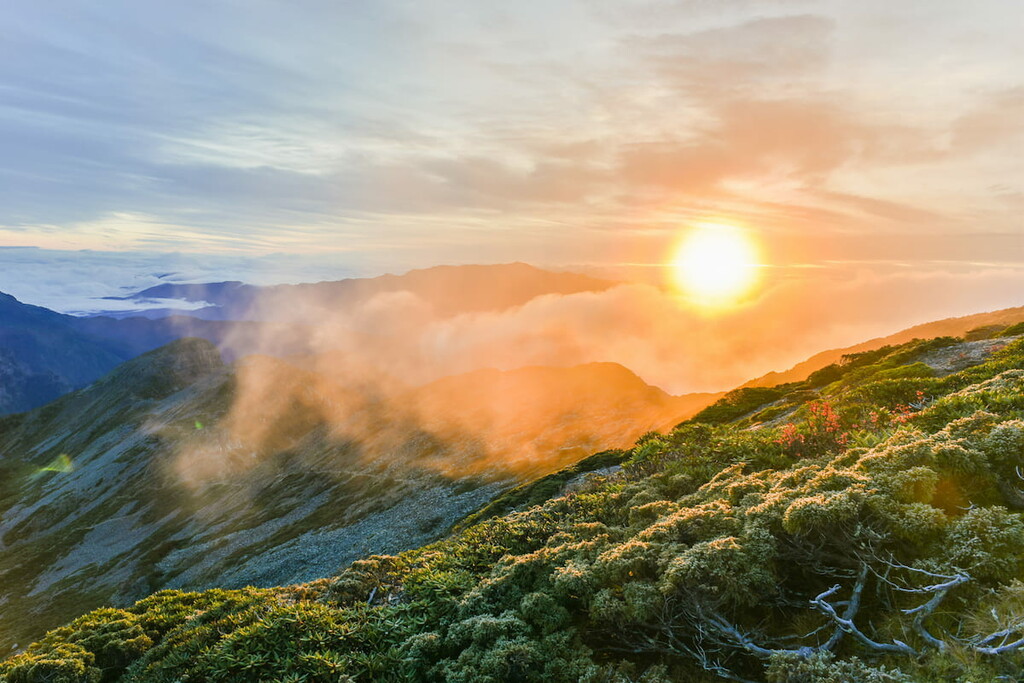
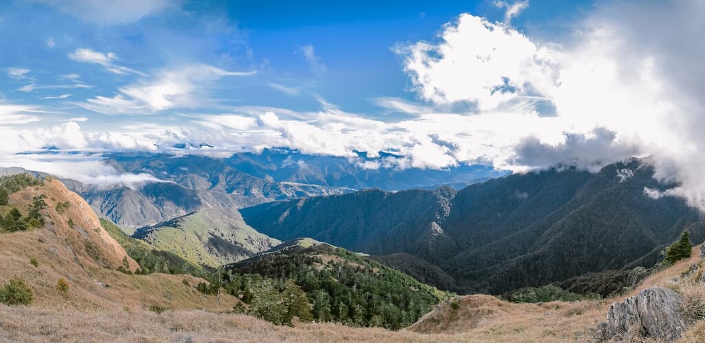
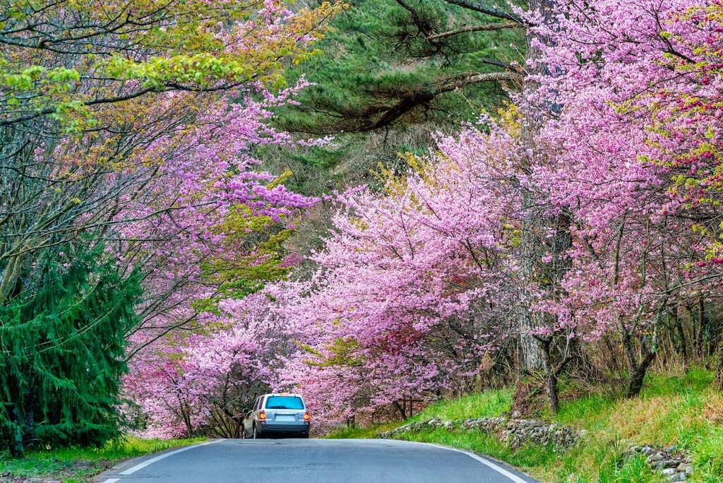
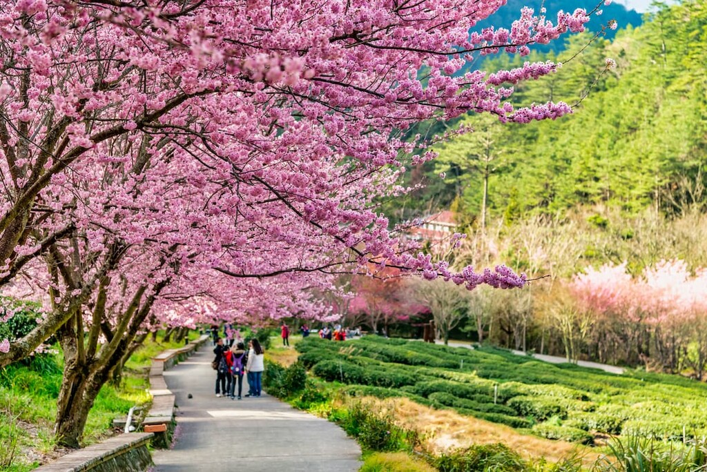
Shei-Pa National Park boasts a beautiful diverse landscape from thick misty valleys, leafy forested trails, rocky mountain terrain, and lively river valleys. It offers outdoor opportunities for all to enjoy.
For hikers seeking to venture out onto lofty mountain trails, one needs to apply for a trekking permit at least five days prior to their trip. Permit applications can be found on the official website of Shei-Pa National Park.
There are three recreation areas in Shei-Pa National Park. Wuling Recreation Area (武陵遊憩區) is where most of the trails begin, and it is located in the Heping District of Taichung City. Many trails also start at the Guanwu Recreation Area (觀霧遊憩區), which is located in the Tai’an Township of Miaoli County, which is also home to the Xuejian Recreation Area (雪見遊憩區).
You can also visit Wenshui Visitor Center (汶水遊客中心) before entering Shei-Pa National Park. The visitor center is located in the Dahu Township of Miaoli County and it offers good information for tourists visiting th epark.
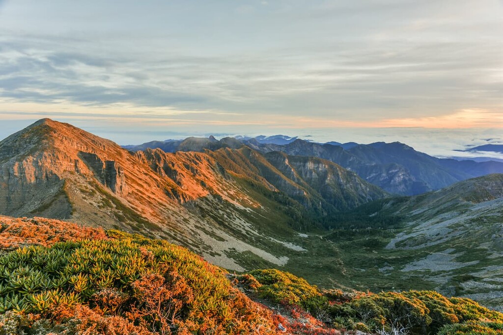
Like most mountains in Taiwan, the Xueshan Mountain Range formed through the upward pressure shift of tectonic plates creating a range of sharp ridged mountains.
One of the most prominent and interesting geological features in the park is found beneath the summit of Xueshan and along the lower slopes of Xueshan North Peaks. This feature is known as a glacial cirque and it was created by glaciers during the height of the last glacial maximum.

There are a total of 37 cirques in the Xueshan area, the most prominent of which is Glacial Cirque Number 1 (一號圈谷). Glacial Cirque Number 1 is the largest glacial cirque in Taiwan, and it is situated below the summit of Xueshan. Glacial Cirque Number 2 resembles a U-shaped crater on the lower ridges of Xueshan North Peak.
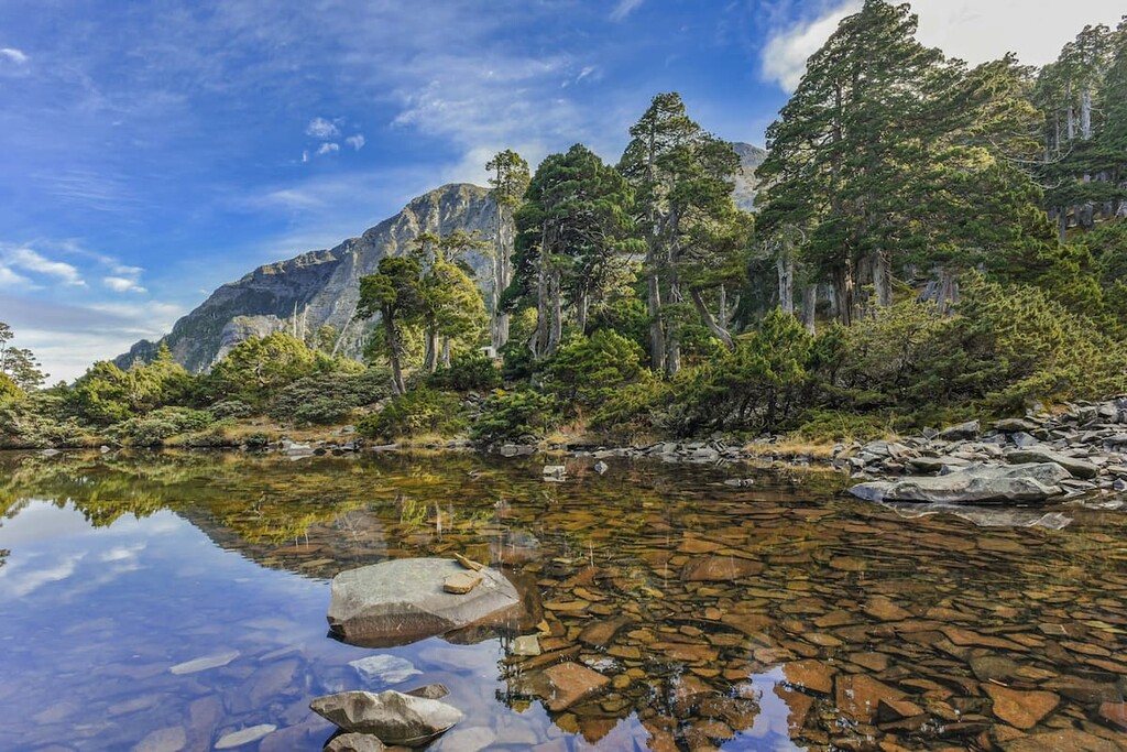
Cuei Pond (翠池) is another natural phenomenon that formed as a result of glaciers. Located at an elevation of 3,520 meters (11,549 ft) on the peak of Xueshan, Cuei Pond is Taiwan’s highest lake..
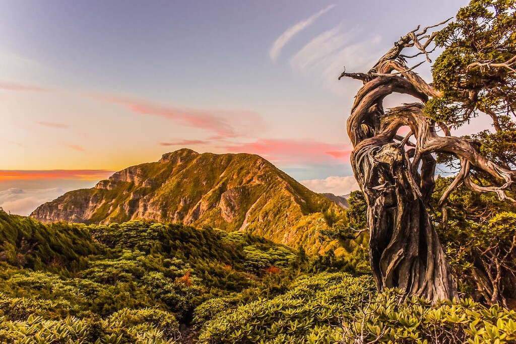
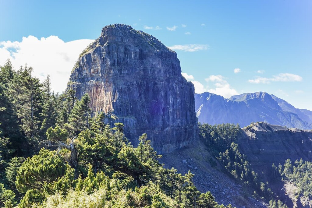
The mountains of Dabajianshan and Pintianshan both have distinctively jagged shapes. Dabajianshan has a cylindrical barrel-like shape, the area around the mountain features a significant horst.
Such horsts occur when plates have either lifted or remained stationary while the surrounding plates have shifted downwards, displaying a wave of raised and sunken rock. The box-folds of Pintianshan are further evidence of the shifting activity of tectonic plates, which have caused the region’s rocks to compress and fold into a unique pattern.
Shei-Pa National Park is also home to several major rivers in Taiwan, one of which is the Tamsui River (淡水河) that flows inwards from Taipei. The river is a major source of erosion in the region.
Due to the variety of climates in the region, a sundry of plant and animal life can be found amongst the different elevation zones of the park.
Shei-Pa National Park has a diverse climate ranging from warm-temperate to subarctic depending on the elevation. The park is divided into five zones: Machilus-Castanopsis Zone, Quercus Zone, Tsuga-Picea Zone, Abies Zone, and Alpine Vegetation Zone.
The Machilus-Castanopsis Zone is found at an elevation between 500 to 1,500 meters (1,640 ft to 4,921 ft) and has a warm-temperate climate. Montane evergreen broadleaf trees, such as the caudate-leaved chinkapin, dominate most of the forest area.
From around 900 meters (2,953 ft), we can spot Taiwan sassafras, the favorite food of endangered Taiwan broad-tailed swallowtail (Papilio maraho). Taiwan sassafras is one of three herb species that has grown since the Pliocene epoch, some 1.8 to 2 million years ago.
The Quercus Zone follows next at an elevation of 1,500 to 2,500 meters (4,921 ft to 8,202 ft). Taiwan red cypress is the dominant forest vegetation found at this elevation.
The Tsuga-Picea Zone has a cool-temperate climate and it dominates the landscape between elevations of 2,500 to 3,100 meters (8,202 ft to 10,171 ft). It consists of a combination of south-facing sunny slopes and northern-facing moist slopes where the Taiwan spruce and Chinese hemlock grow.
The cold-temperate climate of the Abies Zone is located at an elevation of 3,100 to 3,600 meters (10,171 ft to 11,811 ft). Here, subalpine coniferous forest vegetation like the Yushan juniper can be found.
Finally, the sub-arctic alpine vegetation zone is found above 3,600 meters (11,811 ft). Due to its extreme weather conditions, most plants cannot thrive in this environment with the exception of a few cold-tolerant shrubs and grasses.
Shei-Pa National Park receives an annual average rainfall of 1,500 to 3,000 mm (59 to 118 in). All of this rainfall supports the park’s 1,976 species of vascular plants, of which 183 species classify as rare or very rare, such as the Yueshan potentilla and Devol’s balsamine.
Additionally, the park is a haven for wildlife. It is home to 58 species of mammals, 154 species of birds, 39 species of reptiles, 16 species of amphibians, 17 species of fish, and 170 species of butterflies.
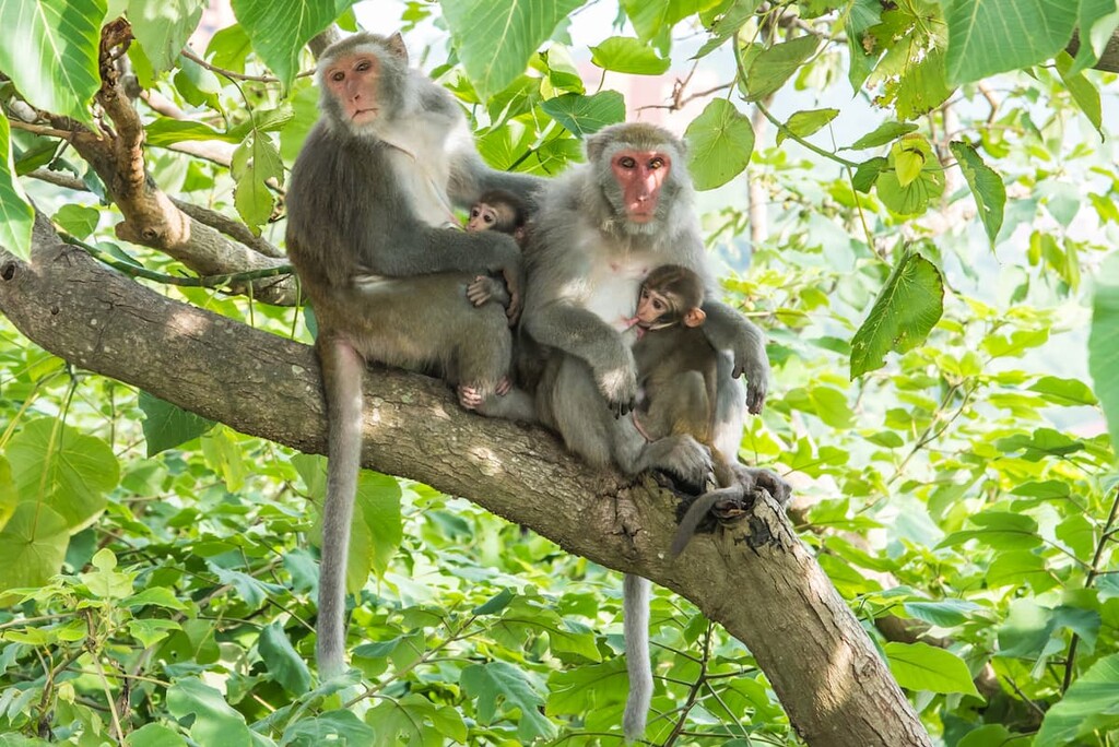
Furthermore, approximately 26 of these animal species found in the park are endemic to Taiwan. The Formosan black bear, Formosan rock macaque, Formosan landlocked salmon, Mikado pheasant, and Swinhoe’s pheasant are a few examples of the rare species that are found in Shei-Pa National Park.
The Formosan landlocked salmon, which is found in Qijiawan Creek (七家灣溪) near Wuling Recreation Area, has quite a fascinating history. As salmon are migratory fish, they are born in rivers, move to the ocean to mature, and then return to the rivers to spawn.
Thus, the presence of salmon in a landlocked lake offers a glimpse into how the region’s environment has changed over time. The Formosan landlocked salmon are an environmental wonder as they are one of the few landlocked salmon species located near the tropics.
Evidence of prehistoric activity in Shei-Pa National Park is present in the uncovered remains of stone tools and weapons, and pieces of pottery buried in the land.
The Atayal (泰雅) peoples settled in the mountainous areas of north and central Taiwan, living at elevations of 1,000 to 1,500 meters (3,281 to 4,921 ft) and subsisted by hunting, fishing, and farming on the land.
During the era of Japanese occupation, the Japanese produced camphor oil. To do so they traveled to Taiwan’s mountainous regions and harvested its trees for camphor wood. As a result, conflict formed between the Japanese and the Atayal. Not long afterward, the Japanese set up police stations along special roads on which they forced the Atayal to live.
One of these so-called surveillance roads is now part of a historic trail that displays the old Japanese police stations. These stations were hidden in bushes and behind rough grass and were used by the Japanese to oppress the Atayal.
There are no Atayal settlements present in Shei-Pa National Park due to their forced removal. But many mountain trails in the park today are remnants of traditional paths that the Atayal used for hunting and travel.
Furthermore, many places in the park still hold Atayal names, such as Kailantekenshan (凱蘭特崑山) and Mutelabashan of the Shengleng Trail (Holy Ridge Trail), and Kalayeshan of the Wuling Quadruple Trail (武陵四秀).
Folklore amongst the Atayal peoples focused on Dabajianshan, as it was believed to be a holy spot. The Atayal traditionally believe that humanity formed from a couple born out of mountain rock at the base of the mountain.
As a result, Dabajianshan has long been highly respected by the Atayal and climbing the mountain was long avoided as it was considered sacred ground. In fact, the peak wasn’t summited until a team of Japanese climbers made the first recorded ascent in 1927.

Shei-Pa National Park was officially established on July 1, 1992, making it Taiwan’s fifth national park.
If you’re looking for an adventure, Shei-Pa National Park is the place to be. With dozens of hiking trails to check out, the park is a veritable adventure paradise. Here are some of the most popular treks to consider on your next trip:
The East Xue Trail is a 22 km (14 mile) trek that takes most people 3 days to complete. It traverses Xueshan East Peak to reach the summit of Xueshan.
This trail starts at the Wuling Recreation Area and ventures first on a 2 km (1.2 mile) climb to Qika Hut (七卡山莊). After reaching the hut, the trail to Xueshan East Peak (雪山東峰) becomes increasingly steep.
In fact, this section of the trail is known as the ‘Crying Slope’ due to its grueling incline. The climb to Xueshan East Peak offers rewarding 360-degree panoramic views of the pointed peaks and dramatic cliffs in the surrounding area.
After an overnight stay at Sanliujiu Hut (三六九山莊), hikers set off early the following morning to enter the thrilling Black Forest. The Black Forest is known for its 1,000 year-old Taiwan white firs. A sighting of a Formosan black bear here is possible, yet rare.
One you make it out of the Black Forest, it is only a 3.7 km (2.3 mi) trek to the summit. However, this will take roughly three hours due to the ruggedness of the terrain.
The difficult journey to the summit takes you past the base of Xueshan’s iconic glacial cirques. The last 800 meters (2,625 ft) of the trail before the summit are above the treeline, thus vegetation dramatically changes at this elevation.
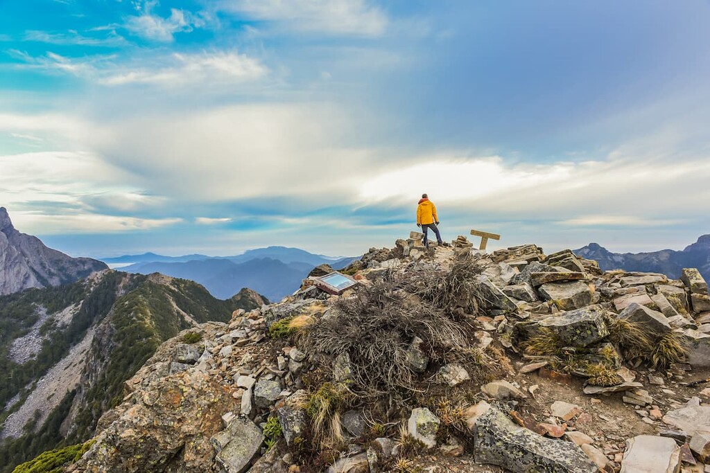
At 3,886 meters (12,749 ft) Xueshan stands tall, and true to its name, is covered in snow in the winter. On a clear day, it offers pristine views of the surrounding mountains in the park, and Taiwan’s highest peak, Yushan, can be spotted to the south.
The trail then leads back from where it started. You’ll first descend from the summit then pass by the glacial cirques before trekking through the Black Forest to your overnight stay at Sanliujui Hut. The next morning, you can make your way back to Wuling Recreation Area.
The West Xue Trail is a seven day-long trail that begins at a trailhead near the 28.5 km (18 mi) marker on Forest Road 230 (230林道). The West Xue Trail is famous for its long, winding path that brings you to some of the highest elevation regions of the park.
Hikers on this trail get the chance to summit 11 peaks, including: Zhong Xueshan (中雪山), Pipidashan (匹匹達山), Da Xueshan (大雪山), Da Xueshan North Peak (大雪山北峰), Cijyunshan (奇峻山), Touyingshan (頭鷹山), Dananshan (大南山), Huoshihshan (火石山), and Bokeershan (博可爾山), Xueshan Main Peak, and Xueshan East Peak.
From the trailhead located on Forest Road 230, one makes their way up the 3,173 meter (10,410ft) Zhong Xueshsan. After reaching the summit, you’ll make your way eastward and summit the other 10 peaks on this trail in the order listed above.
The vegetation along the Xueshan horst in the northeastern part of the park differs from the vegetation found in other parts of the park. This is because the horst topography of the region protects the landscape from the damaging winds of the monsoons. As a result, you can find Chinese hemlocks, firs, and Yushan canes along the trail.
After Cuei Pond, one of the highest alpine lakes in southeastern Asia, hikers summit Xueshan. At the summit, the West Xue Trail links up with the East Xue Trail, and hikers descend the mountain toward Xueshan East Peak and back to the Wuling Recreation Area.
The Shengleng Trail (Holy Ridge Trail) is a grueling and intense five day hike. Even though this trail only takes you across a 10 km (6.2 mi) section of the main ridge in the park, its steep terrain makes it particularly arduous.
Additionally, even though this trail is known as the Shengleng Trail, it’s sometimes referred to as the Holy Ridge Trail. That’s because one of the Japanese climbers who summited Dabajianshan in 1927 described the ridgeline between Xueshan and Dabajianshan as ‘a holy ridge.’ Therefore, this trail is also known as the Holy Ridge Trail.
Along this trail, you’ll get the chance to climb to the top of five peaks, all of which have an elevation of over 3,000 meters (9,842 ft). These peaks are Chryoushan (3,303 m/10,837 ft), Pintianshan (3,524 m/11,562 ft), Sumidashan (素密達山) (3,063 m/11,821 ft), Xueshan North Peak, and Xueshan.
Note that, even though it’s located near this trail, hikers can’t go to the summit of Dabajianshan due to safety concerns. Also keep in mind that this trail is best for experienced hikers that are comfortable moving through steep and exposed terrain.
As notorious as Shengleng Trail, the Xue Jian Trail (雪劍線) is another exciting option for challenge-seekers in Shei-Pa National Park.
This 52.9 km (32.9 mile) long trail takes approximately 5 days to complete and it combines the traditional Xue East Trail and Big Small Sword Trail (大小劍). Note that the latter trail lacks huts and clean water sources. Hikers are expected to carry their own tents and collect water along the way.
Following the East Xue Trail and camping at Cui Pond on the second night, hikers continue towards Xueshan Southwest Peak (雪山西南峰) for another long day. The route to the 3,594 m (11,791 ft) Dajian Shan (大劍山) is filled with rocks and trail junctions, so it requires good navigational skills.
After enjoying the panorama view on Dajian Mountain, camping next to the seasonal Youpolan Pond (油婆蘭池) rewards exhausted hikers with a breathtaking sky full of stars. The fourth day is a 13 km (8.07 mile) return-trip to Jian Shan (劍山) and back. The trail then finishes with a steep 1,800 meters (5906 ft.) descent on the last day.
Tiring as it might be, the trail boasts excellent vistas and an opportunity to see some unique sites like the east cliff of Jiayang Shan (佳陽山), Te-Chi Reservoir (德基水庫) and Dajia River (大甲溪).
Also known as the Wuling Sixiu Trail (si means four in Chinese, and xiu translates as excellence), this three day trail takes you to the summits of Pintianshan, Chryoushan, Taoshan, and Kalayeshan. This trail is strenuous yet superbly rewarding, offering generous views of a sea of blue mountains in the distance.
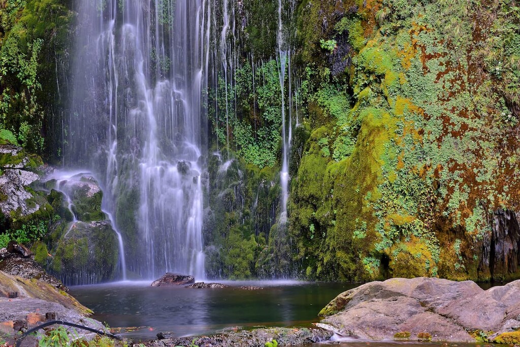
Starting from Wuling Recreation Area, hikers set off on a leisurely 3.5 km (2.2 mile) walk on concrete road to the Chryoushan Trailhead. The majestic 50 meter (164 ft) high Taoshan Waterfall is a beautiful spot to rest before the trail gets steeper. On the unevenly rocky terrain leading up Chryoushan, numerous peculiar and warped old pine trees appear, a prominent feature of the vegetation of Chryoushan.
After trekking past Sancha Campground (三叉營地) and enjoying an overnight stay at Xinda Hut (新達山屋), hikers then embark on a challenging trek to the summit of Pintianshan. Hikers then return to Xinda Hut and follow the trail back to Sancha Campground where they will turn toward the ridgeline that leads to Taoshan.
After spending the night at Taoshan Hut, hikers embark on a 2.5 km (1.5 mile) journey to the summit of Kalaheishan. Finally, you’ll make a four hour descent back to Wuling Recreation Area.
The Daba Peaks Trail (大霸群峰) is a three day round trip hike that begins and ends at Madara Creek Trailhead (馬達拉溪登山口). Once hikers pass the trailhead, the path becomes increasingly narrow and steep as it winds its way up the mountain for 4 km (2.5 mile) to Juijui Hut (九九山莊) where you’ll spend the night.
The following morning, hikers can set off toward their next overnight accommodation while journeying through steadily elevated terrain. The first 2.5 km (1.5 mile) is an uphill climb, followed by a 2.3 km (1.4 mile) flat journey. You’ll continue climbing for another 600 meters (1,969 ft) until you reach Jhongba Cabin (中霸山屋).

The next day, a 1.4 km (0.9 mile) trek leads the way to the base of Dabajianshan, which is prohibited to summit, while hikers make their way along the base of Dabajianshan and over a rocky cliff towards the summit of Xiaobajianshan.
Along the way, you can enjoy a view of the Daba Peaks Trail leading back to the Juijui Hut from the summit of Xiaobajianshan. Upon the descent, you’ll make your way to the summits of Yizeshan (伊澤山) and Jialishan (加利山), both of which are on the list of the Top 100 Peaks in Taiwan.
The Zhijiayang Trail is a three day trek that’s also known as the Jhihjiayang Trail (志佳陽線). It was one of the first trails leading up to Xueshan before the East Xue Trail was established. Hikers may also opt for this trail as it is more challenging than hiking the East Xue Trail to Xueshan.
The significance of this trail is that it begins in the Atayal village of the Huanshan Tribe (環山部落), which allows hikers a taste of the regional culture before embarking on their journey into the mountains. The Atayal have a distinct culture practice of face-tattooing and are known for their colorful weaving art.
After passing the trailhead located on the lands of the Huanshan Tribe, it is a relatively flat 3 km (1.9 mile) journey toward Songbo Farm (松柏農場). Along the uphill trek toward Zhijiayangshan (志佳陽山), hikers pass through a hilly forest lined with pine trees, from where they will reach Piodan Pond (瓢簞池), which is situated in the valley of the south-eastern slope of Zhijiayangshan.
Piodan Pond is commonly referred to as Milk Goat Lake due to its tiny size. Piodan Hut (瓢簞山屋) is a small cabin that can fit up to 10 people, so hikers usually bring their own tent to camp nearby before heading off to the summit of Jhihjianshan (3,325 m/10,909 ft).
Hikers will then descend the mountain through trails populated with Yushan cane as they hike toward Xueshan. Afterward, you’ll head toward Sanliujiu Hut to rest for the night. The following morning, hikers can trek toward Xueshan East Peak and then descend the mountain to the Xueshan Trailhead.
The Taoshan Waterfall Trail is a pleasant 4.3 km (2.7 mile) hike that starts and ends at Wuling Recreation Area. It takes roughly two and a half hours to complete. This trail is a relatively smooth walk on a paved footpath with gradual elevation gain.
Qijiawan Creek is located within 100 meters (328 ft) of the trailhead, and it is where the legendary Formosan landlocked salmon ilive. The Taoshan Waterfall stands proudly at the halfway point of the trek, where hikers can appreciate the long veil of white misty water from a platform before making their way back to the trailhead.
Within Shei-Pa National Park, there are several huts that you can stay at on one of the park’s many multi-days trails. Hikers are responsible for registering for the lottery system for these huts or researching potential camping locations. However, note that campfires are prohibited in the park.
Keep in mind that the water tanks at the huts can be unexpectedly empty, so you may need to find water for yourself on the trail. Be sure to ask people who just visited the area for the most updated information on water availability in the park. Always bring extra water in the dry season.
Around Shei-Pa National Park, visitors have a wealth of accommodation options. Here are some of the best places to check out:
If you’re looking to visit Wenshui Visitor Center or Xuejian Recreation Area, check out the nearby Tai’an Township of Miaoli Country. In the town, you’ll find the luxurious Tangyue Hot Springs Resort (湯悅溫泉會館) and the family friendly Sunrise Hot Spring Hotel.
Tangyue Hot Springs Resort offers comfort to guests, providing facilities such as a spa and wellness center and private hot spring baths.
Sunrise Hot Spring Hotel (日出溫泉飯店) is located a mere 0.5 km (0.3 miles) from Tai’an Hot Springs, and this hotel houses a restaurant, hot tub, and offers children activities. The nearby Quan Ming B&B (泉銘行館) in Dahu, Miaoli County is a more budget-friendly option that’s well worth considering.
For visitors who want to visit Guanwu Recreation Area, which is another 2 hour and 40 minutes’ drive away, Guanwu Villa (觀霧山莊) is worth checking out. The villa is situated inside the recreation area and is the most convenient accommodation option. Shei-Pa Leisure Farm (雪霸休閒農場) in Wufeng Township is just 5.4 km (3.4 miles) away and is also a good option.
For visitors wanting to stay near to the Wuling Recreation Area in the Heping District of Taichung County, Wuling Farm (武陵農場) has a selection of excellent budget-friendly campgrounds.
Alternatively, the Roof-Sky Hotel (屋頂上的天空) in Heping District prides itself on its cleanliness, service, and scenic garden, while the Li Shan Guest House (梨山賓館), on the higher end of the price range, is an entertainment mecca. It houses a restaurant, game room, and a beautiful garden, and offers karaoke and guided tours of the nearby Shei-Pa National Park.
One of the biggest challenges of visiting Shei-Pa National Park is figuring out how you’re going to get there. You have plenty of transportation options to choose from depending on where in the park you want to travel to. Here’s what you need to know before you depart only oru adventures.
There are plenty of ways to get to Shei-Pa National Park and Xuejian Recreation Area.
From the major cities of Taipei, Hsinchu, Taichung, Chiayi, Tainan, and Kaohsiung, take the Taiwan High Speed Rail to Miaoli HSR Station. From here, hop on the hourly Express 101B bus heading toward the Wenshui Visitor Center. The journey should take around 30 minutes.
Alternatively, driving to the park from Taipei, Hsinchu, Miaoli, and Taichung is very doable.
Taipei is the furthest from Wenshui Visitor Center as it is a 130 km (81 miles) drive, which generally takes about 1 hour and 40 minutes. The drive from Hsinchu takes about 50 minutes, while Taichung is about 1 hour away. Miaoli is the closest city to the park as it’s only about 30 minutes away.
Note that if you’re at the Wenshui Visitor Center, getting to the Xuejian Recreation Area requires a vehicle. It takes about 1 hour and 20 minutes to make this 36 km (23 mi) journey.
There is currently no public transportation option available for reaching Guanwu Recreation Area. The easiest way to reach the area is to set out by car from Hsinchu City which is 74 km (46 miles) away.
From there, visitors must drive for over an hour to arrive Guanwu Recreation Area via Taiwan County Highway 122 (縣道122) and the famous winding Dalu Forest Road (大鹿林道). The latter can be closed from time to time due to typhoons. Be sure to check the road conditions before departing on your trip.
Most buses that reach Wuling Recreation Area set out from Guguan (谷關) in Taichung City in the western part of Taiwan.
Visitors can take Bus 153 from Taichung High Speed Rail Station, Bus 850 from Taichung Railway Station or Bus 207 from Fengyuan Railway Station (豐原站) to arrive at Guguan.

From Guguan or Fengyuan, take Bus 865 in the morning and transfer to Bus 866 at Lishan (梨山) to arrive Wuling Recreation Farm. Bus 865 and 866 operate once or twice daily, and the schedules are not closely connected. Therefore it’s better to check the timetable in advance and prepare at least 3 hours of transfer and sightseeing in Lishan.
If you’re coming from Hualien in eastern Taiwan, take the train to Yilan Railway Station where the bus station is just a short walk away. Hop on the twice daily Kings Bus headed toward Wuling Farm, which should take approximately 4 hours.
Alternatively, the drive from Taipei to Wuling Recreation Area, on the east of the park, is a 146 km (91 miles) journey spanning 3 hours. The drive from Yilan takes over 2 hours through a journey of 86 km (53.4 miles.)


tw100
ultra
taiwan-high-three
taiwan-ultras
tw100
ultra
taiwan-high-three
taiwan-ultras
The highest peak in Shei-Pa National Park is Xueshan / Snow Mountain, at 3,886 m.
Notable peaks in Shei-Pa National Park include Xueshan / Snow Mountain, BeiLingJiao Mountain, Kailantekunshan, Kailantekunshan North Peak and Xueshan North Peak / Snow Mountain North Peak.


