Scan the QR code and open PeakVisor on your phone
Northern Taiwan’s Hsinchu County (新竹縣) is famed for its large Hakka community and rugged mountains. There are 320 named mountains in the county, the highest of which is Pintian Shan (品田山) at 3,524 meters (11,562 ft) in elevation. Tayux Moyung (泰矢生山) is the most prominent peak in the county with 760 m (2,493 ft) of prominence.
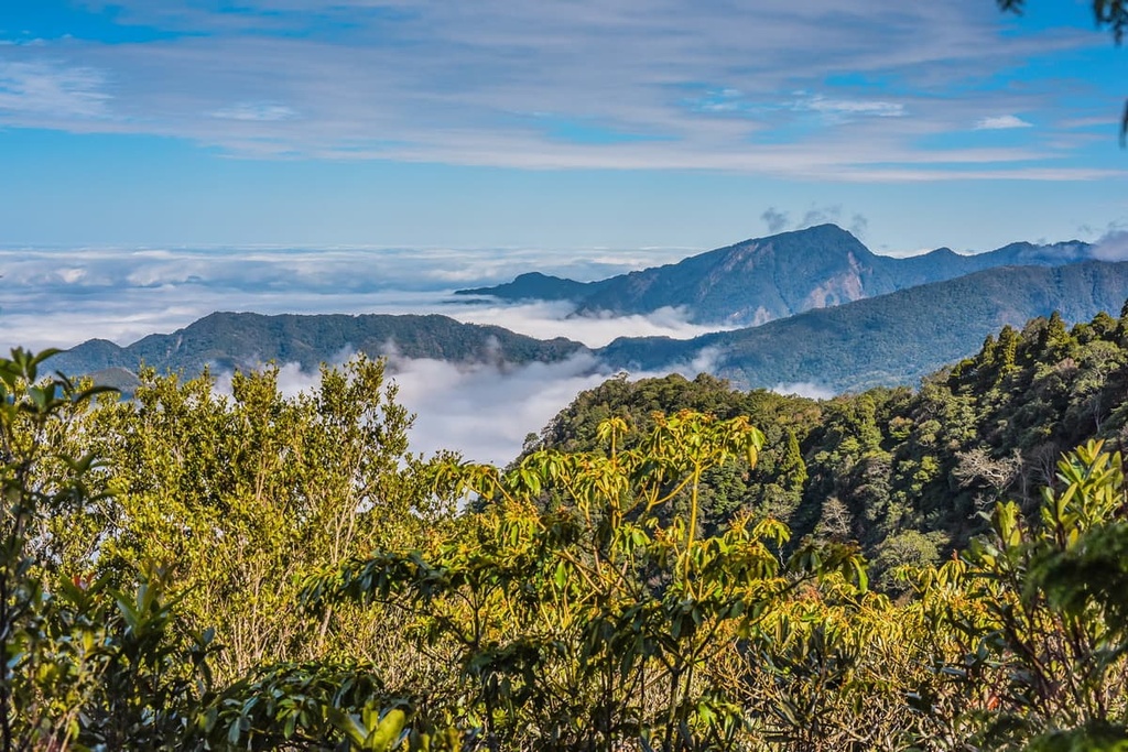
Hsinchu County lies on Taiwan's northwest coast, and it stretches inland into the Xueshan Range's (雪山山脈) backcountry. This large county encompasses 142,759 ha (352,765 acres) of land, and it features flat tablelands combined with soaring peaks. A collection of high, steep mountains dominate Hsinchu's hinterland.
Taoyuan City (桃園市) borders Hsinchu to the north. Meanwhile, Yilan County (宜蘭縣) is located to the east of Hsinchu, Miaoli County (苗栗縣) is situated to the southwest, and Taichung City (臺中市) is located to the south.
Hsinchu's location has made it a popular migration route for Chinese Han immigrants in centuries past. In fact, Taiwan's largest Hakka community resides in Hsinchu County. Residents with ancestral ties to Fujian Province in mainland China, where there is also a sizable Hakka community, account for about 73 percent of the county’s 560,000 residents.
Taiwan’s second-highest peak, Xueshan (雪山), lies in Shei-Pa National Park (雪霸國家公園), which is partially located within Hsinchu County's borders. Six of Taiwan's top 100 peaks, also referred to as Baiyue, are located in Hsinchu County, including:
Known as Taiwan's Silicon Valley, Hsinchu is a technological hub for the island. Hsinchu City, the county's capital, is the base of most of Hsinchu's tech firms. There are three urban townships, six rural townships, and one Indigenous mountain township in Hsinchu County.
Millions of years ago, Taiwan was located underwater. At the time, the Eurasian and Philippine Sea plates fractured and created a rapture, forming Taiwan in the process.
Meanwhile, this tectonic activity built the lofty mountains of Taiwan’s backcountry. Nowadays, one of these mountain chains, the Xueshan Range is home to 17 of Taiwan’s highest peaks, all of which are over 3,000 meters (9,843 ft) in elevation.
Two of Hsinchu’s biggest mountains, Dabajianshan and Pintianshan, are further evidence of tectonic activity. Around these peaks, volcanic pressure caused compressions in the rock, creating Pintian’s signature box folds. Dabajianshan’s circular shape rises above a horst, a raised fault block that’s bounded by multiple normal fault blocks.
The composition of the bedrock in Hsinchu County varies depending on your precise location. But it primarily consists of sandstone, slate, and shale from the Eocene to Miocene epochs.
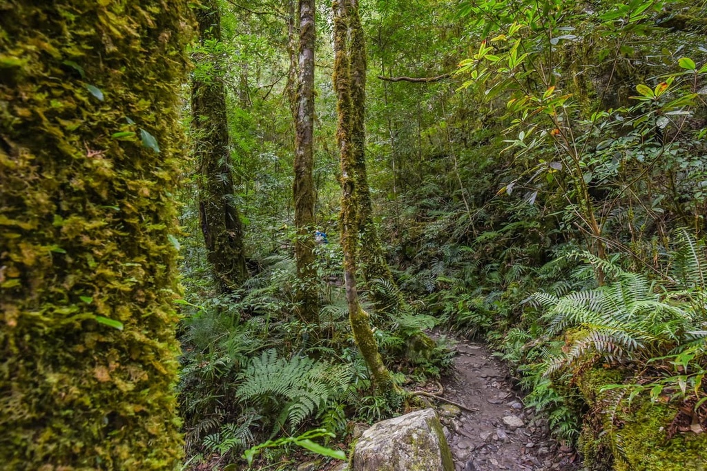
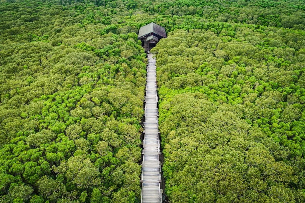
Hsinchu County is home to an assortment of forest types in its more remote areas. Hsinchu’s northern zone, which is centered around Shei-Pa National Park, consists of an evergreen coniferous plant community where you can find species like Taiwan fir, Yushan juniper, Taiwan spruce, and Chinese hemlock. These softwoods grow in cold, temperate climates above 2,500 meters (8,202 ft) in elevation.
Further to the north, Qilan’s Wildlife Reserve’s (棲蘭野生動物重要棲息環境) Divine Tree Garden features Taiwan’s most extensive collection of ancient Taiwan red cypress and yellow cypress trees. Trees aged over 1,000 years reach divine status in Taiwan, and Qilan Divine Tree Garden is home to 51 trees with this status.
In the nearby Mandarin Duck Lake Nature Reserve (鴛鴦湖自然保留區), a mix of conifers and aquatic plants thrive on the hillside. Here, Chinese hemlock grows alongside Taiwan red cypress trees in the higher elevation zones above 2,000 meters (6,562 ft). Additionally, the aquatic plant, Sparganium fallax graebner, is endemic to Mandarin Duck Lake. This perennial plant is a protected species that dates back to the last glacial maximum.
Hsinchu’s first residents are the Indigenous Atayal and Saisiyat tribes. Both tribes traditionally lived in Hsinchu’s remote areas, particularly in the mountains between 500 to 1,000 meters (1,640 to 3,281 ft) in elevation.
In the seventeenth century, the Spanish claimed control over Hsinchu and brought Catholic missionaries to the area. The Dutch overpowered the Spanish in 1642, driving the Spanish out of Taiwan and forming Dutch Formosa in the process. However, this victory ended twenty years later when the Ming dynasty’s legendary soldier Koxinga and his troops battled against the Dutch in southern Taiwan.
After the turn of the eighteenth century, the first Han settlers started arriving in Hsinchu. A mass migration soon followed from Fujian Province, which helped to form a strong Hakka community in what is now Hsinchu County.
Hsinchu’s population began to swell soon afterward. However, Hsinchu wasn’t designated as a county until the Qing dynasty. At the time, it was part of a larger county that covered much of the northern part of the island called Zhuluo County.
Eventually, the Qing dynasty subdivided the existing Zhuluo County into smaller areas. In 1887, Hsinchu belonged to the Taipeh Prefecture (臺北府) alongside the areas of present-day Yilan and Taoyuan counties.
During the Japanese Occupation Era, urban planning took hold in what’s now Hsinchu County. Hsinchu City, known as Shinchiku to the Japanese, became a hub for trade routes between Taipei (臺北市) and Taichung, Taiwan’s two most prosperous cities.
After the takeover from the Japanese, Hsinchu’s industry and development became the focus of the Taiwanese government.
In 1980, the local ministry established Hsinchu Science Park, which greatly helped Hsinchu’s economy by turning it into a hub for technology development. Hsinchu is now the island’s leading city for the information technology and mechanical engineering industries.
Hsinchu County may be a hub for tech and innovation, but it’s also home to some excellent mountains. Here are some of the best hikes in Hsinchu County to check out during your next trip to the region.
The Daba Peaks Trail is a 31 km (19 mi) long route that leads you to the base of Dabajianshan and ascends three peaks. However, note that park officials prohibit the climbing of Dabajianshan's summit for safety reasons.
Nevertheless, this trail is a popular hike as it includes four of Taiwan's top 100 peaks. Hikers also appreciate this trail because it features a thrilling section where you walk a ridgeline on Xueshan (雪山).
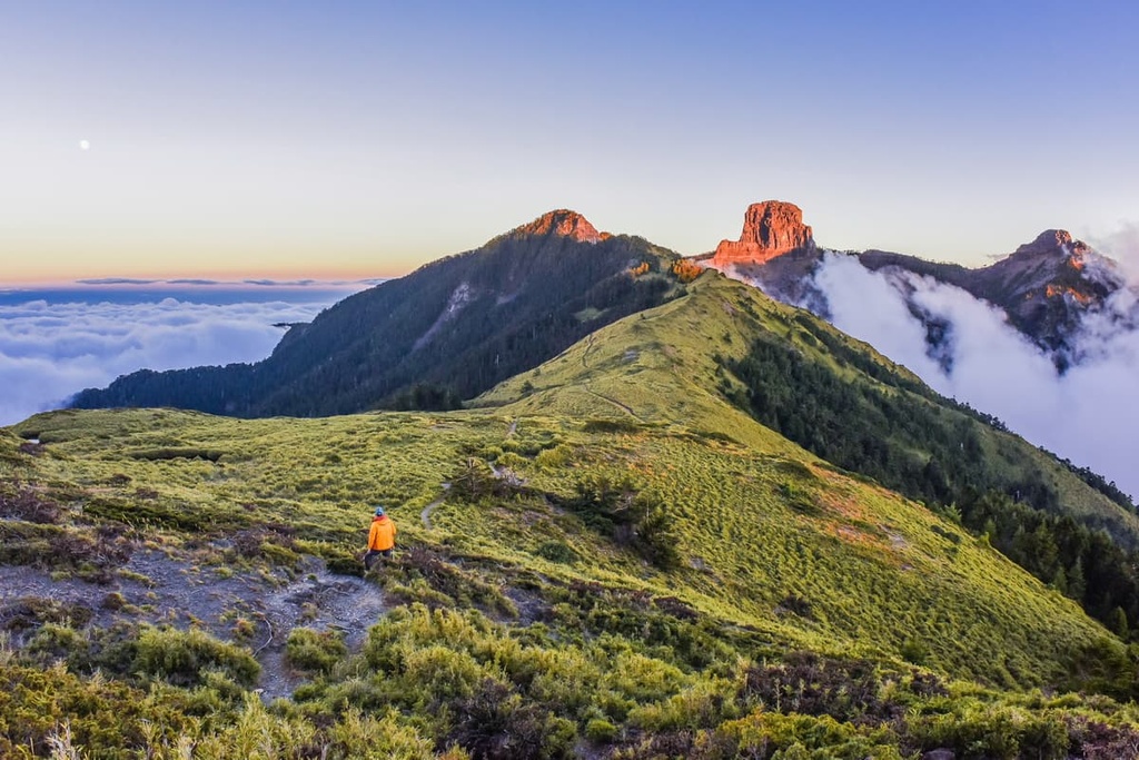
Xiaobajianshan (小霸尖山) is Dabajianshan's neighbor and the highest point of the trail. Its summit offers unrivaled views of Dabajianshan's circular buttress. Wuling Sixiu's mountains and the Xueshan peaks dominate the southern views from the summit, too.
The trail's descent begins as you progress on the path. Yizeshan and Jialishan (加利山), two of Dabajianshan's peaks, are located near the end of the trail, and you’ll get a chance to summit them as you hike.
The Wuling Sixiu Hiking Trail is a three-day journey that climbs four of Taiwan’s Top 100 peaks. In other words, this hike is not for the faint of heart as you’ll climb Pintianshan, Chryoushan, Taoshan, and Kelaye Shan on this 29 km (18 mi) long trek.
Each peak on this trail has its own signature feature. Chryoushan, which is renowned for its vibrant plant life, is the first peak on this itinerary. A thriving pine community grows in Chryoushan’s forests. On Chryoushan’s rocky summit, you can gaze out and see the remaining three peaks that you need to climb on this trail.
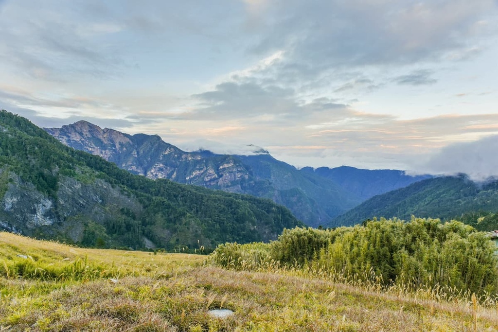
Pintianshan, the highest and steepest mountain on this hike, is next on the list. The infamous Pintian Cliff lies right before the mountain’s summit, and it demands your every last effort and energy to climb. While standing on Pintianshan’s summit, you can appreciate Shei-Pa National Park’s massive peaks to the north and south. Wuling Sixiu's peaks stand in clear view from the summit, too.
The next hill on this itinerary is Taoshan, which is known as Peach Mountain as its summit resembles a peach’s bumpy top. The Taoshan Waterfall is another of Taoshan’s wonders. However, accessing this magical cascade is an extensive side trip and isn’t possible for most people on this trail.
Finally, the smallest of Wuling Sixiu’s peaks (though it is by no means a small mountain), is the Baiyue of Kelaye Shan. Once at the summit, you can see Dabajianshan and Yize Shan, as well as all the peaks of Xueshan. In the nearby Taroko National Park (太魯閣國家公園) to the southeast, you can also see is the stunning Nanhudashan (南湖大山).
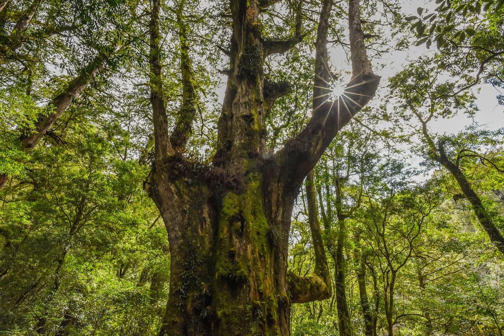
The Qilan Divine Garden is a protected area that’s well-known for its community of ancient cypresses. The cypresses in this grove typically range in age from around 400 to 1,000 years old. However, the oldest tree in the garden is the Confucious tree and it is 2,560 years old—the same age as the famous Chinese philosopher.
Approximately 51 trees in the garden are 1,000 years old or older, having reached divine status. Like the Confucius tree, each tree's name correlates with its influential human figure. For example, there are trees named after the historian Sima Qian, the magistrate Bao Zheng, and the thinker Chu His.
Two walking trails travel through the Divine Garden. One of these trails is 1.2 km (0.7 mi) long and the other is 2.3 km (1.4 mi) long. Visiting the old trees is fascinating in any weather, although the mountain's misty environment typically adds an air of mystery to the forest.
Smangus is a mountainous Atayal village situated at 1,500 meters (4,921 ft) in elevation within Hsinchu’s southeastern hills. This community is famous as it is one of Taiwan’s most remote settlements. The untouched nature and vibrant mountain scenery around the town amaze tourists visiting the area.
Intrepid hikers can make their way to Smangus on a 20.3 km (12.6 mi) long trail that takes most people three days to complete. Smangus Ancient Road boasts two main highlights: a giant cypress grove and the views from Xi Quisi Shan (西丘斯山).
Soon after leaving the trailhead, you’ll make your way to Smangus’ groves of tall cypress trees. Yaya Giant Tree, the highest tree in the area, stands at a height of 35 meters (114 ft). The Atayal people deeply revere these ancient trees, which have soared in height over time.
Tayux Moyung is the first peak on this climbing itinerary. Its thick, dense forest leads to an overgrown summit where there are no views. However, a lush cypress forest thrives on the path to the summit. In this forest, you can also see emerald epiphytes sprouting on the trees’ rough bark.
After making the journey to Tayux Moyung, you can venture toward Xi Quisi Shan. Xi Quisi Shan is a challenging climb as it features sheer cliffs and a sharp gradient. As you gain elevation on the mountain, you can look out and see the forests of Toyux Moyung.
Once you reach the summit, you can enjoy sweeping panoramic views. From Xi Quisi Shan’s summit, you can see Dabajianshan’s cylindrical shape and the Holy Ridge that connects it to Xueshan. In the opposite direction, you can also see the hills of Babokulu Shan (巴博庫魯山), Fuxing Jianshan (復興尖山), Tamanshan (塔曼山), and Meiguiximo Shan (玫瑰西魔山).
Straddling Hsinchu’s border into Miaoli County, the Lion’s Head Mountain Scenic Area encompasses 24,200 ha (59,800 ac) of mountainous terrain. The star attractions here are the hillside Buddhist temples, which are shrouded in forest greenery against a backdrop of peaks.
The Lion’s Head Mountain Historic Trail is the most favored out of the many trails in this area. A short 4 km (2.4 mi) path gives you a chance to see the region’s signature scenic beauty. As you make your way down this windy, hilly trail, you’ll pass by eleven burgundy temples. Countless shrines and calligraphy inscriptions that are carved into rock also appear along this route.
The Quanhua Temple, which is located near the trail’s end, is the grandest of them all. Constructed by the Japanese as a Taoist place of worship, it now combines Buddhist elements in its design. You can even see a colorful mosaic of animated dragons on the red-tiled eaves of the temple.
Additionally, while the Quanhua Temple is a sight to behold in its own right, the views from the grounds that show Hsinchu's endless emerald hinterland are also particularly spectacular.
Situated in the heart of Hsinchu City, Eighteen Peaks Mountain Park is a protected area that’s known for its mountainous terrain. The park is popular with hikers, cyclists, and outdoors lovers as there are many trails to wander within its boundaries.
The area is home to a total of eighteen hills. The highest peak in the park measures 134 meters (440 ft) in elevation and the lowest is 50 meters (164 ft) tall.
While trekking the different routes in the park, it is hard to believe that you’re still technically in a city. Indeed, the park’s eucalyptus forest and dense foliage all make you feel as though you’ve been transported far away from the city to a remote jungle.
Hsinchu City and Neiwan Township are the two top places to stay in Hsinchu County. Hsinchu City is easily accessible and brimming with entertainment options for visitors. Meanwhile, Neiwan Township offers travelers a glimpse into one of Taiwan’s old villages.
In addition to its role as Taiwan's leading technological hub, Hsinchu City has a lot to offer to tourists. In fact, Hsinchu features many natural, historical, and cultural attractions that are sure to delight any visitor.
One of Hsinchu's most well-known landmarks is the respected City God Temple. The shrine’s interior matches its colorful and intricate facade. Animated paintings and many Taoist and Buddhist sculptures adorn the halls of the temple. The temple also hosts weekly opera performances in its spacious courtyard for visitors to enjoy.

For an adrenaline rush, head to Hsinchu's Leafoo Village Theme Park. This amusement park features four smaller zones that are themed to match different geographical regions. For example, the African park features Taiwan's only safari zoo and it is home to 70 wildlife species that you can view by train, land cruiser, or bus.
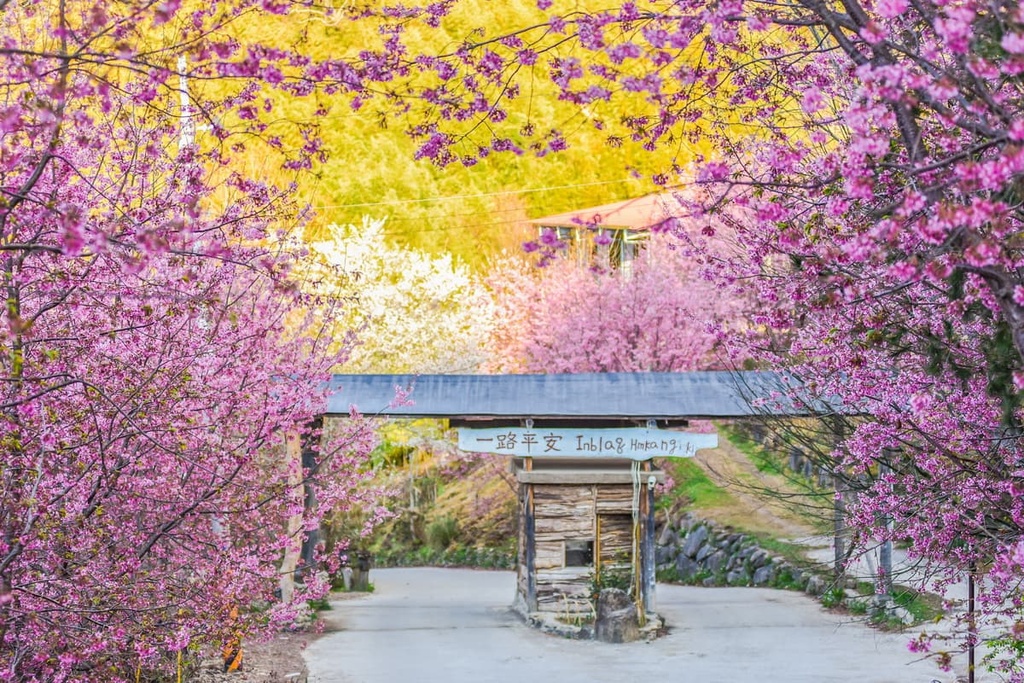
Another one of Hsinchu's delightful sites is the old Hakka village of Beipu Old Street. Beipu's narrow alleyways boast an assortment of tea houses from the Qing dynasty. The village’s old buildings stand in stark contrast to more recent modern developments. While in the village, you can explore its stone-slabbed streets and dine in one of the many traditional Hakka restaurants. Here, you can eat persimmon cakes, rice cakes, and pork pastries.
Finally, for a whiff of salty sea air and a chance to admire the Taiwan Strait, head to Nanliao Fishing Harbour. Hsinchu's port was the first point of arrival of Hakka settlers in the seventeenth century. In 1938, the Japanese began developing the then-unsightly seafront.
Subsequently, Hsinchu's waterfront received a much-needed facelift, transforming it into an attractive area. It’s also a great place to try some of the island’s freshest seafood as there are many restaurants that offer dishes made with the catch of the day.

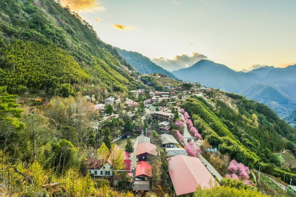
Situated in Hsinchu’s countryside, Neiwan Township is a community that was created by a group of Hakka farmers. Known for its picturesque setting amongst lush forests, Neiwan Township’s landscape is filled with natural beauty.
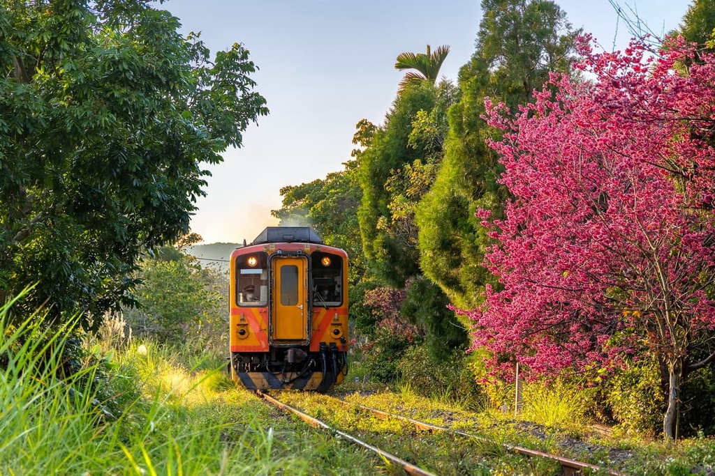
Neiwan’s train line connects it to Hsinchu, making the remote region more accessible to travelers. During Japanese rule, the Japanese built a railway to the town, too, in order to transport felled timber from Neiwan’s woodlands to Hsinchu’s coastal areas for shipment.
The Old Street of Neiwan is the village’s focal point. Here, well-preserved Japanese-style buildings feature against a backdrop of swaying palm trees and mountainous terrain. Countless stalls populate the streets of the village, too. Hakka vendors in Neiwan sell a variety of specialty foods including wild-ginger glutinous rice dumplings and Hakka tea.

Or, if you’re looking for a chance to see Neiwan’s lavish scenery up close, be sure to visit the suspension bridge. Here, you can look out and see the 100-meter (328 ft) wide Youluo River and admire the surrounding camphor woodlands.
After arriving in Taiwan, you can make your way to Hsinchu via the Taiwan High-Speed Rail (HSR) or local express trail (TRA). Alternatively, you can hire a scooter or car for the journey to Hsinchu.
From Taiwan’s two largest hubs, the drive from Taipei to Hsinchu is 84 km (52 mi) long. Meanwhile, the journey from Taichung to Hsinchu is 92 km (57 mi) long.