
Scan the QR code and open PeakVisor on your phone
Miaoli County Mountains is home to 372 named mountains. The highest is Xueshan / Snow Mountain at 3,886 m.
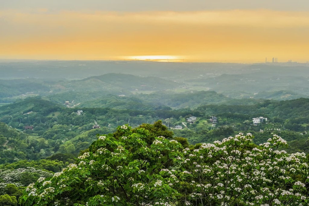
Miaoli County is an administrative region located in northwestern Taiwan. It encompasses a large swath of the island’s western coast as well as part of the jagged Xueshan Range (雪山山脈). The highest and most prominent of Miaoli County’s 372 named peaks is Xueshan (雪山), which also happens to be Taiwan’s second tallest mountain with an elevation of 2,886 m (12,749 ft).
Miaoli County (苗栗縣) is a rugged and mountainous administrative district that’s located in the northwestern part of Taiwan. It contains 449,808 acres (182,031 ha) of terrain including part of Shei-Pa National Park (雪霸國家公園).
The county is located in an excellent part of the island as it is situated far enough from Taiwan’s major cities to be relatively quiet, yet it is still within driving distance from many of the island’s main tourist hubs.
Miaoli is bordered by Hsinchu County (新竹縣), which lies to the north and northeast, and Taichung City (臺中市), which borders Miaoli to the south and southeast. The county also includes a section of shoreline along the Taiwan Strait.
Climatewise, Miaoli’s winters are generally cool with an average temperature of around 16°C (61°F) near the coast. The average temperature in the area drops to about 10°C (50°F) as you move inland due to the increasing elevation. Miaoli’s summers can be humid and hot, with highs of around 34°C (93°F). The best time to visit the region is during the shoulder season, which is between October to December.
Miaoli’s jagged backcountry is home to some of Taiwan’s tallest peaks. The Xueshan Range passes through part of the country, and it includes a number of major mountains, including:
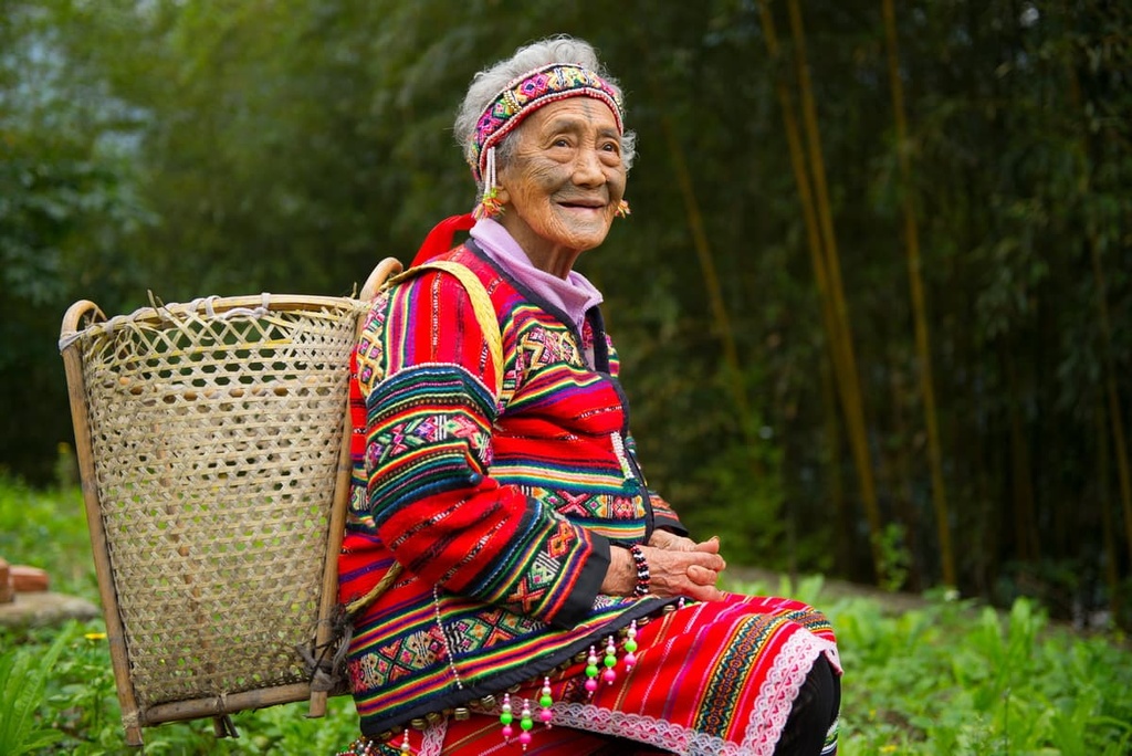
Most of Miaoli’s 567,000 residents live in the flatter, coastal areas of the county, primarily around Miaoli City (苗栗市) or Toufen City (頭份市). Miaoli County is subdivided into two cities, five urban townships, ten rural townships, and an Indigenous mountain township. Tai’an Township (泰安鄉), the county’s Indigenous mountain township, is primarily home to
Atayal and Sasiyat people.
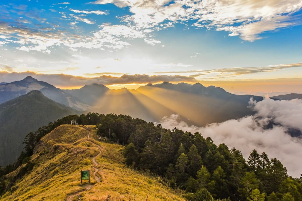
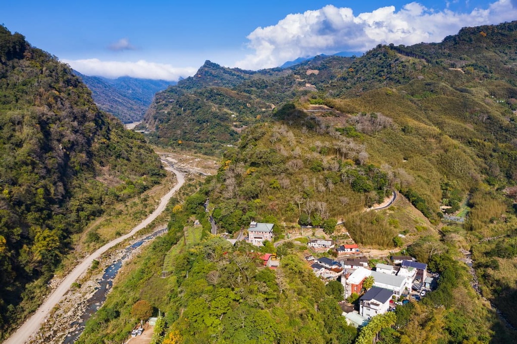
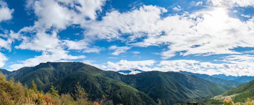
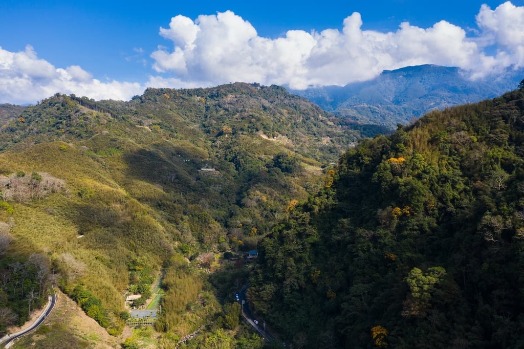
The mountains within Miaoli County are primarily part of the mighty Xueshan Range. Within the county, you can find rugged peaks, tablelands, and plains. Most of the county’s high peaks are located in its easternmost regions while the areas toward the coast tend to be much flatter.
A significant portion of the rocks in Miaoli County are metamorphic in origin though there are also some sedimentary rocks that exist in the region. This includes slates, shales, and sandstones that date back to the Miocene and Eocene epochs.
Within Miaoli County, you can also see evidence of the glaciers that once covered this region during the Pleistocene. This includes glacial cirques, which you can see on many of the island’s highest peaks, including below Xueshan’s summit.
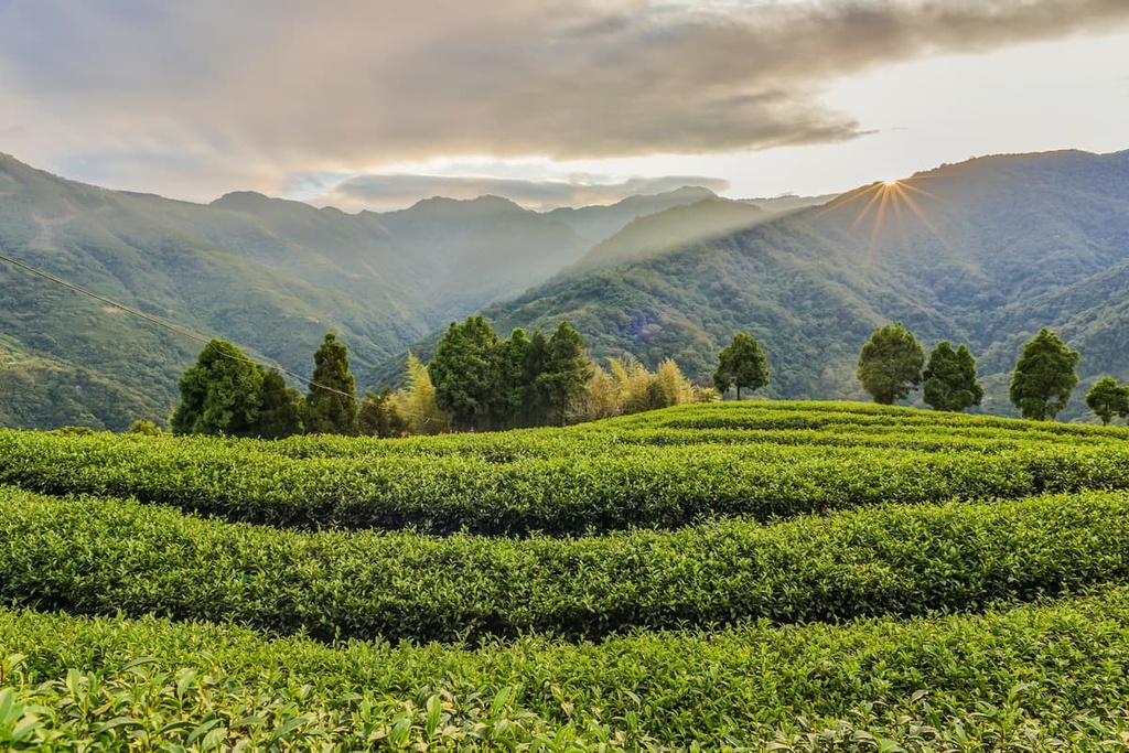
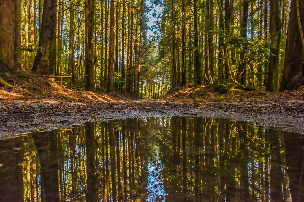
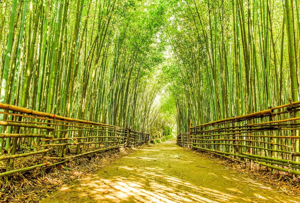
Miaoli’s plant life is as diverse as its terrain. In the elevated regions of Shei-Pa National Park, thriving communities of coniferous trees dominate the landscape above 1,500 meters (4,921 ft).
Taiwan red cypress, Taiwan red pine, and Arishan oak can all be found in the county’s lower coniferous forest belt. As the elevation increases, cold-tolerant conifers such as Chinese hemlock, Taiwan spruce, and Yushan juniper grow on Miaoli’s mountainous slopes.
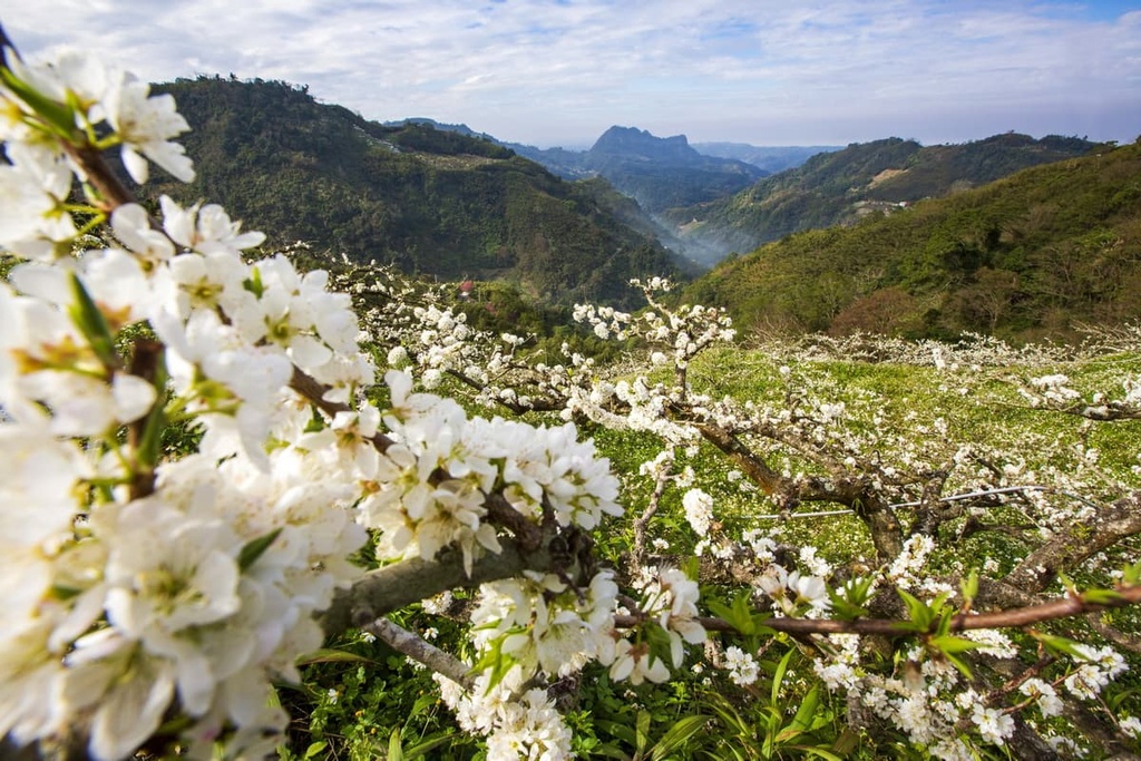
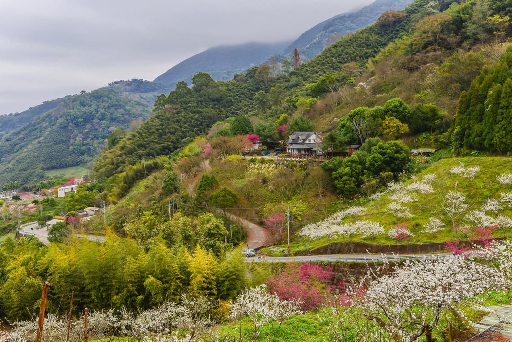
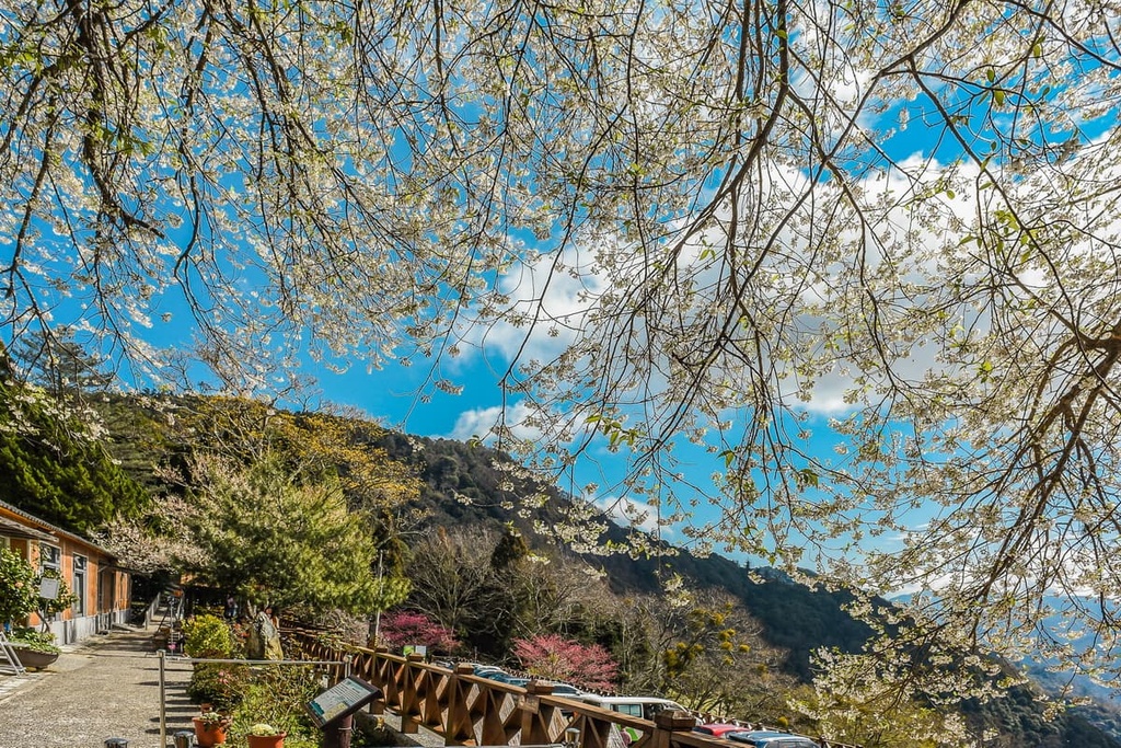
Broadleaf trees grow in Miaoli’s flatter and hotter regions. One of Miaoli’s prettiest springtime trees is the tung tree. During the spring months, the tung tree’s blossoms transform into incredible pink flowers that draw many tourists to the area.
The area that is now Miaoli County has been home to humans for at least 1,000 years. Archeologists have uncovered evidence of extensive human settlement in this region over the past few decades.
This region is part of the traditional territory of the Taokas as well as the Atayal and Saisiyat. However, mass immigration in the seventeenth century brought ships of Han Chinese settlers to Miaoli.
Eventually, Hakka settlers became the dominant ethnic group in Miaoli. As a result, the Indigenous people in the region either had to assimilate or leave. Those who left built communities in Miaoli's mountains.
During the Japanese Occupation Era, Miaoli's mountainous forests were the target of the logging industry. The Japanese noticed that the region was home to huge groves of cypress, cedar, and pine, all of which were valuable for construction and the war effort.
The Atayal and Sasiyat people were displaced from their homelands in the region as a result of all this logging. Soon afterward, the Japanese evacuated them from their mountain dwellings to surveillance roads. Here, Japanese police guarded and monitored the area, watching tribal members’ every move.

Even though it has been quite a few decades since the Japanese Occupation Era ended in Taiwan, Miaoli's tribes have yet to return to the hillside houses that they were forced to flee during the Japanese invasion. As their residences now form part of Shei-Pa National Park, activities like hunting and fishing are prohibited in the area in order to protect the park's ecosystems.
Miaoli’s extensive wilderness areas are home to some of Taiwan’s top outdoor attractions. Here’s a look at some of the best hikes in Miaoli County to check out during your next trip to the region.
Want to scale Taiwan’s second-highest peak? This challenging 22 km (14 mi) trek just might be the one for you.
On this trail, you’ll test your endurance immediately after leaving the parking area as you will encounter the notorious ‘crying slope’ within the first 2 km (1.2 mi) of this hike. This extremely steep section of the trail takes you toward Xueshan East Peak (雪山東峰).
Although it is grueling, this trail does offer stunning vistas as a reward for your efforts. You’ll soon enter the Black Forest, which features 1,000-year-old Taiwan white fir trees and is home to a population of Formosan black bears.
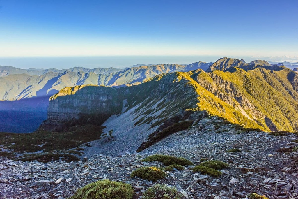
Another highlight of this trip is that it takes you past Xueshan’s glacial cirques. Glacial Cirque Number 1 is Taiwan’s largest cirque, and it sits approximately 800 meters (2,625 ft) below Xueshan’s summit.
Finally, after two days of hiking, you will reach Xueshan’s snow-covered peak. From the summit, a sweeping panorama of jagged mountains and rugged terrain extends in every direction. You can even see Taiwan’s tallest mountain, Yushan (玉山), from Xueshan on a clear day.
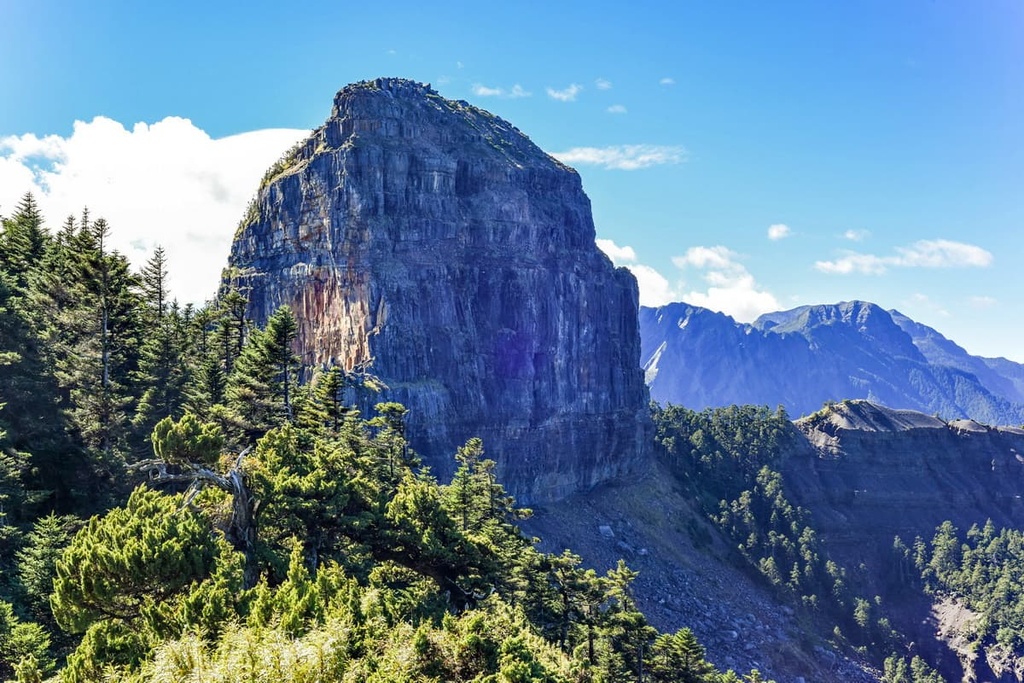
Marvel at the incredible mountain scenery of Miaoli County from Guanwu National Forest Recreation Area (觀霧國家森林遊樂區). Guanwu is located at an elevation of around 2,000 meters (6,562 ft), so it’s the ideal place to see the morning fog rolling off the region’s blue-green sea of mountains.
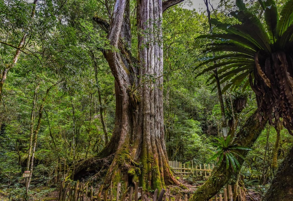
The recreation area is also home to a collection of 2,000-year-old Taiwan cypress trees on Kuaishan (檜山). There are even maple trees on Zhenshan (榛山), which make the park a nice area to visit during the autumn. During the summer, Zhenshan also erupts in flowers thanks to its many rhododendrons and azaleas.
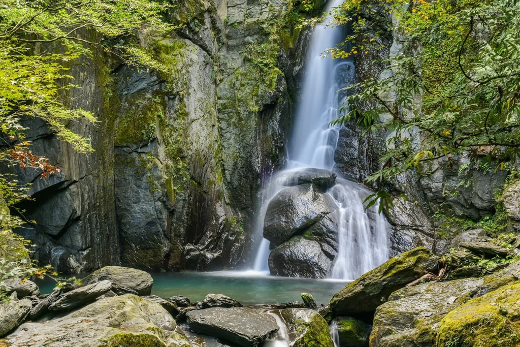
Guanwu also boasts the 30-meter-high (98 ft) Guanwu Waterfall, which is a truly fantastic place to visit on a hike. While in the park, you can also appreciate some excellent views of the nearby Shei-Pa National Park and of both Dabajianshan and Xueshan in the distance.
After a long day of hiking, a trip to the steamy Tai’an Hot Springs (泰安溫泉) is an absolute must. The hot springs’ 47°C (117°F) water evaporates tension from the body and mind, leaving hikers feeling renewed, refreshed, and invigorated.
The hot springs were turned into a resort during the Japanese Occupation Area. However, the region is part of the traditional territory of the Atayal, so you can still experience some aspects of Atayal culture at the nearby village’s many restaurants and eateries.
Uncover history as you walk the ancient Atayal hunting path of Manabang Shan (馬那邦山). This peak was the location of the infamous Manabang Anti-Japanese incident where the Atayal battled against the Japanese to protect their homelands.
Relics of the region’s past still lie on this historic trail, such as ruins of Japanese army bases and battlefields. Manabang’s ugly history is contrasted by the luxuriant nature of its fir and beech forests. Plum blossoms also adorn the path in delightful pastels in the springtime. During the autumn, the trail’s maple forests even transform in color from emerald to ruby.
You will get a chance to admire grand views from Manabang Shan while on this trail. As you hike, you’ll also see the Da’an River as it snakes its way through the region’s grassy peaks. If you’re lucky, you may even see the snow-capped Xueshan in the distance as you trek along the Manabang Shan Hiking Trail.
Dahu Strawberry Fields is an excellent place to check out if you’re in the region between November and April each year. As the area’s name suggests, Dahu Strawberry Fields is a strawberry farm that offers juicy red strawberries for everyone to enjoy.
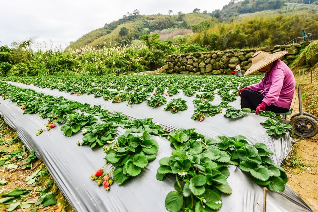
In fact, on this 500 ha (1,236 acre) farm, Dahu grows around 80 percent of the strawberries that are produced on the island, making it Taiwan’s largest strawberry producer. While at Dahu, you can also buy strawberry-infused alcohol, ice cream, and syrup from the souvenir shop.
The Lion's Head Mountain Scenic Area (獅頭山風景區) is one of Miaoli's finest outdoor destinations, particularly among hikers. What sets this series of lush hills apart from the rest of the hiking areas in the county is its collection of bold, opulent temples and otherwise scenic terrain.
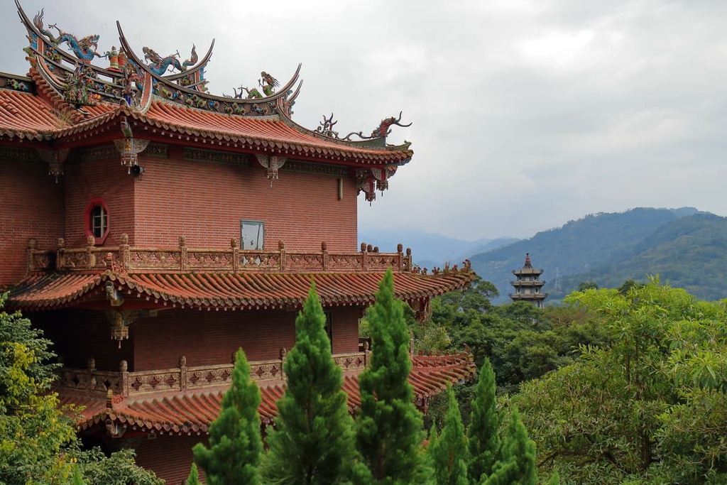
While at the 24,221 ha (59,851 acre) Lion’s Head Mountain Scenic Area, you can choose from a selection of different hiking trails. Some of these trails take you to the area’s many Buddhist temples while others meander their way through the region’s grassy hillsides.
On the Huoyanshan Hiking Trail, you’ll get a chance to summit the so-called flame mountain, Huoyanshan (火炎山). Huoyanshan is somewhat unique in the region as, unlike many of the other peaks in the county, its slopes are nearly devoid of plant life.
This 6.4 km (4 mi) trail follows the path that was originally used by the Atayal tribe to link the villages of Sanyi and Yuanli. Here, you can admire the peak’s massive cliffs and its impressive panoramas. From the summit, you can see the Da’an Valley to the south as well as stunning forests of citronella, lemongrass, and Masson’s pine.
Maoli may not be Taiwan’s largest county by population, but it is home to a number of excellent cities and towns. Here are some of the best places to stay during any trip to Miaoli.
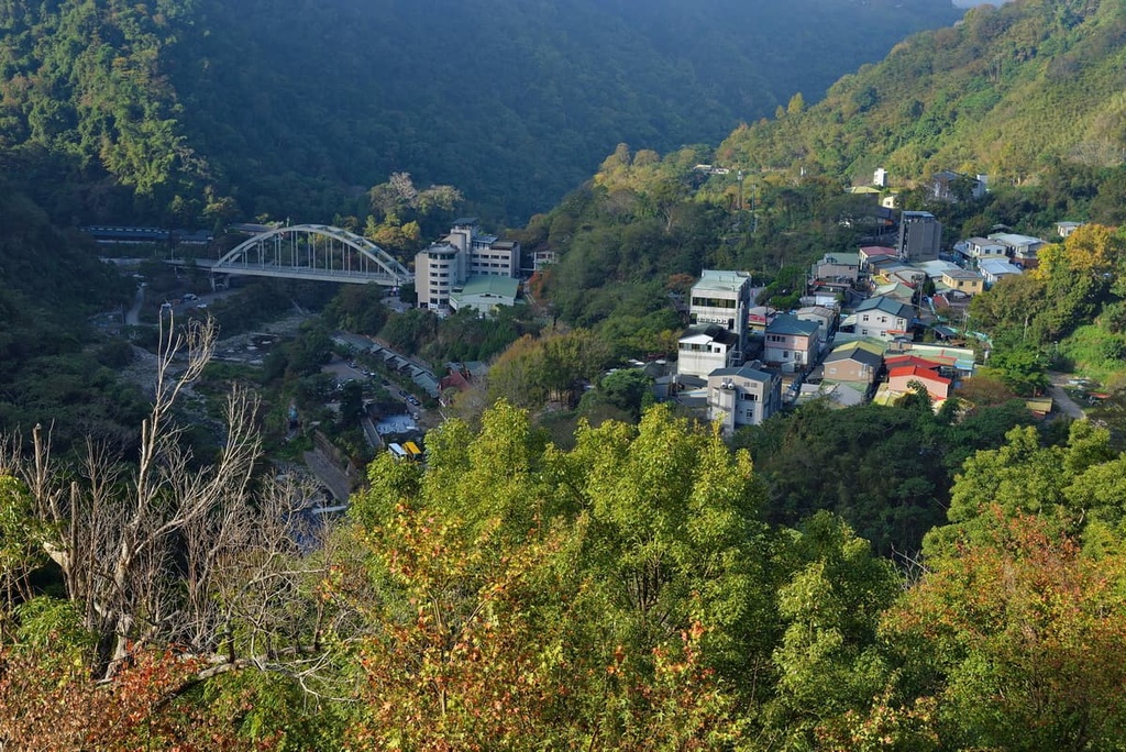
Miaoli is synonymous with outdoor activities, such as hiking, cycling, and mountaineering. Many travelers use Miaoli City as a starting point for a trip to the county’s rugged wilderness, though the city is a worthwhile destination in its own right.
In the city, you’ll find the Miaoli Hakka Roundhouse, which is an exhibit dedicated to Miaoli’s largest ethnic group. Built in as a replica of a traditional toulu, this circular structure boasts fascinating exhibits on Hakka culture.

Alternatively, while in Miaoli City, you can also explore the hillside jungle of Maolishan Park. The park offers great views of the city and beyond. There’s a large selection of trails in the pak, many of which take you to incredible acacia forests. In the park, you can also see the Gongweixu Tunnel, which was built by the Japanese as part of a railway line but is now used as a walkway.
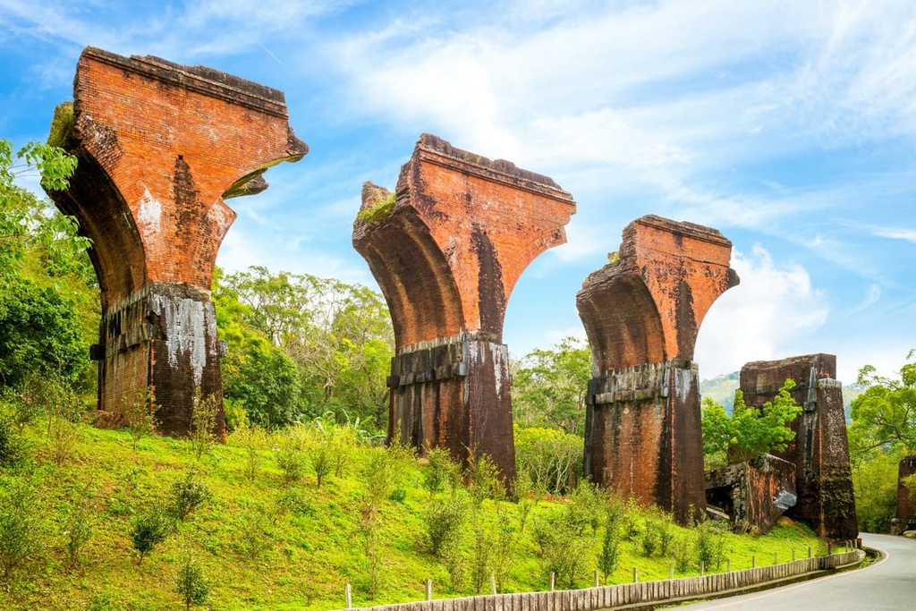
One of Miaoli’s most-visited spots is Longteng Broken Bridge. It was constructed in 1907 by local residents who used glutinous rice and lime as mortar for the bridge itself. This mixture did not hold up well when a massive earthquake hit in 1935, causing the bridge to collapse. What remains is the bridge’s red brick columns, which stand in stark contrast to the surrounding green grassy region, making them a wonderful sight to behold.
Tai’an Township is the largest community in Miaoli County by area as it contains 61,500 ha (151,970 acres) of terrain. Most of the county’s highest peaks are located in the township, so it’s a great place to stay if hiking is a key part of your travel itinerary.
Indeed, Tai’an Township is Miaoli’s adventure capital. You will find the likes of Shei-Pa National Park, Guanwu Forest, and Tai’an Hot Springs in this mountainous region. Furthermore, Tai’an Township is located close to Taichung’s Basianshan Forest (八仙山國家森林遊樂區) and Hualien’s (花蓮縣) Taroko National Park (太魯閣國家公園), so it’s a great place to base yourself for adventures throughout the region.
Tai’an also offers a chance for visitors to sample the Taiwanese staple of tofu at the Xinshuikeng Tofu Street in Chingan Village. The town’s high water quality creates a clean taste and soft texture to the bean curd, making its tofu a must-try if you’re in the area.
To get to Miaoli City from Taiwan’s international airports, you’ll take the Taiwan High-Speed Rail (HSR) or local express train (TRA).
If you prefer to use private transport while in Taiwan, you can hire a car or scooter from any major city to get to Miaoli. Taipei is located about 114 km (71 mi) to the north of Miaoli City while Taichung City is situated about 54 km (34 mi) to the south.


tw100
ultra
taiwan-high-three
taiwan-ultras
tw100
ultra
taiwan-high-three
taiwan-ultras
Yes. Miaoli County Mountains has 372 named mountains. The highest is Xueshan / Snow Mountain at 3,886 m.
The highest mountain in Miaoli County Mountains is Xueshan / Snow Mountain, at 3,886 m.
Miaoli County Mountains has 372 named mountains.


