
Scan the QR code and open PeakVisor on your phone
Taoyuan City is home to 161 named mountains. The highest is Tayux Moyung at 2,450 m.
Taoyuan City (桃園市) is located in the northern part of the island of Taiwan to the southwest of Taipei and New Taipei. There are 161 named mountains in the city’s boundaries, the highest of which is Tayux Moyung (泰矢生山) at 2,450 meters (8,038 ft) in elevation. Tamanshan (塔曼山), a peak straddling the border of Taoyuan and New Taipei City (新北市), is the most prominent of Taoyuan’s mountains with 956 m (3,136 ft) of prominence.
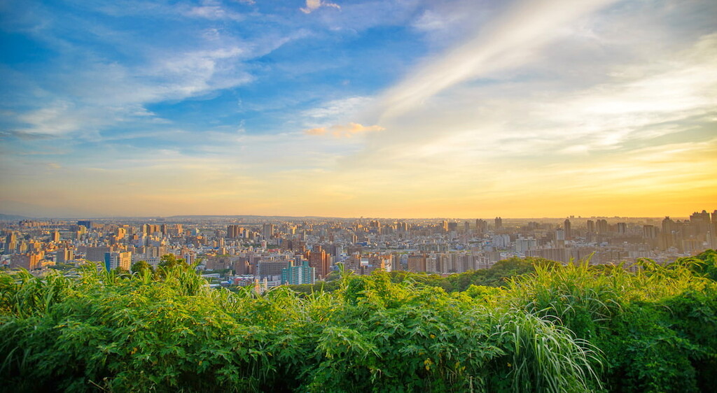
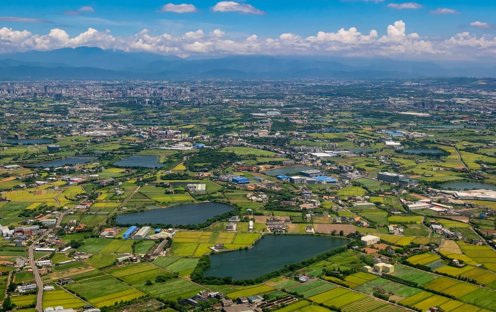
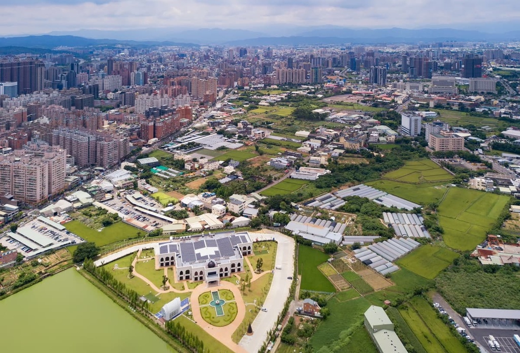
Once a satellite town for nearby Taipei City (臺北市), Taoyuan City has established an identity of its own as Taiwan’s fourth-largest city by area and fifth-largest city by population. Taoyuan covers an area of 122,095 ha (301,703 acres) and it is home to nearly 250,000 residents.
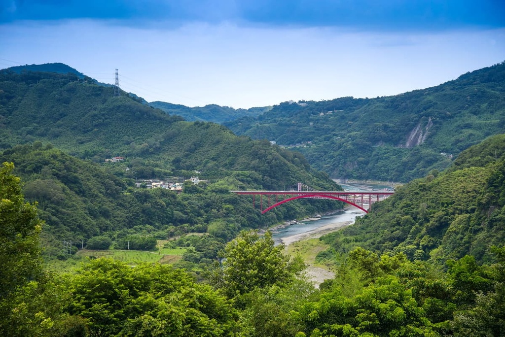
The north-western Taiwanese city of Taoyuan shares land borders with New Taipei City and Yilan County (宜蘭縣) to the east and Hsinchu County (新竹縣) to the west. Taoyuan’s high hills are mainly concentrated in the south within the Xueshan Range (雪山山脈).
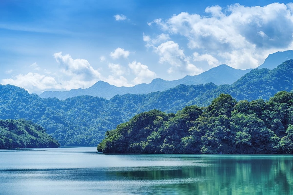
Taoyuan City is home to some of northern Taiwan’s most pristine forests and nature reserves. Lalashan’s (拉拉山) giant cypress tree grove lies in Chatianshan Nature Reserve (插天山自然保留區), while the Dongyanshan National Forest Recreation Area (東眼山國家森林遊樂區) is situated just slightly higher up the mountainside. The picturesque paradise of Xiao Wulai Scenic Area (小烏來風景特定區) is another of Taoyuan City’s many attractions.
Like the rest of northern Taiwan, Taoyuan City boasts a humid subtropical climate where temperatures regularly rise to 34°C (93°F) in the summer months. Winters in Taoyuan are enjoyably mild, with an average high temperature of around 20°C (68°F). However, the high mountainous areas surrounding the city are much colder with average summertime temperatures hovering around 20°C (68°F) and winter temperatures plummeting between 5 and 10°C (41 and 50°F).
Taoyuan’s southern hilly region also receives a large amount of rainfall each year as it normally has a relative humidity level of around 90 percent. This part of the city receives about 3,290 mm (130 in) of rain each year.
The city of Taoyuan features a total of 12 districts and one Indigenous mountain district, the Fuxing District (復興區). Taoyuan District (桃園區) is the seat of the local government. Meanwhile, the southernmost Fuxing District is primarily home to the Atayal people, one of Taiwan’s Indigenous tribes.
The southern hills of Taoyuan City are actually part of the northernmost extension of the Xueshan Range.
The Xueshan Range begins at the snow-capped Xueshan (雪山), Taiwan’s second-highest peak, in the south, and it extends northward toward Taoyuan City. Here, the range curves slightly to the east as it heads to New Taipei City and Yilan County.
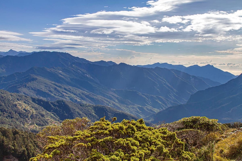
Most of the peaks in this area feature sandstone and shale bedrock that date back to the Oligocene. Some of the main hills in the city are Tayux Moyung and Tamanshan, though they, like all of the region’s major mountains, are located in the southern part of Taoyuan.
Taoyuan’s name translates literally as ‘peach garden,’ which is fitting given the city’s abundance of flowering plants. In Taoyuan’s low-lying plains, the primary ecosystems include broadleaf forests of Formosan alders, peach trees, and Chinese maples.
In Dongyangshan National Forest Recreation Area and Chatianshan Nature Reserve, coniferous trees mix with broadleaf trees throughout the hilly landscape. Taiwan beech, Taiwan red cypress, Formosan juniper, Taiwan fir, and Taiwan hemlock dominate the high-elevation areas of the city.
A group of 18 Taiwan red cypress and Taiwan cypress trees can be found above the 1,500 meter (4,921 ft) zone of Lalashan. The highest tree in this grove is 41 meters (135 ft) tall and 9.8 meters (32 ft) wide.
Additionally, the city’s Chatianshan Nature Reserve is particularly notable as it is home to the southernmost stand of Taiwan beech trees in the northern hemisphere.
Taoyuan’s first settlers were the Indigenous Ketagalan people who resided in the northern plains, valleys, and plateaus of what is now Taiwan. While immigration and urbanization flourished in nearby Taipei City, New Taipei City, and Keelung City (基隆市), Taoyuan City remained a primarily rural region with no large-scale industries or settlements.
Over time, immigrants from the Qing Dynasty’s Fujian and Guangdong provinces established farming communities in Taoyuan, planting peach trees on their fertile land. These peach tree groves are the ultimate source of Taoyuan’s name.
During the Japanese Occupation Era, Taoyuan was part of an administration area called the Shinchiku Prefecture alongside Hsinchu County and Miaoli County (苗栗縣). This period helped Taoyuan establish itself as a city, as the Japanese developed this once-rural area.
Taoyuan separated from Hsinchu and Miaoli County under Chinese rule, and it officially became Taoyuan County in 1950. Nearly 60 years later, Taoyuan City upgraded its status to that of a special municipality area, in which the entire region operates as a county but receives city status.
Taoyuan City may be a rapidly growing metropolis, but it is home to plenty of great hikes for visitors to enjoy. Here are some of the best trails in Taoyuan City to check out during your next visit to the region.
The journey to Taoyuan’s most prominent peak is more of an endurance test than a scenic hike, as Tamanshan’s wooded summit offers no views of the surrounding area. However, Shei-Pa National Park’s (雪霸國家公園) colossal Dabajianshan (大霸尖山) and iconic Xueshan are both visible from the trailhead.
The trail to the top of Tamanshan is characterized by intensely steep slopes that require rope assistance to climb. After the 700-meter (2,297 ft) mark, the terrain is friendlier and more manageable to ascend.
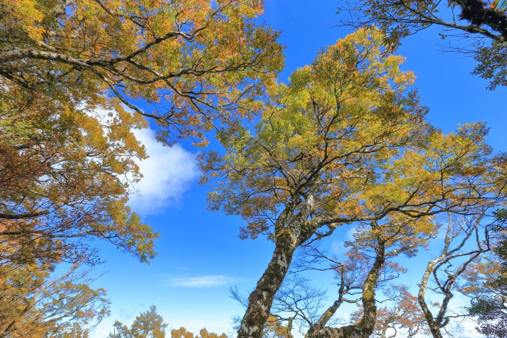
A luscious grove of Taiwan fir and Taiwan red cypress trees dominates the middle to upper slopes of Tamanshan. Springtime showers of rhododendron and cherry blossoms brighten the path with pink pops of pastel. The mood of the trail is transformed in autumn, too, into a cozy crimson world with a forest floor of crunchy, dried leaves.
While Tamanshan’s attractiveness lies in its dense and enchanted woodlands, you can appreciate the surrounding landscape in small clearings located along the trail. In particular, you can see Meiguiximoshan (玫瑰西魔山) and Babokulu Shan (巴博庫魯山), which lie to the south of Tamanshan alongside Lalashan, and Daguan Shan (達觀山), which is situated to the north.
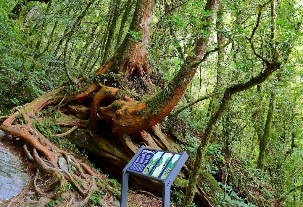
Lalashan’s main wonder is its group of imposingly tall Taiwan red cypress and Taiwan cypress trees, which you can visit on the Lalashan Giant Tree Trail. The highlight of this trail is easily the grove of giant trees on Lalashan, however, the rest of the peak’s stunning woodland scenery isn’t half bad, either.
On this trail, a flourishing broadleaf forest of Chinese maple and red maple set the landscape ablaze with golden foliage during the autumn months. Meanwhile, a peach orchard decorates the forest each spring with delightful bursts of fuschia.
This 3.7 km (2.3 mi) long trail on Lalashan leads to a wooden boardwalk where 18 giant trees line the path. As you are cloaked in a blanket of shade from the lush forest canopy on this trail, it is a perfect place to go forest bathing near Taoyuan.
While the first tree that you’ll encounter on this hike is the tallest, the fifth is the oldest. These towering Taiwan red cypress trees range in age between 500 to 2,800 years. Tree number five, the oldest tree in the grove, is even older than Confucius.
The only Taiwan cypress tree in this massive grave is a two-generation tree, which means a new tree sprouted from an old tree’s dead trunk. The broadest tree is the last tree, number 18, as its canopy measures 19.2 meters (63 ft) in diameter.
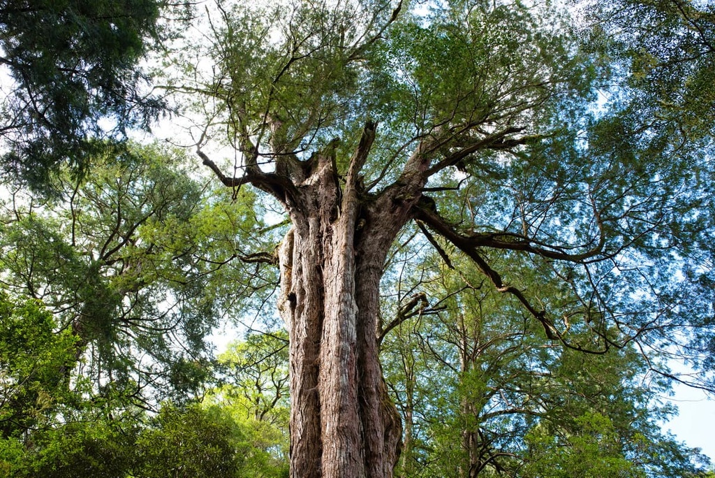
Another giant tree group lies within the boundaries of Chatianshan Nature Reserve in Taoyuan City. Located to the northwest of Lalashan on Heweishan (赫威山) is Taiwan’s lowest elevation grove of gigantic Taiwan red cypress trees.
The 8.5 km (5.3 mi) long loop trail features a group of 100 tall and ancient red cypresses that range in age between 800 and 2,000 years old.
The Eight Immortals Tree is the most striking of the bunch, as an encircling network of eight large trees disguises it among the forest. You can enter the hollowed center of the Eight Immortals and gaze at the blue sky above.
The 3.5 km (2 mi) long Dongyangshan Forest Trail takes you through a dense grove of camphor and fir trees that features a stunning understory of aunt taro and various ferns. The extensive plant community along this trail creates a feeling of traveling through an ethereal viridescent garden, making it the perfect setting for forest bathing.
The trail to Dongyanshan (東眼山) gains 300 meters (984 ft) in elevation; thus, the steep terrain makes this a particularly challenging climb for the region.
Dongyanshan offers superb views from its summit, as you can gaze out onto Guanyinshan (觀音山), Qixingshan (七星山), and the Taipei basin from the top of the mountain. From the summit, you can also see the forests of Manyueyuanshan (滿月圓國家森林遊樂區), the Tamsui River, and Taoyuan City in the distance.
The 8 km (5 mi) long Dongman Trail connects Dongyanshan and Manyueyuanshan (滿月圓山). On this trail, you’ll head south toward Bei Chatianshan (北插天山) before you reach the trailhead that’s located in Manyueyuanshan's marvelous maple orchard.
Starting from Dongyanshan, you’ll enter an aromatic cedar grove that radiates the wooden fragrance of phytoncides. This luscious green route transports you to the thriving beech grove of Bei Chatianshan. Along the way, a chorus of echoing bird tweets and chirping cicadas add an atmospheric touch of being one with nature.
You will then continue northward to the forest of Manyueyuan, which is known for its broadleaf trees and sublime waterfalls.
Most people prefer to make the journey eastward to Manyueyuan as it's mainly a downhill walk from Dongyanshan. However, if you’re looking for more of a physical challenge, consider making the westward journey from Manyueyuan to Dongyanshan as it’s primarily uphill.
The extensive 18 km (11 mi) Zhijishan, Dongyanshan, and Lakashan Circular Trail brings you to four summits as you complete sections of the Dongyanshan Forest and Dongman trails.
One of the highlights of the Zhijishan, Dongyanshan, and Lakashan Circular Trail is the sweeping vistas that you can enjoy of Taoyuan’s backcountry and of Taipei City in the distance.
You’ll begin your journey by scaling Zhijishan (志繼山). While there are no views from Zhijishan’s densely forested summit, you soon enter a rich and varied landscape of streamlined Moso bamboo sheets, rhododendrons, Chinese firs, and cedars.
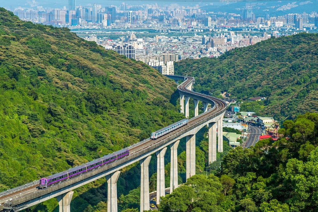
Moving ever onwards, you’ll eventually trek to Donyangshan, the highest summit on this route as you make your way down the Dongyanshan Forest Trail. Dongyangshan boasts supreme 360-degree views from its peaks, including of the Taipei 101 skyscraper in the distance.
As you walk to the next hill, Lakashan (拉卡山), you traverse part of the Dongman Trail’s forest bathing trail. An emerald environment of layered shrubbery and lavish groves of camphor, oak, and red nanmu dominate Lakashan’s verdant slopes. From the summit, you can gaze at the surrounding mountains of Dongyanshan, Zhijishan, Manyueyuanshan, and Kawai Shan (卡外山) and overlook New Taipei City’s rampant wilderness.
To complete this circular trail, you loop northward toward Dongyanshan. On the way, you encounter one of Dongyanshan’s star attractions, a set of giant boulders featuring sea creature fossils from 30 million years ago. Remnants of sea urchins, shells, and foraminifera are exposed on the rock, providing evidence of Taiwan’s once-underwater existence.
Not to be mistaken for New Taipei City’s Wulai District (烏來區), Xiaowulai (小烏來風景特定區) is Taoyuan’s luscious paradise of wild forests and magnificent waterfalls.
One of Xiaowulai’s main features is the SkyWalk, a glass-floored observation deck that overlooks the majestic 50-meter (164 ft) high Xiaowulai Waterfall. Here, an opaque haze of refreshing vapor lingers in the humid air while a milky ribbon of fierce water cascades down the cliff, crashing into the aquamarine pool below.
In the scenic area, you can wander along the region’s many overgrown trails, which take you through a flourishing broadleaf forest. A roped suspension bridge leads you across the flowing Luofu River, where you can appreciate the supreme views of Xiaowulai’s abundant greenery.
As one of the largest cities in Taiwan, there are many places to stay in Taoyuan City. Two of the city’s best areas for visitors are the Daxi District (大溪區) and Longtan District (龍潭區), both of which are home to many cultural and natural attractions.
Known as Taoyuan City’s presidential town, the Daxi District boasts a rich history, a stately vibe, and an abundance of incredible natural areas.
One of the oldest areas of the Daxi District is the aptly named Daxi Old Street (大溪老街). Located on the banks of the Tamsui River, Daxi Old Street boasts ornate baroque architecture that dates back to Japan's Taisho period.
Daxi Old Street is also home to the city’s oldest marketplace, where you can taste any one of the region’s must-try traditional specialties, such as Daxi dried bean curd, moonlight cake, pan-fried buns, and peanut candy.
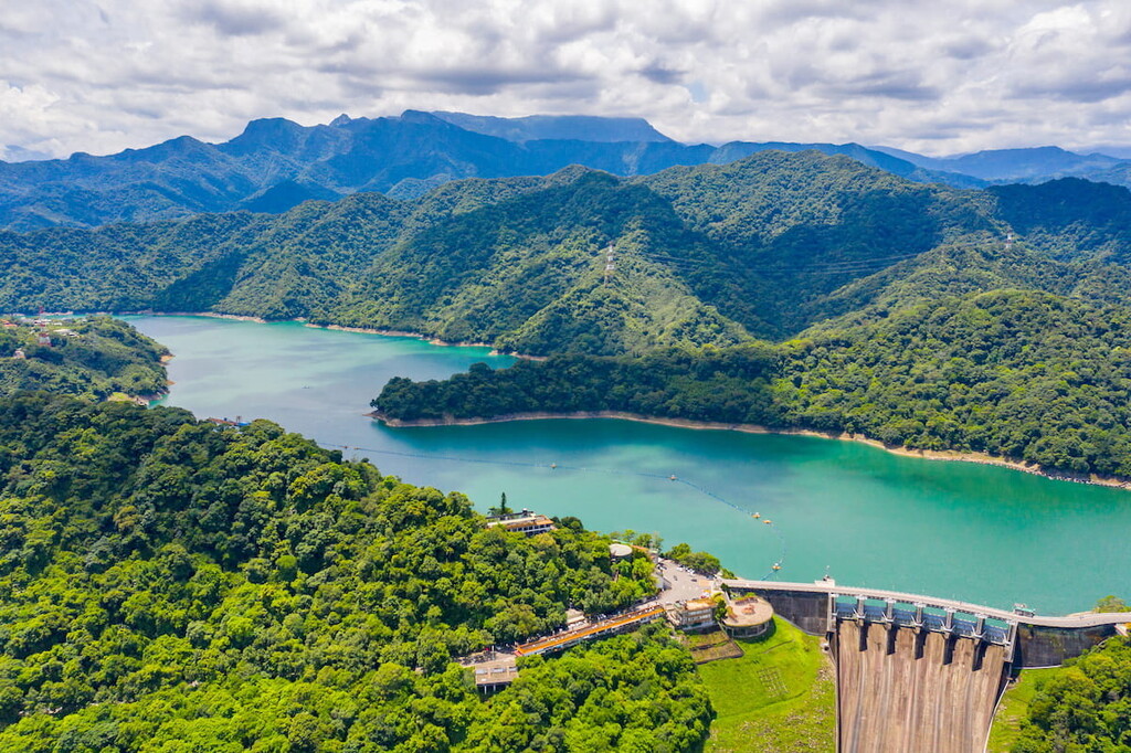
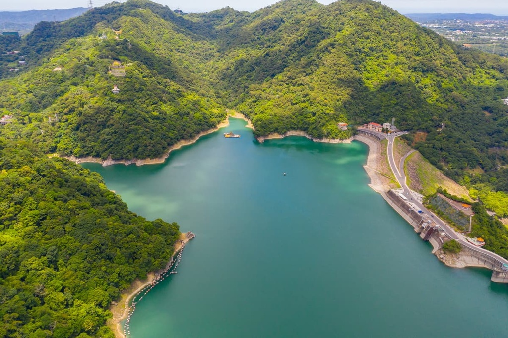
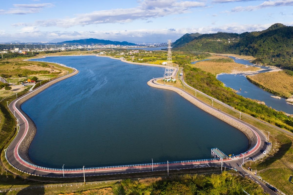
For an idyllic slice of paradise, head to the still crystal waters of Shimen Reservoir (石門水庫). Surrounded by layers of luscious foliage, Shimen Reservoir evokes a tranquil atmosphere of rampant wilderness. The adjacent hills are a prime hiking spot, and there’s even a bicycle trail that traces the reservoir's banks.
Another scenic garden to visit in the area is the verdant Cihu Memorial Park. Once a residence of Taiwan's former leader, Chiang Kai-shek, the estate's beauty impressed him so much that he wished to be buried here. Cherry blossom trees dot the landscape beside the green water lake. Be sure to time your visit to the park so that you can witness the changing of the guard outside Chiang Kai-shek’s tomb.
Alternatively, visit the dense stands of trees at the Bade Bald Cypress Forest. Here, a community of 3,000 bald cypress trees transforms into autumnal shades of golden honey, burnt orange, and deep burgundy. Bald cypress trees can grow up to 50 meters (164 ft) tall; thus, the large trees create a dense forest canopy while piles of fallen warm-shaded leaves litter the floor below.
The Longtan District is one of the more rural areas of Taoyuan City. It is a stronghold of Hakka culture in the region, and it is home to many Buddhist festivals each year.
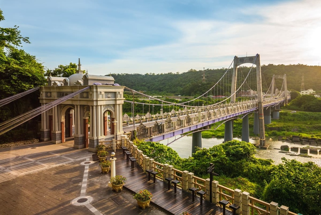
In the district, you’ll find Longtan Lake, whose peaceful setting makes it a charming destination for an escape from the hustle of city life. However, this pond comes to life during June’s annual Dragon Boat Race. The extravagant Nantian Temple, which is situated on Longtan Lake’s island, is also worth checking out. Groves of water chestnut flourish along the lake, and at night, the Longtan Suspension Bridge illuminates in a light show of color for all to enjoy.
Another of Taoyuan’s historic marketplaces is Sankeng Old Street, which is located in the heart of the Longtan District. Taoyuan’s traditional Hakka village, Sankeng, used to be a thriving port before the Dahan River’s water levels dried up. Older Hakka buildings still dot the area’s narrow, snaking roads and many of them sell traditional Hakka cuisines, such as grass cakes, sticky rice cakes, and vegetable buns.
Finally, to experience pure entertainment and thrill, be sure to spend a day at the Window on World Theme Park. At the park, you can brave the highest water ride in Asia amongst various other exciting, fast-paced rides. In addition, you can visit Mini World, which features miniature landmarks from across the globe.
Taiwan’s main international airport, Taiwan Taoyuan International Airport, is located in Taoyuan City. If you arrive at Kaohsiung International Airport, make your way to Taoyuan City via the Taiwan High-Speed Rail (HSR) or local express train (TRA).


Yes. Taoyuan City has 161 named mountains. The highest is Tayux Moyung at 2,450 m.
The highest mountain in Taoyuan City is Tayux Moyung, at 2,450 m.
Taoyuan City has 161 named mountains.


