Get PeakVisor App
Sign In
Search by GPS coordinates
- Latitude
- ° ' ''
- Longitude
- ° ' ''
- Units of Length

Yes
Cancel
❤ Wishlist ×
Choose
Delete
Manyueyuan National Forest Recreation Area’s famed silky waterfalls and burgundy maple forests have long attracted visitors to this wooded haven in northern Taiwan. Lepei Shan (樂佩山) is the tallest and most significant of the 5 named peaks in the park with an elevation of 1,567 meters (5,141 ft).
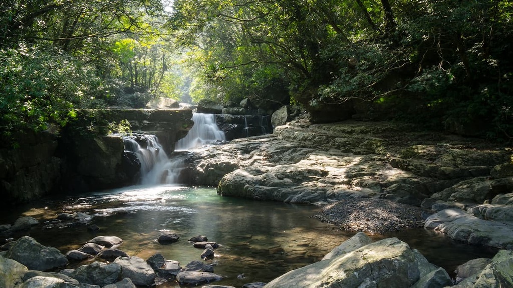
Manyueyuan National Forest Recreation Area (滿月圓國家森林遊樂區), which translates literally as Full Moon National Forest Recreation Area, lies in the Sanxia District (三峽區) of New Taipei City (新北市). It encomapsses 637 ha (1,574 acres) of land in northern Taiwan. The recreation area sits right on the border between New Taipei City and Taoyuan City (桃園市).
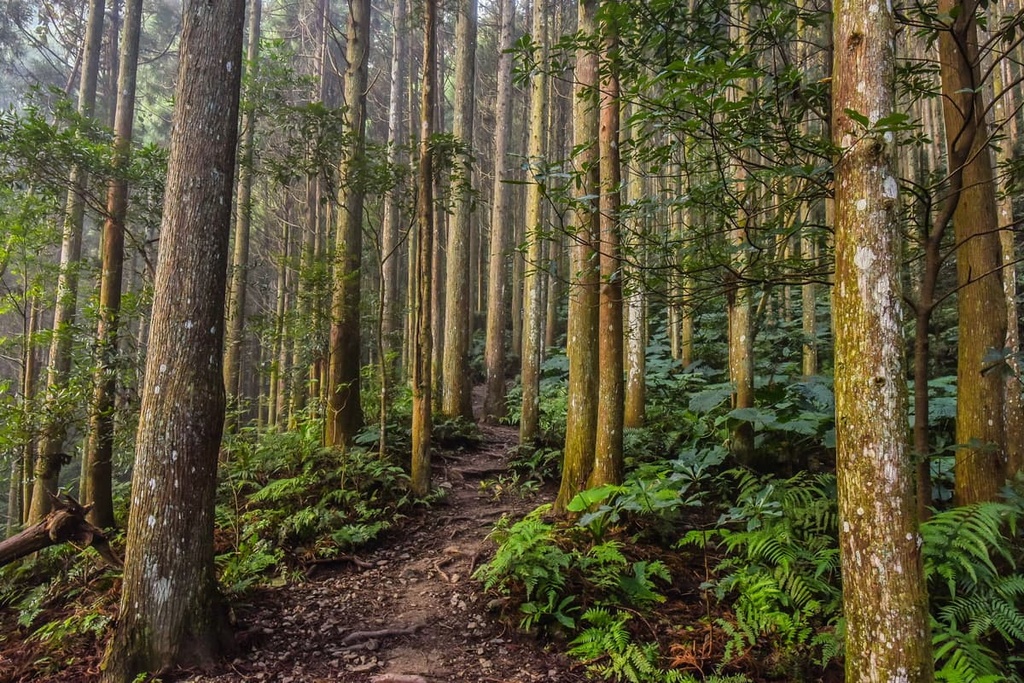
In the recreation area, a flourishing broadleaf forest dominates the landscape between 300 to 1,700 meters (984 to 5,577 ft) in elevation. Maple trees are the most populous trees in these woodlands, though there are also some Japanese cedar forests that are a relic of the region’s past Japanese occupation.
As the elevation in the recreation area is mainly low-lying, the year-round temperature stays relatively warm. Indeed the recreation area has an annual mean temperature of about 20°C (68°F).
Additionally, the recreation area is prone to typhoon damage, as it is located in the unsheltered path of the yearly summer typhoons. The intense 2015 Typhoon Soudelor caused significant damage to the trails in Manyueyuan.
The Dabao River (大豹溪) runs through Manyueyuan’s dreamy landscape, with four mountain streams feeding into this larger waterway. Manyueyuan features two captivating waterfalls featuring long rapids of water sheets falling off steep, deeply cut cliffs.
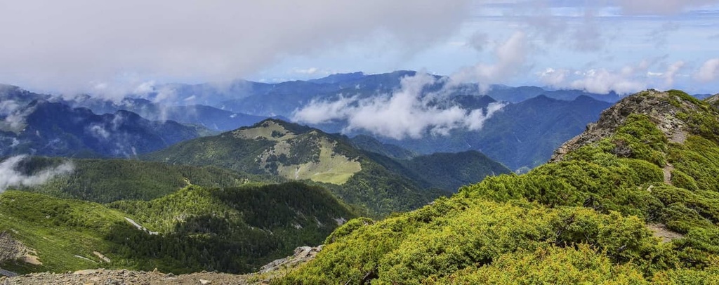
Manyueyuan’s environment is further perfected by its gentle rolling hills that undulate into the distance. The other hills that populate Manyueyuan’s lush landscape are Laka Shan (啦卡山), Manyueyuanshan (滿月圓山), Shuangxi Shan (雙溪山), and Xiongkongnan Shan (熊空南山). The hills opposite Manyueyuan form a circular shape like a full moon, and it’s believed that this is what inspired the forest’s name.
One of Manyueyuan’s main attractions is its negative ion content, which is believed to be the highest in Taiwan. The recreation area’s fertile trees produce 1,854 ions per cubic cm (113 ions per cubic in) of charged energy along its overgrown trails, while the waterfalls in the region generate a whopping 27,192 ions per cubic cm (1,659 ions per cubic in).
Furthermore, a trail in Manyueyuan National Forest Recreation Area links to the nearby Dongyanshan National Recreation Area (東眼山國家森林遊樂區), which is located to the west. This trail allows hikers to marvel at the region’s gorgeous natural landscape in two protected forests.
The recreation area is also surrounded by other popular protected landscapes. This includes Neidong Forest Recreation Area (內洞國家森林遊樂區) to the east, Chatianshan Nature Reserve (插天山自然保留區) to the south, and the Huayuan Mountain Forest (花岩山林花園餐廳) in the north.
Manyueyuan’s hills belong to the Xueshan Range (雪山山脈), which contains a whopping 1,233 peaks, most of which are located in central and northern Taiwan. Its highest peak, Xueshan (雪山), is Taiwan’s second tallest mountain.
The mountains in the recreation area form part of the northern branch of the Xueshan Range and are organized in a full moon shape.
The hill’s rock strata mainly consist of sandstones and shales that date back to the Oligocene. Due to the fragility of these sedimentary rocks, the landscape is heavily eroded. As a result, there are many waterfalls in the recreation area.
Manyueyuan National Forest Recreation Area’s plant life consists of a thriving broadleaf forest of red maple, Japanese cedar, and Taiwan beech. As the forest experiences a humid subtropical climate, Chinese fountain palm and a wide range of ferns grow in these dense woodlands.
Furthermore, every December, the red maple transforms the forest into a blush of burgundy. This annual foliage is one of the biggest attractions of the recreation area and it draws thousands of visitors to the region each year.
As far as wildlife goes, a wide variety of birds inhabit Manyueyuan’s leafy skies. Some of the many bird species in the forest include the white-throated laughing thrush and the red-bellied tit.
Amphibians can also be spotted near Manyueyuan’s mountain streams. There are also dozens of butterfly species found in the forests.
Manyueyuan National Forest Recreation Area was heavily logged during the Japanese Occupation Era, though before that, it was logged on a much smaller scale by two Indigenous tribes—the Alishan (阿里山國家森林遊樂區) and the Baisanshan (八仙山國家森林遊樂區)—who lived in the region for countless generations.
The felled timber produced by the Japanese, alongside other in-demand goods such as tea, created the bustling marketplace of Sanxia Old Street. Although the town’s importance decreased as its status as a major timber producing region declined, Sanxia Old Street still retains its historic architecture.
One of the most important cultural artifacts of the region is an ancient trekking path called the Dongman Trail (東滿步道). The trail now connects Manyueyuan Forest to the western part of the nearby Dongyanshan Forest.
However, its original purpose was to unite two communities of the Atayal tribe. Additionally, during the Japanese Occupation Era, the Japanese took ownership of the road to transport felled timber from Dongyanshan to Manyueyuan and then to Sanxia Old Street.
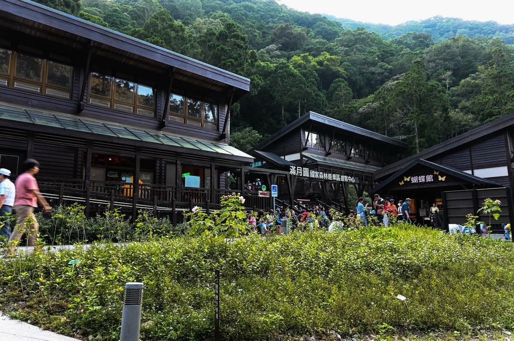
Manyueyuan National Forest Recreation Area offers beautiful woodland trails for visitors to wander. Here’s a quick look at some of the best hiking trails in the region.
Manyueyuan’s waterfalls are undoubtedly its main attraction. The Virgin Waterfall Trail is a 900 meter (2,952 ft) long trail that takes you to see one of the best waterfalls in the recreation area.
This trail begins on a stone-paved path that takes you through a forest of dense ferns. A wooden viewing deck is located at the end of the trail, and it offers great views of the Virgin Waterfall (處女瀑布).
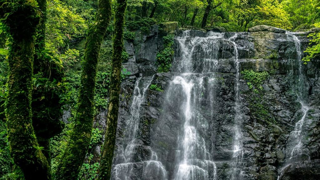
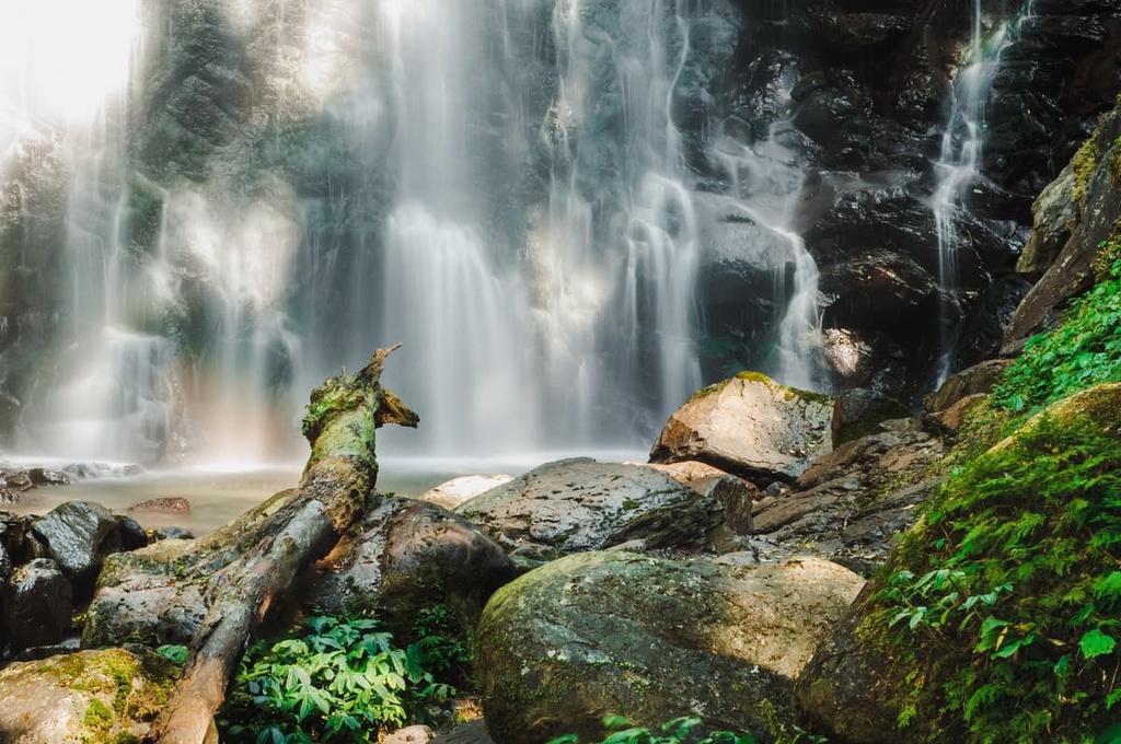
Fed by the Ruizai River, the Virgin Waterfall stands amidst a framework of green lusciousness. Its 10-meter (33 ft) wide water curtain ferociously tumbles from a height of 25 meters (82 ft) to the ground below. As a heavy water vapor mist from the falls floods the surrounding area, a radiant rainbow also appears overhead.
From the viewing deck, visitors can appreciate the sheer magnitude of this three-layered waterfall, which graces the forest with its foaming white sheet of roaring water. The content of negative ions is exceptionally high here; thus, it’s a popular destination for people who want to reap the benefits of the Virgin Waterfall’s beauty and absorb its tranquil effects.
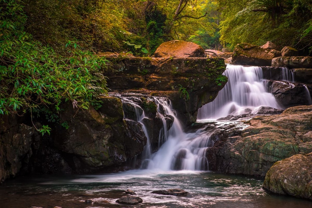
Situated nearby to the Virgin Waterfall is the Manyueyuan Waterfall (滿月圓瀑布), which is also known as the Full Moon Waterfall. Visitors can follow the riverside path of Bengzai Creek along a forest road of soft, plush moss and exuberant epiphytes.
This 1.2 km (0.7 mi) long route features a sheltered trail that takes you past low-hanging bird’s nest ferns and thriving cedar trees. Visitors can hear the dramatic sounds of the Full Moon Waterfall long before they ever get a glimpse of the falls themselves.
Eventually, the forest opens up and you can see the flowing Ruizai River as it gushes over a 20 meter (65 ft) high cliff over its wall of giant, rocky boulders.
Visitors can marvel at the Full Moon Waterfall’s splendor from either the lower viewing deck at the foot of the action or from the observation pavilion above. However, the best view is easily from above as that observation deck, so it’s worth making the extra trek to this fantastic vantage point.
The 1.2 km (0.7 mi) Cedar Forest Trail is a true haven for people looking for a superb forest bathing experience.
A term coined by the Japanese who connected time spent in nature with lower stress levels, forest bathing is the act of walking through a lush, dense forest. From inhaling the fragrant phytoncide, proponents of forest bathing believe that visitors can experience a more serene mental state.
In addition to its plentiful forest bathing opportunities, the Cedar Forest Trail offers excellent opportunities for spotting wildlife. Formosan macaques are commonly seen in the trail’s cedar trees while butterflies tend to flit across the leafy trail. Birdlife is also particularly abundant in this part of the forest.
The Cedar Forest Trail passes through a dense cluster of maple trees, which are a true wonder to behold during the fall months. The best month to view the blood orange foliage is December; however, visitors start flocking to the forest during autumn to witness the maple’s transformation from vibrant green to golden yellow and burnt orange before it finally becomes a bright scarlet.
The trail then descends to the Ruzai River, where visitors can observe Manyueyuan’s aquatic wildlife. Interestingly, the Ruizai River contains a fish ladder to help fish swim upstream. After heavy rains, many smaller waterfalls sashay off the larger boulders surrounding the creek, creating a chorus of moving water.
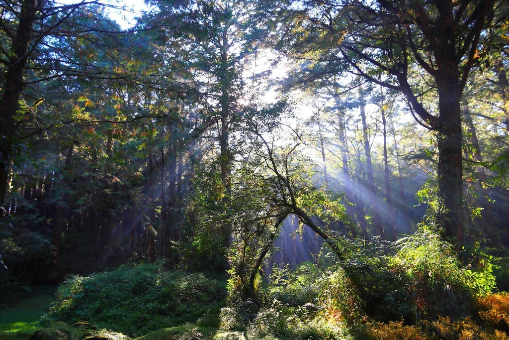
The 7.8 km (4.8 mi) Dongman Trail connects Manyueyuan and Dongyanshan national forest recreation areas. Beginning from Manyueyuan National Forest Recreation Area, the trail makes its way to Bei Chatianshan (北插天山), before it enters Dongyanshan National Forest Recreation Area.
One of the trail’s popularities is its friendly terrain. The course is gentle, as it rises and falls only slightly throughout its length. Thus, people of all ages and fitness levels can enjoy the thriving woodlands of the Dongman Trial.
This trail also features a thriving cedar forest canopy of lush foliage. The views are therefore few and far between, but the Dongman Trail’s main attraction is its flourishing flora, of which it has plenty. Here, rhododendrons bloom in the springtime, creating a slightly pastel palette to the forest’s rich greenery.
Along this trail, you can also enjoy the pure beech woodland that’s located in Bei Chatianshan. Every autumn, a shower of golden leaves decorates this part of the region’s misty forest. Both Manyueyuan and Dongyanshan are home to a thriving community of Japanese cedar trees, so this trail is also a great option for forest bathers.
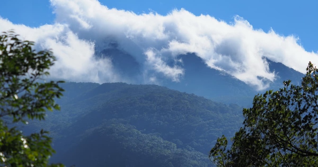
Located in the northern boundary of Chatianshan Nature Reserve, Bei Chatianshan is a steep hill that’s known for its thriving beech forest. Due to its steep gradient, this 10 km (6 mi) trail is considered to be quite challenging, especially after heavy rains, as the muddy path creates an unstable and slippery surface.
The views are incredible along this trail. Through clearings along the trail, hikers can admire the stunning views of northern Taiwan’s gently rolling hills as they ripple into the verdant green distance.
While a beech woodland dominates Bei Chatianshan’s lower forest zone, a redwood community is the primary ecosystem in the higher parts of the mountain. As Bei Chatianshan is located in the cloud belt, it’s also generally covered in a thick misty haae.
From Bei Chatianshan’s summit, hikers can even admire the surrounding hills of Hewei Shan (赫威山), Manyueyuanshan, Lepei Shan, and Wushan (巫山).
Like Manyueyuan National Forest Recreation Area, Dongyanshan National Forest Recreation Area consists of rich, fertile land that houses various wildlife and plant communities. As it was once an ancient logging base, many historic relics are still present in Dongyanshan’s woodlands, such as old railways and bundles of felled logs.
Dongyanshan (東眼山), standing at 1,217 meters (3,992 ft), is the centerpiece of the forest. Visitors can hike up to its summit through fragrant cedar forests. From the summit, hikers can also admire Manyueyuan’s mystical forests, as well as the snaking Tamsui River (淡水河) and the peaks of Manyueyuanshan and Kawaishan (卡外山).
In addition to its ecological charm, Dongyanshan National Forest Recreation Area is home to an impressive collection of fossils. Large outcroppings of sedimentary rocks located around Dongyanshan display countless fossils from 30 million years ago. These fossils are a testament to the complexity of the region’s geologic history.
Manyueyuan National Forest Recreation Area is relatively centrally located in Taiwan. As a result, there are many nearby places for visitors to stay, such as Taipei (臺北市) and Taoyuan (桃園市). Here’s what you need to know before your next visit.
Taiwan’s capital city, Taipei, is bursting with history, culture, innovation, and nature. Taipei contains many green spaces for a huge city. It also features numerous hiking trails and scenic landscapes that are just a short drive away.
Yangmingshan National Park (陽明山國家公園) is located in Taipei’s backyard, and it is a playground for nature lovers. The park is home to 97 named mountains and it is not short on attractions. One of the main attractions in the park is Qixingshan (七星山), which is both the park’s highest peak and a dormant volcano.
Northern Taiwan is notoriously hilly, and Taipei is swamped with nearby hills. In particular, Elephant Mountain (象山) is located at the eastern boundary of Taipei, and it offers excellent views of Taipei’s iconic skyscraper, Taipei 101.
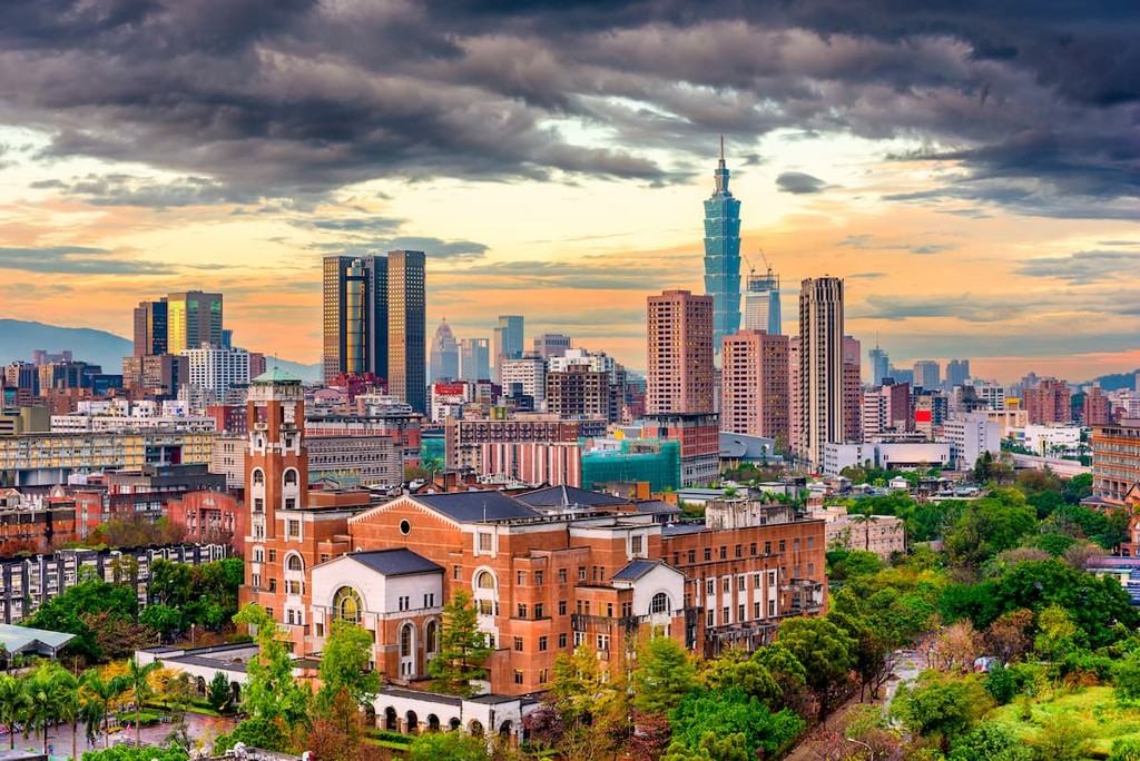
As you ascend the 600 cement stairs to the top of Elephant Mountain, you’ll make your way through an abundance of ferns, including Cibotium Taiwanese and the flying spider-monkey tree fern. From Elephant Mountain’s summit, you can enjoy the spectacular views of Taipei.
Alternatively, you can take the Maokong Gondola to the top of Maokong (貓空), one of Taipei’s other main hills. Maokong’s fields are one of Taiwan’s pioneer tea-growing plantations. On the mountain, you can visit an ancient teahouse and sip on the local oolong tea while taking in the region’s spectacular views.
Or, for a more urban experience, you can venture to the top of Taipei 1010, which once held the title of the world’s tallest building. It is 508 meters (1,667 ft) tall and it is one of the most ecologically-friendly skyscrapers in the world. If you want great views, head to the observation deck on the tower’s 89th floor.
For a true Taiwanese experience in Taipei, you can also visit one of the city’s many bustling night markets. Shilin Night Market has been operating since 1910, making it Taipei’s oldest night market. This popular market boasts a maze of merry vendors selling everything under the sun. Shilin Night Market is famous for its specialty oyster omelet, bubble tea, and stinky tofu.
Located just a short train ride from Taipei is Taoyuan. Taoyuan is home to Taiwan’s main airport and, while the city may not be as exciting as its neighboring capital, its landscape is an underrated gem.
One of the best parts of Yaoyuan is its proximity to an area of natural beauty, Xiao Wulai Scenic Area (小烏來風景特定區). Xiao Wuilai is mainly known for its skywalk, a glass paneled viewing deck that stands 70 meters (230 ft) above the 55-meter (180 ft) Xiao Wulai Waterfall.
The resting place of Taiwan’s beloved former president Chiang Kai-shek is also located in the city’s Cihu Mausoleum. Due to its serenely picturesque setting of gentle verdant hills, luscious willow trees, and a glimmering green lake, President Chiang resided in Cihu and thus was laid to rest in this heavenly garden after his death.
Or you can check out Shimen Reservoir, which is a popular holiday destination for locals. While reservoirs may not seem a likely hotspot for holidaying, many locals are drawn to Shimen Reservoir’s beautiful cobalt-colored lake. Sunrise and sunset are particularly mesmerizing at the reservoir, as the glowing golden light reflects off the lake’s smooth surface.
You can also check out Daxi Old Street, which is one of Taoyuan’s earliest settlements. Daxi Old Street’s market houses were built in the Baroque style, with ornate, detailed artwork adorning each building’s exterior. As you stroll down this ancient road, you can pop into its various stores; however, Daxi’s food shops are particularly worth checking out as they sell delicacies like Daxi dried tofu, rice dumplings, and moonlight cakes.
There’s also Jiaobanshan Park, which is located on the southeastern side of Jiaobanshan (角板山). Maple trees dominate the park, creating a fiery display in the autumn. Pine and plum trees can also be found in the park, which features a springtime blossoming of magenta plum flowers. Jiaobanshan Park is also known for its beautiful sculpture garden.
Since Manyueyuan National Forest Recreation Area is located close to Taipei, visitors can use public transport to get to the forest.
To get there by public transport, take the Taiwan High-Speed Rail (HRS) or local express train (TRA) to Banqiao Station from Taipei Main Station. Once there, board the Taipei bus 702 or 812 to Sanxia Stop 1. Then change to Taipei bus 807, which takes you to Manyueyuan National Forest Recreation Area.
Alternatively, you can make the 49 km (30 mi) drive from Taipei to the national forest recreation area.
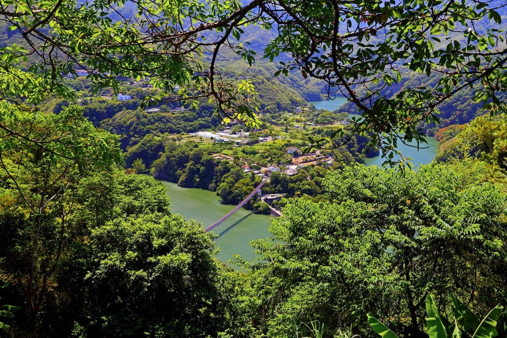
Explore Manyueyuan National Forest Recreation Area with the PeakVisor 3D Map and identify its summits.


