Scan the QR code and open PeakVisor on your phone
Yilan County (宜蘭縣) is an administrative area in northeastern Taiwan that boasts a diverse landscape of grassy flatlands, forests, and rugged mountains. There are 281 named peaks in the county, the highest of which is Nanhudashan East Peak (南湖大山東峰) with an elevation of 3,632 meters (11,916 ft). The most prominent of the peaks in Yilan County is Lankanshan (蘭崁山), which has 755 m (2,477 ft) of prominence.

Yilan County is northern Taiwan’s easternmost county. It encompasses 214,400 ha (529,794 ac) of land to the west of the Pacific Ocean. Yilan borders Hualien County (花蓮縣) in the south and New Taipei City (新北市) to its north. Hsinchu County (新竹縣), Taichung City (臺中市), and Nantou County (南投縣) all lie to the west of Yilan.
As it is situated on Taiwan’s east coast, Yilan County is the island’s first point of impact during typhoons and monsoon season. For this reason, Yilan County receives a high annual rainfall average of 3,340 mm (132 in).
Known for its low-lying grasslands, Yilan’s extensive Lanyang Plain is an alluvial prairie created by the Lanyang River (蘭陽溪). This flatland occupies Yilan’s eastern area, forming a triangular zone between the coastal Toucheng (頭城鎮) and Su’ao townships (蘇澳鎮) and inland Sanxing Township (三星鄉).
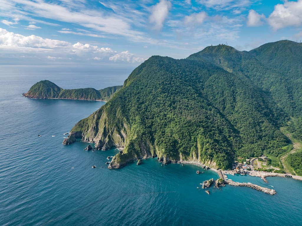
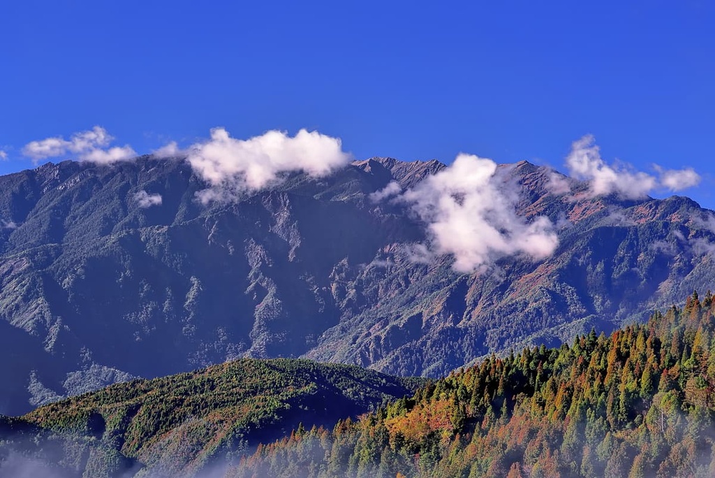
Yilan’s peaks gradually rise in height beyond the Lanyang Plain. The mountains soar sharply as you make your way to the south toward Hualien’s hilly hinterland. Additionally, the Central Mountain Range (中央山脈) is located in the southern part of Yilan while the Xueshan Range (雪山山脈) covers a section of the western region of the county.
One of Yilan’s most famed attractions is Taipingshan National Forest Recreation Area (太平山國家森林遊樂區). Once an industrial logging base, Taipingshan’s dense woodlands draw acclaim for its picturesque misty mountain setting.
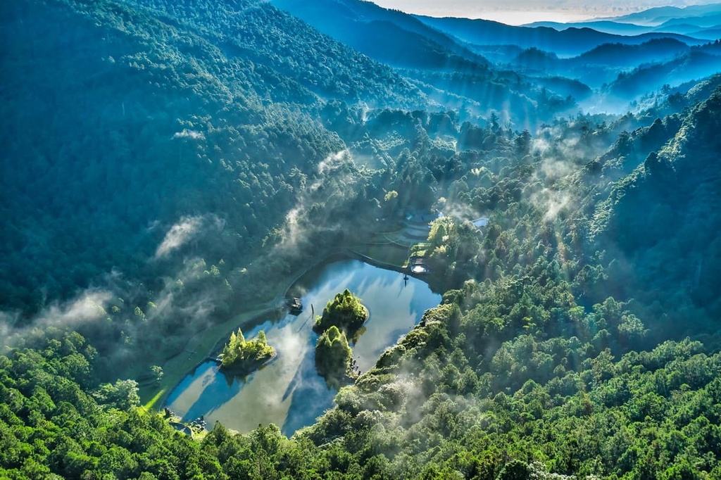
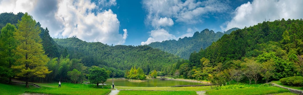
Another one of Yilan’s points of pride is Cueifong Lake (翠峰湖), the largest alpine lake in Taiwan. This lake is located at an elevation of 1,900 meters (6,234 ft), and it covers 20 ha (49 acres) of terrain. It expands in size to 25 ha (62 acres) during Yilan’s rainy season.
Yilan City (宜蘭市) is the county’s capital. There are eleven total administrative regions within the county, including three urban townships, six rural townships, and two mountainous Indigenous townships.
Yilan’s hills are part of Taiwan’s two massive mountain ranges: the Central Mountain Range and the Xueshan Range.
The bedrock of the Central Mountain Range consists primarily of the slate from the Tertiary period. Meanwhile, the Xueshan Range, which passes through northwestern Yilan, features sandstones and slates from the Oligocene epoch.
Within Yilan County, you can also see large alluvial fans in the upper Lanyang River. These alluvial fans create massive gravel deposits in the county as the river carries a significant amount of silt that settles in the riverbed.
Yilan County has a varied range of plant life due to its diverse landscape. In the open plains of the county, you’ll find a subtropical plant community. The main tree species that you’ll find in these areas are Formosan sweet gum, acacia, and eucalyptus.
As the elevation starts to increase in Yilan County, the flora transforms into a broadleaf forest. Here, you’ll find species such as Taiwan red maple and bird lime trees.
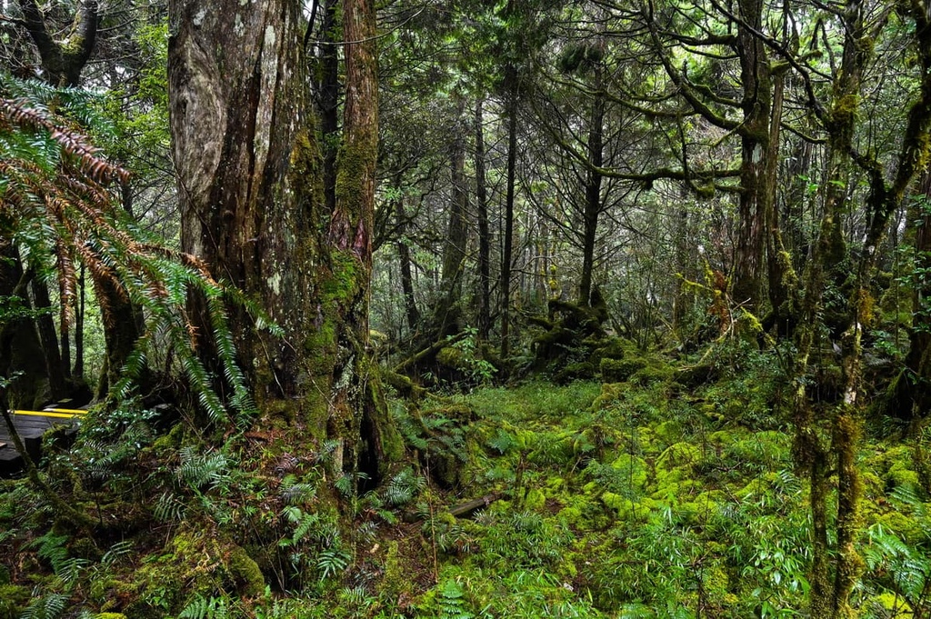
Conifers begin to dominate Yilan’s landscape in regions of 2,000 meters (6,562 ft) in elevation. The dominant evergreen species in these high-elevation locales within the county are Taiwan hemlock, Taiwan beech, and Taiwan cypress.
Yilan’s first human settlers were the Kavalan Tribe. Based around the Lanyang Plain, the Kavalan are the Yilan region’s largest Indigenous group, followed by the Atayal. However, the Atayal have since migrated eastward over the Central Mountain Range to Yilan’s Datong Township (大同鄉), which is where many members of the Atayal Tribe live to this day.
The Kavalan and Atayal were later joined by Han settlers who left the Qing dynasty’s Fujian Province in mainland China and migrated to Taiwan in the late eighteenth century. It took nearly 100 years for the Han to progress south into Yilan from the coastal areas of Taipei (臺北市), Keelung (基隆市), and Hsinchu. Eventually, Han migrants established rice farms in Yilan’s low-lying flatlands.
Yilan’s history follows the same pattern as northern Taiwan’s past perils. The Spanish colonized the area in the seventeenth century, after which the Dutch pursued control of Taiwan. Following Koxinga’s defeat of the Dutch, the Qing dynasty then ruled over Taiwan. Following that, the Japanese claimed ownership of the land. The infamous Japanese Occupation Era in Taiwan occurred between 1895 to 1945.
Over the years, Yilan County has been part of many other administrative regions. It first formed part of the enormous Taipeh Prefecture. This included modern-day Hsinchu County, Taoyuan City (桃園市), Keelung City, New Taipei City, Taipei City, and Yilan County. Under Japanese rule, Yilan County fell under the administration of Taihoku Prefecture, together with Keelung City, New Taipei City, and Taipei City.
However, the Japanese soon discovered Taiwan’s wealth of cypress trees and its mountainous forests. As a result, logging operations began in these areas. Taipingshan National Forest became one of Taiwan’s top three logging bases during this time.
Once Japan handed Taiwan over to the Republic of China in 1945, Yilan became part of Taipei County. In 1950, Taiwan’s government established Yilan County as part of Taiwan Province. This made Yilan one of Taiwan’s 13 counties.
Yilan County is home to a number of excellent hiking areas. Here are some of the best cities and towns to check out in the region.
On the Jian Jing Historic Trail, you can get a glimpse into Taipingshan’s logging past as you wander along the region’s emerald forests. As you hike this trail, you’ll see the disused train tracks that run across the mountain, a relic from previous times.
Abandoned tools, deserted trolleys, and derelict worker huts are some of the many other artifacts that you can see on this trail. You can also experience the wonderment of nature’s resilience as you gaze at the overgrown railroad near the trail.
There are even a few observation decks that overlook Yilan’s sweeping scenery along this short trail. From these observation decks, you can see the expansive Lanyang Plain to the east. You can also observe Shei-Pa National Park’s (雪霸國家公園) Xueshan (宜蘭市) and the Holy Ridge that connects to Dabajianshan (大霸尖山) to the west.
Additionally, if you hike this trail during the spring months, you can marvel at the cherry blossoms in the region that transform the path with plumes of pink flowers.
On the Cueifong Lake Trail, you can trek to Taiwan's largest alpine pond, Cueifong Lake, to witness the stillness of its smooth glassy waters. The setting for the trail is idyllic, as a Taiwan red maple forest creates a stirring presence in any season.
The woodlands along this trail flourish in spring while rainy mists suspend over the pond during the summer months. Red foliage dominates the trail in autumn, while a white snow blanket covers the ground in winter.
The 4 km (2.4 mi) Cueifong Lake Trail loops around the pond and gives you a chance to spot the region’s wildlife. Here, Taiwan sambar deer and mountain goats graze at the waterhole's edge while Mandarin ducks wade in the lake.

The Juizhize Nature Trail offers a chance to cross the Duowang Suspension Bridge and appreciate some of Yilan County’s most incredible forests. Due to Taipingshan’s humid and rainy climate, a variety of plants thrive along the trail. You can admire Taipingshan’s biodiversity as you stroll along this luxurious greenery.
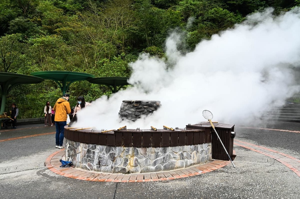
As it is engulfed by verdant mountains, the landscape of the Juizhize Nature Trail is incredibly scenic. Along this route, the bubbling Duowang River snakes its way through the valley. Nearby, the Juizhize Hot Springs’ thermal smoke lingers in the air, creating wispy heated clouds.
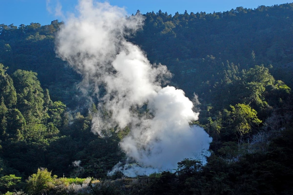
At the Juizhize Hot Springs, you can soak in the boiling 90°C (194°F) water and feel your worries melt away. The steaming spring water escapes through the rock’s crevices at an alarmingly hot 140°C (284°F) but undergoes a cooling process, which makes the water the perfect temperature for a relaxing bath.
Japanese loggers built Juizhize Hot Springs as a tranquil escape from their tiring trade. The scenery at the hot springs is attractive, as it is surrounded by luscious evergreen forests and rolling jade mountains. At the hot springs, you can watch the steam rising above sodium bicarbonate waters as you hear the joyous chirping of birds echoing from the nearby woods.
Journey above the clouds on this 1.2 km (0.7 mi) trail to Wangyangshan’s (望洋山) peak. The summit of Wangyangshan is also the perfect place to marvel at the sunrise as it breaks over Yilan’s hilly landscape.
Yilan’s mountains surround the forested Nao-ao River Valley and grassy Lanyang Plain. Thus, from the Wang Yang Shan Trail, you can admire the splendid views across the terrain. From Wangyangshan, you can gaze out at the Pacific Ocean and you can even see Guishan Island (龜山島) in the distance.
Another scenic sight from Wangyangshan is Cueifong Lake. This sunrise viewing platform overlooks Taiwan’s largest alpine lake, giving you a chance to admire the lake’s still waters as they reflect the region’s resplendent amber skies.

The Songluo Hiking Trail traces the Songluo River (松羅溪) and wanders into traditional Atayal hunting grounds. This 4 km (2.4 mi) long trail passes through wooden lowlands of dense camphor trees.
One of the trail’s highlights is watching the wildlife graze in the region’s meadows and drink from the creek. You can spot marine life in the river’s clear waters while a swarm of dragonflies circulates in the humid air.
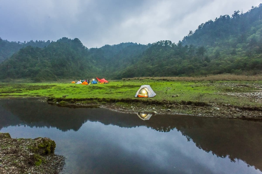
To experience a night in the wild, many hikers set up camp along the Songluo Riverbank. Here, you can sleep to the sounds of nature and wake up to the radiant sunrise as it warms the environment with its golden glow.
To experience the best of Yilan’s city life, nature, and stunning coastline, consider staying in Yilan City, Jiaoxi Township (礁溪鄉), or Su’ao Township.
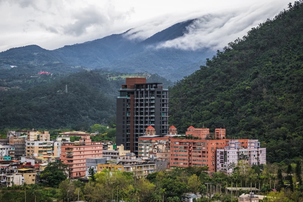
Yilan’s capital is less chaotic and bustling than nearby Taipei or Taichung. However, Yilan’s laid-back vibes and crowd-free attractions are its main highlights.
While in the city, be sure to sample Yilan’s delicious delicacies at the Dongmen Night Market (東門夜市). At the market, you can enjoy the intoxicating merry atmosphere of cajoling vendors and eager customers as you stroll across the sizzling street stalls. The market’s many vendors sell an array of Yilan delicacies like spring onion pancakes, peanut rolls with ice cream, and red yeast cuttlefish.
Another one of Yilan’s hotspots is the Yilan Brick Kiln (宜蘭磚窯). Yilan’s clay resources are the perfect component for making bricks. As a result, residents of Yilan built thirteen red brick kilns to produce the in-demand product for construction. However, the development of concrete replaced bricks in construction in the region, which led to the abandonment of the Yilan Brick Kiln. Thankfully, the kiln is still well-preserved and it now serves as a museum that showcases this part of Yilan’s past.
One of Yilan's most scenic regions is the stunning Jiaoxi Township. Flanked by rolling hills that border the northern Lanyang Plain, Jiaoxi Township is considered to be a rural area of Yilan.
Jioxi Township is home to Yilan's largest body of water, the 17 ha (42 acre) Longtan Lake (龍潭湖). Known as one of Yilan's most scenic spots, Longtan Lake is surrounded by flourishing subtropical broadleaf forest. You can take a walk along a wooden boardwalk to admire the lake’s calm waters and surrounding greenery. Visitors to the area can also check out the several ornate temples that are located within walking distance of the lake.
Alternatively, Jiaoxi Hot Springs (礁溪溫泉) is one of Yilan's wonders, as it's rare for a flat area to sprout thermal springs. Locals love to bathe in the enriched mineral waters of the hot springs as some believe that they purify and clear the skin.
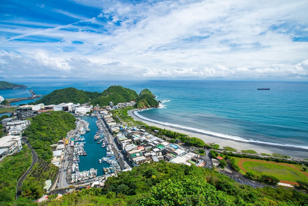
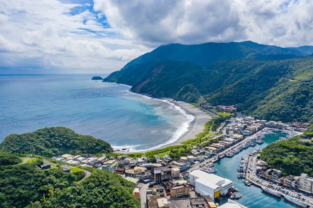
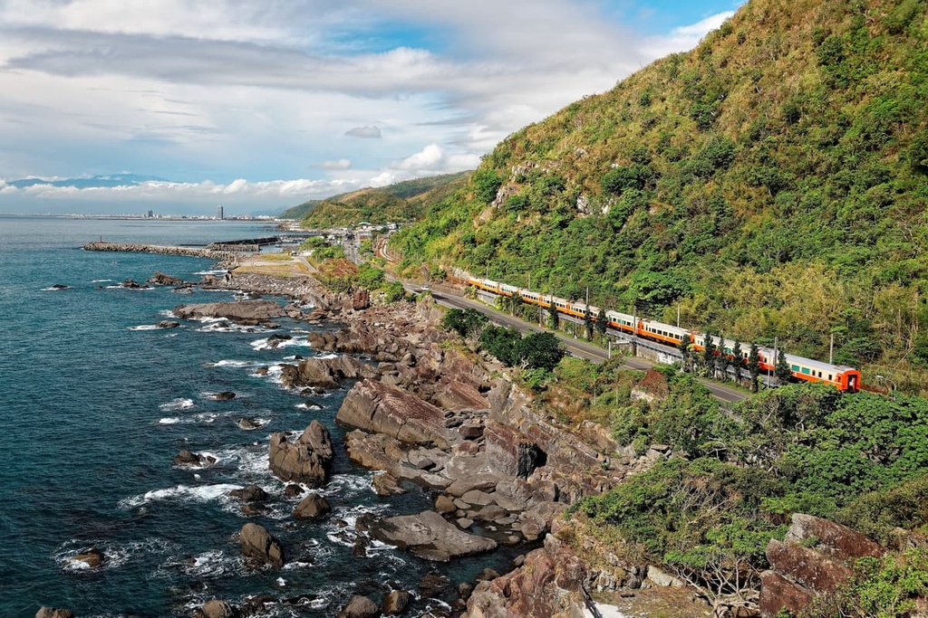
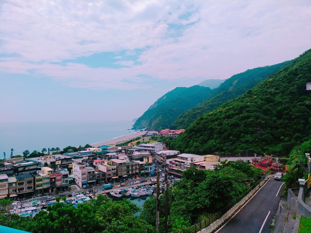
Yilan’s coastal township, Su’ao, is a paradise of golden sandy beaches and aquamarine water. Locals flock to Su’ao to visit some of Yilan’s finest beaches and to enjoy Taiwan’s year-round warmth.
Another of Yilan’s gems that’s located in the township is Su’ao Cold Springs (蘇澳冷泉), a rarity in Taiwan and across the globe. As the springs have a lukewarm temperature of 22°C (72°F), you will initially feel cold as you enter the water. But, since the springs contain high amounts of carbon dioxide, many residents believe that bathing in them regulates and improves your blood circulation.
Finally, if you want to admire Yilan’s pristine coastline, head to Su’ao’s Neipi Beach (內埤海灘). This charming area earned the title ‘Lovers Bay’ for its romantic atmosphere, especially at dusk and daybreak. While at the beach, you can choose from numerous activities on offer, such as surfing, hiking, scuba diving, kayaking, fishing, and hiking.
You can get to Yilan County easily via public transport. To do so, upon arriving at Taiwan’s international airports, make your way to Taipei via the Taiwan High-Speed Rail (HSR) or the local express train (TRA). Once in Taipei, take a local express train (TRA) from Taipei Main Station to Yilan City.
Alternatively, if you prefer to hire a car or scooter, the journey from Taipei to Yilan is 64 km (40 mi).