Get PeakVisor App

❤ Wishlist ×

Choose
Delete

Yushan Range

There are 148 named mountains in the Yushan Range. The highest and the most prominent mountain is Yushan.

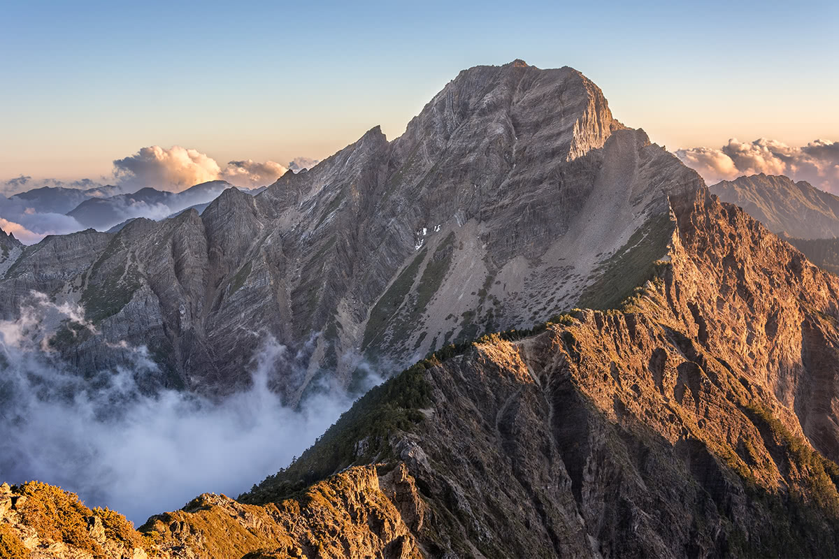
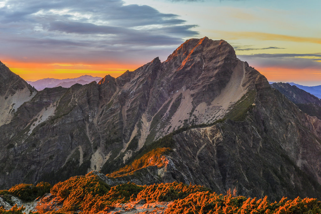
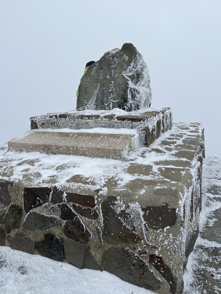
Yushan (玉山, Jade Mountain) is the tallest peak in Taiwan, reaching a height of 3,952 meters. Due to its elevation, Yushan’s peak is often snow-covered, and the reflection of sunlight on the snow is where it receives its “jade” name. Yushan is the centerpiece of Taiwan’s massive Yushan National Park, which is considered the location of Taiwan’s most pristinely preserved wilderness. Many of Taiwan’s endemic animals can still be found in Yushan National Park. Yushan’s prominence of 3,952 meters makes it the 27th most prominent mountain in the world.

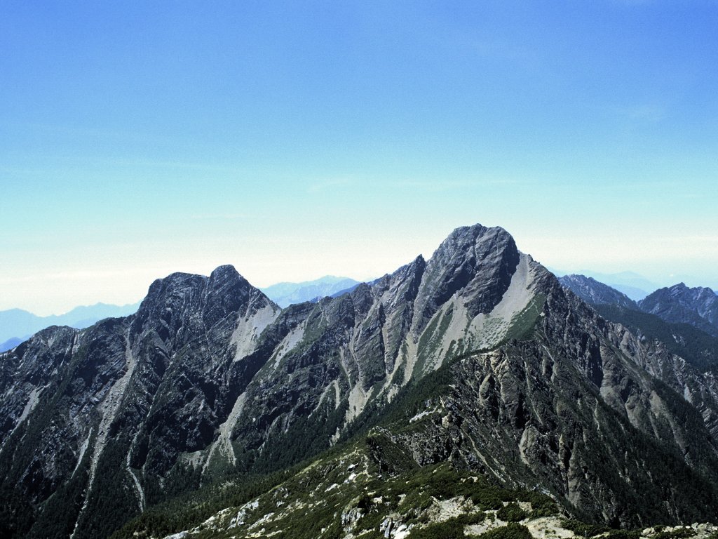
Yushan is comprised of five major peaks: Main Peak (3,952 meters), Eastern Peak (3,869 meters), Northern Peak (3,858 meters), Southern Peak (3,844 meters), and Western Peak (3,467 meters). Yushan’s five peaks are famous for each possessing unique characteristics even though they are located so closely together. East Peak is considered one of Taiwan’s “10 Major Summits”; South Peak is the sharpest peak and made mostly of black shale; North Peak actually consists of two peaks shaped like camels’ humps; and West Peak is covered by forests. Total, Yushan National Park contains more than 30 peaks greater than 3,000 meters high, making it a dream destination for avid hikers. However, permit requirements for park entry and its isolated location mean that it is not a crowded national park.

Yushan was formed as a result of intense tectonic activity between the two plates that converge under Taiwan. Hikers within the park will be able to see evidence of this everywhere, including the Great Precipice, Fuzi Cliff, and Guanshan Cliff. Yushan is also famous for the diverse flora visible on the way up the mountain, with six distinct zones divided by elevation: broadleaf forest, Chamaecyparis, Tsuga Chinensis, Abies Kawakamii. subalpine shrub, and alpine herbaceous.

Yushan (玉山, Jade Mountain), Taiwan

Major Trails and Hiking Areas

  • Batongguan Trail: This trail is actually a historical relic of the Japanese occupation of Taiwan, when it was constructed in order to more efficiently administrate the mountainous regions where aboriginal Taiwanese often lived. The trail is nearly 100 kilometers long and stretches all the way to Hualien at its easternmost point. It crosses mountains including Banaiyike Mountain (2,820 meters), Xiuguluan Mountain (3,860 meters), Dasuiku Mountain (3,642 meters), Batongguan Mountain (3,335 meters), and Huangma Mountain (1,288 meters), to name a few.
  • Yushan Peaks Trail: A 45 kilometer trail located completely 3,000 meters above sea level, the Yushan Peaks Trail crosses all of the five major Yushan peaks. Due to its elevation, length, and incline, this advanced trail requires sufficient experience and proper equipment. Avid hikers can also take the trail to surrounding Linzhi Mountain (2,854 meters), Lulin Mountain (2,845 meters), Lushan (2,981 meters).
  • Nanhengsan and Guanshan Trails: Both of these trails begin at the Nanheng Freeway and pass through some of the most famous mountains in Yushan National Park (outside of Yushan Mountain itself). More popular peaks include Kuhanuosin Mountain (3,115 meters), Taguan Mountain (3,222 meters), Guanshanling Mountain (3,176 meters), and Mamayudun Mountain (2,032 meters).
  • Southern Section Two Trail: Yet another long trail, the Southern Section Two Trail totals more than 60 kilometers and travels in an S-shape through the mountains. Factors such as steep cliffs, untamed undergrowth, and fast-changing weather make this trail suitable for adventurers. Major peaks include Dafenjian Mountain (3,028 meters), Banaiyike Mountain, Batongguan Mountain, Lulu Mountain (3,279 meters), Beimian Mountain (3,172 meters), and Xiangyang Mountain (3,608 meters).
  • Xinkang Trail: Xinkang trail is relatively shorter than most of the trails in Yushan National Park at only 27 kilometers, but its high elevation and scarce water along the trail make it especially difficult. Xinkang Trail passes through top mountains such as Xiangyang Mountain, Sancha Mountain (3,496 meters), Xinkang Mountain (3,331 meters), Xinxian Mountain (3,143 meters), and Lianli Mountain (3,136 meters).
  • Mabolasi Trail: Known as one of the top four most difficult trails in Taiwan, Mabolasi Trail is not for the faint of heart. The trail is located on a fault ridge and is thus steep on both sides. Although a trail exists, it is not as carefully maintained as other trails in the park and may be difficult to follow at times. Mabolasi Trail passes through Batongguan Mountain, Banaiyike Mountain, Mabolasi Mountain (3,785 meters), Malijia South Mountain (3,546 meters), and Kexibonan Mountain (3,264 meters).

Cabins

Like most major mountains in Taiwan, Yushan is located in a protected national park, so there are no railways or cable cars. However, there are cabins located throughout most of the major trails for hikers on longer excursions.

  • Central Golden Cabin
  • Lele Cabin
  • Dafenshan Cabin
  • Kuhanuosin Cabin
  • Meishan Youth Center
  • Yakou Villa
  • Malijia South Mountain Cabin
  • Mabugu Cabin

Towns and Villages

Tungpu and Meishan: These two villages are home to the Bunun aboriginal peoples, who migrated to the Yushan area around 300 years ago.

Explore Yushan Range with the PeakVisor 3D Map and identify its summits.

Register Peak
Peak Name
Latitude
Longitude
Altitude
Register
Teleport
PeakVisor
This 3D model of Sagarmatha National Park in Nepal was made using the PeakVisor app topographic data. The mobile app features higher precision models worldwide, more topographic details, and works offline. Download PeakVisor maps today.
 Download OBJ model
PeakVisor
The download should start shortly. If you find it useful please consider supporting the PeakVisor app.