Get PeakVisor App
Sign In
Search by GPS coordinates
- Latitude
- ° ' ''
- Longitude
- ° ' ''
- Units of Length

Yes
Cancel
❤ Wishlist ×
Choose
Delete
Da Xue Shan National Forest Recreation Area (大雪山國家森林遊樂區) is an outdoor recreation destination featuring luscious highland forests and jagged peaks in central Taiwan. The recreation area is home to 7 named mountains, the highest of which is Xiao Xue Shan (小雪山) at 2,999 metres (9,839 ft) in elevation. Shaolai Shan (稍來山) is the most prominent peak in the forest with 310 m (1,017 ft) of prominence.
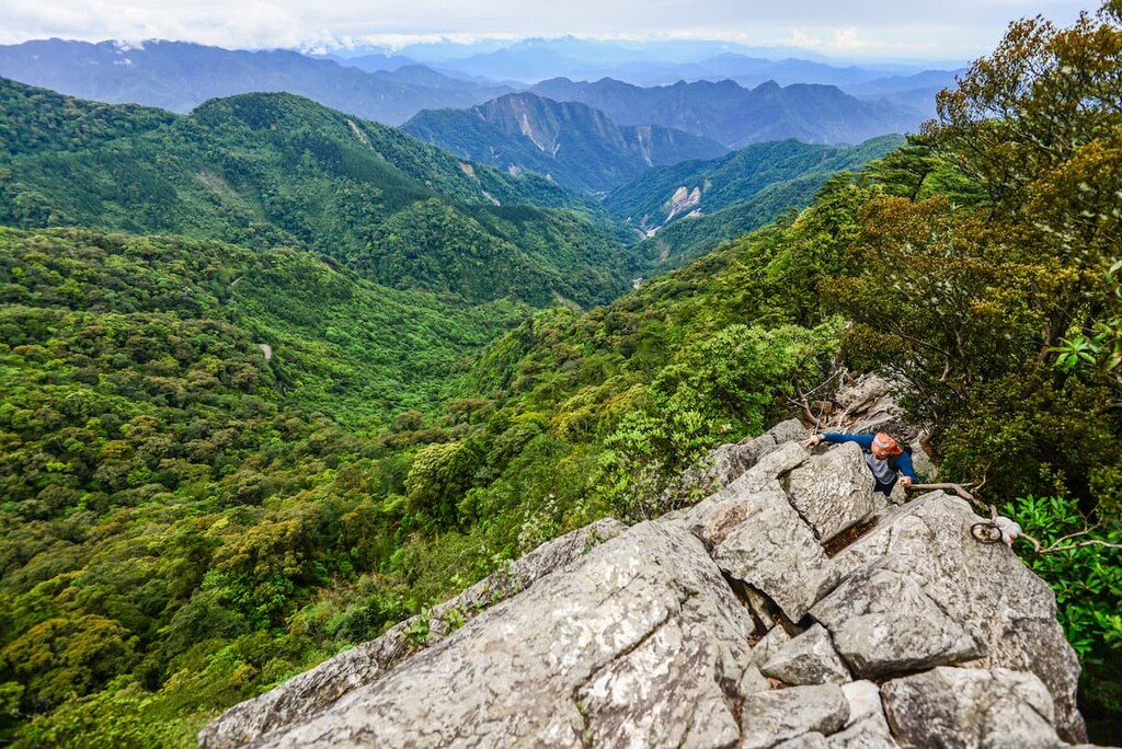
Located in the Heping District (和平區) of Taichung City (臺中市), Da Xue Shan National Forest Recreation Area covers 3,963 ha (9,793 ac) of hilly land in central Taiwan. Despite the mention of Da Xue Shan in its name, the grand peak of Da Xue Shan (大雪山) actually falls outside the boundaries of the recreation area, and it is located just to the northeast.
Xiao Xue Shan is situated the southwestern limit of Shei-Pa National Park (霸國家公園). The other five peaks of Da Xue Shan National Forest Recreation Area lie to the south of the park’s boundary. The four remaining hills in this zone are Anma Shan (鞍馬山), Shan Jiao Shan (山椒山), Chuan Xing Shan (船型山), and Shao Lai Shan South Peak (稍來山南峰).
A highlight of the Da Xue Shan National Forest Recreation Area is the famed Xueshan Giant Tree, which sits on the southern slope of Xiao Xue Shan. It is notable for its 49-metre (161 ft) height and estimated age of 1,400 years.
The verdant highlands of Da Xue Shan National Forest Recreation Area sit at the cloud cover line of 2,000 metres (6,562 ft). At this elevation, swarms of Taiwan hemlock, Huangshan pine, and Taiwan cypress flood the landscape. Meanwhile, warm-temperate broadleaf plants are found in the lower regions of the forest.
Thus, the forest’s elevation ranges between 1,000 to 2,999 metres (3,281 to 9,839 ft. This large range in elevation allows various plant communities to flourish in both the low, warm forests and the cooler forest belts found at higher elevations.
Due to Da Xue Shan National Forest Recreation Area’s high elevation, the temperature in the forest rarely peaks above 20°C (68°F). The summer average sits around a refreshing 18°C (82°F) though the winter months have an average temperature of -5°C (23°F).
One of the main attractions of Da Xue Shan National Forest Recreation Area is the Yakou Observation Deck, which allows visitors to gaze far afield, observing the landscape of pointed peaks and flourishing forests that dominates the region.

Here, the southwestern branch of the Xueshan Range (雪山山脈) snakes its way toward Xueshan (雪山), Taiwan’s second tallest mountain. Baigu Dashan (白姑大山) is also visible from the Observation Deck to the east and Yushan (玉山) pierces the sky to the south.
Other notable areas of interest surrounding Da Xue Shan National Forest Recreation Area include Basianshan National Forest Recreation Area (八仙山國家森林遊樂區) to the east and Taichung City (臺中市) to the west.
The hills of Da Xue Shan National Forest Recreation Area form the gentler southwestern end of the Xueshan Range. As the mountain range heads east, it increases in height and ruggedness. Further toward the east, the Xueshan Range features craggy mounds that zigzag along the main massif as they approach the snow-capped peak of Xueshan.
Da Xue Shan National Forest Recreation Area's peaks consist of a mixture of slate and metamorphosed sandstone from the Eocene epoch. They also boast a top layer of shale interbedded with slates and sandstones.
As Da Xue Shan National Forest Recreation Area is entirely located below an elevation of 3,000 metres (9,842 ft), the landscape is home to pristine forests of evergreen and hardwood trees.
A mix of coniferous and broadleaf forests dominate the woodlands in the reserve between 2,200 to 2,600 metres (7,218 ft to 8,530 ft). Taiwan hemlock, Taiwan red cypress, and Huangshan pine are found in the forest's upper reaches, while Taiwan red maple covers the lowest parts of the forest. Pseudosasa japonica bamboo is also found within the region’s coniferous and broadleaf forests.
Fagaceae plants, like the jolcham oak, are found in forests between 1,800 to 2,200 meters (5,905 to 8,530 ft) in elevation. Here, you can also find Mori's oak and Castanopsis kawakamii hayata.
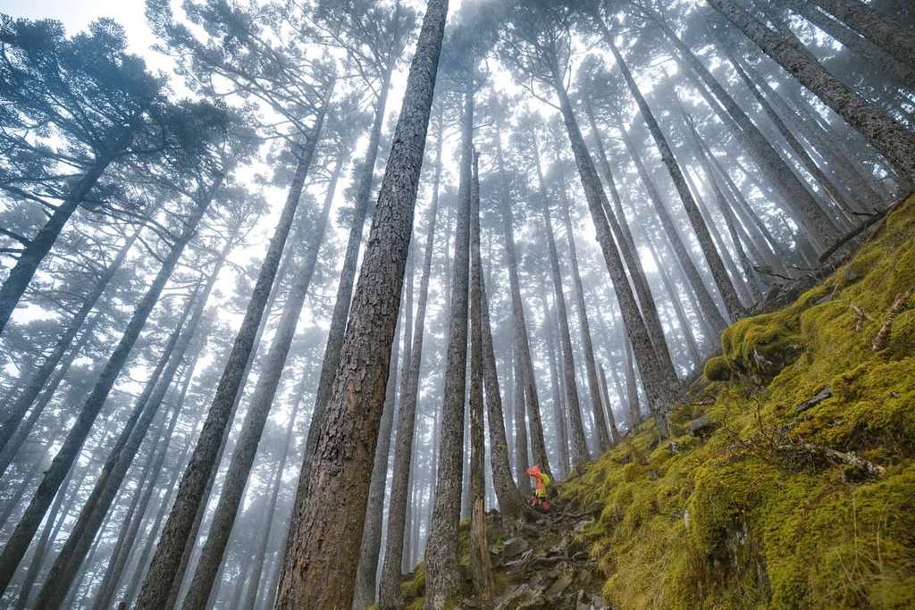
Wildlife thrives in Da Xue Shan Forest, especially when it comes to birds. Nearly 100 bird species have been recorded in the forest, of which 12 are native to Taiwan. The Taiwan magpie, emperor's pheasant, and blue-bellied pheasant are some of the typical birds found in the region.
Other animals found in the park include the white-faced flying squirrel, Taiwan sambar deer, and Taiwan wild boar. There are also many species of butterflies in the Da Xue Shan Forest, the most common of which is the swallowtail.
The felling of Taiwan’s virgin forests coincided with the onset of the Japanese Occupation Era. Once Japan gained control over Taiwan in the 1890s, they started exploring the island’s lush mountain woodlands.
But for the Japanese to achieve total power over Taiwan’s forests, one problem stood in their way: Taiwan’s Indigenous peoples who traditionally lived high up in the island’s mountain ranges..
The Japanese ordered the Atayal tribe, who traditionally lived in what is now the Da Xue Shan National Forest Recreation Area area, to relocate to a guarded road in a lower region. Here, the Japanese officials could surveil the Atayal’s every movement.
Now that the mountains were free of their residents, the Japanese implemented a widespread practice of logging of Taiwan’s coniferous and broadleaf trees. To transport the mighty felled logs to lower regions, the Japanese constructed a wide path of 2 to 3 metres (6.5 to 10 ft) throughout the region to facilitate the passage of horse-drawn carts.
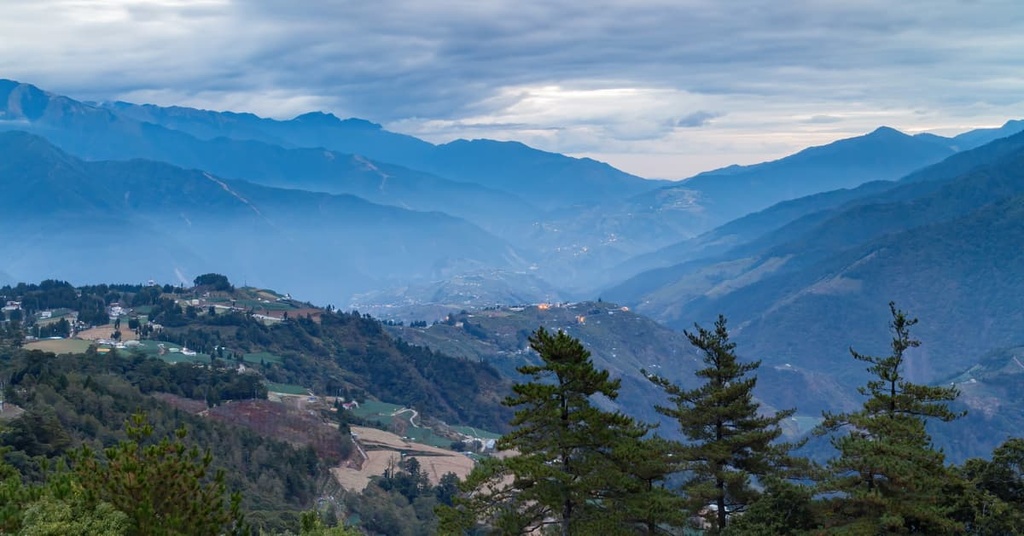
This track, known as the Wooden Horse Trail, is still visible in Da Xue Shan National Forest Recreation Area today. Nowadays,s where visitors can see the old logging path, which is now lined by swathes of Taiwan red cypress and Taiwan red maple.
Here are some of the most popular hiking trails in and around Da Xue Shan National Forest Recreation Area.
The Snow Mountain Shenmu Trail is a 1.5 km (1 mi) leisurely hike to the Xueshan Giant Tree and Tianchi, an alpine lake near Xiao Xue Shan. The return journey is uphill, but on the outward journey, you get to enjoy some downward hiking from Xiao Xue Shan Visitor Centre.
Along the trail, a lofty 49-metre-high (61 ft) Taiwan red cypress stands alone, its bewitching presence dwarfing the surrounding evergreen trees. Bearing a width of 13 metres (42 ft), the 1,400-year-old Xueshan giant tree is a true wonder to behold.
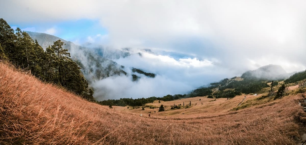
As the trail’s elevation is between 2,400 to 2,500 metres (7,874 to 8,202 ft), hikers can admire the serene views of the region’s undulating hills and pristine mountain forests, including Bei Sanzhui Shan (北三錐山).
Tianchi, which translates as Sky Lake, is situated a short walk away along the brick path. Consuming half a hectare of chilly water, Tianchi exudes tranquillity and calm from its glossy jade surface. A haze of mist usually encircles the lake’s chilly waters, like an enchanted potion bubbling in a witch’s cauldron.
The much-loved Yakou Observation Deck along the trail provides a commanding view of the region’s hilly terrain. It offers views of Xueshan Range’s mountains, including Xueshan. Taiwan’s tallest peak, Yushan, can also be seen to the south.
Xueshan Giant Tree, Tianchi, and Yakou Observation Deck are not the only scenic highlights of the Xueshan Shenmu Hiking Trail.
Luscious woodlands of dense Taiwan hemlock, Taiwan red cypress, Huangshan pine, and Taiwan red maple all adorn the trail. Spring and summer are particularly great times to visit as they offer the best chance to see the forest with blooming foxgloves, chrysanthemums, and wild lilies.
Along the 15 km (9 mi) Xiao Xue Shan National Trail, hikers climb the four hills of southern Yuanzui Shan (鳶嘴山), Shaolai Shan, Chuan Xing Shan, and Anma Shan before ending at the Xiao Xue Shan Visitor Centre.
As the elevation of the trail ranges between 2,000 to 2,600 metres (6,562 to 8,530 ft), hikers can observe the landscape’s transformation from a temperate broadleaf woodland to a coniferous forest.
Since it is the longest trail in the Da Xue Shan Forest, the Xiao Xue Shan National Trail is a popular trekking path amongst visitors. While most of the path is relatively easy, the steep cliffs of Yuanzui Shan pose a major obstacle for new hikers.
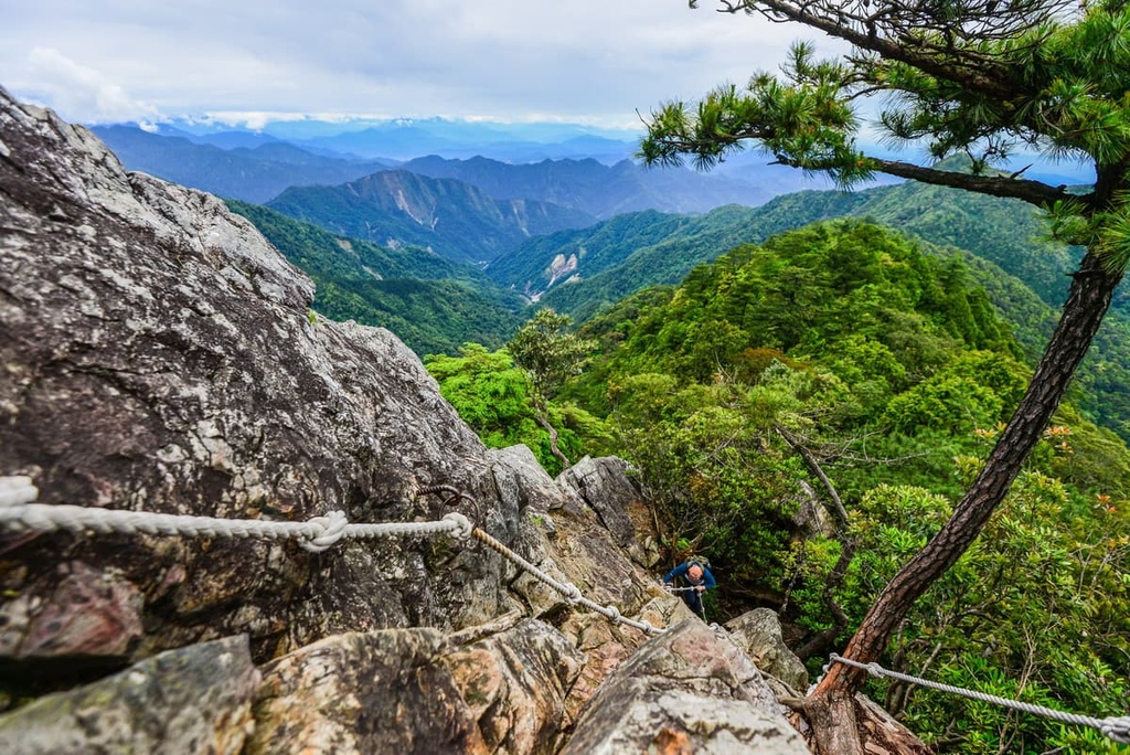
Starting in the south, hikers on the trail will climb Yuanzui Shan. From the top, you can see Hengling Shan (橫嶺山), Shan Jiao Shan, and Chuang Xing Shan.
Shaolai Shan is next on the itinerary. Countless Taiwan red maples adorn Shaolai Shan’s dense forest, which is most spectacular in autumn. A scarlet backdrop of crimson and burgundy foliage envelopes the misty mountain path and the messy forest floor of crunchy dead leaves.
An observation deck straddles the trail between Shaolai Shan and Chuang Xing Shan. From here, you can enjoy sweeping vistas of Anma Shan, Chaung Xing Shan, Shaolai Shan, Yuanzui Shan, and Xiao Xue Shan.
Hikers then follow the path and set forth toward Chuan Xing Shan. While it is not a particularly high peak at only 2,279 metres (7,477 ft) in elevation, the views from the peak are incredible.
As hikers make their way down the undulating trail, a flourishing rhododendron and Taiwan red maple forest gradually transforms into a shaded enclave of Taiwan hemlock and Huangshan pine. The crisp coloured maple shifts the landscape from a leafy green oasis to a blushing scarlet wooded wonderland in autumn.
As hikers trek onwards, they’ll reach Anma Shan. At the summit, Xiao Xue Shan’s pinnacle peeks out to the northeast. You can also see Bei Sanzhui Shan to the east, Chuan Xing Shan to the south, and Shan Jiao Shan to the west from the top of Xiao Xue Shan. Once you’re done taking in the views, you’ll head back to the Xiao Xue Shan Visitor Centre.
The 3 km (1.8 mi) sheltered Da Xue Shan Forest Bathing Trail leads through a dense Taiwan cypress thicket on Anma Shan’s gentle and verdant slope.
The main highlight of the Da Xue Shan Forest Bathing Trail is its rich selection of flora and fauna. Here, taiwan hemlock and Huangshan pine stand alongside Taiwan red maple and Taiwanese sweetgum, emitting the wood-scented phytoncides into the refreshing mountain air.
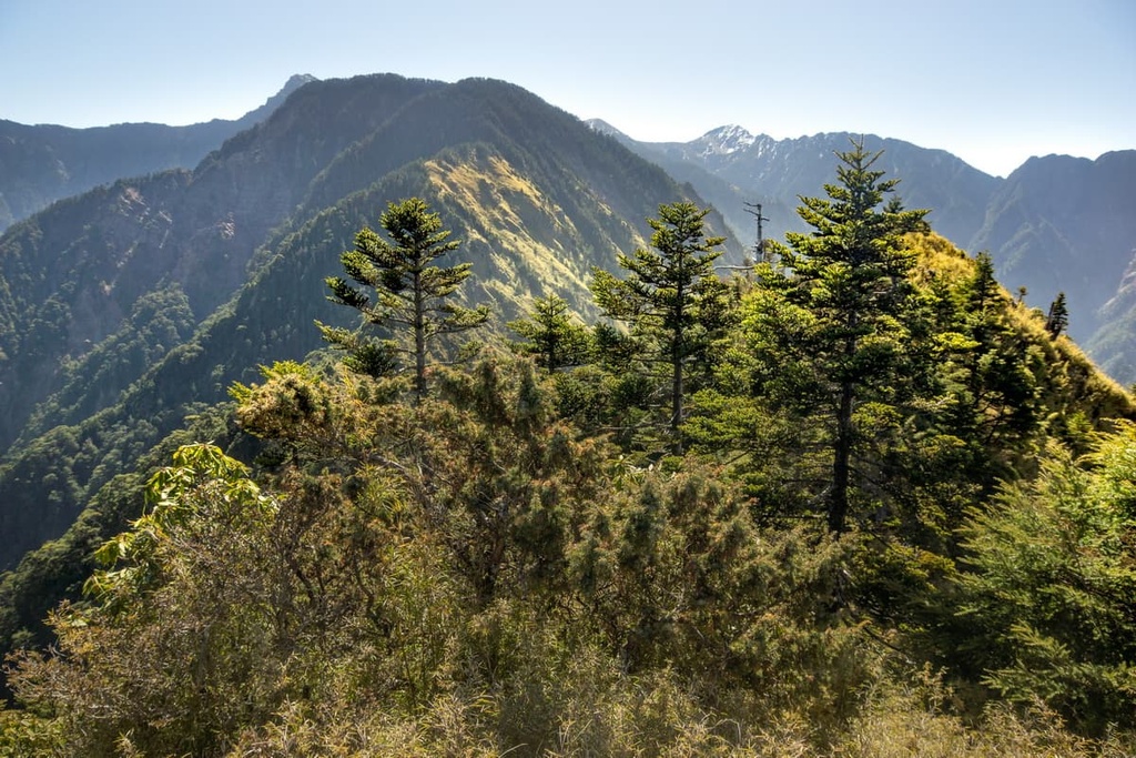
Scientists have linked the release of phytoncides from trees to reduced stress and fatigue in humans. Inhaling phytoncides into our bodies may increase our white blood cells, too, but more research is needed to confirm these findings.
In addition to these trees, a beautiful bounty of flowers blooms in spring and summer along the trail. Rhododendrons flourish in the spring, while foxgloves and lilies bloom in the sunny summer months.
The white-throated laughing thrush, red-headed tit, tea-bellied nuthatch, and woodpeckers’ melodic chitter resonate throughout the woods on this trail, too, bringing a soothing ambience to the forest.
The Hengling Shan Hiking Trail is 6.6 km (4 mi) long from trailhead to summit, and it takes you to the top of Hengling Shan. One of the highlights of climbing Hengling Shan is that it features a pristine environment and thriving temperate forests.
Hikers on the trail can journey through a fragrant cedar woodland that shades the path from the ever-present Taiwan sun. Along the way, hikers can admire the attractive high mountain blooms of crystal orchid, wild peony, and red juniper. Also adorning the pathway is the luscious, serrated fingers of fern plants, gracefully extending their reach to caress the forest floor.
The path becomes noticeably steeper past the 3.5 km (2 mi) mark. While hikers will trek most of the path in the sheltered woodlands, there are moments when you can also see Yuanzui Shan and Shaolai Shan along the trial.
Hengling Shan’s summit is entirely submerged in a thriving Yushan azalea forest; therefore, you won’t enjoy any views from the top. However, the journey through the mountain’s luscious woodlands is scenic, and hikers often love the quietness of trekking through this verdant environment.
The historic Wooden Horse Trail is 3 km (1.8 mi) long and it is located on the slopes of Anma Shan between 1,900 to 2,000 metres (6,233 to 6,562 ft). Hikers begin the trail at the Anma Shan Work Station, an ancient logging office that administered the operation and transportation of felled timber during the Japanese Occupation Era.
Throughout the trail, there are several wooden bridges that you get to cross. Hikers will also pass through shaded, thriving forests that emit a fragrant cypress aroma. The broadleaf Taiwan red maple is a much-admired tree here in the autumn months.
Along the trail, hikers can see the wide track that was once used to haul loads of timber during the Japanese Occupation Era. Overall, the trail provides a unique way to learn more about the region’s often difficult history.
Taichung is the closest city to the Da Xue Shan National Forest Recreation Area. Miaoli County’s (苗栗县) Tai’an Township (泰安鄉) is situated just to the north of the recreation area. Meanwhile, the nearby Shei-Pa National Park is a haven for outdoor recreation.
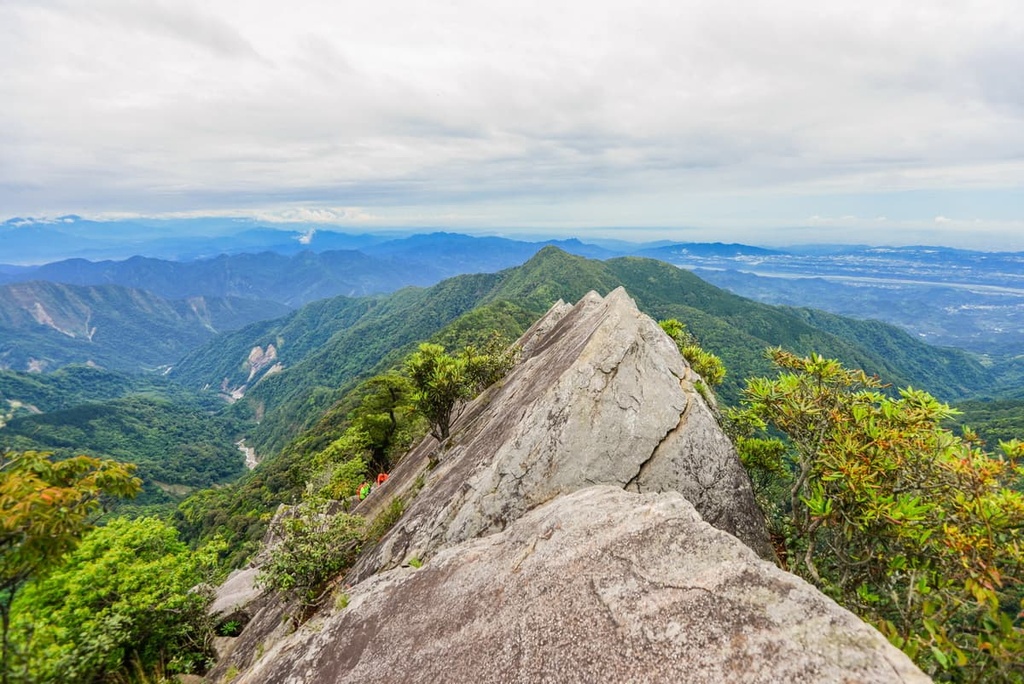
The city of Taichung is located in central Taiwan, and it offers the perfect blend of city life and pristine nature.
Located in the heart of Taichung lies the picturesque Taichung Park. An artificial lake covers a third of the park’s 20 ha (49 acre) green space, where visitors can rent a boat to admire the thriving banyan forest from the lake's still waters. Two impressive pavilions stand watch over the lake, one of which was purposefully built to impress a visiting Japanese prince.
Dongshi Forest Garden is considered the Yangmingshan National Park (陽明山國家公園) of Taichung. Dongshi Forest Garden covers 225 ha (556 acres) of flowering plants within the city limits. It is home to plum blossoms, cherry blossoms, azaleas, and rhododendrons.
Dakeng Scenic Areas is located just a short day trip from Taichung, too. Here, you can enjoy one of a number of hiking trails to the summit of Dakeng Shan.
Flower lovers are spoilt for choice in Taichung, another well-known floral attraction in the Xinshe District. The Xinshe Sea of Flowers is a widely recognised annual event in the months of November and December, when endless patchwork fields of lavender, sunflowers, cosmos, begonia, cleome, and sage flowers bloom.
Additionally, Taichung's bustling Feng Chia Night Market is a magnet for locals and first-time visitors. Exuberant billboards illuminate the crowded road, which is jam-packed with stalls selling Taichung delicacies, Taiwan staple food, fashion, electronics, and everything in between. Stinky tofu, sweet potato balls, and stewed pork are all highly recommended.
The mountainous Tai’an Township is a quaint and charming village where visitors can bask in the gorgeous landscape of forested hills.
Tai’an Township is most well-known as the gateway to Shei-Pa National Park, which is home to Xueshan, Taiwan’s second-highest peak. The trek to Xueshan is only rivalled by the pilgrimage to Yushan.
Hordes of eager and intrepid hikers flock to Shei-Pa National Park to ascend its snow-capped peaks. Hikers can also see the mountains of nearby Taroko National Park (太魯閣國家公園) and the Central Mountain Range (中央山脉) while hiking in the park.
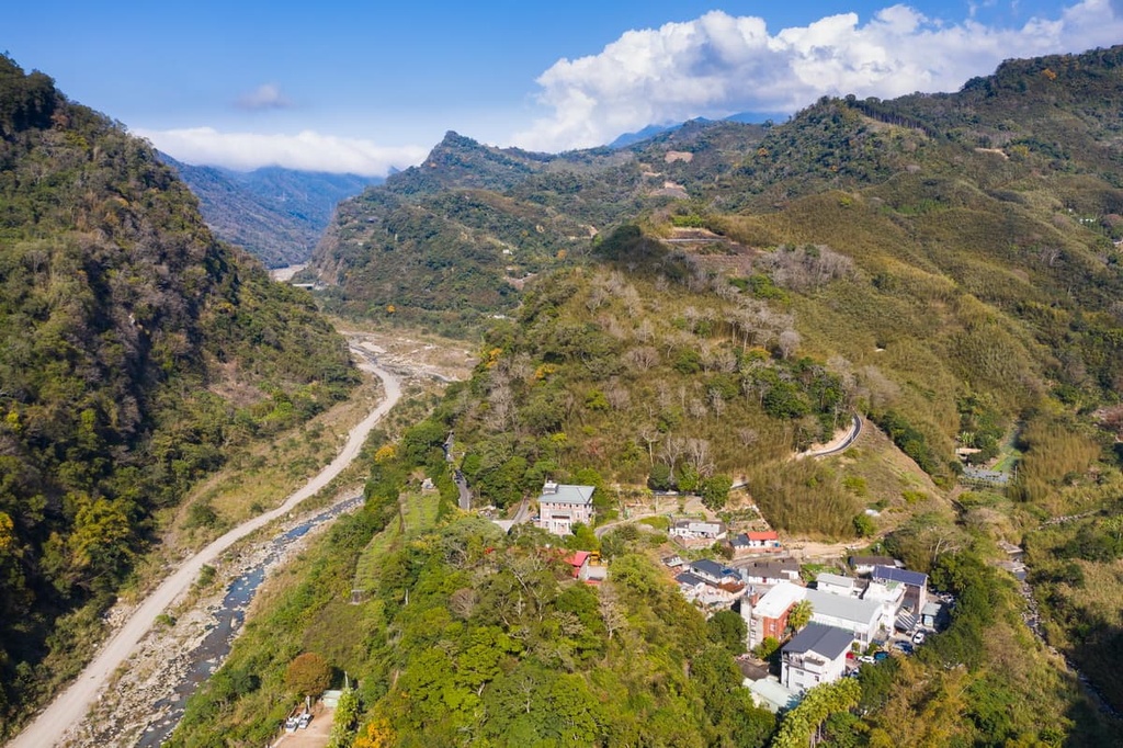
The nearby Tai’an Hot Spring is a most welcome respite for the exhausted hikers after trekking Shei-Pa National Park’s high mountains. Considered to be the best thermal bath in Taiwan, Tai’an Hot Spring provides excellent views of Hu Shan and Henglong Shan while you soak in the spring’s warm water.
Another hiking area located near Tai’an Township is the Guanwu National Forest Recreation Area (觀霧國家森林遊樂區). Here, visitors can clearly see the ridgeline connecting Xueshan to Dabajianshan (大霸尖山) from the forested peaks of Guanwu.
Within the township itself, Xishuikeng Tofu Street is a notable road that’s dedicated to tofu. While walking along the street, visitors can sample different ways of preparing tofu and they can try local delicacies.
Visitors can board the Taiwan High-Speed Rail (HSR) or local express train (TRA) to Taichung City from any of Taiwan’s major cities. If arriving at Taichung HSR Station, visitors should take the 153 bus to Dongshi, before transferring to the 252 bus headed for Da Xue Shan National Forest Recreation Area.
Visitors arriving at Taichung TRA station will need to change platforms and hop on the train to Fengyuan. Once there, visitors can then board the 90, 206, or 207 bus headed for Dongshi. There, they will alight and board the 252 bus to Da Xue Shan National Forest Recreation Area.
Additionally, Da Xue Shan National Forest Recreation Area is just a 69 km (43 mi) drive from Taichung City.

Explore Da Xue Shan National Forest Recreation Area with the PeakVisor 3D Map and identify its summits.


