
Scan the QR code and open PeakVisor on your phone
Lujiaokeng Ecological Reserve has 18 named peaks. The highest is Mt. Zhuzi at 1,095 m. Other notable peaks include Mt. Zhuzi North Peak, Mt. Xiaoguanyin and Xiaoguanyinshanbeifeng.
Lujiaokeng Ecological Reserve (鹿角坑生態保護區) is located in the northern section of Yangmingshan National Park (陽明山國家公園) in northern Taiwan. The highest and most prominent mountain in the reserve is Zhuzishan (竹子山), which has an elevation of 1,095 metres (3,593 ft). There are a total of 18 named mountains in the Lujiaokeng Ecological Reserve.
Lujiaokeng Ecological Reserve comprises a region spanning 1,474 ha (3,642 acres) of the massive Yangmingshan National Park. Other regions that cover Yangmingshan National Park are Qixingshan Special Scenic Area (七星山自然文化景觀核心特別景觀區), Datunshan Lianfeng Special Scenic Area (大屯連峰自然文化景觀核心特別景觀區), and Dajianhou Mountain Special Scenic Area (磺嘴山大尖後山外圍核心特別景觀區).
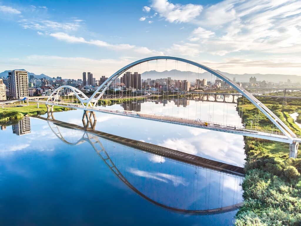
Yangmingshan National Park is located on the sunken shoulders of Taiwan’s capital, Taipei City (臺北市), which rests in a basin below the mountains. Lujiaokeng Ecological Reserve is situated in the Taipei district of Beitou (北投區) and the New Taipei City (新北市) districts of Sanzhi (三芝區), Shimen (石門區), and Jinshan (金山區).
Zhuzishan is the highest mountain in the reserve. Other notable mountains in Lujiaokeng include Xiao Guanyinshan (小觀音山), Zhumupingshan (豬母屏山), Xiaosanshan (小嵩山), and Zhulishan (竹里山).
Zhulishan (竹里山) is the northernmost and easternmost mountain in the area. Meanwhile, Morujishan (摸乳基山) is located at the southern boundary of the reserve. Xiao Guanyin Xi Feng, also known as Xiao Guanyin West West Peak (小觀音山西西峰) is located in the westernmost point of the reserve.
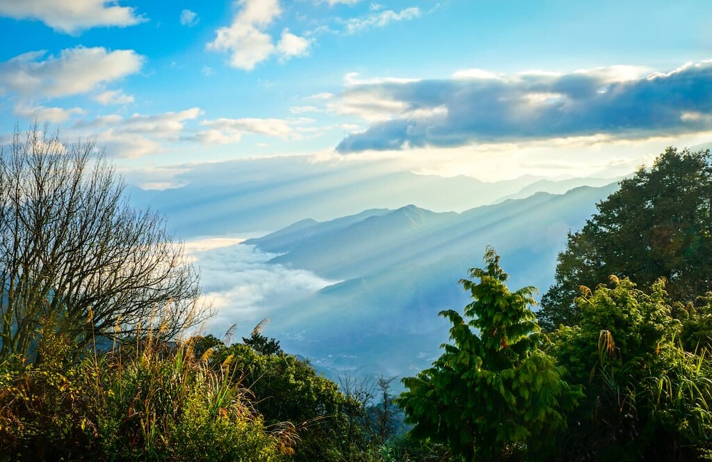
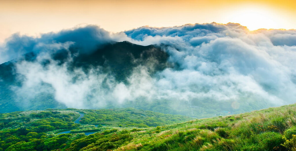
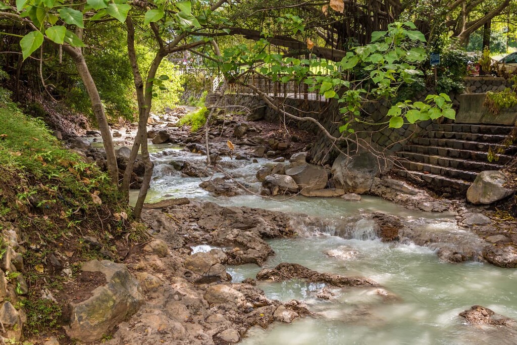
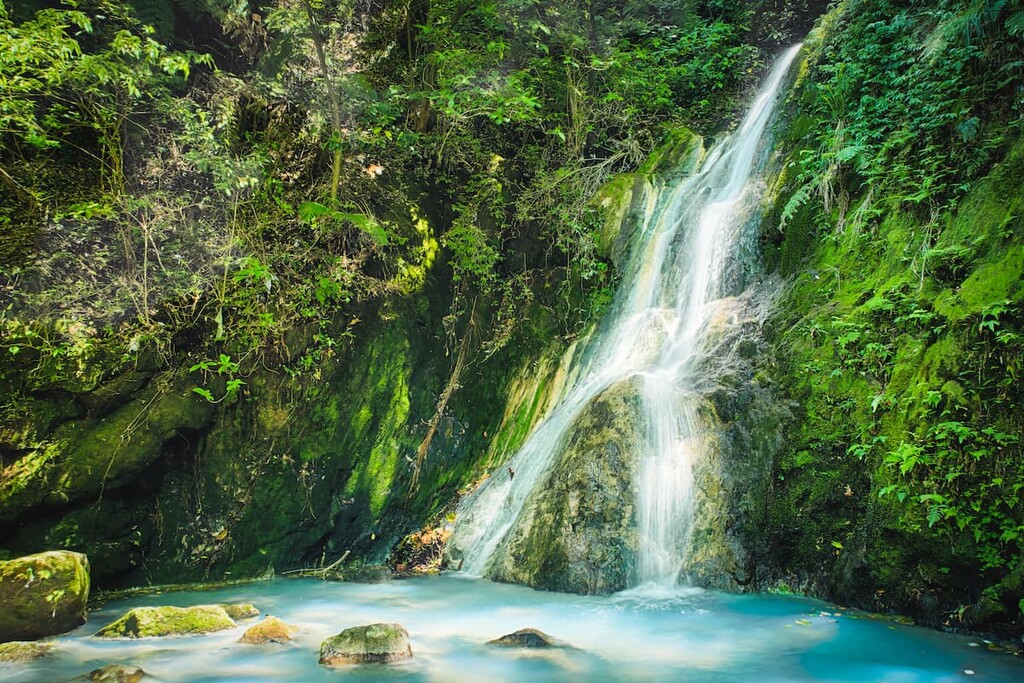
As the reserve is a protected area, the region retains much of its original environment with peaceful primitive forests spreading across the lofty peak area with deep valleys dipping towards the numerous creeks. Both Datun Creek and Fenglin River create a meandering path that leads hikers to spellbinding waterfalls within Lujiaokeng.
Additionally, the reserve is located near a number of other protected areas. These include Laomei Green Reef (老梅綠石槽), which is situated north of the reserve, and the Northeast Coastal Reserve (東北角沿海保護區) to the east. Furthermore, Taipei City (臺北市) sits in the basin below the expansive Yangmingshan National Park, while Tamsui River (淡水河) flows to the west of the reserve.
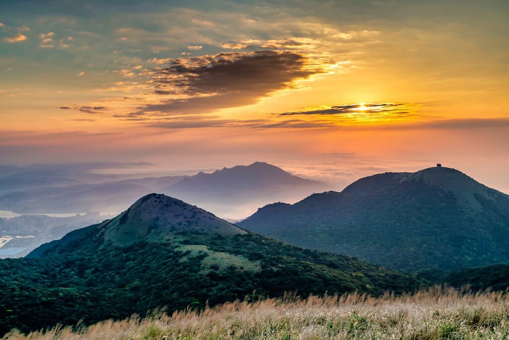
Zhuzishan and Xiao Guanyinshan form part of the Datun Volcano Group (大屯火山群), which comprises around 20 volcanoes in northern Taiwan that erupted approximately 13,000 to 23,000 years ago.
The peaks of Lujiaokeng Ecological Reserve are comprised of sedimentary rocks of the Pleistocene epoch. This rock strata contains tuff breccia of pyroxene and hornblende andesite.
Due to the high levels of seismic activity in Yangmingshan National Park, a plethora of hot springs and fumaroles are present in the area. Macao Hot Springs (馬槽溫泉), which was once open to the public, is located in the south of Lujiaokeng Ecological Reserve.
Xiao Guanyinshan houses the largest crater in Taiwan, with dimensions of 1,200 metres (3,937 ft) wide and 300 metres (984 ft) deep. During the volcanic explosion that created the crater, a channel of lava collapsed on the peak, creating a hollow depression. As a result, the crater of Xiao Guanyinshan is even more significantly larger than the crater on Mount Fuji in Japan.
As a result of the turbulent volcanic history of Yangmingshan National Park, which led to the formation of highly acidic soils, the vegetation in Lujiaokeng Ecological Reserve is both unique and varied.
Furthermore, the arrival of the annual northeast monsoon impacts the vegetation by bringing a barrage of heavy rain and significantly lowering winter temperatures. This is why a subtropical rainforest coexists in the same region as a temperate evergreen broad-leaf forest.
A primitive broad-leaved forest stretches across the reserve, containing many plants such as the rhododendron ‘Briggs Red Star’, Rhododendron hyperythrum, Deutzia taiwanensis, and Maackia taiwanesis.
Other plant life includes the Taiwanese sweetgum, Machilus kusanoi, Assam indigo, and Japanese maple. In addition, a variety of fern species populate the forest area, such as Alsophila metteniana, Cyathea mitteniana, Angiopteris angustifolia, and Cibotium taiwanense.
The seasonal blooms of delicate flowers in the reserve add a breath of vitality to a sea of green foliage. Cherry blossoms, azaleas, and hydrangeas flourish in spring, while winter welcomes the flowerings of plum blossoms and camellias. In autumn, the leaves of the Japanese maple transform into warm red and deep yellow.
The peaks of the Xiao Guanyinshan range and Zhuzhishan are submerged in a swarm of Pseudosasa japonica, also known as arrow bamboo, sometimes so thick that it blocks the views from the summit.
The mammals inhabiting the confines of Lujiaokeng Ecological Reserve include the Taiwanese monkey, Taiwanese mountain boar, red-bellied squirrel, Taiwanese hare, and the ferret badger.
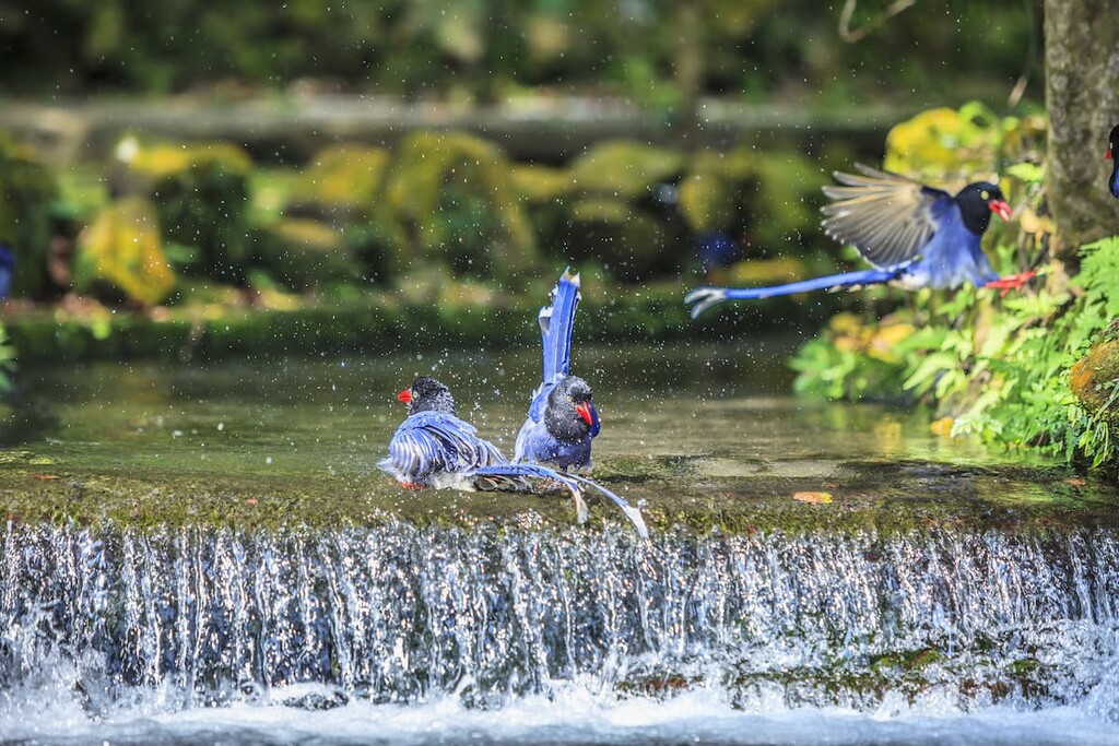
A total of 40 species of local and migratory birds makes the reserve area their home, such as the great crested eagle, kestrel, kingfisher, white wagtail, and large capuchin.
Furthermore, 70 species of butterflies flit around the reserve, and another 70 species of aquatic animals inhabit the streams, such as the Taiwan stone bee. Another 24 species of reptiles are present, as are 12 species of amphibians, such as the Taipei tree frog.
The area of Lujiaokeng Ecological Reserve houses many ancient paths that were used as roads to transport minerals, fish, and other produce to coastal towns and the capital, Taipei. Relics of the past are unveiled along some old trails in this region. For example, the so-called Mountain House (山之家) was once a resting spot built by the Japanese, and Sanban bridge, also known as Sanbanqiao (三板橋), was constructed between 1856 to 1875, during the Tongzhi reign of the Qing Dynasty.
Han Chinese people started to settle in the area of Datun Volcano Group in Yangmingshan National Park during the Qianlong period of the Qing Dynasty (1711 to 1799) . The abundant supply of water from the numerous rivers flowing through the park aided in the production of agriculture and the creation of farming villages.
Xiao Guanyinshan, together with Qixingshan and Datunshan, was the initial area of the former Daiton National Park, which was established by the Japanese during the Japanese Occupation Era.
In 1963, park officials implemented plans to rezone the park, including the New Taipei City district of Jinshan, which is now part of Lujiaokeng Ecological Reserve. Yangmingshan National Park was established on September 15, 1985.
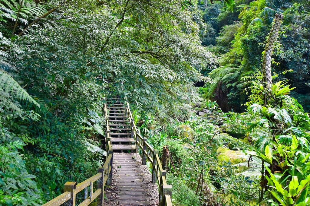
Much of Lujiaokeng Ecological Reserve features ancient paths that have been preserved to showcase their historical elements amidst a dense primitive broadleaf forest. Mountain trails to the peaks of Xiao Guanyin and Zhuzishan are key features, as is the shaded trail to the majestic Fenglin Waterfall (楓林瀑布).
Three options are available for the loop trails that summit the peaks of Xiao Guanyinshan: Small O, Medium O, and Large O.
The Medium O trail includes trips up Xiao Guanyinshan West Peak (小觀音山西峰), Xiao Guanyinshan West West Peak (小觀音山西西峰), Xiao Guanyinshan North North Peak (小觀音山北北峰), Xiao Guanyinshan North Peak (小觀音山北峰), and Xiao Guanyinshan (小觀音山).
Meanwhile, the Large O trail includes Xiao Guanyinshan Northwest Peak (小觀音山西北峰), and the Small O trail excludes Xiao Guanyinshan North North Peak.
Starting from the parking area of the saddle of Datunshan, hikers commence the trek by passing relics of the Mountain House that was built during the Japanese Occupation Era as a leisure post but has since been abandoned.
As hikers begin to ascend the base of Xiao Guanyinshan, they have to navigate a dense jungle of bamboo forests, making it difficult in some parts to keep sight of the path. Violets are also peppered along the course, adding a touch of finesse to the unkempt, rough Pseudosasa japonica bamboo forest.
Hikers may encounter piles of ghost money strewn along the path. While the presence of ghost money usually alerts one of an unfavourable event, in this case, it is used as a means to track the course of the overgrown path so that hikers can retrace their steps should they get lost.
Once hikers pass the impenetrable bamboo corridor, the forest begins to open up, and hikers can see Datunshan (大屯山) in the near distance. Additionally, the district of Tamsui lies behind the peak with the vast, blue water of the East China Sea stretching as far as the eye can see.
After summiting Xiao Guanyinshan West Peak, hikers can distinguish the snow-capped mountain of Xueshan (雪山) standing solidly 90 km (56 mi) away in Shei-Pa National Park (雪霸國家公園). Hikers can also observe and appreciate the entire Xiao Guanyin mountain range when facing in the opposite direction.
Hikers then embark on the summit of Beizhuzhishan, also known as Xiao Guanyinshan West West Peak. This peak offers full views of the coastal Sanzhi and Shimen districts, which extend towards the horizon of the East China Sea where the sea meets the clouds.
Onwards, hikers trek towards Xiao Guanyinshan North North Peak as they descend the Pseudosasa japonica bamboo blanketed mountain through a low mountain broadleaf forest, wading through whispering creeks that lead to a valley.
From here, hikers begin to climb the steep slope of Xiao Guanyinshan North North Peak. The summit does not afford any views due to masses of tall bamboo; however, the trail up and down the mountain is beautiful as cherry blossoms illuminate the path in spring, with maple adding a warm glow in autumn.
Hikers then head towards Xiao Guanyinshan North Peak, which overlooks a few coastal villages and flower farms in the Shimen District and then trek onwards to Xiao Guanyinshan Main Peak. Here, visitors can enjoy the expansive view of Qixingshan (七星山) alongside the wispy steaming fumaroles of Xiaoyoukeng. Nearly the entire Taipei basin can be seen from this point, too, as can the Tamsui River as it meanders its way through the city.
Hikers then descend the mountain towards the saddle of Datunshan car park, from where they began the trail. As hikers descend the Xiao Guanyinshan and walk through the bamboo forest, they will recognise the familiar ‘Mountain House’ that they passed at the start of the journey. Eventually, visitors will find their way back to the trailhead and complete this arduous, but wonderfully enjoyable 6 km (3.7 mi) mountain path.
This reasonably easy 5km (3 mi) return trail follows the meandering Fenglin Creek as it leads towards the divine beauty of Fenglin Waterfall (楓林瀑布). This trail is also known as the Fenglin Waterfall (楓林瀑布) Trail.
Hikers commence the trail from the Lujiaokeng Ecological Reserve Control Point. They will follow the gurgling Fenglin Creek as it flows through the damp, shaded region of a broadleaf forest of Taiwan sweetgum and Japanese maple. The river dips through a valley as hikers frequently cross the refreshingly cool stream to follow the path to the waterfall.
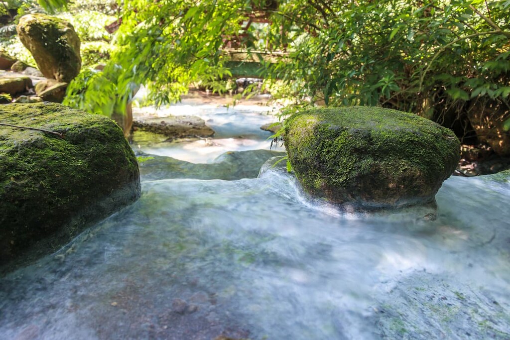
After 2.5 km (1.5 mi) of clambering on the loose rocky path that can be very slippery, hikers will encounter the glorious 20-metre (66 ft) curtain of rippling water roaring from Fenglin Waterfall (楓林瀑布). The captivating sight of the grand waterfall set against an emerald entity of dense foliage is supremely thrilling. At the same time, hikers revel in the invigoratingly crisp environment that the sheltered forest creates.
This 7 km (4.3 mi) return trail features a combination of industrial roads, mountain trails, and river crossings. It is also known by its other name, Blue Road Ancient Road, as it traces the Datun Creek to the west of Xiao Guanyinshan. Datun Creek originates from the giant volcanic crater in Taiwan, Xiaoguanyinshan.
The path from Sanzhi District (三芝區) to Tamsui District (淡水區) of New Taipei City was often impenetrable due to the frequent flooding of the Datun Creek; thus, locals built a road to connect these two districts in the Yangmingshan National Park area. This historic path features an ancient bridge constructed during the Tongzhi period of the Qing Dynasty.
As hikers embark on this course, the striking beauty of cherry blossoms, Pseudosasa japonica bamboo, and many ferns are noted along the secluded forested paths. Frequent river crossings are once again expected on this trail as it leads hikers to Ganlu Waterfall.
This trail is an 8 km (5 mi) route through a Pseudosasa japonica bamboo forest that visits Zhuzishan, the northernmost peak in the reserve, and the picturesque Alibang Waterfall. The remote nature of this trek means that the only way to reach the beginning of the trail in Daozhaohu village is by driving.
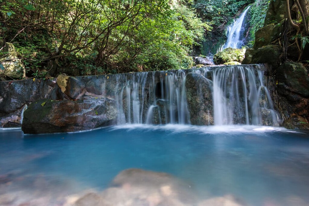
At first, the trail is gentle and undemanding as the path forks up the mountain. Eventually, the view opens up to display the grand spectacle of Alibang Waterfall as it spills its foaming white waters in the valley below.
Hikers then follow a path that leads them to the bottom pool of Alibang Waterfall. Here, trekkers can take respite in the sheltered, opaque forest that cradles the graceful cascading torrent of falling water.
Afterwards, hikers escalate the slopes of the mighty waterfall to make their way up the mountain. From here, the route starts to become more intense as the gradient increases drastically and the path is slippery in places.
As hikers clamber near the summit of Zhuzishan, they encounter sweeping views of the Jinshan area in the east and the nearby coast. A bamboo forest welcomes hikers to the nearby summit of Zhuzishan. At this point, the Pseudosasa japonica bamboo is so thick that it can be tedious to venture through as it involves labour to traverse continuously.
A military control zone straddles the summit of Zhuzishan; therefore, hikers will not reach the summit. However, there are many clearings from which they can enjoy panoramas of Lujiaokeng Ecological Reserve and beyond.
This 4.2 km (2.6 mi) trail covers ancient and features relics of the past in ruined dwellings along a quiet country road. The sound of nature reverberates as hikers shift through the forest as a chorus of birds chirps merrily against the soft ripples of the running stream and the gentle breeze whistles through the dense foliage.
Along this trek, you’ll get a chance to visit Hongyegu Waterfall, a magnificent 12-metre (39 ft) high cascade that turbulently gushes crisp mountain water down its smooth, elegant neck.
On this route, autumn brings about bursts of scarlet maple leaves, with spring presenting pops of soft pastels of cherry blossoms along the trail. The scenic beauty of this trail is one of its main attractions.
Due to Lujiaokeng Ecological Reserve’s close proximity to the capital of Taiwan, visitors have the option of staying in the exciting city of Taipei or staying in the north coastal region of New Taipei City.
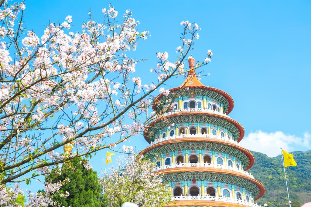
Taiwan’s thrilling capital city boasts an eclectic fusion of Japanese and Chinese influences, with an added dose of its Taiwanese flair and identity. Architecture, history, and cuisines express the presence of Japan and China on this fascinating island. Additionally, visitors are sure to encounter many of Taiwan’s smiling, friendly, warm, and welcoming people.
As a first-time traveller to Taipei, visiting the elaborately animated temples is simply a must. Longshan Temple was built in 1738, making it Taipei’s oldest temple.
Additionally, Longshan Temple is renowned for its inclusiveness, as worshipers of Taoism, Buddhism, and Confucianism all frequent here. The temple is a wondrous sight, as it features an artificial waterfall in the courtyard with two bronze dragon pillars planted solidly at the front hall entrance. The atmosphere is calming and tranquil, despite the busy crowds of worshippers.
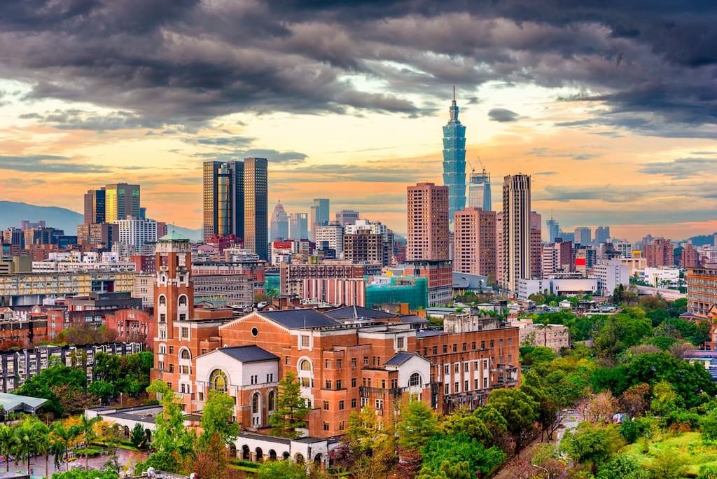
The city’s iconic landmark Taipei 101 is situated in the east of Taipei. The most impressive views of this 508-metre (1,667 ft) high tower head to Elephant Mountain, located one MRT stop away. The trail up this 184 metre (604 ft) hill is paved with a series of endless steps, doubling as a fantastic workout on the way to appreciate Taipei’s skyline.
Meanwhile, Elephant Mountain features numerous observations to admire the glorious view of Taipei’s tallest building, which also happens to be the tallest green building in the world.
For another mesmerising perspective of Taipei from high up, Maokong Mountain offers views of tea plantations and the luscious forests that swarm in the south of Taipei. Visitors can access this mountain via the Maokong Gondola, close to the Taipei Zoo MRT stop.
Alternatively, visitors can opt to ride in a crystal-floored cable car on the gondola, allowing them a thrilling ride as they gaze past their feet towards the tea farms below. On Maokong Mountain, visitors can wander along one of the mountain trails or visit one of the many tea houses that brew the local delicacy of oolong tea.
Finally, a prime place to savour the splendour of a traditional Taiwanese tea ceremony is the gorgeous Wistaria Teahouse, a designated city historic site in Taipei. Visitors can sip oolong tea as they unwind, gazing out onto the courtyard, which features koi ponds, wisteria vines, and the quaint wooden styled Japanese architecture.
The north coast of New Taipei City offers an impressive variety of scenic nature from its white-sand beaches, quaint fishing villages, and algae-carpeted reef.
Baisha Bay in the Sanzhi District features a white sand beach, which stretches along the coast for 1 km (0.6 mi). Due to its proximity to Taipei, it is a popular seaside attraction in northern Taiwan. Here, visitors can enjoy watersports, such as surfing, diving, and angling.
The rippling rocky algae fingers of the Laomei Green Reef in Shimen District extends along the coast of north Taiwan for 700 metres (2,296 ft). This unique natural oddity results from the spill-over of lava flow from the Datun Volcano Group as they made their way toward the East China Sea. This phenomenal sighting is only visible during low tide; thus, visits need to be timed accordingly.
Another scenic attraction is Shimendong, or Shimen Cave, which is located in Shimen District. The natural arch of Shimendong was once considered to be Taiwan's northern gate as the giant stone arch resembled an ancient city gate that safeguarded its city inhabitants. Visitors can access the top of the arch via a series of steps from where they can admire the glorious and dramatic sunsets.
Fuji Fish Market, found along the coast of the Shimen District, is the Taiwanese equivalent of Tokyo's iconic Tsukiji Fish Market. For the freshest catch of the day, a trip to Fuji Fish Market is your best bet. Visitors should expect to haggle when purchasing fish, so it's best to visit with a local who can barter on your behalf. The calming views of the East China Sea welcome visitors before they enter the clean and modern fish market. A superb selection of fish is laid out, from lobsters, crabs, sea urchins, cuttlefish, and clams.
In Jinshan District of New Taipei City lies the Dharma Drum Mountain, which is set on the hills of Zhuzijiaoshan. The area features beautifully manicured gardens which add to the tranquillity of the peaceful setting.
Here, visitors can enter the Dharma Drum Mountain World Centre for Buddhist Education, which offers insight and information to visitors on Buddhism. Meanwhile, views of the brilliantly blue East China Sea gently dance in the distance.
From the major cities of Kaohsiung, Tainan, Chaiyi, Taichung, Hsinchu, and Taoyuan, take the Taiwan High Speed Rail (HSR) or the express train (TRA) to Taipei Main Station.
From here, visitors can make their way to Yangmingshan National Park by taking the MRT red line from Taipei Main Station to Jiantan MRT Station. Visitors will then board the R5 bus which drives to the entrance of Yangmingshan National Park.
At Yangmingshan National Park, visitors can then hop on the Yangmingshan 108 bus, which forms a loop around the park. It stops at the saddle of Datunshan, the entrance point to the Xiao Guanyinshan Trail, and the southern region of Lujiaokeng Ecological Reserve.
For visitors wanting to reach the northern section of Lujiaokeng Ecological Reserve, specifically to traverse the Zhuzishan and Alibang Waterfall Trail, it is best to hire a car or a scooter and drive 32.6 km (20 mi) to the remote northern section of Lujiaokeng Ecological Reserve.


The highest peak in Lujiaokeng Ecological Reserve is Mt. Zhuzi, at 1,095 m.
Notable peaks in Lujiaokeng Ecological Reserve include Mt. Zhuzi, Mt. Zhuzi North Peak, Mt. Xiaoguanyin, Xiaoguanyinshanbeifeng and Xiaoguanyinshanxixifeng.


