
Scan the QR code and open PeakVisor on your phone
Dajian Mountain and Jiayang Mountain Ecological Reserve has 25 named peaks. The highest is Xueshan / Snow Mountain at 3,886 m. Other notable peaks include Dajian Mountain, Mt. Cuichi Sancha and South Peak of Xue Mountain.
Dajian Mountain and Jiayang Mountain Ecological Reserve (大劍山、佳陽山生態保護區) is a protected area in the southern region of Shei-Pa National Park (雪霸國家公園) in central Taiwan. There are 25 named mountains in the reserve, the highest and most prominent of which is Xueshan Main Peak (雪山) at 3,886 metres (12,749 ft) in elevation.
Dajian Mountain and Jiayang Mountain Ecological Reserve is located in the Heping District (和平區) of Taichung County (台中县). It is situated between Jiaren Mountain and Madara River Ecological Reserve (佳仁山、馬達拉溪區域生態保護區) and Taiwan Sakura Salmon Ecological Reserve (台灣櫻花鈎吻鮭生態保護區), both of which are located in Shei-Pa National Park.
Out of 24 named mountains in the park, 5 are part of the top 100 peaks of Taiwan. These peaks are:
Additionally, Xueshan Main Peak, the reserve’s highest point, is the second-highest mountain in Taiwan, trailing only Yushan (玉山), the tallest mountain in Taiwan at 3,952m (12,966ft), in elevation. Xueshan is actually a massif composed of six peaks:
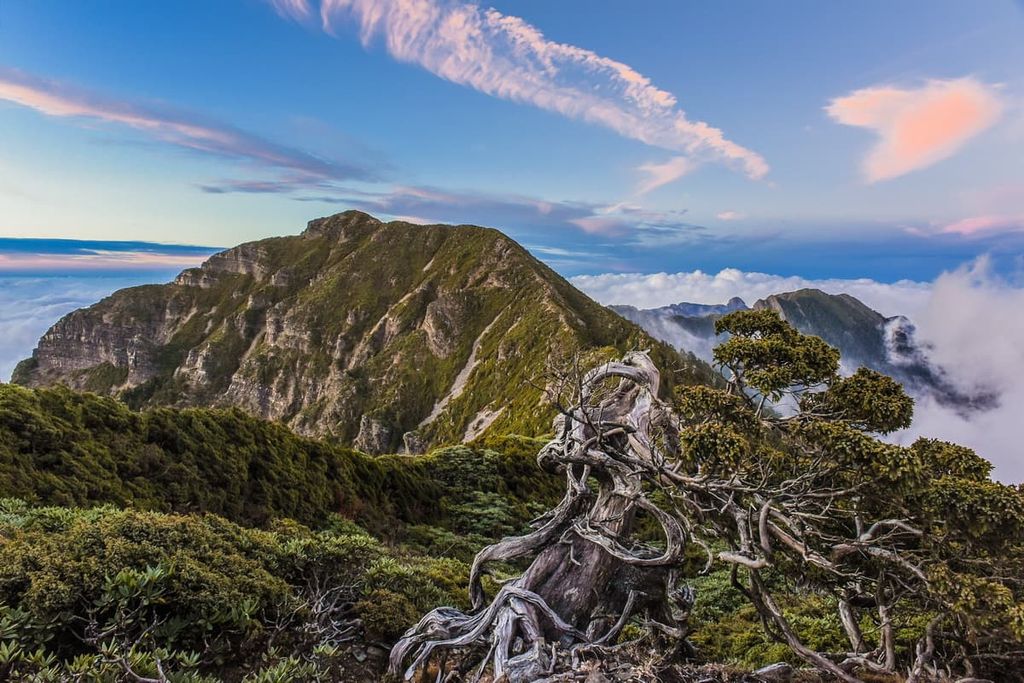
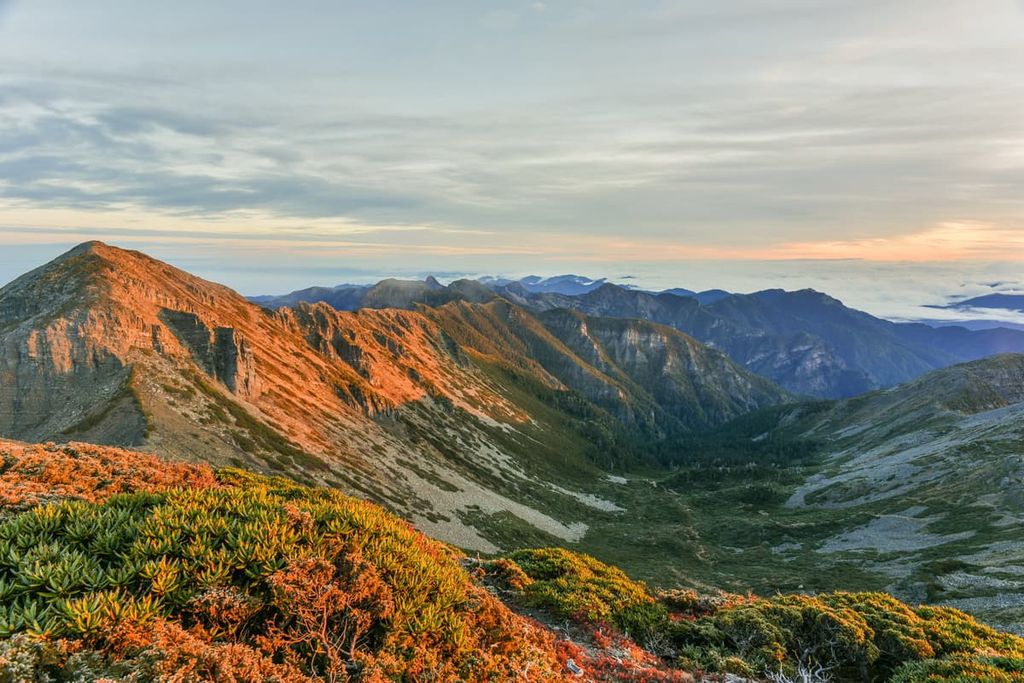
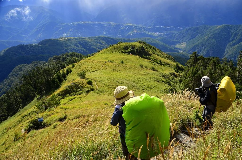
Dajian Shan is particularly well known for its alpine ridge, which connects its three peaks: Dajian Shan, Jiayang Shan and Jian Shan. From here, hikers can witness impressive views of intense sharp mountain ridges, forested saddles, and a moving sea of dense mountain clouds along the mountain trails of the Dajian Shan ridge.
Forming the northern boundary of Dajian Mountain and Jiayang Mountain Ecological Reserve is Xueshan Main Peak. Zhijiayang Shan marks the eastern border of the reserve, while both the southern and western edge of the reserve is located at Yu Luo Wei Shan (宇羅尾山).
Nearby areas of interest beyond Dajian Mountain and Jiayang Mountain Ecological Reserve are Hehuanshan West Peak (合歡山西峰) in the south and Da Xue Shan (大雪山) to the west. The sacred mountain of Dabajianshan (大霸尖山) sits to the north of the reserve, while Zhongyang Jianshan (中央尖山) of Taroko National Park (太魯閣國家公園) is situated in the east.
Due to Taiwan’s precarious location at the intersection of various tectonic plates, the forceful collision of the Eurasian and Philippine Sea tectonic plates was responsible for the formation of the island’s mountain ranges.
As a result, Taiwan is home to five major mountain ranges, including the Xueshan Range (雪山山脈), which stretches from Taichung County to New Taipei City (新北市).
Dajian Shan, Jiayang Shan and Jian Shan all form part of the southern extension of Xueshan Range, which culminates at Xueshan Main Peak. From Xueshan, the mountain chain joins with Cuichi Sancha Shan (翠池三叉山) to the west, then heads to the south, connecting Dajian Shan, Jiayang Shan, and Jian Shan. After Jian Shan, the mountain range cuts into the Dajia River where it links to Baigu Shan (白姑大山) in the south.
Interestingly, the area of Dajian Mountain and Jiayang Mountain Ecological Reserve holds a total of 37 glacial cirques, showing evidence of intense glacial activity in years past. This glacial past is also visible on the mountain slope below the summit of Xueshan Main Peak.
Glacial Cirque Number 1 is the name bestowed on the largest glacial cirque in Taiwan. Another prominent glacial cirque is found on the lower ridges of Xueshan North Peak, known as Glacial Cirque Number 2, which resembles a U-shaped crater.
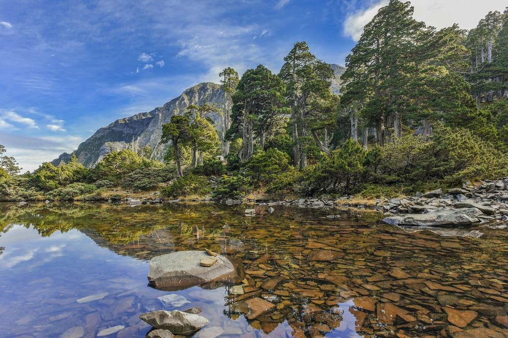
The alpine lake of Cuei Pound (翠池), situated at 3,520 metres (11,549 ft) on the peak of Xueshan, was created from glacial activity during the last glacial maximum. Cuei Pond is Taiwan’s highest lake, with its waters never running dry, even in the most frosty winters.
As many colossal peaks and low valleys are present in the Dajian Mountain and Jiayang Mountain Ecological Reserve, the reserve contains five distinct microclimates, each of which features specific plant life.
The lower regions of the reserve feature warm temperate ecosystems. An evergreen broadleaf forest of Lauraceae and Fagaceae plants is found in lower elevations between 500 to 1,500 metres (1,640 to 4,921 ft).
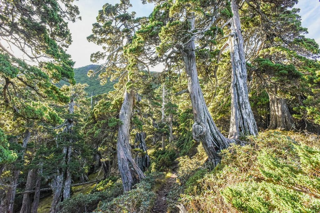
Moving higher up in elevation within the reserve, the plant life changes to a temperate coniferous broadleaf forest of Taiwan red cypress and Chinese cork oak at 1,500 metres to 2,000 metres (4,921 to 6,562 ft). As the elevation increases further, the cool-temperate trees of Taiwan spruce and Chinese hemlock are nurtured in regions of 2,000 to 2,800 metres (6,562 to 9,186 ft).
Taiwan fir dominates the vegetation in subalpine forest zones of 2,800 to 3,500 metres (9,186 to 11,483 ft), while Yushan juniper flourishes in the frigid alpine slopes at 3,400 to 3,600 metres (11,155 to 11,811 ft).
The broadleaf evergreen silvergrass submerges the mountain slopes in the Dajian Mountain and Jiayang Mountain Ecological Reserve, which tends to grow between 500 to 1,500 metres (1,640 to 4,921 ft). As silvergrass thrives in sunny spots, Pseudosasa japonica bamboo prefers a more shaded environment and cooler temperatures. Thus, Pseudosasa japonica bamboo thrives in the saddles of mountain roads and slopes that receive less direct sunlight.
A variety of wildlife inhabits the region of Dajian Mountain and Jiayang Mountain Ecological Reserve. The endemic and endangered Formosan black bear roams the mountains, as does the native Formosan macaque. Taiwan serow, Taiwan wild-boar, and the Formosan white-faced flying squirrel make this hilly area their home.
The endemic Mikado pheasant and Swinhoe’s pheasant comprise part of the 60 species of birds that occupy this area. Other bird species witnessed here are Taiwan yuhina, coal tit, laughing thrush, and Mandarin duck.
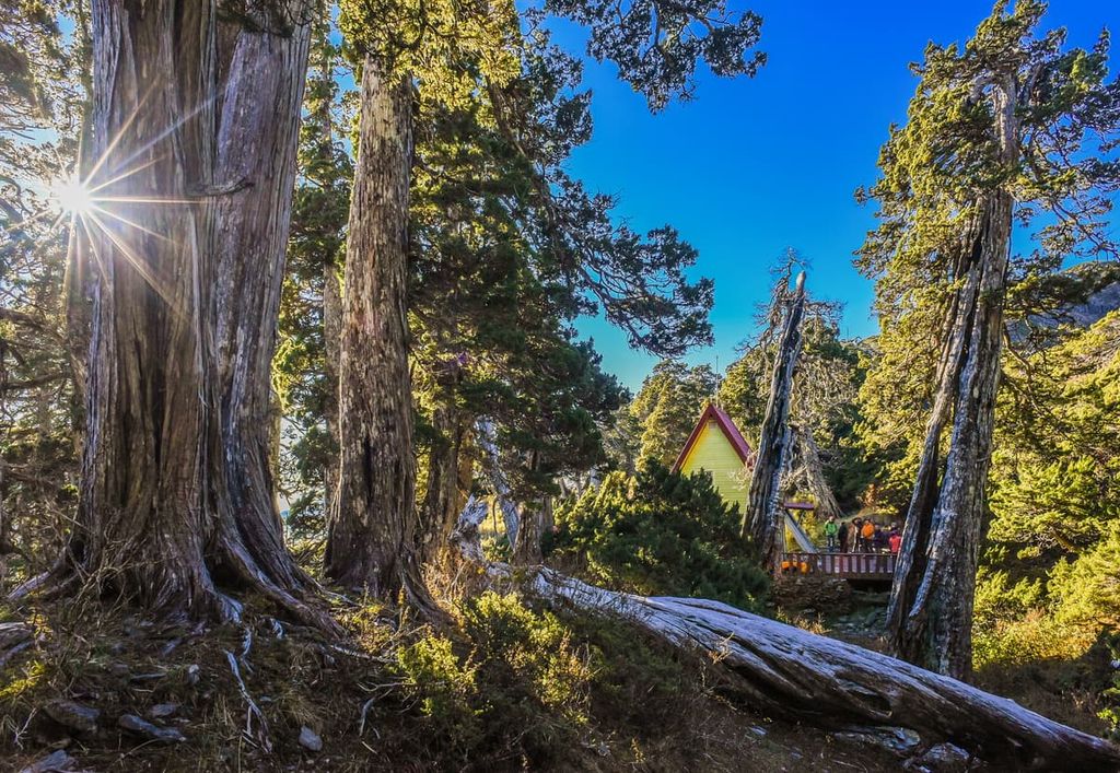
The elevated mountainous village of Huanshan (環山) is a community of Atayal people who live in the valley at an elevation of 1,600 to 1,800 metres (5,249 to 5,905 ft), where mountains of 3,000-metre (9,842 ft) in height encircle the basin of Huanshan.
The Atayal are one of the Indigenous peoples of what is now Taiwan who have lived on the island since time immemorial. During the Japanese Occupation Era, police stations were established along the mountain roads in the reserve. This was done purposefully in order to control village residents and minimise interference in logging camphor trees for industrial gains.
In the 1960s, a mountain road was constructed to connect Yilan to Heping District, making the area more accessible. As a result, many Atayal have moved back into the community and made Huanshan their home. Thus, Huanshan now has thriving high-cold agriculture produce of persimmons, pears, and peaches.
The three prominent mountains of Dajian Shan, Jiayang Shan, and Jian Shan are the most desired peaks to climb in this region. Furthermore, two well-favoured paths lead to Xueshan, which also feature additional peaks in the Dajian Mountain and Jiayang Mountain Ecological Reserve.
As the southern slope of Jian Shan displays a curved edge with a significant sheer drop, it resembles a crescent in the shape of a sword. Thus, it is known as ‘little sword,’ while Jiayang Shan, the taller mountain, is called the ‘big sword.’
Over three days on this trail, hikers will summit the four peaks of Tui Lin Shan (推論山), Buyi Qihan Shan (布佚奇寒山), Jiayang Shan, and Jian Shan. The entrance point to the trail is located on Songmao Road.
The trek into the mountains on this trail is amusingly referred to as a ladder due to its vertical appearance and gruellingly relentless incline. A towering cedar forest that leads to thick bunches of silvergrass awaits hikers as they climb a constant 1,700 metres (5,577 ft) before the path flattens.
After a hard day of tireless climbing, hikers reach Tui Lun Shan. From here, the ridgelines from You Po Lin Shan (油婆蘭山) snakes its way south to Jiayang Shan, creating a winding mountain road across the alpine land. You Po Lin Camp is located after the summit of Tui Lun Shan, where hikers are graciously afforded an overnight rest stop before tackling Buyi Qihan Shan, Jiayang Shan, and Jian Shan the following morning.
As hikers ascend the mountain path to Buyi Qihan Shan, Chinese hemlocks cover the mountain terrain while the peak of Jiayang Shan is revealed above the tree line of the approaching Taiwan fir forest.
The Buyi Qihan cliffs are notoriously known as a brutal endurance test as hikers test their balance and grit on the terrifyingly sheer rock walls. After the laborious climb on these infamous cliffs, the summit of Buyi Qihan Shan is a suitable place to rest and relax, even though it is heavily forested.
The forest clears as hikers head onwards, and the mountain scenery is constant as hikers appreciate the mammoth peaks of Hehuan Shan (合歡山) and Jiayang Shan. The hills of Buyi Qihan Shan and Dajian Shan are easy to see, too, when looking back on the path. As hikers scale towards the summit of Jiayang Shan, the trail overlooks a scarily sharp collapse on the cliff of Jiayang Shan. Once at the peak, Xueshan West Peak stands boldly within sight.
After taking in the landscape, hikers then continue to Jian Shan, which has a gentler slope, where they will enter the Pseudosasa japonica bamboo forest. As Jian Shan is covered with trees, hikers can witness no views from the summit. Hikers then head back to You Po Lin Camp, tracing through the striking hemlock and fir forest along the way.
Dajian Shan Hiking Trail is a two-day trek that leads hikers to the minor hill of Tui Lin Shan and then toward the base camp of You Po Lin where they will complete their journey and embark towards Dajian Shan the following morning.
While hikers can link this trail to Jiayang Shan and Jian Shan, which are further south of Dajian Shan, the journey to Dajian Shan covers a different path altogether. Thus, once hikers have completed the trek to Dajian Shan and returned to camp, they can then embark south towards Jiayang Shan and Jian Shan.
After climbing the steep slopes to Tui Lin Shan and resting at You Po Lin camp, hikers can set off toward Dajian Shan, turning right at the forked mountain road and heading northwards. To get to Jiayang Shan and Jian Shan, hikers take the left path to head southward.
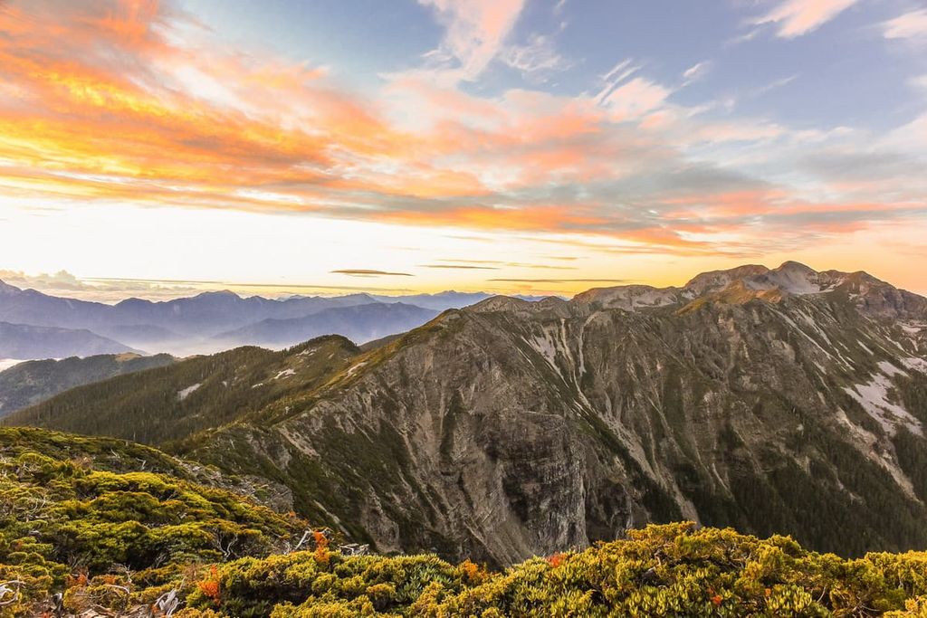
Along the route to Dajian Shan, hikers are presented with dramatic mountain scenery, ranging in colour and intensity from bold green to hazy blue based on the proximity of the peaks. Hikers can distinguish the nearby Jiayang Shan and Baigu Shan in the distance, as well as the steep ridges of Zhongyang Shan, Nanhu Dashan (南湖大山), Hehuan Shan, and Qilai Shan (奇萊山) of Taroko National Park.
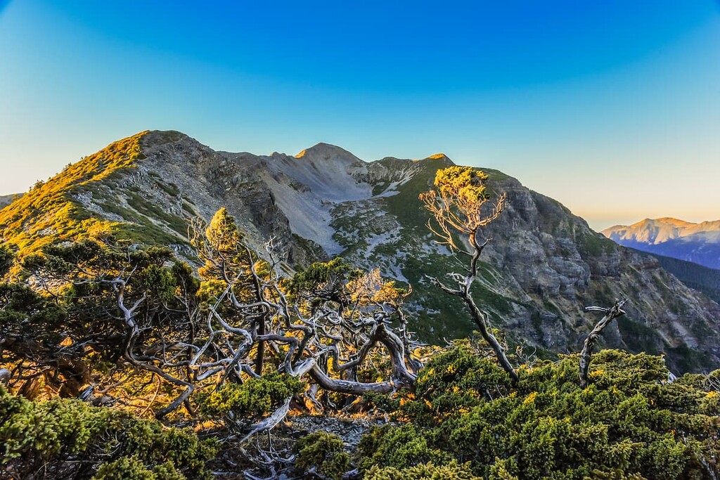
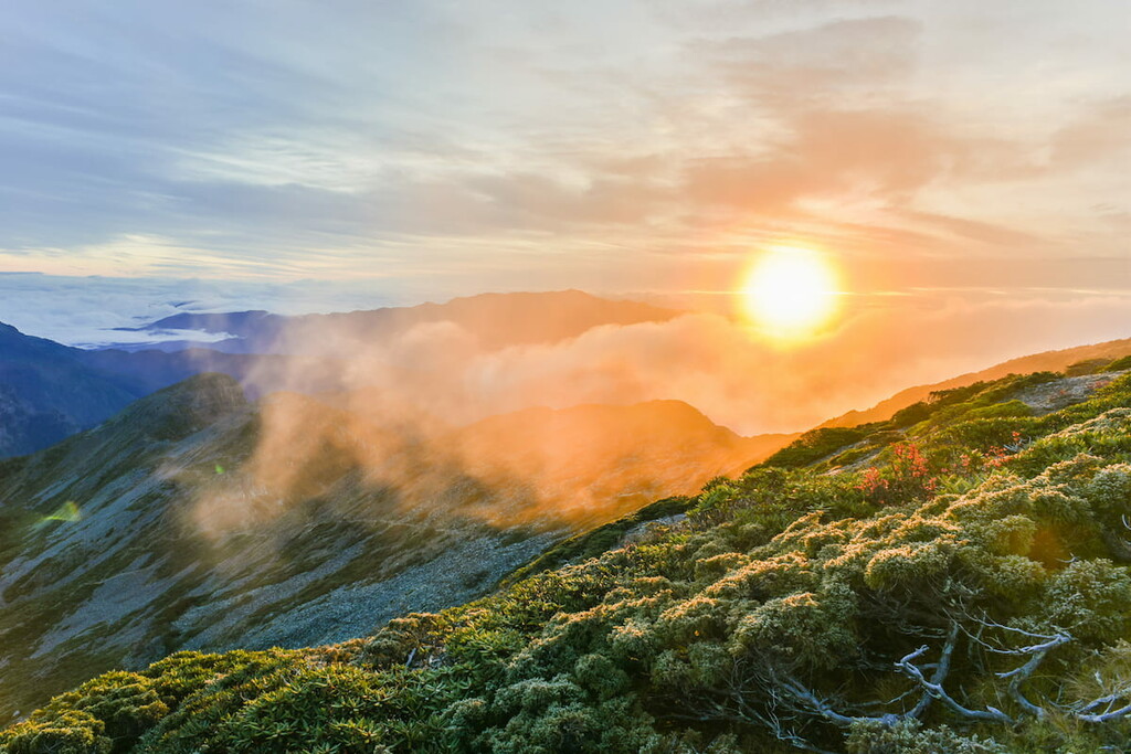
Amidst dense fog and bushy shrubs, the mountain terrain is similar to that of an underwater world of intricate corals. Yushan juniper creates a hauntingly terrific sight with its white stained bark and crooked, warped branches veering their poking twigs in all directions.
The formidable presence of a rock wall is situated in the last 1 km (0.6 mi) before Dajian Shan. While hikers do not have to scale the wall vertically, there are loose stones along the steep ridgeline; therefore, hikers should tread cautiously.
On the summit of Dajian Shan, hikers can appreciate the meandering jagged mountain edge extending its graceful neck southwards to the soaring peaks of Jiayang Shan and Jian Shan. Hikers can enjoy the mighty snow-capped exhibit of Xueshan in its entirety.
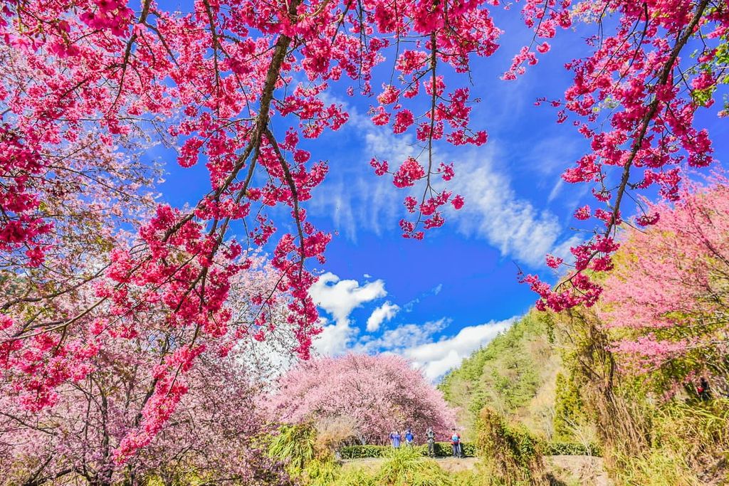
The Ma Wu Ba Shan Hiking Trail commences at Pingding Suspension Bridge of the land of the Huanshan tribe. This route is favoured for its springtime beauty as beautiful pockets of blooming wisteria, cherry blossoms and rhododendron burst with colour, adding serenity to the tiresome trek. Clusters of Taiwan white pine forests accent the route along the climb, obscuring views along the path.
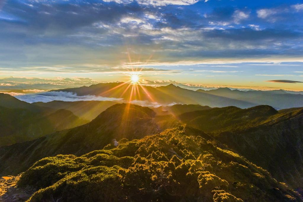
As hikers ascend the mountain, Zhijiayang Shan comes into view amidst the clearing of the pine forests. Zhongyang Jianshan can also be seen, though it seems far closer than it actually is. The base peak of Ma Wu Ba Shan (馬武霸山) is a field of grass that offers a 360 degree views of Ma Wu Ba Shan Main Peak (馬武霸主峰), Xueshan Main Peak, Zhijiayang Shan, and the nearby mountains of the Central Mountain Range (中央山脈).
Ma Wu Ba Shan Base Peak is more popular than Ma Wu Ba Shan Main Peak as there are no prospects from the forested main peak. Climbing to Ma Wu Ba Shan Main Peak involves a messy path of fallen trees, no clear path, limited scenery, and a scarce water supply.
Before the East Xue Hiking Trail was established, the primary route to reach Xueshan Main Peak was via Zhijiayang Shan. Although the East Xue Hiking Trail is the preferred route, as it covers less mileage, the Zhijiayang Shan Hiking Trail is a superb alternative to scale Xueshan as hikers can enjoy different prospects along the journey.
One of the highlights of this trail is that the starting point is situated in the village of Huanshan; thus, visitors can discover the rich cultural heritage of the Atayal people, including their creative weaving techniques.
Once hikers depart from the village, they climb the gentle slope for the first 3 km (1.8 mi) until they reach a challenging rock wall that follows a steep path to the Piaodan Hut for an overnight rest.
The following morning, hikers set off early to Zhijiayang Shan, passing the still waters of Piaodan Pool and entering a pine forest before reaching the summit that is shrouded with Yushan cane. While there are no views from the mountain, hikers can appreciate the view to Xueshan, Dajian Shan, and Zhongyang Jianshan in the clearing between the forest.
Hikers then follow onwards, heading to the ultimate peak of Xueshan, from where hikers can enjoy the Holy Ridge linking Xueshan and Dabajianshan. At the same time, the western highlands of Zhijiayang Shan, Dajian Shan, and Da Xue Shan are easy to see. In the north, hikers can note the striking appearance of Dabajianshan, as well as Pintianshan (品田山) and Mutelaba Shan (穆特勒布山). While in the east, the hills of Shenmazhen Shan (審馬陣山) and Nanhu Dashan (南湖大山) are on display.
Hikers then descend Xueshan, passing Glacial Cirque Number 1 and stopping at Sanliujiu Hut overnight. The following morning, hikers summit Xueshan East Peak, the final mountain of the Zhijiayang Shan Hiking Trail, before they arrive at Wuling Recreation Area.
The West Xue Hiking Trail crosses several mountains that do not feature in the Dajian Mountain and Jiayang Mountain Ecological Reserve. However, Xueshan Main Peak, Cuichi Sancha Shan, and Da Nan Shan (大南山) form part of the expedition. The West Xue Hiking Trail is for experienced hikers who desire a challenge as the trail spans seven days over a milage of 28.5 km (18 mi).
Hikers begin the journey from 230 Forest Road, climbing Xueshan East Peak before reaching the iconic Xueshan Main Peak. For the remainder of the expedition, hikers will summit Cuichi Sancha Shan, Xueshan West Peak, Huoshishan (火石山), Da Nan Shan (大南山), Touyingshan (頭鷹山), Qijunshan (奇峻山), Da Xueshan North Peak (大雪山北峰), Da Xueshan (大雪山), Pipidashan (匹匹達山), and Zhong Xueshan (中雪山).
One of the striking features of this route is Taiwan’s highest alpine lake, Cuei Pond. The sparkling clear waters of Cuei Pond display the sharded rocky surface of the lake. The water is so still that the verdant Yushan juniper forest surrounding the lake is mirrored on its surface. The serene beauty of this lake inspires feelings of tranquillity and calm.
The slow-paced golden sandy beach city of Yilan (宜蘭市) is the closest city to Dajian Mountain and Jiayang Mountain Ecological Reserve. For visitors wishing for a unique experience, accommodation facilities are offered at the mountain village of Huanshan, where visitors can immerse themselves in the customs and traditions of the Atayal people.
The laid-back and unhurried lifestyle of the city is one of the reasons why visitors love Yilan. Adding to the relaxed atmosphere is an abundance of exquisite natural beauty, from the inviting turquoise waters washing onto the endless stretch of beach to lush shaded forests and jaw-dropping waterfalls.
If there is one rule for visiting Yilan, it is to head to the beach. While the more desired beaches are Su’ao, Wai’ao, Wushi, and Shuangxi, any beach will delightfully treat visitors to stunning scenery and the passionately tranquil crashing of waves. Surfers especially love the beaches in Yilan as the swells intensify during typhoon season.
Guishan Island is a prime spot to admire the promise of daybreak and the intensity of sundown. It is also a superb place to spot playful whales and dolphins in the sparkling cerulean waters of the Pacific Ocean. In addition, crab watching is also an activity that visitors enjoy due to the density of crabs living in the fumaroles of the island.

Longtan Lake is one of the top leisure spots in Yilan County as its glassy still waters reflect the verdant woodlands that layer the surrounding hills. Visitors can take a stroll on the wooden walking path around the lake to appreciate its pristine beauty and to be an audience to the sounds of flowing water and the tweeting of birds.
For a unique tea tasting experience, tea lovers can treat themselves to a traditional Taiwanese tea ceremony. Taiwan tea ceremonies have been held for 400 years and observing an elaborate tea ceremony is a delightful experience for those who want to be educated on Taiwanese tea culture. Feng Chung Villa in Datong Township performs a top-rated tea ceremony that features several integral steps in creating, appreciating, and tasting a perfect cup of tea.
As Huanshan lies in a valley, the mountain scenery is constant in the region. The smoggy mountain mist engulfs the valley in damp and cold conditions, which creates a captivating scene, despite the limited view of the mountains.
Wandering the roads of Huanshan, it seems as though the village lives in a dreamlike trance due to the quiet and slow living of its residents. One cannot help but feel relaxed in this mountain community where the people welcome visitors with open arms.
The Atayal people encourage visitors to immerse themselves in the Atayal customs and traditions. The Zhan Xiumei Cultural Relics Museum displays a collection of old tools, kitchen utensils, and old photos to convey stories of the wisdom of the Atayal people.
The Atayal proudly present their culture by singing ballads, performing dances, demonstrating their innovative system of pounding rice, and weaving colourful fabrics.
The easiest way to travel to the Dajian Mountain and Jiayang Mountain Ecological Reserve is via Yilan. From Taipei, visitors should take the local express train (TRA) from Taipei Main Station to Yilan or Luodong Train Station.
The Kuo-Kuang Bus 1751 departs from Yilan, and the Kuo-Kuang Bus 1764 departs from Luodong. Both buses terminate at Wuling Farm.
Another option is to rent a car or scooter from Yilan or Luodong. Yilan is an 86 km (53 mi) journey from the reserve, while Luodong is approximately 88 km (54 mi) away. To get to the mountain village of Huanshan, visitors can hire a taxi for the 11 km (7 mi) drive.


tw100
ultra
taiwan-high-three
taiwan-ultras
tw100
ultra
taiwan-high-three
taiwan-ultras
The highest peak in Dajian Mountain and Jiayang Mountain Ecological Reserve is Xueshan / Snow Mountain, at 3,886 m.
Notable peaks in Dajian Mountain and Jiayang Mountain Ecological Reserve include Xueshan / Snow Mountain, Dajian Mountain, Mt. Cuichi Sancha, South Peak of Xue Mountain and Snow Mountain Southwest Peak.


