
Scan the QR code and open PeakVisor on your phone
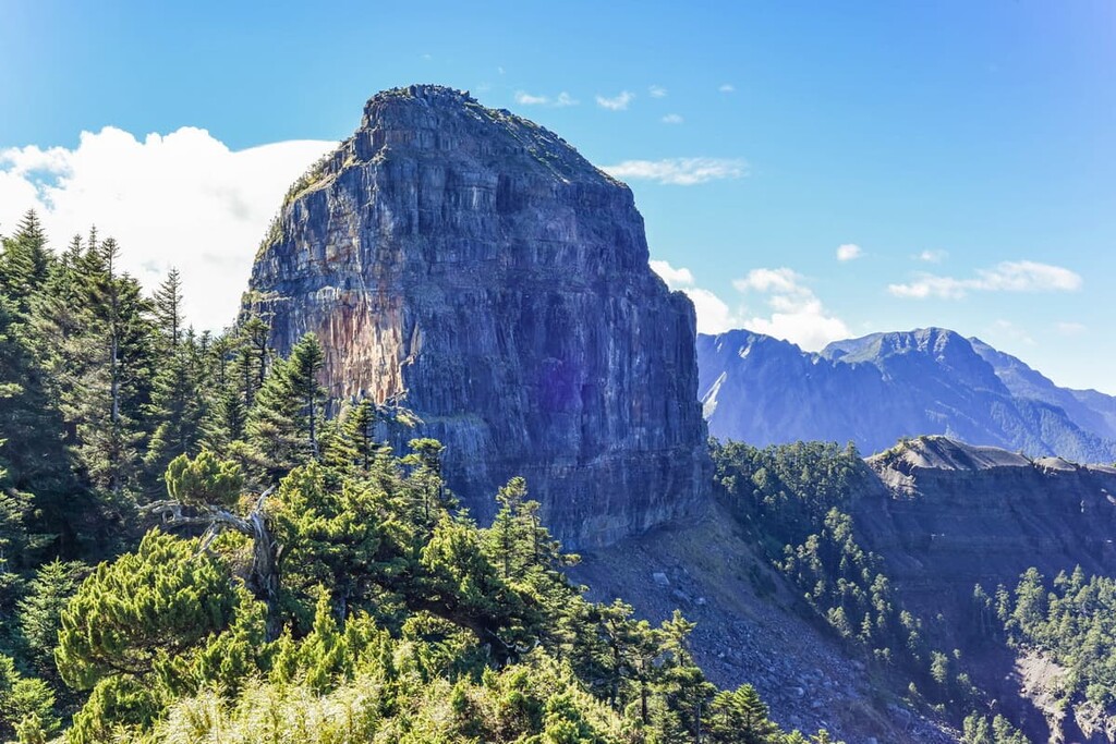
Jiaren Mountain and Madara River Regional Ecological Reserve (佳仁山、馬達拉溪區域生態保護區) lies in the northwestern zone of Shei-Pa National Park (雪霸國家公園) in central Taiwan. Out of a total of 14 named mountains, the highest peak in the reserve is Zhongshan (中山) at 2,637 metres (8,652 ft) in elevation, while the most prominent hill is Luchang Dashan Bei Feng (鹿場大山北峰) at 2,611 metres (8,566 ft) in elevation.
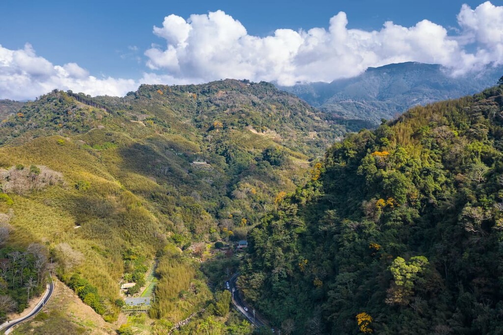
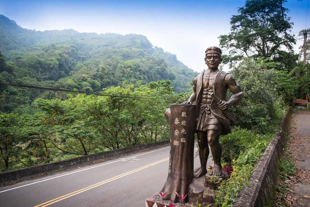
Jiaren Mountain and Madara River Regional Ecological Reserve is located in the Tai’an Township (泰安鄉) of Miaoli County (苗栗縣). This area is renowned for its remote location as the cluster of lofty peaks limits passage into the mountainous region.
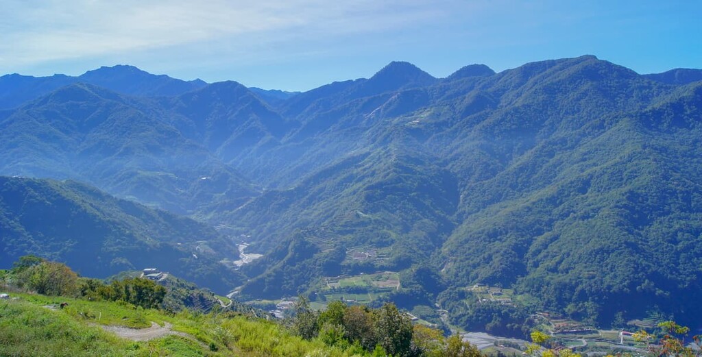
The elevation in the reserve ranges from 760 metres (2,493 ft) in the Da’an River Valley to 2,637 metres (8,652 ft) on the summit of Zhongshan. In the winter, snow is prevalent on the peaks of higher mountains in the reserve.
The reserve enjoys a temperate climate with an average winter temperature of 9°C (48°F) at 1,000 metres (3,281 ft) in elevation, dropping to 41°F (5°C) over 2,000 metres (6,562 ft). In summer, the temperature averages around 22°C (71°F) for areas over 1,000 metres (3,281 ft) and 16°C (61°F) for areas around 2,000 metres (6,562 ft) in elevation.
Rainfall is plentiful in the reserve, with an average precipitation of 1,500 to 3,000 mm (59 to 118 in). Precipitation is most common in the reserve during May and October, which are the months that herald in the appearance of heavy monsoons and ravaging typhoons.
Places of interest situated near the reserve are Basiashan National Forest Recreation Area (八仙山國家森林遊樂區) in the south and Taiwan’s second tallest mountain Xueshan (雪山) to the east. Dong Xi Shui Shan (東洗水山) is also located to the west, while Yemagan Shan (野馬敢山) is located to the north.
The peaks of Jiaren Mountain and Madara River Regional Ecological Reserve belong to the Xueshan Range (雪山山脈). Located to the northwest of the expansive Central Mountain Range (中央山脈), the Xueshan Range extends southwest to central Taiwan.
The rock strata of the mountains lying northwest of Xueshan comprise marginally of metamorphosed rock from the Miocene to Eocene epochs. The degree of metamorphism decreases from southeast to northwest. The primary rocks in the range are sandstones, shales, and slates.
The other prominent peaks in Jiaren Mountain and Madara River Regional Ecological Reserve are Zhenshan (榛山), Nengjia Shan (能甲山), Heliu Shan (合流山), Jiaren Shan (佳仁山), and Laosong Shan (老松山).
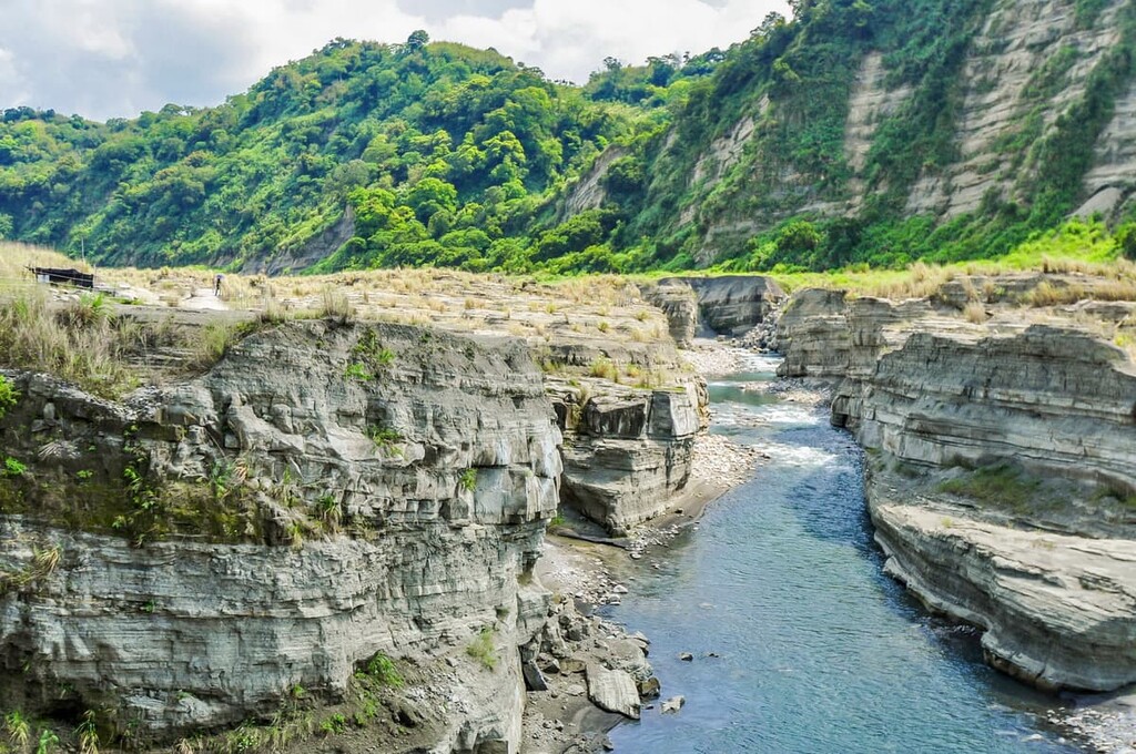
Kaui Shan (檜山) is the northernmost peak with Zhongshan (中山) and its slopes signal the eastern boundary of Jiaren Mountain and Madara River Regional Ecological Reserve. The Da’an River (大安溪), which merges into the upper reaches of the Madara River, intersects the northeast and southwest peaks in the region. The southernmost hill is Heliu Shan (合流山), with Nankeng Shan (南坑山) creating the western frontier.
Three distinct microclimates exist in the Jiaren Mountain and Madara River Regional Ecological Reserve. Each of these distinct microclimates affect the plant life that can grow in certain parts of the reserve.
Vegetation belonging to the warm-temperate Machilus-Castanopsis Zone can be found from 500 metres to 1,500 metres (1,640 to 4,921 ft) in elevation within the reserve. Plant species common in the montane evergreen broadleaf forest are a mixture of Lauraceae and Fagaceae trees, such as camphor and chestnut trees.
Extending along the elevation of 1,500 to 2,500 metres (4,921 to 8,202 ft) is the Quercus Zone, where a temperate montane coniferous forest dominates the landscape. Cloud cover envelopes the mountain forests belonging to this zone, adding moisture and humidity to the landscape. Taiwan red cypress, Arishan oak, Taiwan red pine, and Formosan alder are typical forest trees in this zone.
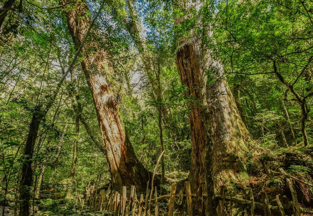
Furthermore, on the mountain slope of Kuaishan, five tall Taiwan red cypress trees tower above the forest floor, the most elderly of which is 2,000 years old.
Moving upward in elevation, the Tsuga-Picea Zone dominates the landscape between 2,500 to 3,100 metres (8,202 to 10,171 ft) in elevation in this part of Taiwan. As the highest peak in the reserve is Zhongshan at 2,637 metres (8,652 ft), the Tsuga-Picea Zone only extends upward for a further 1,637 metres (5,371 ft) in this area. Chinese hemlock and Taiwan spruce are the principal species that flourish in this cool-temperate montane coniferous forest.
Kuaishan and in Guanwu, the area just north of Zhenshan, is the only place in the world where the endemic vascular plant Devol’s balsamine, also known as Impatiens devolii T.C. Huang, grows.
In terms of wildlife, 58 species of mammals live in this region, such as the Formosan macaque, Taiwan wild boar, Formosan white-faced flying squirrel, and the Reeve’s muntjac. The Mikado pheasant, Swinhoe’s pheasant, Mandarin duck, and Taiwan yuhina are among the 154 bird species present in this region.
Butterflies are common in this area, with the tailed green jay, Vanessa butterfly, and swallowtail comprising part of the 170 butterfly species present in the region.
As Jiaren Mountain and Madara River Regional Ecological Reserve forming part of Shei-Pa National Park, the land within the reserve is highly mountainous.
The Atayal and Sisiyat are two Indigenous communities that traditionally lived in the mountains of what is now Shei-Pa National Park. The Sisiyat people lived in elevations between 500 to 100 metres (1,640 to 3,281 ft), while the Atayal traditionally preferred higher elevations of 100 to 1,500 metres (3,281 to 4,921 ft).
The Atayal and Sisiyat co-existed peacefully in their mountain homes until the arrival of Japanese officers who were interested in the vast amounts of camphor trees in the lower elevation regions of the mountains. Thus, during the Japanese Occupation Era of Taiwan, Japanese officials sought to gain control of the mountain forests by forcing the Atayal and Sisiyat people to move to areas under oppressive surveillance.
In the area between the Beikeng and Madara rivers, a stretch of policed mountain road still exists to this day. In fact, this is where the Japanese forced the Atayal and Sisiyat people to live. Japanese officials posted police stations every 5 km (3 mi) along the road as they kept a cruelly watchful eye on the tribes they wanted to manage. This road now forms part of a trail, known as the Beikeng Creek Historic Trail (北坑溪古道), where hikers can note the severe oppression imposed on the Atayal and Sisiyat people.
The Atayal and Sisiyat are thus no longer dwelling in the region of Shei-Pa National Park; however, they did leave their mark on the area with their old mountain routes, which connected them to other tribes and which they would use to hunt and fish. These ancient roads have been preserved and are favourable hiking trails showcasing the history of these mountain-dwelling tribes.
Today, approximately 18,000 Atayal and Sisiyat people live in the surrounding areas of Shei-Pa National Park, where many have lived since the end of the Japanese occupation era.
The Beikeng Creek Historic Trail is popular and educational for hikers to witness the treatment of people during Japanese rule. However, the mountain trails are just as popular in the reserve as they offer clear views of Dabajianshan (大霸尖山) and the Xueshan.
The quietness and nature song from the rustling breeze and the melodic chirruping of birds on this pristine path through a cedar woodland leading to the giant trees is the highlight of this trail. Five Taiwan red cypress trees of one thousand years or older stand imposingly tall along the trail, brushing the tufts of cloud cover with its dense foliage.
Starting from Guanwu Recreation Area, hikers head into the forest near the 1.2 km (0.7 mi) mark on Leshan Forest Road. Along the way, they’ll cross a rope suspension bridge, be encircled by lush greenery, and follow a path that leads to a cedar forest.
As this path was once used as a trolley road to transport timber during the logging industry, remains of partly disassembled railways are present along the route. Hikers can visibly distinguish the five peaks of Wuzhishan (五指山) in the clearings along the dense cedar forest.
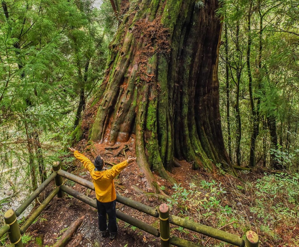
At the end of the forest, the five colossal Taiwan red cypress trees stand along a circular path. The first giant tree is the tallest at 47 metres (154 ft), while the second giant tree has the greatest circumference of 17 metres (56 ft). Both trees have an estimated age of 2,000 years.
In this area, the endemic Impatiens devolii T.C. Huang, otherwise known as Devol’s balsamine, flourishes and is the only place in the world where it grows.
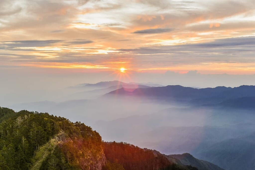
If hiking in the afternoon, the fog rolls in like clockwork every day, obscuring the views but adding an enrapturing misty beauty to the path. Hikers then head towards the trail's end to the 6 km (3.7 mi) mark on Leshan Forest Road.
Cloudy pine forests and spectacular views of the prominent peaks of Shei-Pa National Park are the highlights of the hiking trail to Zhenshan. The trailhead is situated on Dalu Forest Road, near Guanwu Villa, and the path to the summit is 4 km (2.4 mi) long.
Being a loop trail, hikers can take a left at the fork in the road and first endure a series of steep stairs towards the summit. Alternatively, they can take the gentler path up the mountain on the right.
During the climb, hikers will enter a woodland of Taiwan red cypress, Taiwan hemlock, Huangshan pine, and Taiwan white pine that extend towards the heavens, but are, at times, submerged in forest clouds. Toward the summit of Zhenshan, clusters of rhododendrons thrive, such as Taiwan rhododendron and Yushan rhododendron.
An observation deck sits at the intersection of the circular trails at the top of Zhenshan, which affords hikers 360 degree panoramic views. Xueshan, Dabajianshan, Xiaobajianshan, Pintianshan (品田山), and the Holy Ridge stretch across the landscape. The peak of Zhenshan is also renowned as being a prime spot for bird watching.
The Daba Xilin hiking trail summits the four mountains of Banshan (班山), Sanrong Shan (三榮山), Zhongshan (中山), and Nengjia Shan (能甲山) over four days. Banshan sits outside the Jiaren Mountain and Madara River Regional Ecological Reserve; however, the other three mountains are located within its borders.
Starting at Dalu Forest Road, hikers first ascend the mountain slope leading to the saddle between Sanrong Shan and Banshan. At first, the path seems relatively straightforward; however, hikers soon descend rocky crags to level with the Madara River's meandering river bed, leading into a pine forest. After the pine forest, hikers encounter a dense thicket of silvergrass, which follows a steep trail up to the summit of Banshan, the first mountain of the course.
Hikers then move to the River Valley Giant Wood Camp, where hikers will rest overnight. The following morning, hikers awake to tackle the peak of Sanrong Shan. The climb to Sanrong Shan has the feel of an obstacle course, as hikers climb over fallen trees, wade through a barrage of waist-high Pseudosasa japonica bamboo and scramble over steep boulders.
While the climb is taxing, there is beauty along the route as hikers traverse through sections of dense forests. A vast cypress forest dominates the valley, while a woodland of pine covers the region just below the summit. Hikers will also notice giant cypress trees along the mountain saddle.
Hikers will reach the summit of Sanrong Shan, where a clear 360 degree view awaits them. To the north lies Jinjie Shan (境界山) and Jiecheng Shan (結城山), while Xueshan West Peak (雪山西峰) is located to the southeast. Meanwhile, in the west is Luchang Dashan Bei Feng (鹿場大山北峰) and Dong Xi Shui Shan (東洗水山北峰), while hikers can observe the grasslands of Jiali Shan (境界山) in the east.
Hikers then make their way back to the River Valley Giant Wood Campsite for an overnight stop before embarking towards Zhongshan and Nengjia Shan in the early hours of the morning. A pine forest with spiky pine cones scattered across the forest floor presents itself after hikers turn right on the mountain path towards Zhongshan. The previous day, hikers took a left to summit Sanrong Shan.
The trail to Zhongshan is primarily smooth and not too challenging, and another cluster of pine trees shelter the hiking route as hikers ascend the saddle leading up to Zhongshan. The summit of Zhongshan is open, and the forestland to the east can be observed, while in the west, the snow-capped west peak of Xueshan and the Holy Ridge are in clear sight.
Hikers set forth towards Nengjia Shan as they descend the mountain saddle where a woodland of cedar trees welcomes the hikers to a shaded path. An endless azalea forest covers Nengjia Shan Main Peak; however, the nearby southern peak of Nengjia Shan ridge offers views of the four peaks of the Daba Xilin hikers successfully summited.
Hikers then retrace their steps back to the River Valley Giant Wood Camp; however, they can opt to take the mountain path that does not summit the mountains of Zhongshan and Nengjia Shan on the route back. After spending the night at the camp, hikers move down the hill following the same way they climbed on the first day. Thus, they will pass the mountain road leading to Banshan before descending to the Dalu Forest Road.
Hikers begin their trek on 230 Forest Road, close to Daxueshan Recreation Area. The forest road is rampant and wild, yet delightfully beautiful, especially with the sightly presence of pretty purple foxgloves. Hikers journey for 16.5 km (10 mi) along this brilliantly rugged forest road, trekking through overgrown grasslands and crossing the gurgling Da’an River to reach the overnight campsite.
The following morning, hikers continue the path on 230 Forest Road leading towards Heliu Shan. Ascending the steep Heliu Shan, hikers encounter a labyrinth of trees blocking the way up the mountain. Once finding their way through the wooded maze, a clearing presents hikers with picturesque views of Xiao Xue Shan (小雪山) before reaching the overgrown summit of Heliu Shan where shrubbery is so rampant that no prospects can be enjoyed.
Hikers then set off north along the mountain road towards Laosong Shan. Leafy woodlands with fallen lumber spread across the ground, permeated in a velvety mossy cloak, that decorate the journey to Laosong Shan. The sun's penetrating rays barely infiltrate the dense forest cover, making the shaded path cool and slightly humid.
Along the journey and in sections of open terrain, hikers can see the peak of Laosong Shan. However, verdant vegetation grown on the summit obscures the prospects of views on Laosong Shan. Hikers then make their way back to the campsite situated on the base of Heliu Shan where they will spend the night before the expedition to the third mountain of Wuming Shan (無名山) in the morning.
Next, hikers ascend Heliu Shan to take the mountain path towards Wuming Shan. Walking along the mountain saddle, hikers can distinguish the nearby conquest of Wuming Shan amidst the morning clouds. A forest of impenetrable heather serves as a hindrance to hikers, as the journey is not easy having to cut through the dense grass.
Hikers eventually reach the rhododendron-filled summit of Wuming Shan, which bears no prospects for expansive views; however, the emergence of the afternoon mountain forest mist creates a moody and spooky atmosphere.
Finally, hikers follow the mountain path back to Heliu Shan and descend to the overnight campsite. The following morning, they will return to the start of the mountain trail at Xiaoxue Recreation Centre, trekking through the untamed landscape of 230 Forest Road.
Relics of stone buildings and dilapidated wooden structures outline the Beikeng Creek Historic Trail. This old surveillance road was created in 1922 and has an elevation of 1,600 metres (5,249 ft) on the eastern mountain slope of Beikeng Shan (北坑山).
Beikeng Ancient Road stretches for 33 km (20.5 mi) through the mountain road from Guanwu to Erbensong between 1,300 to 2,200 metres (4,265 to 7,218 ft) above sea level. However, most hikers visit the Beikeng Station, one of twelve residential sites situated along the hilly road.
Hikers begin the trail at Xuejian Recreation Area and set off along Simajian Forest Road for 6.2 km (3.8 mi) until the Beikeng mountain pass approaches. A dense forest of camphor and pine trees dominates the mountain forest when ascending Beikeng Shan.
Along the way, when you stumble across a clearing in the trees, you can enjoy exquisite views of the landscape. Dabajianshan (大霸尖山), Xiaobajianshan (小霸尖山), and the Holy Ridge connecting Dabajianshan and Xueshan can be noted in the distance. Taking the lower right pathway, hikers descend 250 metres (820 ft) on the mountain road where Beikeing Ancient Road is situated, roughly 2 km (1.2 mi) away.
The mountain trail connects to the 14.6 km (9 mi) mark on Beikeng Ancient Road. This site was once the Japanese administrative and military hub known as Beikeng Station.
Ten buildings, both intact and crumbling foundations, still stand in this post, which comprises a judo hall, a kendo hall, clinic, ammunition depot, trading exchange, residence, and dormitories. In addition to the buildings that remain, remnants of plates are scattered along the forest floor, as are old glass bottles and jars with Japanese inscriptions.
Here, a mixture of traditional Japanese wooden slat structures with thatched roofs, buildings made of brick covered with cement, and moss-covered stone walls made of interlocking flat, long rocks offer a fascinating glimpse into the architectural styles of the past.
Taichung City (台中市) is the closest city to the southern set of mountains in the Jiaren Mountain and Madara River Regional Ecological Area. Hilly peaks complicate the route to Guanwu; thus, visitors can only take the country road from Hsinchu (新竹市) to access the starting area for the trails in the northwest section of the reserve.
Taiwan's third-largest city is considered the arts and culture capital of the island; thus, creative spaces can be found throughout the city. Additionally, Taichung is renowned for its natural beauty, as it is located close to the mountains of Shei-Pa National Park.

Calligraphy Greenway is a 3.6 km (2.2 mi) linear stretch leading from the National Museum of Natural Science to the National Museum of Fine Arts. Between these two grand museums, an area of 6.5 ha (16 acres) of abstract sculptures, landscape art, and majestic water fountains fill the space. Inspired by calligraphy's free and flowing movement, this park advocates fun, individuality, and elegance with its creative natural art forms.
Meanwhile, Rainbow Village, which was once an old military village on the brink of demolition, is a hugely popular attraction in Taichung. The last remaining resident and former soldier, Huang Yung-Fu, refused to leave his living quarters and instead decided to paint the rundown building in bright colours and jolly patterns. His painting job saved the building and attracted visitors wishing to admire the cheerful murals painted in all colours of the rainbow.
The Cultural Heritage Park is an art and design space housed in a restored Japanese distillery building. Innovative designs and artsy sculptures decorate the thoroughfares of this space, while quirky aesthetics adorn the exterior of shops and restaurants. Twenty-eight structures in this park are listed as historic structures, adding an element of history to this enjoyable and eccentric venue.
Dongshi Forest Garden is located on the outskirts of Taichung City in Dongshi District. The gardens of Dongshi blossom year-round. Plum blossoms flower in January, and romantic cherry blossoms arrive between January and March. In the spring months of April to May, azaleas mature, and tundra plants like rhododendrons flourish throughout the summer months.
In addition, between March to September, a firefly display illuminates the night skies. The red maple leaves in the trees also signal the arrival of autumn between November to January.
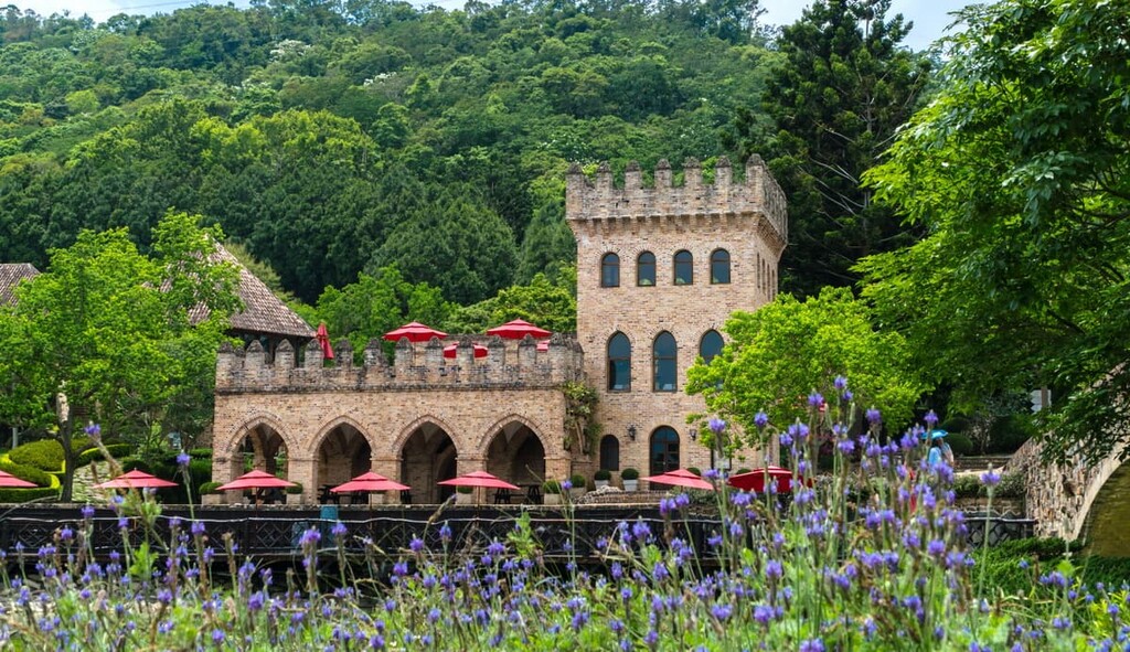
In fact, one area of Taichung that one could easily mistake for the region of Provence in France is the Lavender Cottage, which features endless rows of sweetly scented lavender growing in its fields. Nestled in the mountains between Tougui Shan (頭拒山) and Anying Shan (暗影山), the Lavender Cottage is bathed in a forestland of greenery.
Visitors can head to the coffee shop and admire the generous views of the mountains and lush landscape of rolling hills and verdant valleys. The lavender garden sits at the end of the walking trail that leads visitors through the picturesque setting of the mountainside cottage.
The modern city of Hsinchu is rich in history, as it was one of the first settlement areas of the Hakka people. The art scene in Hsinchu is thriving, and visitors can admire this attractive city's artwork, architecture, and landscape.
The main thoroughfare of Hsinchu, Beimen Street, exhibits an array of varying architecture, from red brick buildings, wooden tea houses to dilapidated structures from the Qing dynasty. Beimen Street also holds an assortment of ancient medicinal coves, local street food, and a modern array of eclectic coffee shops. Walking around this area offers insight into Hsinchu, both past and present.

Hsinchu Park is located centrally near the train station. Despite its central location, visitors find tranquillity along the leafy walking paths which line the serene lake. Springtime is a popular time to visit the park as it is a prime spot to admire the blooming cherry blossoms. Hsinchu Park also houses a zoo that’s home to rare species, such as Bengal tigers and orangutans.
A top attraction in Hsinchu is the Eighteen Peaks Mountain Parks, which comprise eighteen hills that stretch along a meandering 8 km (5 mi) road through the park. People of all ages and abilities can enjoy the outdoor adventure this park holds, as the hills are not too high and the gradients are gentle. The highest peak is Shibajianshan (十八尖山) at 134 metres (440 ft) in elevation.
For art lovers, the Railway Art Warehouse displays local artwork and engaging exhibitions of Taiwanese artists. The Railway Art Warehouse is named after its former operating establishment as a station warehouse constructed in 1941. Thus, this place is an attraction for both people interested in art, history, and architecture.
As there is no public transport that travels directly to the Jiaren Mountain and Madara River Ecological Reserve, visitors will need to hire a car or scooter or taxi to the area. To access the mountains southeast of the Madara River, visitors can start their journey from Taichung. To get to the hills northwest of the Madara River, visitors can make their way from Hsinchu City.
To get to Hsinchu City or Taichung, visitors can take the Taiwan High-Speed Rail (HSR) or local express train (TRA) from the major cities of Taipei, Taoyuan, Chiayi, Tainan and Kaohsiung.

From Taichung, visitors can board the local train to Fengyuan Station and begin their journey along 140 County Road, which links to 47 Central Road, which shall connect to the Forest Road, the southern gateway of Jiaren Mountain and Madara River Regional Ecological Reserve. It is a 61 km (38 mi) journey from Taichung and a 40 km (25 mi) journey from Fengyuan Station.
From Hsinchu, visitors can take the local train to Zhudong and then hire a car or scooter to drive on 122 County Road, which connects to the Dalu Forest Road, the gateway of the north of Jiaren Mountain and Madara River Ecological Reserve. The journey from Hsinchu to the Jiaren Mountain and Madara River Ecological Reserve northern entrance is 75 km (47 mi), while it is a 54 km (33 mi) journey from Zhudong.


