
Scan the QR code and open PeakVisor on your phone
Kinmen County is home to 58 named mountains. The highest is Taiwushan at 253 m.
Kinmen County (金門縣) is a group of islands located off China’s (中國) southeast coast. For many years, Kinmen County was a military ground between China’s nationalists and communists, vying to claim Taiwan’s land. Despite its war-torn past, Kinmen County is a beautiful land of gentle hills, pristine coasts, and rich culture. Taiwushan (太武山) is the tallest of the 58 named peaks, measuring 253 meters (830 ft).
Kinmen County lies 187 km (54 miles) west of Taiwan’s island. Meanwhile, Taiwan’s off-shore island is 10 km (6 mi) from Xiamen (廈門市) in China’s Fujian Province (福建省). It’s so close that you can see Fujian’s city light flickering in the distance at nighttime. Separated by Xiamen and Weitou bays from the Fujian Province, Kinmen County covers 15,300 ha (37,807 ac) of land over 20 islands.
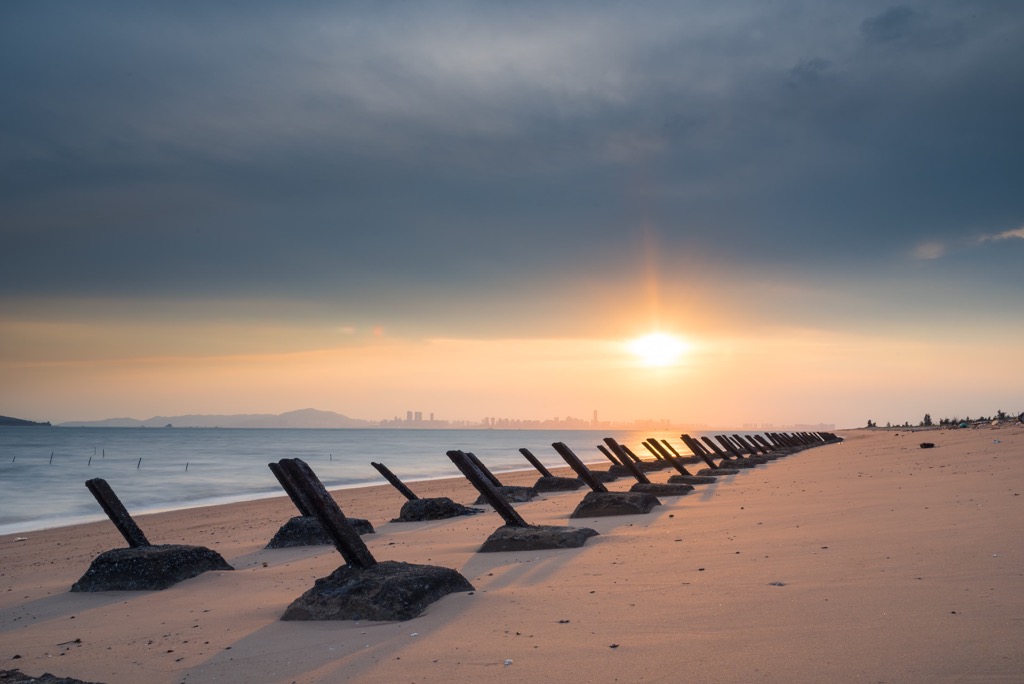
As the current retreats, many small islets appear in Kinmen County’s waters. However, these tiny posts are uninhabitable as they disappear at high tide. Kinmen County’s main islands are Kinmen and Lieyu (烈嶼島), while Dadan (大膽島), Erdan (二膽島) and Menghu (猛虎嶼) are some of its smaller isles.
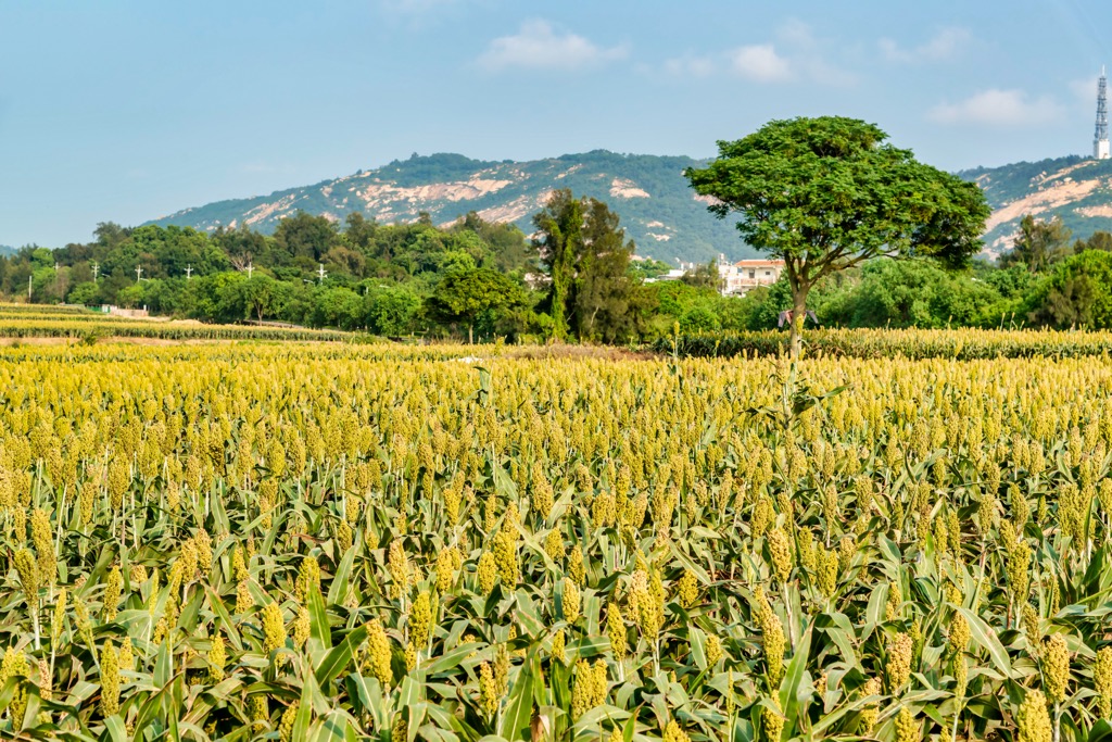
On land, the terrain is mostly flat, with small undulating hills. Kinmen County’s other notable peaks are Qilinshan (麒麟山), Jhaizai Hill (五虎山), and Nantaiwushan (南太武山).
The Taiwan Strait runs south of Kinmen County, where Taiwan’s other off-shore island, Penghu County (澎湖縣), lies. Thus, Kinmen County has a marine subtropical climate, with intense ocean winds blowing off the Taiwan Strait. Meanwhile, unlike most of Taiwan, Kinmen County receives little rain, averaging 1,000 mm (39 in) a year.
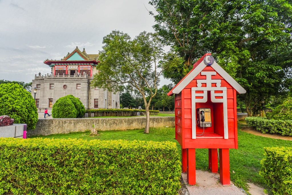
Kinmen County’s most well-known attraction is its multitude of Wind Lion God sculptures. As Kinmen is so windy, the locals honour the Wind Lion God, which protects them from vicious sea storms. There are 68 statues around Kinmen County, each of them uniquely different in design and paintwork.
While Kinmen County is a small area, its islands have numerous attractions. The Mashan Observation Post (馬山觀測站), once a spy bunker, is the northernmost sight, with Zhaishan Tunnel (翟山坑道) near Kinmen County’s southernmost point. To the west is Shaxi Fort (沙溪堡) on Lieyu Island, and the Shanhou Folk Culture Village (金門山后民俗文化村) is in the east. Kinmen and Leiyu islands and the surrounding waters are also part of Kinmeng National Park (金門國家公園).
Much like the rest of Taiwan, Kinmen County was once an underwater entity. The land gradually appeared from upliftment around 100 to 200 million years ago. Thus, the rock bed in Kinmen’s eastern hills contain granite gneiss, which accumulated in the sea. Red laterite stone comprises Kinmen’s western peaks.
Along Kinmen’s coast, there are many weathered rocks. The stormy weather conditions of strong winds and intense wave action eroded the stones to different shapes.
Kinmen County once had a thriving forest, but the land became barren over time. Forestation was the first significant contributor to plant life dying, but the powerful sea winds stripped Kinmen’s land of its rich soil, and the wars decimated any growing plants.
In recent years, Kinmen’s authorities created afforestation efforts so that Kinmen could become a flourishing land again. However, the species planted have to be hardy plants that can withstand Kinmen’s winds, such as eucalyptus, acacia, and she-oak.
Over time, Kinmen developed its own native plants. In fact, 542 endemic Kinmen plants can’t be found anywhere else in Taiwan. These species are the soft bollygum tree and Chinese sumac.
According to historians, human life in Kinmen County can be traced back 5,000 to 8,000 years ago. However, in 1949, the time war first began in Kinmen County, residents fled the Kinmen’s battlefields. Once the long, dark war-torn past was finally over in 1992, civilians could return to their homes after 43 years of conflict.
The war began as China’s two parties, the communist People’s Liberation Army (PLA) and the nationalist Kuomintang (KMT), known as the Battle of Guningtou. These two opposing groups wanted to reign over Taiwan, and by capturing control of Kinmen, they would then expand their power to Taiwan’s mainland.
While the KMT troops initially overpowered the PLA army, the PLA did not give up and kept attacking the KMT soldiers. In 1954 and 1955, and again in 1958, the PLA army bombed Kinmen. The KMT remained in Kinmen County for another 40 years, guarding the island should the PLA infantry strike again.
In 1992, the KMT military vacated Kinmen County, and it was safe again for Kinmen’s residents to return.
Kinmen County’s major hiking trails and areas are:
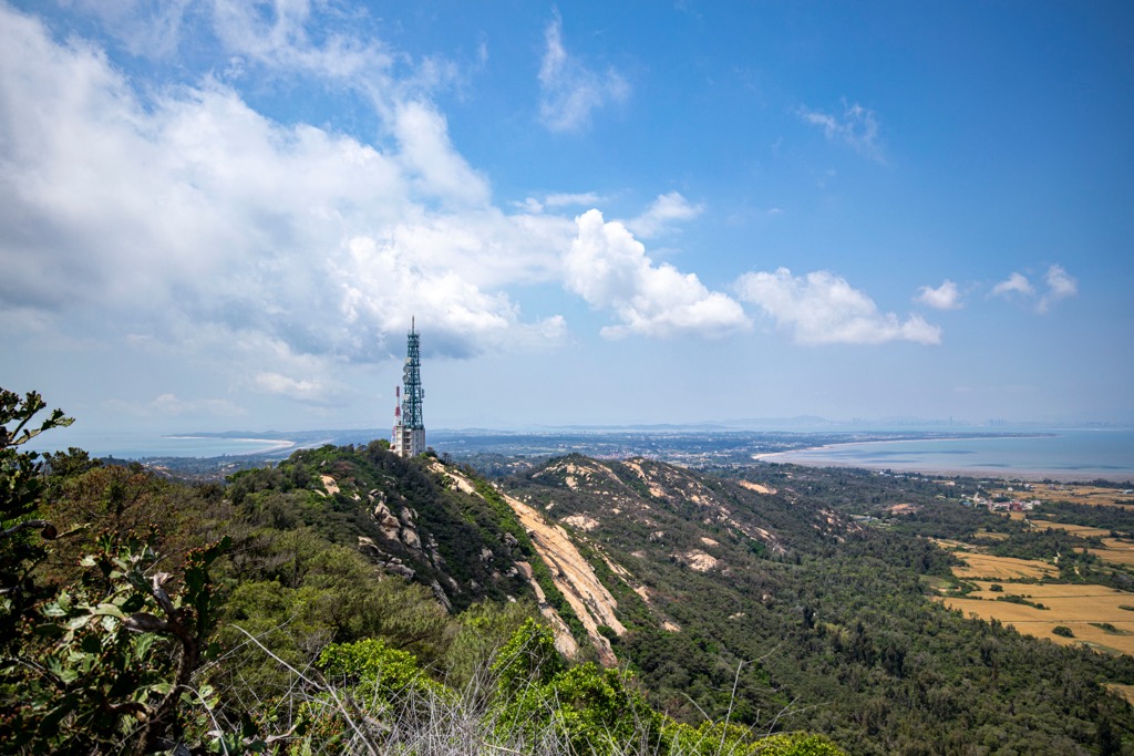
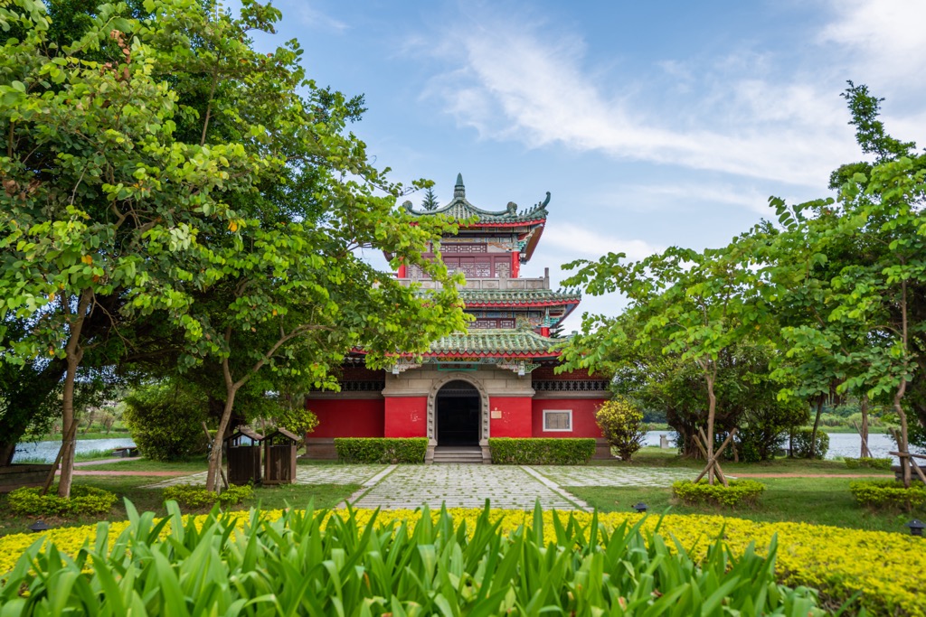
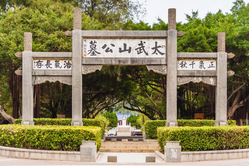
Climb Kinmen County’s highest hill for splendid unobstructed views of Kinmen Island and beyond. The path to Taiwushan is only 2 km (1.2 mi), so people of all ages and fitness levels can climb the gentle route.
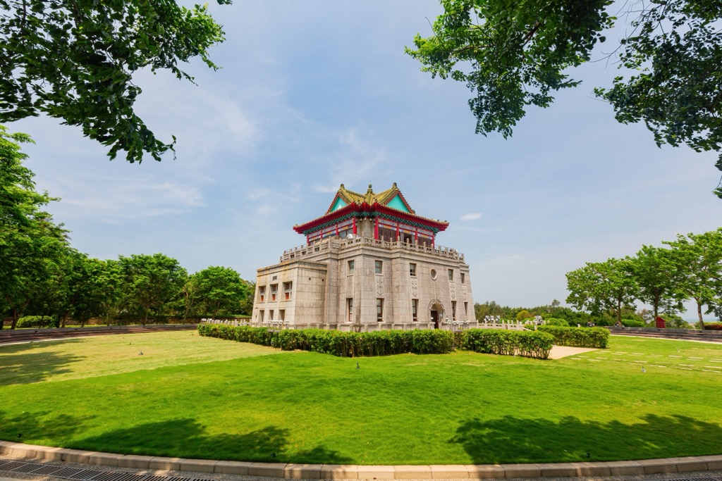
Although, the walk up the peak will not be a quick journey. You’ll want to stop at significant monuments along the way devoted to Kinmen’s military past. One of the most iconic sites is Wu Wang Zai Ju (毋忘在莒), a large boulder that Chiang Kai-shek, Taiwan’s former president, inscribed. It reminds readers not to forget Kinmen’s war-torn past.
Once you reach Taiwushan’s peak, you’ll be amazed at the panoramic views. In the distance, you’ll see green fields rolling out towards the sea and Xiamen’s tall skyscrapers.
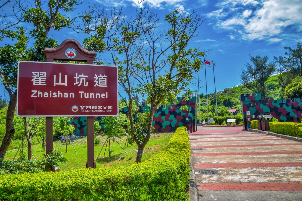
Head into Kinmen’s underbelly by visiting the Zhai Shan Tunnel Road. This secret underground passage allowed as many as 42 boats to pass through the tunnel during wartimes on the island.
Kinmen locals joined forces, hacking and chipping the earth to create this secret waterway. It took them five years to complete this amazing fete. You have to see it to believe it.
As soon as you descend into the cool tunnel, you’ll feel Kinmen’s overbearing humidity melt away. Strips of fluorescent lights show the rock’s wrinkled crevices and bottle-green water. They lead you to the lake's bottom along a paved passageway. By the end of the tunnel, you’re in awe of this unique tunnel and the laborious efforts it took to complete.
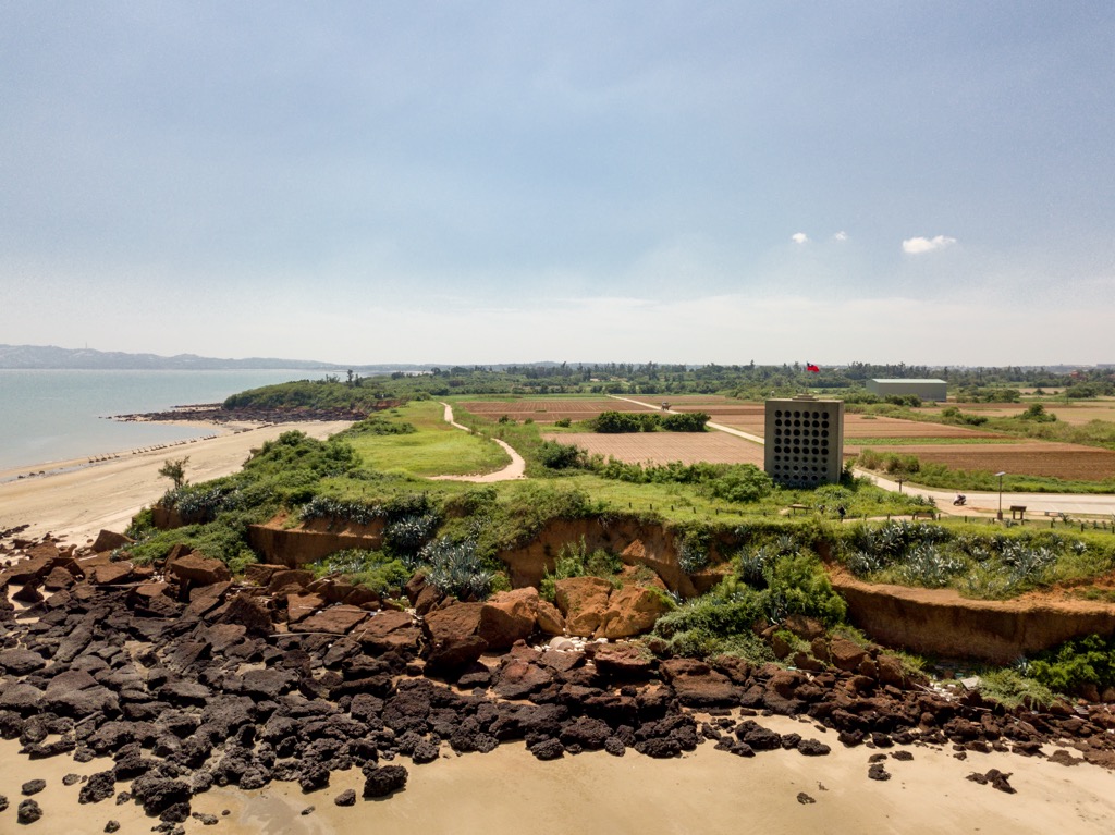
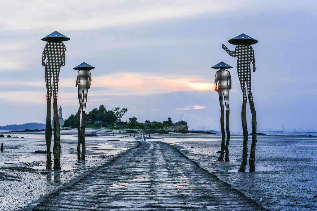
At high tide, Jiangongyu Islet (建功嶼) looks like a floating landmass, but you’ll have to wait for low tide for the magic to happen. As the tide ebbs, the stone walkway to the coastal oasis appears.
Tall steel sculptures of Kinmen fishermen with extra long limbs to accommodate the rising tide line the path to the islet. It’s quite fascinating to observe the water level at high tide from the sculpture’s mud and sediment on their lower legs.
Once you reach the Jiangongyu Islet, known for its rich biodiversity, look out for crabs, anemones, and other intertidal creatures on the shore. There is a large statue of Koxinga on the small island, gazing out towards the sea. After admiring the stone sculpture of Taiwan’s fierce fighter, look out towards the deep blue sea for stunning views.
Kinmen County’s westernmost site is the coastal Shaxi Fort on Lieyu Island. Another relic of Kinmen County’s warring past, Shaxi Fort was once an ammunition depot with bunkers. Explore its underground tunnels, the longest of which is 140 meters (459 ft).
While Shaxi Fort’s passages below ground are an interesting visit, you can’t deny its surrounding scenic beauty is its main attraction. The picturesque wooden boardwalk leads you to a viewing platform where you can admire beautiful seascapes and views of outlying Xiamen City.
Xiamen's busy daytime city life and evening lights provide an excellent contrast from the remote oceanside of Shanxi Fort. While admiring the scenery, you can also spot Kinmen’s small islets of Dada, Erdan, and Menghu.
In Kinmen County’s older times, residents would walk the South Wind Gap Ancient Road (南風隙古道), connecting the townships of Jinsha (金沙镇) and Jinhu (金湖鎮). The route starts between the low-lying saddle of Taiwushan and Nantaiwushan and heads towards Tai Lake (太湖).
The path’s name comes from the ferocious monsoon winds that pummelled the land between the two hills. While the trail withstands nasty gales, the scenery is beautiful, with undulating green meadows along which wound vines, rhododendron bushes and hydrangeas thrive.
From South Wind Gap Ancient Road’s highest point, you can gaze over Jinsha Township to the north and Tai Lake’s clear blue waters in the south. You can also clearly see Kinmen Island’s craggy coastline and its gentle hills of Shi Shan (石山) and Beique Shan (北鵲山).
While Kinmen County isn’t known for its abundance of woodlands, you will find lush leafy foliage at the Kinmen Forest Park (金門森林遊樂區). A Kinmen County’s afforestation effort, authorities planted original tree species that had been wiped out from natural disasters and the war.
Kinmen Forest Park is the only forest recreation area in the whole island county. In the 36-ha (89 ac) grove, you’ll find over 420 plant species, such as the swamp pine, bamboo, macadamia, and walnut trees. The main 500-meter (1,640 ft) boulevard has flourishing tall swamp pine trees on either side. As you walk down the thoroughfare, inhale the woody phytoncide released from the dense forest.
The large garden is beautiful in the flowering season with its many colorful blooms throughout the park. It also has an ecological pond where aquatic plants and wildlife can be observed. During the winter months, migratory birds gravitate around the pool, which is the place for bird spotting.
When visiting Kinmen County, staying on the larger Kinmen Island is best for convenience and being in a central location. Jinsha Township and Jincheng Township (金城鎮) are two popular areas with interesting attractions.
Situated in Kinmen Island's northeastern peninsula, Jinsha Township lies between green hills and coastal waters. It holds a special interest in its ancient villages and historical military outposts.
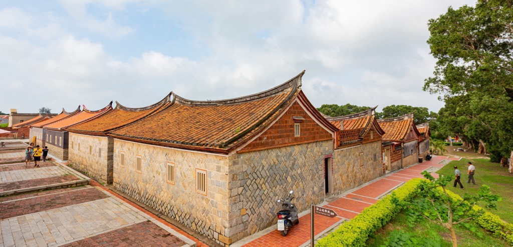
One of the first places to visit is Shanhou Folk Culture Village. Come for the 19th-century red brick Fujian-style architecture, and stay for the street food. Locals still occupy the village and serve specialities like oyster dishes to visitors. Wander around the compound with red brick paved alleyways and detailed murals. It's a fascinating visit and well worth the hype.
To extend your ancient sightseeing, head to Sha Mei Old Street. A mix of old and new, Sha Mei Old Street still retains its nostalgic feel with dilapidated buildings and lines of flourishing pot plants sprouting growth. You may spot recent additions like painted modern wall art that adds more flavour to the atmospheric alley. The older sections of this old market town are known as Shamei Morroco for its sandy-colored walls and geometric angles.
Next, make your way to the northernmost area of the Mashan Observation Post. During Kinmen's Guningtou War, KMT soldiers spied on neighboring Xiamen City. Military personnel used special high-powered binoculars and telescopes to spy on daily life in the Fujian Province. The building also has a broadcasting room where KMT troops radioed their sightings to their allies. When you visit the Mushan Observation Post, you can see the old spy bunkers and broadcasting rooms.
At the opposite end of Kinmen Island in the southwest is Jincheng Township. Much like Jinsha Township, the attractions focus on Kinmen's wartime past, but there are also many beautiful natural areas for visitors to see.
Walk on the white sand bay of Ou Cuo Sandy Beach (歐厝沙灘), where an old and rusted military tank lies wedged in the sand. If you visit at low tide, you can view the old army chariot, now home to intertidal marine life that has taken over the military carriage. The mix of historical relics and stunning natural scenery make this beach a fascinating find. Don't miss the glowing sunset over Ou Cuo Sandy Beach that extends over the Taiwan Strait.
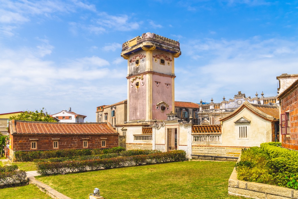
For a charming fusion of old Chinese and European architecture, visit Deyue Tower (得月樓). Built in 1931, history steeps the beautiful compound. Constructed during warring and public looting, the top floor of Deyue Tower has gun holes for troops to aim their weaponry at bandits approaching the village. As an esteemed ancient landmark, Deyue Tower is one of Taiwan's top 100 historical buildings.
Finally, admire the many Wind Lion God Statues around Kinmen County. There are situated in every township and village and look different to the next. You'll mainly find them along Kinmen's coastal stretches. Xiashu Wind Lion God (夏墅風獅爺) is an azure blue state with red ribbons, gold paws and a happy smile that protects Kinmen's Harbor. While the Kinmen Cheng Wind Lion God 2 (金門城風獅爺二) is a delicate small stone carving with the creature usually donning a red cape. You'll have lots of fun finding the many Wind Lion Gods throughout Kinmen County and admiring their ornate carvings and creations.
The best way to reach Kinmen County is by air. You can fly from Taipei, Kaohsiung, Taichung, Tainan, Chiayi, and Penghu County. Once you arrive in Kinmen County, you’ll land in Jinhu Township (金湖鎮) on the main Kinmen Island. Hiring a car, scooter, or bicycle is best to make your way around the island.
To reach Lieyu Island, make your way to Kinmen Harbor in Jincheng Township and take a ferry westwards to the neighboring smaller island.


Yes. Kinmen County has 58 named mountains. The highest is Taiwushan at 253 m.
The highest mountain in Kinmen County is Taiwushan, at 253 m.
Kinmen County has 58 named mountains.


