
Scan the QR code and open PeakVisor on your phone
Kinmeng National Park has 25 named peaks. The highest is Taiwushan at 253 m. Other notable peaks include Nán Tài Wǔ Shān, Taiwu Shan and Shí Shān.
Located in the coastal zones on Kinmen County (金門縣), the offshore Kinmeng National Park (金門國家公園) preserves Taiwan’s marine ecology and military history on this once war-torn land. Taiwushan (太武山), located inland, is the highest and most prominent mountain of the 25 named hills, measuring 253 meters (830 ft).
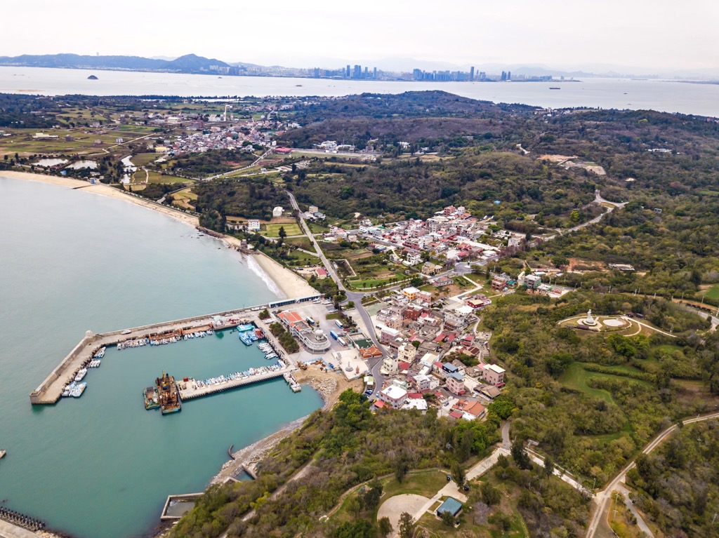
Lying off the southeast coast of China (中國), Kinmen County lies 10 km (6 mi) from Xiamen (廈門市), Fujian Province (福建省). Covering 3,529 ha (8,720 ac), Kinmeng National Park comprises five separate areas scattered around the island. Taiwu Mountains, Guningtou (古寧頭), Gu’gang (古崗), Mashan (馬山), and Lieyu (烈嶼) each hold a piece of Kinmeng National Park's history.
The Taiwan Strait flows south of Kinmeng National Park, while Xiamen Bay separates Kinmen County from mainland China. A distance of 187 km (54 mi) divides Taiwan island from the smaller Kinmen Island.
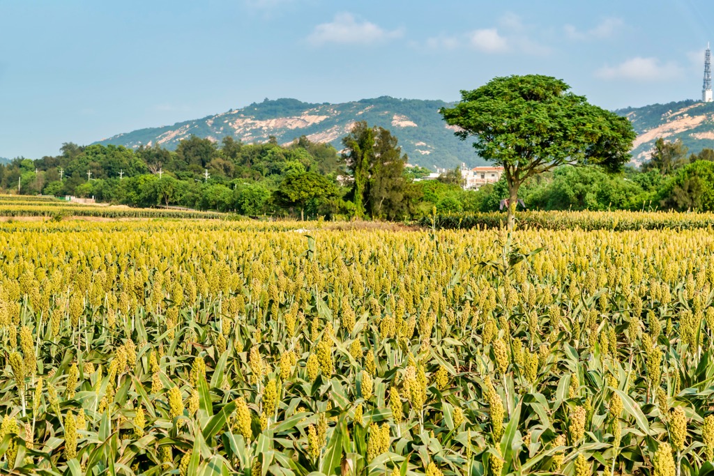
A subtropical marine climate of strong ocean winds befalls onto Kinmeng National Park's flat land. The rainfall collected at 1,000 mm (39 in) a year is insufficient to feed the soil as annual evaporation uses 1,680 mm (66 in) of water. Thus, farming is not ideal in Kingmeng's arid, dry soil.
Known for its blistering winds, Kinmen locals honor the Wind Lion God that protects them against the forceful blows from the sea. Considered to be Kinmen’s cultural heritage and an exquisite piece of artwork, a total of 68 sculptures lie across Kinmen’s islands.
As Kinmeng National Park primarily covers Kinmen's coastal areas, the land is flat and gentle. Kinmeng's highest hill, which lies inland, is relatively short at 253 meters (830 ft). Meanwhile, Taiwan's tallest peak, Yushan (玉山), stands at an imposing 3,952 meters (12,966 ft).
Some of Kinmeng National Park's other hills of stature and interest are Nantaiwushan (南太武山), Shishan (石山), Jhaizai Hill (五虎山), and Shuang Rushan (雙乳山).
Kinmeng National Park enjoys an obscure location many miles away from its reigning land. Taiwan lies to Kinmeng's east, where Yushan and Xueshan (雪山) are the two tallest peaks.
To Kingmeng's southeast are the Penghu Islands (澎湖縣), another of Taiwan's offshore isles. Mainland China's Xiamen City lies to the west, with Quanzhou (泉州市) to the northeast.
Kinmeng National Park’s area and hills, once an underwater area, uplifted around 100 to 200 million years ago. Large amounts of granite gneiss deposits accumulated underwater, forming the rock bed of Kinmeng’s eastern hills. The western mountains comprise laterite’s red rock in their stratum.
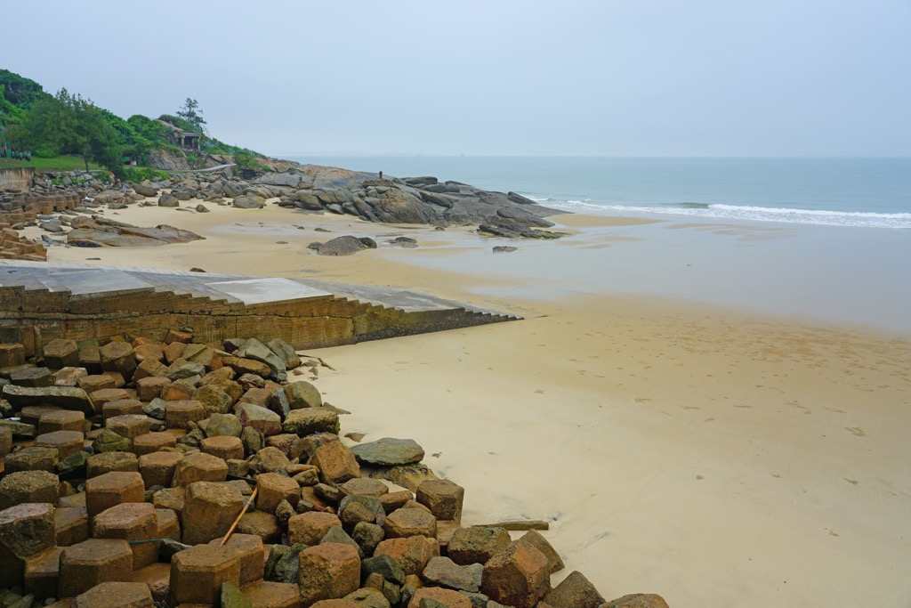
Eroded and weathered rocks feature along Kinmeng National Park’s coastline. The sea’s constant battering has whipped and shaped the rocky cliffs with intense winds.
A dense natural forest once thrived on Kinmen Island. A combination of war, forestation, and intense winds shelled the fertile, prosperous land. In recent years, afforestation efforts account for eucalyptus, acacia, and coastal she-oak.
Some of Kinmen’s 542 vascular plants are not found in Taiwan. Thus, Kinmen’s native and unique plants are the soft bollygum tree and the Chinese sumac.
Migratory birds flock in Kinmen as their base during the winter season. Birdlife is diverse and abundant, ranging from the magpie to the goldfinch and the falcon. A total of 283 birds roam Kinmen’s skies.
Animals in conservation are the otter and the horseshoe crab. Considered a living fossil, the horseshoe crab predates dinosaurs by 300 million years.
Historians can trace human activity in Kinmen County back 5,000 to 8,000 years ago. Mass migration occurred during the Qing dynasty when Koxinga built and expanded his military, and the construction of wooden warships thus depleted the island's forests.
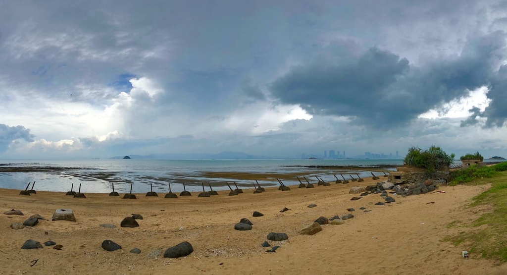
The Battle of Guningtou in 1949 marked Kinmen’s first string of wartimes. In a civil war between communists and nationalists, Kinmen's land was the determiner who would overtake Taiwan. Having seized control of Xiamen, the communist People's Liberation Army (PLA) set sights on gaining ground in Kinmen.
Two hundred thousand communist soldiers descended on Kimen. Within three days, the Kuomintang (KMT) troops obliterated the opposition. The following year, 700 more PLA members flocked to Kinmen to lose to 298 KMT fighters again.
In a desperate attempt to claim the island, the PLA shelled Kinmen County from 1954 to 1955 and again in 1958. For another forty years, the anti-communist KMT troops remained in Kinmen, and the offshore island was their military base should communist China decide to attack again.
In 1992, civilians could return to Kinmen to continue their daily lives uninterrupted. Three years later, in 1995, Kinmeng National Park was established.
Kinmeng National Park offers splendid nature trails and old military tunnels beneath the ground. Visitors enjoy exploring both types of paths on the historical island. The major hiking trails and areas are:
Kinmeng National Park’s highest hill holds interest for its historical importance and scenic landscape. Unveil Kinmen’s military past upon your journey to Taiwushan, as many significant wartime reminders lay exposed on the route.
A short climb of only 2 km (1.2 mi), hikers usually devote half a day to hiking Taiwushan to stop at the many battle monuments and historic sites. Perhaps the most iconic site on the trail is the Wu Wang Zai Ju (毋忘在莒) stone inscription. Inscribed by Chiang Kai-shek (蔣中正), the Taiwanese president, the message’s meaning reminds people not to forget the past’s turmoil.
On Taiwushan’s summit, you have a 360° field of vision of Kinmen County. The green pastures softly unfurl towards the coastline, where the emerald landscape meets the cerulean sea.
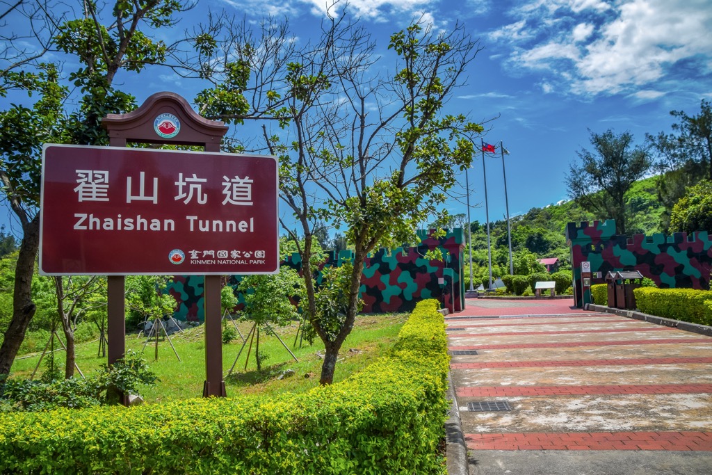
Change your surroundings by heading to the passages built beneath Kinmen's land. Kinmen locals hacked the earth to create tunnels alongside the waterways, allowing 42 boats access to the secret strip.
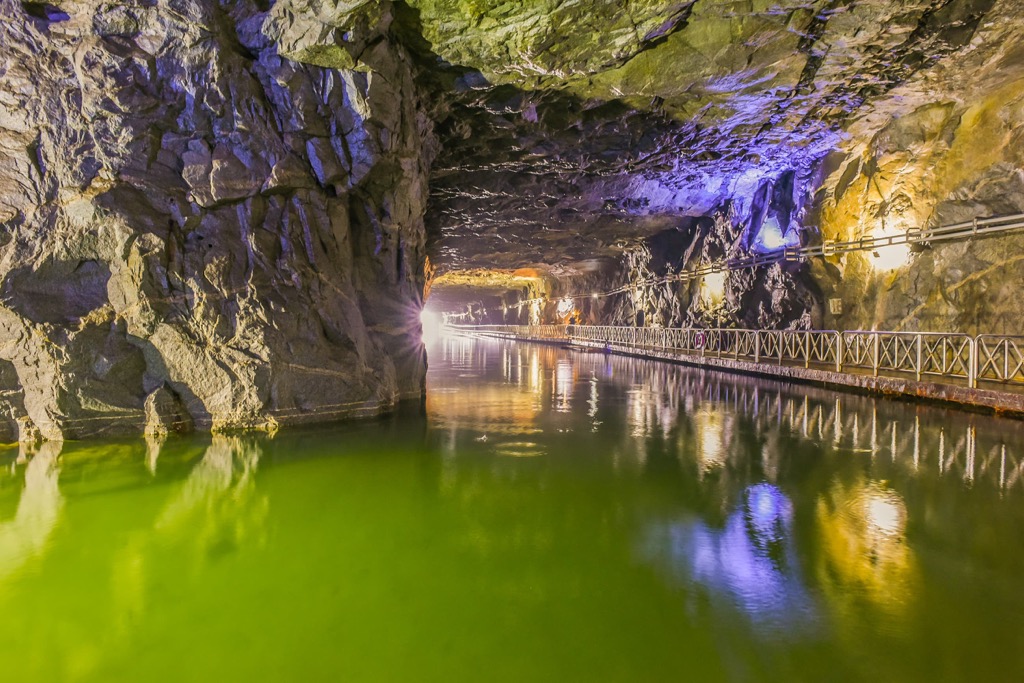
Illuminated by fluorescent lights to add a colourful atmosphere, walk the paved path leading to the bottomless lake. A welcome respite in summer, you will enjoy the cool, damp chillness of the Zhai Shan Tunnel Road (翟山坑道).
It's not hard to feel amazed at the workforce and determination of Kinmen’s military workers. Five years of heavy labor involved digging and hollowing this underground tunnel.
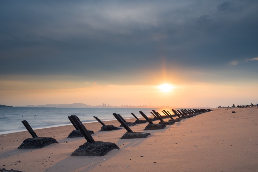
One of Kinmeng’s most prominent scenic spots, Triangle Fortress, lies on Kinmen Island’s northwestern shore. Once a military outpost for KMT troops, the Triangle Fortress retains its army facade, and the camouflaged exterior paintwork and army netting create the military aesthetic. However, this old fort is now a trendy coffee shop.
If a steaming cup of ginger milk tea doesn’t appeal to you, the views from Triangle Fortress will surely warm your heart. The nearby green field of acacia trees attracts the winter migratory birds, where you can observe the birdlife in close range.
Ci Lake’s (慈湖) calming presence lies adjacent to the verdant field. Piercing amber rays of sunrise and sunset reflect off the still surface. Lieyu Island is within view, as you can distinguish the many fortresses scattered along its shore.
At nighttime, the view of Xiamen City is exquisite. The city’s shoreline buildings shine like a rainbow, with hues of blues, purples, golds, and reds.
Venture the myriad of secret underground passageways beneath Qionglin Village. Spanning a total mileage of 1.4 km (1 mi), Kinmen’s largest military subterranean passageway links to 12 exit points.
Built for the prospect of long-term battles, KMT fighters stocked the tunnels with ammunition. Treading through the dark, dank passages ignites the uncertainty of war and a sombre mood.
Once you finish the course, the radiant Taiwan sunlight blinds you momentarily. Pay attention to the striking and stately Fujian architectural structures lined along the street.
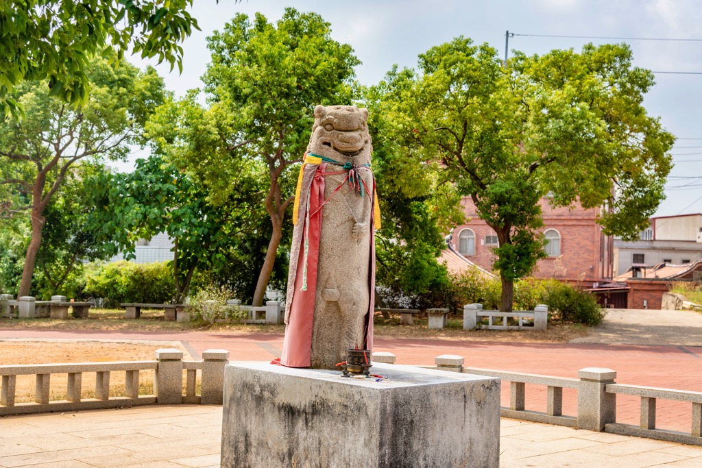
Nearby is the iconic Qionglin Wind Lion God (瓊林風獅爺), a 188 cm (74 in) high stone statue, the tallest of Kinmen’s 68 feline sculptures. Kinmen locals rever and worship the wind lion god who protects them against the brutal island winds.
In the far west of Kinmeng National Park, Shaxi Fort (沙溪堡) straddles the coast of Lieyu Island. Head below ground to explore Shaxi’s tunnels, the longest spanning 140 meters (459 ft). The underground compound once held bunkers and an ammunition depot.
Shaxi Fort’s most striking feature lies in its scenic beauty above ground. Walk the wooden boardwalk towards Shaxi’s viewing pavilion, overlooking the seashore.
Further afield, you can distinguish the islet’s shapes of Dada (大膽島), Erdan (二膽島), and Menghu (猛虎嶼). From the remote oceanside of Shanxi Fort, Xiamen’s busy daytime city life and evening lights are an excellent contrast.
Wedged between Taiwushan and Nantaiwushan is the old historic route that Kinmen locals trod in earlier times. Named after the northeast monsoon's gruelling passage through the saddle, the South Wind Gap Ancient Road (南風隙古道) is a picturesque path of lush growth.
The trail ascends and dips, allowing you to admire Kinmen's glorious views. Taiwushan and Nantaiwushan rise on either side of the track, providing you with constant hillside outlooks. Along the trail, a green landscape of wood vines, rhododendron bushes, and hydrangeas flourish.
From the route's highest point, you can overlook Jinsha Township's (金沙镇) green pastures to the north and Tai Lake's (太湖) crystal waters to the south. The island's rocky coastline is visible from the track. In the background are the nearby verdant hills of Shi Shan and Beique Shan (北鵲山).
Devoid of large, overpopulated cities, many smaller townships comprise Kinmen County. Jincheng Township (金城鎮) and Jinsha Township are two of Kinmen’s well-visited places.
Kinmen County’s capital, Jincheng Township packs a punch of touristic sites for its small size. Located near to the sea, Jincheng Township has endless beaches and a hilly inland area.
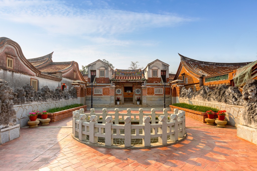
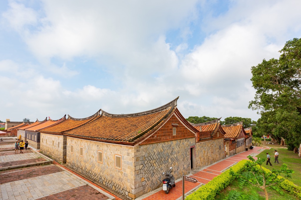
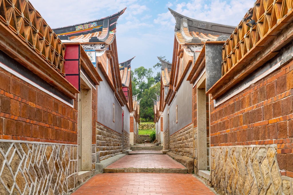
Once a family compound of Fujian's Xue ancestors, Zhushan Village's (薛厝坑) historical presence spans over 650 years. The earthy red-brick and amber-tiled exteriors are eye-catching and attractive. While most of the village is well-preserved, dilapidated walls pair beautifully with interwoven vines and tree branches.
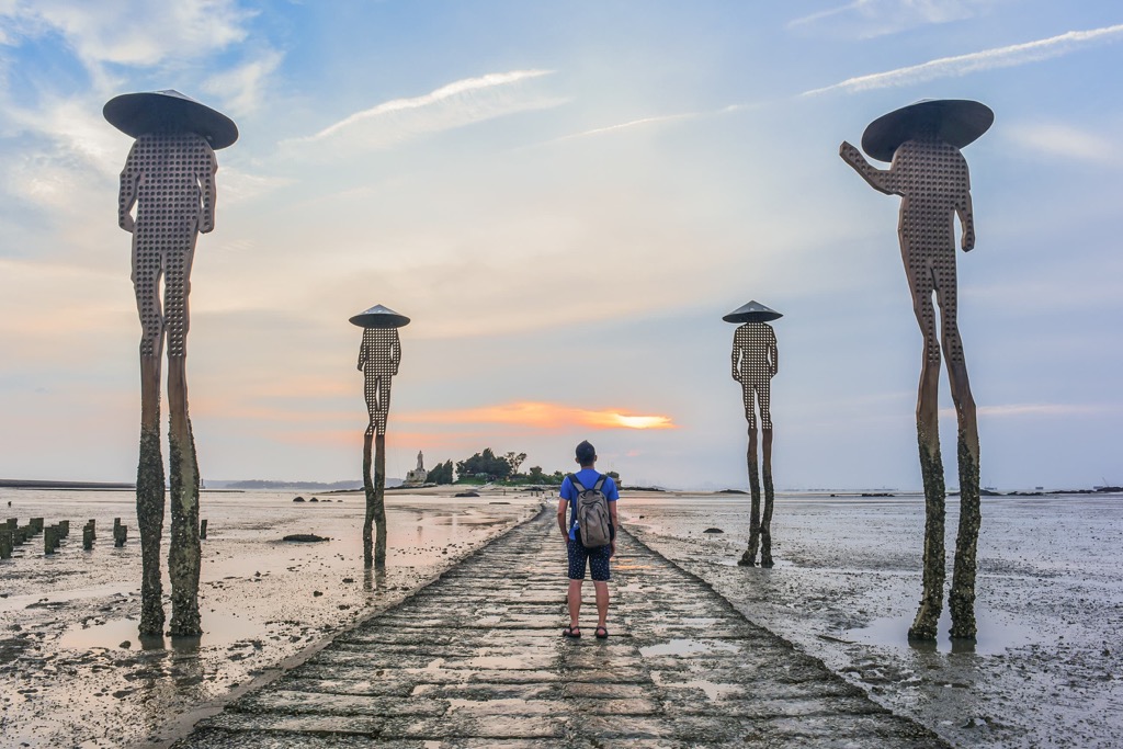
Wait for the ebbing tide to sink your feet in the damp sand towards Jiangong Islet (建功嶼). Known for its astounding biodiversity, spot the crabs, anemones, and other intertidal creatures on the shore. The mighty statue of Koxinga stands facing the sea on Jiangong Islet, and his gaze preempts you to admire the scenery of the cobalt sea.
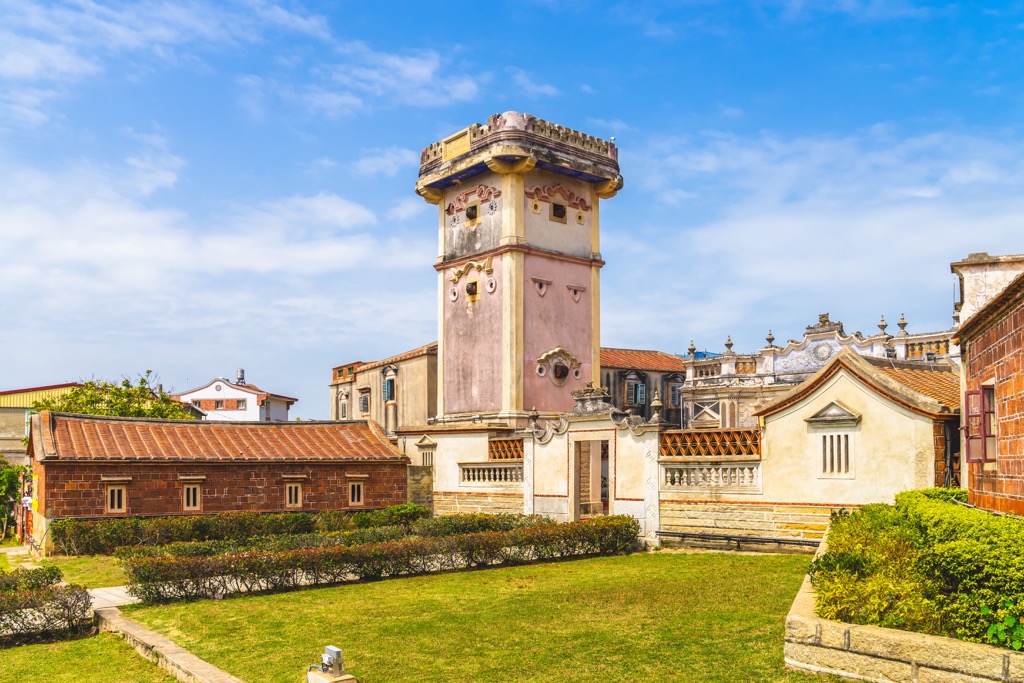
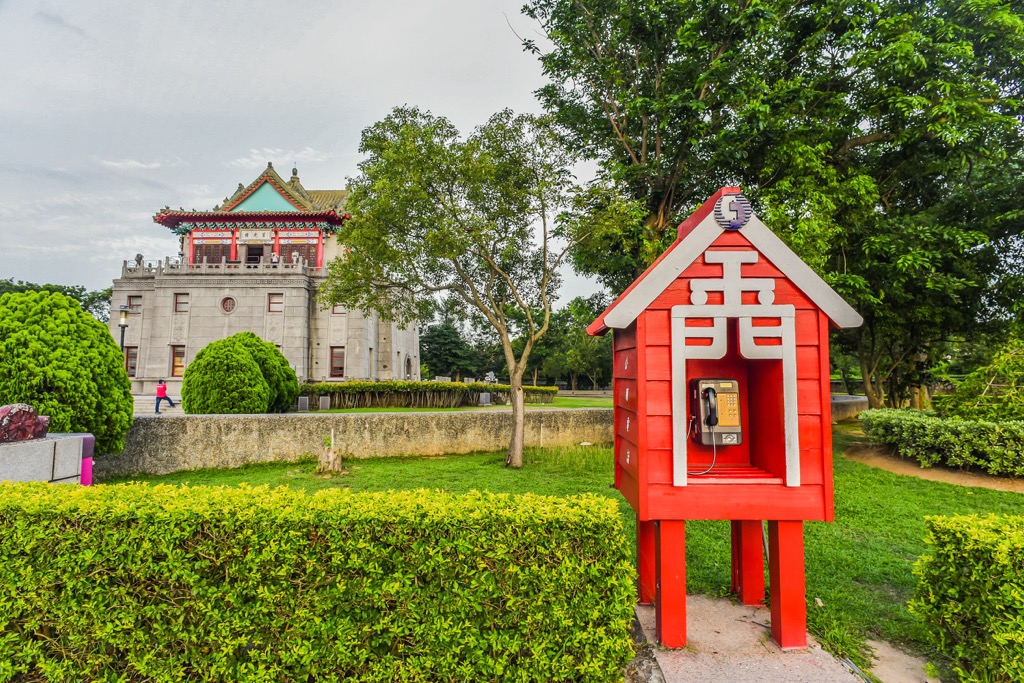
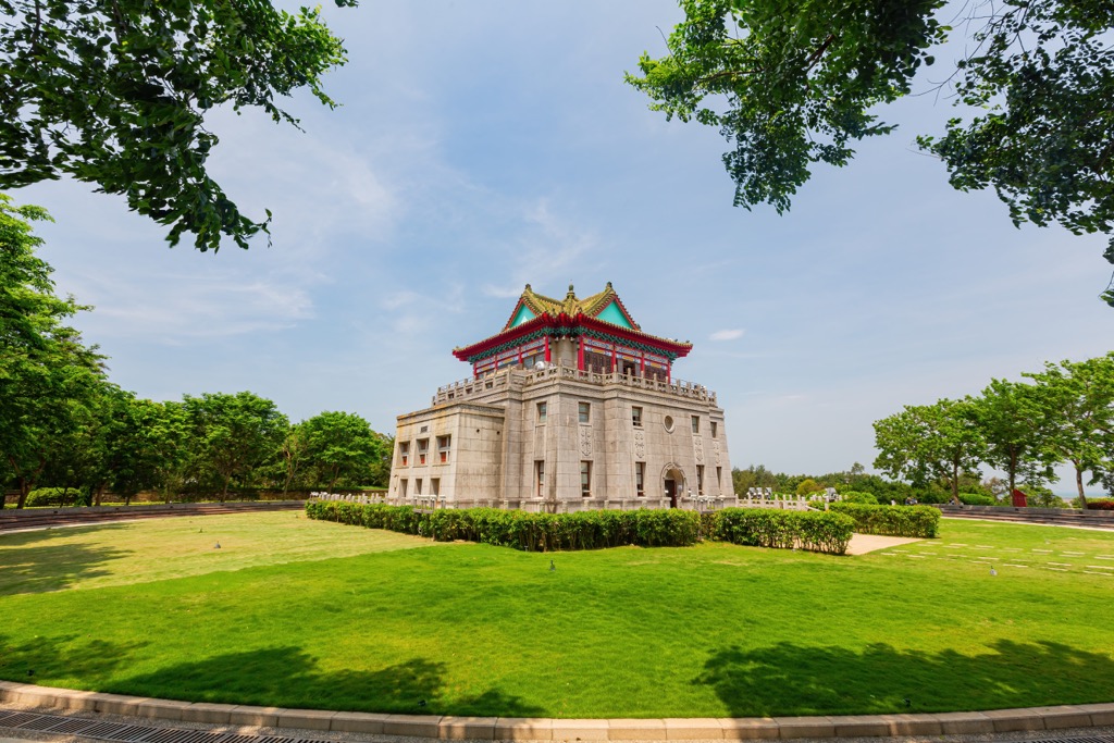
Finally, visit one of Kinmen's famous landmarks, the Juguang Tower (莒光樓). Situated near the Kinmen Harbor, the Rushan (乳山) hills lie on the opposing end. The four-sided pagoda features three storeys of intricate design. The second floor's viewing deck allows you to gaze at the scenery from four different angles.
Kinmen’s northernmost township, Jinsha’s eastern coastline is an undulating hilly zone. Many places of interest lie in Kinmen’s second largest area, from military outposts to ancient raods.
Like Jincheng’s Zhushan Village, Jinsha Township boasts its own historical settlement known as Shanhou Folk Culture Village (山后民俗文化村). Wander through the courtyards, alleyways, and green open spaces of this 19th-century compound. In recent years, Shanhou’s cuisine is becoming a magnet for tourists, with their oyster dishes receiving raving reviews.
Situated on the northeastern coastline of Kinmen Island, KMT soldiers once used the Mashan Observation Post (馬山觀測站) to spy on activity in Fujian Province’s Xiamen City. As China’s land is only 2 km (1.2 mi) away, military guards used high-powered binoculars to observe life in the nearby offshore territory. You can enter the museum where you take the tunnels below ground and explore the bunker’s equipment of telescopes and radio broadcasting.
Finally, head to Sha Mei Old Street (沙美老街) for a charming glimpse of Jinsha’s ancient market life. The slightly rundown exterior creates a nostalgic scene as new life thrives in overgrown rows of pot plants lining the cobbled stone streets. One house, in particular, draws a crowd. Known as Shamei’s Morroco, its sandy tones and angled beams imitate the earthen mudbrick architecture of the Middle East.
When you visit Kinmeng National Park, you will first land at the Kinmen Airport. Flights operate from Taipei, Kaohsiung, Taichung, Tainan, Chiayi and the Penghu Islands. Once in Kinmen County, you can hire a car, scooter, or bicycle to make your way around the small island.
To reach Lieyu Island, take a ferry from Kinmen Harbor in Jincheng Township to cross the channel towards Luocuo Village.


The highest peak in Kinmeng National Park is Taiwushan, at 253 m.
Notable peaks in Kinmeng National Park include Taiwushan, Nán Tài Wǔ Shān, Taiwu Shan, Shí Shān and Jhaizai Hill.


