
Scan the QR code and open PeakVisor on your phone
Yushan Peaks Special Scenic Area has 11 named peaks. The highest is Yushan / Jade Mountain at 3,952 m. Other notable peaks include Yushan East Peak / Jade Mountain East Peak, Yushan North Peak / Jade Mountain North Peak and Yushan South Peak / Jade Mountain South Peak.
Yushan Peaks Special Scenic Area (玉山群峰特別景觀區) forms the focal area of Yushan National Park (玉山國家公園), which is situated in central Taiwan. The tallest and most prominent peak of Yushan Peaks Special Scenic Area is Yushan (玉山), which doubles as Taiwan’s highest mountain at 3,952 metres (12,966 ft). There are 11 named mountains in this scenic area, of which 7 of them are part of Taiwan’s Top 100 Peaks.
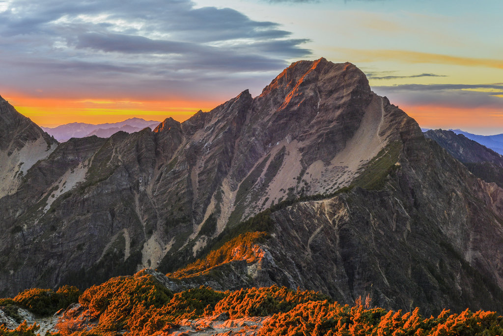
Yushan Peaks Special Scenic Area is situated in Xinyi Township (信義鄉) of central Taiwan’s Nantou County (南投縣). Yushan holds the title as Taiwan’s highest peak as well as the tallest mountain in Northeast Asia.
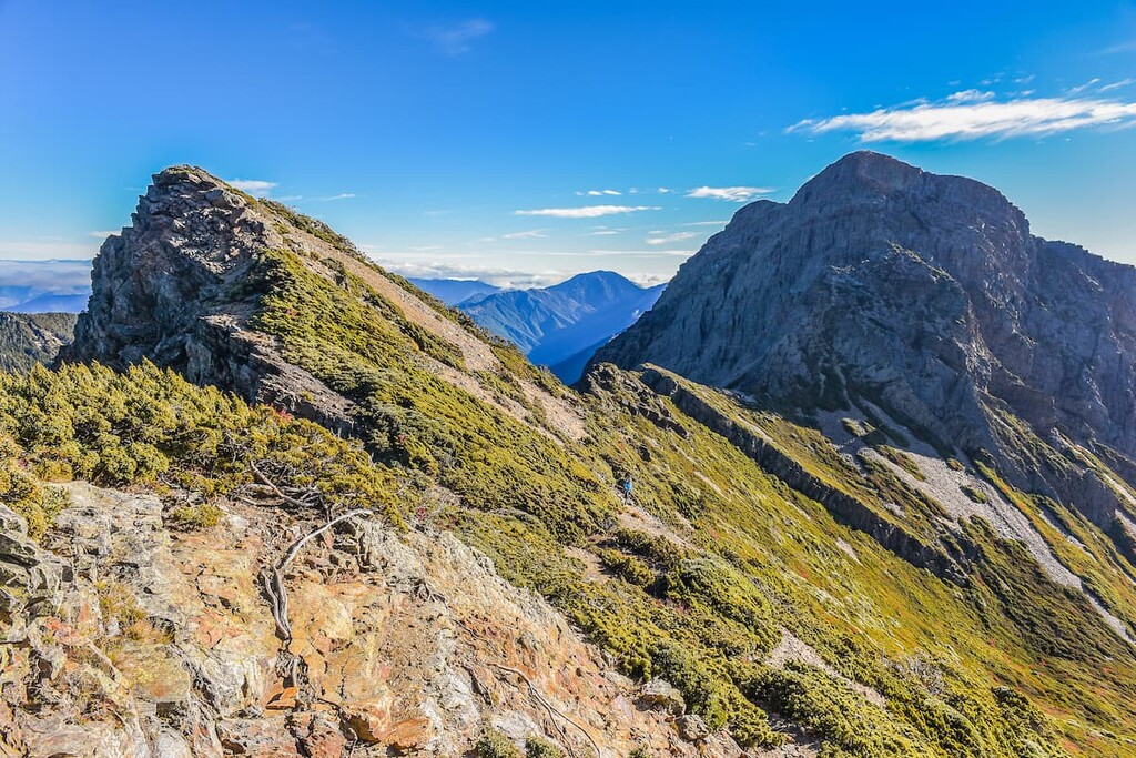
The Yushan massif is tall as it is expansive, comprising five peaks: Yushan Main Peak (玉山主峰), Yushan East Peak (玉山東峰), Yushan North Peak (玉山北峰), Yushan South Peak (玉山南峰), and Yushan West Peak (玉山西峰).
Other prominent mountains in the region are Dongxiaonanshan (東小南山), Nan Yushan (南玉山), Yushan Yuanfeng (玉山圓峰), Lushan (蘆山), and Sancha Feng (三叉峰).
The elevation of Yushan Peaks Special Scenic Area ranges from 300 metres (984 ft) in the river valleys to 3,952 metres (12,966 ft) on the summit of Yushan Main Peak. For this reason, the climate and vegetation differ in accordance with the elevation.
The annual average temperature of this mountainous region above 2,500 metres (8,202 ft) is 11.3°C (52°F); however, the temperature drops sharply to 5.9°C (43°F) in areas above 3,500 metres (11,482 ft). The hilly mountain terrain is cloaked with snow in the winter months, but the crisp fresh air remains cool in the summertime.
The annual rainfall in the Yushan Peaks Special Scenic Area is 3,000 to 4,700 mm (118 to 185 in). Yushan Peaks Special Scenic Area also endures an intense annual humidity level of 80 percent in addition to its chilly temperatures and high annual rainfall. The excessive humidity levels are due to the condensation of the dense damp air that circulates throughout the region’s towering peaks.
The emerald forest fairyland of Alishan National Forest Recreation Area (阿里山國家風景區) is located to the west of Yushan Peaks Special Scenic Area. Aowanda National Forest Recreation Area (奧萬大國家森林遊樂區) is located north of the area, while the mountain retreat of the Shi Keng Hot Springs (十坑溫泉) is situated in the south. To the west of Yushan Peaks Special Scenic Area is Fuyuan National Forest Recreation Area (富源國家森林遊樂區).
From as early as 3 million years ago, the shifting of the Eurasian and Philippine Sea plates created a force so strong that land rose vertically in the form of the steep peaks, creating the Central Mountain Range (中央山脈). Until then, Taiwan was merely an underwater seabed waiting for its moment of formation.
As a result of repeated clashes of tectonic plates, the topography of Taiwan continued to develop and expand, forming Yushan and the rest of the Yushan Range (玉山山脈). The Yushan Range comprises 148 named mountains, of which 11 peaks are listed in Taiwan’s Top 100 Peaks. It is located to the west of the Central Mountain Range and spans three counties: Nantou (南投縣), Kaohsiung (高雄市), and Chiayi (嘉義縣).
Unmetamorphosed rock from the Miocene epoch characterises the rock strata that are found in the western part of Yushan. In contrast, the rocks in the east are mainly composed of metasandstone and slate from the Tertiary period. Black shale dominates the slopes of Yushan South Peak.
Remnants of the region’s underwater past are present on the Great Precipice (大峭壁), a giant boulder displaying fossils of extinct marine species. Ripples are also present on the face of the rock, further demonstrating its oceanic heritage.
Five different environments span across the elevation levels of Yushan Peaks Special Scenic Area, affecting the vegetation growth within those belts.
A subtropical climate is present in the low-lying areas and valleys. This then changes to a temperate, a cool temperate, a cold temperature, and a sub-frigid environment as the elevation increases.
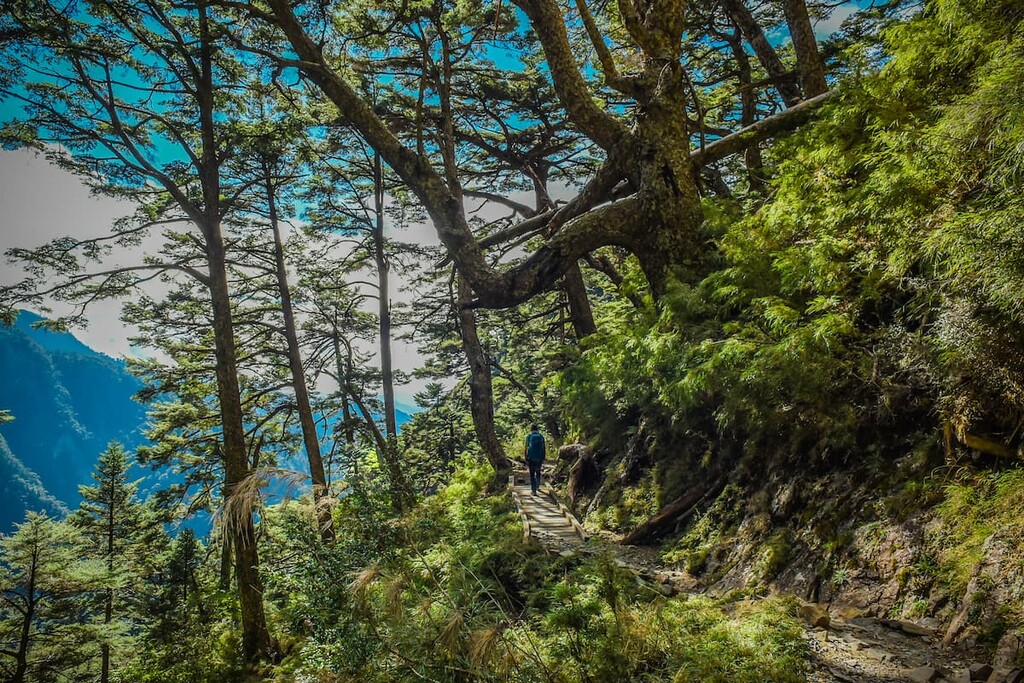
From ground level to 1,500 metres (4,921 ft), the plant life is characterised by a Machilus-Castanopsis zone featuring a mixed broadleaf forest. This low to middle elevation zone sits under the cloud forest belt; thus, subtropical plants are best nurtured in this environment, such as the endemic Taiwan Douglas-fir, Taiwan incense-cedar, and the Phoebe formosana.
As the elevation rises between 1,500 to 2,500 metres (4,921 to 8,202 ft), the climate begins to drop as clouds and fog linger on the damp mountain slopes. A temperate climate affects the vegetation of the oak forest zone featuring primarily Lauraceae and Fagaceae trees, such as Alishan elm, Taiwania, Taiwan cypress, and Taiwan maple.
Moving up higher in elevation, a cold-temperate zone comprising a coniferous forest characterises the vegetation between 2,500 to 3,100 metres (8,202 to 10,170 ft) in the park. Taiwan hemlock, Taiwan red pines, Taiwan spruce, Chinese white pine, and Quercus semecarpifolia dominate the landscape in this region.
A fir forest belt succeeds in elevation from 3,100 to 3,600 metres (10,170 to 11,811 ft). It is mostly situated below the summit of Yushan and its surrounding peaks. The lower regions are dominated by Taiwan hemlock, while Yushan juniper appears in the upper part of the forest belt. Additionally, Taiwan fir is another tree species that thrives in the forest.
Finally, at 3,600 metres (11,811 ft) and above in elevation lies the alpine vegetation zone. Due to the extreme weather conditions in this area, such as wind, snow, frost, and freezing temperatures, the vegetation that flourishes in this high region comprises tundra plants and herbaceous plants. Common plants found in this region are Adenophora uehatae Yamamoto, Taiwan edelweiss, and Gentiana arisanensis Hayata.
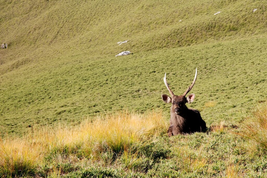
In terms of the wildlife that roams the land of Yushan Peaks Special Scenic Area, a total of 65 species of mammals wander the mountains and forests. These include the Formosan black bear, sambar deer, Taiwan macaque, and Taiwan serow.
Birdlife thrives in the region, too, with 233 species of birds present in the area. This includes 29 endemic species. Common birds include the tawny old, northern goshawk, Steere’s liocichla, rufous-faced warbler, and the black-throated bushtit.
There are 46 species of reptiles in the special scenic area, including 31 species of snakes, 12 species of lizards, and three different species of turtles. In addition, 21 species of amphibians inhabit the area, as do 286 species of butterflies.
The first-ever recorded summit of Yushan was completed in 1900 during the Japanese Occupation Era by two Japanese anthropologists. Yushan was conferred the name Mount Niitaka by the Japanese climbers; thus, Niitaka Arisan National Park was established in 1937. Interestingly, the Japanese navy fleet used the code ‘Climb Mount Niitaka’ when ambushing the US naval base at Pearl Harbor in Hawaiʻi, on 7 December 1941.
After the Japanese relinquished control of Taiwan during the Second World War, the name of Mount Niitaka was changed to Yushan (Jade Mountain) as the heavily bedded snow covered peak reportedly resembled cloudy jade stone.
Old bits of pottery and tools are found in the nearby villages of Dongpu (東埔) and Wanshiang (望鄉) of Xinyi Township in Nantou County, where Yushan Peaks Special Scenic Area is located. These antique artefacts belong to the Bunun tribe, who migrated to central Taiwan from the coastal plains some 300 years earlier. The Bunan people settled on both sides of the steep Central Mountain Range, living in elevations of up to 1,000 metres (3,281 ft).
During the Japanese Occupation Era, the Japanese forcefully removed the Bunun people from their homelands as the Japanese wanted to control the mountain forests of Yushan. The Batongguan Traversing Road in the east of Yushan National Park is evidence of the measure of control that the Japanese craved to rule the Bunun people. As a result of the forced displacement, many people of Bunan ancestry now live throughout the counties of Nantou (南投縣), Kaohsiung (高雄縣), Taitung (臺東縣), and Hualien (花蓮縣).
For many Taiwanese, the expedition to Yushan is a pilgrimage of sorts, the ultimate bucket list trek for people of all ages and abilities. The international significance of this esteemed climb is starting to increase, too.
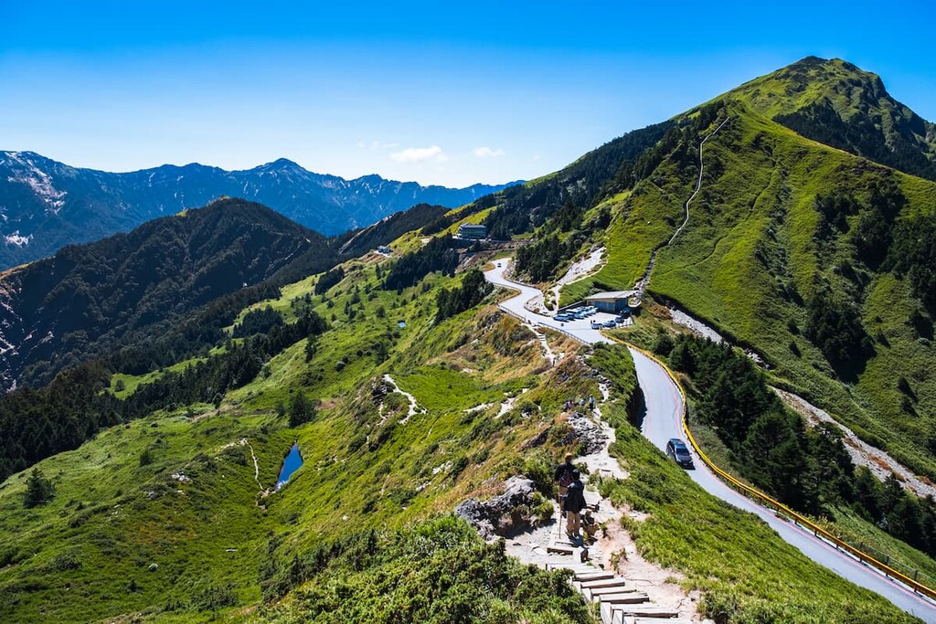
Undoubtedly one of Taiwan's most desired and popular hiking trails, the Yushan Main Peak Trail, commences at Tataka Trailhead. Hikers can decide the length of their trek, summiting the classic peak of Yushan or linking the hike to include its surrounding mountains. The journey from Tataka Saddle to Yushan Main Peak is 10.9 km (6.7 mi) long.
While it is doable to summit Yushan in one day, hikers usually split the trek between two days to fully appreciate the mountain and allow for ample rest when climbing the highest peak in Taiwan.
Once hikers depart the trailhead, they trek for 8.5 km (5.3 mi) to the mountainous Paiyun Lodge, situated at 3,402 metres (11,161 ft). Despite the great distance, the climb to Paiyun Lodge is not too challenging, as, throughout the trail, the elevation gain is 1,000 metres (3,281 ft). However, some hikers report feeling the side effects of elevation change as they reach the 3,000-metre (9,842 ft) mark before Paiyun Lodge.
Hikers will then encounter a mixture of ascents and descents throughout the journey to Paiyun Lodge, but the path is composed chiefly of steady inclines. Hikers can take a breather at any of the resting points at every 500 metres (1,640 ft). At the 5 km mark (3.1 mi), a viewing platform offers pristine views of the surrounding peaks and the changing landscape of forest belts containing Taiwan hemlock, Taiwan fir, Yushan juniper rhododendron, and alpine grass.
Hikers spend the night at Paiyun Lodge (排雲山莊); however, pre-booking your stay is essential at least a month in advance due to limited accommodation space.
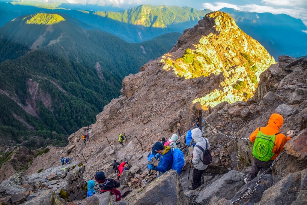
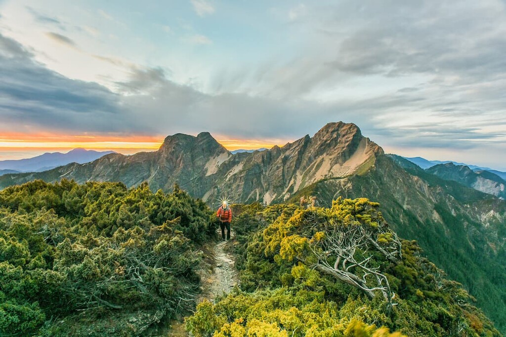
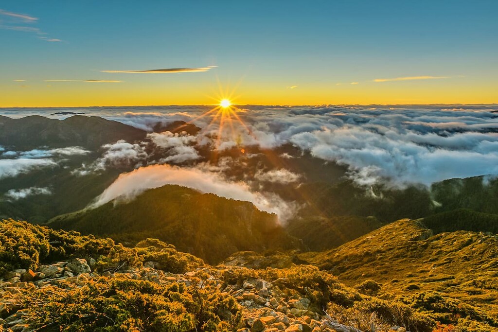
In the morning, hikers awake early to summit Yushan, especially if they wish to witness the early rays of sunrise gradually unveil the dramatic mountainous scenery showcased before them. Although it is only a 2.4 km (1.5 mi) climb to the summit, there is a 500 m (1,640 ft) elevation gain, and this is where the trail gets tricky and where hikers need to show grit and endurance.
Also, as this is an exceptionally sought-after path, you will most likely have to follow a crowd up the mountain, which may not feel too enticing, especially before one's morning coffee. Some narrow paths are so thin that only one hiker can pass at a time, leaving one standing on the freezing, draughty mountain ridge. Hikers can make use of steel cables near the summit to help them climb the steep sections. As it is so windy, steel barriers are erected on the ridgeline for the hiker's safety.
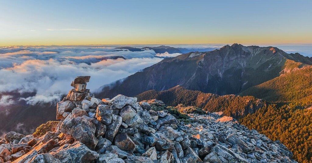
Finally, as hiker’s reach the summit of Yushan, which is cradled in the centre of its surrounding peaks, they can appreciate a 360 degree panoramic landscape of Yushan East Peak, Yushan North Peak, Yushan South Peak, Yushan West Peak, and Yushan Yuanfeng.
If hikers are feeling energised and eager to summit another peak, Yushan East Peak is a further 1.2 km (0.7 mi) trek from the summit of Yushan Main Peak. Yushan East Peak is the second-highest mountain in the area at 3,869 metres (12,694 ft).
Hikers continue onwards from Yushan Main Peak, scrambling over ridgelines to reach the top of Yushan East Peak. Thus, this trail is very challenging as hikers need to climb between the peaks at a high elevation. The vertical cliffs of Yushan East Peak are even steeper than those found while climbing Yushan Main Peak, so hikers need to take care when crawling up the rocky mountain cliffs.
In the background, Yushan Main Peak and Yushan North Peak create a dramatic landscape of craggy rock cliffs and solid grand mountains.
Yushan North Peak houses the highest building and weather station in Taiwan at an elevation of 3,858 metres (12,657 ft). The views of Yushan Main Peak are most prominent from the summit of Yushan North Peak; thus, it is popular for hikers to continue the trek to Yushan North Peak to take in the commanding peak of Yushan.
Yushan North Peak is situated 2.4 km (1.5 mi) from Yushan Main Peak. Summiting the peak involves a descent down rocky cliffs to the Main North Fork path, which leads the journey to the North Peak. During the expedition to Yushan North Peak, hikers will encounter a 300-metre (984 ft) sheer gravel slope, which tests the hiker’s determination and stamina.
As hikers near the summit of Yushan North Peak, they will notice the solar panels propped against the edge of the mountain, ready to absorb the Taiwanese sun. From Yushan North Peak, hikers can note Yushan Main Peak, Yushan East Peak, Yushan West Peak, and Yushan Far North Peak. The giant mountains of Qilaishan (奇萊山), Nanhudashan (南湖大山), Baigu Dashan (白姑大山), and even Xueshan (雪山) can be detected in the distance on a clear and sunny day.
To reach Yushan West Peak, hikers pass the Yushan Xifeng trailhead from Paiyun Lodge. The journey to Yushan West Peak from Paiyun Lodge is 2.2 km (1.4 mi) in length.
The trip to Yushan West Peak also involves a high-elevation climb. Hikers will encounter a particularly narrow passage at the 500 metre (1,640 ft) mark as they clamber over steep rocky cliffs; thus, hikers should heed extreme caution.
Pseudosasa japonica bamboo forests await hikers along the path, and Yushan West Peak is entirely covered with woodlands of Yushan juniper. Through the trees, one can even identify the formidable Yushan Main Peak.
An exciting attraction on Yushan West Peak is the Xifeng Shrine, set against the backdrop of mountains in the woodland. The Japanese constructed it to pay homage to the god Amaterasu. After the Japanese Occupation Era, the management of Yushan National Park rebuilt the shrine to grant it a new identity. Xifeng Shrine is made entirely from wood and retains the simple and graceful Japanese architecture style.
Yushan South Peak lies the furthest from Yushan Main Peak at the end of a 2.4 km (1.5 mi) path. Hikers wishing to summit Yushan South Peak also can summit its nearby neighbour, Dongxiaonanshan, which is located further south. Yushan South Peak is known for its mountain ridge that snakes southwards, resembling the shape of a dragon.
Hikers can also hike Yushan Main Peak from Tataka Saddle during this trip; however, instead of stopping at Paiyun Lodge, they head south via the mountain passage for a 2 km (1.2 mi) trek toward the overnight accommodation at Yuanfeng Cabin that is located on Yushan Yuanfeng.
In the morning, hikers embark towards Yushan South Peak, which is a slightly more accessible trail than Yushan Main Peak and Yushan East Peak as it is devoid of steel cables to hoist oneself up the mountain. However, hikers still need to scale rocky cliffs to reach the summit.
The route is enjoyably challenging yet relatively moderate, and hikers can set out early to witness the spectacular daybreak on the 3,844 metres (12,612 ft) mountain. Yushan Main Peak, Yushan East Peak, and Yushan Yuanfeng are in clear view to the north, as are Dongxiaonanshan, Xiaonanshan, and Nan Yushan in the south.
Hikers then continue south for a further 1 km (0.6 mi) climbing an approachable, gentle wide slope to reach the summit of Dongxiaonanshan. In the distance, hikers note the fields of Pseudosasa japonica bamboos below and the surrounding mountains of Nan Yushan, Xiaonanshan, Yushan South Peak, Lu Shan, and Andong Kushan.
Hikers can either return towards the main trail of Yushan Main Peak or continue to hike towards the southern peaks of Lu Shan, Nan Yushan, and Xiaonanshan along the mountain passage that connects these peaks with Yushan South Peak.
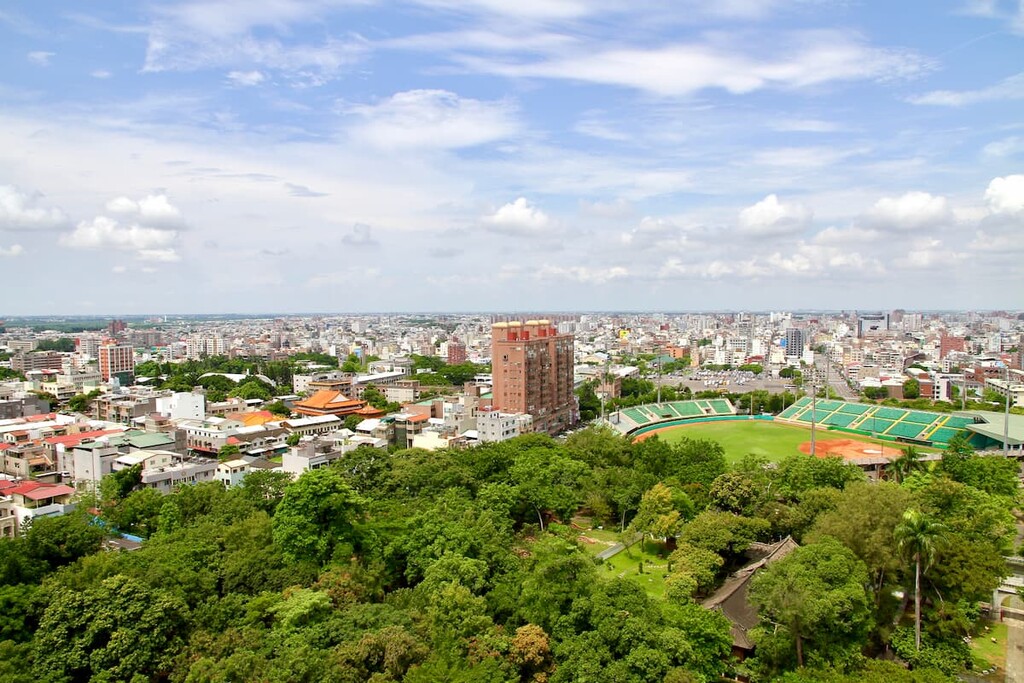
The west coast city of Chiayi (嘉義市) is the most accessible and closest city to Yushan Peaks Special Scenic Area. Visitors could also stay in Nantou City (南投市); however, this is less accessible but presents more opportunities to appreciate the dramatic landscapes of cloud covered mountains and sparkling blue lakes of Taiwan’s top scenic areas. Here’s what you need to know about each city:

There are a number of great attractions waiting for visitors at Chiayi City. For example, the Hinoki Village is a timepiece of the past, with 28 restored Japanese styled wooden houses that served as a residential area for Japanese loggers and management of the lumber industry during the Japanese Occupation Era.
The Hinoki Village was the destination point of felled logs transported on the Alishan Forest Railway from the cypress woodlands of Alishan Forest. This area is now an outdoor museum that features restaurants, a food village, a food market and bookstores to add to the entertainment value.
Wenhua Road Night Market is a 500 metre (1,640 ft) stretch of road that features vendors hustling their specialities along a strip of illuminating Chinese lanterns. Chiayi specialities such as Chiayi turkey rice and fish head casserole is sold in this jostling thoroughfare. Allegedly, the best grapefruit green tea in Taiwan is sold here, too.
The Sun-Shooting Tower is a 62-metre (203 ft) brown aluminium structure that is situated in Chiayi Park. The attractive tower holds a circular shape and displays a 40-metre (131 ft) vacant narrow strip in the middle representing the cracked giant sacred tree in Alishan. Visitors can head to the viewing platform at the top of the tower to enjoy the extensive panoramas of Chiayi City.
Lantan Lake is a manufactured reservoir that dates back to Dutch rule in the 1600s. The Dutch dug into the Bazhang River to create a pool to provide irrigation to nearby farmlands. The still waters mirror the verdant landscape, which hikers can best view from the skywalk. The picturesque lake features hiking trails and a camping group, and the peaceful, quiet atmosphere attracts locals and tourists to unwind in nature.
Visitors can take the Alishan Forest Railway from Chiayi City to the wooded wonderland of Alishan National Forest Recreation Area. The dreamlike forests enveloped in a cloak of misty mountain air, a carpet of moss, and ancient trees so tall they pierce the overhanging clouds is a hypnotising sight. Visitors flock to admire the soft pink bursts of cherry blossoms in the spring months.
One cannot compare Nantou City to the bustling cities of Taipei or Kaohsiung; however, the attraction of this sleepy town is the proximity to beautifully scenic areas.
The calm cerulean waters of Sun Moon Lake (日月潭) and its bevvy of blue mountains feature as one of Taiwan's top tourist destinations. Wooden walkways line the lake's edge for visitors to appreciate the pristine beauty of the expansive still lake with ornate temples marking a striking backdrop against the simplicity of nature.
The Formosan Aboriginal Culture Village (九族文化村) is accessed via cable car to the mountains overlooking Sun Moon Lake. This mountainous village showcases the customs and traditions of Taiwan’s Indigenous communities while also entertaining in the form of three theme parks. Incredibly scenic, superbly educational, and boundless fun, visitors of all ages will enjoy the Formosan Aboriginal Culture Village offerings.
Dongpu Hot Springs is a hugely popular place, too, especially for tired hikers returning from their Yushan expeditions. The small village of Dongpu features twelve hot spring hotels with a variety of open-air spring pools, spas, and saunas. Visitors can thoroughly relax and restore their spent energy while marvelling at the stunning scenery of sizzling hot springs and giant mountains.

Hehuanshan National Forest Recreation Area features Hehuanshan (合歡山), which is considered one of Taiwan's most accessible top 100 mountains. A dusting of snow drapes the mountain forest of Hehuanshan in winter, and in summer, it offers a welcome respite in its fresh mountain air from the relentless Taiwanese heat. The hiking trails provide dramatic alpine scenery for hikers to admire, together with the delicate floral beauties of blooming rhododendrons, lilies, and goldenrod.
From the major cities of Taipei, Taoyuan, Hsinchu, Taichung, Tainan, and Kaohsiung, take the Taiwan High-Speed Rail (HSR) or local express train (TRA) to Chiayi.
Board the 7322 bus heading to Alishan, and once there change to the 6739 bus to Sun Moon Lake. Alight at the Tataka Visitor Centre, located very close to Tataka Saddle, the trailhead to Yushan.
Visitors can also rent a car or scooter from Chiayi City to Yushan Peaks Special Scenic Area. The journey covers 86 km (53 mi).


tw100
ultra
taiwan-high-three
taiwan-ultras
tw100
ultra
taiwan-high-three
taiwan-ultras
The highest peak in Yushan Peaks Special Scenic Area is Yushan / Jade Mountain, at 3,952 m.
Notable peaks in Yushan Peaks Special Scenic Area include Yushan / Jade Mountain, Yushan East Peak / Jade Mountain East Peak, Yushan North Peak / Jade Mountain North Peak, Yushan South Peak / Jade Mountain South Peak and Yushan Far North Peak.


