
Scan the QR code and open PeakVisor on your phone
Yunlin County (雲林縣) is a rural administrative district that’s located in central Taiwan. The county is home to farms that provide the island with some of its finest crops. Farmland accounts for approximately 68 percent of Yunlin County, most of which is quite flat. However, there are 52 named mountains in the county, the highest of which is Jiananyunfeng (嘉南雲峰) at 1,803 meters (5,915 ft) in elevation. The most prominent point in the county is Dajianshan (大尖山), which has 404 m (1,325 ft) of prominence.
Yunlin County is an administrative region of Taiwan. It is arguably one of the island’s most rural regions as it is home to relatively few urban areas.
Rather, Yunlin County is primarily home to rich agricultural land that produces the ingredients for some of Taiwan’s staple food products, such as soy sauce, sesame oil, coffee, and pickled cabbage.
Yunlin’s countless farms also provide the island with meat, eggs, and dairy products. Many fishing ports are located along Yunlin’s coastline, too, bringing fresh batches of seafood to the island daily.
Yunlin’s northern neighbor, Changhua County (彰化縣), is another of Taiwan’s large farming communities. While Changhua County borders Yunlin to the north, Chiayi County (嘉義縣) sits just to the south of Yunlin. Nantou County (南投縣) is located just to the east of Yunlin, too while the Taiwan Strait is situated to the west.
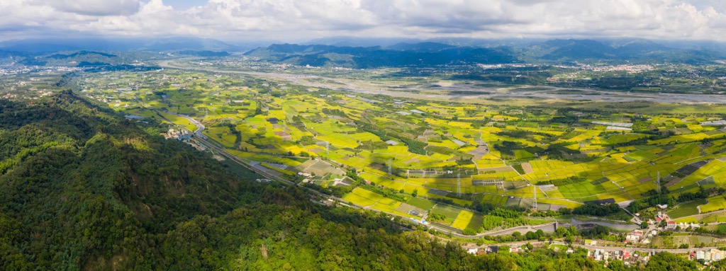
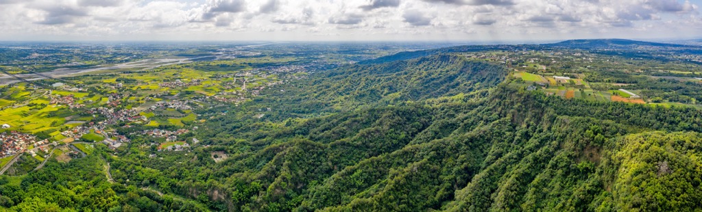
The successful agricultural industry in Yunlin is a product of the county’s location. The county is situated on the northern edge of the Chianan Plain, so nearly 90 percent of it is flat while only 10 percent of it is hilly. There are some mountains in Yunlin County, of course, most of which are part of the Alishan Range (阿里山山脈). Some of the main high points in the county include Fanzitianshan (番子田山), Erjianshan (二尖山), and Shibishan (石壁山).
Furthermore, the region’s sunny climate and otherwise pleasant weather help to support a flourishing agricultural industry in the county.
In Yunlin, the average annual temperature is normally around 79°F (26°C) while the average annual rainfall total is about 1,029 mm (41 in). That being said, summertime in the county can reach temperatures of around 91°F (33°C), while winters are more mild with average temperatures of approximately 70°F (21°C).
Although the county itself isn’t particularly mountainous, Yunlin is home to some peaks. Most of these peaks are part of the Alishan Range, which is the second-smallest range with around 568 named peaks.
The Alishan Range starts in Nantou County and traverses both Yunlin and Chiayi counties before ending in Tainan. Most of the rocks in the range are sandstones and shales that date from between the Miocene and Pleistocene epochs.
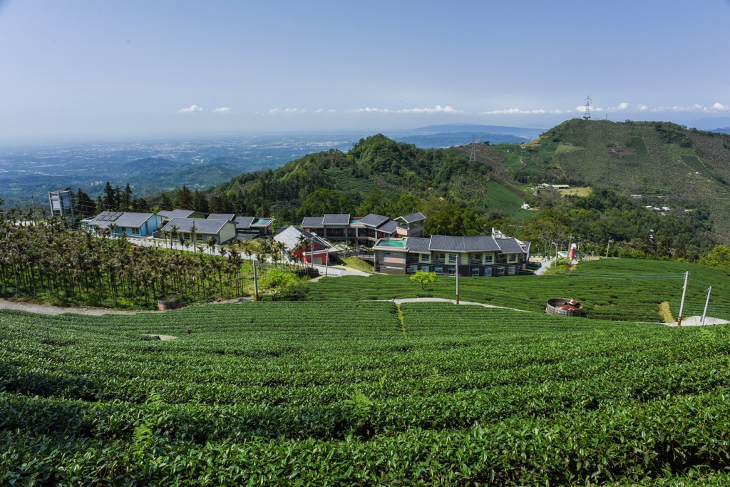
Since most of Yunlin County is used for agriculture, there are relatively few areas of native ecosystems within the region. Much of the region is home to farmlands that grow fruit trees, coffee shrubs, and tea bushes.
Of course, you can find native flora in the county. This includes stands of acacia, sweetgum, and eucalyptus, all of which thrive in the region’s lowlands.
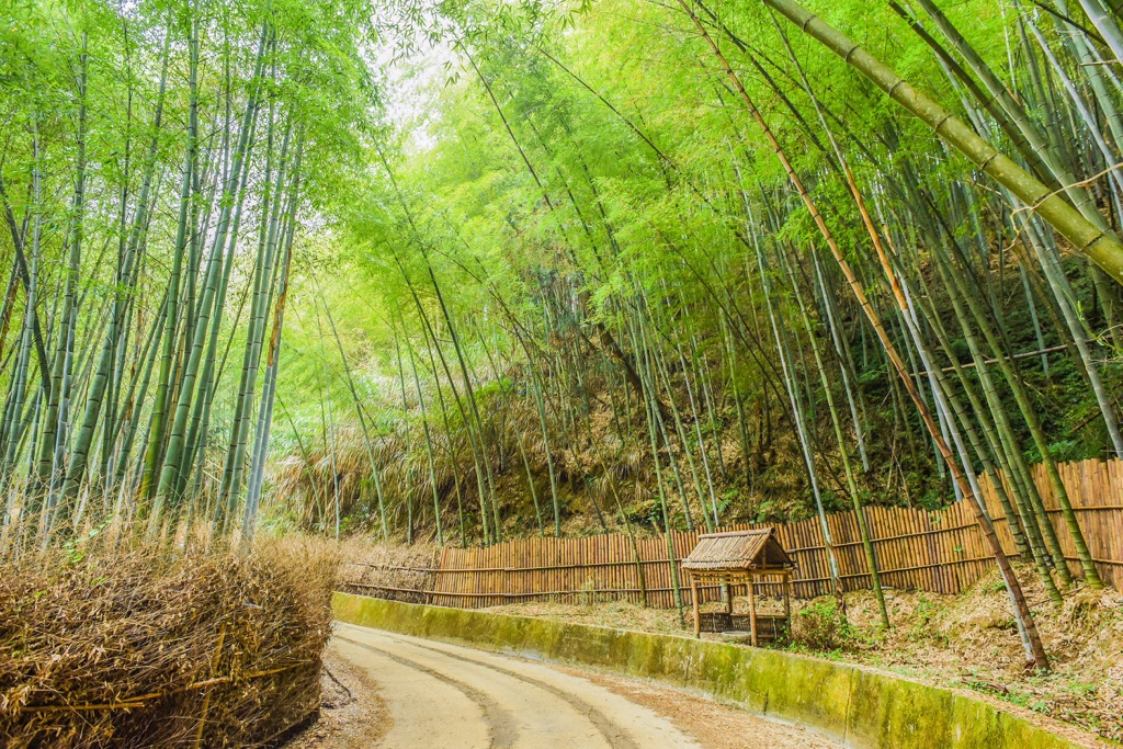
The higher elevation regions of Yunlin County have their own unique ecosystems. These areas are primarily home to a mix of broadleaf and coniferous trees, though you can also find dense thickets of the temperate mōsō bamboo (Phyllostachys edulis) in the county.
The land that is now part of Yunlin County has been home to humans for countless generations. A number of Indigenous tribes have ancestral ties to this area, however one of the first periods of mass immigration to the region occurred during the Qing dynasty.
During this time, large numbers of Zhangzhou, Quanzhou, and Hakka settlers migrated from the mainland to what is now Yunlin County. Many of these settlers opted to live in culturally insular communities, many of which still exist to this day.
As each of these communities has its own cultural and religious practices, each made its own unique mark on the landscape. One way in which this is particularly evident is in the construction of temples to honor deities. Each of the three main ethnic groups in Yunlin had their own belief systems so they each built their own temples. As a result, Yunlin boasts more temples for its size and population than nearly anywhere else on the island.
Yunlin may not be the mountain hub of Taiwan, but it does have a lot to offer for the adventurous hiker. Here are some of the best hiking areas in Yunlin County to check out during your next visit to the region.
The Jiananyunfeng and Shibi Mountain Hiking Trail is a wooded path that leads through a gorgeous bamboo forest where long jade shoots tower towards the sky.
As you climb, striking cinnamon trees greet you with their contorted branches and snaking roots. The trail becomes steeper and more challenging with a network of bulky tree roots. A giant Juixiong tree, aged 300 years, hovers over the leafy forest and exerting its granduer.
Jiananyunfeng's summit is mainly sheltered, but the view of Data Shan's (大塔山) pinnacle between the lush leafiness is majestic in the clearings.
Onwards you trek towards Shibi Shan. Take advantage of the viewing platforms along the ridgeline. You can gaze towards the magical Alishan Forest (阿里山國家森林遊樂區) and admire the Qingshui River's winding passage.
Dense foliage shades Shibi Shan's course, but make your way towards the meandering ridgeline for amazing views. The wavy hilly scenery of Juedashan (掘沓山), Waihushan (外湖山), and Chuheshandongfeng (出合山東峰) is beautifully scenic. As you near Shibi Shan's summit, a dense bamboo thicket appears, covering the peak's apex.
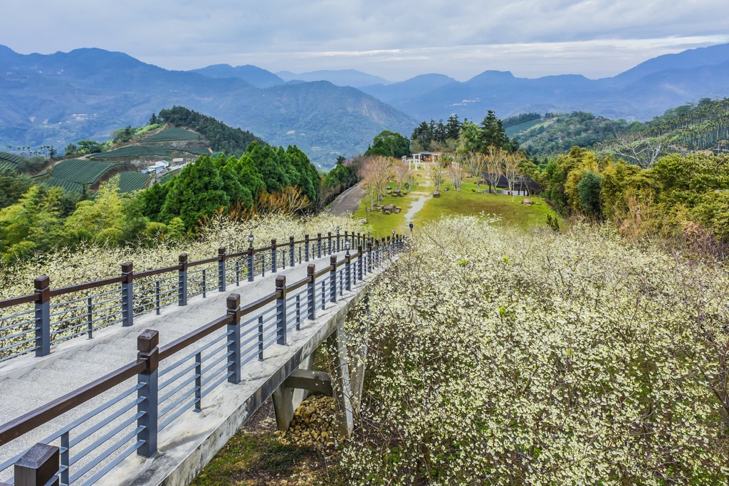
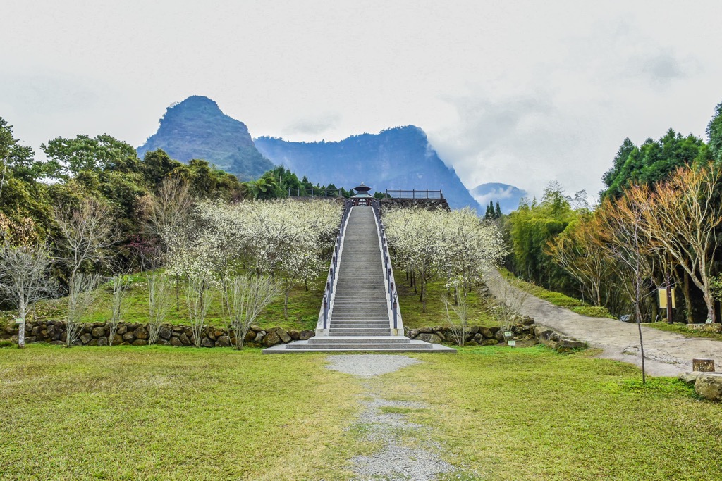
A short but much-loved path due to its relative ease, the Caoling Qingxi Trail (草嶺清溪步道) lingers above the Qingshui River’s course. Walking the steel path connected to Caoling’s (草嶺) hillside feels effortless on the 1.5 km (0.9 mi) flat trail.
From 500 meters (1,640 ft), you have a generous outlook onto the vast green meadows that rise to meet the Alishan hills. Keep alert as many birds cross your path, and you can observe their enduring and peculiar antics from the elevated trail.
Your view is constantly changing as you wind along the mountain’s curvature. Rolling hills soon flatten, transforming into fertile farmlands and verdant valleys.
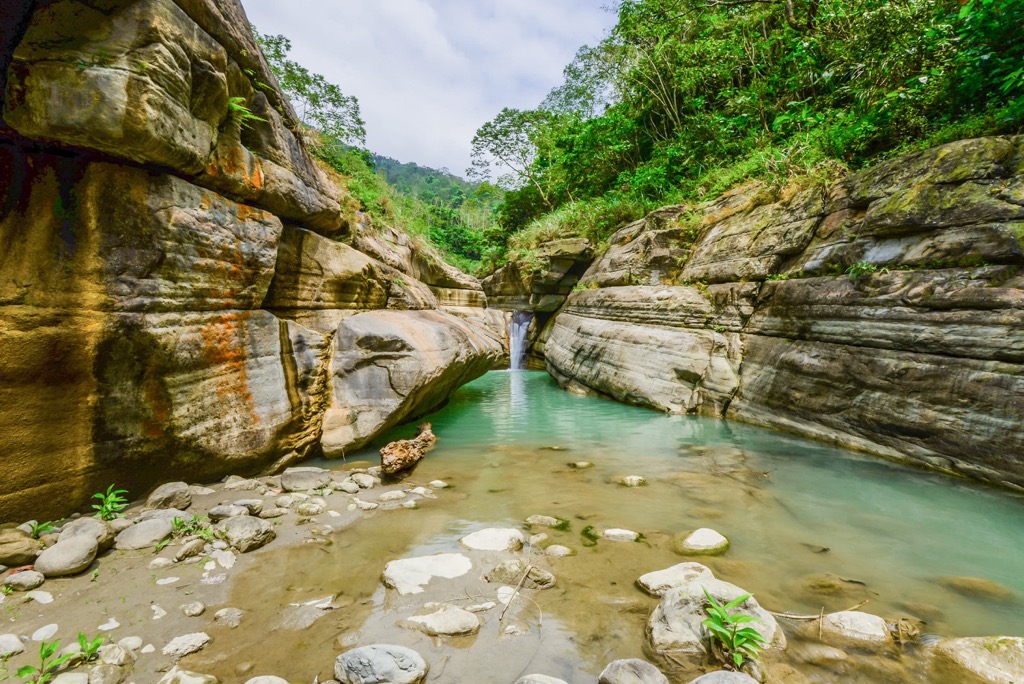
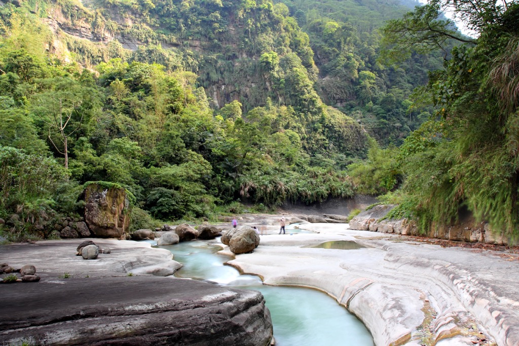
Trace the Penglai River’s (蓬萊溪) bubbling sound as it flows downhill. Feel the cool, damp air caress your face while strolling the shaded, leafy path next to the stream. Known as the Fairy Valley, the mystical emerald woods bestow an enchanting world.
The more you descend the slope, the more dramatic scenery of larger rock walls ensues. The desire to dive into the clear sapphire water is tempting, but the temperature is icy and chilling. Pay close attention to spot any frogs hopping along the track.
Cross the roped suspension bridge to the trail’s end, the Lianxin Falls (連心瀑布). A small and gentle cascade spills over a stone bed into an aquamarine pool. The surroundings are lush with a delightful spring bouquet of peach blossoms, wild ginger flowers, and rhododendrons.
Affectionately known as ‘Coffee Mountain’, a plantation of coffee trees thrives in Hebaoshan’s woodlands. A trip to Hebaoshan (荷苞山) is incomplete without tasting a satisfyingly percolated warm brew.
Hebaoshan’s coffee shrubs are an afforestation effort. Shipped from Africa, farmers planted Arabica beans in the fertile soil. To aid in the growth, farmers also sowed tung trees, as coffee thrives in indirect light. In springtime, tung blossoms erupt in creamy blooms, a stirring sight.
A variety of flowering trees grow along the course. Inhale the floral aromas of magnolias, hibiscus, and peach blossoms’ pastel petals. From the summit, you can observe Douliu City’s (斗六市) life happening below.
Straddling the border of Yunlin and Chiayi counties is the colossal Dajianshan. After fueling yourself with a fresh pot of Yunlin’s finest coffee, watch the sunrise streak over the horizon on Dajianshan’s pinnacle.
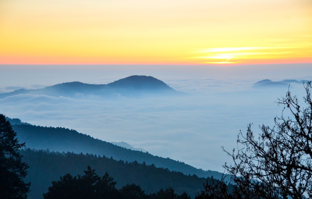
Famed for its glowing twilight spectacle, a journey to Dajianshan is best suited either in the early morning or evening. These times also coincide with the misty mountain fog cascading across the sky. When you’re at a high elevation, the swirling clouds create an ethereal vision as they suspend below the peak’s summit.
Situated near Alishan Forest, Dajianshan’s summit faces the flourishing Alishan hills. Taiwan’s tallest hill, Yushan (玉山), is also visible in Nantou County. The opposite view overlooks the expansive farming meadows of Yunlin County.
Advance through the torii gates to commence your trek on the Longgoumai Forest Trail (龍過脈森林步道). The undulating mountain ridge between Linnei Shan (林內山) and Chukoushan (觸口山) imitates a bumpy dragon’s back, after which the trail is named.
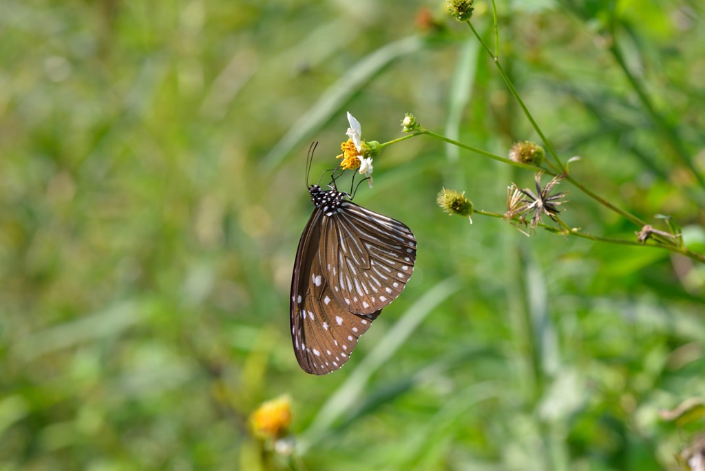
Spottings of Formosan rock macaques remind you of the remote location in Yunlin’s wilderness. Keep your bananas to yourself, which causes the monkeys to expect food from visitors. Sightings of the purple-spotted butterfly add a beautiful element to the luxuriant forest.
As the course continuously dips and raises, your surroundings change too. A damp, emerald world of broadleaf arboreals thrives in the lower elevations. While out in the clearings above, you have an entire field of vision onto the outlooks. Changhua’s Baguashan (八卦山) hills trail northwards to the north, while Yunlin’s southern peaks dot the landscape.
Yunlin County is unique for Taiwan because it is currently the only county not to have a namesake city. For example, while you can find Nantou City in Nantou County, there is no such thing as Yunlin City.
Thankfully, there are plenty of great urban areas and towns in Yunlin County to check out, even if they have their own unique names. If you’re looking for an urban area to visit in the county, consider Douliu City. Meanwhile, Gukeng Township is a nice option for a more rural adventure.
Here’s what you need to know about the main cities and towns in Yunlin County before your next visit to the region.
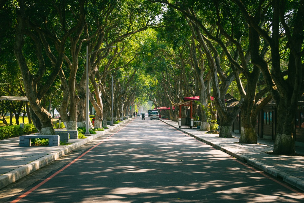
Yunlin’s capital city is very different from what you’d find in most of Taiwan’s capital cities. Unlike the hustle and bustle of Taipei, Douliu City boasts a satisfying peaceful ambiance where people go about their lives without unnecessary urgency.
One of Douliu City's most notable features is its well-preserved historical buildings. For example, Taiping Old Street (太平老街), which is located a stone's throw from the train station, showcases a strip of Baroque-style homes that were built in the early 1900s. During the spring, the narrow street turns into a lovely place to go for a stroll as it boasts rows upon rows of colorful lanterns for visitors to enjoy.
Another area of historical interest in the city is the Japanese houses on Yunlin Road (雲林路). Initially constructed as living quarters for Japanese police officers, these dormitories feature the simple and elegant Japanese wooden architectural style. Now that these dormitories have been transformed into coffee shops and cute cafes, they are the perfect place to enjoy a sugary treat while admiring the Japanese trade work and construction of the 1930s.
Finally, what better way to experience Douliu City than taste your way through a night market? As Yunlin is the hand that feeds Taiwan, Douliu Zhuangjing Night Market (斗六莊敬夜市) offers a diverse range of food, from Vietnamese beef pho to a selection of bread and Yamamoto steaks. The sweet potato balls, papaya milk, and xiaolongbao are also regular crowd-pleasers at the market.
Known for its annual coffee festival, Gukeng Township is a rural community that packs a punch when it comes to things to see and do. Plus this incredible town is situated just a short train ride away from Douliu City, so it’s a great place to visit on a day trip.
One of Taiwan’s much-loved theme parks, Janfusun Fancy World (劍湖山世界主題樂園), is actually located in Gukeng Township. As a result, while you’re in Gukeng, you can take to the rollercoasters and admire the verdant, mountainous landscape in the process. The park’s 88-meter (288-ft) Ferris wheel also gives you a chance to admire beautiful views of Yunlin's hills. Or, if you bring your swimwear, you can always enjoy the town’s water park to cool off on a hot summer’s day.
After a day full of excitement, thrills, and sun at Janfusun Fancy World, you can also escape to the Green Tunnel Park (古坑綠色隧道公園). This incredible park is lined by rows of mango trees, and it offers a casual 2 km (1.2 mi) hiking path for visitors to enjoy. Here, you can enjoy the sounds of nature and the occasional choo-choo of the Taiwan Sugar Train as it passes by.
Last but not least, while in Gukeng, you can always head to the Honey Museum (蜜蜂故事館), where you can learn more about how honey is made, make your own, and, of course, sample some of the sweet stuff. At the museum, you can get a wide range of honey products, too, such as its delicious honey ice cream!
To get to Yunlin County, you can take the Taiwan High-Speed Rail (THSR) or local express train (TRA) from any of Taiwan’s major cities. If you’re flying to Taiwan, you can take the THSR from the Taiwan Taoyuan International Airport (TPE) directly to Yunlin.
Or, if you’d prefer not to rely on buses and public transportation for all of your travels. You can take the train from the airport all the way to Douliu City. From there, it’s possible to rent a car or scooter and then travel around the county.


