

Share

Scan the QR code and open PeakVisor on your phone
Scan the QR code and open PeakVisor on your phone
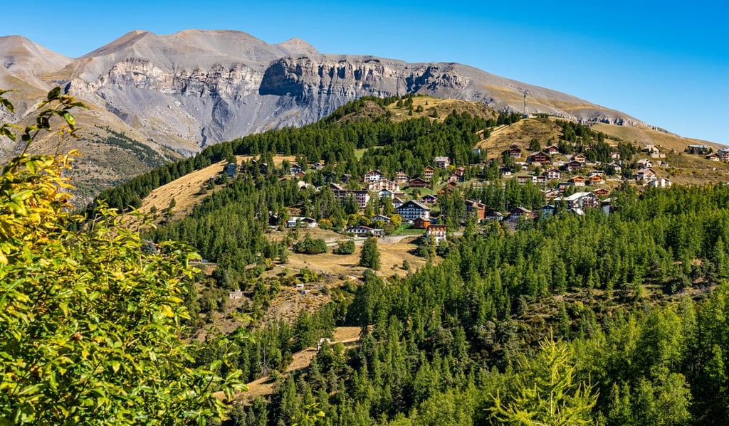
From the sun-drenched Côte d'Azur to the sublime Mont Blanc massif, France boasts many legendary European hiking destinations. There are 36077 named mountains in France. The highest and most prominent mountain is Mont Blanc (4,810 m/15,781 ft).
The French Republic (République Française), commonly known as France, is a country in Western Europe.
France covers a total area of approximately 643,801 sq km (248,573 sq mi), making it the 42nd largest country in the world and the third largest in Europe. It has a population of roughly 68,042,591 people.
Metropolitan France is one of the westernmost countries in continental Europe. It shares borders with 8 countries: Spain, Andorra, and Monaco in the south, Belgium to the north, and Germany, Luxembourg, Switzerland, and Italy to the east.
The North Atlantic Ocean and the Mediterranean Sea encircle France to the north and south, respectively. The English Channel separates France from England by as little as 33 km (20 mi) across the Strait of Dover. France has approximately 3,427 km (2,129 mi) of coastline.
Outside metropolitan France are 13 overseas territories with varying degrees of autonomy. Five of these territories have the same status as mainland France:
French Guiana is France's largest overseas territory and second-largest region. It covers an area of 83,534 km2 (32,253 sq mi) with a population of over 301,000 people.
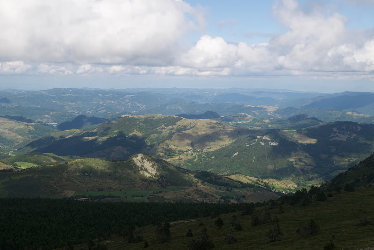
Mainland France's geography is diverse. It's generally defined by rolling hills and flat plains to the north, and mountainous areas to the south, which include the Pyrénées and the Massif Central (Massís Central).
The east is France's most mountainous area, home to the Jura Mountains (Massif du Jura) and the Alps. Other notable mountain ranges in France include the Vosges on the French-German border and the Morvans in the Bourgogne-Franche-Comté region.
The Massif Central is located in southeast France, stretching across approximately 15 percent of the country. The largest mountain range in France, the Massif Central's landscape is defined by lush mountain slopes and plateaus. The highest peak in the Massif Central is Puy de Sancy (1,885 m/6,188 ft).
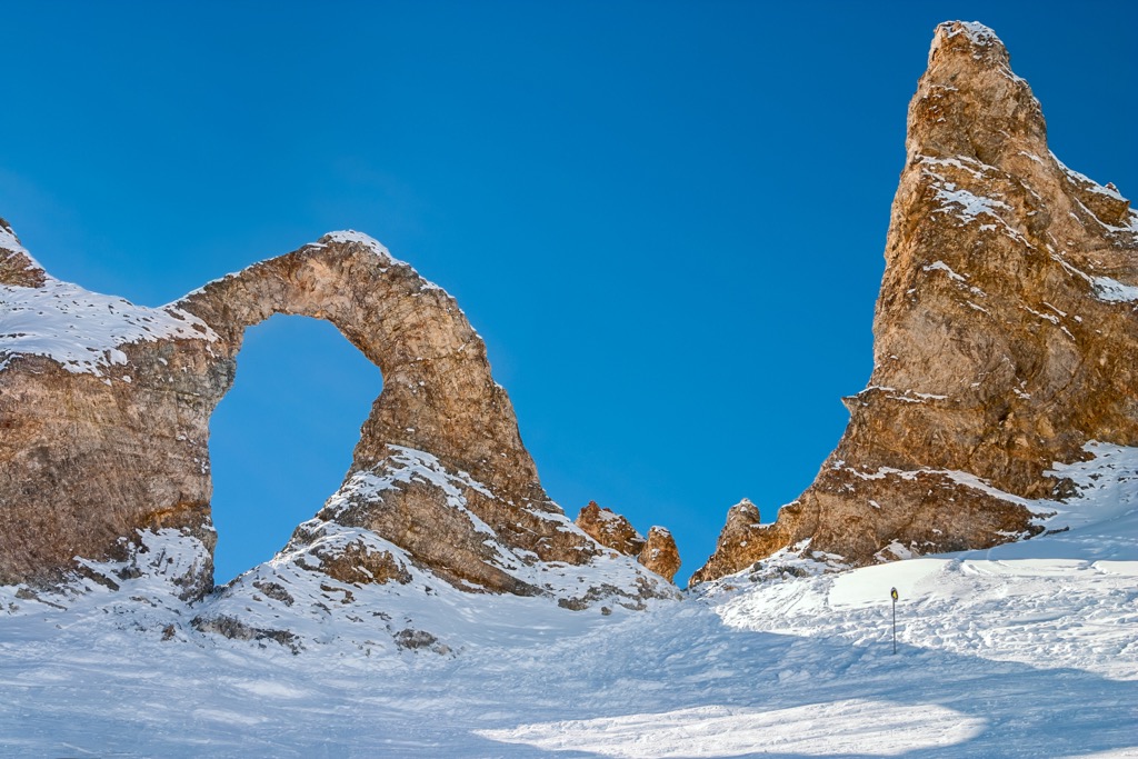
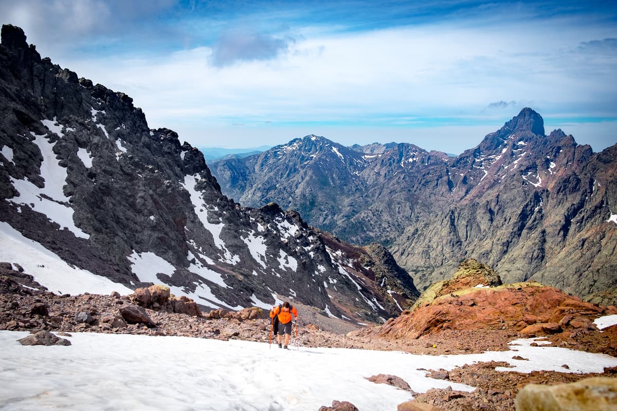
The Pyrénées sit on the French-Spanish border, extending over 500 km (310 mi) from the Cantabrian Mountains to Cap de Creus. The Pyrénées is a high and jagged mountain range notable for its cirque valleys, expansive waterfalls, and lack of mountain lakes. The highest summit in the French Pyrénées is Vignemale (3,298 m/10,820 ft).
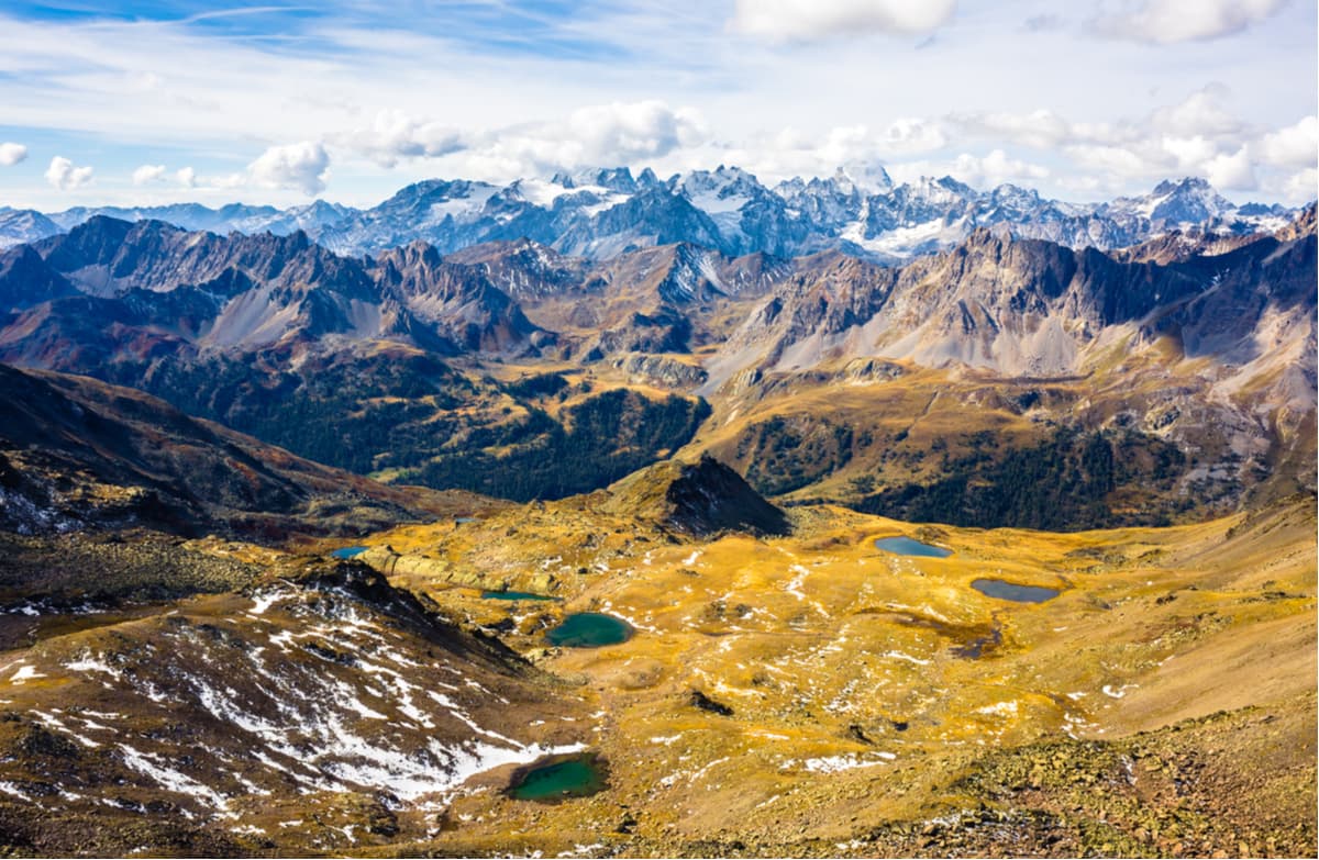
The Alps are the highest and largest mountain range entirely within Europe, stretching for 1,200 km (750 mi) across 7 countries. The French Alps are famed for the crystalline peaks of the Mercantour massif and for containing France's highest mountain, Mont Blanc (4,810 m/15,781 ft). In addition, Mont Blanc is the highest mountain in Europe (outside of Russia) and is ranked 11th in the world for topographic prominence.
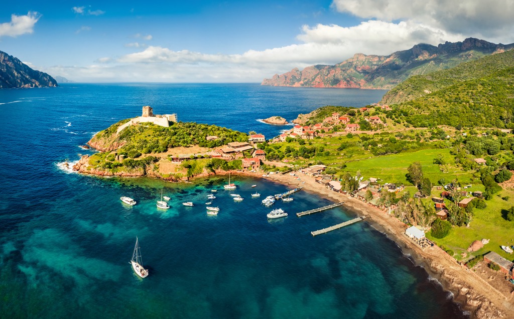
Over 150 islands are dotted along the French coastline. The largest island of metropolitan France is Corsica, which encompasses an area of 8,722 sq km (3,368 sq mi).
Several major rivers meander through France, the longest of which is the Loire, at 1,006 km (625 mi) in length. Europe's second-longest river, the Rhine, forms the border between France and Germany. Other significant rivers in France include the Seine and the Rhône.
There are 347 lakes spread across France, the largest and deepest of which is Lake Bourget (Lac du Bourget), with a surface area of 44.5 sq km (17.2 sq mi).
France's largest and capital city is Paris. Other notable cities include Marseille, Lyon, Nice, and Toulouse.
Due to its size and its position at the edge of western Europe, France's geology is complex. France's geology is generally split into 13 different regions, including the Massif Central, the Paris Basin, the Aquitaine Basin, the Alps, and the Pyrénées.
Perhaps the most important geological event in France's history is the Alpine orogeny, a mountain-building event that shaped most of western France.
The Alpine orogeny occurred during the Late Mesozoic and the current Cenozoic eras around 66 million years ago. Convergent movements between the African, Eurasian, and Cimmerian Plates created many of the mountains across continental Europe, including the Alps.
The Alpine orogeny is ongoing in some parts of the Alps. Large parts of the Western Alps are composed of Helvetic and Penninic nappes, which are predominantly limestone, schist, gneiss, and granite.
The Massif Central, France's largest mountain range, is older than the Alps, forming mainly during the Caledonian and Variscan orogenies.
The oldest parts of the Massif Central date back to the Neoproterozoic Era over 500 million years ago. Along with the Massif Central, the Variscan uplift shaped many of the mountain ranges of France, such as the Vosges, the Ardennes, and the Morvan.
The Pyrénées are much older than the Alps, dating back to the Paleozoic and Mesozoic eras 100 to 150 million years ago. The range's current structure results from a collision between the microcontinent Iberia and the European Plate, which is now southern France. The composition of the Pyrénées is varied, with granite and gneissose rocks in the east and granites and limestones in the west.
France's largest geological feature is the Paris Basin, which occupies large parts of northern and central France. It's a sedimentary basin formed over the remains of uplands from the Variscan orogeny. The basin is composed primarily of expansive valleys and minor hills.
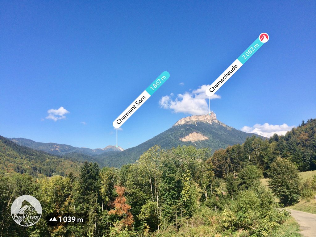
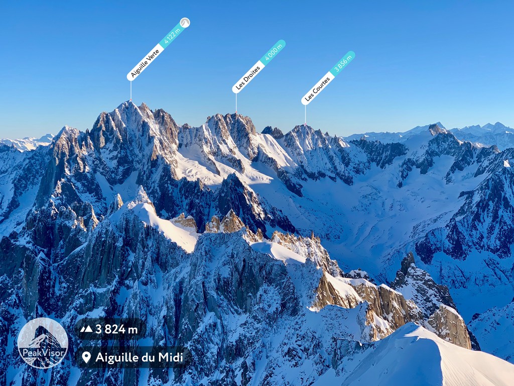
Today, France's highest mountains are located in the Pyrénées and Alps, including some of the highest summits in western Europe. Some famous French mountains aside from those already mentioned include Barre des Écrins (4,102 m/13,458 ft), Aiguille Verte (4,122 m/13,524 ft), Chamechaude (2,082 m/6,831 ft), and Monte Cinto (2,706 m/8,878 ft).
France provides visitors with a snapshot of western Europe's beautiful and diverse fauna and flora. Read on to learn about France's wildlife.
The fauna of mainland France is relatively typical of Western Europe. Over 120 mammalian species inhabit mainland France — commonly occurring large species include wild boars, red deer, and roe deer.
Rare species of significance include Iberian ibex, European fallow deer, and Iberian chamois, all of which were reintroduced to France. Rare predatory mammals include brown bears and Iberian lynxes.
Other notable mammal species found in France include red foxes, European wildcats, European polecats, Alpine marmots, European hares, and Pyrenean desmans.
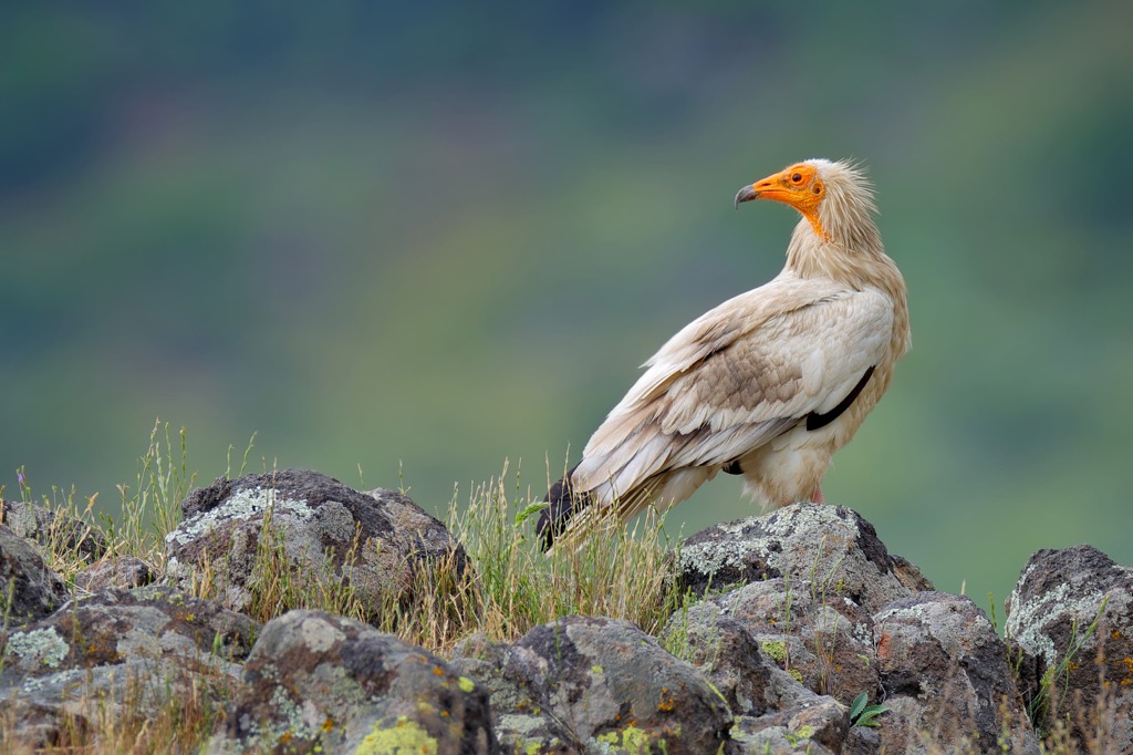
Roughly 610 bird species have been spotted in French skies. Southern France is a popular stopover for many African species, like Egyptian vultures, bee-eaters, and flamingoes.
France is home to around 40 percent of short-toed eagles in Western Europe, which are mainly found in the Massif Central. Common birds of prey that call France home include hen harriers, buzzards, red kites, and eagle owls.
Other notable bird species in France include common chaffinches, dunnocks, Eurasian blackcaps, bullfinches, and Eurasian jays.
Twenty reptile species inhabit France, including common European adders, European pond turtles, Montpellier snakes, and European leaf-toed geckos. Amphibian species include fire salamanders, Alpine newts, and Iberian water frogs.
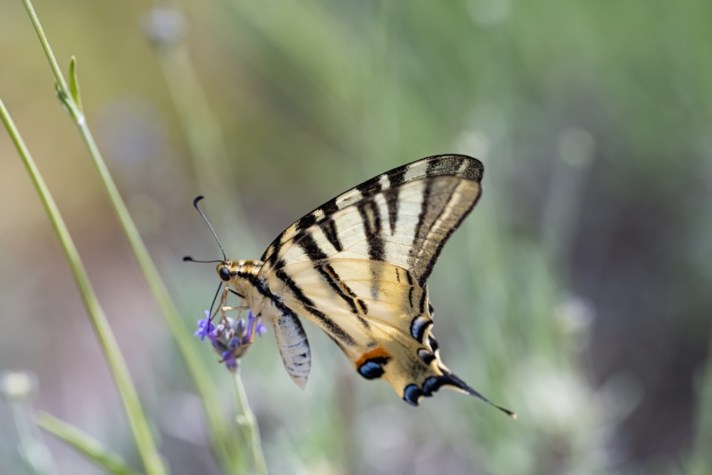
There are thought to be over 35,000 insect species native to France. This includes thousands of beautiful butterfly species, such as old world swallowtails, Queen of Spain fritillaries, and purple emperors.
France's rivers boast over 80 fish species, including largemouth bass, northern pike, muskie, and walleye.
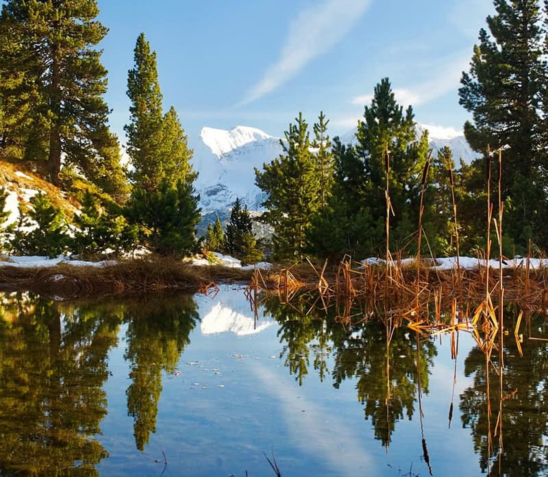
Roughly 29 percent of France is forested, making it one of Europe's top 5 countries for forest coverage. Approximately 140 tree species grow in France. The most common species are pines, birches, poplars, willows, chestnuts, junipers, and oaks.
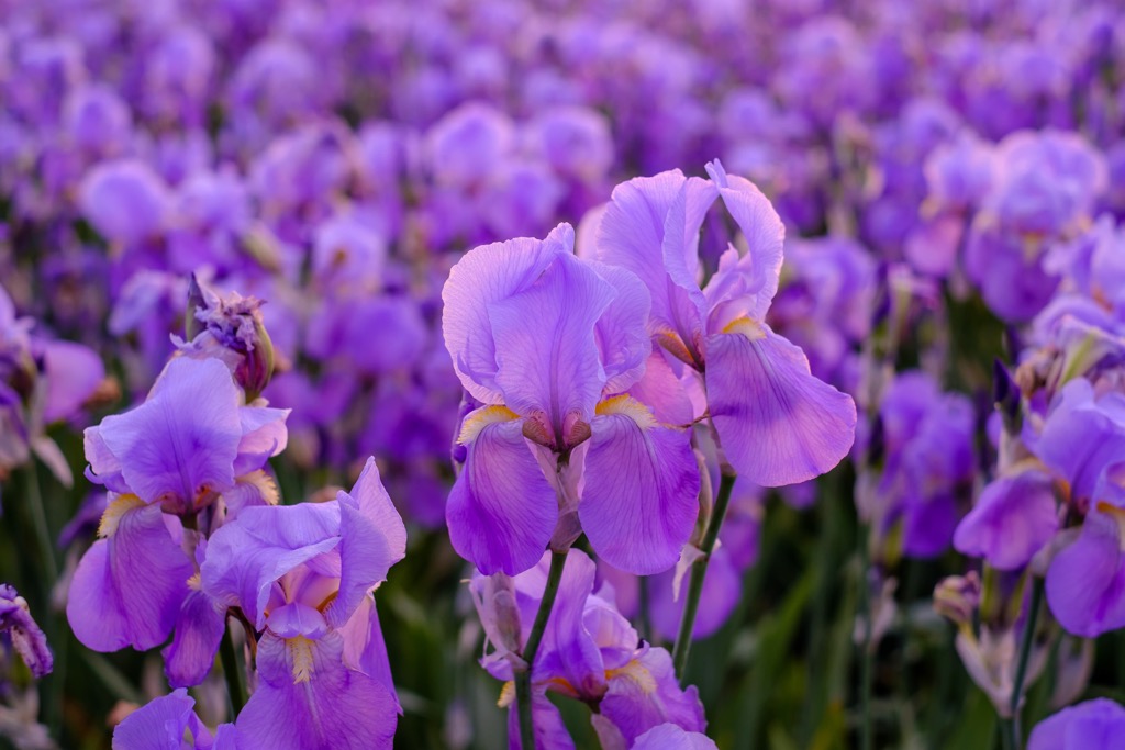
There are over 25,000 plant and fungi species in France. Many vibrant flowers grow across France, such as lilies of the valley, lavender, peonies, lilacs, hyacinths, poppies, and tulips.
Nearer the Mediterranean are olive trees, vines, and mulberry and fig trees, as well as laurel, wild herbs, and the low scrub known as maquis.
The iris, also known as the fleur-de-lis, is the national flower of France and has been an important symbol since the twelfth century.
France is famed for its fungi, with over 3,000 species nationwide. Common edible mushrooms which can be found in France include chanterelles, girolles, penny buns, morilles, and truffles.
Modern humans have been inhabiting the area that's now France for tens of thousands of years. Some of the earliest signs of human inhabitants are cave paintings in the Caves of Gargas dating back to 25,000 BCE.
Read on to learn about the history of France.
The earliest recorded history of France dates back to the Iron Age. Modern France has roughly the same borders as the region known by the Romans as Gaul. The Gauls were a band of Celtic tribes that spoke the Gaulish language.
During the first century BCE, the Carthaginians, Greeks, and Romans founded settlements and colonies on the southern coast of Gaul. This led to the Romans annexing the south half of Gaul and establishing the province of Gallia Narbonensis.
Between 58–51 BCE, the Romans and Gauls fought the Gallic Wars, which resulted in the Romans conquering the entirety of Gaul. Gauls were integrated into the Roman Empire, and Gallo-Roman culture became prominent in the region.
As the Roman Empire began to collapse, barbarian raids from the Germanic Franks became increasingly common in Gaul. In the fifth century, Frankish King Clovis I began ruling Gaul. The Frankish Empire successfully ruled large parts of western Europe for hundreds of years, culminating in the reign of Charlemagne.
Charlemagne established the first Kingdom of France, known as West Francia, in the western half of the Carolingian Empire as a result of three civil wars and the Treaty of Verdun. West Francia became increasingly successful under the House of Capet, which was founded in the tenth century by Hugh Capet.
The Hundred Year's War (1337 - 1453) was the result of a succession crisis due to the collapse of the House of Capet. The war was fought between the House of Valois, a branch of the Capetian dynasty, and the English House of Plantagenet. Joan of Arc is one of the most prominent figures of the Hundred Year's War.
Victory for the House of Valois in the Hundred Year's War marked the start of the Ancien Régime, a period from 1500 to 1789, which saw France transform into an absolute monarchy. The French Renaissance and the Protestant Reformation also occurred during the Ancien Régime.
Following the French Wars of Religion from 1562 to 1598, the House of Valois was overthrown by the House of Bourbon. Monarchical political power in France peaked with the rule of "the Sun King," Louis XIV.
The French Revolution (1789 - 1799) resulted in the end of France's absolute monarchy. The result was the abolishment of the monarchy and the founding of the First French Republic.
The First French Republic lasted until the establishment of the French Empire under Napoleon Bonaparte. The Napoleonic Wars (1803 - 1815) resulted in the French Empire's defeat and Napoleon's exile to the island of Saint Helena.
France then underwent several changes in rule, including a brief return of the monarchy and the formation of the Second and Third French Republics. The Third French Republic was formed in 1870.
France played a key role in the First World War as one of the Triple Entente powers, along with the Russian Empire and the United Kingdom of Great Britain and Ireland.
France was one of the Allied Powers in the Second World War until Nazi Germany occupied it in 1940. During this period, Germany ruled northern France directly, while the Vichy government controlled southern France. Of metropolitan France's Jewish population of 340,000, over 150,000 died during the Second World War.
The Fourth French Republic was established in 1944 following France's liberation. France recovered slowly after the Second World War, partly due to the First Indochina War (1946 - 1954) and the Algerian War of Independence (1954 - 1962).
Following the 1958 Algerian Crisis, French President Charles de Gaulle founded the Fifth French Republic, which led to large-scale decolonization in the 1960s.
Today, France is active in world affairs as a member of the UN Security Council and NATO. It's also one of the founding members of the European Union (EU).
There’s no shortage of hiking options in France with 9 national parks and 48 natural parks.
France is home to some of the highest mountains in Europe, so hikers should come well-prepared. Bring appropriate hiking gear, plenty of food and water, and carefully map your route. Check weather conditions and inform others of your itinerary. Stop by a visitor's center for more trail information if you're visiting a national park.
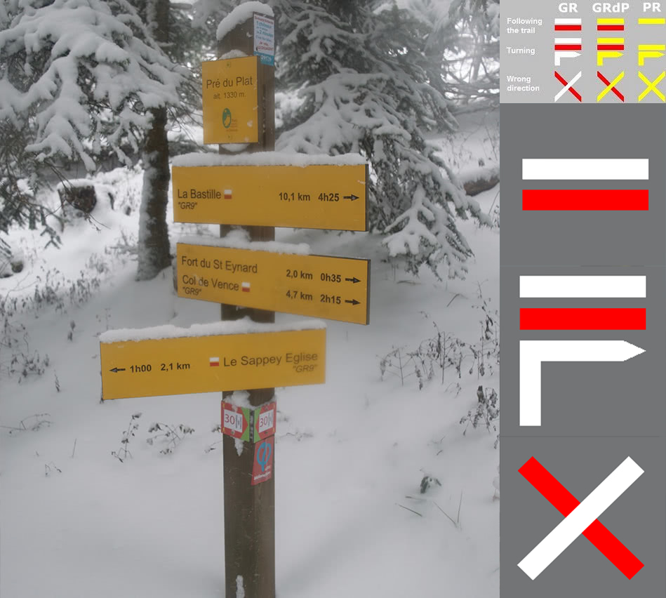
The trails in France are marked by the following signals:
Read on to learn about some of the best hikes in France.
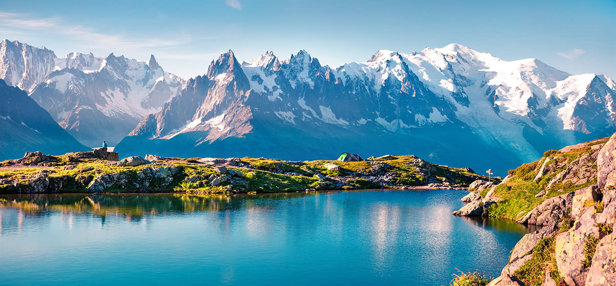
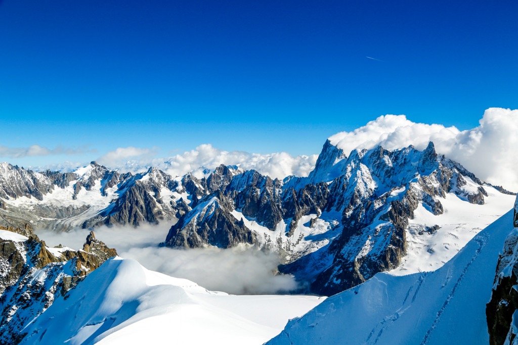
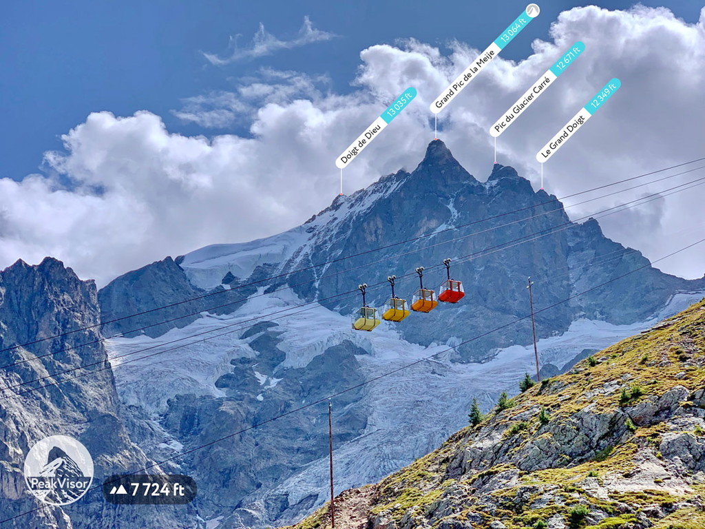
The Mont Blanc massif is located within the Alps on the French-Swiss border.
It consists of eleven individual summits and six subsidiary peaks over 4,000 m (13,123 ft), including Mont Blanc (4,810 m/15,781 ft), the highest mountain in Europe outside of Russia. Some of the other highest summits in the Mont Blanc massif include Mont Maudit (4,465 m/14,649 ft), Dôme du Goûter (4,304 m/14,121 ft), and Mont Blanc du Tacul (4,248 m/13,937 ft).
While Mont Blanc is not a particularly technical mountain, its sheer height means you'll need plenty of cardiovascular, strength, endurance training, and climbing conditioning. Hiking equipment, such as crampons, is required higher up the mountain.
The Goûter Route is widely considered to be the most straightforward route up Mont Blanc. From Les Houches, take the Bellevue-Téléphérique cable car and walk to the Refuge de Tête Rousse (3,165 m/10,383 m) to begin this trek.
Along the Goûter Route, you'll pass over the slopes of Dôme du Goûter and over the Rocher de la Tournette (4,677 m/15,344 ft). Other landmarks on the way up Mont Blanc include the Refuge du Goûter (3,835 m/12,582 ft) and the Refuge Vallot (4,322 m/14,179 ft).
The Goûter Route is around 18 km (11 mi) in length. It takes two or three days to complete depending on whether you spend the night at Refuge de Tête Rousse.
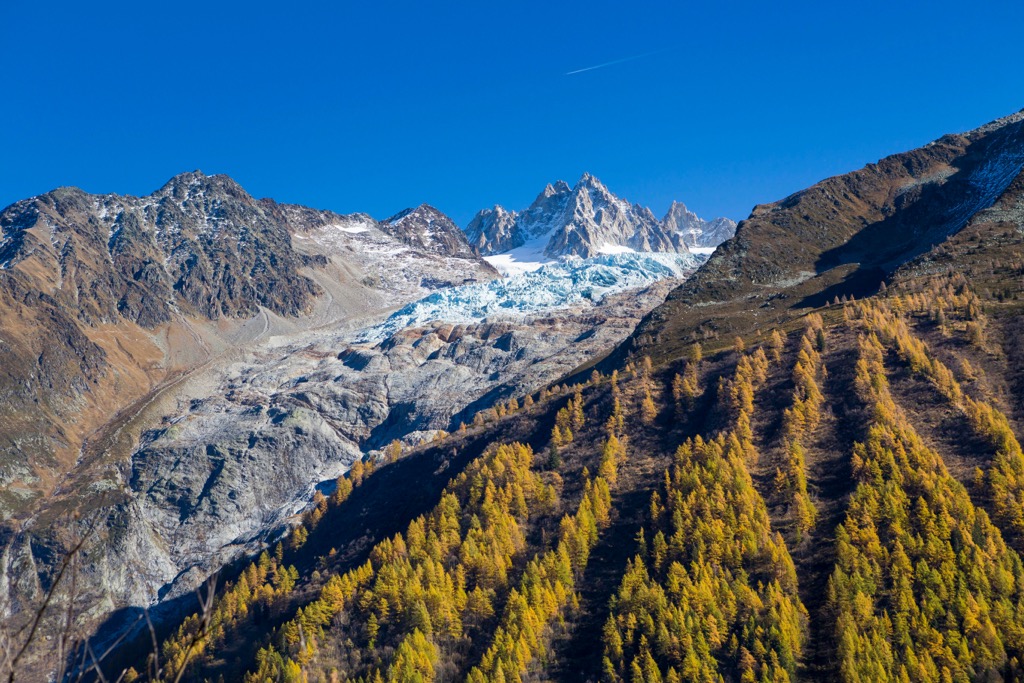
The best and most famous long-distance hike in the Mont Blanc massif is the Tour du Mont Blanc (TMB). The Tour du Mont Blanc is one of the world's oldest long-distance hiking trails, dating back to the mid-eighteenth century.
The TMB is a 170 km (105 mi) loop, usually completed anti-clockwise from Les Houches. You'll hike through seven valleys in the Mont Blanc massif, offering some of the finest scenery in the Alps. The TMB passes over the French border into Switzerland and Italy and takes 9 to 14 days to complete.
Other classic Alpine mountains worth discovering in the Mont Blanc massif include Aiguille Verte (4,122 m/13,524 ft), Aiguille du Midi (3,842 m / 12,605 ft), and Aiguille du Tour (3,540 m/11,614 ft).
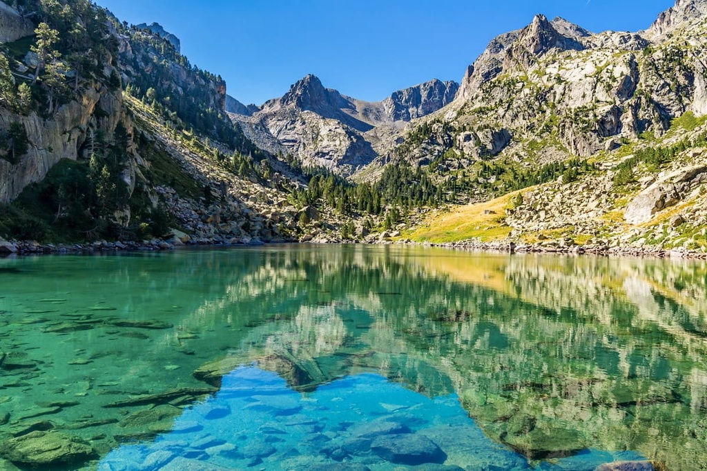
Straddling the French-Spanish border, Pyrénées National Park (Parc national des Pyrénées) covers an area of 458 sq km (177 sq mi) within the departments of Hautes-Pyrénées and Pyrénées-Atlantiques.
The park lies within the Pyrénées mountains and encompasses many of the range's highest mountains and most famous features. One unmissable hike in Pyrénées National Park is to the breathtaking Cirque de Gavarnie.
This cirque boasts 1,500 m (4,900 ft) rock walls and is over 3,000 m (9842 ft) wide at the top. French novelist Victor Hugo described it as the “Colosseum of nature" due to its size and beauty.
The Cirque de Gavarnie has several waterfalls, including Gavarnie Falls (Grande Cascade de Gavarnie), the second-highest waterfall in Europe, with a 422 m (1,385 ft) drop.
One of the most popular ways of seeing the Cirque de Gavarnie is on the 13 km (8 mi) loop trail starting and ending at Hôtel du Cirque de Gavarnie.
Alternatively, you can see the Cirque de Gavarnie from above by scaling Pic du Taillon (3,144 m/10,315 ft) from the Refuge des Sarradets (2,587 m/8,487 ft). Taillon is one of the easiest of the 3,000ers surrounding the Cirque de Gavarnie to climb.
Another popular excursion in Pyrénées National Park is Vignemale (3,298 m/10,820 ft). Vignemale is the highest mountain in the French Pyrénées and one of the ten highest summits in the entire Pyrénées range.
It's part of the Vignemale massif, a semicircle of minor summits around Vignemale, which includes Pointe Chausenque (3,204 m/10,512 ft), Piton Carré (3,197 m/10,489 ft), and Petit Vignemale (3,032 m/10,489 ft). The main summit is officially called Grand Vignemale or Pique-Longue in French.
The T4 voie normale (normal route) up Vignemale starts from the Refuge de Bayssellance (2,651 m/8,697 ft). It takes roughly six hours to complete depending on weather conditions.
Mercantour National Park (Parc national du Mercantour) covers an area of 679 sq km (262 sq mi) within the departments of Alpes-de-Haute-Provence and Alpes-Maritimes. The park is connected to the Maritime Alps Natural Park, which sits on the other side of the French-Italian border.
Mercantour National Park centers around seven valleys within the Maritime Alps (Alpes Maritimes): Bevera, Cians, Roya, Tinee, Ubaye, Verdon, and Vesubie. The park also contains Cime du Gélas (3,143 m/10,311 ft), the third-highest summit in the Maritime Alps. You'll find over 550 km (341 mi) of hiking trails to explore in Mercantour National Park.
Cime du Gélas, named because of the many glaciers on its north face, is a challenging mountain which is best to climb between May and October when there's less ice. One popular route is on a there-and-back trail from Saint-Martin-Vésubie. The trail is approximately 10.5 km (6.5 mi) in length.
Arguably a better climb than Cime du Gélas is the park's second-highest summit, Mont Pelat (3,050 m/10,007 ft). Mont Pelat is considered one of the easiest Alpine 3000ers, with only 900 m (2,952 ft) of uphill walking from the starting point at Parking du Laus.
From Mont Pelat you'll have the best possible view of Lac d'Allos (2,228 m/7,309 ft), Europe's largest mountain lake. Yellow markers and signposts make the trail up Mont Pelat easy to follow. This walk is approximately 12 km (7.5 mi) in length.
You'll find many beautiful lakes in Mercantour National Park, and one of the finest is Lac de Trécolpas (2,150 m/7,057 ft). This small peaceful lake sits in the shadow of several sublime summits, including Cime de l'Agnellière (2,700 m/8,858 ft) and Cime de Juisse (2,580 m/8,465 ft).
The voie normale to Lac de Trécolpas is on the out-and-back trail from the Lower Car Park (Parking Inférieur) near Restaurant L'Alpage. The route passes through forests and near the Chalet Vidron (1,763 m/5,784 ft). This walk is approximately 8.5 km (5.2 mi) in length.
Other popular mountains worth visiting in Mercantour National Park include Mont Bégo (2,872 m/9,423 ft), Grand Capelet (2,935 m/9,629 ft), and Mont Pépoiri (2,674 m/8,773 ft).
The 925 sq km (357 sq mi) Écrins National Park (Parc national des Écrins) is the second-largest national park in metropolitan France after Cévennes National Park (Parc national des Cévennes).
The park encompasses the Massif des Écrins, part of the Dauphiné Alps (Alpes du Dauphiné) in the department of Hautes-Alpes. Roughly 800,000 visitors flock to the park annually to explore this stunning Alpine landscape.
Écrins National Park boasts some of the highest peaks in the Dauphiné Alps, including the range's highest mountain, Barre des Écrins (4,102 m/13,458 ft).
The voie normale for Barre des Écrins is a traverse of the length of Glacier Blanc starting from the Refuge du Glacier Blanc (2,542 m/8,340 ft). The route also provides access to Dôme des Écrins (4,015 m/13,173 ft), one of the easiest Alpine 4,000ers.
The hike up Barre des Écrins is dangerous, with a significant risk of serac falls. A guide is needed for everyone other than highly experienced mountain climbers. The ascent is usually completed over two days, with overnights at the Refuge des Écrins (3,161 m/10,370 ft) and Refuge du Glacier Blanc.
A more straightforward mountain worth climbing in Écrins National Park is Pic de Morgon (2,324 m/7,625 ft). Also known as Grand Morgon, Pic de Morgon towers over the Lac de Serre-Ponçon (779 m/2,559 ft) and is the highest point in both the Pontis and Savines-le-Lac communes.
The best way to climb Pic de Morgon is from the Pierre Arnoux car park in Savines-le-Lac. The panorama of Lac de Serre-Ponçon is well worth the climb. This walk is approximately 14.5 km (9 mi) in length.
Other popular mountains worth visiting in Écrins National Park include La Meije (3,982 m/13,064 ft), Vieux Chaillol (3,161 m/10,374 ft), and Aiguilles de Chabrières (2,402 m/7,881 ft).
Vanoise National Park (Parc national de la Vanoise) covers an area of approximately 534 sq km (206 sq mi). It centers around the Tarentaise Valley (Vallée de la Tarentaise) and Maurienne Valleys (Vallée de la Môrièna) in the French Alps. Between the two valleys is the park’s namesake, the Vanoise massif.
Established in 1963, Vanoise National Park is France's oldest national park. The Vanoise massif is the third-highest massif in France after Mont Blanc and Massif des Écrins.
Vanoise National Park is connected to Gran Paradiso National Park (Parc national du Grand Paradis) across the Italian border, making it a part of the largest contiguous protected area in the Alps.
The hike up La Grande Casse (3,855 m/12,647 ft), the highest summit in the Vanoise massif, is challenging but a much simpler climb than the likes of Barre des Écrins.
The voie normale for La Grande Casse is via an out-and-back trail via the Glacier des Grands Couloirs (3,682 m/12,080 ft). The route ascends the mountain's southwest side, starting and ending at the Refuge du Col de la Vanoise (2,518 m/8,261 ft). This hike is approximately 11.6 km (7.2 mi) in length.
One breathtaking hike in Vanoise National Park is to the Col de la Vanoise underneath Aiguille de la Vanoise (2,796 m/9,173 ft). You can pick up this trail from east of Pralognan-La-Vanoise near the Auberge les Fontanettes.
This looped trail leads through woodlands before skirting along the edge of Lac des Vaches (2,321 m/7,615 ft) below Aiguille de la Vanoise. You'll then climb up a moraine of the Glacier de la Grande Casse (2,810 m/9,219 ft).
Along the way, you can spot the summit of La Grande Casse to the northeast. The walk is approximately 12.2 km (7.5 mi) in length.
Other popular mountains in Vanoise National Park include L'Aiguille Percée (2,761 m/9,058 ft) and Aiguille de la Grande Sassière (3,746 m/12,293 ft).
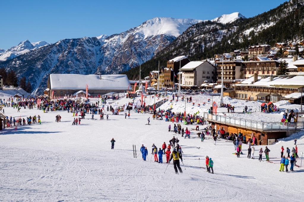
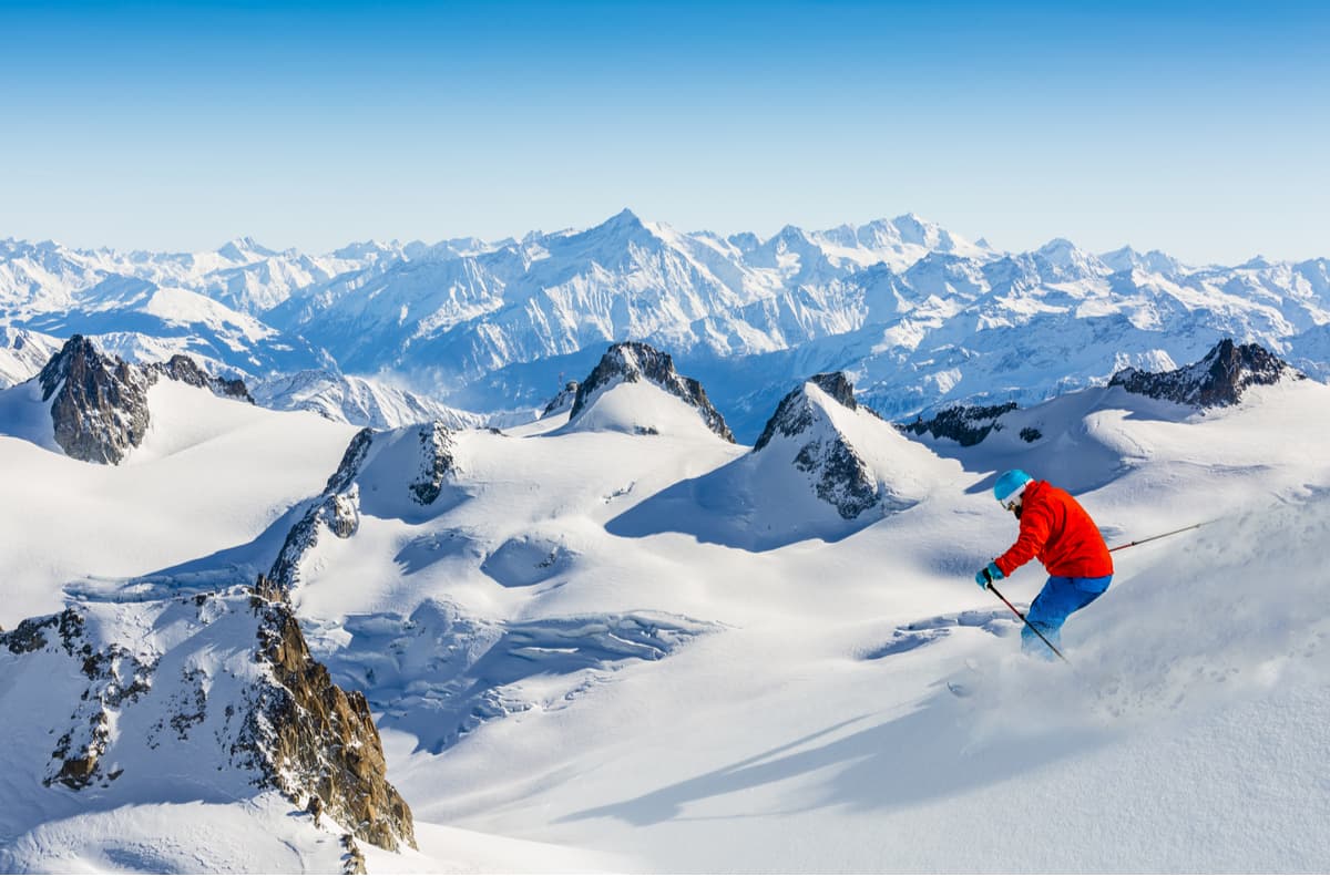
Skiing and snowboarding enthusiasts will find more than 250 ski resorts in France.
The greatest concentration of resorts are in the Alps along the Swiss and Italian borders. You'll also find resorts in the Pyrénées along the Spanish and Andorran borders. Additionally, there are a small number of resorts in the Massif Central.
On the administrative map, the country's three most important ski regions are Auvergne-Rhône-Alpes, Provence-Alpes-Côte D'Azur in the Alps, and Occitania in the Pyrénées.

The largest ski resort in France and the French Alps is Les Trois Vallées, or "The Three Valleys" in English, in Auvergne-Rhône-Alpes. Les Trois Vallées consists of the Saint-Bon, Allues, and Belleville valleys — a fourth valley, Maurienne, was added in 1997. The resort lies partly within Vanoise National Park.
The area comprises four major and three additional "smaller" ski resorts with more than 600 km (373 mi) of connected slopes and more than 155 ski lifts with one single ski pass. These ski resorts are:
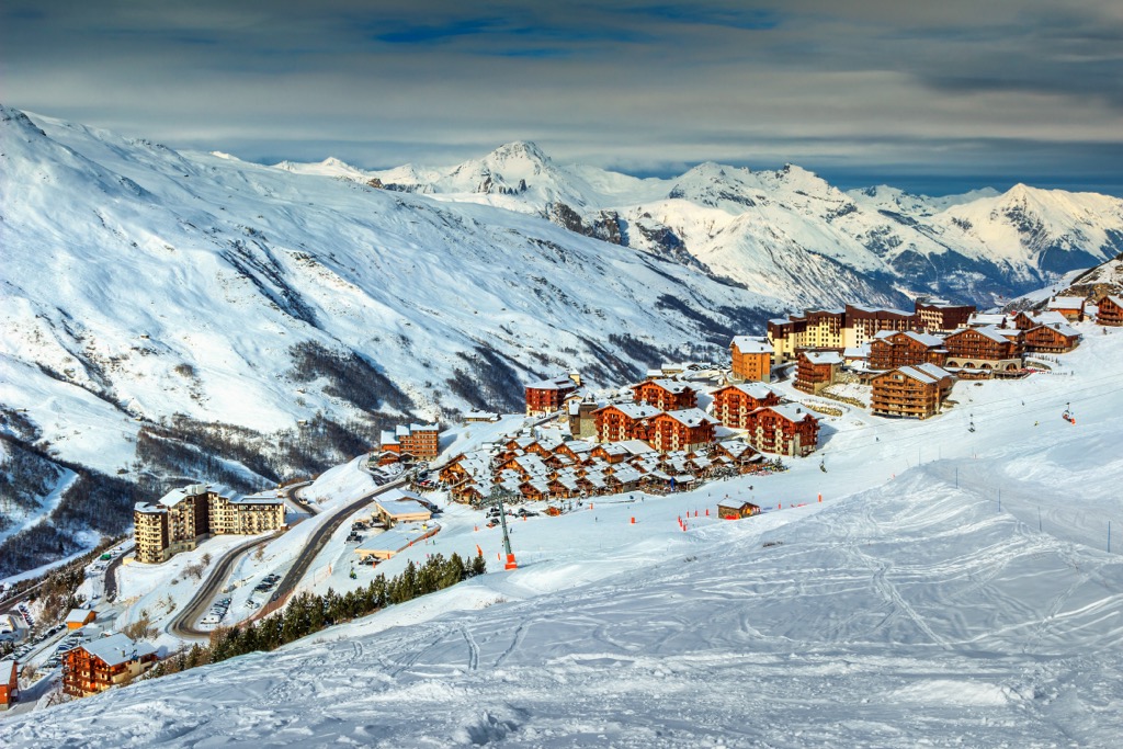
As a result, Les Trois Vallées is the largest ski area in the world. It's slightly larger than the nearby Les Portes du Soleil (Morzine, Avoriaz, Les Gets, Châtel, Morgins, Champéry, and others), which contains more than 580 km (360 mi) of slopes and more than 165 ski lifts.
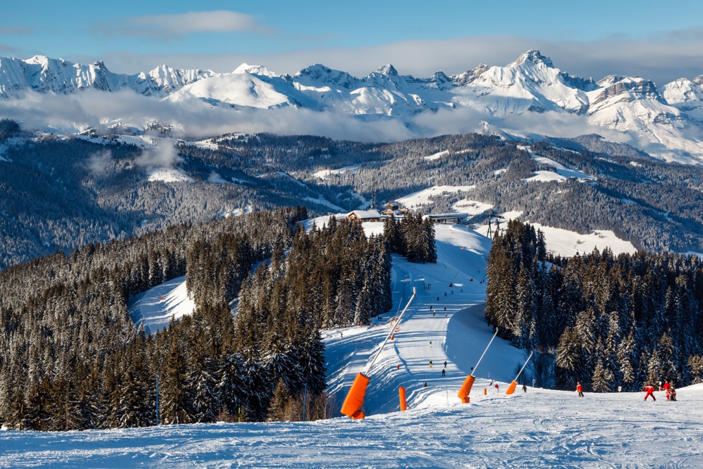
Other ski areas in the French Alps with over 100 km (61 mi) of slopes and more than 20 ski lifts each include the following:
All of these are ski resorts near Nice and Marseille — the two largest cities in the south of France.
The largest ski resort in the French Pyrénées is Grand Tourmalet/Pic du Midi, with more than 100 km (62 mi) of slopes and more than 25 ski lifts.
That said, Grand Tourmalet/Pic du Midi is smaller than the three resorts in the Spanish Pyrénées: Baqueira/Beret, La Molina/Masella-Alp 2500, and Formigal. It's also smaller than Grandvalira in Andorra — the largest in the Pyrénées with 210 km (130 mi) of slopes and 74 lifts. Grand Tourmalet/Pic du Midi is also the nearest ski resort to Toulouse.
The three largest ski resorts in the Massif Central are Le Lioran, Le Mont-Dore, and SuperBesse–Puy de Sancy, which have 60 km (37 mi), 40 km (25 mi), and 40 km (25 mi) of slopes and more than 10 ski lifts, respectively. These are the main ski resorts near Montpellier.
Check the France ski resorts map in the World Mountain Lifts section of the site. It includes real-time information about open ski lifts/slopes in France with opening dates and hours. There are also year-round cable cars, funiculars, cog railways, aerial tramways, and other types of mountain lifts.
Boasting world-class restaurants, exquisite architecture, and unmatched museums, France's major cities offer something for everyone. Read on to learn about France's main cities and towns.
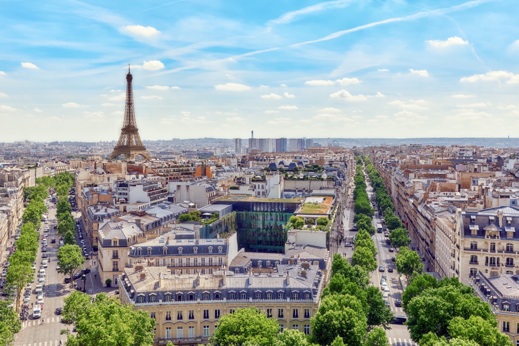
"The City of Light," France's capital Paris is one of the treasures of western Europe. For over 400 years, Paris has been a center for culture, cuisine, fashion, and science.
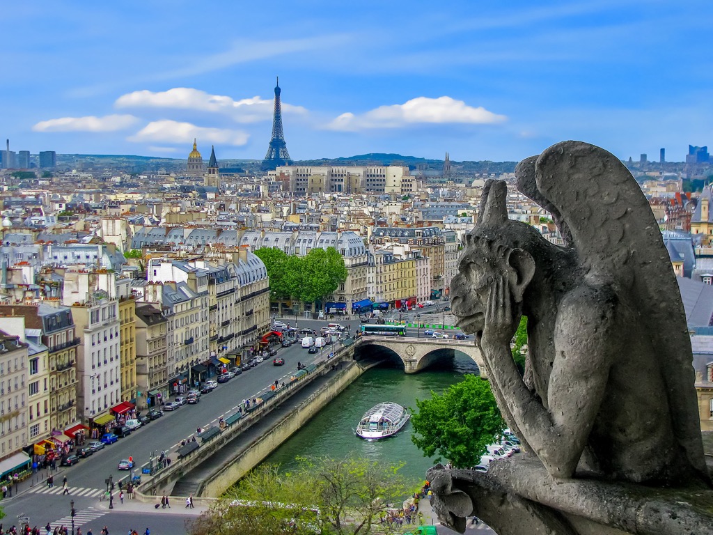
Paris is home to some of the globally famous landmarks, such as the Eiffel Tower, the Cathédrale Notre-Dame de Paris, and the Arc de Triomphe. There's no shortage of potential activities in Paris, with outstanding attractions like the Louvre Museum, the Palace of Versailles, and Disneyland Paris.
Paris is one of the world's most connected cities, making it the perfect base from which to explore France's natural wonders. Additionally, several regional natural parks surround Paris, including French Vexin Regional Natural Park (Parc naturel régional du Vexin français) and Oise - Pays de France Regional Natural Park (Parc naturel régional Oise - Pays de France).
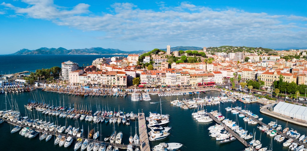
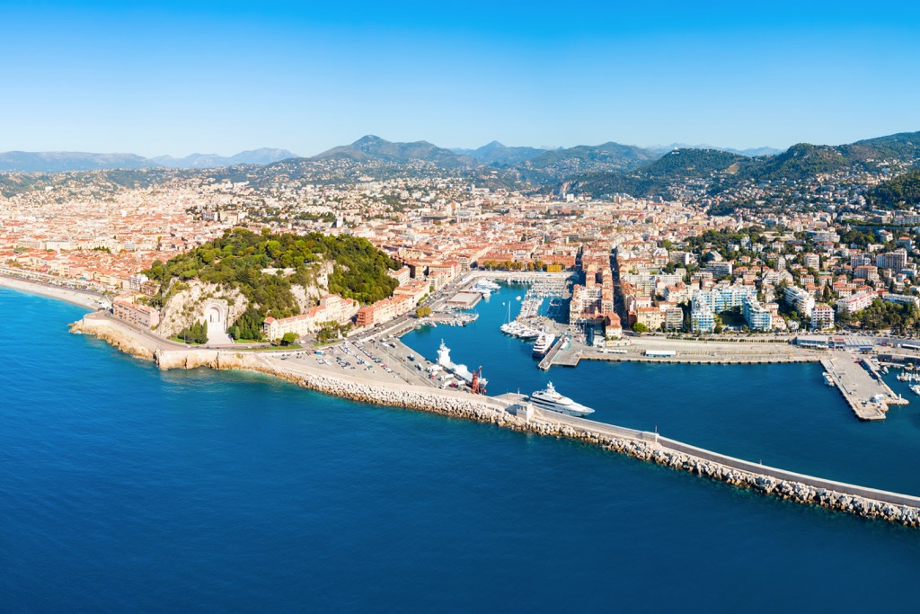
Marseille is France's second city and the largest settlement on the French Riviera (Côte d'Azur). Marseille is famed for its long history, having been founded by the Ancient Greeks as Massalia in 600 BCE. It's also among the sunniest cities in France, with over 2,800 hours of sunshine on average annually.
Marseille is a beautiful city with plenty to keep you busy between hiking adventures. Dine on fresh fish along the Old Port of Marseille (Vieux-Port de Marseille), enjoy birdseye city views from the remarkable Basilique Notre-Dame de la Garde, or uncover ancient history at the medieval Abbaye Saint-Victor.
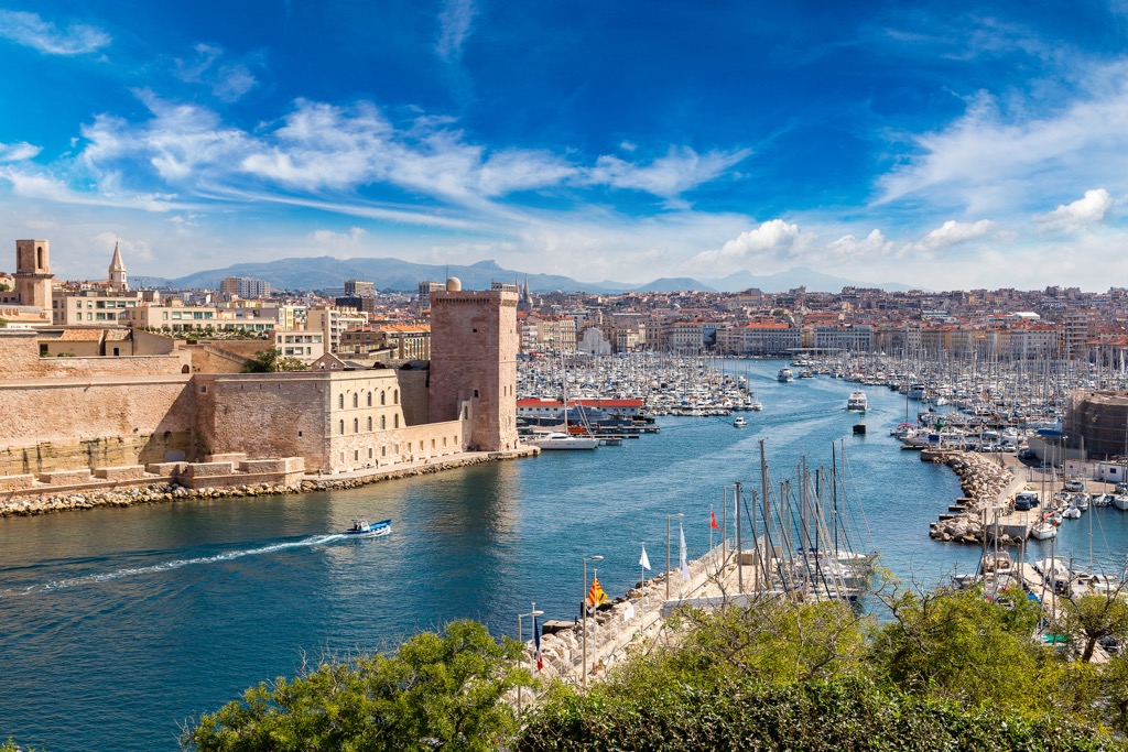
Due to its location on France's Mediterranean coastline, Marseille is close to many major hiking areas. Calanques National Park (Parc national des Calanques) is located adjacent to Marseille. Meanwhile, Écrins National Park and Mercantour National Park are located less than 220 km (136 mi) away.
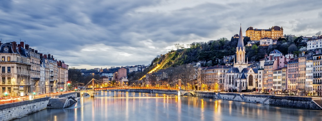
Situated where the Rhône and Saône rivers meet is the city of Lyon. Once the capital of Roman Gaul, Lyon is now one of France's largest cities, serving up some of France's finest cuisine and a host of historical sites.
During your stay in Lyon, ensure you explore the Place Bellecour, France's third-largest square, and take in the panorama from the ornate Basilica of Notre-Dame de Fourvière. Other top attractions include the fourteenth-century Cathédrale Saint-Jean-Baptiste and the contemporary Musée des Confluences.
There are few better cities to stay in than Lyon if you plan to explore the French Alps. Lyon is located within 210 km (130 mi) of the Mont Blanc massif, Vanoise National Park, and Écrins National Park.
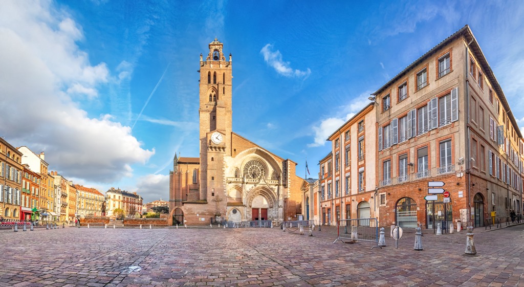
Toulouse is the prefecture of Occitania and France's fourth-largest city. Toulouse is a picturesque city filled with pastel-painted buildings, riverside parks, and architectural delights. It's famous across the continent for being one of Europe's largest aerospace hubs.
Top attractions in Toulouse include the eleventh-century Romanesque Basilique Saint-Sernin de Toulouse, the Musée des Augustins fine arts museum, and Gothic Couvent des Jacobins.
Toulouse is located in southwestern France, close to some top hiking areas in and around the Pyrénées. Pyrénées National Park is located 160 km (99 mi) to the southwest and the Ariège Pyrenees Natural Regional Park (Parc naturel régional des Pyrénées ariégeoises) is located 130 km (80 mi) to the south of Toulouse.
Travel east along the French Riviera from Marseille and reach the sun-drenched city of Nice. Sat at the foot of the French Alps, Nice is regarded as one of France's most attractive cities, earning it the nickname Nice la Belle (Nice the Beautiful). Its beauty meant it was a popular resort for British royalty in the eighteenth century, including Queen Victoria and Edward VII.
Nice has excellent historical and cultural attractions, like the seventeenth-century Cathédrale Sainte-Réparate and the Promenade des Anglais. Ensure you walk to the top of Castle Hill for the best view of Nice.
Nice is near some popular hiking destinations thanks to its proximity to the French Alps. Mercantour National Park is located approximately 50 km (31 mi) from Nice, while
Azure Prealps Regional Natural Park (Parc naturel régional des Préalpes d'Azur) is located less than 55 km (34 mi) from Nice.

Explore France with the PeakVisor 3D Map and identify its summits.

top10
ultra
glacier
europe-4500ers
alps-4000ers
italy-ultras
france-ultras
top10
ultra
glacier
europe-4500ers
alps-4000ers
italy-ultras
france-ultras
top50
ultra
glacier
alps-4000ers
france-ultras


