Scan the QR code and open PeakVisor on your phone
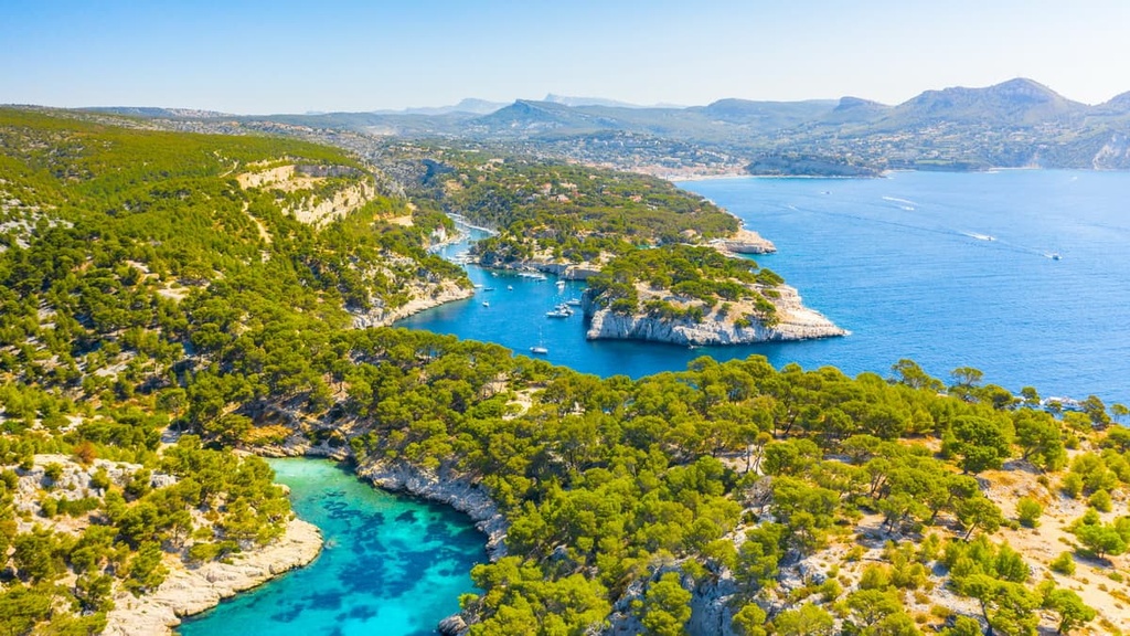
Discover the sublime sea cliffs and coves of France's Mediterranean coastline when you visit Calanques National Park (Parc national des Calanques). There are 308 named mountains in the park, the highest and the most prominent of which is Mont Carpiagne (646 m/2,119 ft).
Calanques National Park extends for 20 km (12.4 mi) along France's sun-drenched Mediterranean coastline. It encompasses an area of approximately 520 sq km (201 sq mi) within Bouches-du-Rhône and is located next to France's second-largest city, Marseille.
Calanques National Park is unique as 93 percent of its territory is oceanic, and it's the only peri-urban national park in France to contain both marine and terrestrial areas.
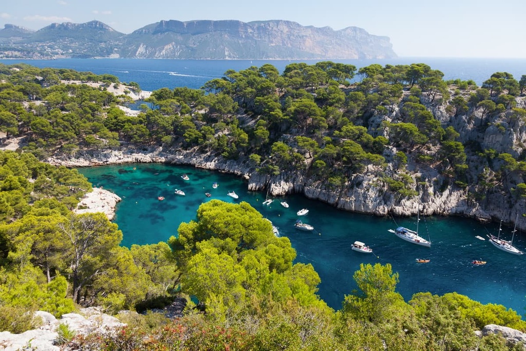
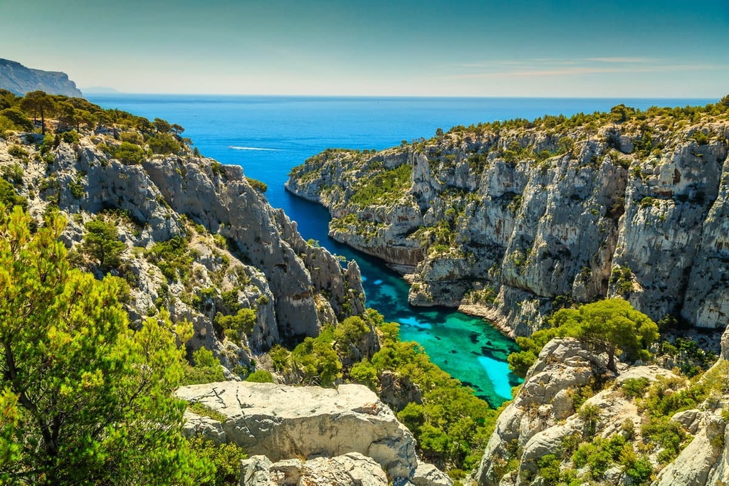
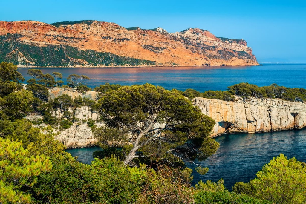
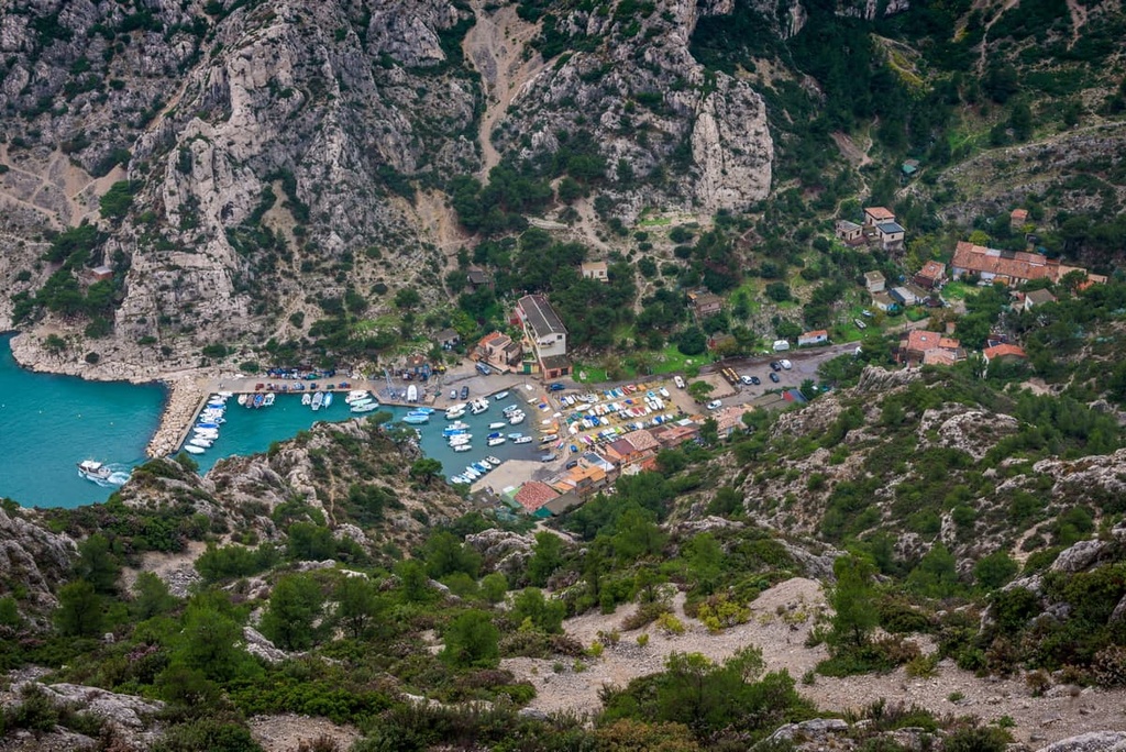
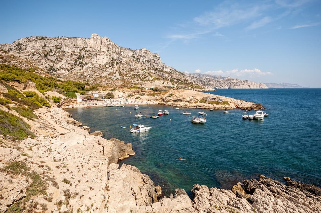
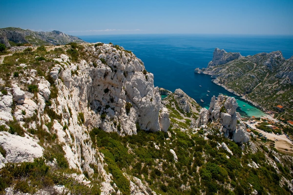
The park's key characteristic is the Calanques massif (massif des Calanques). This massif features a series of dramatic steep-walled sea inlets dotted along its coastline that are known as Calanques. The largest of these inlets is Calanque de Sormiou. Other notable Calanques include Calanque de Morgiou, Calanque de Port-Miou, and Calanque de Sugiton.
The Calanques massif also includes a string of rugged limestone mountains, the highest of which is Mont Puget (563 m/1,847 ft).
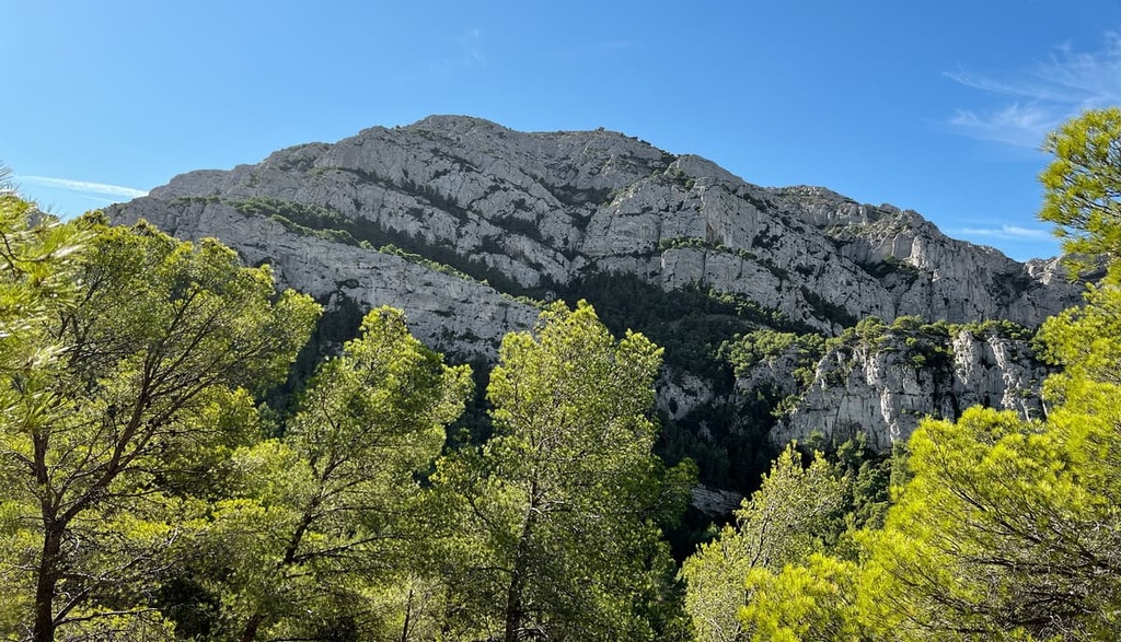
Further inland to the park's north is the Saint-Cyr massif (Massif de Saint-Cyr). This is the highest massif in the park, and it contains the park's highest mountain, Mont Carpiagne (646 m/2,119 ft).
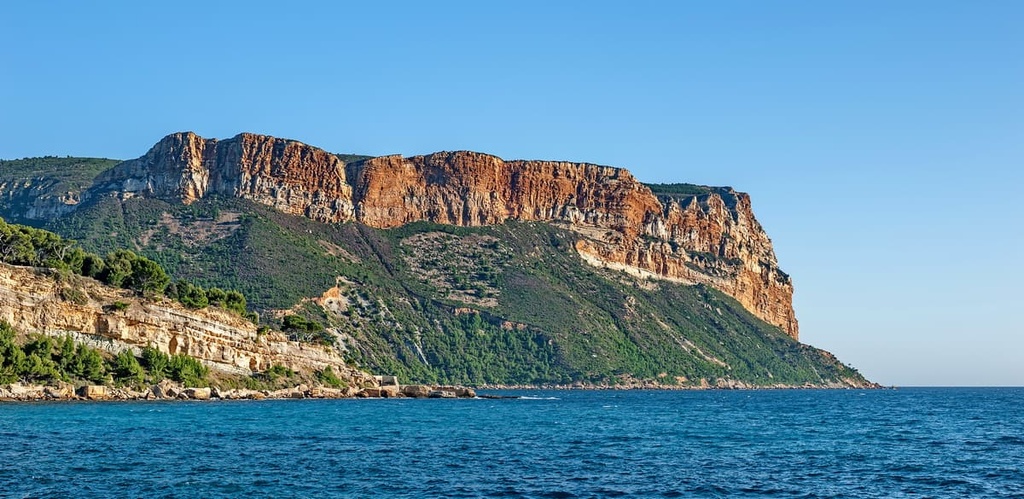
The park's third and final massif, the Cap Canaille massif, is located at the park's eastern edge. It culminates in the Montagne de la Canaille (380 m/1,247 ft) and is famous for having some of the highest sea cliffs in Europe.
Perhaps the most intriguing areas of Calanques National Park are located under the sea. Calanques National Park is home to two underwater canyons, Cassidaigne and Planier, which reach depths of over 1,500 m (4,921 ft). They are renowned for their biodiversity as they are both home to many endangered species.
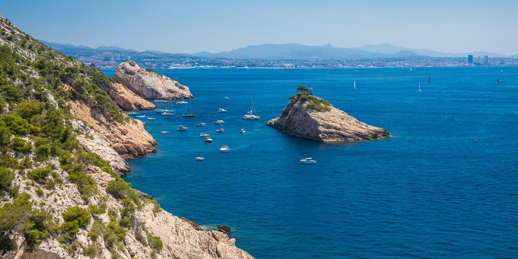
Additionally, several islands and archipelagos are located within the Calanques National Park, including the Frioul Archipelago, the Riou Archipelago, and L'île Verte.
The closest park to Calanques National Park is Sainte-Baume Natural Regional Park (Parc Naturel Régional de la Sainte-Baume), which is located less than 50 km (31 mi) away to the northeast.
Over 1.8 million people live within 70 km (43 mi) of Calanques National Park as the Aix-Marseille-Provence Metropolitan Area is located on the park’s doorstep. Notable settlements near Calanques National Park include Marseille, Aix-en-Provence, and Toulon.
Calanques National Park is composed primarily of limestone. These sedimentary rocks formed during the Jurassic and Cretaceous Periods of the Mesozoic Era approximately 80 million years ago.
This limestone formed when organic and mineral sediments deposited on the bottom of the Jurassic and Cretaceous seas were compressed over the course of millions of years by water pressure and other sediment layers.
Roughly 60 million years ago, the European and African tectonic plates collided and overlapped, raising the rocks of Calanques National Park to the surface.
Then, over the next several million years, erosion sculpted the park's landscape. Variations in sea level and glaciation have created the park's steep Calanques.
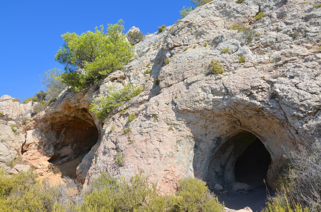
The park's limestone bedrock features karst topography, and there are many caves, sinkholes, and underground rivers in the area. Notable examples of karst phenomena in the park include the underground river of Port-Miou and the Saint-Michel d'Eau Douce cave.
The current landscape of Calanques National Park is extremely arid. Much of the topography of the region is the result of erosion from a mixture of natural occurrences, climate change, and human activity.
Between 30,000 and 19,000 BCE, Southern France had a cold oceanic climate. During this time, glaciers reached over 150 km (93 mi) inland to points as far away from the coast as Sisteron. Eventually, the glaciers retreated, and the region gained the Mediterranean climate that it has to this day.
As a result of this increasingly warm climate, humans thrived in the region. However, overexploitation of the land for farming over the following millennia resulted in the loss of natural environments. The soils in the region never recovered, leading to the rocky landscape that we see in the area to this day.
The limestone composition of Calanques National Park has also created a series of low-lying rugged mountain massifs and some of the finest sea cliffs in Europe. Only two mountains in the park, Mont Carpiagne (646 m/2,119 ft) and Mont Saint-Cyr (610 m/2,001 ft), exceed 600 m (1,968 ft) in elevation.
Other notable summits in Calanques National Park include Marseilleveyre (434 m/1,424 ft), Mont Lantin (562 m/1,844 ft), and Béouveyre (366 m/1,200 ft).
Calanques National Park is home to a surprising variety of wildlife and internationally important marine habitats despite its barren appearance. Read on to find out more about the ecology of Calanques National Park.
Approximately 100 terrestrial animal species inhabit Calanques National Park. Birds constitute roughly 80 percent of these species, and 67 of these species are nationally protected.
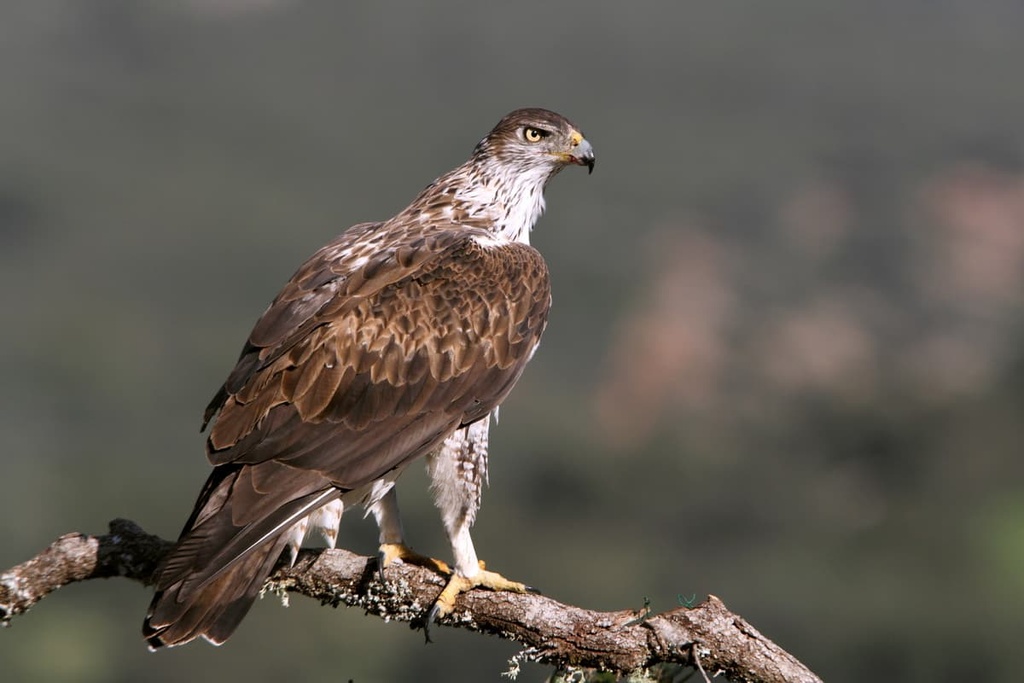
The rarest of these species is Bonelli's eagle. Only 32 Bonelli's eagle nests have been documented across France, one of which is located within Calanques National Park.
Most of the bird species that live in Calanques National Park are seabirds, including yellow-legged gulls, crested cormorants, and Cory's shearwaters. Other notable bird species found throughout the park include peregrine falcons, wallcreepers, and Eurasian eagle-owls.
Bats are the most common mammals in the park, with 13 species present in the region. The most interesting of these species is the European free-tailed bat. With a wingspan of 40 cm (15.7 in), it's one of the largest bat species in Europe.
Besides bats, several other mammals live within Calanques National Park, including deer, wild boars, foxes, and genets.
Calanques National Park's rocky terrain makes it an excellent habitat for reptile species, such as Montpellier snakes, ocellated lizards, and European leaf-toed geckos.
The most interesting of Calanques National Park's insect species is the Saga pedo bush cricket. Known colloquially as the Spiked Magician, the Saga pedo is one of the world's largest insects.
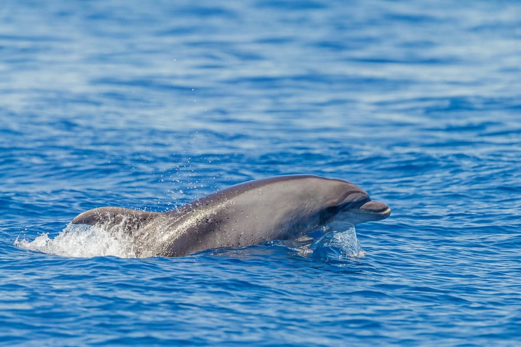
Below the waves of Calanques National Park live 60 protected marine species, including bottlenose dolphins, pilot whales, and loggerhead sea turtles.
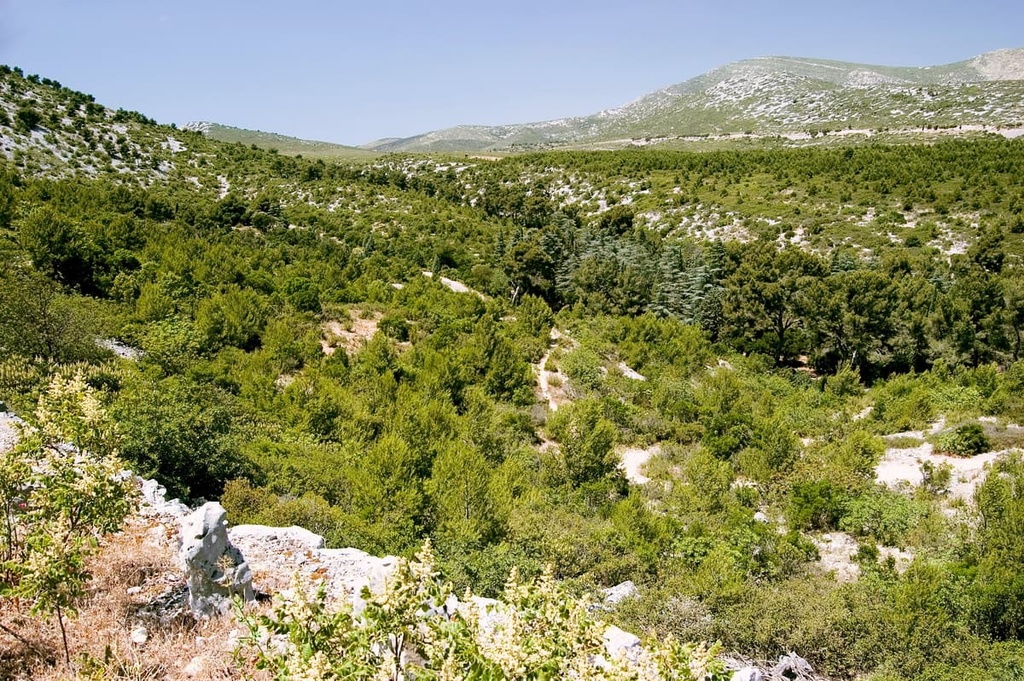
Calanques National Park contains several different environments, including forests, low shrublands, and grasslands.
Due to the poor soil quality in the region, the park's forests are made up of hardy trees such as Aleppo pines, holm oaks, and downy oaks.
Some of the park's Mediterranean shrublands, which grow out of the region’s limestone soils, are known as garrigues. These low shrublands are more varied than the forests in the area, and their major plant species include everything from junipers and sasparillas to kermes oaks and rosemary.
The other kind of shrubland that grows out of the acidic soils in the region is the maquis shrubland. This vegetation is thicker and thornier than what you find elsewhere in the park, and its primary vegetation consists of strawberry trees, myrtle, thorny brooms, and French lavender.
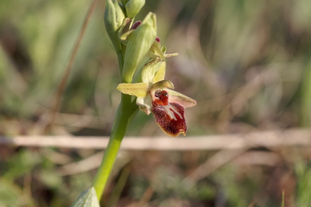
Many flowering plants manage to survive along the park's coast and across the grasslands. Examples of these plants include sand lilies, dwarf irises, giant orchids, and early spider-orchids.
Humans have inhabited Calanques National Park for over 300,000 years since the Lower Paleolithic Period. The area's karstic cave systems have played an essential role in local human history for tens of thousands of years.
There are over 15 caves with archeological significance in Calanques National Park. Out of these caves, the most important to archeologists is the Cosquer Cave (La Grotte Cosquer). This cave was first discovered by contemporary archeologists in 1985 and is located within the Calanque de Morgiou.
The Cosquer Cave contains 150 pieces of cave art that date back 27,000 years to the Pleistocene glacial period.
These pieces of cave art include 65 hand stencils and sketches of bison, horses, and even penguins. Pictures of animals such as penguins give insight into how much the climate of what is now southern France has changed over the past 30,000 years. Rising sea levels have destroyed most of the cave's art, and the cave entrance is now 37 m (121 ft) below sea level.
Another lesser-known cave, the Cave of the Trémies (La Grotte des Trémies), contains the park's oldest human remains—those of a 300,000-year-old Neanderthal.
Within the Marseilleveyre massif, the Rolland Cave (La Grotte Rolland), contains archeological remains dating back to the Neolithic Period, including pottery.
The cave takes its name from a bandit named Rolland, who terrorized the region in the Middle Ages and used the cave as his base. A vast fortune accrued by Rolland's gang was said to be kept in the cave but has never been found.
Agriculture has played a central role in the human history of Calanques National Park for millennia.
Overgrazing and land exploitation over the course of thousands of years has produced a barren landscape with poor soil quality in the area that is now Calanques National Park. The remains of ancient sheepfolds created by burning down forests are still visible across the area.
Many military batteries were built in Calanques National Park in the eighteenth and nineteenth centuries to protect against the British Navy.
By the nineteenth century, agriculture had ceased in the region, and chemical plants had become the area's primary industry. By the twentieth century, the chemical plant industry had disappeared, leaving behind waste, ruins, and landfills.
However, the environment in the region began to recover over the course of the following century. Hiking became increasingly popular across the area as the French Alpine Club and the Marseille Excursionists began constructing refuges and trails.
The Calanques National Park was established on April 18, 2012, to protect the area's unique inlets and marine biodiversity. It is one of the newest national parks in France, alongside Forêts National Park (Parc National de Forêts).
Despite the park's modest elevation, hikers shouldn't underestimate the difficulty of hiking in Calanques National Park. Due to their steep cliffs and rugged terrain, the park's mountains and Calanques can be dangerous, even for experienced hikers.
Hikers should ensure that they have the correct equipment before hiking in Calanques National Park. Bring along topographic maps, sun protection, plenty of food and water, and good hiking boots whenever you venture outside in the region.
To keep the park clean, hikers should also bring a garbage bag, as there aren't many trash receptacles throughout the park. Stay on the park's marked trails to avoid disturbing wildlife and to avoid accidental falls. You can find out more about the park's trail systems on the park's official website.
Read on to learn more about some of the best hiking areas and trails in Calanques National Park.
Located in the north of Calanques National Park is the Saint-Cyr massif. As the highest massif in the park, the Saint-Cyr massif affords exceptional views of the Calanques massif and Marseille.
The southern half of the Saint-Cyr massif, including the southern slopes of Mont Carpiagne (646 m/2,119 ft), falls within the firing zone of the Carpiagne Military Camp (camp de Carpiagne). Therefore, hikers are prohibited from hiking in these southern areas of the massif.
The best way to explore the Saint-Cyr massif is on the trail leading to Calanques National Park's two highest summits, Mont Carpiagne and Mont Saint-Cyr (610 m/2,001 ft).
This looped route is approximately 11 km (6.8 mi) long and takes roughly 4 hours and 30 minutes to complete. You can start this walk from the Anciens Fours à Coux in La Barasse to the north of the massif.
Monte Puget (563 m/1,847 ft) forms a part of the Calanques massif, along with the peaks of Estret (460 m/1,509 ft) and Marseilleveyre (434 m/1,424 ft). It's the highest mountain in the massif and the fourth-highest summit in Calanques National Park.
It's often believed that Mont Puget is named after seventeenth-century Baroque sculptor Pierre Puget; however, the mountain's name predates Pierre Puget by centuries. While not the mountain's namesake, Pierre Puget does have a close relationship with Mont Puget.
Legends say that following an argument with local officials in Marseille about the cost of sculpting a statue of Louis XIV, Pierre Puget carved his face into the side of the mountain in protest. While this legend has never been proven, the vague outline of a man's face on the mountainside is visible from Luminy. This carving is known as Puget's Head.
Despite being the highest mountain in the Calanques massif, tourists sometimes overlook Mont Puget. That said, a well-managed trail leads to the summit, which offers vistas of the Saint-Cyr massif and Marseille.
The trail that leads to the summit of Mont Puget approaches the peak from the north near the Luminy Campus of the Aix-Marseille University Faculty of Sciences (Université d'Aix-Marseille, Faculté des Sciences de Luminy). It's a 12 km (7.4 mi) loop trail that takes around 4 hours and 30 minutes to complete.
Along the way, you'll see the legendary Puget's Head and several old lime kilns from the park's industrial past. The walk takes you onto the Col de Sugiton and the Col de la Candelle. You'll first reach the summit of Aiguille Guillermin (540 m/1,771 ft) and then Mont Puget.
Perched on a headland overlooking the bay of Marseille is Marseilleveyre (434 m/1,424 ft). The name Marseilleveyre can translate as “to see Marseille,” a fitting name for a mountain that affords some of the finest views of France's second city. It forms a part of the minor Marseilleveyre massif (Massif de Marseilleveyre).
Marseilleveyre is a historic hiking area with various trails ranging from leisurely seaside strolls to hair-raising mountain treks. The mountain is one of the park's emblems, and it has featured in many pieces of literature and art, most notably "The Gulf of Marseilles Seen from L'Estaque" by Paul Cézanne.
The best way to climb Marseilleveyre is on the trail from the north of the mountain near Château Pastré. This looped trail is approximately 12 km (7.4 mi) long and takes around 5 hours to complete.
Along this trail, you'll pass the small sandy beach at the Calanque de Marseilleveyre and the narrow winding cove of Calanque de Callelongue.
The second highest summit in the Marseilleveyre massif, Béouveyre (366 m/1,200 ft), is just as rewarding to climb as its more famous neighbor. The panorama from the summit toward the rugged island of île Maïre is one of the best views in the park.
You can pick up the trail leading to the summit of Béouveyre from the Madrague de Montredon bus stop. This out-and-back trail is 4.6 km (2.8 mi) long and takes approximately 2 hours and 15 minutes to complete. It's possible to get a bus back to the starting point at the end of the walk.
You should note that some light scrambling is required towards the beginning of this walk. A head for heights is also needed on this hike as there are several steep cliffs on the route.
Along this walk, you'll pass the barren seaside hill of Mont Rose (84 m/275 ft), where you can enjoy some gorgeous vistas of Marseilleveyre and Marseille.
Located at the far eastern end of Calanques National Park, Cap Canaille offers some of the best sea views in France. Even Louis XIV thought highly of Cap Canaille—he considered the cape to have the most beautiful cliffs in the Kingdom of France.
Hikers can enjoy an easy walk to the highest sea cliff on the cape, Montagne de la Canaille (380 m/1,246 ft). You can pick up the trail from La Ciotat. This loop trail is 8 km (5 mi) long and takes approximately 2 hours and 30 minutes to complete.
Along the way, it's possible to visit several scenic spots, including the Belvédère du Mugel and the Calanque de Figuerolles. A section of this route also crosses the historic Route des Crêtes. From atop the cliffs, you'll be treated to stunning views back across Calanques National Park.
No trip to Calanques National Park is complete without discovering the largest inlet in the park, Calanques de Sormiou. This cove has one of the best beaches in the park, and there's a restaurant called Le Château where you can grab a bite to eat after your hike.
You should note that, like many of the park's Calanques, Calanques de Sormiou is very busy during the summer months.
Several trails lead to the Calanques de Sormiou, and one of the most popular is via the Col de Sormiou (220 m/722 ft). You can pick up this trail from the La Cayolle bus stop in Sormiou. This out-and-back trail is 2.6 km (1.6 mi) long and takes about an hour to complete. From the Col de Sormiou, there are excellent views of the Calanques de Sormiou.
An alternative route to Calanques de Sormiou is via the Col des Baumettes (166 m/545 ft). You can pick up this trail in Les Baumettes. This out-and-back trail is 2.1 km (1.3 mi) long and takes less than an hour to complete.
From sprawling metropolises to quaint seaside villages, Calanques National Park is home to a wide variety of settlements. Read on to find out more about Calanques National Park's best towns and cities.
Marseille is the perfect place to stay if you want to visit Calanques National Park. France's second-largest city boasts a picturesque old harbor, world-class museums, and ornate architecture. The city's crowning jewel is the Basilique Notre-Dame de la Garde, which sits on a 149 m (489 ft) limestone outcrop.
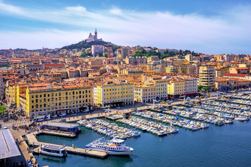
During your stay in Marseille, consider touring the Museum of Civilizations of Europe. You can also explore the Mediterranean by taking a boat out to Château d'If, one of the settings in Alexandre Dumas's The Count of Monte Cristo. Marseille also borders Calanques National Park, so you'll have no trouble discovering the park's best hiking areas from the city.
Popular hotels in Marseille include the Toyoko Inn, the Golden Tulip, and the Radisson Blu Hotel.
Located along the coast to the east of Calanques National Park is Toulon. This city on the French Riviera is famed for its maritime history, Mediterranean cuisine, and Provençal market.
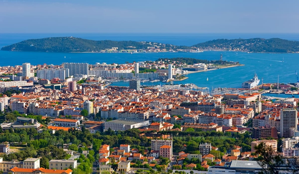
Toulon also sits in the shadow of Mont Faron (589 m/1,932 ft). A cable car leads from the city to the summit and provides sweeping views of the Côte d'Azur.
Toulon is located less than 40 km (25 mi) from Calanques National Park, making the park easy to reach by car. Popular hotels in Toulon include Hôtel Bonaparte, OKKO Hotel, and Grand Hôtel Dauphiné.
Cassis is a town that’s situated in the middle of Calanques National park, between the Cap Canaille and Calanque de Port Pin. Cassis roughly marks the start of the French Riviera, and it's easy to see why with its sandy coves and crystal clear waters.
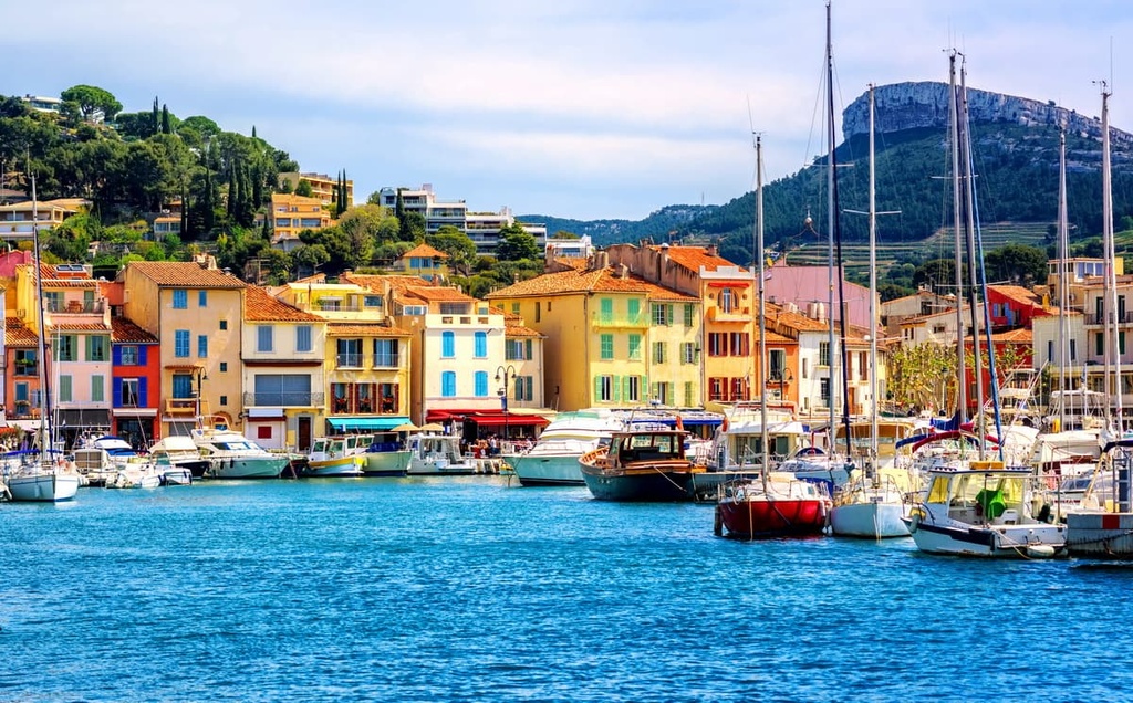
Cassis is a small town of around 7,000 people, and it is an ideal place to stay for visitors to Calanques National Park. Popular hotels in Cassis include Hôtel Les Roches Blanches, Hôtel Le Golfe, and Hôtel La Rade.
Located on the far eastern edge of Calanques National Park is La Ciotat. La Ciotat is a charming port city that offers everything you need for an idyllic vacation on the French Riviera.
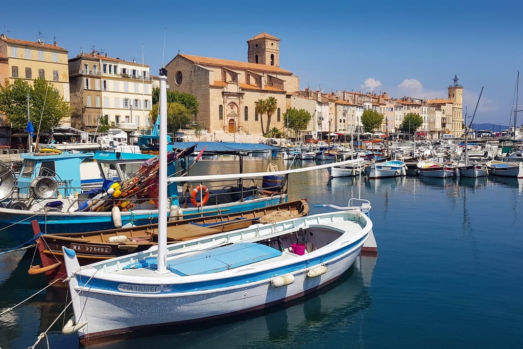
During your stay in La Ciotat, don't miss out on driving down the Route des Crêtes, a historic road that weaves along the cliff tops of Cap Canaille. Popular hotels in La Ciotat include Hotel SPA Plage St Jean, Hôtel La Rotonde, and the Best Western Premier Hôtel du Vieux-Port.
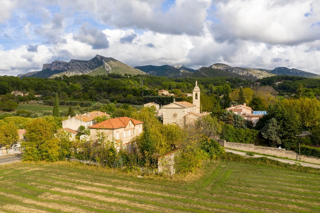
With Calanques National Park to the south and the Garlaban massif to the north, Aubagne is a superb vacation destination for avid hikers. Aubagne is an attractive town with plenty of natural beauty, having won several awards in the Concours des villes et villages fleuris (Competition of Cities and Villages in Bloom).
Aubagne is also a lively town with a strong cinematic heritage. It hosts festivals year-round, including the International Film Festival of Aubagne, which is rated one of the top 20 film festivals in France. Popular hotels in Aubagne include the Best Western Linko Hôtel, Campanile Marseille Est, and Le Relais D'Aubagne.