
Scan the QR code and open PeakVisor on your phone
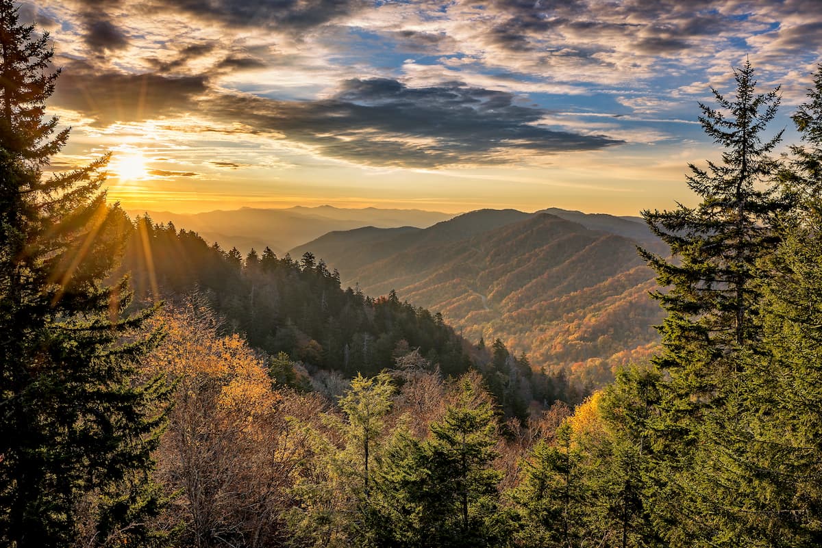
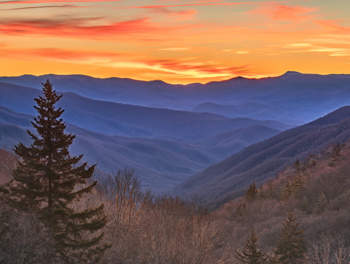
With plentiful opportunities for outdoor recreation, the Cherokee National Forest is home to some of the best mountain scenery and wildlife sighting opportunities in the US states of Tennessee and North Carolina. The forest contains 257 named mountains, the highest and most prominent of which is Roan High Knob (6,283ft/1,915m).
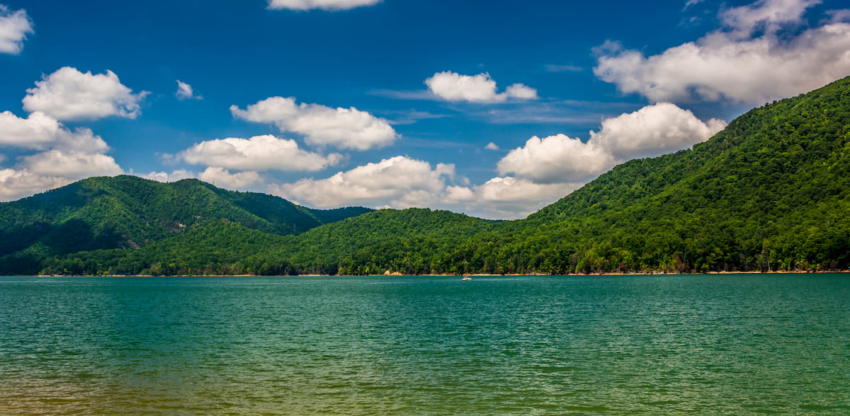
Cherokee National Forest is located along the border between the US states of Tennessee and North Carolina, though most of the forest is in Tennessee. In total, the forest covers some 655,598 acres (265,311 ha) of land, including the vast majority of the Tennessee side of the border from Virginia in the north to Georgia in the south.
Cherokee National Forest happens to be the largest area of public land in the state of Tennessee, far surpassing the size of other areas like the Big South Fork National River and Recreation Area and the Land Between the Lakes National Recreation Area, the latter of which is mostly in Kentucky.
The forest includes parts of McMinn, Washington, Polk, Sullivan, Carter, Monroe, Greene, Unicoi, Johnson, and Cocke counties in Tennessee as well as a section of Ashe County in North Carolina. Cherokee National Forest can be split into 2 separate sections, a northern and a southern section, which are divided by the Great Smoky Mountains National Park.
Cherokee National Forest is located in one of the most mountainous parts of Tennessee and North Carolina and, as such, it is situated next to a number of major areas of public land.
In particular, Cherokee National Forest is located to the north of the Chattahoochee-Oconee National Forest (Conasauga District) and the Cohutta Wildlife Management Area. It is also situated to the west of Pisgah National Forest, Nantahala National Forest, Great Smoky Mountains National Park, and Lamar Alexander Rocky Fork State Park.
Meanwhile the Jefferson National Forest, George Washington National Forest, and Grayson Highlands State Park form Cherokee National Forest’s northern border. Finally, the western part of the forest bottoms out at the low-lying region surrounding the Tennessee River Valley.
Within the Cherokee National Forest, there are a number of major protected areas. These include the forest’s 11 official wilderness areas:
While most of these wilderness areas are located wholly within Cherokee National Forest 2 of them, including Big Frog Wilderness, Cohutta Wilderness, are also partially located within Chattahoochee-Oconee National Forest, while the Joyce Kilmer-Slickrock Wilderness is also partially situated within the Nantahala National Forest.
The mountains within the Cherokee National Forest are part of the Blue Ridge Mountains, which is a subsystem of the Appalachian Mountains which runs from Georgia to the border between Maryland and Pennsylvania to the east of the Appalachian Ridges and Appalachian Plateaus.
Within Cherokee National Forest, there are a number of Blue Ridge Mountain subranges, including the Unaka Mountains, the Great Smoky Mountains, the Newfound Mountains, and the Unicoi Mountains.
Although each of these subranges boasts their own unique geologic history, they have a shared ancestry as part of the Blue Ridge Mountains. For the most part, the Blue Ridge Mountains are composed of metamorphic and meta-sedimentary rocks, though some sedimentary rocks and igneous intrusions do exist in relatively small numbers throughout the region.
The Blue Ridge Mountains are particularly rich in natural resources, such as feldspar, copper, and mica, all of which were mined in the region in years past.
Moreover, the mountains in and around Cherokee National Forest started to form between 1.1 billion and 250 million years ago through the Grenville and Alleghenian orogenies. Indeed, the Blue Ridge Mountains and many of the landforms we see today in the Cherokee National Forest are the remnants of an ancient mountain range which likely once surpassed the Alps and Himalaya in size before being eroded down to their current shapes.
Major peaks in the forest include Roan High Knob, Big Bald, Big Frog Mountain, Bean Mountain, Hall Mountain, and Gravel Knob.
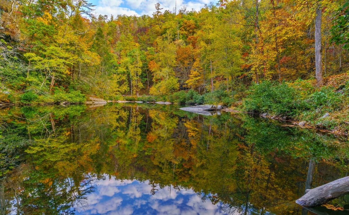
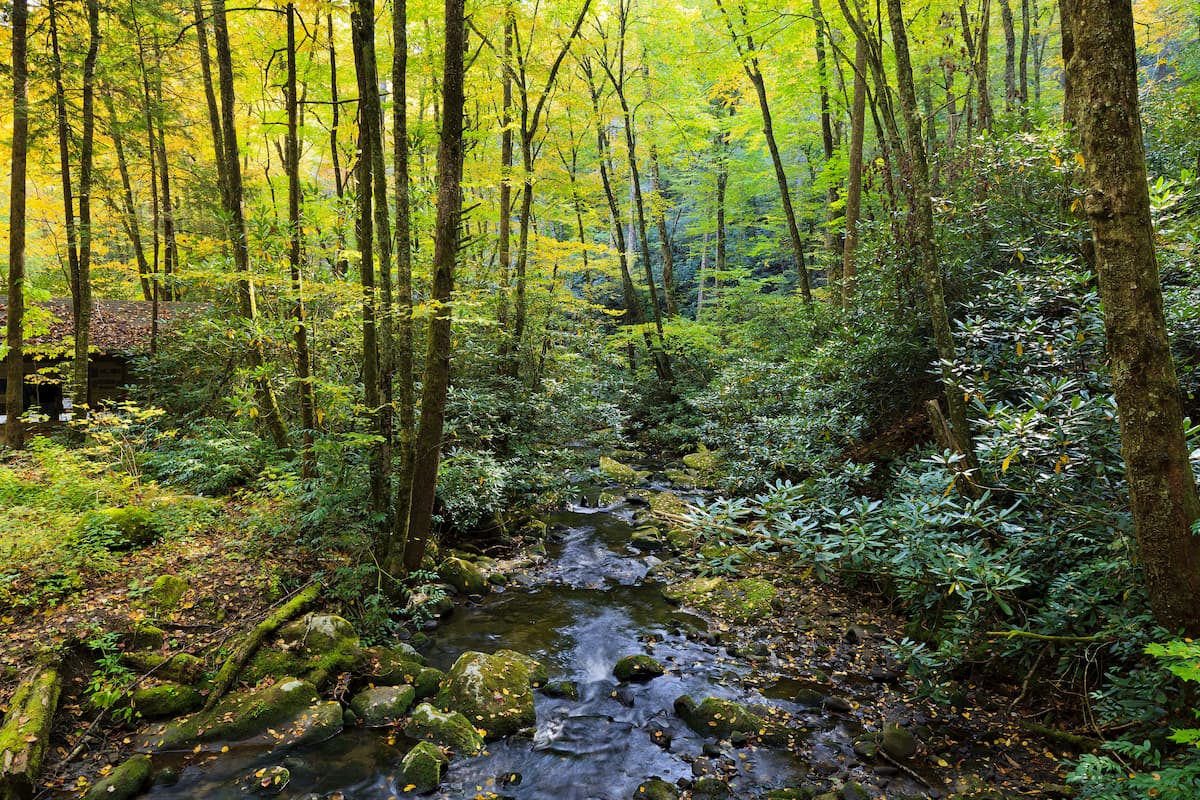
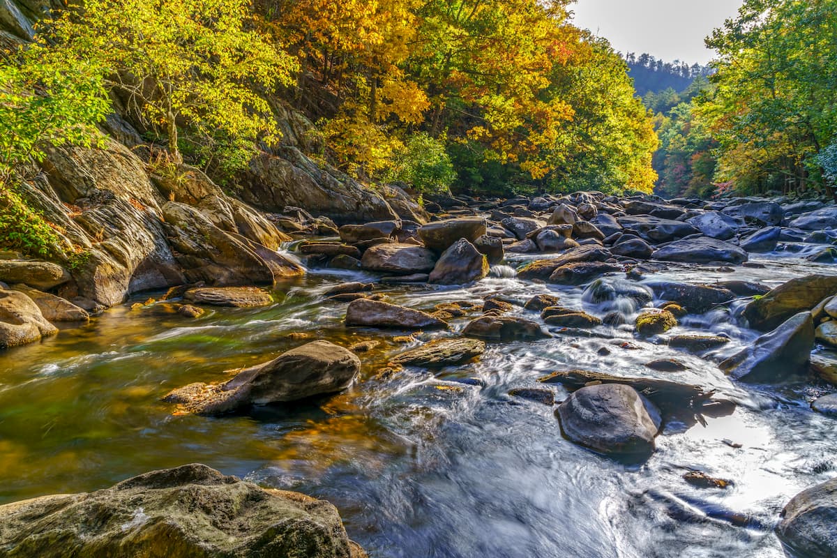
Cherokee National Forest is home to some exceptional scenery and a plethora of flora and fauna.
The composition of the woodlands in Cherokee National Forest depends greatly on your elevation, though you can find stands of mixed oak forests at lower elevations and some spruce-fir forests at the highest parts of the region.
Moreover, the Cherokee National Forest exists almost completely within the Appalachian-Blue Ridge forests ecoregion, which is considered to be one of the most biodiverse temperate forests on Earth.
Wildlife watching in Cherokee National Forest is particularly fantastic as the region is home to a wide array of mammals, amphibians, birds, reptiles, and fish. Some of the most notable mammals in the forest include black bears, bobcats, white-tailed deer, foxes, coyotes, raccoons, and opossums.
Meanwhile, reptiles in the forest include eastern box turtles, common snapping turtles, southeastern five-lined skink, and 2 venomous snakes: the timber rattlesnake and the northern copperhead. There are many different amphibians found in the forest, including the hellbender and the Jordan’s salamander.
When it comes to bird life, the Cherokee National Forest doesn’t disappoint. There are enough bird species here, such as juncos, eagles, peregrine falcons, cardinals, and turkey vultures to keep even the keenest of ornithologists happy.
Although many often think of the land that is now the Cherokee National Forest as a wild and remote landscape, this region has long been home to humans.
Indeed, humans have lived in and around these mountains for thousands of years and the land is the traditional territory of the Cherokee, including the ancestors of the Eastern Band of Cherokee Indians who were able to remain in the region even after the passage of the 1830 Indian Removal Act.
European visits to the region started in the mid-16th century when Hernando de Soto of Spain travelled around what is now the southeastern United States. In the aftermath of the French and Indian War in the late 18th century, settlers of European descent began to flock to the area, though they mostly settled in the lower-lying and more fertile areas of the Tennessee Valley to the west.

The discovery of gold in the southeastern states in the early part of the 19th century eventually led to the forced and violent removal of tens of thousands of Indigenous peoples from their ancestral homelands in and around Cherokee National Forest. Most of the Cherokee (alongside many other tribes) were forced to walk along what is now known as the Trail of Tears to Oklahoma.
Although some of the Cherokee were able to remain and their descendents are the Eastern Band of Cherokee Indians of the Qualla Boundary in Cherokee, North Carolina, many more were forced to go to Oklahoma, which is why the Cherokee Nation is headquartered so far from their ancestral homelands.
The Cherokee Forest itself has its roots in the early 20th century, after the passage of the Weeks Act of 1911. This act gave the federal government permission to acquire various parcels of private land in the eastern United States in order to better manage them for the purpose of resource conservation.
The Cherokee National Forest was officially designated and during the 1930s, the forest was the site of a number of major Civilian Conservation Corps (CCC) projects.
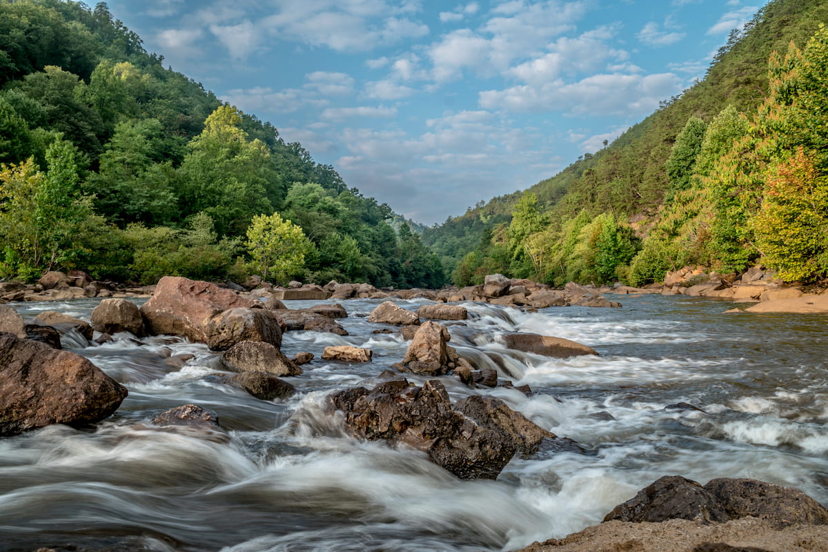
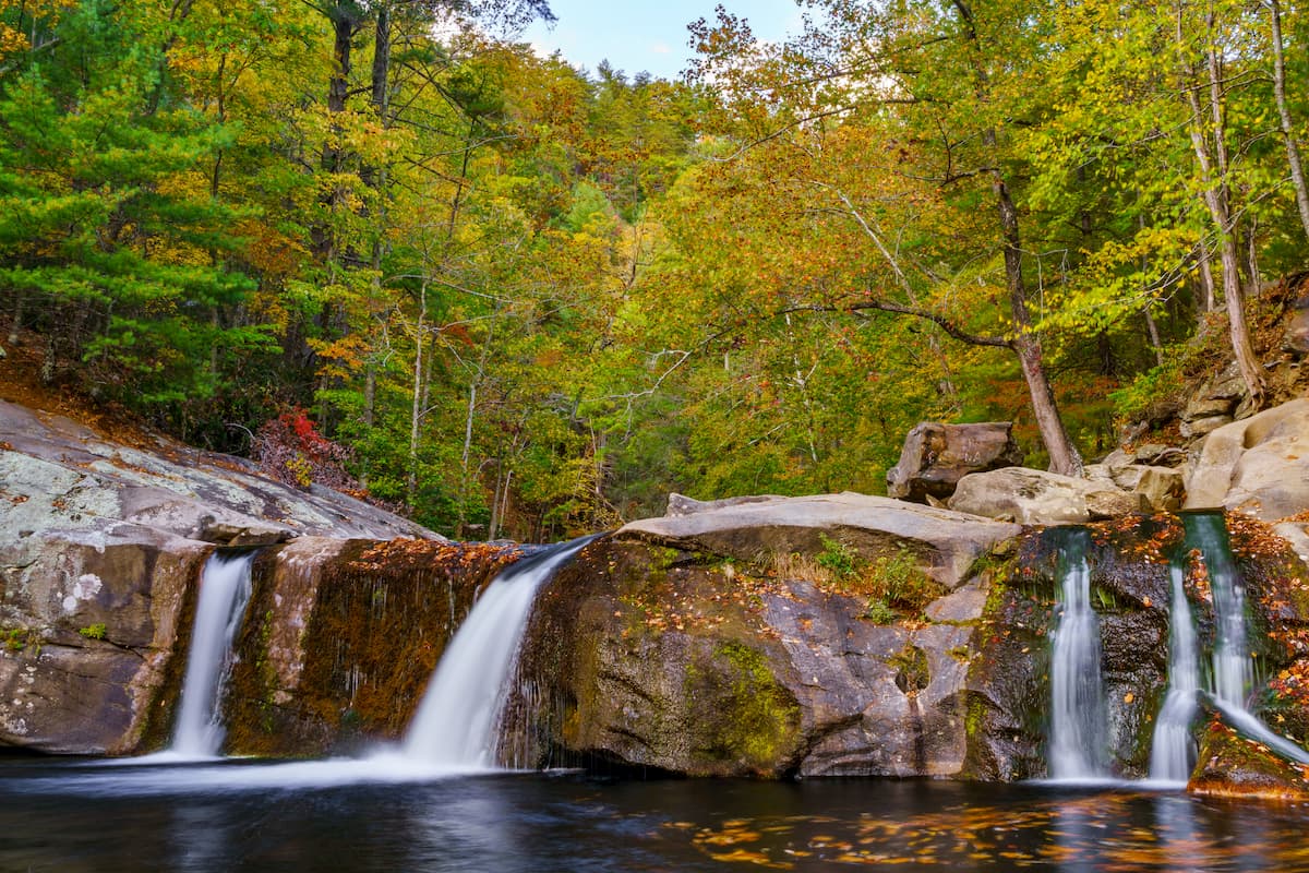
Perhaps the most notable recent event in recent Cherokee National Forest history was that the forest’s Ocoee Whitewater Center was the site of the Olympic whitewater events during the 1996 Summer Olympics in Atlanta (the XXVI Olympiad). While the river itself is natural, it’s important to note that quite a bit of engineering was required to create the slalom course required for the Olympics.
To this day, the Ocoee Whitewater Center remains a popular outdoor recreation destination, as does the rest of the forest. Within Cherokee National Forest, there are hundreds of miles of trails and dozens of campgrounds for visitors to enjoy.
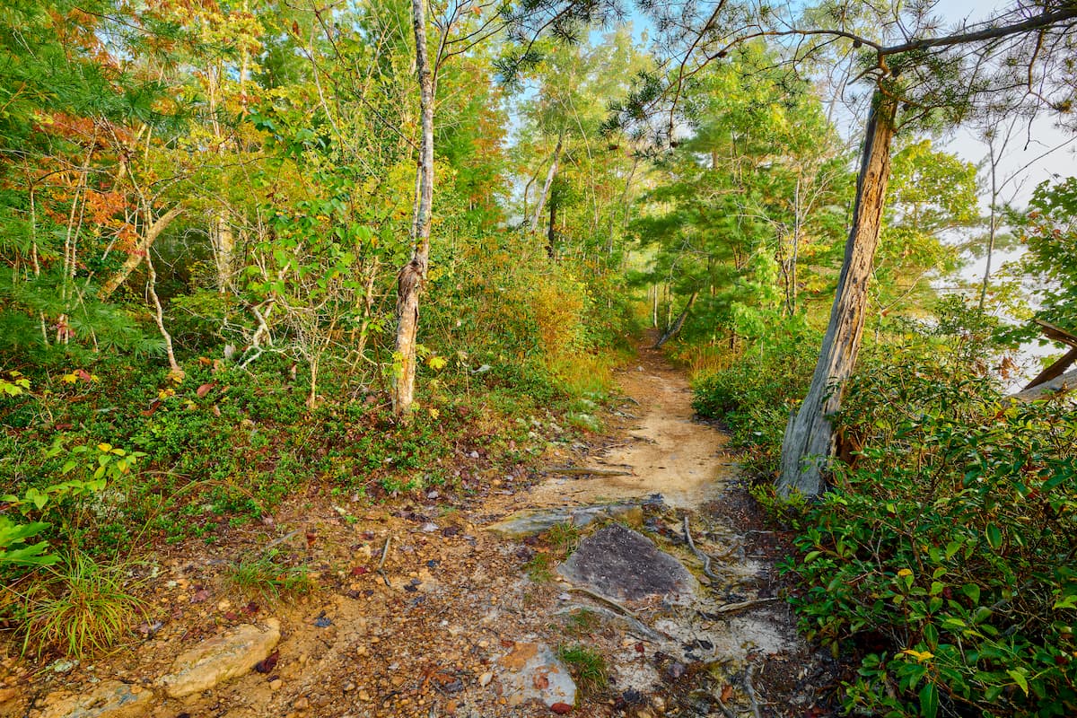
Looking for a place to adventure in the Cherokee National Forest? Check out these great hiking and recreation destinations.
One of the oldest long-distance trails in the United States, the Appalachian Trail passes through the Cherokee National Forest for about 150 miles (241.4km) on its way from Springer Mountain, Georgia to Mount Katahdin, Maine.
In Cherokee National Forest, the trail provides excellent views of the surrounding region, especially of the Unaka Mountains. The trail enters Cherokee National Forest from the northern border of Great Smoky Mountains National Park and, for the most part, stays within the forest’s boundaries until it enters the Lewis Fork Wilderness in Virginia.
Visitors can consider hiking the entirety of the Cherokee National Forest section of the trail or you can use the trail as an access point to check out other shorter day hikes and backpacking trips in the region.
Not to be confused with the John Muir Trail (JMT) in California’s Sierra Nevada, which travels through Yosemite, Kings Canyon and Sequoia National Parks, the John Muir Recreation Trail (Forest Service Trail #152) is a 20.7 mile (33.3km) long trail that follows the Hiwassee River for much of its length.
The trail was actually constructed in the 1970s by the Youth Conservation Corps as a community service project. It was intended to follow a path similar to the one that John Muir took when he walked from Kentucky to Florida, as is detailed in his book A Thousand Mile Walk and it makes for a nice day hike or short backpacking trip.
Named for Benton MacKaye, an influential forester and the person who first proposed the idea for the Appalachian Trail, the Benton MacKaye Trail (BMT) is a 300 mile (480km) long hiking trail that travels from Springer Mountain, Georgia to Davenport Gap in Great Smoky Mountains National Park.
Although the trail shares a starting point with the Appalachian Trail (AT), it is a completely separate hike that shares just the first few miles of its journey with the AT.
Unlike the AT, which heads northeast from Springer Mountain to the Nantahala National Forest, the BMT heads northwest through the Cherokee National Forest. The trails intersect just south of Great Smoky Mountains National Park but the BMT stays in North Carolina as it traverses the park while the AT follows the Tennessee-North Carolina border.
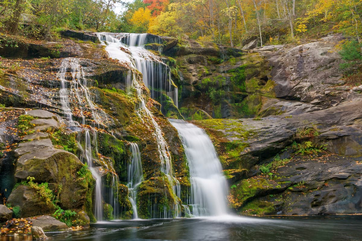
Whether you’ve already hiked the Appalachian Trail or you’re simply looking for an adventure that’s a bit off the beaten path, a hike of the Benton MacKaye Trail (BMT) is a sure bet for anyone that enjoys stunning mountain views and raging waterfalls.
Located in the southern section of the Cherokee National Forest along the border of North Carolina and Tennessee, the Joyce Kilmer-Slickrock Wilderness is a popular destination for outdoor recreation. It contains 10 named mountains, the highest and most prominent of which is Stratton Bald.
The wilderness was named after Joyce Kilmer, the renowned author who wrote the poem “Trees.” These days, it is home to one of the largest areas of old growth forest in the eastern United States and some of the trees in the wilderness are more than 400 years old.
There are plenty of great trails to check out in the wilderness, including the Slickrock Creek Trail, the Ike Branch Trail, the Big Fat Gap Trail, and the Memorial Loop Trail.
The Cohutta Wilderness is located in both the Cherokee National Forest and the Chattahoochee-Oconee National forest. It is home to 11 named mountains, the highest and most prominent of which is Big Frog Mountain.
The wilderness is one of the most popular recreation areas in the region and the Benton MacKaye Trail apsses through it on its way into the rest of the Cherokee National Forest. There are also many other great hiking trails to check out, including the Horseshoe Bend, Hickory CReek, Rice Camp, Hickory Ridge, and East Cowpen trails.
Although it’s not technically a major hiking destination, the Ocoee Whitewater Center is certainly worth including in our list due to its status as a watersports hub in the region. The center is located in the southernmost part of the Cherokee National Forest, near the North Carolina-Tennessee-Georgia border.
In the summer months, the center has scheduled water releases for boaters, but there plenty of outfitter services in the area that offer guided rafting trips if you’re not already an experienced whitewater paddler.
The center also provides great access to some nearby trails, including the riverside Rhododendron Trail and the 30 mile (48.2km) long Tanasi Trail System. Although there’s no campground at the center, there is a day-use picnic area and a gift shop for visitors to enjoy.
Here are some of the best places to stay before or after your trip into Cherokee National Forest:
Asheville is a bustling city of about 90,000 residents in the western region of North Carolina. It is a popular destination for outdoor lovers due to its proximity to the area’s many national forests and parks. Moreover, Asheville has good road and air connections to the surrounding region.

Situated to the west of the Cherokee National Forest, Knoxville is a city of some 187,000 residents that's a cultural and commercial hub for eastern Tennessee. The city is the location of the University of Tennessee’s main campus and it has a large airport which serves as a transportation center for the region.

Chattanooga is located to the west of the Cherokee National Forest along the Tennessee River. It has about 180,000 residents and it is a popular tourist destination thanks.
The city is just a short drive from Great Smoky Mountains National Park, as well as the Cherokee National Forest and its location along a number of major highways make it a great transport hub for visitors for anyone looking to visit eastern Tennessee.

Although it’s located a decent distance to the south of Cherokee National Forest, the city of Atlanta is the capital and most populous city in Georgia as well as a major commercial center in the region. The city also happens to be home to the busiest airport in the world by passenger traffic, so it’s a great starting point for visitors traveling from further afield.


southern-appalachian-6000ers
nc-5000ers
tennessee-4500ers
south-beyond-6000
southern-appalachian-6000ers
nc-5000ers
tennessee-4500ers
south-beyond-6000


