
Scan the QR code and open PeakVisor on your phone
The Newfound Mountains include 207 named peaks. The highest is Crabtree Bald at 1,621 m. Other notable peaks include Sandymush Bald, Crab Orchard Fields and Little Sandymush Bald.
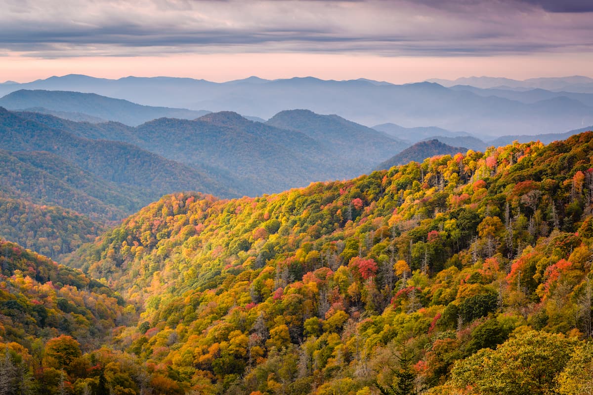
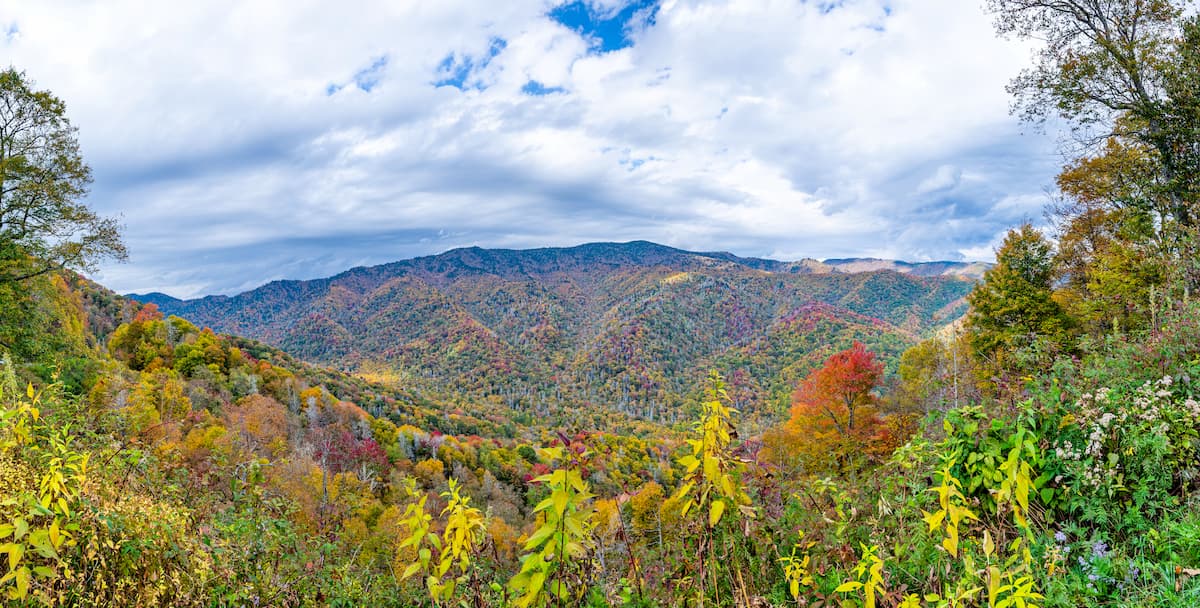
Home to a small collection of prominent peaks and rolling hills, the Newfound Mountains are a subrange of the Appalachian Mountains located along the border of the US states of North Carolina and Tennessee. The range contains 149 named mountains, the highest and most prominent of which is Crabtree Bald (5,292ft/1,613m).
Forming the central part of the border between the states of North Carolina and Tennessee, the Newfound Mountains are one of many subranges of the Appalachian Mountains in the region. It is contained within parts of Cocke County, Tennessee and within parts of Buncombe, Madison, and Haywood counties in North Carolina.
The range is located within a heavily mountainous section of the United States within the Blue Ridge Mountains geological province. It forms a boundary between the Great Smoky Mountains and the Unicoi Mountains to the south, as well as the Walnut Mountains, Black Mountains, and Unaka Mountains to the north.
Moreover, the Newfound Mountains are situated to the west of the Great Balsam Mountains, the Plott Balsams, the Great Craggy Mountains, and the Alarka Mountains. They are bordered to the west by the relatively low-lying plains of the Tennessee River, which separates the range from the Appalachian Plateaus, the Appalachian Ridges, the Cumberland Mountains, and the Cumberland Plateau to the west.
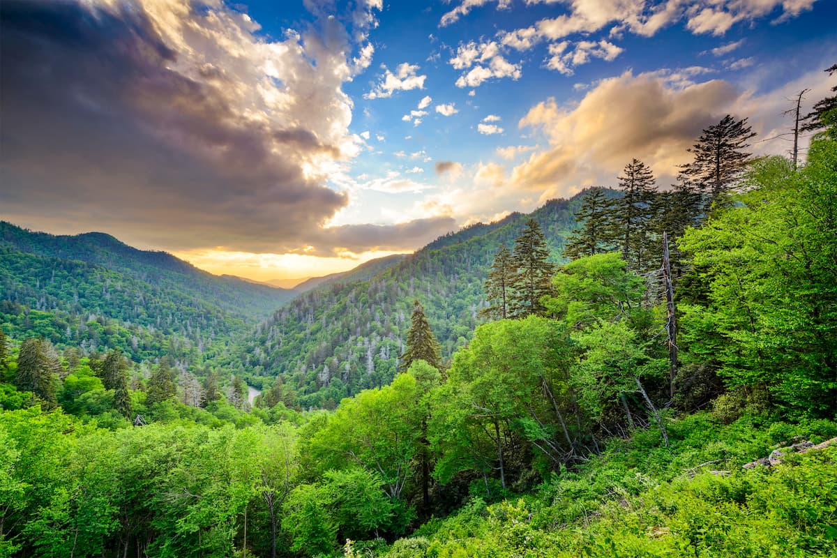
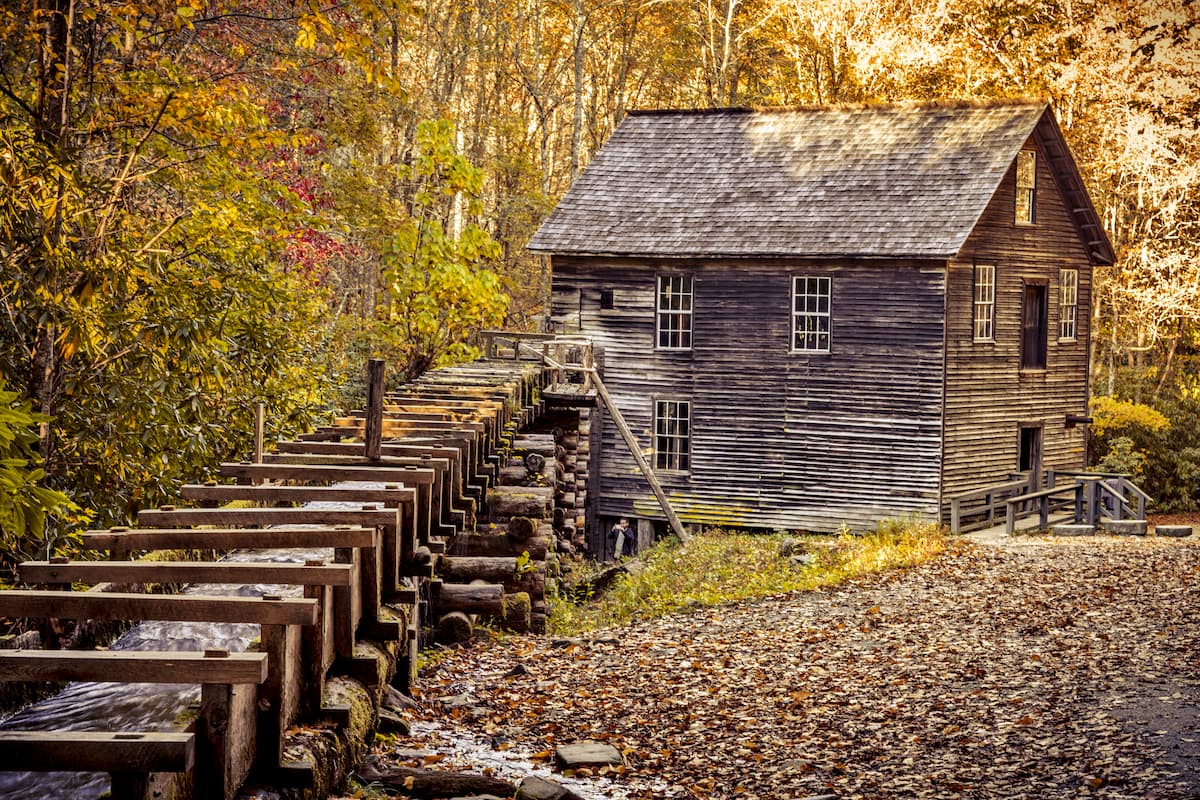
Unlike their neighbors to the south, the Great Smoky Mountains, which are contained almost entirely within the Great Smoky Mountains National Park, the Newfound Mountains are located on a patchwork of private and public lands. There are a number of smaller parks in the range, including the Sandy Mush Community Center and parts of the Cherokee National Forest.
From a geological perspective, the Newfound Mountains are a subrange of the Blue Ridge Mountains, which is itself a subrange of the Appalachian Mountains. While the Appalachian Mountains extend from the state of Alabama all the way to the province of Newfoundland and Labrador in Canada, the Blue Ridge Mountains cover a slightly smaller area from northern Georgia to the western panhandle of Maryland.
The Blue Ridge mountains are what’s known as a geologic or physiographic province. Within the Blue Ridge Mountains, and subsequently, the Newfound Mountains, the majority of the bedrock is sedimentary or metasedimentary in origin, such as genesis, quartzites, shists, and slates.
The mountains within the range formed during the course of a number of different mountain building events, including the Grenville orogeny and the Alleghenian orogeny, approximately 1.1 billion to 250 million years ago.
Major highpoints in the range include Crabtree Bald, Sandymush Bald, Big Butt Mountain, Mary Knob, and Bluff Mountain.
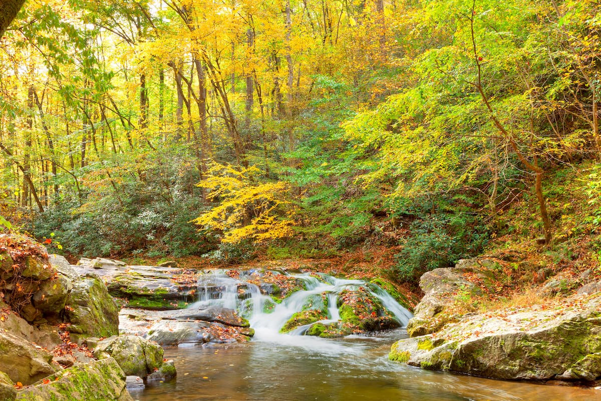
The Newfound Mountains are located within the Blue Ridge Mountains ecoregion, which, according to the World Wildlife Fund, is one of the most biodiverse broadleaf woodlands in the world.
Hundreds of animal and plant species call the region home. The lowest elevation sections of the range are dominated by mixed oak forests. Meanwhile, the mid-elevations are home to spruce-fir forests, particularly above 4,400 feet (1,350m) and the very highest parts of the range have some red spruce, balsam fir, and fraser fir.
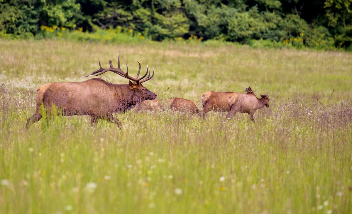
Wildlife in the Newfound Mountains includes the typical mammals found in the southern Appalachians, such as black bears and white-tailed deer, as well as wild boar, though the latter are an introduced species in the region.
The Newfound Mountains and the surrounding region have long been home to humans. Within the range, the area is considered the ancestral homelands of the Cherokee, particularly the Eastern Band of Cherokee Indians, whose ancestors lived in the area long before the arrival of non-Indigenous colonizers in the 16th through 18th centuries.
After the French and Indian War ended in 1763, settlers of European descent started to colonize the region, instigating conflict with the Cherokee, whose people had lived in the range for thousands of years.
This conflict ultimately culminated in the passage of the Indian Removal Act in 1830 by President Andrew Jackson, which forcibly and brutally removed tens of thousands of Indigenous peoples from the Newfound Mountains and the surrounding region along what is now known as the Trail of Tears.
After the removal of Indigenous peoples from the area, the region was developed and heavily logged, particularly in and around the Great Smoky Mountains to the south. This over-logging eventually led to the establishment of the Cherokee National Forest in 1920, which contains a substantial portion of the Newfound Mountains, and the Great Smoky Mountains National Park to the south in 1940.
These days, Cherokee National Forest is managed under the US Forest Service’s motto of “Land of Many Uses,” which allows for both outdoor recreation and resource extraction.
The Newfound Mountains are mostlylocated within a small section of the Cherokee National Forest between the Great Smoky Mountains to the south and the Unaka Mountains to the north. Within this section of the forest, there is one very popular hiking destination: the Appalachian Trail.
Within the Newfound Mountains, there is a section of the trail that runs from just south of I-40, past the northern boundary of the range into the Unaka Mountains, where the section terminates along US Highway 19W.
It starts just north of Great Smoky Mountains National Park and follows the crest of the Appalachian Mountains, mostly along the border between Tennessee and North Carolina.
Although it’s possible to just hike this section of the trail, many section hikers choose to start at the southern edge of Great Smoky Mountains National Park, as it’s considered one of the most beautiful sections of the southern part of the trail. Keep in mind that you will need permits to hike the trail in the national park. You can get more detailed information about permits and regulations in Cherokee National Forest from the forest service website.
Here are some of the best places to stay during your trip to the Newfound Mountains:
Knoxville is home to over 187,000 people, which makes it the largest city in East Tennessee. It is located just to the west of the Newfound Mountains and it is the location of the main campus of the University of Tennessee.

The city is also one of the largest in Appalachia and it is often considered a gateway to Great Smoky Mountains National Park to the south of the Newfound Mountains. It is well connected by highway, including on I-40, which travels just south of the Newfound Mountains, and it has a busy airport with service to destinations around the United States.
The city of Asheville is situated to the east of the Newfound Mountains. It has a population of over 92,000 people, which makes it the largest in the western region of North Carolina.

Asheville is a popular outdoor recreation destination, thanks to its proximity to the southern Blue Ridge Mountains. You can get to Asheville by road along I-40 or I-26, or by air via the Asheville Regional Airport.


The highest peak in the Newfound Mountains is Crabtree Bald, at 1,621 m.
The Newfound Mountains have 207 named peaks.


