
Scan the QR code and open PeakVisor on your phone
The Great Balsam Mountains include 312 named peaks. The highest is Richland Balsam at 1,951 m. Other notable peaks include Lickstone Ridge, Black Balsam Knob and Mount Hardy.
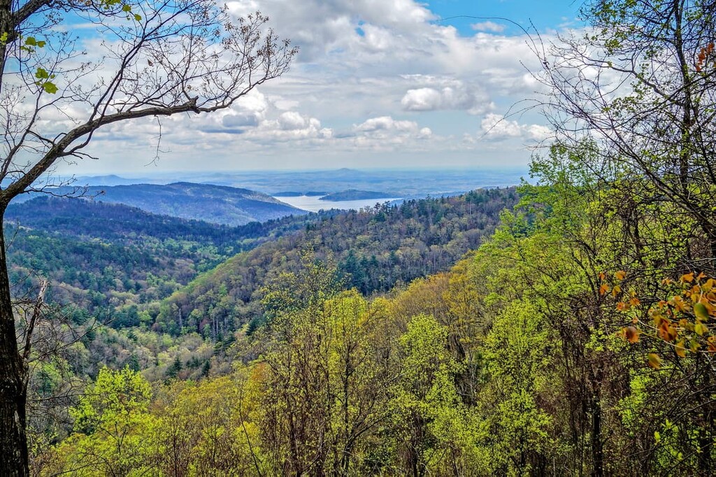
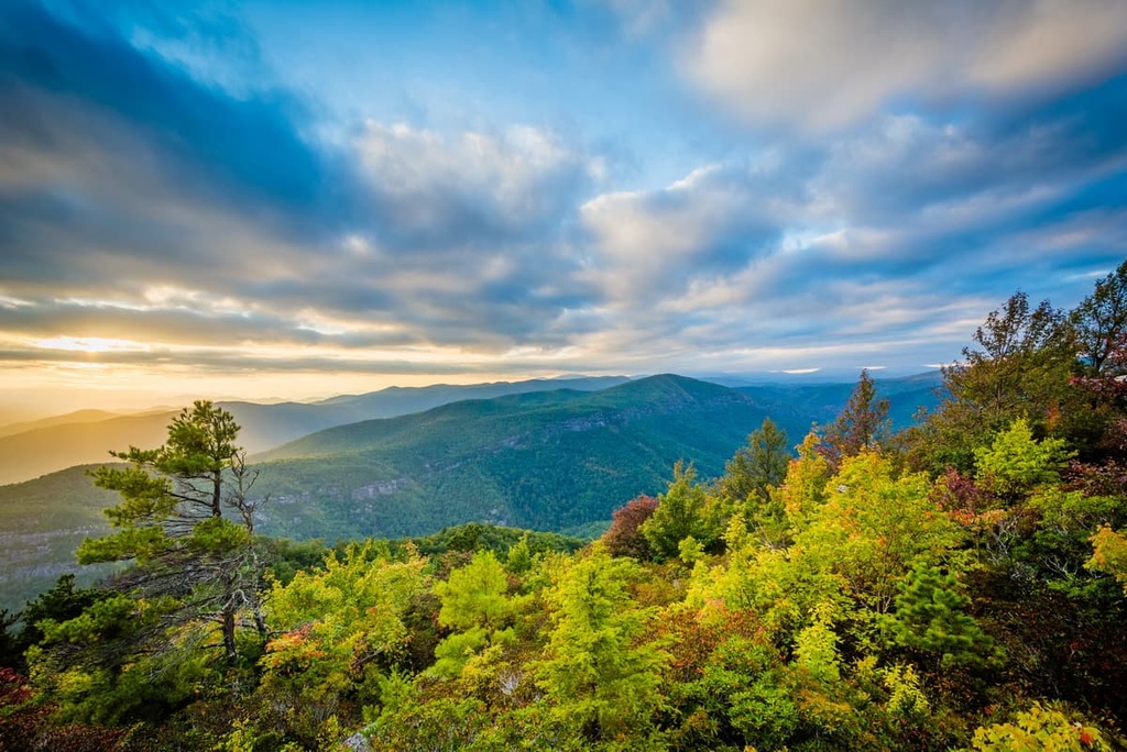
Home to rugged ridges and dense forests, the Great Balsam Mountains is a subrange of the Blue Ridge Mountains that’s located in the southwestern part of the US state of North Carolina near the state’s border with South Carolina and Georgia. There are 312 named mountains in the range, the highest and most prominent of which is Richland Balsam (6,410 ft/1,951 m).
Also known simply as the Balsam Mountains, the Great Balsam Mountains are a major subrange of the Blue Ridge Mountains.
They are located in the southwestern part of the US state of North Carolina in Buncombe, Henderson, Transylvania, Haywood, and Jackson counties. Additionally, the range is situated to the east of the Qualla Boundary, which is a territory of the Eastern Band of Cherokee Indians, and the range is located just to the north of the state’s borders with South Carolina and Georgia.
The Great Balsam Mountains are not a linear mountain range. Rather, they form a somewhat trapezoidal shape that’s about 21 miles (34 km) long and 18 mi (29 km) wide. They cover a large swath of land between the city of Asheville to the northeast, the town of Franklin to the southwest, the town of Rosman to the southeast, and the cities of Wanyesville and Canton to the northwest.
For the most part, the Great Balsam Mountains are surrounded by other subranges of the Blue Ridge Mountains.
This includes the Cowee Mountains and Saluda Mountains to the south, the Great Smoky Mountains and the Alarka Mountains to the west, the Newfound Mountains to the northwest, and the Black Mountains and Unaka Mountains to the northeast. Meanwhile, the rest of the Blue Ridge Mountains and the Piedmont–Southeast Coast are located to the east of the range.
Although the range is not located along the main crest of the Blue Ridge Mountains (the crest is situated to the west and is dominated by the Great Smoky Mountains), the Great Balsam Mountains are home to a handful of excellent outdoor recreation destinations.
In particular, the range contains parts of the Nantahala National Forest (Nantahala Ranger District) and the Pisgah National Forest. Within the Pisgah National Forest, the range also contains the Shining Rock Wilderness and the Middle Prong Wilderness.
The Blue Ridge Parkway, which runs for 469 miles (755 km) and is a linear park managed by the National Park Service, also traverses the Great Balsam Mountains. The road actually runs over Richland Balsam, the highest point in the range, at milepost 431. Richland Balsam is the highest point on the entire parkway and the views from its summit are second to none.
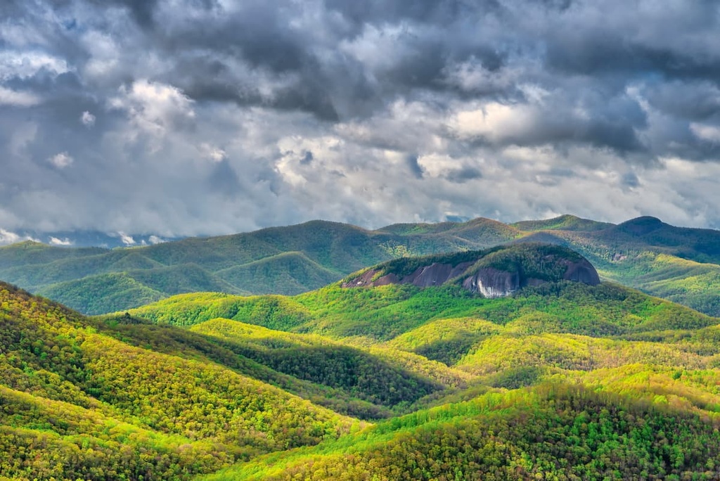
However, the most famous peak in the range is arguably Cold Mountain in Pisgah National Forest, not Richland Balsam.
Cold Mountain was used as the main story location in Charles Frazier’s 1997 novel Cold Mountain. The novel was later adapted into a film in 2003, but, interestingly enough, the movie was filmed in Romania’s Carpathian Mountains instead of in the Great Balsam Mountains.
But, perhaps most importantly, Cold Mountain was given its very own beer, the Cold Mountain Winter Ale, by the Ashville-based Highland Brewing Company. The beer was produced in partnership with the local Southern Appalachian Highlands Conservancy and a portion of the beer’s sales go toward conservation efforts.
For a true Great Balsam Mountains adventure, you can hike the 30.1 mi (48.4 km) Art Loeb Trail to the summit of Cold Mountain and enjoy a refreshing Cold Mountain Winter Ale at the campground after your adventure. (As always, please drink responsibly!)
Geologically, the Great Balsam Mountains are a part of the Blue Ridge Mountains, which are, in turn, a subrange of the Appalachian Mountains. The Blue Ridge Mountains run roughly from northern Georgia to southern Pennsylvania while the Appalachians extend from northern Alabama all the way to the province of Newfoundland and Labrador in Canada.
The geologic history of the Great Balsam Mountains, therefore, is heavily intertwined with that of the rest of the Blue Ridge Mountains.
For the most part, the Blue Ridge mountains started to form during the Grenville and Alleghenian orogenies, which took place about 1.1 billion to 250 million years ago. This makes the Great Balsam Mountains, alongside the rest of the Appalachians, among the oldest remaining mountain ranges on the planet.
The rocks in the region are primarily metamorphic in origin. Much of the Great Balsam Mountains is dominated by hornblende gneiss, mica schist, and minor amphibolite, as well as biotite-garnet gneiss and quartz. There are also occasional igneous intrusions and plutons, but most of the region is Proterozoic and Phanerozoic aged metamorphic rock.
Major peaks in the range include Richland Balsam, Black Balsam Knob, Mount Hardy, Reinhart Knob, Sam Knob, Mount Pisgah, and Cold Mountain.
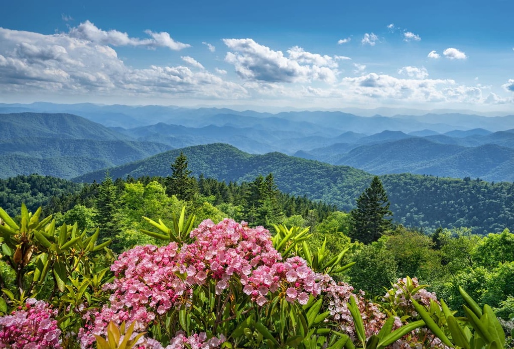
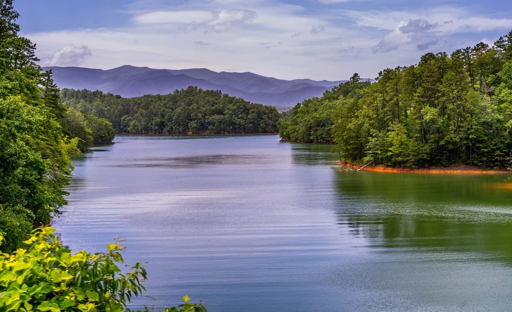
Nestled in the heart of the southern Blue Ridge Mountains, the Great Balsam Mountains are a true haven for biodiversity. The range itself also serves as a critical wildlife corridor that connects Great Smoky Mountains National Park to the west and the Nantahala National Forest to the east.
As is the case with most of the rest of the Blue Ridge Mountains, the Great Balsam Mountains contain a range of ecological zones.
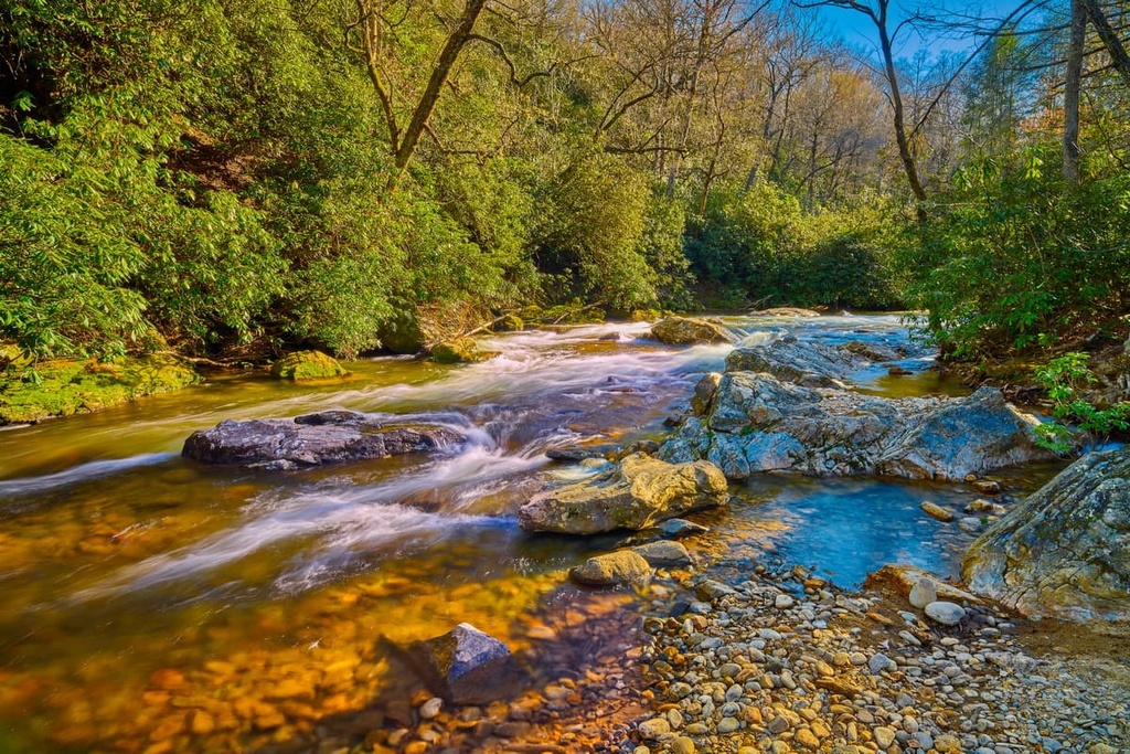
The lowest elevations of the range are dominated by flood plains and bogs near major rivers while other areas are home to hardwood forests such as oak-hickory woodlands, oak-chestnut woodlands, and shortleaf pine-oak heath. You can also find tree species such as red maple, eastern hemlock, American beech, and black locust in the range.
There are also some smaller sections of spruce-fir woodlands in the range. However, these forests only exist above around 5,500 feet (1,676 m) in elevation, so there aren’t many of them in the Great Balsam Mountains. At these higher elevations, the forests are primarily home to red spruce and Fraser fir.
That said, while there are a handful of old-growth forests left in the region, primarily in the more remote parts of Pisgah National Forest, the vast majority of the Great Balsam Mountains were logged during the last century. According to the Southern Appalachian Highlands Conservancy, there are only about 3,000 acres (1,214 ha) of old-growth forests left in the range.
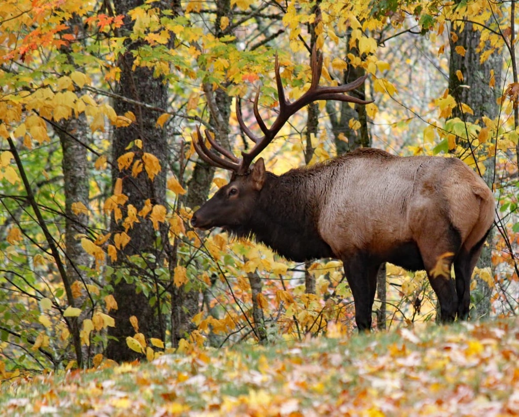
Wildlife in the range is similar to that of other nearby locations. You can find a range of mammal species, such as bobcats, coyotes, white-tailed deer, beavers, and black bears. There are also many different fish species found in the range’s waterways, including the rainbow trout, brown trout, and the native brook trout.
Humans have lived in and around the mountain range that is now called the Great Balsam Mountains since time immemorial. Researchers have uncovered archeological sites that date back at least 8,000 years to the people of the Paleo-Indian culture. In more recent millennia, the region became part of the traditional territory of the Cherokee people.
Although it’s unclear when the first Europeans traveled to the area of the Great Balsam Mountains, Hernando de Soto of Spain did venture to the greater Blue Ridge Mountains region during his 1540 expedition.
In the centuries that followed, a wave of settlers from western European countries, including the United Kingdom, began to arrive in what is now the Great Balsam Mountains. Many of these settlers brought enslaved Black people with them, too, in an attempt to farm and develop the land.
During the 1800s, however, the region saw an influx of settlers after the discovery of gold in nearby Georgia. This eventually led to the forced removal of Indigenous people from their ancestral homelands under the Indian Removal Act of 1830 and other laws.
As a result of the Indian Removal Act, which was signed into law by Andrew Jackson, tens of thousands of Indigenous people were forcibly removed from their homelands. In the area in and around the Great Balsam Mountains, the Cherokee were forced to march along what later became known as the Trail of Tears to what’s now Oklahoma.
Current citizens of the Cherokee Nation, which is currently headquartered in Oklahoma, are primarily descendants of the Cherokee who were forced to walk the Trail of Tears.
Meanwhile, the citizens of the Eastern Band of Cherokee Indians, which is a sovereign nation with a territory near the Great Balsam Mountains called the Qualla Boundary, are primarily descendants of the few Cherokee who were able to remain in the area after the Indian Removal Act.
In the decades that followed the Indian Removal Act, the region in and around the Great Balsam Mountains became a particularly popular destination for immigrants and for others looking for agricultural and mining opportunities.
By the late 1800s, the region also became an important area for conservation-focused forestry efforts and it is often considered to be the cradle of US Forestry.
In 1888, George Vanderbilt II purchased a large area of land near Asheville, which included Cold Mountain, and built a country estate with a huge mansion called the Biltmore House. Over the next decade, Vanderbilt expanded his estate by accumulating hundreds of thousands of acres of land.
Around this same time, Vanderbilt hired Gifford Pinchot to help manage the forests on his estate. In 1905, Pinchot became the first head of the newly created US Forest Service and Vanderbilt hired Carl Alwin Schenck to manage his land. Not long afterward, Schenck created the Biltmore Forest School, which became the first school of forestry in the US.
The real start to US forestry, however, came with the passage of the Weeks Act in 1911, which gave the US government the authority to buy forest land so that it could be managed by the US Forest Service. After the death of George Vanderbilt in 1914, his wife, Edith, sold the forest to the US Government, which was able to purchase the land thanks to the Weeks Act, for just $5 an acre.
Vanderbilt’s forest later became the Pisgah National Forest in 1916. The Nantahala National Forest was established just a few years later in 1920. Many decades later, as a result of the 1984 North Carolina Wilderness Act, the two wilderness areas in the range, the Shining Rock Wilderness and the Middle Prong Wilderness, were also formally designated.
There are also a number of smaller protected parcels of land in the range, such as the Dix Creek Tract and the Cold Mountain Game Lands. Most of these parcels were purchased by the Southern Appalachian Highland Conservancy and are either managed by the conservancy, other non-profits, or the North Carolina Wildlife Resources Commission.

Nowadays, the Great Balsam Mountains are home to some of the best outdoor recreation opportunities near the city of Asheville. The range is a popular hiking, biking, and paddling destination, especially for anyone that’s looking for solitude in the mountains.
The Great Balsam Mountains are one of the best hiking destinations in the greater Asheville region. Here are some of the best hiking areas to check out during your next trip to the range.
Pisgah National Forest encompasses a sizable swath of the northern and eastern Great Balsam Mountains, including the portions of the range that are located in the Shining Rock Wilderness Area and the Middle Prong Wilderness.
One of the best hiking areas in the Pisgah National Forest section of the range is Mount Pisgah itself. There are a number of hikes that lead to Mount Pisgah, though the Mount Pisgah Trail is arguably the most popular. It is 3.2 miles (5.1 km) long round-trip and it takes you from the Mount Pisgah Parking Area to the summit.
Other hikes in the Mount Pisgah region include the Buck Springs Trail (1.1 mi/1.8 km), Laurel Mountain Trail (7.4 mi/11.9 km), Shut-In Trail (16.3 mi/26.2 km), and the Frying Pan Trail (2.1 mi/3.4 km).
Additionally, the Great Balsam Mountains section of the Pisgah National Forest contains Cold Mountain, which is located in the Shining Rock Wilderness.
The best way to reach the summit is via the locally famous Art Loeb Trail which is 30.1 mi (48.4 km) Art Loeb Trail, which is a designated national recreation trail. Although it could be done as a very long day hike, most people hike the trail as a 2–3 day backpacking trip. It’s technically a section of the Mountains to Sea Trail, too, so you can also turn your adventure up Cold Mountain into a long-distance hiking journey.
A large portion of the southern Great Balsam Mountains is located within the Nantahala Ranger District of the Nantahala National Forest. Here, the landscape is dominated by mostly low-lying peaks and rugged valleys.
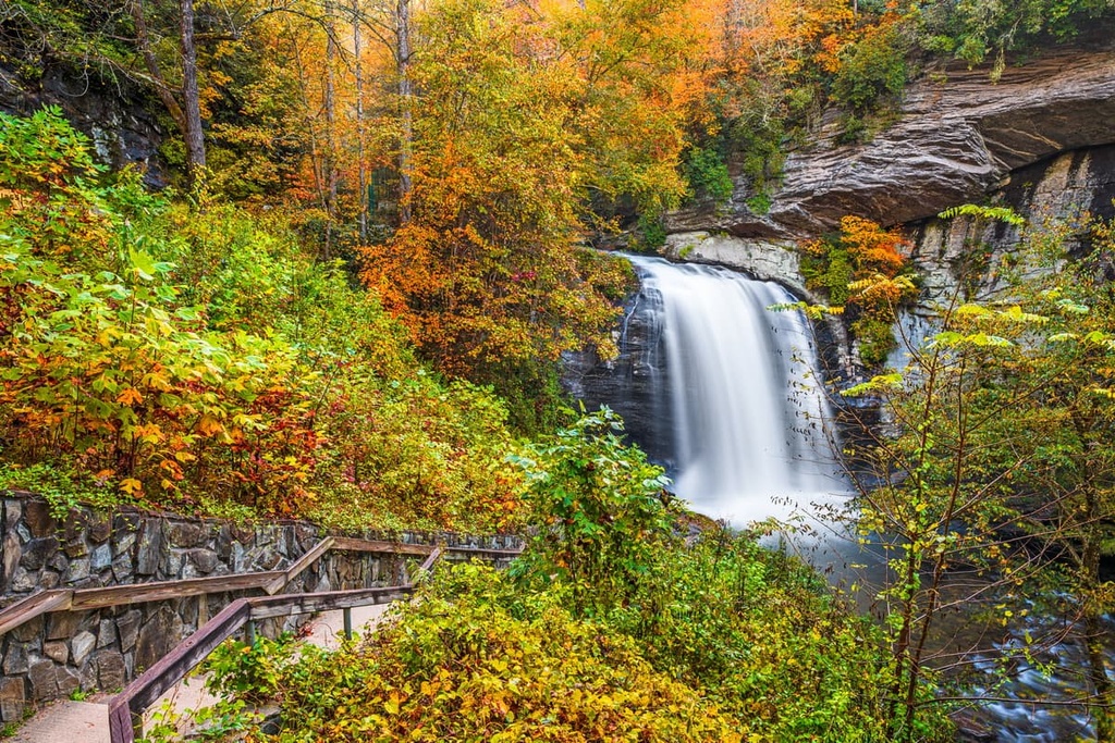
Technically, the Appalachian Trail crosses through the ranger district, but it passes to the west of the Great Balsam Mountains in the Southern Nantahala Wilderness. There are a few other hikes you can check out in the region, both in the Great Balsam Mountains and just adjacent to them, including the trails to Whitewater Falls, Standing Indian Mountain, and Kimsey Creek.
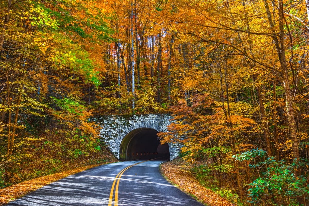
The Blue Ridge Parkway is a scenic drive that runs almost the entire length of the Blue Ridge Mountains from Great Smoky Mountains National Park in the south to Shenandoah National Park in the north. It is technically a linear park that’s managed by the National Park Service.
Soon after leaving Great Smoky Mountains National Park, the Blue Ridge Parkway enters the Great Balsam Mountains and traverses the range for about 42 miles (67.6 km). In fact, the highest point of the entire road is Richland Balsam, which is the highest peak in the range.
Although the park is mostly a road, it offers unparalleled access to some of the finest hikes in the Great Balsam Mountains.
There are a handful of great short trails in the range that depart from the road such as the Richland Balsam Trail (1.5 mi/2.4 km), the trail to the Roy Taylor Overlook (0.1 mi/160 m), the Bear Pen Gap Trail (0.2 mi/320 m), and the Devil’s Courthouse Trail (0.4 mi/640 m).
If you’re looking to spend the night in the Great Balsam Mountains, you have a number of accommodation options to choose from.
There is a slew of campgrounds located in and around the range, including the Mount Pisgah Campground on the Blue Ridge Parkway.
The Nantahala Ranger District of the Nantahala National Forest is also home to both the Standing Indian Campground and the Van Hook Glade Campground. Meanwhile, the Pisgah Ranger District of the Pisgah National Forest is home to the Lake Powhatan Campground, the North Mills River Campground, the Sunburst Campground, and the Wolf Ford Horse Camp.
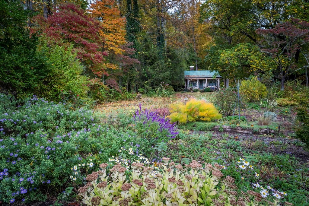
For the most part, rental cabins in and around the Great Balsam Mountains are privately owned. You may be able to find some cabins available for rental sites like Airbnb or VRBO if you’re looking for a comfortable mountain getaway in southwestern North Carolina.
Additionally, there are a handful of rental cabins available in the Nantahala National Forest. However, only the Balsam Lake Lodge is located in the Great Balsam Mountains. The lodge features 16 twin-sized beds and it has great access to the lake. You can make reservations either on Recreation.gov or by calling the local ranger offices.
Backcountry or “dispersed” camping is allowed at designated sites in the national forest lands within the Great Balsam Mountains. Dispersed camping means that you’re camping away from developed areas and that your campsite will not have a bathroom or other similar amenities so you must be self-sufficient during your stay.
In the Nantahala National Forest (Nantahala Ranger District), you can find dispersed campsites at the following locations:
Note that, even though some of these areas are called “campgrounds,” they don’t provide the amenities that you’ll find at the developed areas listed in the campgrounds section of this article.
Meanwhile, in the Pisgah Ranger District of the Pisgah National Forest, you’ll find dispersed camping opportunities in the Shining Rock Wilderness.
Keep in mind that campfires are not allowed while camping in the Shining Rock Wilderness and that you must use a bear canister for storing your food. Group sizes are also limited to 10 people in the wilderness. For more information, contact the local ranger offices.
Looking for a place to stay near the Great Balsam Mountains? Here are some of the best cities and towns to check out in the area.
Asheville is a city of some 95,000 people located just to the north of the Great Balsam Mountains. It is the largest city in the western part of North Carolina and it has long been known as a hub for outdoor recreation.
The city of Asheville is a bustling college town that’s home to about a dozen institutes of higher education, including the University of North Carolina at Asheville. It’s also the headquarters for the North Carolina Outward Bound School, which offers outdoor education expeditions for both young people and adults.
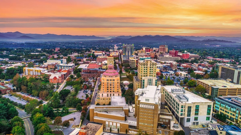
If you’re looking to venture into the northern part of the Great Balsam Mountains, Asheville is a great place to stay. The city is home to dozens of hotels and it has a lively restaurant and bar scene. Asheville is easily accessible by road and it has a small regional airport with good connections to major cities in the eastern and central US.
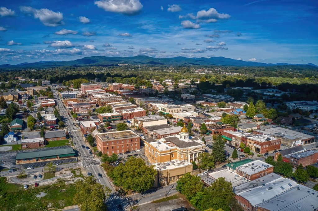
Hendersonville is a city that’s located to the east of the Great Balsam Mountains, approximately 22 miles (35 km) to the south of Asheville. It is home to about 15,000 people and is a hub for the southwestern part of the state.
The city features a number of museums and historic sites, including the Mineral and Lapidary Museum of Henderson County and the Western North Carolina Air Museum. Sierra Nevada Brewing Company also opened a brewery just to the north of the city that has become a popular tourist attraction in recent years.
Bryson City is a community of about 1,500 people that’s located to the west of the Great Balsam Mountains. It is situated just outside of Great Smoky Mountain National Park and it is home to the popular Nantahala National Outdoor Center, which offers outdoor guiding and equipment rental services to visitors.
Due to its excellent location between the Great Balsam Mountains and the Great Smoky Mountains, Bryson City is a great place to stay if you’re looking to adventure western North Carolina. The town is only about 1 hour by road from Asheville and about 3 hours by road from both Chattanooga in Tennessee and Atlanta in Georgia.


The highest peak in the Great Balsam Mountains is Richland Balsam, at 1,951 m.
The Great Balsam Mountains have 312 named peaks.


