Scan the QR code and open PeakVisor on your phone
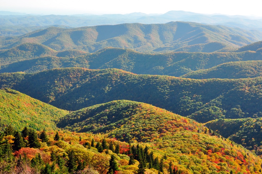
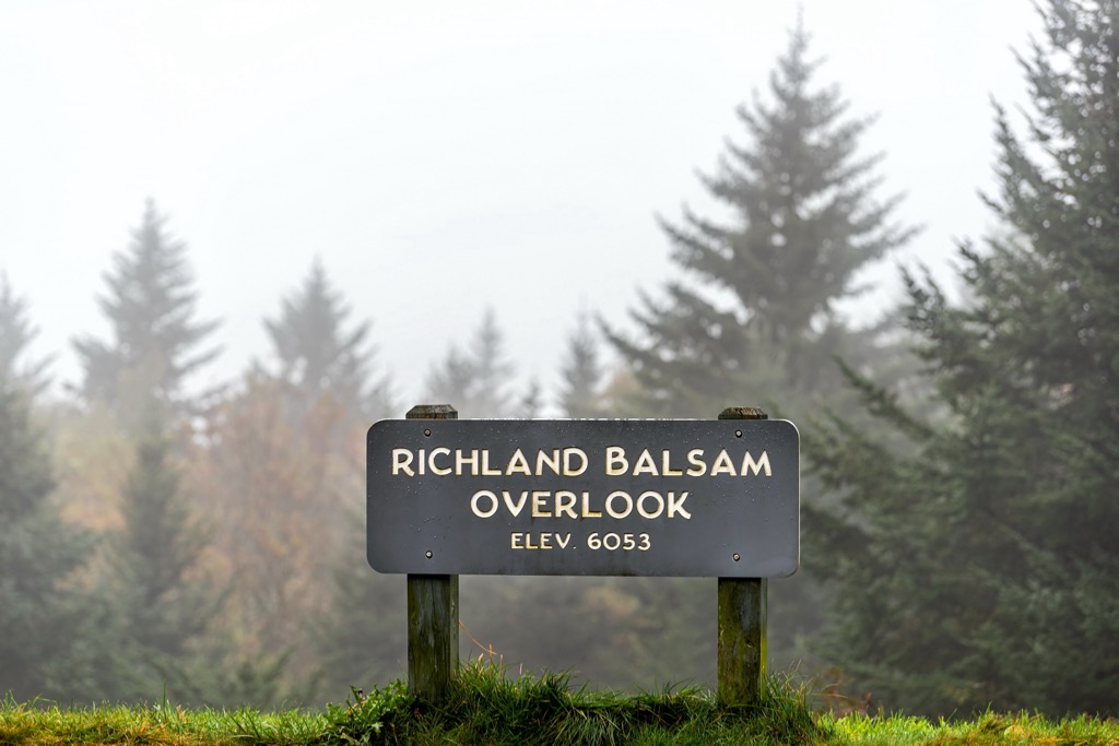
located within the US state of North Carolina. The wilderness encompasses high mountain ridgelines within the Blue Ridge Mountains. The tallest and most prominent peak in the region is Richland Balsam at 6,404 feet (1,952 m) tall with 3,064 feet (934 m) of prominence.
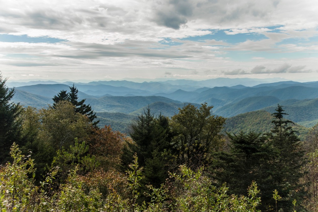
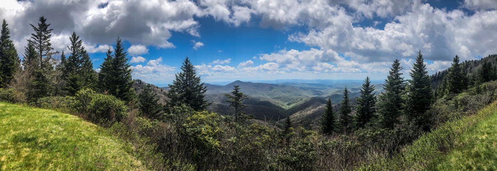
The Middle Prong Wilderness is located in Pisgah National Forest within the western portion of the US state of North Carolina. The wilderness is marked by rugged ridgelines, steep peaks and viewpoints of the surrounding landscape.
This protected region spans 7,900 acres (3,197 ha) across the forested landscape with elevations ranging between 3,200 to 6,400 feet (975 to 1950 m). The surrounding terrain marks one of the wettest regions in the continental US, following the Pacific Northwest.
The Blue Ridge Parkway forms a U-shape in the area, marking the western and southern boundaries of the wilderness. The larger and more popular Shining Rock Wilderness lies directly east of the wilderness, with the two protected regions being separated by NC 215.
The Middle Prong of the Pigeon River, which the wilderness was named after, has its headwaters located within the wilderness. The West fork of the Pigeon River lies along the eastern boundary of the wilderness, with NC 215 following along its path.
The Right Hand Prong West Fork of the Pigeon River is located in the western stretches of the wilderness while various other creeks and streams run through the forested landscape. While a majority of the wilderness is forested, some of the tallest peaks and buttes are free of flora offering sweeping views of the surrounding landscape.
Additionally, the Middle Prong Wilderness is surrounded by popular outdoor recreation areas. The Nantahala District of Nantahala National Forest covers land directly south and west of the wilderness. Sections of Pisgah National Forest extend to the southeast and east while the Cold Mountain Gameland is situated to the north. Great Smoky Mountains National Park is located northwest of the wilderness.
The mountains within and surrounding the Middle Prong Wilderness are part of the Blue Ridge Mountains. The Blue Ridge Mountains extend from the US state of Georgia northward to Maryland and Pennsylvania, marking a subrange of the Appalachian Mountains.
The Blue Ridge geologic province extends from Georgia to Pennsylvania, marked by its distinct landforms and geological history. Both igneous and metamorphic rocks are found throughout the region with slates, gneisses, schists, and quartzites all being common.
Rocks found in the region began forming between 1 billion and 250 million years ago, dating back to the Precambrian and Paleozoic eras. The base of the range was formed during both the Grenville and Alleghian orogenies.
This geological history makes the Blue Ridge Mountains much older compared to major ranges such as the Alps or Himalaya, both of which were formed during the Alpine orogeny around 65 million years ago. Mountains and ridgelines visible today are the result of the range being heavily eroded over the course of hundreds of millions of years.
Major peaks within the Middle Prong Wilderness include Richland Balsam, Mount Hardy, Spot Knob, and Green Knob.
The steep hillsides and ridgelines are populated by hardwood forests. Forested terrain often includes maple, elm, beech, birch, hemlock, oak, and spruce-fir forests. The wilderness, along with the neighboring Shining Rock Wilderness, is home to the American ginseng and green pitcher plant.
Sections of both hardwood and spruce-fir forests help support a variety of animal species. The surrounding network of protected terrain provides the ideal habitat for yellow-bellied sapsuckers, northern flying squirrels, northern saw-whet owls, and black-capped chickadees.
Larger mammals in the region include black bear, deer, coyote, beaver, and skunk. The waterways of the region provide habitat for hellbenders as well as rainbow, brook, and brown trout.
The land surrounding the Middle Prong Wilderness marks part of the ancestral homelands and traditional territory of the Cherokee people. Artifacts from the Paleo-Indian culture dating back nearly 8,000 years, have been found throughout the southern US.
North Carolina is part of the traditional territory of the Cherokee Nation and the Eastern Band of Cherokee Indians, as are parts of what are now the states of Tennessee and Georgia. The plethora of game and freshwater rivers helped make the Blue Ridge Mountains an ideal location for the Indigenous peoples.
An expedition through the region in 1540, led by Spaniard Hernando de Soto, marked the first recorded contact between the Indigenous peoples and Europeans. Over the following decades, the Cherokee signed multiple treaties and trade deals with the early Irish, English, and Scottish immigrants in the area.
The Cherokee people went on to form the unified Cherokee Nation and national government during the 1700s. By the 1800s, gold had been discovered in nearby Georgia leading to a drastic increase of population in the surrounding region.
This ultimately led to the US government forcibly removing the Cherokee people from their ancestral lands, forcing them onto reservations, and killing the Indigenous peoples. The US government tried to trick the Cherokee Nation into signing over their land via the Treaty of New Echota in the 1830s.
Despite never signing the treaty, the Cherokee were forcibly removed from the region following the Indian Removal Act of 1830. This forced the Cherokee people, and other Indigenous peoples in the eastern US, onto reservations west of the Mississippi River in present-day Arkansas and Oklahoma. This long journey would later be known as the Trail of Tears, with around 16,000 Cherokee people starting the journey and an estimated 4,000 Cherokee people dying en route.
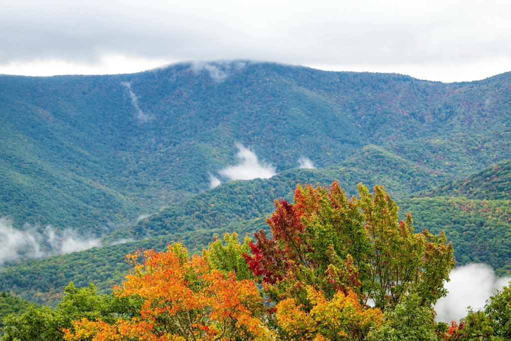
In the early twentieth century, the surrounding terrain was heavily logged, followed by wildfires in the 1940s. Remnants of these fires can still be seen throughout the region with the grassy “balds” being a direct result of the wildfires.
Pisgah National Forest was originally established in 1916, marking one of the first national forests in the eastern US. Middle Prong Wilderness was established in 1984 to further protect the landscape and reduce the number of visitors in the neighboring Shining Rock Wilderness.
The Middle Prong Wilderness is home to more primitive trails compared to nearby Shining Rock Wilderness. Here are a few of the popular trails within the wilderness:
Green Knob marks the fourth tallest and fourth most prominent peak in the wilderness. This loop trail begins in the northern stretches of the wilderness and climbs steadily throughout. From the top of Green Knob hikers have sweeping views of the Nantahala National Forest and the Blue Ridge Mountains extending to the south. The trail then descends gradually following along the Middle Prong of the Pigeon River back to the trailhead. This loop is 8.7 miles (14 km) long and features 3,024 feet (922 m) of total elevation gain.
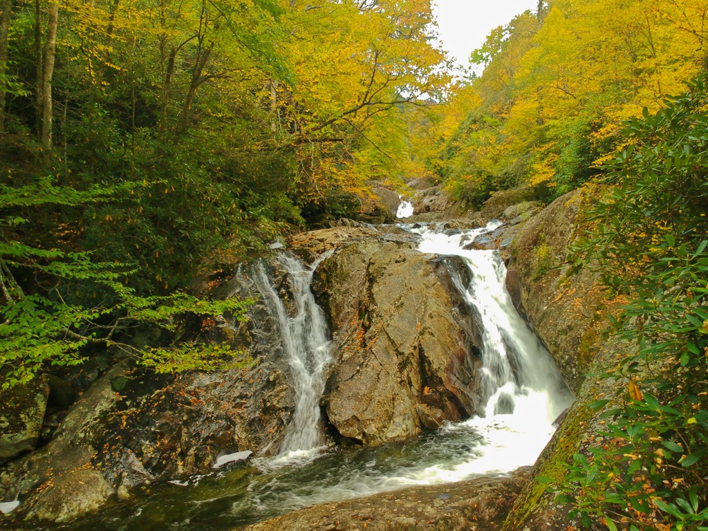
This out and back route begins along the southern edge of the wilderness on the Blue Ridge Parkway. From the road the trail gradually descends throughout the densely forested hillside following along Haywood Gap Stream before it connects with the Middle Prong of the Pigeon River. There are numerous scenic viewpoints along the trail that feature the lush forest landscape, babbling brooks, and small waterfalls. This out and back route is 3 miles (4.8 km) long and features 987 feet (301 m) of elevation gain.
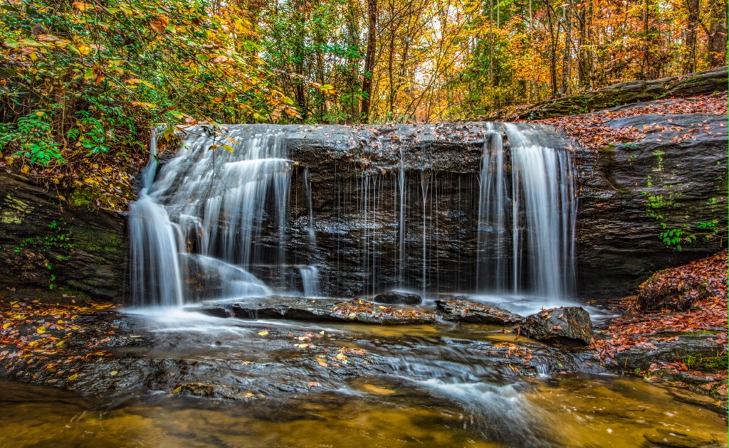
Located just off NC 215, this short hike features one of the most stunning waterfalls in the region. The short trail is relatively flat and follows along Green Creek through the lush landscape. The trail then opens up to Little Bird Falls cascading down the rocky stepped terrain. The out and back route is 0.3 miles (0.5 km) long and features 82 feet (25 m) of elevation gain.
Looking for a place to stay near the Middle Prong Wilderness? Here are some of the best cities and villages to check out in the region:
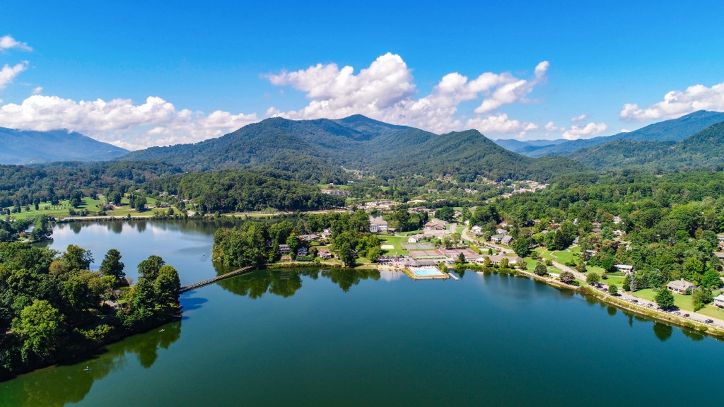
The small town of Waynesville is less than a thirty minute drive north of the wilderness. Situated in the heart of the Blue Ridge Mountains, the town is home to 10,000 people and is surrounded by opportunities for outdoor recreation.
Besides its close proximity to the wilderness, Waynesville is also close to Blue Ridge Parkway and the Great Smoky Mountain National Park. The downtown streets feature locally owned shops, restaurants, and craft breweries. Visitors can also explore the surrounding hiking and mountain biking trails or visit the town’s museum and local theater.
The city of Asheville marks the closest major city to the wilderness. Home to over 91,000 residents, the city is situated at the confluence of the French Board and Swannanoa rivers. As the most populous city in western North Carolina, Asheville acts as a cultural and economic hub for the surrounding region.
Surrounded by the Blue Ridge Mountains, Asheville is known for its proximity to outdoor spaces for hiking, running, backpacking, fishing, and mountain biking. Downtown Asheville is home to more breweries per capita than any other city in the country. Other popular spots in the city include the Biltmore Estate and River Arts District.