Scan the QR code and open PeakVisor on your phone
The Saluda Mountains lie on the border of North Carolina and South Carolina in the United States. They are part of the Blue Ridge Mountains and the range contains 96 mountains. Coldbranch Mountain is the highest (3,337 ft/1,017 m) and Hogback Mountain (3,2112 ft/979 m) is the most prominent (1,099 ft/335 m).
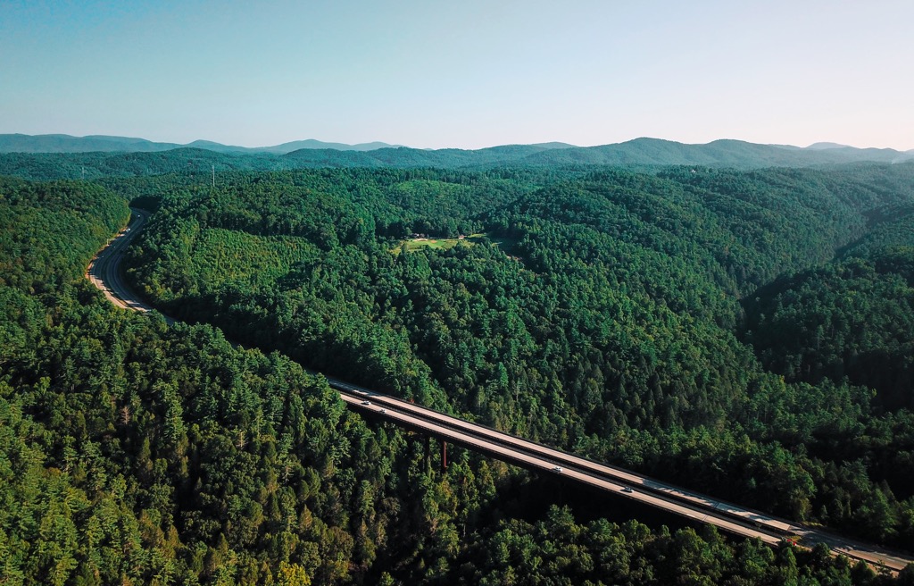
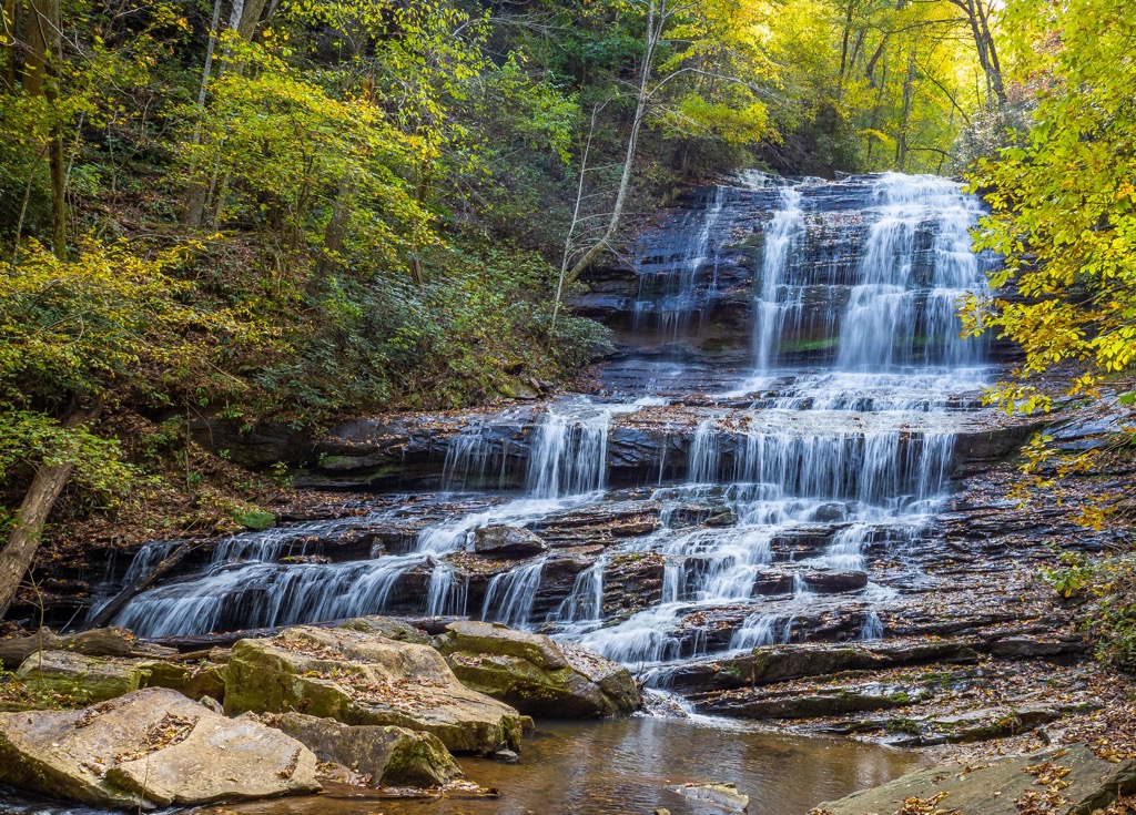
The Saluda Mountains are located in Greenville County and Pickens County, South Carolina and Transylvania County and Henderson County, North Carolina. The slopes and summits are thickly forested and serve as the watersheds for several rivers. The watersheds contain more than 100 miles (160 km) of permanent streams.
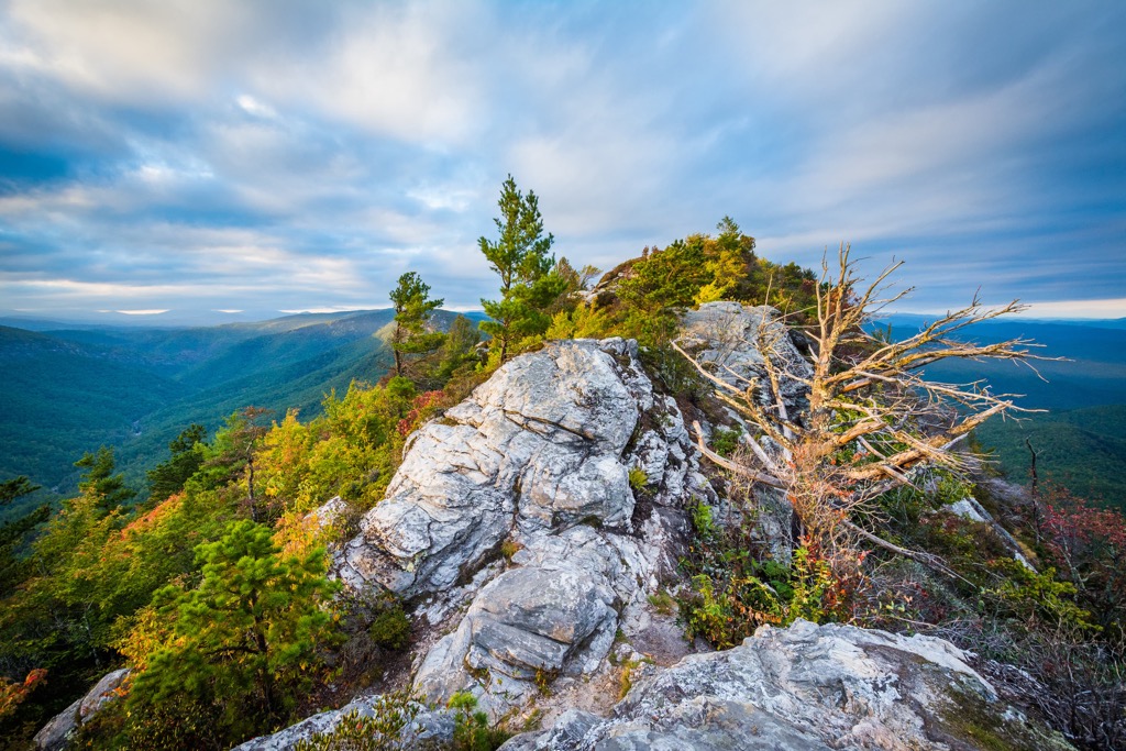
Several designated areas protect parts of the mountain including the Watson-Cooper Heritage Preserve, Greenville Watershed, Table Rock Reservoir Watershed, and Table Rock State Park. The tallest peaks in the range are Coldbranch Mountain (3,337 ft/1,017 m), Slicking Mountain (3,327 ft/1,014 m), and Little Rich Mountain (3,327 ft/1,014 m).
The range is part of the Blue Ridge Mountains and, by extension, part of the Appalachian Mountains. The range formed 560 to 320 million years ago due to tectonic plate movement, the opening and closing of ancient oceans, and volcanic events. The area around the Greenville Watershed is considered part of the Inner Piedmont terrane.
The mountains contain deposits of lithium, emeralds, copper, titanium, and vermiculite, but in quantities too small to warrant mining. They are primarily formed of granitic material, though much of it has metamorphosed to gneiss and quartzites. The soil contains large quantities of quartz sand.
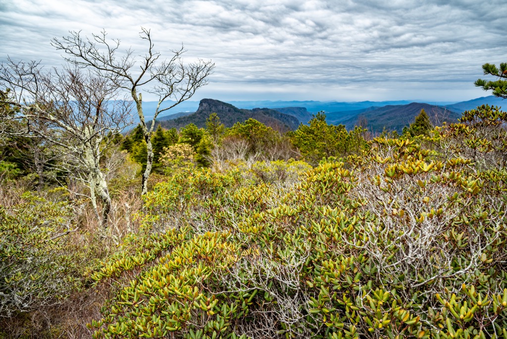
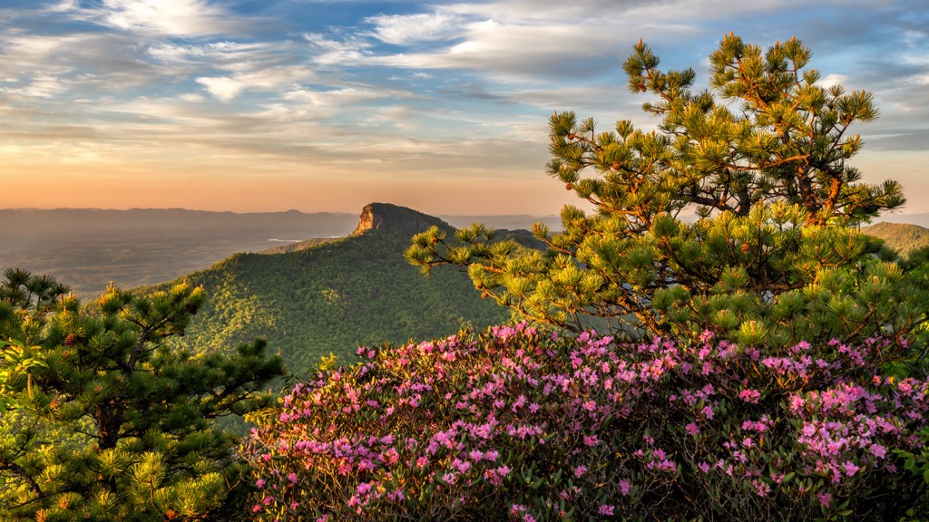
The region receives around 60 in (152 cm) of rain annually which supports robust forests and stream systems. Much of the mountains are covered in mature hardwood forests that can be categorized into five groups.
The first is Southern Appalachian Oak Forest which consists of oak, hickory, maple, white ash, and white pine and occurs at lower elevations. The second type is Southern Appalachian Cove Forest. This type has buckeye, maple, white ash, basswood, tulip poplar, silverbell, eastern hemlock, American beech, cucumber tree, and lots of wildflowers.
The next forest type is Southern Appalachian Low Mountain Pine Forest with short-leaf and Virginia pine. Some hardwoods, such as southern red oak, Chestnut oak, Scarlet oak, Pignut hickory, grow here too, as do shrubs like huckleberry and blueberry.
Central and Southern Appalachian Montane Oak Forest occurs at higher elevations between 3,000 to 4,500 ft (915 to 1,370 m) and supports mainly forest of red and white oak. The Southern Appalachian Montane Pine Forest and Woodland has Table Mountain pine, pitch pine, and Virginia pine.
The forests support a handful of species of concern including several bat species, pickerel frogs, and peregrine falcons. Other species include black bears, woodrats, salamanders, ravens, and ruffed grouse. Brook trout, rainbow trout, and smallmouth bass live in the streams.
The region was originally Cherokee territory. The Cherokee moved into South Carolina around 1400 after being pushed out of the Great Lakes region because of conflict with Iroquois and Delaware tribes. The Cherokee divided their time and labor between agriculture, hunting, and trade. Agriculture, with corn as a staple crop, allowed them to create stable villages.
The arrival of European explorers and settlers ushered in increasing conflict. Most Cherokee sided with the British during the Revolutionary War. They ceded most of their land in South Carolina to the U.S. government by 1777. The final piece of land was ceded in 1816.
The Table Rock Watershed was established in the 1920s so it contains less human settlements from the last century. More signs of human settlements exist in the North Saluda Watershed, established in the 1950s, such as old chimneys and rock walls, cemeteries, glass bottles, clay pots, and moonshine barrels.
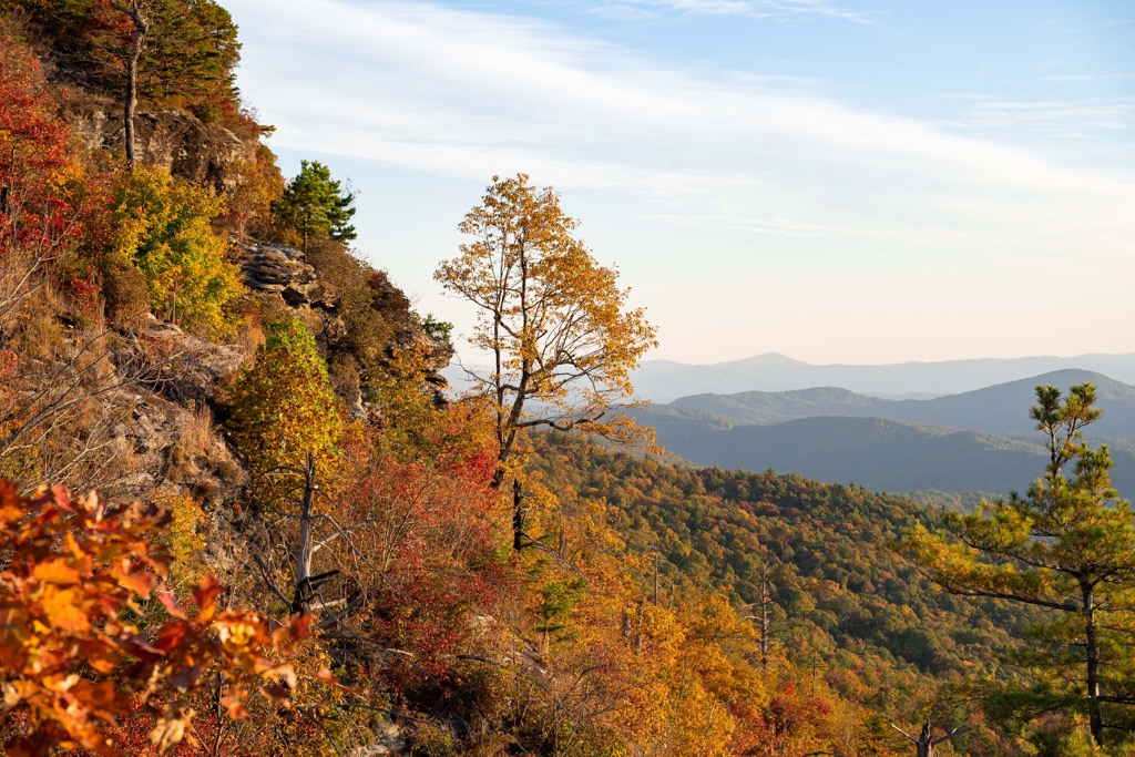
In addition to the longer hikes listed below, there are trails to several of the other tall peaks in the range including Battered Rock Mountain (3,287 ft/1,002 m), Bursted Rock Mountain (3,241 ft/988 m), Long Rock (3,232 ft/985 m), and Panther Mountain (2,887 ft/880 m).
The Saluda Mountains Passage is 9.1 mi (14.6 km) and rated as moderate to strenuous. The trail follows the ridge between the northern edge of the Poinsett Watershed and the border of the Carolinas. The Poinsett Watershed supports 19,000 acres (7,690 ha) of mainly wilderness areas and thriving ecosystems. There are strict rules on trail usage and it is best to check guidelines before recreating in the area.
The Foothills Trail to Dolves Mountain (3,304 ft/1,007 m) is a 14 mi (22.5 km) one way trail located in the Watson-Cooper Heritage Preserve. It has 715 ft (218 m) of elevation gain and passes Sassafras viewpoint, Grunting Spring Gap, Dolves Mountain, Slicking Gap, and Gum Gap along the way.
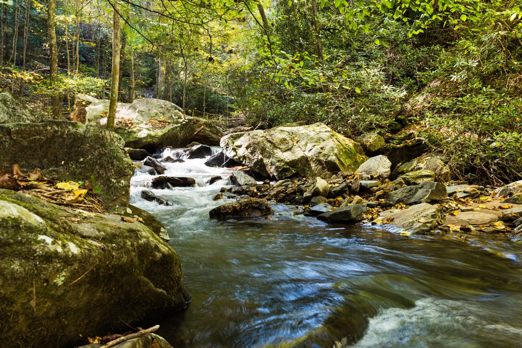
The trail to Table Rock is 6.9 mi (11.1 km) out and back with 2,300 ft (700 m) elevation gain. It is a popular route, open year-round, and considered challenging. The parking lot is located at Table Rock State Park nature center on West Gate Road. The trail has uneven rock stairs and rocks and logs across the trail. It passes highlights like Carrick Creek Falls and the Governor’s Rock overlook. There are great lookout points along the way and from the top.
The nearest major cities fall in North Carolina and Georgia, although there are plenty of small towns nearer to the range that offer accommodation and amenities.
Asheville, North Carolina is 40 mi (65 km) to the north, a small city of 92,000 people nestled into the Blue Ridge Mountains. The city offers a quick escape to numerous trails, as well as the Blue Ridge Parkway. The Biltmore Estate is a well-known attraction in the area. The 250-room mansion and 8,000 acre (3,240 ha) estate are open for tours, and offer shops, dining, and upscale lodging.
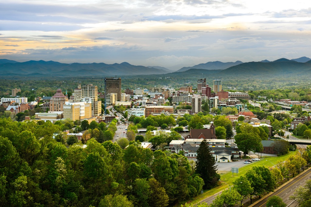
Those looking to tap into the city’s creative side can visit the River Arts District for dozens of galleries and workshops, or check out the events calendar to see what live music is coming up. The dining scene is diverse, plating up not only southern classics but also a variety of cuisines and locally-inspired meals by innovative chefs. Lodging options include hotels, resorts, cabins, B&Bs, campgrounds, and RV parks.
Located 115 mi (185 km) to the east, Charlotte, North Carolina has a population of 875,000 people. Thrill seekers can find the world’s tallest and fastest giga coaster at Carowinds Amusement Park or the largest man-made whitewater river at the US National Whitewater Center. A number of trails, parks, and nature preserves can be reached easily within the city or at its periphery.
Enjoy the food in the city whether prepared by one of the many James Beard nominated chefs, fresh from a farmers market, or from a food hall such as the 7th Street Public Market and Optimist Hall. Accommodation, whether it be hotels, resorts, or B&Bs, are readily available throughout the city.

Atlanta, Georgie lies 170 mi (275 km) to the southwest and has a population of 498,000 people. A few highlight attractions include the Martin Luther King, Jr. National Historic Park, the National Center for Civil and Human Rights, the Atlanta Aquarium, and the Botanical Garden. Stone Mountain Park is a breath of fresh air from the urban center, offering 3,200 acres (1,295 ha) of lakes, forests, and trails around an enormous mass of exposed granite.
Atlanta is culturally diverse and has a dining scene to match. Go to Buford Highway for hundreds of ethnic meals, Buckhead for fine dining and American classics, Southwest Atlanta for southern eats and vegan and vegetarian meals, or check out the food halls in both Eastside and Westside. You’ll have no problem fInding convenient accommodation for any budget in the city’s distinct neighborhoods.