
Scan the QR code and open PeakVisor on your phone
The Cowee Mountains include 197 named peaks. The highest is Yellow Mountain at 1,563 m. Other notable peaks include Shortoff Mountain, Cowee Bald and Hogback Mountain.
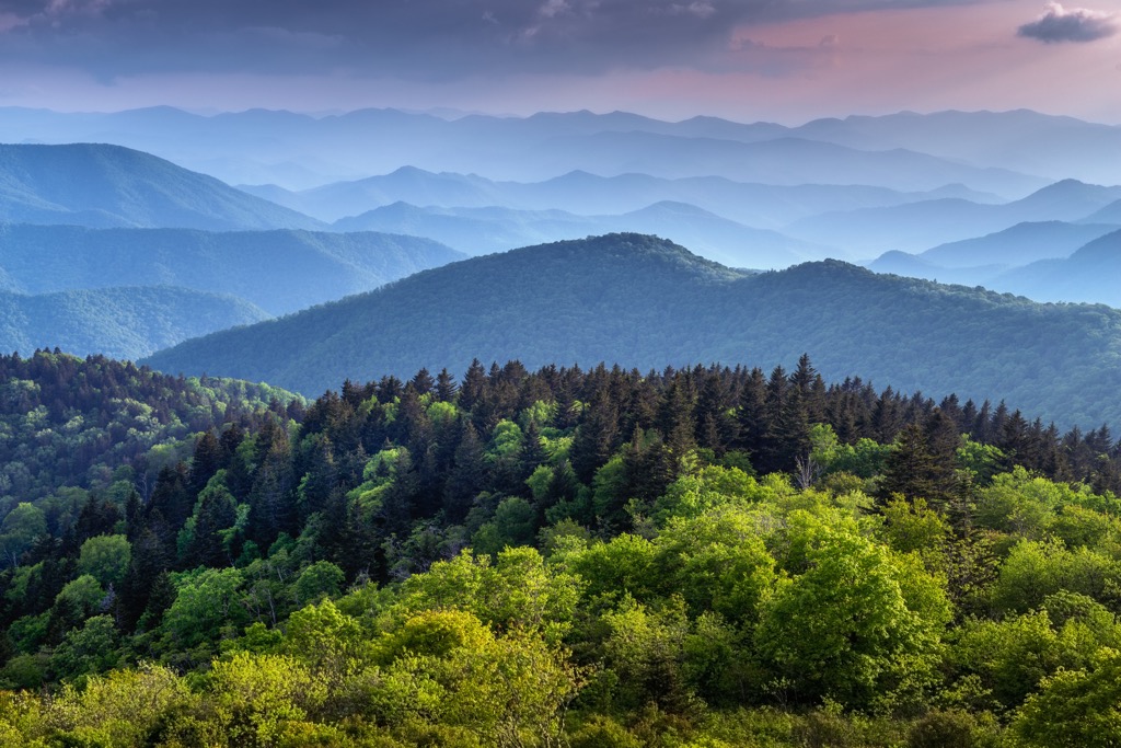
The Cowee Mountains are part of the Blue Ridge Province of North Carolina, USA, lying within Nantahala National Forest. The range includes 197 peaks. The highest, Yellow Mountain (5,128 ft/1,563 m), is considered one of the state’s most challenging hikes despite not being the state’s tallest mountain. Cowee Bald (4,957 ft/1,511 m) is the most prominent peak in the range, rising 1,765 ft (538 m).
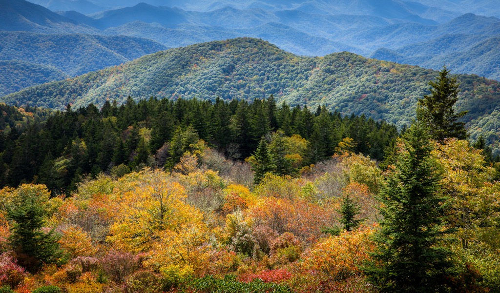
The Cowee Mountains fall within Nantahala National Forest in southwestern North Carolina in Jackson and Macon counties. The 197 peaks range from 3,500 ft (1,065 m) to nearly 5,200 ft (1,585 m), supporting mainly oak and hardwood forests. They are part of the Blue Ridge Province in the southern Appalchians.
The range lies south of Great Smoky Mountain National Park and Cherokee National Forest, southwest of Pisgah National Forest, and northeast of Chattahoochee-Oconee National Forest.
Yellow Mountain is the tallest peak at 5,128 ft (1,563 m). Although it is not North Carolina’s tallest peak, Yellow Mountain is one of the state’s most demanding trails. Shortoff Mountain (5,003 ft/1,525 m), Cowee Bald (4,957 ft/1,511 m), and Black Rock Mountain (1,503 m/4,931 ft) are the next three tallest peaks.
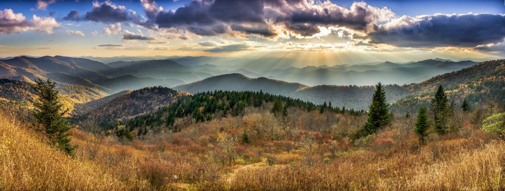
The Cowee Mountains are part of the Blue Ridge Province in the southern Appalchians. The province stretches from Pennsylvania to Georgia. It is composed of highly deformed metamorphic rocks from the Precambrian era, such as schists, gneisses, slates, and quartzites, with extensive igneous intrusions.
The Blue Ridge province is narrower in the north, at times only 13 mi (21 km) wide, and widens towards the south, reaching up to 70 mi (113 km) across. Thrust faults separate the western boundary from the Valley and Ridge province.
The range formed between 1.1 billion and 250 million years ago as tectonic plates collided. This collision of the North American and African continental plates stopped around 250 million years ago. As the continents began to stretch, it created fractures in the crust that later filled with sediment.
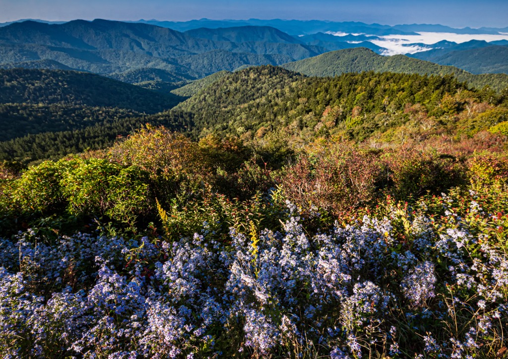
Ranging elevations across the mountain slopes support several forest communities, creating a variety of habitats for both resident and migratory birds, as well as mammals, amphibians, and reptiles.
Northern hardwood forest typically occurs between 4,000 and 5,200 ft (1,220 and 1,585 m). It is dominated by yellow birch, sugar maple, yellow buckeye, and beech, with some red oak mixed in. The understory contains laurel, doghobble, hobblebush, red elderberry, mountain holly, serviceberry, blueberry, and striped maple.
Hardwood forests provide a number of natural cavities that are perfect for cavity-nesting species. A few examples include northern saw-whet owls, black-capped chickadees, yellow-bellied sapsuckers, and Carolina northern flying squirrels.
Hardwoods are particularly good habitat for veerys, black-throated blue warblers, rose-breasted grosbeaks, blue-headed vireos, dark-eyed juncos, black-billed cuckoos, and ruffed grouse. Several kinds of salamanders also thrive in this environment.
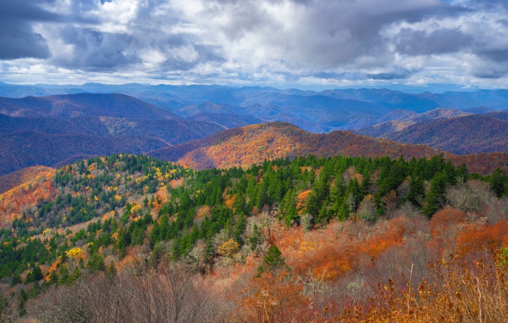
Oak forests grow between 3,500 and 5,500 ft (1,065 and 1,675 m). The forest is characterized mainly by red oak, with some white oak, chestnut oak, red maple, striped maple, sugar maple, yellow birch, and white ash mixed in. Catawba rhododendron, great laurel, flame azalea, highbush blueberry, highbush cranberry, mountain laurel, and ferns fill the understory and forest floor.
A number of woodpeckers and hawks, wood thrushes, ovenbirds, black-and-white warblers, scarlet tanagers, and eastern wood-pewees make their home in oak forests. Across the forest types, white-tail deer, coyotes, black bears, raccoons, squirrels, foxes, river otters, and beavers are some of the primary mammal species.
Although the highest point in the Cowee Mountains is under 5,200 ft (1,585 m), in surrounding mountains that reach higher elevations, spruce-fir forests typically occupy elevations between 5,200 and 6,000 ft (1,585 and 1,830 m). Red spruce and frasier fir are the dominant species, and some spruce can extend into lower elevations.
Within the region there is a fair amount of overlap in the species that inhabit spruce-fir and hardwood forests as the two lie adjacent to one another. Spruce-fir forest provides important habitat for the red crossbills, northern saw-whet owls, black-capped chickadees, and red-breasted nuthatches.

Many migratory birds pass through the forests including black-throated green warblers and blackburnian warblers. The region falls within the range of yellow-rumped warblers and magnolia warblers. Swainson’s thrush and hermit thrush occupy the understory in this forest type.
Humans have made their homes in the mountains and valleys of North Carolina for almost 12,000 years since the end of the last ice age. Over 1,000 years ago, Cherokee culture began to emerge, their territory ultimately stretching from the Ohio River to Alabama. The society has a matrilineal structure. Living in small villages with a large council house, the Cherokee practiced agriculture and their primary crops were corn, beans, and squash.
The first encounter with Europeans took place in 1540 when the Spanish explorer Hernando DeSoto passed through the region on the hunt for gold. Unintentionally, this was also the beginning of a deadly transfer of European diseases to Native Americans. The Cherokee maintained tentative alliances with explorers and settlers into the 1700s, although they continued to die from introduced diseases and military campaigns.
During the Revolutionary War in the 1770s, the Cherokee sided with the British. Following the American victory, the Cherokee lost a lot of land in western North Carolina. With the land they did retain, they worked to adapt to new circumstances by establishing schools, churches, and written language.
In 1838 and 1839, intensive outside interest in agricultural land, mining and other natural resources in the region created a tragic forced expulsion known as the Trail of Tears. The Cherokee were forced from their homelands in Georgia, North Carolina, and Tennessee and sent to reservations in Oklahoma. Many died on the strenuous journey.
Several hundred Cherokees escaped and hid out, eventually forming the Eastern Band of the Cherokee Indians in 1868. Settlers practiced intensive logging in the southern Appalachians from the late 1800s to the early 1900s. The passage of the Weeks Act in 1911 helped the federal government get control over swaths of land to better manage and conserve the region’s forests.
With peaks up to 5,128 ft (1,563 m), these are not the tallest mountains in the state. However, the tallest peak in the range, Yellow Mountain, is arguably one of North Carolina’s most strenuous trails.
Yellow Mountain (5,128 ft/1,563 m) is topped by a historic fire tower which provides an unobstructed panoramic view. However, to get to the summit of Yellow Mountain, one must first summit Cole Mountain, Shortoff Mountain (5,003 ft/1,525 m) – the second tallest peak in the range, and Goat Knob.
The trailhead is located at Cole Gap off of Buck Creek Road from Route 64. At over 10 mi (16 km) out and back, the trail dips and climbs as it winds up and down all four mountains. The first peak is Cole Mountain. From here, the trail dips back down to Cole Gap before a series of switchbacks leads to summit Shortoff Mountain.
At the top, the trail briefly flattens out, giving a quick breather, before a series of mini descents and ascents towards Goat Knob. The trail drops steeply to Yellow Mountain Gap where it connects with an old Forest Service fire road. The final push climbs from the gap to summit Yellow Mountain.
Perched on the summit, the fire tower was built in 1934 by the Civilian Conservation Corps and remained in use until 1969. It has been maintained so hikers can climb to the top and be rewarded for their efforts with sweeping views across the mountains.
The path to Cowee Bald, the second tallest peak in the range, is 4.4 mi (7.1 km) out and back with 400 ft (123 m) of elevation gain. A road leads nearly to the top. Most people park at a stream crossing 2.2 mi (3.5 km) from the summit and walk the rest of the way. Those with 4WD or high clearance vehicles can cross the stream and drive even closer.
From the stream, there are a few steep sections but otherwise the trail is not too challenging. Cowee Bald also has a fire tower and the views from the top take in the surrounding mountainscape and Bryson City.
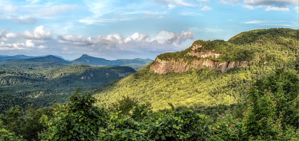
This 2.5 mi roundtrip loop trail climbs from 4,410 ft to 4,930 ft (1,344 m to 1,503 m). The hike is not too strenuous but is very scenic with impressive 700 ft (213 m) high cliff walls towering over the trail. Mountain laurel blooms along the path in abundance in mid-June.
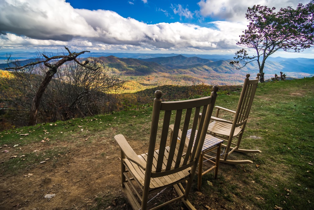
There are options for dispersed camping and designated campgrounds within and around the Cowee Mountains in Nantahala National Forest. Three towns – Franklin, Highlands, and Cashiers – are located to the west, south, and east respectively and all have accommodation, dining, and other amenities.
85 mi (135 km) to the northeast, Asheville, North Carolina is tucked into the heart of the Blue Ridge Mountains and has a population of 92,000 people. In a flash you can be on the Blue Ridge Parkway going for a scenic drive or taking advantage of the easy access to a plethora of hikes. Cool off in the summer with a visit to Sliding Rock Natural Waterslide in Pisgah National Forest. In less than an hour, reach Great Smoky Mountains National Park to explore the Great Smoky Mountains.

Around the city, visit the Biltmore Estate for a taste of luxury. The 250-room, 8,000 acre (3,237 ha) estate originally belonged to a member of the Vanderbilt family. In addition to touring the mansion, visitors can wander through the gardens, shop, dine, or stay over in upscale lodging. Tap into the heart and soul of the city by finding one of the many live music venues or exploring the River Arts District. Keep an eye out for cultural events such as African drumming at the LEAF Global Arts Center.
The city’s dining options accommodate a wide range of tastes with offerings of pizza, southern classics, taquerias, and an emphasis on farm-to-table dining, and local and seasonal produce. Stay over in a familiar hotel, a cozy cabin, a charming B&B, or book a hostel or campground for more rugged and budget-friendly lodging.
Atlanta, Georgia lies 135 mi (220 km) southwest of the Cowee Mountains. Georgia’s state capital is home to just under half a million people and has an important and diverse cultural history. Learn more at the National Center for Civil and Human Rights, the Martin Luther King, Jr. National Historic Park, and the Atlanta History Center.
Sports fans can catch a game at Truist Park or the Mercedes-Benz Stadium, or visit the Centennial Olympic Park from the 1996 summer olympics. Explore the city’s neighborhoods along the Atlanta Beltline – a network of trails that passes street art and restaurants along the way.

Get outside at the Arabia Mountain National Heritage Area and Davidson-Arabia Mountain Nature Preserve spanning over 2,000 acres (810 ha). The Kennesaw Mountain National Battlefield Park on Kennesaw Mountain has 17 mi (27 km) of trails, monuments, and a museum detailing the history of the site of the Civil War’s Battle of Atlanta.
There are tons of accommodation options in this bustling city, each neighborhood with a different vibe and options ranging from budget to luxury. The restaurant scene reflects the diversity of the city’s inhabitants. Check out restaurants honoring the city’s civil rights history by dining at The Municipal Market or Paschal’s Restaurant.


The highest peak in the Cowee Mountains is Yellow Mountain, at 1,563 m.
The Cowee Mountains have 197 named peaks.


