
Scan the QR code and open PeakVisor on your phone
The Plott Balsams include 37 named peaks. The highest is Waterrock Knob at 1,917 m. Other notable peaks include Browning Knob, Mount Lyn Lowry and Plott Balsam.
The Plott Balsams are a mountain range in the US state of North Carolina, neighbored by the Great Smoky Mountains and the Great Balsam Mountains. The Plott Balsams are part of the Blue Ridge Parkway and contain 37 peaks. Waterrock Knob is the tallest at 6,289 ft (1,917 m), and the most prominent (1,952 ft/595 m).

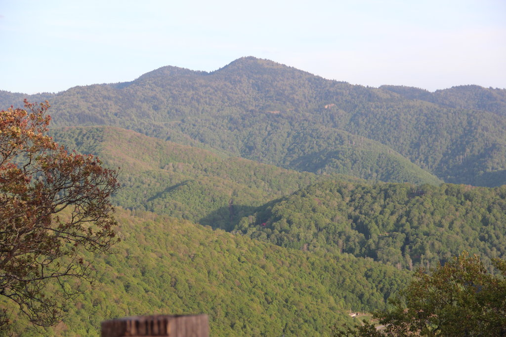
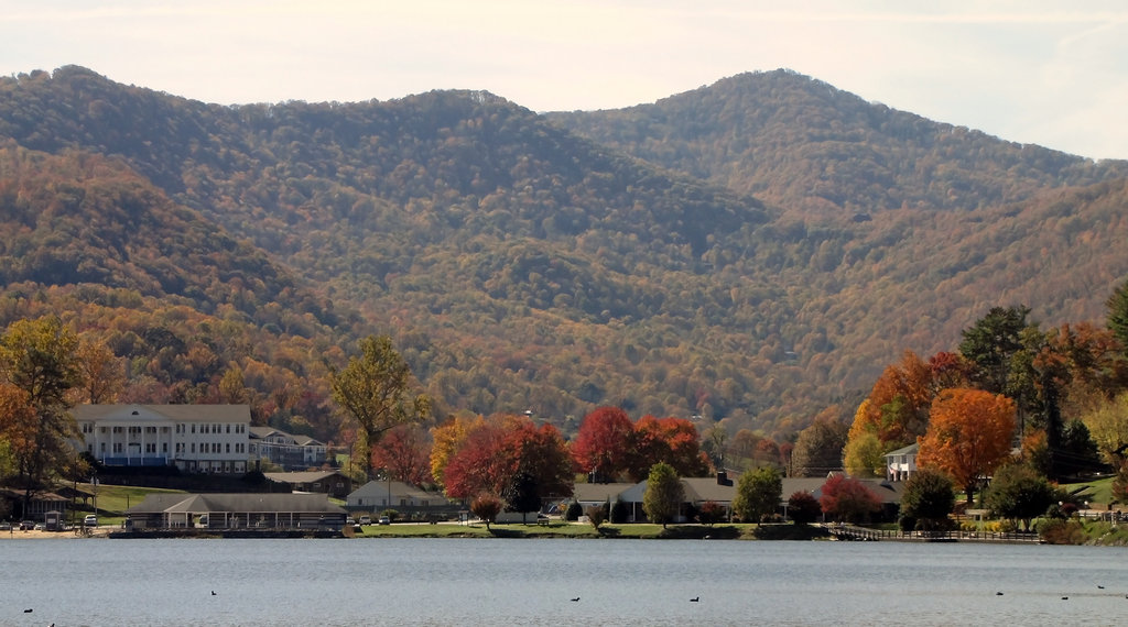
The Plott Balsams span from the Tuckasegee River Valley in Sylva, North Carolina to Maggie Valley. Peaks range from 2,100 ft (640 m) to more than 6,000 ft (1,828 m) on Waterrock Knob (6,289 ft/1,917 m), Browning Knob (6,243 ft/1,903 m), and several other peaks.
Situated along the Blue Ridge Parkway, there is easy access to several viewpoints near the ridgeline. The Plott Balsam Overlook is situated at 5,020 ft (1,530 m). The Waterrock Visitor Center is located at 5,820 ft (1,774 m) making it the highest elevation center along the parkway.
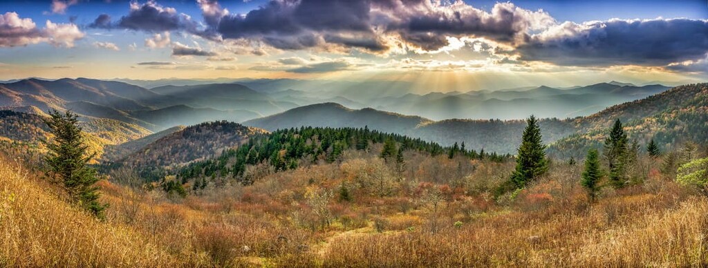
The range is located between the Great Smoky Mountains and the Great Balsams. Although the Plott Balsams are impressive in their own right with several peaks over 6,000 ft (1,829 m) and fantastic vistas, the range is sometimes overlooked for its taller neighbors.
The Plott Balsams are part of the Blue Ridge Mountains of the Southern Appalachian range. Most of the range is covered by the CopperHill Formation. Dating back to the Precambrian era, rocks of this formation are primarily metagraywacke with some mica schist, metaconglomerate, quartzite, and meta-arkose.
The range contains deposits of sulfides such as copper, iron, and zinc. It also has mineral deposits of pyrrhotite, pyrite, chalcopyrite, sphalerite, magnetite, silver, gold, and some garnet.
As a whole, the oldest rocks of the Appalachian Mountains formed over one billion years ago when the continents were all part of a single supercontinent. Around 750 million years ago, the supercontinent began to stretch apart. Around this time the Oconee basin formed along part of present day Carolinas, Tennessee, and Georgia.
About 540 million years ago, the crust separated and formed continents with shallow seas filling in the space between them. As water filled the Oconee basin, it carried silt, sediment, and clay to the basin floor. Over millions of years sediment accumulated. This makes up the bedrock of the Plott Balsam Mountains.
Rocks made of coarse sediments are more resistant to erosion and make up ridges and peaks while rocks with smaller sediment break down more easily. Over time, weather and water have shaped the landscape today, carving out less resistant rocks while leaving behind rocky outcroppings, ledges, and waterfalls.
About 470 million years ago, the plates began to move towards each other, eventually colliding. The collision raised mountains. As this happened, intense pressure and heat formed igneous plutons from magma that cooled deep beneath the earth’s surface.
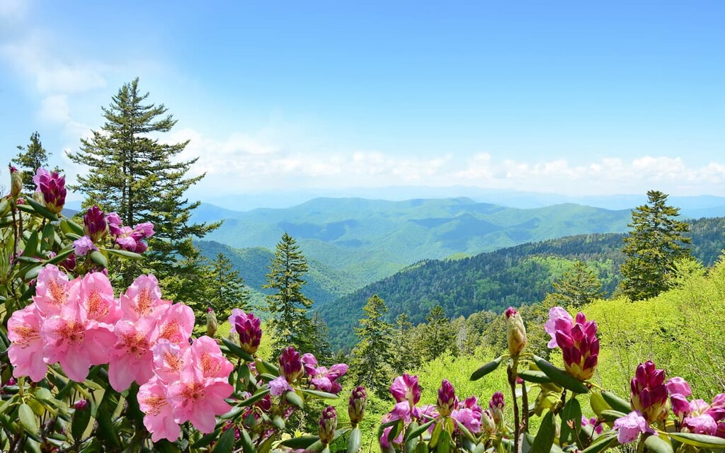
The Blue Ridge Parkway, including the Plott Balsams, support Appalachian spruce-fir forests, northern hardwood forests, and high elevation bogs. Numerous conservation organizations are involved with protecting the mountains, including The Nature Conservancy and the National Park Service.
Within the spruce-fir forests, red spruce and fraser fir dominate, accompanied by mountain ash, fire cherry, mountain maple, and striped maple. The understory contains Canada blackberry, red-berried elder, mountain cranberry, and hobblebush. This forest type grows over 4,595 ft (1,400 m).
Hardwood forests grow above 4,430 ft (1,350 m) and typically share a lower border with spruce-fir forests. Common trees include beech, yellow birch, sugar maple, red maple, yellow buckeye, and striped maple. Shrubs such as rhododendron, doghobble, hydrangea, and hobblebush grow in the understory.
These forests provide important high elevation habitat for birds of special concern including the Northern saw whet owl, red crossbill, black-throated warbler, and brown creeper. The range is also valuable in the state for the habitat it creates for alder flycatchers, black-capped chickadees, common ravens, and red-breasted nuthatches. Other species that live here include the pine siskin, black-billed cuckoo, yellow-bellied sapsucker, rose-breasted grosbeak, and golden-crowned kinglet.
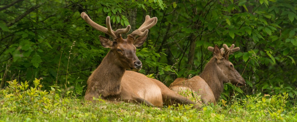
The Blue Ridge Parkway is home to more than 50 species of mammals including deer, black bears, opossums, coyotes, and bobcats. Some animals that were extirpated from the range, such as beavers, elk, peregrine falcons, and river otters, have begun to return in recent years. In addition to the hundreds of birds that live or migrate through the region, the mountains are also home to dozens of amphibians and reptiles.
The western portion of North Carolina is part of the ancestral land of the Eastern Cherokee, part of an extensive territory that extended across the region. Early hunter gatherers shifted to a culture where the women cultivated corn, beans, squash, and sunflowers.
The Spanish explorer Hernando de Soto arrived in 1540 on the hunt for gold. In addition to taking slaves, Europeans also carried over foreign diseases that decimated Native populations. Despite these struggles, the Cherokee strove to coexist with arriving explorers and settlers for two hundred years, even as they lost more and more of their land to outsiders.
The dynamic changed abruptly with the discovery of gold in Georgia in 1828. With an intense new focus on the region, previous land agreements were put aside. The Indian Removal Act of 1830 “gave” Cherokee people land in Oklahoma in exchange for their homeland. Five years later, the Treaty of New Echota claimed nearly all Cherokee land east of the Mississippi for the US government.
Cherokee were forced out along the “Trail of Tears” to reservations in Oklahoma. More than 16,000 people were forced to walk 1,200 mi (1,930 km) west under grueling conditions and nearly one fourth of people died. Those who managed to remain banded with those who escaped and established the Eastern Band of Cherokee Indians.
The range received its name from the Plott family. In 1750, a German immigrant named Johannes Plott arrived. He settled his family in the mountains and used his five Hanover hounds for bear hunting. His son bred the German dogs with local stock to create a highly prized hunting dog. Today, Plott Bear Hounds are the North Carolina state dog.
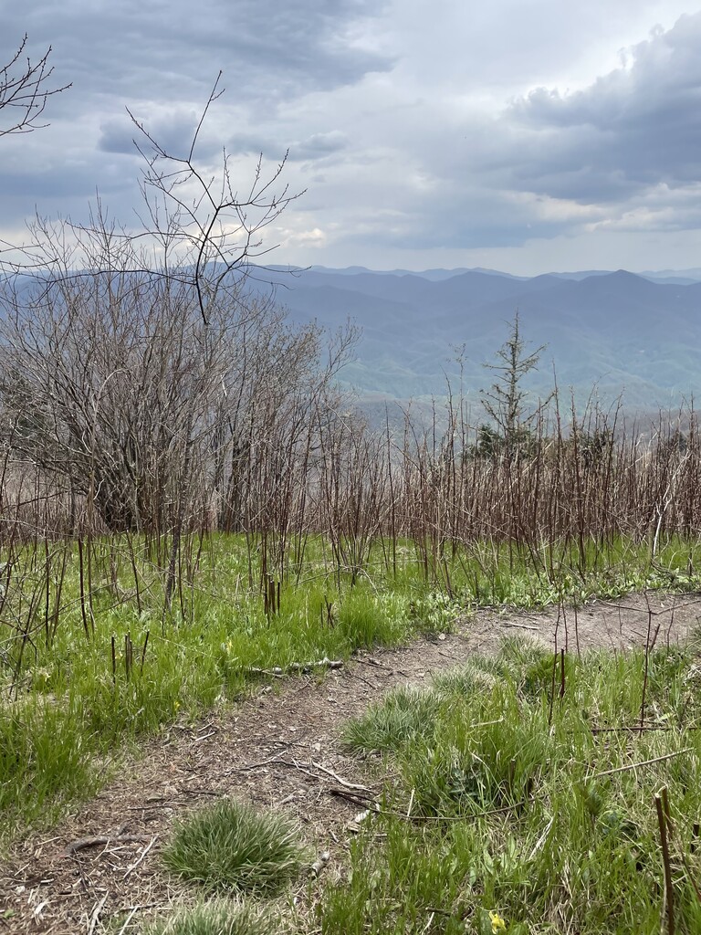
The Plott Balsams offer both easy and adventurous hikes. It is easy for tourists to cruise through the mountains on the Blue Ridge Parkway and take in the exceptional views with relatively little exertion.
There is easy access off the Blue Ridge Parkway to Waterrock Knob, the tallest peak in the range. This is a popular spot for tourists. A visitor center sits near the summit and a short trail, Waterrock Knob Trail, leads to the summit for sweeping views.

Those looking for an adventure can undertake a bushwacking route to summit four of the peaks over 6,000 ft. South Beyond 6000 (SB 6k) is a program that encourages hikers to summit the forty peaks over 6,000 ft (1,829 m) in the Southern Appalachians.
A rough trail allows hikers to take in four of the Plott Balsam peaks over 6,000 ft (1,829 m) – Plott Balsam, Lyn Lowry, Waterrock Knob, and Yellow Face. A recommended route for this endeavor begins with an 8 mi (12.8 km) bushwhack from Waterrock parking lot to Plot Balsam and back. From there, drop to the Blue Ridge Parkway and head out and back to Yellow Face (#237).
Although there is no official trail, the route used by other hikers can be followed decently well in some spots. Some portions require bushwacking but great views reward hikers for the effort. The Carolina Mountain Club has detailed descriptions of reaching these four peaks.
The Plott Balsams are located close to small communities and within a few hours of several larger cities. There are campsites along the Blue Ridge Parkway for those planning to stay directly in the mountains.
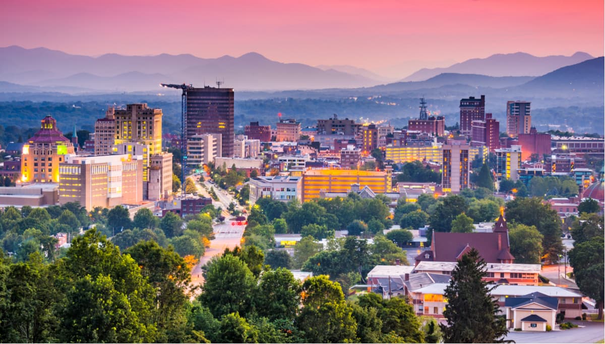
Asheville is an hour or less away from the mountains and has a population of 94,000 people. When you get there, jump on a trolley tour or go for a self-guided walking tour on the Urban Trail to learn more about the city’s history.
One top attraction is the Biltmore Estate. Once the winter home of a member of the Vanderbilt family, it is possible to tour the 250 room mansion and the gardens, and to enjoy shopping, dining, and upscale lodging on the 8,000 acre (3,235 ha) estate. Asheville lies near Pisgah and Nantahala National Forests and offers a great jumping off point for exploring the Blue Ridge Mountains.
Asheville offers diverse dining options with a big emphasis on local ingredients and craft beers. You can explore local foods yourself at the seasonal farmers markets or sign up for a food tour of the city. Those looking for a more hands-on experience can take a foraging class in the surrounding mountains. Depending on your style, you can find cozy B&Bs, rental cabins in the woods, historic or budget hotels, and campgrounds to stay over.
Charlotte has a population of 880,000 people and is about a three hour drive from the mountains. The city boasts the largest man-made whitewater river and offers a CLT Trail Guide to explore six outdoor experiences in the city with more than 22 miles (35 km) of trails, and stops at local business and restaurants. Besides the city's museums, visit the many murals around the city honoring and telling stories of the city’s African American history.
Charlotte has a wide selection of restaurants and craft beers. Whether you're in the mood for international cuisines, southern food, or vegetarian dishes, you’ll find it here. The city offers a range of hotels, vacation properties, and budget motels. There are campgrounds and RV parks outside the city for a more rustic experience.


The highest peak in the Plott Balsams is Waterrock Knob, at 1,917 m.
The Plott Balsams have 37 named peaks.


