
Scan the QR code and open PeakVisor on your phone
The Great Craggy Mountains include 43 named peaks. The highest is Craggy Dome at 1,853 m. Other notable peaks include Bullhead Mountain, Craggy Pinnacle and Craggy Gardens.
The Great Craggy Mountains are located in the western portion of the US state of North Carolina. They feature rugged terrain and are part of the larger Blue Ridge Mountains. The range has 43 named mountains with Craggy Dome being the tallest at 6,079 feet (1,853 m) and the most prominent with 1,017 feet (310 m) of prominence.
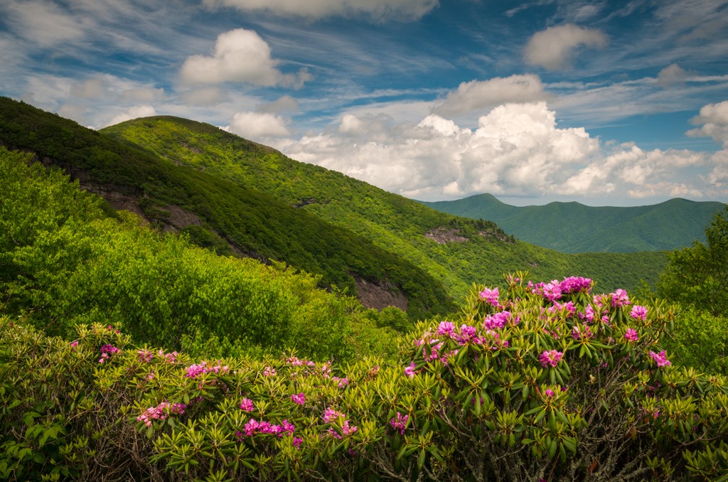
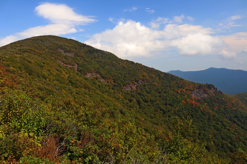
The Great Craggy Mountains, often called the Craggies, are a range situated in western North Carolina. This rugged landscape features numerous peaks, ridgelines, and deep valleys, which have been eroded over the course of millions of years.
The entire range spans roughly 194 sq miles (503 sq km) across the western portion of the state, just northeast of the city of Asheville. All of the peaks lie within Buncombe County. Further northeast lies the Black Mountains, separated by the Cane River and the Cane River valley.
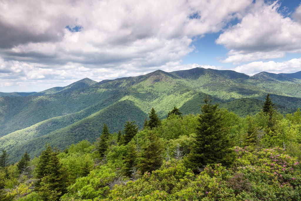
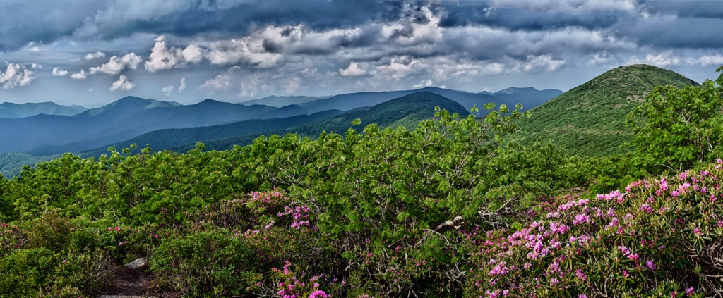
Elevations range from around 2,500 feet (762 m) up to the summit of Craggy Dome. A majority of the range is densely forested, similar to the rest of the Blue Ridge Mountains. However, the main ridgeline in this range is often free of tree coverage.
The Burnett Reservoir lies along the eastern edge of the range. Throughout the Great Craggy Mountains lie numerous creeks, streams, and rivers. Some of the most prominent include Beetree Creek, Swannanoa River, and Ivy Creek.
Along with surrounding mountain ranges, the Great Craggy Mountains form the Swannanoa Rim, referred to as “Eastern America’s highest and most historic skyline”. This ridgeline has intrigued many hikers and trail runners who attempt to complete a traverse across the skyline each year.
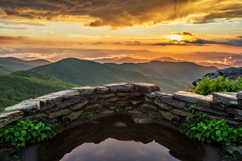
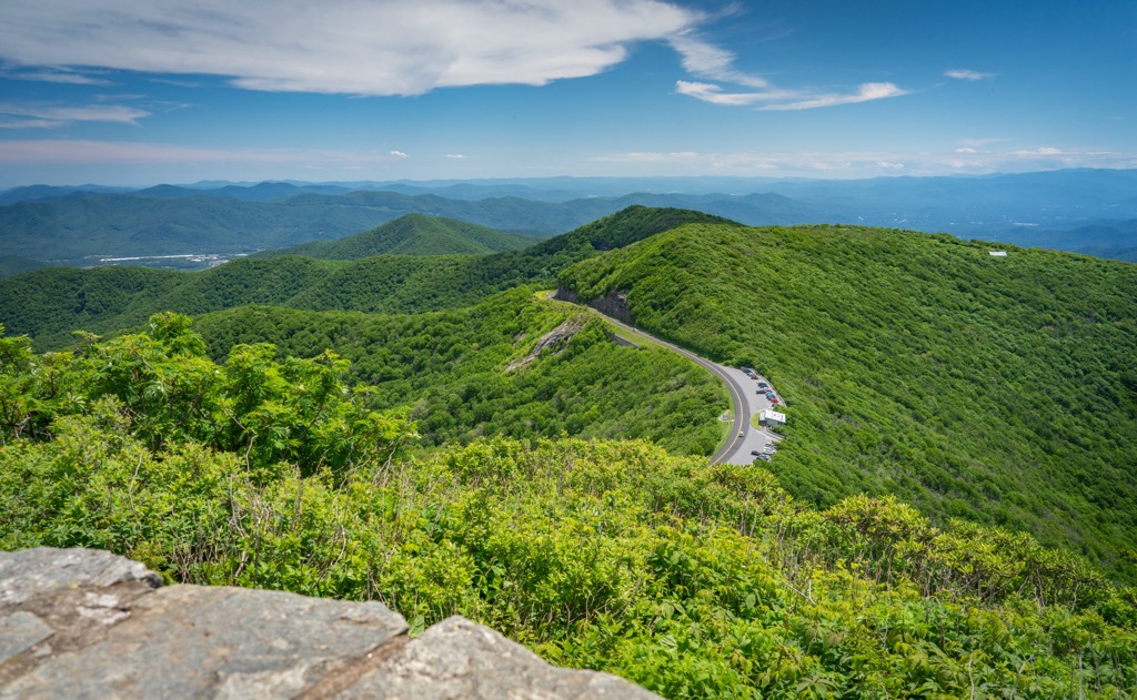
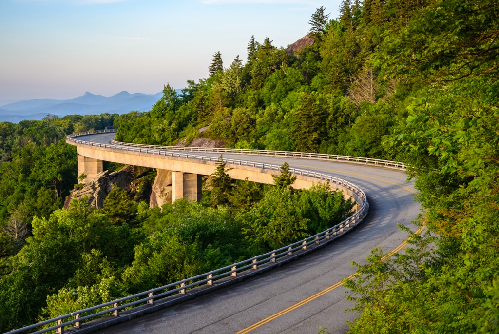
Additionally, the Great Craggy Mountains are surrounded by popular outdoor recreation areas. The range lies within Pisgah National Forest while the Craggy Mountain Wilderness Study Area and Blue Ridge Parkway run through the range. Mount Mitchell State Park lies just north of the range.
The Great Craggy Mountains mark a subrange of the larger Blue Ridge Mountains which extend from the US state of Georgia northward to Maryland and Pennsylvania.
The Blue Ridge Mountains are also a subrange of the greater Appalachian Mountains which span along the east coast of the US into the Canadian province of Newfoundland and Labrador. The peaks within the Blue Ridge Mountains are separated from the Black Mountains by the Cane River.
This range lies within the Blue Ridge Mountain geologic province where peaks consist of both igneous and metamorphic rocks. The Great Craggy Mountains share a similar geological history to the rest of the subranges in the Blue Ridge Mountains.
Rocks found in the range, and the rest of the Blue Ridge Mountains, date back to the Precambrian and Paleozoic eras. The entire range began forming between 1 billion to 250 million years ago in the Grenville and Alleghenian orogenies.
The peaks once lay along the seafloor but were slowly thrust upwards due to tectonic shifting. Over the course of millions of years the range was eroded, leaving behind the ridgelines and valleys visible today.
Major peaks within the Great Craggy Mountains are Craggy Dome, Lane Pinnacle, Snowball Mountain, Wallace Mountain, and Bullhead Mountain.
The ecology of the Great Craggy Mountains is similar to that of the nearby Pisgah National Forest. The surrounded network of national forest and wilderness areas allow for a variety of flora and fauna to thrive.
Lower and mid-elevations in the range are covered in shortleaf pine-oak heath, and oak-hickory forests. The range also features heath bald, blueberry, and large patches of rhododendron. Other tree species include red oak, mountain ash, beech, and buckeye.
The main ridgelines primarily feature low growing plants and grasses allowing hikers to have panoramic views of the range.
Common animal species found in the range include white-tailed deer, bobcats, black bears, coyotes, and beavers. Waterways in the region are populated by rainbow, brook, and brown trout.
The land in and surrounding the Great Craggy Mountains has been inhabited by humans for thousands of years, long before the arrival of European settlers in the region.
Determining precise territorial boundaries of the Indigenous peoples of the region can be difficult. However, this region marks part of the ancestral homelands of the Cherokee people. Artifacts from the Paleo-Indian culture have been found throughout the southeastern US, with some dating back as early as 8,000 years ago.
The ancestral homelands and traditional territory of the Cherokee Nation, and the Eastern Band of Cherokee Indians, spans across present-day North Carolina, Tennessee, and Georgia. The Blue Ridge Mountains are rich with fresh water sources and wildlife, making it an ideal place for the Indigenous peoples.
A Spanish expedition led by Hernando de Soto, marked the first recorded contact between the Indigneous people of the region and European settlers in 1540. Over time settlers began to inhabit the region. Many of the early Irish, English, and Scottish immigrants formed treaties and trade deals with the tribes of the region.
In the early 1700s, the various bands of Cherokee tribes joined forces and formed a unified government. Gold was discovered in nearby Georgia in the early 1800s leading to a drastic increase of settlers throughout the region. Many of these new people disregarded the Indigneous peoples’ claim to the land.
The discovery of gold ultimately led to the US government forcibly removing the Cherokee people and other tribes from the region. Settlers were backed by the US Army as they attacked, harassed, displaced, and killed the tribal members.
During this time the US government also tried to trick the Cherokee Nation into signing the Treaty of New Echota which would sign over all of their land. Though the Cherokee tribal leaders never signed the treaty, the US government proceeded with forcibly removing them from their land. Many of the Cherokee tribal members were forced onto reservations in present-day Arkansas and Oklahoma.
Those who survived were formed to make the long trek to the Midwest. This long and dangerous journey from the east coast to the midwest would later be known as the Trail of Tears. It is estimated that nearly a quarter of all who were forced on this journey died en route.
The Pisgah National Forest was formally designated in 1916 with continual expansions over the following decades. Today the Great Craggy Mountains offer ample opportunities for outdoor recreation for those throughout western North Carolina.
The Great Craggy Mountains are home to a plethora of hiking and backpacking trails. Here are a few of the most popular trails in the region:
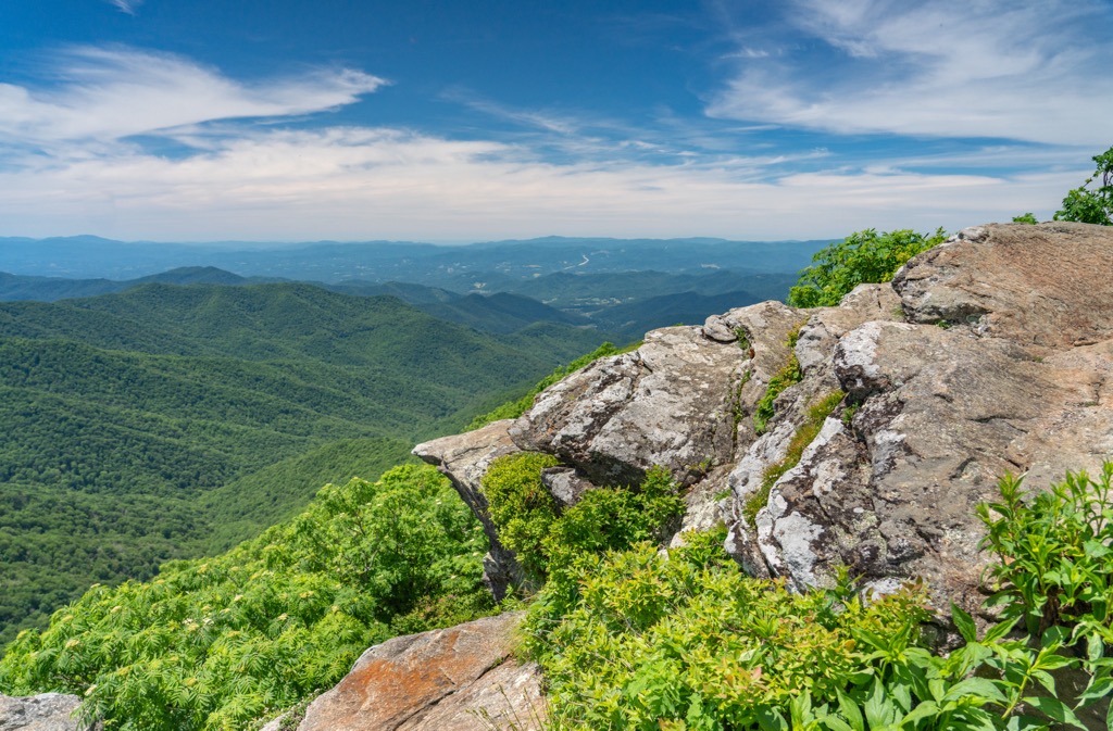
This hiking route is situated in the southern half of the Great Craggy Mountains within the Blue Ridge Parkway. The loop is the most popular hiking trail in the region and offers hikers sweeping views of the surrounding ranges and ridgelines.
The route begins by climbing steadily through the forested hillsides before opening up to a viewpoint near the summit of High Swan. This trail is 3.7 miles (6 km) round trip and features 882 feet (269 m) of total elevation gain.
The Craggy Pinnacle Trail is one of the most stunning hiking routes throughout the entire Blue Ridge Parkway. This route begins by climbing through the forested hillside while the trail is lined with a plethora of rhododendrons.
Purple and magenta flowers dominate the landscape for a few months out of the year, attracting visitors from across the region. A scenic plateau marks the turn around point for this route. Round trip the trail is just one mile (1.6 km) in length and features 242 feet (74 m) of elevation gain.
Despite being located just near the Blue Ridge Parkway, the Craggy Gardens Trail showcases some of the less viewed natural beauty. Hikers can simultaneously witness the blooming wildflowers and changing colors of leaves, all while taking in views of western North Carolina. This out and back trail is 1.9 miles (3 km) in length and features 574 feet (175 m) of total elevation gain.

Looking for a place to stay near the Great Craggy Mountains? Here are some of the best cities and villages to check out in the region:
The city of Asheville lies just southwest of the Great Craggy Mountains. Home to around 91,000 residents, Asheville is situated along the confluence of the Swannanoa and French Board rivers. Asheville marks the most populous city in western North Carolina, establishing it as the cultural and economic hub of the region.

The Blue Ridge Mountains surround the city, which has allowed it to blossom into an ideal spot for outdoor recreation. Throughout the year the city is known for its access to trails for hiking, trail running, and mountain biking. The waterways of the region are regularly used for whitewater rafting and paddleboarding.
Besides being a hub for outdoor recreation, Asheville is also known for its plethora of craft breweries, boasting the most breweries per capita for a US city. Other sites to see in the city include the River Arts District and the Biltmore Estate.
Old Fort is a small town located southeast of the Great Craggy Mountains. Home to around 815 residents, the town is surrounded by the Pisgah National Forest. The town’s close proximity to nature and multiple nearby waterfalls has established it as a hub for hiking and mountain biking.
Old Fort is one of fifteen Mountain Heritage Trout Cities in the state of North Carolina due to its pre-Revolutionary War history. Those passing through or staying in Old Fort can check out the McDowell County Visitor Center and the Mountain Gateway Museum that showcases some of the region’s history.


The highest peak in the Great Craggy Mountains is Craggy Dome, at 1,853 m.
The Great Craggy Mountains have 43 named peaks.


