
Scan the QR code and open PeakVisor on your phone
The Cohutta Wildlife Management Area (WMA) is located in the northern stretches of the US state of Georgia. The Cohutta Mountains lie within the WMA, marking some of the oldest mountains in the world. The tallest and most prominent peak in the region is Flat Top Mountain at 3,727 feet (1,136 m) tall with 630 feet (192 m) of prominence.
The Cohutta WMA lies in the northern section of the US state of Georgia, along the state’s border with Tennessee. This terrain lies within the Conasauga District of the Chattahoochee-Oconee National Forest.
Spanning 96,503 acres (39,053 ha), this WMA covers land in Murray, Fannin, and Gilmer counties. Terrain in the region is similar to that found throughout northern Georgia, southeastern Tennessee, and southwestern North Carolina.
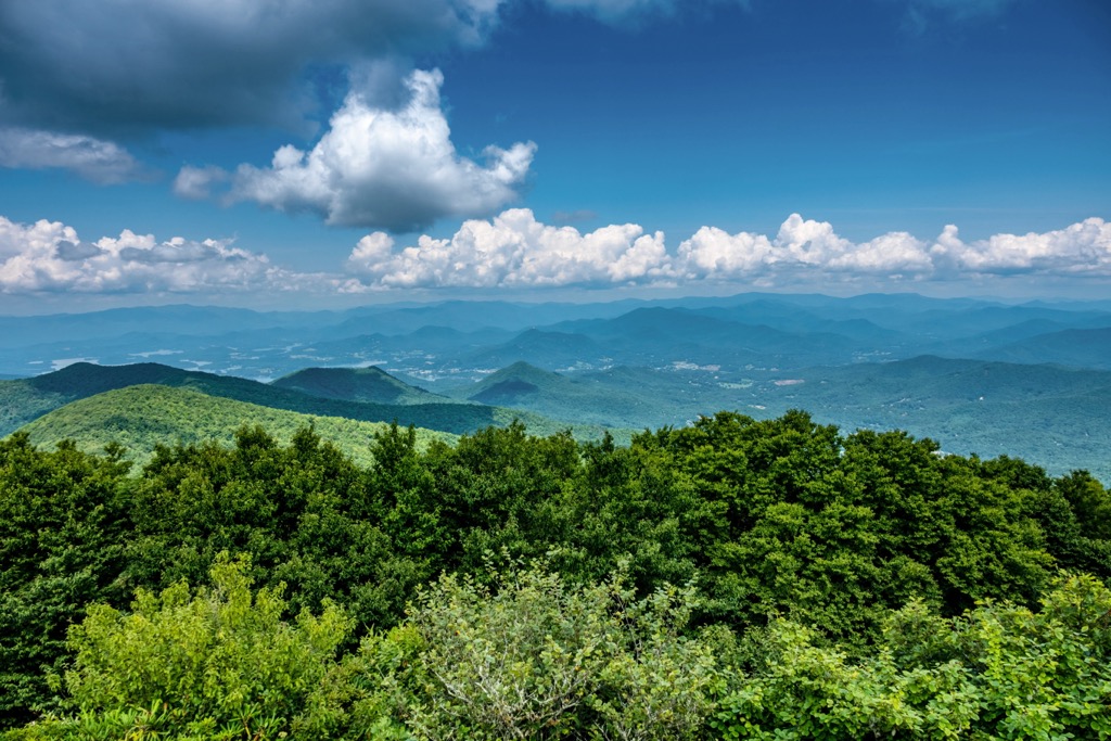
Rolling hillsides are met with deep valleys and dense sections of forest, interspersed with small fields and plateaus. The Conasauga River and Jacks River run through the north of the WMA while the Ellijay River and Coosawattee River are situated to the south.
The main ridgeline runs roughly in an east to west fashion with the eastern side of the range trending to the north. Cohutta WMA is situated near Georgia's border with both Tennessee and North Carolina.
Peaks found in the region are part of the Cohutta Mountains, which travel northeast where they are classified as the Smoky Mountains. The surrounding ranges are part of the Blue Ridge Mountains, a subrange of the Appalachian Mountains.
Additionally, the Cohutta WMA is surrounded by popular outdoor recreation areas. The WMA is encompassed in the Cohutta Wilderness, which marks the second largest wilderness in the state of Georgia. Both the wilderness and WMA lie within the range lies within the Conasauga District of the Chattahoochee-Oconee National Forest.
Other nearby areas include sections of Chattahoochee-Oconee National Forest while the Cherokee National Forest and Gee Creek Wilderness are located to the north in Tennessee.
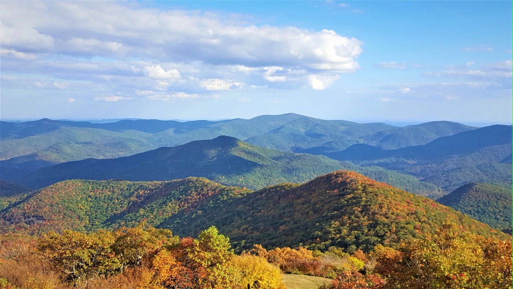
The Cohutta Mountains define the terrain in the Cohutta WMA. These peaks mark part of the oldest known mountains found in the entire world. The northeast trending range runs into the states of Tennessee and North Carolina where they transition into the Smoky Mountains.
These peaks are part of the Blue Ridge Mountains, a subrange of the Appalachian Mountains which extend from the US state of Alabama, northward into the province of Newfoundland and Labrador in Canada.
The WMA marks a unique geological region of the greater Blue Ridge and Appalachian Mountains. The rolling hills and ridgelines are surrounded by the relatively flat landscape of the Georgia Piedmont.
Both igneous and metamorphic rock can be found throughout the peaks in the WMA. Rocks in this region date back to the Precambrian and Paleozoic eras. These peaks began forming roughly 1 billion years ago, taking shape during the Grenville and Alleghenian orogenies.
The geological history of the region dates the Cohutta Mountains as one of the oldest ranges in the world, once marking the border of a prehistoric ocean. At hundreds of millions of years old, the Blue Ridge Mountains are much older than notable ranges such as the Alps and the Himalaya, both of which were formed during the Alpine orogeny, roughly 65 million years ago.
Tectonic activity slowly thrust up the surrounding mountain ranges. Millions of years of erosion carved out the landscape, leaving behind the deep valleys and rolling hills visible today.
Major peaks within the Cohutta WMA include Flat Top Mountain, Doogan Mountain, Dyer Mountain, Grassy Mountain, and Iron Mountain.
The Cohutta WMA is part of the larger Blue Ridge Mountains ecoregion, which spans across sections of Georgia, North Carolina, South Carolina, Tennessee, and Virginia. The varied topography and abundance of rivers and streams allow for a variety of flora and fauna to thrive.
Lower elevations are often populated by forested patches featuring heath, oak, hickory, shortleaf pine, and chestnut trees. Many of these species are found near the waterways in the region. Forested sections at mid-elevations consist of mixed pine-hardwoods. The highest peaks in the WMA occasionally feature spruce and fir trees.
Some larger mammals that inhabit the region include deer, bobcats, foxes, coyotes, and occasionally black bears. Spotting these animals, with the exception of deer, is rather unlikely.
Waterways in the region are known for their prolific population of trout along with beavers and river otters. Birds commonly found include wild turkeys, ducks, sparrows, eagles, hawks, and owls.
The surrounding national forest is also home to the Phausis reticulata, commonly referred to as the blue ghost firefly. Named after its distinct blue color, visitors are most likely to spot this firefly during warm summer nights.
The land that is now part of the surrounding Chattahoochee-Oconee National Forest, has a human history dating back thousands of years. This land marks part of the ancestral homelands of the Cherokee people. Artifacts dating back to the Paleo-Indian culture have been found in the surrounding region.
The ancestral homelands of the Cherokee people are known to have extended throughout present-day northern Georgia and through parts of North Carolina and Tennessee.
The first recorded contact between Europeans and these Indigenous peoples occurred in 1540. A expedition led by Hernando de Soto of Spain traveled throughout the southeastern US, traveling into present-day Tennessee. Along the way, the expedition made contact with many Tribal Nations.
Many bands of the Cherokee Tribe went on to develop trade deals with the early English, Irish, and Scottish immigrants who settled throughout the region in the following decades. In the early 1700s, the Cherokee people had established a unified national government consisting of its many Tribes.
Discovery of gold in the surrounding Blue Ridge Mountains, led to a massive influx of settlers throughout the region during the 1800s. This increased population led to the US government forcibly removing the Cherokee from their ancestral lands.
This brutal process resulted in the death of many Cherokee people while those who survived were forced onto reservations. The Treaty of New Echota was signed in 1835, forcing the remaining Cherokee members to walk to reservations in present-day Oklahoma.
This widespread forced removal and journey would later be known as the Trail of Tears. An estimated 16,000 Cherokee people began the journey with nearly a quarter of them dying along the route.
Members who made it to Oklahoma would later form the Cherokee Nation. Some Cherokee people managed to stay on their native land and formed the Eastern Band of Cherokee Indians, with headquarters in present-day North Carolina on the Qualla Boundary.
Land purchased by the United States Forest Service in 1911 later became the Chattahoochee National Forest. More land was purchased throughout the following decades, further expanding the national forest lands. Eventually the forest was administratively combined with the Oconee National Forest.
The surrounding Cohutta Wilderness was established in 1975. Today the Cohutta WMA features over 158 miles (254 km) of trails that can be used for hiking, biking, and horseback riding.
There are numerous hikes found throughout the Cohutta WMA. Below are a few popular routes to check out on your next visit to the region:
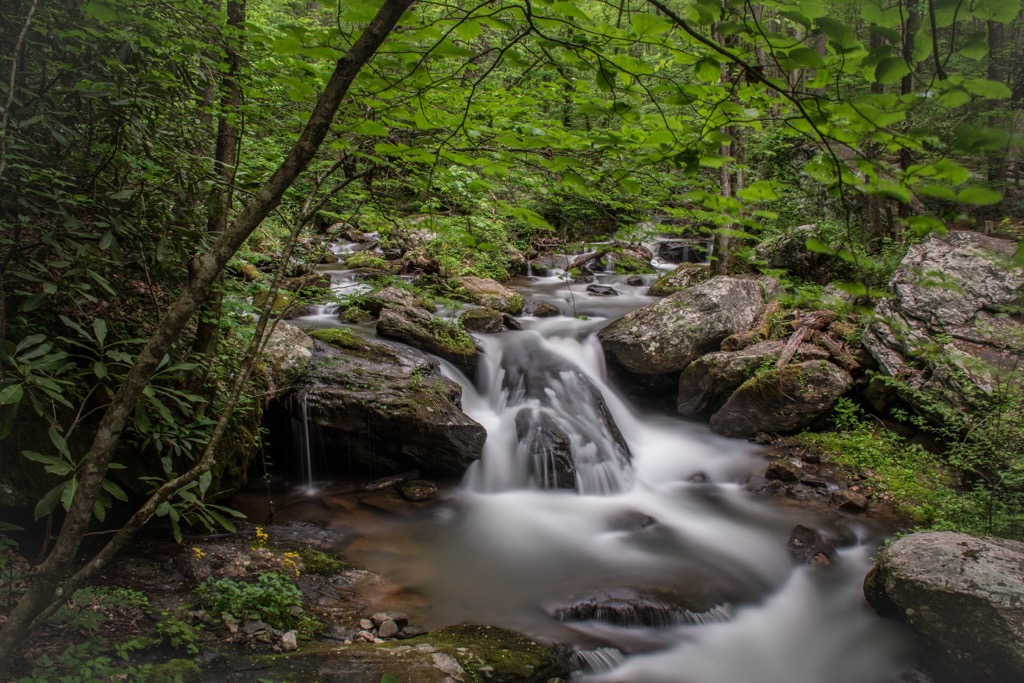
This out and back route is situated along the southern edge of the WMA. The trail winds through the forested landscape, following along Emery Creek throughout. Hikers should note that there are multiple creek crossings and this trail should not be hiked when water levels are high.
Along the route are two sets of waterfalls, nestled amidst the forested landscape. Visitors should wear footwear that can get wet. The out and back route is 5.9 miles (9.5 km) and features 902 feet (275 m) of elevation gain.
Situated in the southeastern portion of the WMA, this trail follows along the two branches of Bear Creek. The route can be hiked throughout the year and offers views of the changing forested landscape.
Numerous small climbs and descends lead hikers up towards the headwaters of the creek. This loop trail is 6.4 miles (10.3 km) long and features 1,108 feet (338 m) of total elevation gain.
Jacks River lies in the northern section of the WMA, along the state’s border with Tennessee. The river is known for having some of the best trout fishing in the entire state. This out and back route climbs steadily throughout and features 22 river crossings each way.
Though the trail can be completed as a day hike, it is often used as a backpacking route with a campsite located just past the Rice Camp trail. The entire route is 14.8 miles (23.8 km) long and features 1,059 feet (323 m) of elevation gain.
Looking for a place to stay near the Cohutta Wildlife Management Area? Here are some of the best cities and villages to check out in the region:
The city of Dalton, Georgia lies just west of the Cohutta Wildlife Management Area. Known as the “Carpet Capital of the World,” Dalton is home to 34,000 residents. The downtown streets are lined with local shops and restaurants while the Blue Ridge Mountains lie just a short drive to the north and northeast.

Those visiting the region can explore the Bandy Heritage Center Museum, Dave & Pauli’s Art Emporium, Burr Performing Arts Park, or the Artistic Civic Theatre. During the warmer months of the year, the nearby Conasauga River provides opportunities for kayaking, rafting, and swimming.
Chattanooga, Tennessee lies northwest of the Cohutta Wildlife Management Area, marking the closest major city. Situated along the Tennessee River, Chattanooga lies in the foothills of the Appalachian Mountains with a population of 180,000 residents.
As a major city in the state, Chattanooga is home to the Hunter Museum of American Art, Chattanooga History Center, and the Tennessee Valley Railroad Museum. The city is known for its thriving music and arts scene found throughout the downtown area. A short drive outside the city lies Rock City, a tourist attraction centered around Lookout Mountain that features a waterfall and stunning natural landscape.


_viewed_from_Eton_Elementary%2C_Jan_2018_1.jpg)


