
Share

Scan the QR code and open PeakVisor on your phone
Scan the QR code and open PeakVisor on your phone
The northernmost mountain range in the United States, the Brooks Range is a massive collection of remote peaks situated in the northern region of the state of Alaska and a small portion of the Yukon Territory in Canada. It contains 438 named peaks, the highest and most prominent of which is Mount Chamberlin (9,019ft/2,749m)
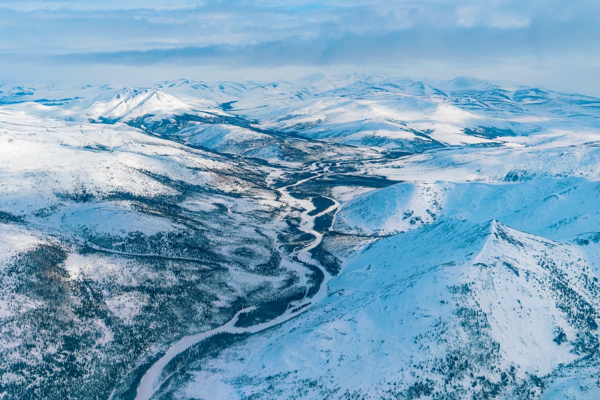
Situated in northern Alaska, the Brooks Range (Athabaskan: Gwazhał) is a major mountain range in the North American Arctic. The range extends for about 700 miles (1,000km) from the westernedge of northern Alaska until its terminus in the northern part of Canada’s Yukon Territory.
For the most part, the Brooks Range is located within the North Slope Borough, though it also extends into the neighboring Northwest Arctic Borough and the Unorganized Borough. The range is almost entirely located north of the Arctic Circle, though there are some peaks in the western portion of the range that are just a few minutes of latitude to the south of the Circle.
The Brooks Range is situated to the south and east of the Arctic Ocean, and, in particular, the Beaufort Sea and the Chukchi Sea. Meanwhile, it is located to the west of the Yukon Intermountain Ranges and to the north of the Alaska Intermountain Ranges, both of which are collections of loosely-related peaks in the Yukon and Alaska, respectively.
Within the Brooks Range, there are a number of large national parks, preserves, monuments, and wildlife refuges. These include the Arctic National Wildlife Refuge, which forms a contiguous protected area in the eastern part of the range with Ivvavik National Park and Vuntut National Park in Canada’s Yukon Territory, and the Mollie Beattie Wilderness.
Other federally-managed land areas located within the range include the Gates of the Arctic National Park and Preserve, the Gates of the Arctic Wilderness, the Noatak Wilderness, Noatak National Preserve, Cape Krusenstern National Monument, Kobuk Valley National Park, Selawik National Wildlife Refuge, and the Selawick Wilderness Area.
Moreover, the Brooks Range is situated just to the north of the Yukon Flats National Wildlife Refuge, Kanuti National Wildlife Refuge, and the Nowitna National Wildlife Refuge, all of which are located in lower-lying floodplains of the region’s major rivers.
Technically speaking, the Brooks Range is a part of the greater Rocky Mountains system, which cuts across the Canadian territories and provinces of the Yukon and British Columbia, before entering the United States and continuing southward to northern New Mexico.
However, the Canadian definition of the Rockies generally terminates in the Far Northern Rockies of the Canadian Rockies in British Columbia and the peaks in the Yukon are considered to be a separate mountain system.

Regardless of how one defines the Rocky Mountains, however, the Brooks Range is unequivocally the northernmost part of the American Cordillera, which is a major system of mountain ranges that extends from the range southward, through North America and South America before terminating in the Andes in the southernmost tip of Chile and Argentina.
In particular, the range is believed to have formed during the Mesozoic as the Arctic Alaska terrane collided with another terane offshore. During the Tertiary, the range uplifted further, helping to create the mountains that we see today.
For the most part, the rocks within the Brooks Range are sedimentary in origin, with large outcrops of limestones, particularly in the central part of the range. Since much of the range’s rock originated under an ancient sea, it is particularly rich in marine fossils, which one would not ordinarily expect to find at such high elevations in inland Alaska.
Moreover, the region did have some fairly sizable deposits of precious metals, especially gold. In fact, the Brooks Range saw its own version of a gold rush after the height of the Klondike Gold Rush in nearby Yukon, especially after miners found some gold in the Koyukuk River.

While much of the gold wasn’t extractable due to the miner’s limited technology, some large nuggets were found in the Kobuk River and its tributaries in the early 1900s. The major gold deposits in the region, however, were found in Nome, which spurred its own gold rush from about 1899 to 1909 and was much more prosperous because of the ease with which gold could be extracted from the land.
Major peaks include Mount Chamberlin, Mount Isto, Mount Igikpak, Mount Michelson, Mount Hubley, and Killik Peak.
The Brooks Range is located within an ecoregion that’s defined by the WWF as the Brooks-British Range Tundra.

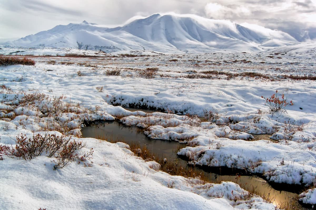
Within this region, the climate is decidedly Arctic, with frigid cold winter low temperatures and balmy summer highs. Additionally, the range receives relatively little precipitation, particularly when compared to other Alaskan mountain ranges to the south, such as the Chugach Mountains and the Saint Elias Mountains.
For the most part, the Brooks Range is dominated by a landscape of grases and shrubs. Other types of vegetation are limited and are found mostly at the lower elevations and in river drainages.
In particular, the treeline is located in the southernmost part of the range, about 300 miles (483km) to the north of the city of Fairbanks. Around the tree line, one can find some stunted white spruces, alpine firs, lodgepole pine, dwarf birch, and willow.
However, much of the range is alpine tundra, which is mostly grasses, sedges, shrubs, and similar hearty plants.
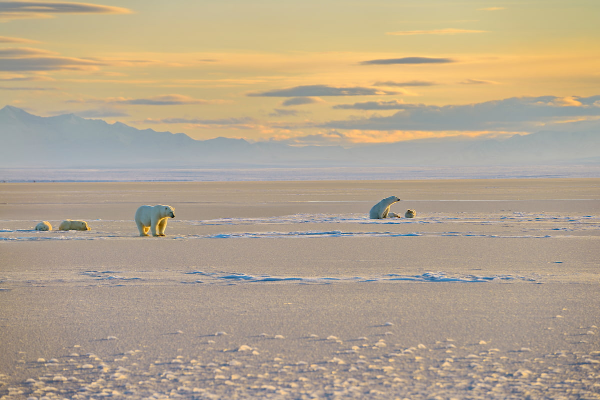
Wildlife is particularly abundant in and around the Brooks Range. Indeed,the range is located along the migration routes of a number of large herds of caribou. Other major species that live in the Brooks Range include polar bears, wolves, grizzly bears, Dall’s sheep, foxes, and snowshoe hares.
In the eastern part of the range, visitors can also find the northernmost breeding populations of both gyrfalcons and golden eagles in the United States.
Humans have lived in and around the Brooks Range for tens of thousands of years. The range is part of the traditional territory of a number of groups, including the Iñupiat, the Gwich’in, and the Koyukon.
Perhaps the first people of European descent to visit the inland portion of the range were Russian traders who journeyed up the Yukon River toward the city of Nulato. However, Russian traders were known to have traded with more northerly coastal communities earlier in the 19th century.
In the mid-1800s, the British Royal Navy sailed fairly extensively around the northern coastal regions of the Brooks Range in an attempt to map the coastline of the region.
Then, in the 1860s, the United States bought Alaska from Russia in the Alaska Purchase, which eventually led to the establishment of a number of military outposts and meteorological stations in the region, particularly in the town of Utqiaġvik.
By the 1880s and 1890s, the US Government launched a systematic geological and topographical survey of the Brooks Range in order to map the territory.
However, the first major influx of people of European descent from Canada and the contiguous United States into the Brooks Range started just after the height of the Klondike Gold Rush, when disappointed prospectors flocked westward after hearing about the discovery of gold in the Koyukuk River and near Nome.
Although relatively short-lived, like Alaska’s other gold rushes, the miners in Nome were particularly profitable from about 1899 to about 1909, after which point, many prospectors left the area.
The next major survey of the region was actually commissioned by the US Government to survey the Brooks Range and the North Slope for oil. In 1924, a team of geologists headed out into the range to survey for oil deposits, which then-President Warren Harding wanted to identify in case the country needed a future wartime supply of oil.
While the expedition didn’t actually identify any major petroleum reserves (which we now know do exist in sizable quantities), they did successfully manage to cross the range from south to north, traverse the North Slope, and arrive in the town of Utqiaġvik (then called Barrow).
During World War II, the US Government moved to create new infrastructure in Alaska out of fear of an enemy attack from the Pacific. The military established a number of airstrips in small communities around the range, including at Bettles, which is in the southern part of the Brooks Range.
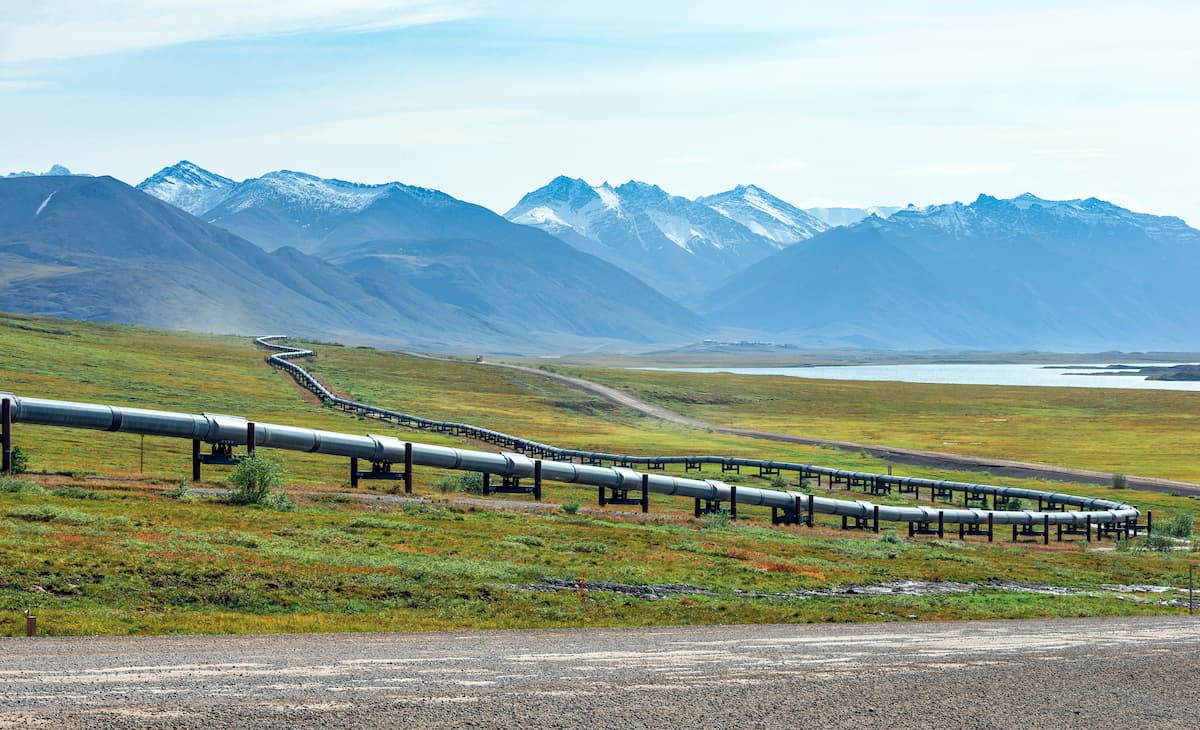
After the war, there was a push to create new roads in the region after the discovery of oil along the Arctic coastline. As a result, the then-governor of Alaska, Walter Hickel, approved a plan that allied for the creation of a highway so private companies could access the region’s northern oil deposits.
The road, which came to be known as the Hickel Highway, was built in 1969 over the course of 100 and was meant to connect Fairbanks to the communities at Bettles and Anaktuvuk Pass and to the North Slope at the community of Sagwon.
Unfortunately, the private companies that Hickel had hoped would use the road didn’t want land access to the oil fields - especially not one that was so far to the west that it served no purpose in helping to maintain the future Trans-Alaska Pipeline System. In fact, they were happy enough with their air and sea access and rarely ever used the Hickel Highway. Eventually, the road fell into a state of disrepair as the government of Alaska didn’t want to pay to maintain it.
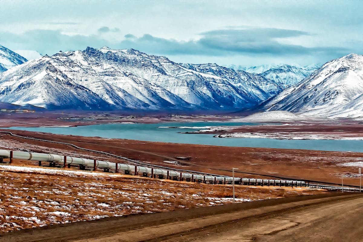
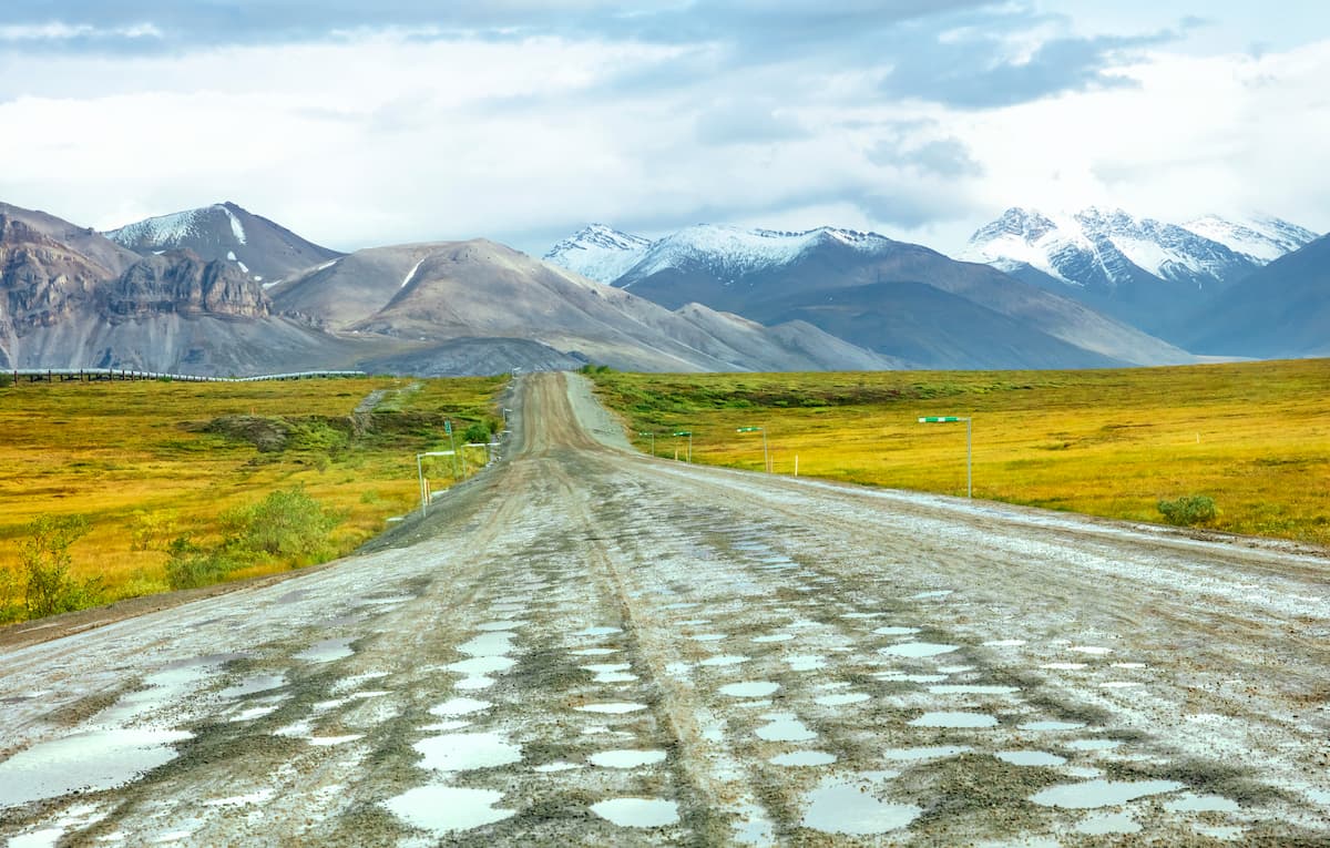
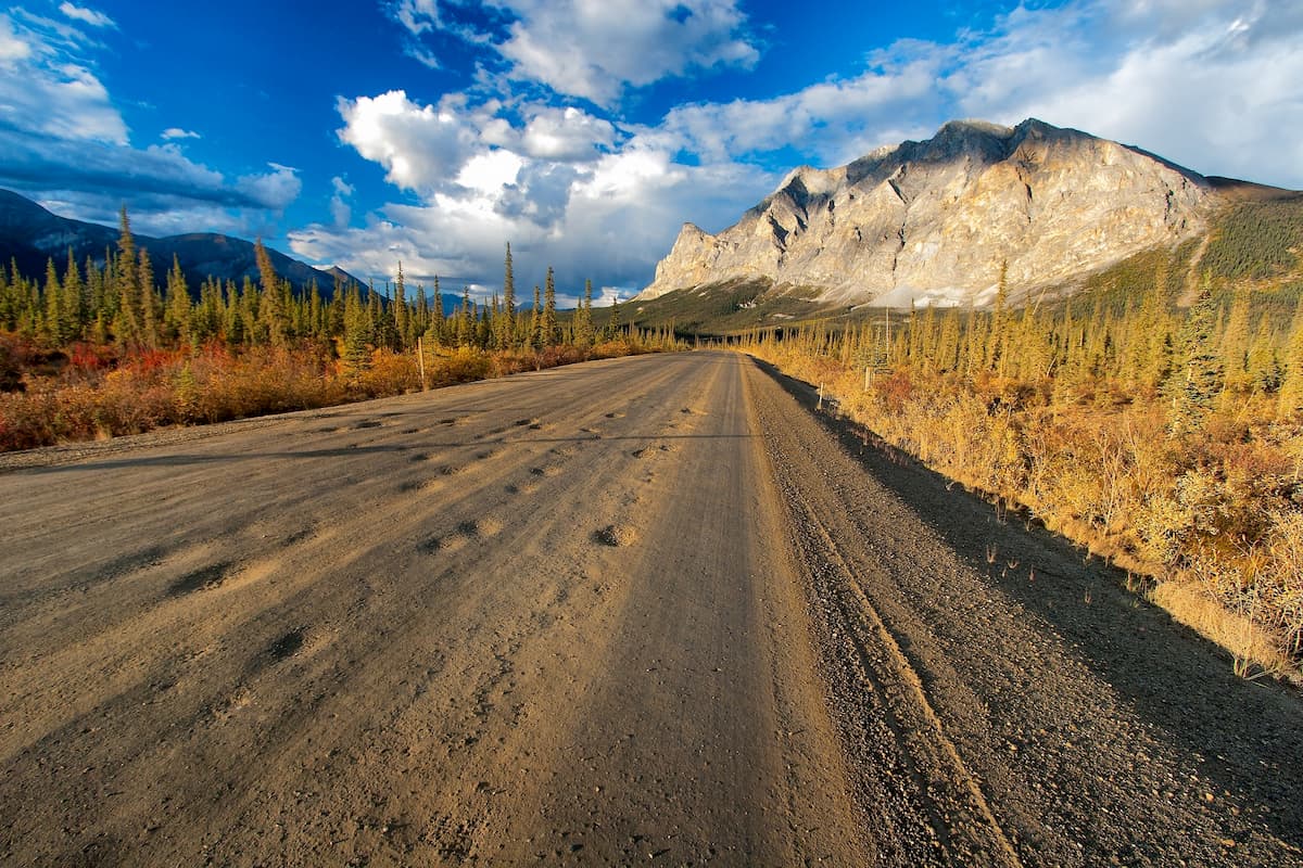
As the Trans-Alaska Pipeline System was built, however, the private oil companies in the region needed a route that would provide them with access from the coastal community of Deadhorse to the pipeline. As a result, the Alyeska Pipeline Service financed and built the earliest portion of the Dalton Highway, which connected the Yukon River to Livengood.
The road building really began in earnest, however, in 1975 and, after a few years, the company then “gifted” the road to the state, which eventually completed it and opened the entirety of the Dalton Highway (Alaska Route 11) to the public in 1994.
Around the same time as the construction of the Dalton Highway and the push for Arctic oil exploration, there was also a movement to protect many of Alaska’s stunning natural landscapes.
In 1978, President Jimmy Carter established 15 national monuments in Alaska, many of which were later converted into national parks and preserves with the passage of the Alaska National Interests lands Conservation Act (ANILCA) in 1980.
Among the protected areas were the Arctic National Wildlife Refuge, the Gates of the Arctic National Park and Preserve, the Kobuk Valley National Park, the Noatak National Reserve, and the Yukon Flats National Wildlife Refuge, all of which are located in or around the Brooks Range.
These days, due to the remoteness of the region, many of the Brooks Ranges’ parks are infrequently visited, especially when compared to other more southerly Alaska national parks like Kenai Fjords, Glacier Bay, and Denali.
However, the region is exceptionally culturally significant to the Indigenous peoples whose ancestors have lived in the area since time immemorial. Moreover, it is a popular destination for outdoor recreation for people looking to undertake an extended, self-supported expedition that’s well off the beaten path.
While the Brooks Range isn’t exactly the easiest of Alaska’s mountain ranges to access, it is home to some fantastic hiking opportunities. Here are some of the best places to check out in the range:
Gates of the Arctic National Park and Preserve is the second largest national park in the United States after Wrangell St. Elias to the south. It contains 74 named mountains - the highest and most prominent of which is Mount Igikpak - within its 8.4 million acres (3.3 million ha) area.
Encompassing an area larger than the country of Belgium, Gates of the Arctic is a vast area of stunning mountain scapes and Arctic tundra. There are no established trails in the park, however, so a solid understanding of backcountry navigation is a must in the park.
Getting to Gates of the Arctic is somewhat tricky, though you do have options. Visitors can fly into Bettles or Anaktuvuk Pass, which make for great starting points into the park. It’s also possible to drive from Fairbanks to Coldfoot, where there is a campground, post office, store, motel, and a small airstrip.
Or, hikers can simply start walking from the Dalton Highway and head directly into the mountains. The possibilities are truly endless!
Covering some 19.2 million acres (7.7 million ha), the Arctic National Wildlife Refuge is the United States’ largest wildlife refuge. It is situated in the northeastern corner of Alaska and it includes 78 named mountains, the highest and most prominent of which is Mount Chamberlin.
Forming a contiguous international protected area with Ivvavik and Vuntut National Parks in Canada, the Arctic National Wildlife Refuge is a haven for the region’s wildlife. The refuge is home to a wide range of species, including grizzly bears, moose, wolves, lynx, wolverines, caribou, and polar bears, though it is under threat from potential oil drilling and oil exploration.
The refuge is managed by the US Fish & Wildlife Service and is open to hikers and backpackers all year long. However, like Gates of the Arctic, there are no official trails in the Arctic National Wildlife Refuge, so map and navigation skills are a must.
While the Brooks Range is certainly remote, it is home to a number of communities. Here are some of the best places to check out if you’re visiting the region:
The largest city in Alaska’s interior region, Fairbanks is home to about 31,000 residents and is located to the south of the Brooks Range. While the city is not in the Brooks Range, it is home to the region’s largest airport and is connected to Anchorage and many other major Alaskan communities by road.
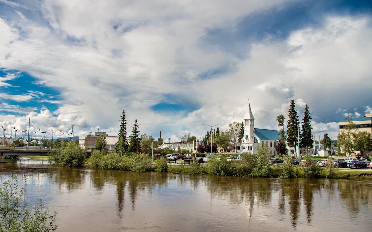
As a result, most people venturing into the eastern part of the Brooks Range start their travels in Fairbanks, where you can drive up the Dalton Highway or take a flight to one of the region’s smaller communities.
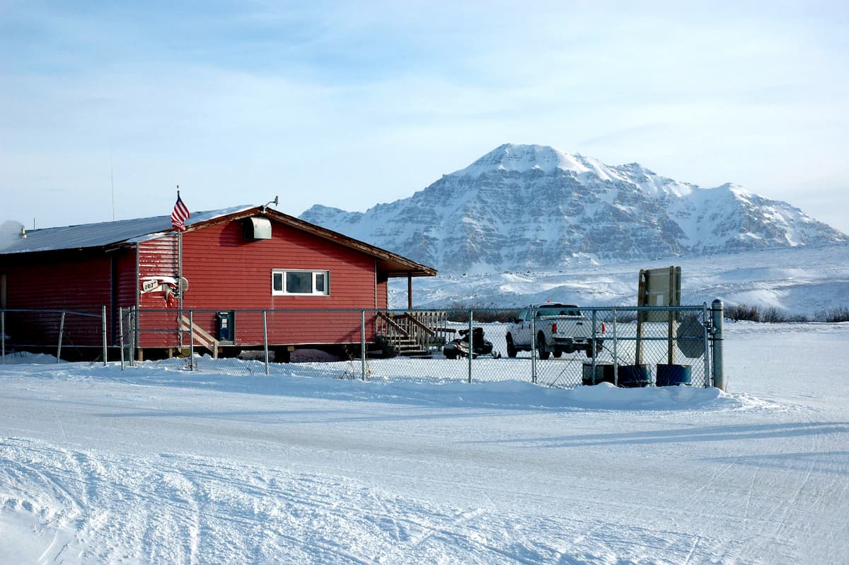
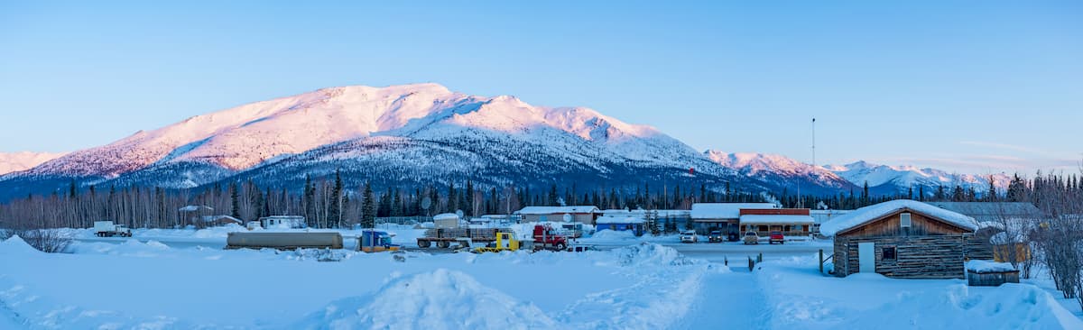
Located in the heart of the Brooks Range, Coldfoot is home to about 10 people. While the town is not particularly large, it is situated along the Dalton Highway and it serves as the last service point for some 240 miles (400km) before the town of Deadhorse.
Coldfoot does have a lodge and other services for tourists, which make it a nice stop on your way into the Brooks Range. Moreover, the US Fish & Wildlife Service, the National Park Service, and the Bureau of Land Management run a joint visitor center in the town during the summer months.
Situated off the western edge of the Brooks Range, Kotzebue is a city of about 3,000 people. Kotzebue is located close to the city of Nome and it is generally regarded as a gateway to the region’s parks, such as Kobuk Valley National Park and Selawik National Wildlife Refuge. It is accessible by air from both Anchorage and Nome,
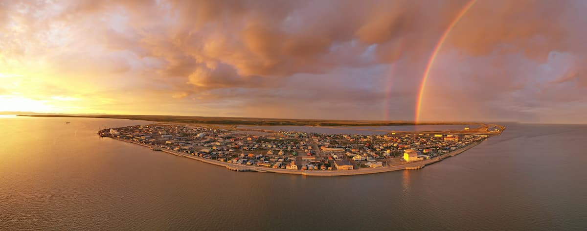
Formerly known as Barrow, the town of Utqiaġvik is the northernmost city in the United States. It is home to about 4,200 residents, which makes it the largest city in the North Slope Borough. While no roads connect the city to the rest of Alaska, it does have an airport with regular connections to Anchorage and Fairbanks and can be a nice starting point to trips to the rest of the Brooks Range.
Explore Brooks Range with the PeakVisor 3D Map and identify its summits.


