Scan the QR code and open PeakVisor on your phone
The Noatak National Preserve is a remote protected region situated in the northwestern part of the US state of Alaska. The region helps protect the Noatak River Basin and lies north of the Arctic Circle. The tallest and most prominent of the 26 named peaks is Black Mountain at 4,944 ft (1,507 m) tall with 3,205 ft (977 m) of prominence
The Noatak National Preserve lies in the northwestern stretches of the US state of Alaska. It lies above the Arctic Circle and covers 6.5 million acres (2,630,457 ha) of land with 5.7 million acres (2,306,708 ha) being designated as the Noatak Wilderness, the fourth largest wilderness area in the country.
This national preserve was established in order to protect the Noatak River Basin, which marks one of the only fully remaining intact ecosystems. The Brooks Range marks the northern boundary while the Baird Mountains are to the south. Together these boundaries help enclose the valley of the Noatak river.
The entire preserve lies within the Arctic Circle and is home to the largest mountain-ringed river basins in all of North America. The remote nature of the preserve has helped ensure minimal amounts of human interaction, allowing the natural habitat to thrive.
While southern stretches of the preserve feature a forested landscape, a majority of the protected region consists of arctic tundra. The thin boreal forests in the south are met with the towering peaks of the Brooks Range that surround the basin.
Though summer temperatures in the tundra can reach around 70 degrees Fahrenheit (21 degrees Celsuis), the terrain becomes extremely cold throughout much of the year, making it impossible for many plants to grow. Further north lies a polar desert which marks one of the driest places on earth.
The Noatak River cuts across the center of the preserve in an east to west fashion before entering the Kotzebue Sound of the Chukchi Sea. The river spans 400 miles (644 km) and is classified as a Wild and Scenic River. Major lakes in the preserve include Feniak Lake, Lake Narvakrak, Tulugak Lake, and Navashak Lake.
Noatak National Preserve is located near numerous forests and wilderness areas. The Kobuk Valley National Park and Selawik National Wildlife Refuge lie to the south while Gates of the Arctic Wilderness is situated directly east. The Alaska National Petroleum Reserve is situated to the north while the Cape Krusenstern National Monument lies to the west.

The peaks within and surrounding Noatak National Preserve are part of Brooks Range (Gwazhał). These peaks are considered by some to be the northernmost subrange of the greater Rocky Mountains which extend southeast through Canada and the US.
The entire Brooks Range spans 700 miles (1,100 km) east to west covering land in northern Alaska into Canada’s Yukon Territory. These rugged and impressive peaks once lay on the floor of an ancient seabed. As the ocean retreated, marine fossils were embedded into the rock formation. Today, fossils found in the limestone structures date back to the Cambrian period.
Additionally, the rugged landscape was formed from its location along a fold and thrust belt. During the Mesozoic, the land was slowly thrust upwards, giving rise to the jagged peaks that define the region. Further uplift was caused by the collision of the Arctic Alaska terrane and the oceanic Angayucham terrane.
Igneous and metamorphic rocks from the Precambrian can be found throughout the preserve and much of northern Alaska. Much of this region remained ice free during the Pleistocene which allowed humans to migrate into present-day North America.
The polar desert that lies northeast of the preserve and Brooks Range, was formed during the Cenozoic era 66 million years ago. Continual phases of glaciation and glacial retreating further carved out the region leaving behind the sweeping river valley.
Major peaks found within the Noatak National Preserve include Black Mountain, Tututalak Mountain, Siniktanneyak Mountain, and Mount Koklak.
The varied topography of the region allows for a variety of both flora and fauna to thrive throughout the national preserve. The southern edge of the preserve marks a transitional zone between the thin boreal forest and the arctic tundra to the north.
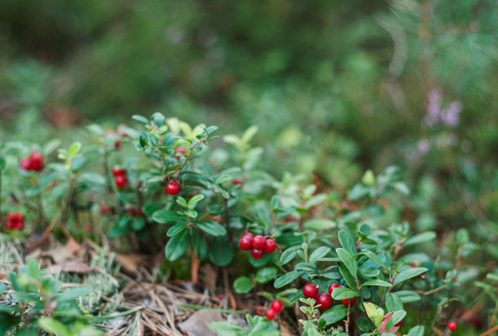
The southern portions of the preserve feature patches of boreal forest though a majority of the plant life consists of low-growing tundra. The tundra regions commonly feature mountain alder, dwarf bird, Labrador tea, willows, and cottongrass. Wetter sections feature a bog terrain which supports populations of bog rosemary, cranberry, and salmonberry.
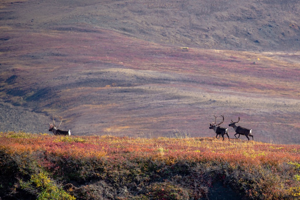
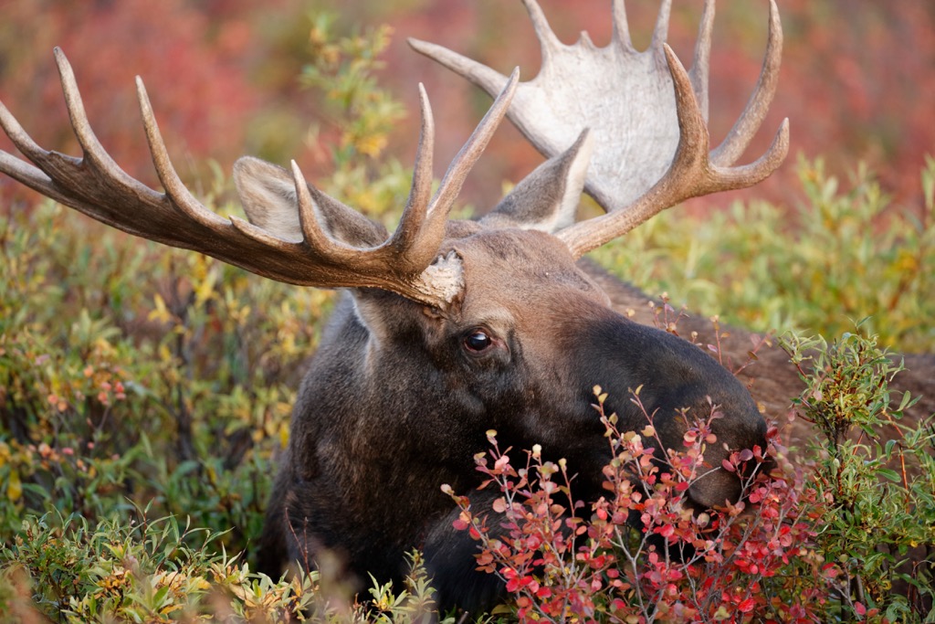
The vast protected region is abundant with animal life. Larger mammals in the region include grizzly bears, Alaskan moose, black bears, Arctic foxes, Dall’s sheep, wolves, and caribou. Large birds found in the preserve include Canada geese, tundra swans, as well as a variety of loons. Birds of prey such as golden eagles, rough-legged hawks, and gyrfalcons are also common.
The Noatak River that runs through the center of the preserve, marks important breeding grounds for chum, pink, chinook, and sockeye salmon. The lakes of the region are home to species of trout along with Arctic grayling, and Arctic char.
While there have been minimal findings of human occupation within the national preserve, the land surrounding the preserve contains numerous archaeological sites. It is estimated that humans have inhabited the region beginning as early as 13,000 years ago, with discoveries having been made along the Bering Land Bridge National Preserve.
Researchers have discovered traces of the Arctic Small Tool tradition (ASTt) throughout the surrounding region. The early ancestors of the contemporary Iñupiat are likely to have settled along the west coast of present-day Alaska. Over time the Indigneous peoples began traveling throughout the Brooks Range, which marks the traditional homelands of the Nunamiut (Nunataaġmiut), an Iñupiat people.
For thousands of years the Indigneous people lived harmoniously with the land, withstanding the harsh conditions of living above the Arctic Circle. Remnants of settlements dating back to the 1600s have been found along lake shores in the preserve. It is believed these settlements were abandoned due to the arrival of diseases brought by Europeans which the Indigenous peoples had no natural immunity to.
During the 1850s, British explorers arrived in the Noatak Valley. Surveys by these British expeditions continued throughout the following decades. By the end of the nineteenth century, a large influx of people fled to the region for the Klondike gold rush.
This influx of people further forced the Indigneous people from their homelands. By the early 1900s, nearly all of the Indigenous peoples of the region were centered around the community of Noatak.
The region was originally established as the Noatak National Monument in 1978 by then President Jimmy Carter. In 1980, the region was designated a National Preserve. To this day there are no roads that enter the preserve; instead visitors can enter by air, boat, or snowmobile.
Since the establishment of the preserve, a majority of the region has been designated a wilderness and the Noatak River is classified as a National Wild and Scenic River.
There are no designated trails within the Noatak National Preserve and no designated roads leading into the region. Hikers will find seemingly endless ‘’game trails’ that have been established by the wildlife of the region.
One of the most popular ways to explore the preserve is to float the Noatak River. The headwaters of the river are located at the Gates of the Arctic National Park and Preserve and the river flows westward across the Noatak National Preserve.
Most visitors who float the river begin near the headwaters and end at Lake Matcherak, Kotzebue, or the small village of Noatak. Besides the headwaters, the Noatak River features class I-II rapids and the ideal time to float is between July and September.
Those with wilderness experience can enjoy the endless amounts of backcountry hiking and camping within the preserve. The region marks one of the least disturbed ecosystems in the world, with stunning views throughout.
Hikers can hire a charter plan to drop them off in the preserve, or pick them up along the Noatak River. Many people choose to float part of the river and get picked up by plane from the center of the preserve. Opportunities for flightseeing are also available with charters operating out of Kotzebue and Bettles.
Looking for a place to stay near the Noatak National Preserve? Access into the preserve is easiest during the summer months. Below are a few local spots that provide the easiest access to the preserve.
The city of Kotzebue (Qikiqtaġruk), lies in the Arctic Borough region of the state of Alaska. Home to around 3,200 residents, the city marks the most populous community in the entire region.

Kotzebue is situated on a spit that reaches out into the Kotzebue Sound and is situated near the drainages of the Kobuck, Selawik, and Noatak rivers. Around eighty percent of the population are Iñupiat, many of whom practice their cultural traditions.
Visitors can check out the Northwest Arctic Heritage Center to learn more about the native history of the people and the region. The city can be reached by plane with regularly scheduled air taxis from Anchorage.
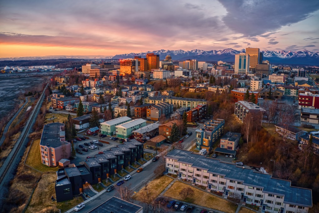
Situated along the south central coast of the state, Anchorage is the most populous city in all of Alaska. Home to around 292,000 residents, Anchorage contains around 40% of the state’s population. The city lies along the Cook Inlet and often acts as a common refueling spot for international cargo flights.
Just outside the city limits lie the expansive frontier of Alaska. East of the city lies Chugach State Park while Kenai National Wildlife Refuge is to the south, Lake Clark National Park and Preserve to the west and the Denali Wilderness to the north. Anchorage is also home to numerous museums including the Alaska Native Heritage Center and the Alaska Museum of Natural History, among others.