Scan the QR code and open PeakVisor on your phone
The Gates of the Arctic Wilderness is a remote protected region situated in the northern part of the US state of Alaska. The rugged landscape in Gates of the Arctic is the third largest designated wilderness area in the country. The tallest and most prominent of the 99 named peaks in the wilderness is Mount Igikpak at 8,264 ft (2,519 m) in elevation and with 6,142 ft (1,872 m) of prominence.
The Gates of the Arctic Wilderness lies within Gates of the Arctic National Park and Preserve. It covers 7.2 million acres (2,913,700 ha) of land, making it the third largest designated wilderness in the nation after the Wrangell-Saint Elias Wilderness and Mollie Beattie Wilderness.
The region got its name after Bob Marshall traveled to it in the 1930s and found two massive peaks that looked like a stunning gateway into the Arctic. These massive peaks are situated at the North Fork of the Koyukuk River.
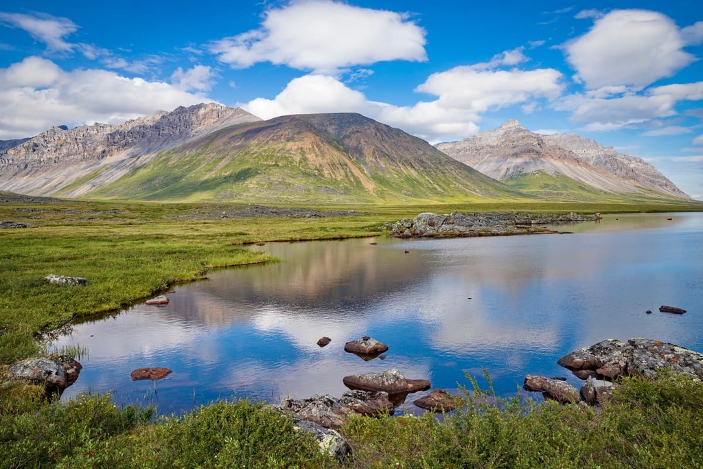
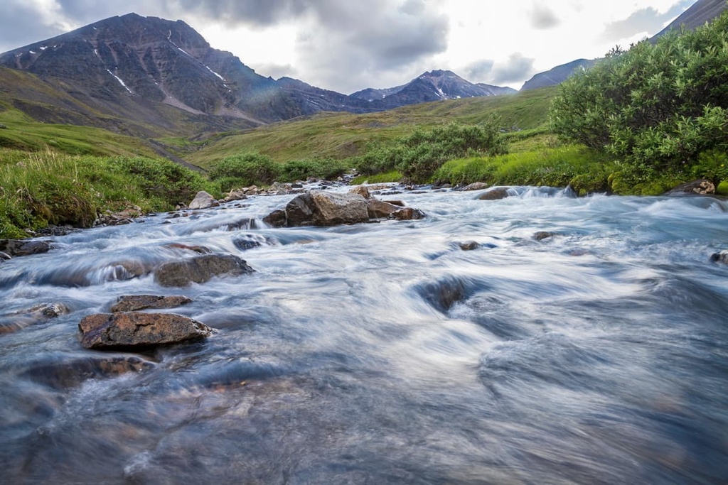
The Brooks Range runs throughout the wilderness, which lies entirely above the Arctic Circle. Sweeping glacial cirques and valleys can be found throughout the parts of the wilderness that are located in the Brooks Range. Additionally, the southern slopes of the region feature thin boreal forests that quickly give way to the rugged and remote mountain range.
Rolling tundra lies to the north of the range and it features a landscape that’s too dry and cold for trees to grow. To the north of the tundra lies a polar desert that’s classified as one of the driest places on the planet.
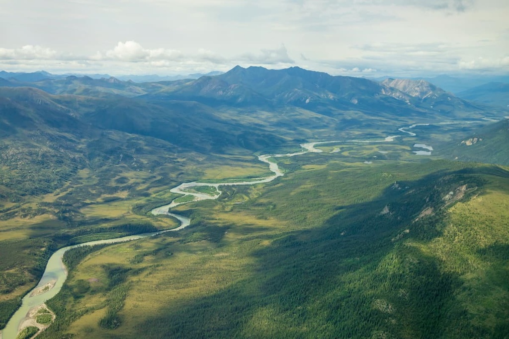
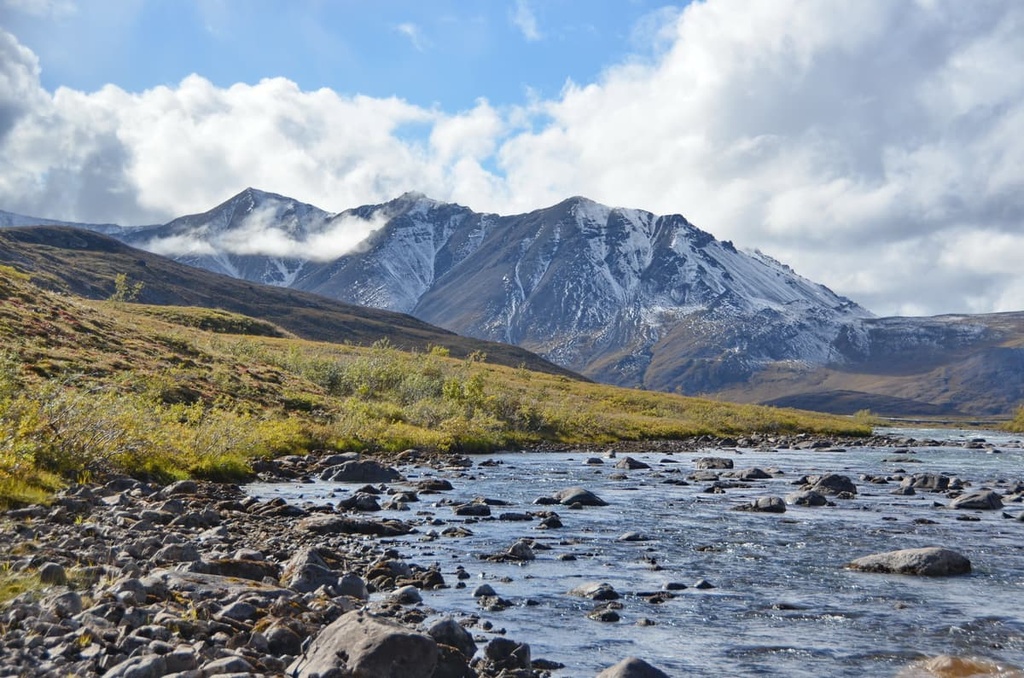
Numerous rivers and alpine lakes are scattered throughout the wilderness, helping the local fauna survive the region’s otherwise inhospitable conditions. There are six Wild and Scenic Rivers that lie entirely within or partially within the wilderness. These include all of the Alatna River, John River, Kobuk River, North Fork of the Koyukuk River, Tinayguk River, and part of the Noatak River, which is the longest Wild and Scenic River in the entire country.
Gates of the Arctic Wilderness is located near numerous forests and wilderness areas. These include the rest of the Gates of the Arctic National Park and Preserve, Noatak Wilderness Area, Arctic National Wildlife Refuge, and Yukon Flats National Wildlife Refuge.
The peaks within the Gates of the Arctic Wilderness are part of Brooks Range (Gwazhał), which is considered by some to be the northernmost subrange of the greater Rocky Mountains. The Brooks Range spans 700 miles (1,100 km) east to west from northern Alaska into Canada’s Yukon Territory.
The rugged landscape of the range was formed in an ancient seabed, which left behind marine fossils which can still be found today. Fossils from the Cambrian period have been found in the limestone structures of the central Brooks Range.
Additionally, the range lies along a fold and thrust belt, which led to its formation during the Mesozoic. During this time, the Arctic Alaska terrane collided with the oceanic Angayucham terrane, leading to uplift of the region.
Both Precambrian igneous and metamorphic rocks can be found throughout the wilderness and much of northern Alaska. During the Pleistocene, much of northern Alaska remained ice free, allowing humans to migrate into what’s now known as North America.
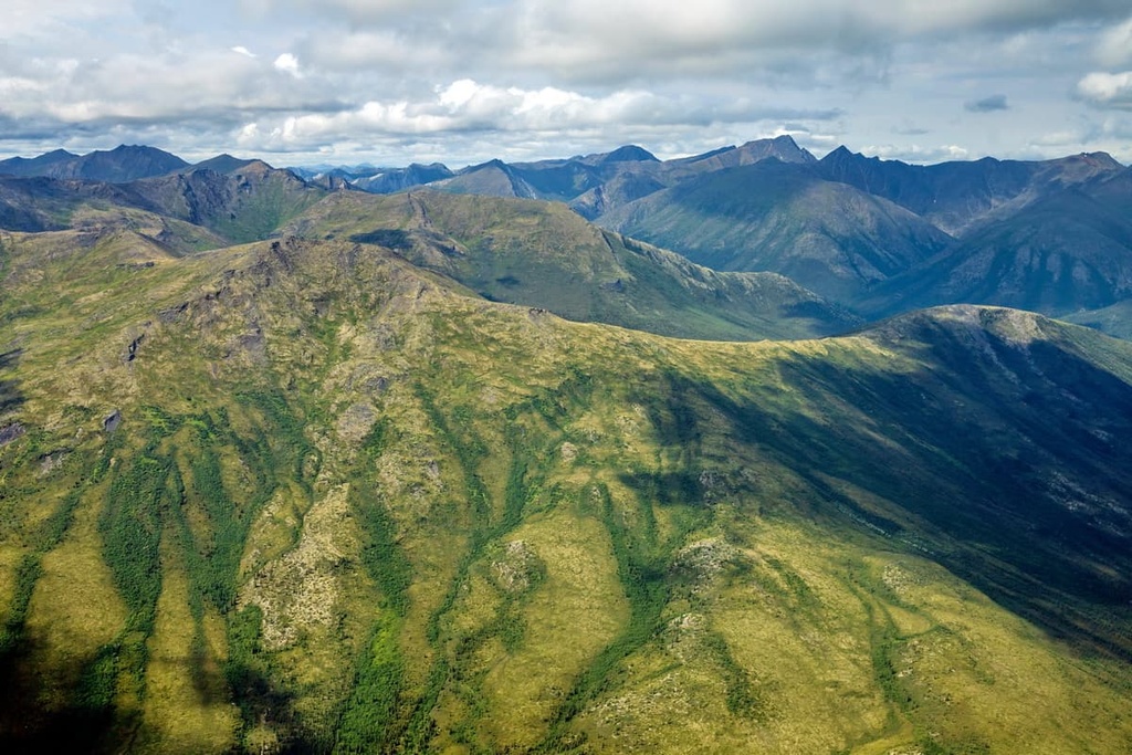
The Cenozoic era began 66 million years ago and led to the formation of the polar desert that’s situated just to the north of the Brooks Range. Today, the desert is characterized by a dry landscape with sand dunes. Alternating phases of glaciation and glacial retreat carved out the wilderness, leaving behind the glacial cirques and rugged peaks that we see to this day.
Major peaks found within the Gates of the Arctic Wilderness include Mount Igikpak, Killik Peak, Grizzly Mountain, Cockedhat Mountain, and Bluecloud Mountain.
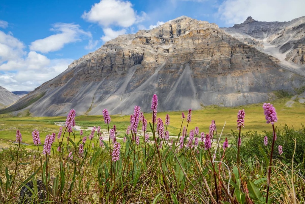
The vast landscape of the Gates of the Arctic Wilderness experiences extreme temperatures and other harsh conditions. As a result, relatively few plants call the region home.
Most plant life in the region can be found in the southern stretches of the wilderness. Here, the boreal forest consists of black and white spruce trees. The northern stretches of the wilderness have minimal to no flora.
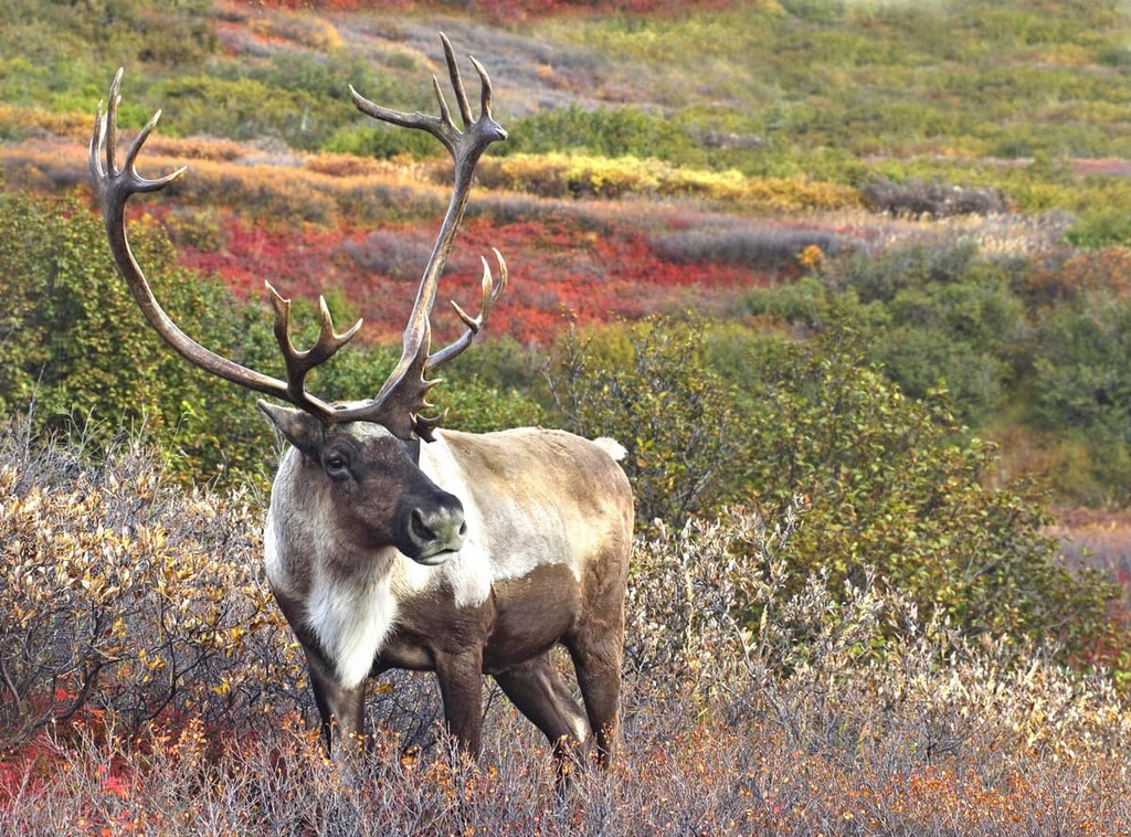
Caribou travel in large herds throughout the wilderness while grizzly bears roam in a more solitary fashion. Other large mammals found in the wilderness include moose, wolves, black bears, Dall sheep, wolverines, and coyotes.
Smaller mammals that are common in the wilderness are lynxes, Arctic ground squirrels, river otters, Arctic fox, beavers, snowshoe hares, muskrats, and collared pikas.
Numerous bird species live in the forested landscape of the region. Some of these species include peregrine falcons, bald eagles, Arctic terns, ospreys, golden eagles, great horned owls, and northern hawk-owls.
There are more than half a million caribou in the wilderness who migrate through the central Brooks Range twice each year: north in the summer and south in the winter. The waterways in Gates of the Arctic are also full of char, grayling, and chum salmon.
The land within the Gates of the Arctic Wilderness has been inhabited by humans for thousands of years. Nomadic peoples have inhabited the region for at least the last 12,500 years. Along Iteriak Creek lies the Mesa site, which has evidence of human habitation dating back 10,300 years.
Evidence of the people of the Arctic Small Tool tradition (ASTt) has been documented throughout the region. The first Iñupiat people began inhabiting the region around 1200 CE. The ancestors of the contemporary Iñupiat likely began settling along the coast of the region before eventually heading into the Brooks Range, which is where the Nunamiut (Nunataaġmiut), an Iñupiat people, traditionally call home.
A decline in caribou population led the nomadic Nunamiut people to leave their homelands during the early 1900s, though a rise in the caribou population led to their return in the 1930s.
By 1949, there were only two semi-nomadic groups in the region who came together to establish the Anaktuvuk Pass community along the Anaktuvuk River.
A Northern Athabaskan people known as the Gwich’in people have also lived in the region for the last 1,000 years but they eventually moved south out of the current wilderness boundaries. Many Gwich’in people currently live in communities in Alaska, Yukon, and Northwest Territories.
The region was not regularly visited by White settlers until the late nineteenth century. During this time, the prospect of gold led people to Alaska, though the northern stretches of the state were never as heavily mined for precious minerals.
The name of the park dates back to 1929 when wilderness activist Bob Marshall traveled through the region. After seeing the Frigid Crags and Boreal Mountain along the North Fork of the Koyukuk River, he stated the region appeared to be the “Gates of the Arctic.”
Efforts to protect the region and establish a national park began in the 1960s. Eventually, in 1978, the region was protected as the Gates of the Arctic National Monument. The region was later designated as a national park and preserve in 1980. The wilderness area was established at the same time.
Do keep in mind, however, that, while it may be referred to as a “wilderness” the region around Gates of the Arctic continues to be home to many Gwich’in and Iñupiat people. Many of the communities in the region are both small and remote, but they are a testament to the fact that people have lived in the area since time immemorial.
There are no designated trails within the Gates of the Arctic Wilderness, though there are countless ‘game trails’ that have been established by the wildlife of the region. Experienced hikers often try to travel around 6 miles (9.6 km) each day in the wilderness due to the ruggedness of the terrain.
Multiple river crossings, boggy ground, and dense vegetation make traveling through the landscape incredibly difficult. Learning about the topography of the region is essential for those planning a multi-day backpacking trip. Groups are limited to 10 people when in the wilderness as to help further preserve the protected landscape.
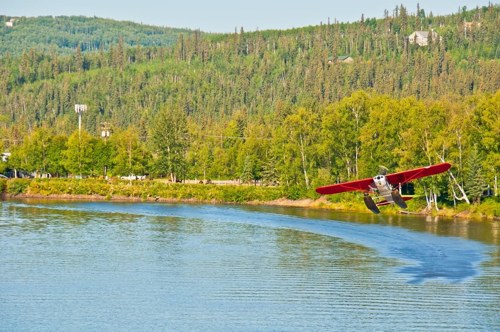
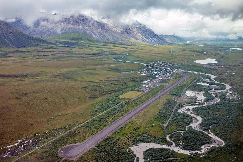
The National Park Service does not maintain any trail systems or roads as the region is intended to be a trail-free zone. Those wishing to venture to the region must fly from Fairbanks. Small airlines provide flights to the gateway communities around the wilderness, which include Coldfoot, Beetles, and Anaktuvuk Pass.
Looking for a place to stay near the Gate of the Arctic Wilderness? Those visiting the region should note that, while there are small settlements within the park, they are generally not open to tourists as they are very remote towns that have little infrastructure to support visitors.
With that in mind, here are some of the best cities and villages to check out in the region before or after your trip to Gates of the Arctic.
The city of Fairbanks serves as the main access point for those wishing to visit Gates of the Arctic. From the city, hikers can take an airplane to either Bettles or Anaktuvuk Pass to start their journey. The community of Coldfoot lies 280 miles (451 km) to the north of Fairbanks along Dalton Highway and offers a motel, store, and campground.
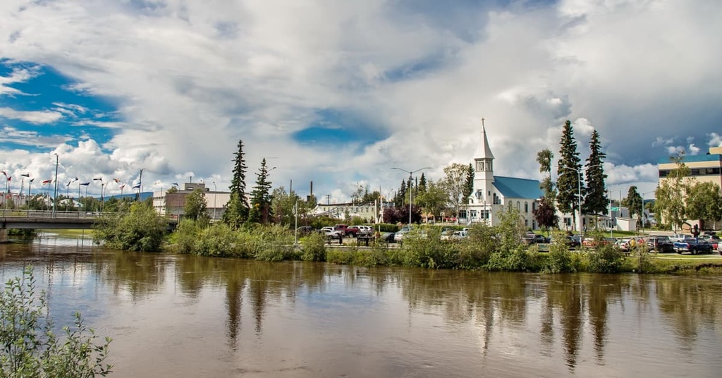
Fairbanks is home to around 32,000 residents, making it the most populated city in the Interior region of Alaska and the second largest city in the state. Surrounded by rugged mountains, lush forests, rivers, and lakes, Fairbanks offers a true immersive experience into the beauty of Alaska. Visitors can often spot the northern lights on a clear and dark night.
The summer months in Fairbanks provide endless daylight, offering visitors seemingly endless opportunities for outdoor activities. The downtown region of Fairbanks is also full of local restaurants, historic sites, and museums.