
Scan the QR code and open PeakVisor on your phone
Atlin/Téix’gi Aan Tlein Provincial Park has 25 named peaks. The highest is Mount Nesselrode at 2,444 m. Other notable peaks include Mount Bressler, Mount Service and Boundary Point 95;Mount Ogilvie.
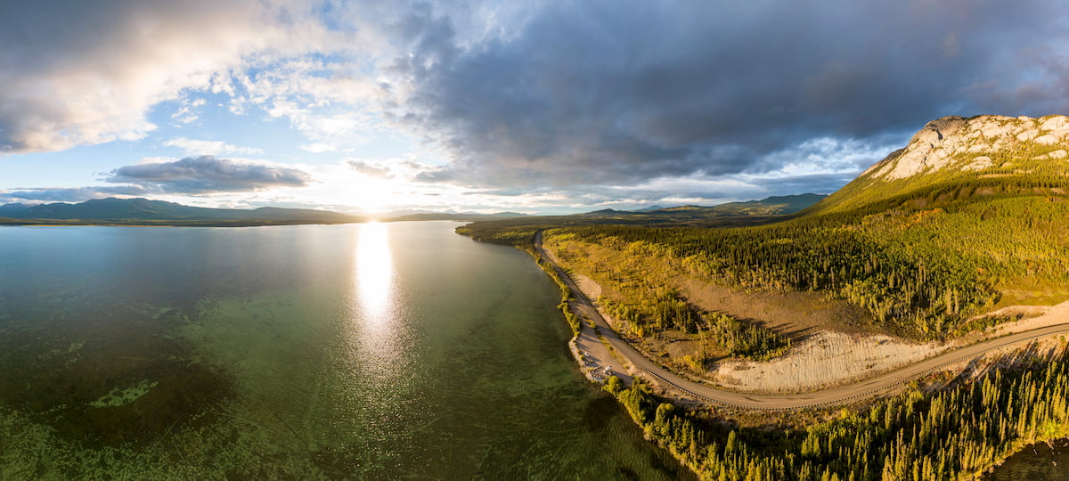
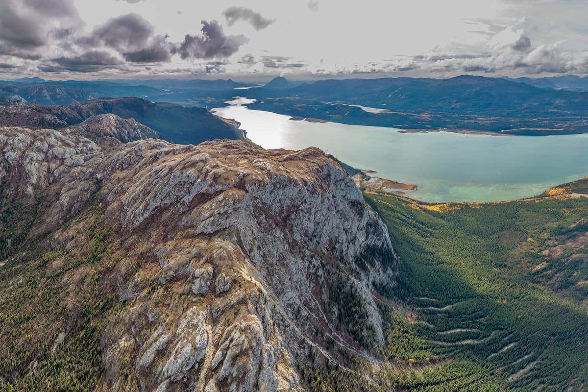
Nestled along the southern edge of Atlin Lake, Atlin/Téix'gi Aan Tlein Provincial Park is a stunning and remote protected area in the northernmost part of the Canadian province of British Columbia. The park contains 23 named mountains, the highest of which is Mount Nesselrode (2,444m/8,018ft), and the most prominent of which is Birch Mountain (2,058m/6,752ft).
Atlin/Téix'gi Aan Tlein Provincial Park covers an area of some 3,011 square kilometers (1,162 sq. mi) in the northern part of British Columbia in Canada. The park is located within the province’s Stikine Region to the south of the Yukon Territory and it borders the boroughs of Haines and Juneau within the US state of Alaska.
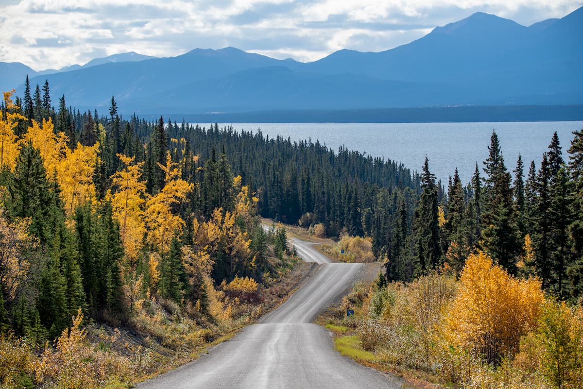
As one of the most remote parks in British Columbia’s provincial park system, there are no roads leading into Atlin/Téix'gi Aan Tlein. Indeed, with the exception of the area directly on the shores of Atlin Lake, the park is highly mountainous and it contains peaks that are part of the Juneau Icefield and the Skagway Ranges of the Canadian Coast Mountains.
Moreover, the Atlin/Téx'gi Aan Tlein Provincial Park is located fairly close to a number of other major parks and conservancies, both within the US and Canada.
In particular, Atlin/Téx'gi Aan Tlein Provincial Park is located to the west of the Nakina-Inklin Rivers/Yáwu Yaa Conservancy and to the north of the Taku River/T’akú Téix’ Conservancy, Mount Edziza Provincial Park and Recreation Area, Stikine River Provincial Park, and Spatsizi Plateau Wilderness Provincial Park.
Meanwhile, it is situated to the east of the Tongass National Forest, Glacier Bay National Park, Kluane National Park and Reserve, Wrangell-St. Elias National Park and Preserve, and Tatshenshini-Alsek Provincial Park.
Finally, Atlin/Téxi'gi Aan Tlein is nestled to the south and southeast of Willison Creek-Nelson Lake/Sít’ Héeni Conservancy, Indian Lake-Hitchcock Creek/Át Ch'îni Shà Conservancy, Mount Minto/K’iyán Conservancy, Tutshi Lake/T’ooch’ Áayi Conservancy, and the Upper Gladys River/Watsíx Deiyi Conservancy.
The mountains within Atlin/Téix'gi Aan Tlein Provincial Park are part of the Canadian Coast Mountains, which is a massive chain of peaks that stretches down the coastal region of British Columbia and Alaska, as well as a small section of the southern Yukon.
Interestingly, the Canadian Coast Mountains are actually part of an even larger mountain system known as the American Cordillera, which starts to the north in the Brooks Range of Alaska and stretches to the southern tip of South America in the Andes of Argentina and Chile.
Although the many subranges of the Canadian Coast Mountains have their own unique geologic history, the region as a whole is the result of multiple periods of tectonic activity, particularly subduction of the Farallon and Insular Plate under the North American Plate.
Furthermore, the Atlin/Téix'gi Aan Tlein Provincial Park is located just to the south of a region known as the Atlin Volcanic Field (a.k.a. Llangorse Volcanic Field/Surprise Lake Volcanic Field). The Atlin Volcanic Field is a large area of Pleistocene to Holocene-aged cinder cones on the Teslin Plateau, centered around Cracker Creek Cone.
This region, which is in and around Gladys Lake, has experienced a number of eruptions in the past, though the most notable was perhaps one in 1898 (whether or not an eruption actually happened is contested). Moreover, the volcanic activity of the region has left behind some sizable mineral deposits and placer mining was once a fairly sizable industry in the area.
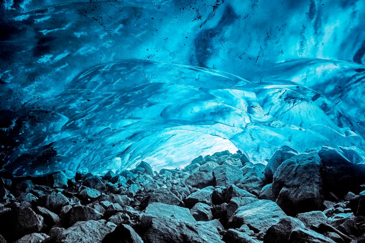
Additionally, Atlin/Téix'gi Aan Tlein Provincial Park owes much of its current landscape to the region’s icy past. Indeed, the area in and around the park has been glaciated in recent years and part of the park even encompases a portion of the Juneau Icefield, which is home to hundreds of glaciers, though the vast majority are shrinking each year.
About one-third of Atlin/Téix'gi Aan Tlein Provincial Park is actually covered in ice. Some of the largest glaciers in the park include the Llewellyn Glacier and the Willison Glacier, both of which cover more than a combined 80,000 ha (197,000 acres).
Major peaks in the Atlin/Téix'gi Aan Tlein Provincial Park include Mount Nesselrode, Mount Bressler, Mount Service, Mount Ogilvie, Birch Mountain, The Cathedral, and Mount Adams.
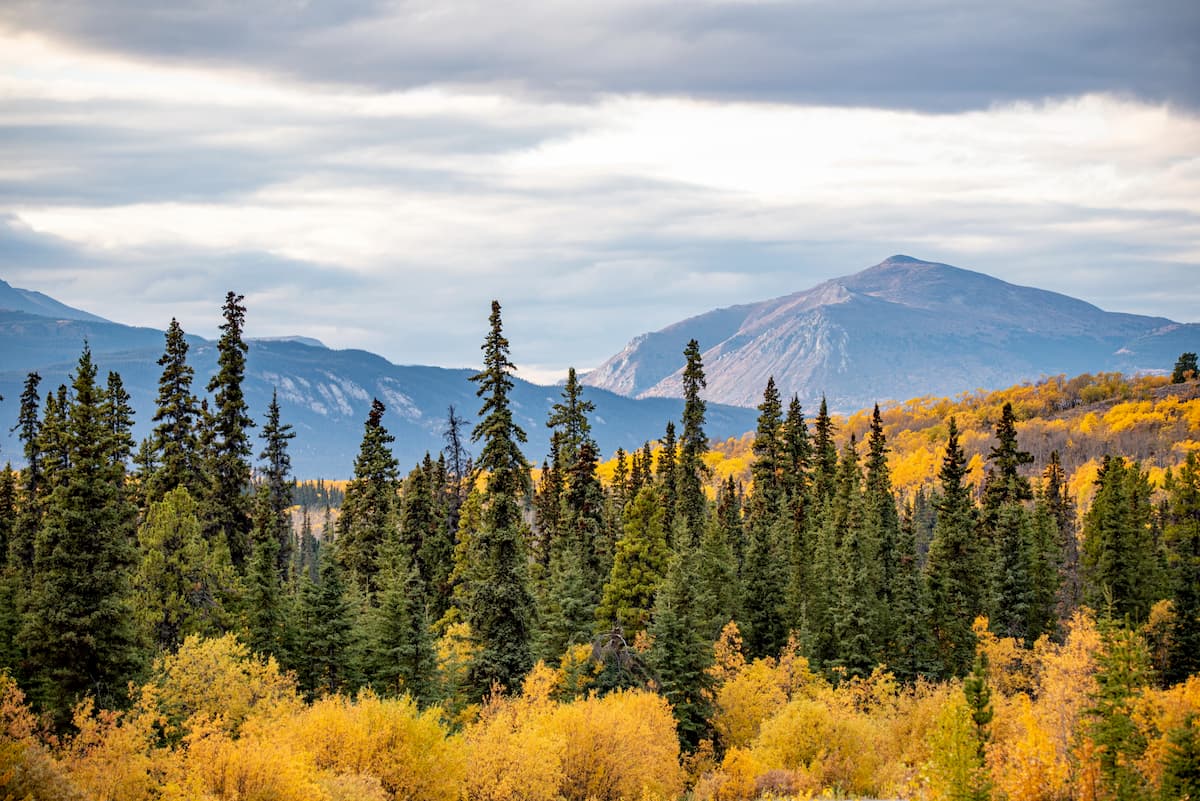
One of the many features that make Atlin/Téix'gi Aan Tlein so special is the park’s rich biodiversity. In particular, the park contains three distinct ecological zones.
At the lowest elevations, the park is home to forests of birch, willow, and spruce, which eventually transition into black spruce and white spruce at mid-elevations. Meanwhile, the highest elevations in the park are home to alpine tundra, which supports a variety of different shrubs and wildflowers.
One of the other major ecological features in Atlin/Téix'gi Aan Tlein Provincial Park is Atlin Lake, itself. The lake measures some 775 square kilometers (300 sq. mi), which makes it one of the largest freshwater lakes in all of British Columbia. Within the lake, there are sizable populations of lake trout, whitefish, Dolly Varden, and Arctic grayling.
As far as wildlife goes, Atlin/Téix'gi Aan tlein Provincial Park doesn’t disappoint. The park is home to a wide range of different fauna, including mountain goats, moose, Dall sheep, caribou, marmots, beavers, pikas, otters, timber wolves, black bears, and grizzly bears.
Like the rest of what is now British Columbia, the region in and around Atlin/Téix’gi Aan Tlein Provincial Park has a long and storied history of human inhabitation. In particular, the region is part of the traditional territory of the Taku River Tlingit First Nation, whose ancestors have lived in the area since time immemorial.
Whether or not European fur trappers and Russian traders ever made it to the Atlin region is a point of debate. However, the Klondike Gold Rush to the north in the Yukon Territory in the late 1800s did bring a sizable number of eager prospectors to the region. When gold was discovered in the area in 1898 by Fritz Miller of Germany, many would-be miners rushed into the area in the hopes of making it rich.
In fact, the Atlin region became one of the most profitable gold mining areas outside of the Klondike region during the late 19th and early 20th centuries. Indeed, Atlin still has a gold mining industry and tens of millions of dollars worth of gold have been extracted from the area over the course of the last century.
During the 1920s, Atlin became a relatively popular destination for tourists. This relative boom in tourism was made possible by the construction of the MV Tarahne, a passenger vessel and steam ship which offered visitors a chance to go on a luxury tour around Teresa Island in Atlin Lake while also getting to enjoy afternoon tea in style.
By the 1930s, however, the MV Tahrane was abandoned on the beach after the tour operator that owned her decided to close up shop. After the Atlin Historical society undertook significant repairs of the boat, however, the Tahrane is living a second life as a destination for receptions, weddings, and other gatherings.
Interestingly, the region in and around the park was completely inaccessible by road untilt the construction of the Atlin Highway in 1949. Until this point, the community was more or less inaccessible during the winter and, although there is no road access to Atlin/Téix’gi Aan Tlein Provincial Park, the fact that nearby Atlin is connected to the road system makes visiting the park much easier.
That being said, Atlin/Téix’gi Aan Tlein Provincial Park wasn’t a concept until the 1970s. During the early part of the decade, there were proposals to create a hydroelectric project using water from Atlin Lake and the nearby Taku River.
However, in a push to protect the region’s rich ecosystems, the provincial government created Atlin/Téix’gi Aan Tlein Provincial Park just to the south of the town of Atlin and they decided to include much of the waters of the Atlin Lake within the park boundaries to protect it from further development.
These days, due to the remoteness of the park, it’s not as well visited as some of the protected areas in southern British Columbia, such as Tweedsmuir Provincial Park. However, Atlin/Téix’gi Aan Tlein Provincial Park remains a fantastic place to visit if you’re looking for a truly exceptional outdoor experience in northern British Columbia.
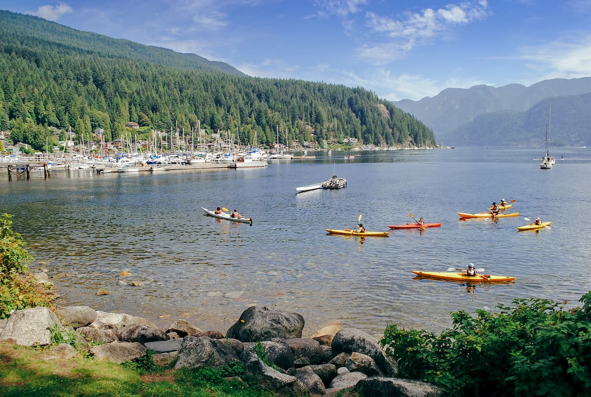
Although much of Atlin/Téix’gi Aan Tlein Provincial Park is trailless, there are a handful of trails in the area for visitors to enjoy. Additionally, the park is particularly popular among climbers, many of whom head up to the Juneau Icefield, and among paddlers, who enjoy the many water-based activities that the region has to offer.
If you’re interested in some on-trail adventures during your trip, check out the following trails:
Located on the western banks of Atlin Lake, directly to the west of the town of Atlin, the Shortest Railway Trail is a quaint 4 km (2.5 mile) walk down an abandoned rail line. The hike along this rail line, which was once known as the Taku Tram, provides a nice view of some historic buildings as well as Tagish Lake.
The Sloko Lake Trail is a 2km (1.2mi) walk from the southern edge of Atlin Lake to the small Sloko Lake just to the south. Although the hike is fairly short, it offers some great views and solitude in the park.
A 4.5km (2.8mi) long hike connecting Sloko Inlet and the base of the stunning Llewellyn Glacier near Mount Adams, the Mount Adams Trail is a great little adventure if you have a free afternoon.
Looking for a place to stay before or after your trip to Atlin/Téix'gi Aan Tlein Provincial Park? Here are some of your best options:
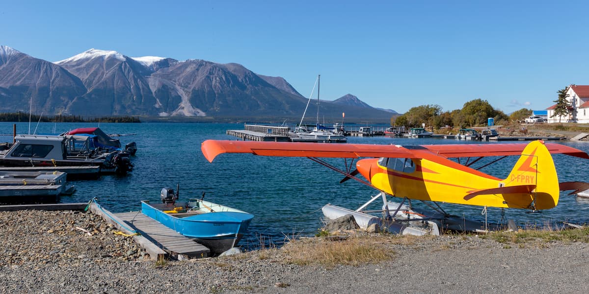
The community of Atlin is situated to the east of Atlin Lake, about 20 km (12.4 mi) by air from Atlin/Téix'gi Aan Tlein Provincial Park. Atlin is home to about 450 residents and it is known for its gold mining and tourism industries.
These days, Atlin is accessible via the Atlin Road (Yukon Highway 7), which connects it to Tagish Road (Yukon Highway 8) some 92 km (57 mi) to the north. From Tagish Road, motorists can then connect to the Alaska Highway (Yukon Highway 1), which offers access to Whitehorse.
Moreover, Atlin does have a small airport, which generally serves as the starting point for ventures into Atlin/Téix'gi Aan Tlein Provincial Park, unless you’re looking to travel into the park on foot or by boat over Atlin Lake.
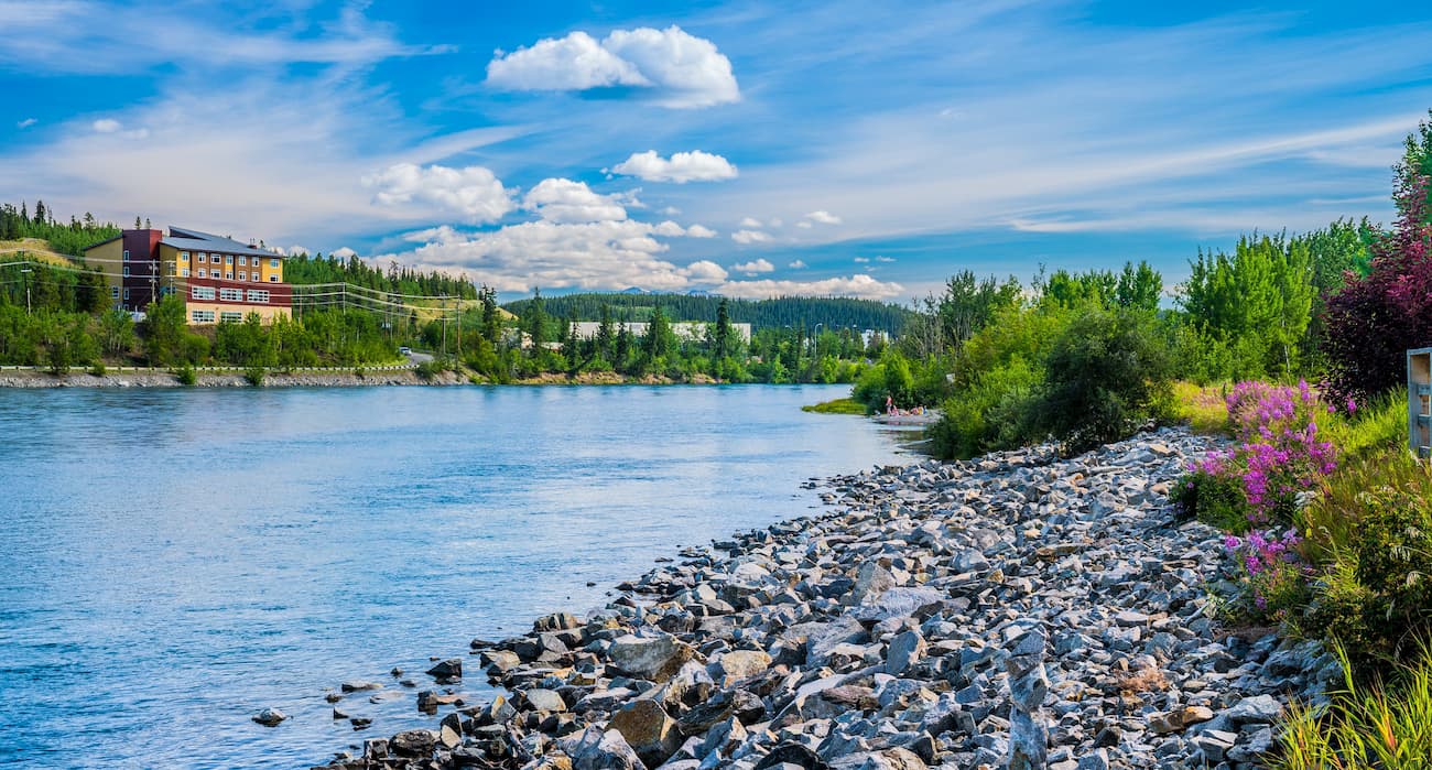
The capital and only city in the Yukon Territory, the city of Whitehorse is home to about 25,000 residents.
Whitehorse is located about 2.5 hours to the north of Atlin and it is the largest road-accessible city in the vicinity of the park for quite some distance. Although Juneau is technically larger than Whitehorse, a ferry is required to get there by car.
Moreover, Whitehorse is located along the Alaska Highway, which means it has gerat road connections to the surrounding region. Whitehorse also has the region’s busiest airport, which offers flights to destinations as far away as Ontario and even Germany.
Located about 5 hours away by road, the community of Haines, Alaska is home to about 1,700 residents. Haines is situated near the northern edge of the Alaska Panhandle and it is connected to the Alaska Highway by the Haines Highway (don’t forget your passport, though if you want to make this international drive!).
The town is a popular destination all year round thanks to its many outdoor recreation opportunities. In the summer, the town hosts a number of festivals and in the winter, it is a world-famous heli-skiing destination.
Haines also has connections on the Alaska Marine Highway to other parts of coastal Alaska, as well as a small airport, which offers flights to the surrounding communities, including Sitka, Juneau, Skagway, and bush plane service into the mountains for outdoor recreation purposes.


The highest peak in Atlin/Téix’gi Aan Tlein Provincial Park is Mount Nesselrode, at 2,444 m.
Notable peaks in Atlin/Téix’gi Aan Tlein Provincial Park include Mount Nesselrode, Mount Bressler, Mount Service, Boundary Point 95;Mount Ogilvie and Mount London.


