
Scan the QR code and open PeakVisor on your phone
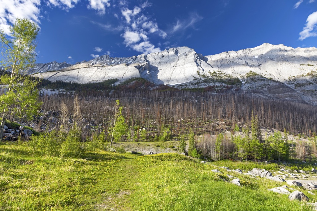
The Colin Range is one of the many ranges in the beautiful Jasper National Park, in western Alberta, Canada. The range includes some peaks that are popular for hiking, such as Hawk Mountain and Roche Bonhomme. Sirdar Mountain is the tallest (2,804 m /9,199 ft) and most prominent (1,254 m / 4,114 ft) of the 11 peaks in the range.
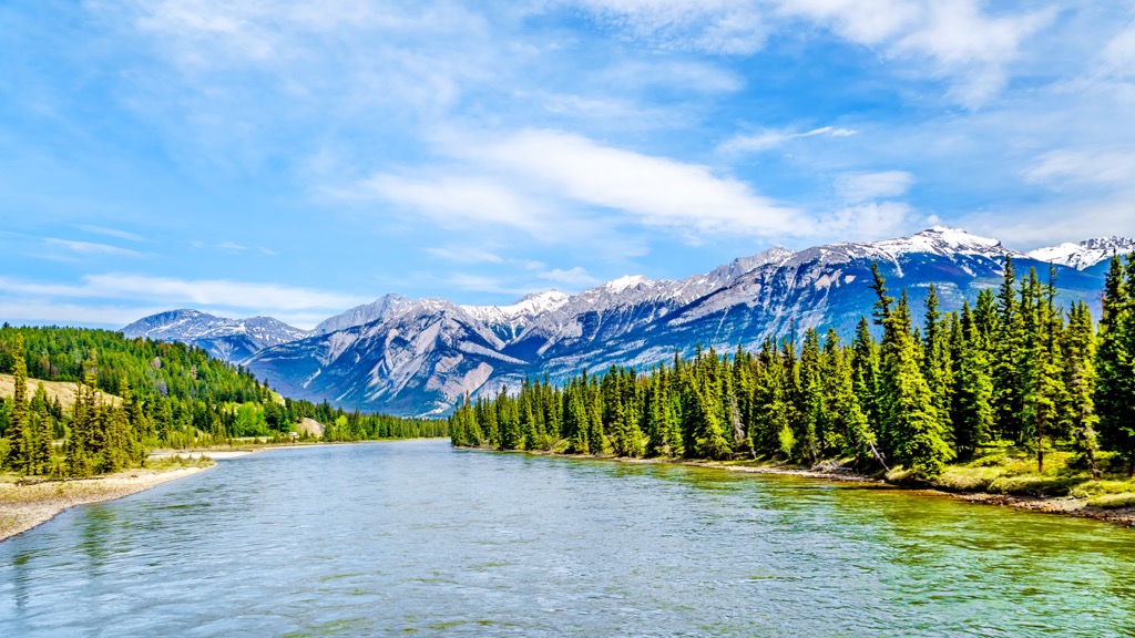
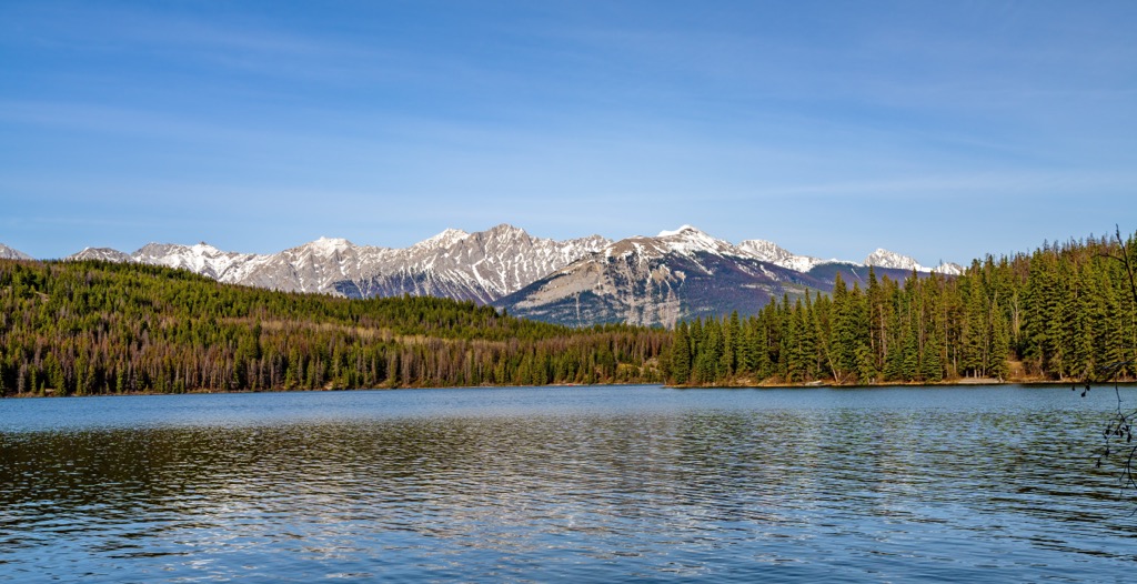
Jasper National Park is one of the most beautiful places in Alberta, Canada, and the world. The park has many renowned mountains and attractions, such as Pyramid Mountain, Maligne Lake, and the Miette Hot Springs.
The Colin Range is one of the many ranges that are encompassed within Jasper National Park. The park contains many ranges and their respective attractions.
The Colin Range is near the town of Jasper, in the middle of the park. The Jacques Range and Miette Range are located west of the Colin Range, and the Maligne Range borders the south end of the Colin Range. The Queen Elizabeth Ranges and Nikanassin Range are located southeast of the Colin Range. North and west of the Colin Range are the Bosch Range and the Victoria Cross Ranges.
Jasper National Park is one the many parks that are found in the Canadian Rockies. Other nearby parks and wilderness area include:
The geological formation event responsible for the Colin Range is known as the Laramide orogeny. The Laramide orogeny formed the Rocky Mountains which were the last of the southern Canadian Cordillera to be formed.
Mountain formation on Canada’s west coast began over 100 million years ago when the Columbia Mountains started to form. Then followed the Interior Mountains of British Columbia which were later covered by lava flows to create the interior plateaus.
The Coast Mountains were then formed from the newly accreted terranes and volcanic activity that had been occurring. The westernmost mountains to form as part of the Cordillera are the Insular Mountains, which include the Vancouver Island Ranges, as the underwater mountains that create Haida Gwaii and other coastal islands.
The Laramide orogeny started about 75 million years ago when an oceanic tectonic plate continued to subduct beneath the west coast of North America. In Canada, the subduction angle was steep, and it caused the fault along the ancient continental margin to compress. All the mountains of the western cordillera formed west of the ancient western coastline of North America, out of accreted and volcanic rocks.
The Rocky Mountains formed along the ancient continental margin, which currently coincides with much of the border between British Columbia and Alberta. At the beginning of the Laramide orogeny, there was a massive inland sea that extended east from the newly forming western cordillera. The sea was underlain by thick layers of marine sediment and layers of sand, mud, and silt.
The pressure from the tectonic collision started compressing the continental margin, heating the layers of rock so they could start to fold. When the rocks wouldn’t fold, they would break and crack, creating faults, which are cracks in the earth’s crust.
The tectonic collision pushed the layers of rock west. When enough force was exerted, layers of Paleozoic and Cretaceous rock would be lifted and pushed east, upon the adjacent crust. The orogeny continued for over 45 million years, and the process continued over and over again, with layers of rock being pushed up and over the adjacent layers.
This method of mountain building is referred to as the fault – thrust process. The layers of rock broke at a fault line and were thrust above the adjacent layers. In this way, the Colin Range was formed, alongside all the other ranges of the Rocky Mountains.
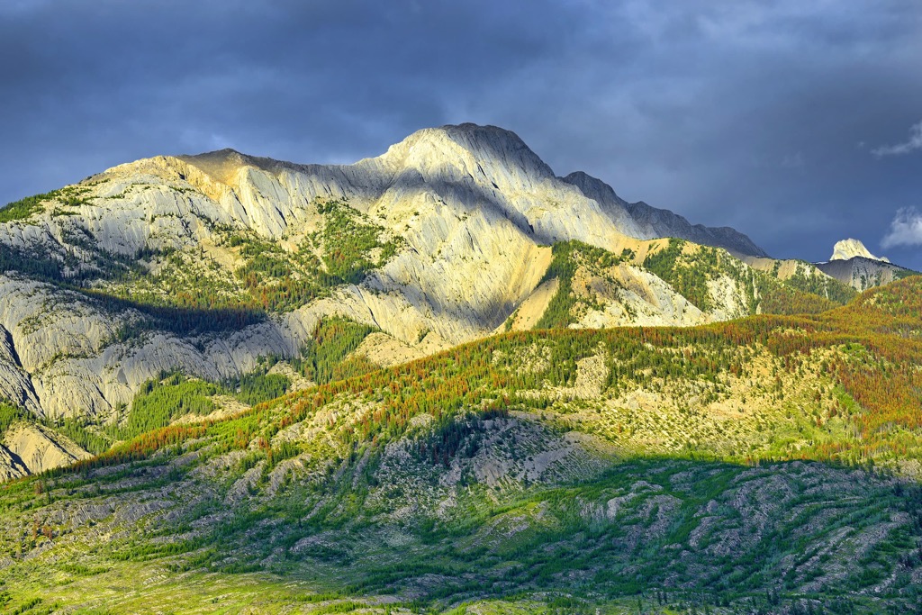
The Rockies are primarily composed of limestone, which was created from the layers of marine sediment that had been deposited at the bottom of the ancient inland sea during the Paleozoic. During the Cenozoic, eroded sand, silt, and mud flowed into the sea, which would become the sandstone, mudstone, and shale.
A couple million years ago, the Pleistocene started, which would dramatically affect the topography of the Rockies, changing them from their ancient form to the rugged and precipitous peaks that we know today.
During the glacial maximums of the Pleistocene, local glaciers coalesced across the Canadian Cordillera to cover the west in a layer of ice that was many kilometers thick in places. The glaciers and ice sheet eroded the mountains, carrying immense amounts of debris, carving u-shaped valleys and cirques in their wake.
As the ice sheets melted, glacial debris was deposited across the landscape. Sometimes the debris is only a veneer over the bedrock, or it can be found as kames, drumlins, moraines, and eskers.
Furthermore, as the ice sheet flowed south from Jasper National Park, avalanches would deposit debris on top of the ice sheet. As the ice melted about 12,000 years ago, the hitch-hiking rocks were deposited across the landscape as erratics. Indeed, the Okotoks Erratic, known as ‘Big Rock,’ is believed to have originated in Jasper National Park, having traveled over 400 km (240 mi) towards the south.
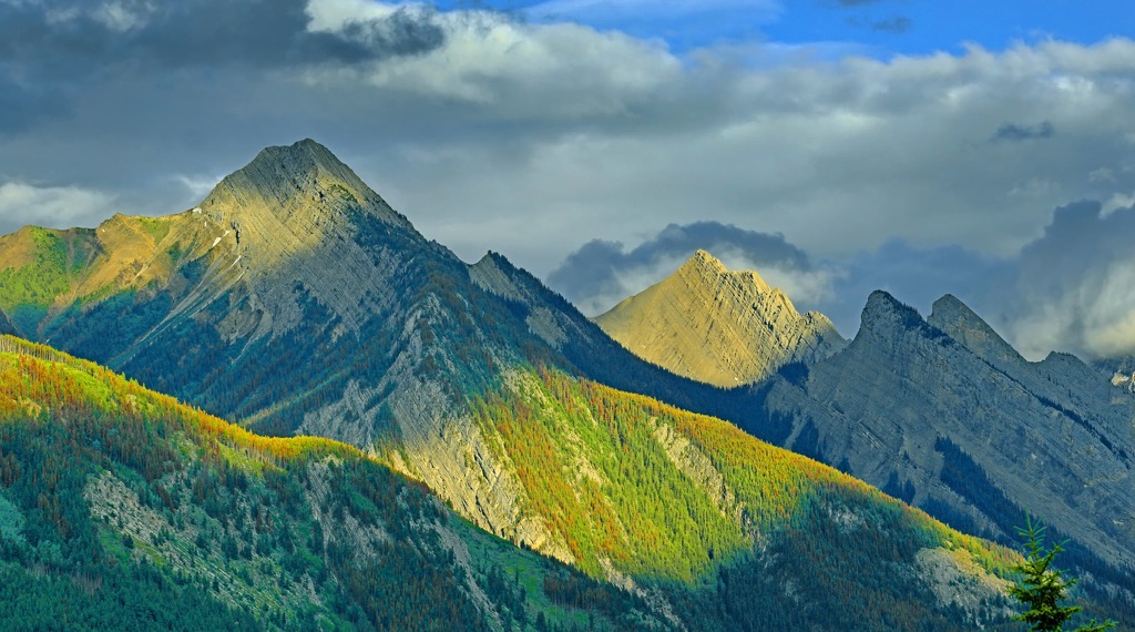
The ecology of the Colin Range is typical of the Rocky Mountain Natural Region. This region has the highest precipitation in Alberta, long cold winters, and short cool summers which have distinct effects on the three ecological subregions of the range.
The lowest elevations are part of the montane subregion, which has the most diverse habitats, vegetation, and wildlife. There are more than 300 rare plant species that can be found throughout the Colin Range and 140 of them only grow in the Rocky Mountain Natural Region.
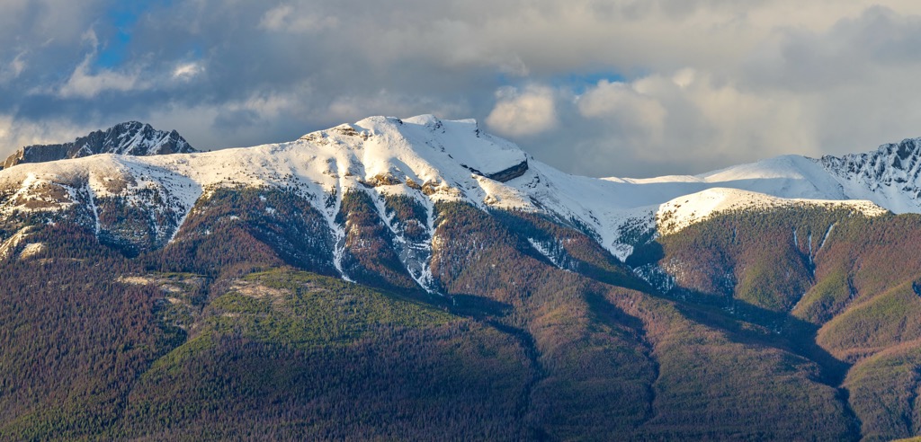
The highest elevations are dominated by the Alpine tundra which is rocky with minimal vegetation. The windswept and storm battered peaks are home to only the most resilient vegetation, such as lichen, sedge, and heath.
The alpine trees are stunted and twisted because of the fierce winds that blow across the mountain tops. Some birds, such as the white-tailed ptarmigan will nest among the alpine rocks and mountain goats and bighorn sheep use the alpine to avoid predators.
Other animals that inhabit the alpine are the hoary marmot, Columbian ground squirrel, and the pika. These small ground dwellers make nests among the alpine rocks and feed from the vegetation along the tree line.
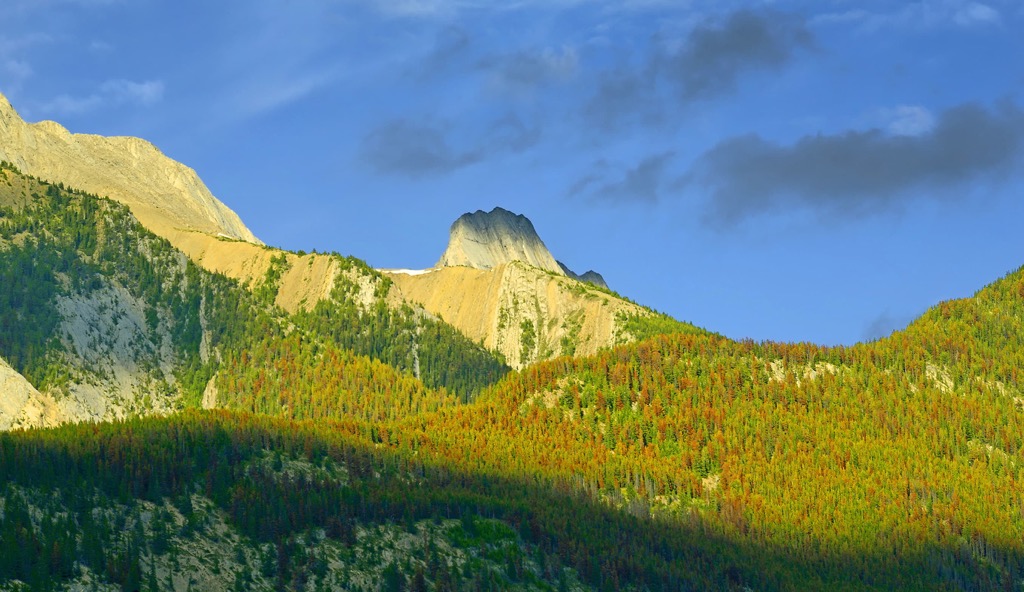
The subalpine subregion is the transition between the relatively lush montane subregion and the barren alpine subregion. The subalpine of the Colin Range is home to grizzly bears, black bears, cougars, white-tail deer, mule deer, elk, mountain goats, and bighorn sheep; however, most animals spend winter in the valleys of the montane ecoregion.
Forests of Engelmann spruce, subalpine fir, white spruce, larch, and lodgepole pine fill the subalpine forests. Subalpine fir is the most resilient to the cold, such that it dominates the forests along the tree line. Moist sites commonly grow dwarf birch and willow shrublands.
Some of the birds that you may see in the Colin Range are the MacGillivray’s warbler, white-crowned sparrow, lazuli bunting, gray-crowned rosy finch, American pipit, and the warbling vireo. The Colin Range is full of spectacular wildlife and an incredible variety of flora.
The eastern slopes of the Rocky Mountains are the site of incredible archeological discoveries regarding the early inhabitants of Alberta and possibly North America. The reason for the incredible discoveries is that the eastern slopes, including the Colin Range were among the first areas to become ice free as the cordilleran and continental ice sheets melted from the continent.
The continental, or Laurentide, ice sheet and the cordilleran ice sheet, which covered the mountains moved and grew with relative independence of each other. During the Pleistocene, there were times that the two ice sheets pulled back, leaving the eastern slopes relatively free of ice. These ice-free times are what is referred to as the ice-free corridor that ancient people may have used to populate part of North America.
During the glacial maximums of the Pleistocene, the ice sheets converged along the eastern slopes, cutting off any migration routes. The convergence of the cordilleran and Laurentide ice sheets is what brought the massive glacial erratics from Jasper to Okotoks, in southern Alberta. An erratic is a rock that has been transported by glaciers to a different location. These often stand out as large, out of place rocks in the prairies.
About 13,000 years ago the ice-free corridor opened for the most recent time, permitting travel between Yukon and Alaska, through Alberta, to Montana and the southern half of North America. The melting of the ice along the eastern slopes also created opportunities for ancient people to start moving north, to inhabit the new territory.
The Ktunaxa, Tsuu T’ina, Stoney Nakoda, and Cree, as well as the Métis Nation are the contemporary First Nations that claim the Colin Range as part of their traditional territory. The region has seen significant change of inhabitants since the first people came to the slopes of the Colin Range.
Of the modern First Nations, the Ktunaxa were likely among the first to extend their reach to the eastern slopes. The range was the eastern extent of the Ktunaxa territory, which traditionally included the land between Columbia River Valley in the Regional District of Central Kootenay and the eastern slopes of the Rockies.
The Tsuu T’ina broke away from their original ancestors, who were part of the Dane-zaa (Beaver) Nation, to move from the northern forests and begin to inhabit central Alberta. The Tsuu T’ina traditionally inhabited the regions around what are now Jasper and Edmonton until conflict with the Cree drove them further south to near what is now Calgary.
The Cree are Algonquin-speaking First Nations from the Great Lakes region in the east. Along with the Stoney Nakoda, who are related to the Sioux First Nations of the Great Plains of what is now North Dakota, they migrated west under pressure from the westward settlement of people of European descent.
The Cree and Stoney Nakoda often worked as guides for European fur traders and as intermediaries in the fur trade between other First Nations and Europeans. The fur trade facilitated early European settlement near the Colin Range.
Among the first European settlements in the area was Jasper House, a North West Company outpost. While the settlement was moved from the original fort site, Jasper House was the beginning of the Municipality of Jasper and Jasper National Park.
Jasper National Park was established 1907 and encompassed a significant part of the Athabasca River valley and the surrounding ranges. The Athabasca River valley has many significant archeological and cultural sites pertaining to the ancient people that first inhabited the region.
The river valley was among the most fertile areas in the region and there was a relative abundance of wildlife in the forests and fish in the river to sustain the semi-nomadic groups. As such, it makes sense that the valley became the home to many Cree descended homesteaders, who settled the region during the fur trade boom.
With the establishment of the park, the Jasper Exodus occurred where homesteaders in the Athabasca Valley were evicted from the new park boundaries. Many of the inhabitants were Cree and they moved north, to join their relatives, in what is now the area around Grande Cache, Alberta.
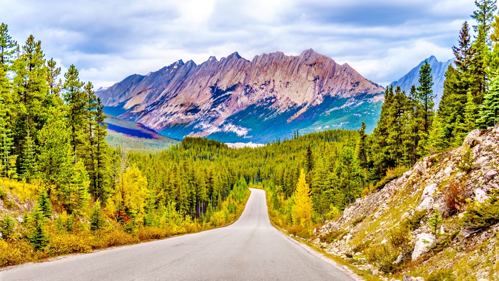
Jasper National Park is considered one of the most beautiful places in Canada. While, to the south, Banff National Park is more popular, the northern, Jasper National Park holds many remote wilderness gems that aren’t sullied by hordes of tourists. Among the gems of Jasper National park are the following hikes and destinations of the Colin Range:
Receiving its name from the Overlanders, this trail follows the route of emigrants from Ontario who traveled up-valley to the Cariboo gold fields of northern British Columbia. The 15.5 km (9.6 mi) trail passes through the montane forests that border the Maligne River along the northwest edge of the Colin Range.
The trailhead is located at Sixth Bridge Picnic area and the trail follows the Maligne River to its confluence with the Athabasca River. About halfway through the trail are the remains of the John Moberly homestead.
John Moberly was one of the many Métis homesteaders that was evicted from the area when Jasper National Park was created. Henry John Moberly was a fur trader, who entered into service with the Hudson’s Bay Company in 1854. After eviction from the park, Moberly moved his homestead to Smoky River, north of Grande Cache.
The Jacques Lake trail is about 12 km (7.5 mi) and leads from Maligne Lake Road, through the south end of the Colin Range, to Jacques Lake in the Jacques Range. The trail has relatively little elevation gain and is good for a day trip or for a backpacking adventure.
The trail follows a narrow mountain valley, passes four lakes, crosses a watershed divide, and skirts the base of Sirdar Mountain. The trail is open to mountain bikes, however, the single track after Summit Lakes is quite demanding. The route is great for an early season trip when the high country is still packed with snow.
Many of the mountains of Jasper National Park consist of steep walls and exposed ridges that are beyond the realm of scramblers and are best left for mountaineers. However, with an easy approach, a variety of terrain, minimal scree-slogging, and a short crux make Hawk Mountain one of the most popular scrambles in Jasper National Park.
There are two main routes that lead up the peak, known as Morro Creek, left and Morro Creek right. Each has different aspects that add to the adventure of summiting a mountain. Both routes start along the Overlander trail and diverge at Morro Creek. Regardless of the route, the summit offers incredible views of the Athabasca Valley, the Colin, Jacques, and Bosch Ranges.
The Colin Range is home to Hawk Mountain, which is one of the most popular scrambles in Jasper National Park, and many other fantastic trails and destinations. The following are some of the towns closest to the Colin Range in Jasper National Park from where you can stay before, during, or after your adventure in the Rockies.
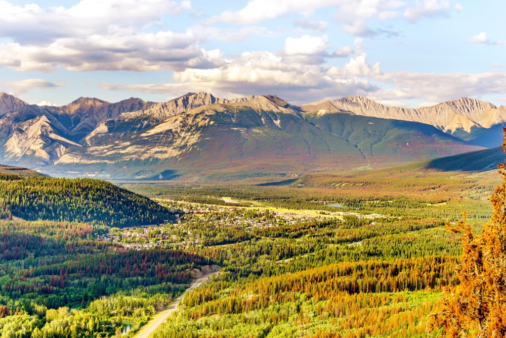
The municipality of Jasper is the closest community to the Colin Range, which is only about 10 km (6 mi) east of the community. The original settlement of Jasper House, a North West Company fur-trading outpost, was established in 1813 east of the current townsite.
In 1907 the town of Jasper was established in 1907 as the commercial center for the newly created Jasper National Park and was created to mirror the popular town of Banff in Banff National Park.
Considered to have some of the most stunning landscapes and beautiful scenery in Canada, some of the popular hikes around Jasper include the hike to Sunwapta Peak, the Sulphur Skyline Trail, and the Maligne Canyon Hike.
Miette Hot Springs and Maligne Lake, and Pyramid Mountain are other popular tourist destinations while in the park. Visitors regularly see grizzly bears, moose, elk, black bears, and countless species of birds. The rugged limestone peaks, lush forests, massive glaciers, and stunning lakes help create memorable adventures.
Located about 65 km (39 mi) east of the Colin Range, Hinton was established on the doorstep of the Rocky Mountains and is a popular location from which to start wilderness adventures. The town is adjacent to the wilderness areas of William A. Switzer Provincial Park, Whitehorse Wildland, Jasper National Park, Willmore Wilderness Area, and Rock Lake – Solomon Creek Wildland.
Hinton was founded in 1911 when the Grand Trunk Railway built a station house at the current townsite. The town experienced its initial growth thanks to the coal deposits that are found in abundance along the eastern slopes of the Rockies.
While the town faced a downturn as commodity prices fell, it felt a resurgence in the 1950s when a pulp mill was constructed. While natural industries still play a role in the local economy, the community is striving to draw tourists as it is a gateway to the Canadian Rockies.


