Scan the QR code and open PeakVisor on your phone
The Nikanassin Range is one of the front ranges of the Canadian Rockies. The range is located in the northern part of Alberta, Canada to the east of the town of Jasper. It forms the eastern edge of Jasper National Park. The range has 33 named peaks, of which Ruby Mountain is the tallest at 2,900m (9,512ft) in elevation while Blackface Mountain is the most prominent with a prominence of 912 m (2,992 ft).
Located along the eastern border of Jasper National Park, in Alberta, Canada, the Nikanassin Range is one of the front ranges of the Rocky Mountains. The town of Jasper is located to the west of the range and the city of Edmonton is situated about 350 km (210 mi) east of the range.
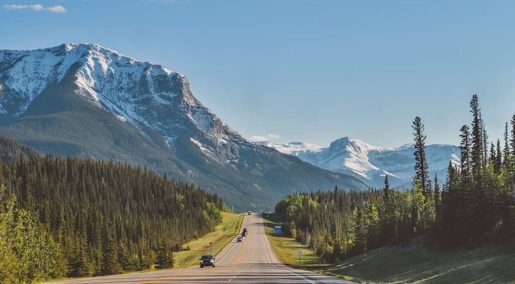
There are two main highways that provide access to the Nikanassin Range. Highway 16, the Yellowhead Highway, which connects to Highway 97 at the town of Jasper, runs along the northern end of the range. Highway 40 parallels the east side of the range and there are many access rods from Highway 40 that lead westward into the range.
Highway 40 is a forestry trunk road that runs north-south through the foothills of the eastern slopes and is a major access road to many of the front ranges and public land use zones. Highway 40 is accessed from Highway 16 in the north, or Highway 11 in central Alberta.
There is access to Highway 40, from the Trans-Canada Highway (Highway 1) in the south; however, while the drive to the Nikanassin Range from Highway 1 would be spectacular, it would be hard on your vehicle and take a long time.
The Fiddle Range is located to the northwest of the Nikanassin Range while the Jaques Range and the Queen Elizabeth Range are located to the west. The Miette Range is a subrange situated at the northern end of the Nikanassin Range.
Furthermore, the Nikanassin Range is the easternmost range of Jasper National Park. The range is also partly contained within Coal Branch Public Land Use Zone and Whitehorse Wildland Provincial Park.
As part of the front ranges of the Rocky Mountains, the Nikanassin Range was one of the last ranges of the Rockies to form. The Rockies started forming about 75 million years ago and its mountain building event, called the Laramide orogeny, lasted about 35 million years.
The Rockies started to form as tectonic plates under the Pacific collided with the continental plates under North America. Since the tectonic collision occurred in a northeast orientation, the first mountains of the Rockies to form were the southwestern ranges.
As the collision continued, massive layers of Paleozoic limestone and dolostone cracked and were then squeezed so that the layers lifted up and stacked on top of the Cretaceous sandstones and shales to the northeast. The mountains continued to be formed as thrust faulting continued, which is where the layers of stone crack and uplift onto the ground to the northeast.
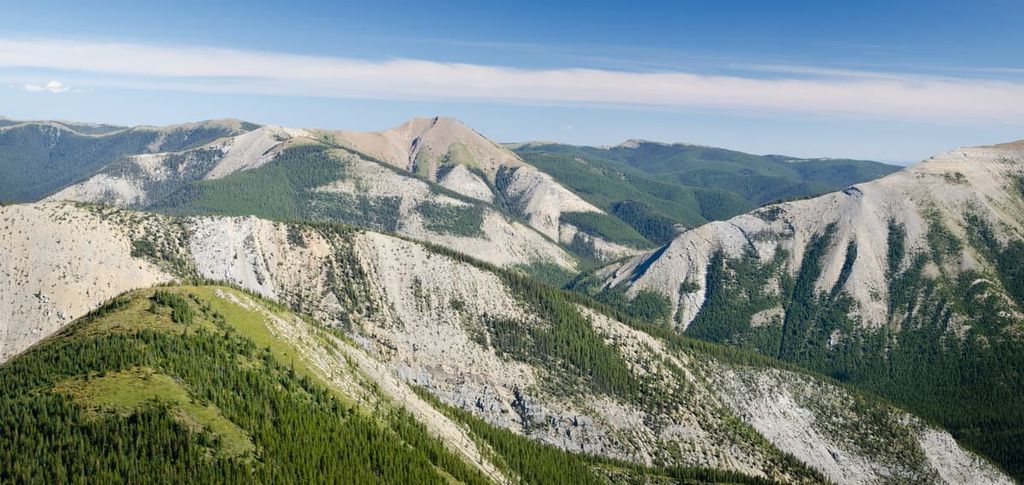
The front ranges are characteristically composed of near-vertical mountain faces as the layers were thrust in a near-vertical orientation. The peaks and ridges of the Nikanassin Range are made of durable limestone and dolomite, whereas the softer Cretaceous sandstones and shales were heavily eroded and displaced, which created the valleys between the ranges.
Furthermore, the foothills to the east of the Rockies were formed after the front ranges when the force from the collision was great enough to thrust fault only the upper Cretaceous layers. The sandstones and shales were thrust upward to create the rows of foothills that lay in the same orientation as the Rockies. These foothills look like roof shingles with a gradual incline rising east to their peak where they drop off sharply to the valley in the east.
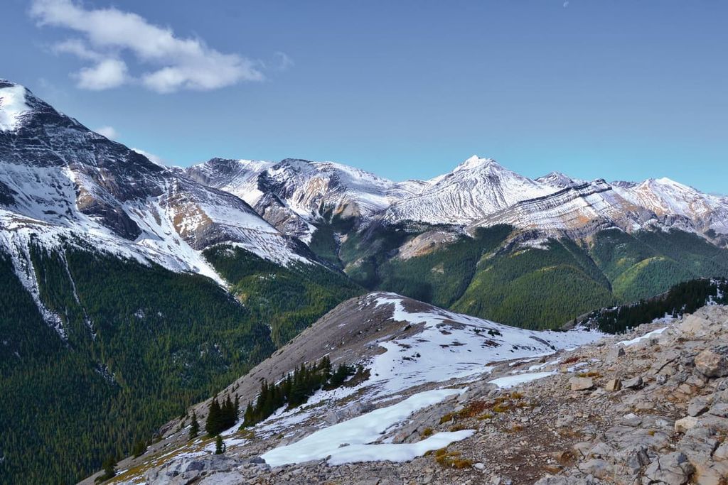
As the mountains and foothills formed, erosion was immediately acting to wear them down. While there was significant erosion over the 55 million years since the Rockies formed, the topography that we see today is mainly from the last glacial maximum of the Pleistocene. The Cordilleran ice sheet covered the Rockies in over a kilometer of ice, while the Laurentide ice sheet covered the rest of Canada to the east of the Rockies.
These glaciers scoured the softer stones from the valleys and even eroded portions of the limestone peaks. Cirques are created as glaciers recede from the tops of mountains leaving a bowl-like depression in the side of a mountain.
Tarns are lakes that form in cirques and other alpine glacial depressions. The landscape also has moraines, eskers, and kames, all of which are piles of glacially eroded rocks and sediment that were deposited in different ways.
It is important to note that the Canadian Rockies used to sit on the continental margin of North America. In other words, Alberta used to be a coastal province and a shallow sea that often extended to the west. Prehistorically, during the Mesozoic, the shore was covered with forest and marshes with an abundance of plants. With time, the prehistoric forests were covered with sediment and the organic material became the coal reserves that are found on the eastern slopes of the NIkanassin Range.
The Nikanassin Range is part of the Rocky Mountain Natural Region. The three subregions of the Rocky Mountain Natural Region are the Alpine, Subalpine, and Montane Subregions. The alpine describes above the treeline with the subalpine covering the slopes of the mountains. The montane ecology exists in the valley floors and out toward the foothills.
The alpine subregion of the Nikanassin Range is the coldest and receives the most precipitation. The winters are long and cold and the growing season is short. Trees try to grow as high in elevation as they can; however, the alpine landscape is usually barren with minimal communities of sedge and heath. Trees that do manage to grow are stunted and twisted from the fierce winds that blow over the peaks.
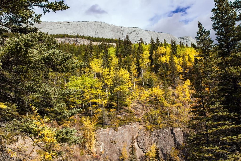
The subalpine forests are filled with a mix of Engelmann spruce and subalpine fir. Dense forests of lodgepole pine cover the base of the mountains and the montane valleys. Larch trees are typically found along ridges and there are also scattered stands of aspen. Willow and poplar tend to grow only in the valleys where there is significant moisture.
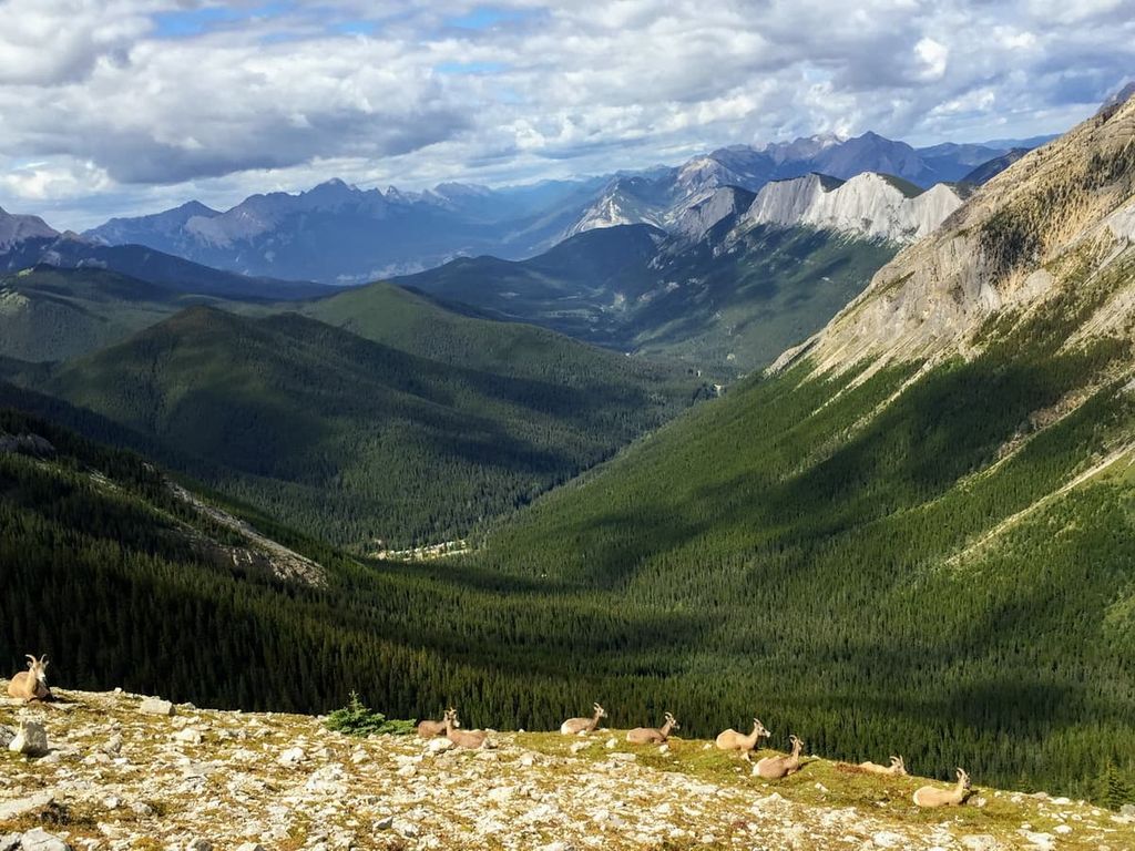
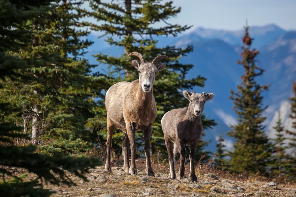
Within the Nikanassin Range, the forests contain a wide variety of animals, such as grizzly bears, moose, elk, black bears, wolves, deer, cougars, and foxes. Mountain goats and bighorn sheep inhabit the rocky peaks of the range, while most other animals only inhabit the forests. Marmots, pika, as well as several bird species such as the American pipit and the white-tailed ptarmigan also inhabit the alpine area; however, the birds only inhabit the alpine for nesting season.
The Nikanassin Range and the eastern slopes and foothills of the Rockies from Yukon and Alaska, through Alberta to Montana, are part of an ancient ice-free corridor. It is believed that the ice-free corridor was one of the routes through which North America was originally populated by humans; however, the timeline of arrival is disputed.
The ice-free corridor was likely open for thousands of years during the Pleistocene and was most recently closed from about 20,000 years ago to 13,000 years ago. The archaeological evidence suggests that the glaciers receded first in the south and gradually opened towards the north. As the ice receded and the land became inhabitable, first animals started migrating north and people subsequently followed.
The modern First Nations that claim the Nikanassin Range as part of their traditional territory are the Ktunaxa, Tsut T’ina, Stoney Nakoda, and Cree, as well as the Mountain Métis Nation. The range was the eastern extent of the Ktunaxa territory who inhabited the Columbia River Valley in the Regional District of Central Kootenay to the eastern slopes of the Rockies.
The Tsuu T’ina were originally part of the Dane-zaa (Beaver) Nation, though they eventually moved further south. They inhabited the regions around what are now Jasper and Edmonton until conflict with the Cree drove them further south near what is now Calgary.
The Stoney Nakoda are related to the Sioux First Nations of the Great Plains of what is now North Dakota and the surrounding area. The Cree are Algonquin-speaking First Nations from the Great Lakes region in the east. Both the Stoney Nakoda and Cree migrated west under pressure from the westward settlement of people of European descent. The Cree and Stoney Nakoda often worked as guides for European fur traders and as intermediaries in the fur trade between other First Nations and Europeans.
The fur trade was responsible for early European settlement near the Nikanassin Range, which primarily occurred near what is now the town of Jasper. However, as the fur trade declined, mining became a major economic driver as vast ore deposits were discovered along the eastern slopes in the late nineteenth and early twentieth centuries.
The Nikanassin range is mainly located in what is now Jasper National Park, which was established 1907. With the establishment of the park, the Jasper Exodus occurred where homesteaders in the Athabasca Valley were evicted from the new park boundaries. Many of the inhabitants were Cree and they moved north to what is now Grande Cache.
The Nikanassin Range is part of Jasper National Park, which is considered to have some of the most beautiful landscapes and scenery in Canada. The following are some of the trails and attractions that are part of the Nikanassin Range.
The Miette Hot Springs are a commercially developed hot spring that’s located in Jasper National Park. The springs are located about 60 km (37 mi) to the east of the Jasper townsite and the pool is filled 100 percent with natural mineral water that is about 40 degrees C (104 degrees F). There are amenities at the hot springs, including change rooms, a gift shop, and a café at the hot springs.
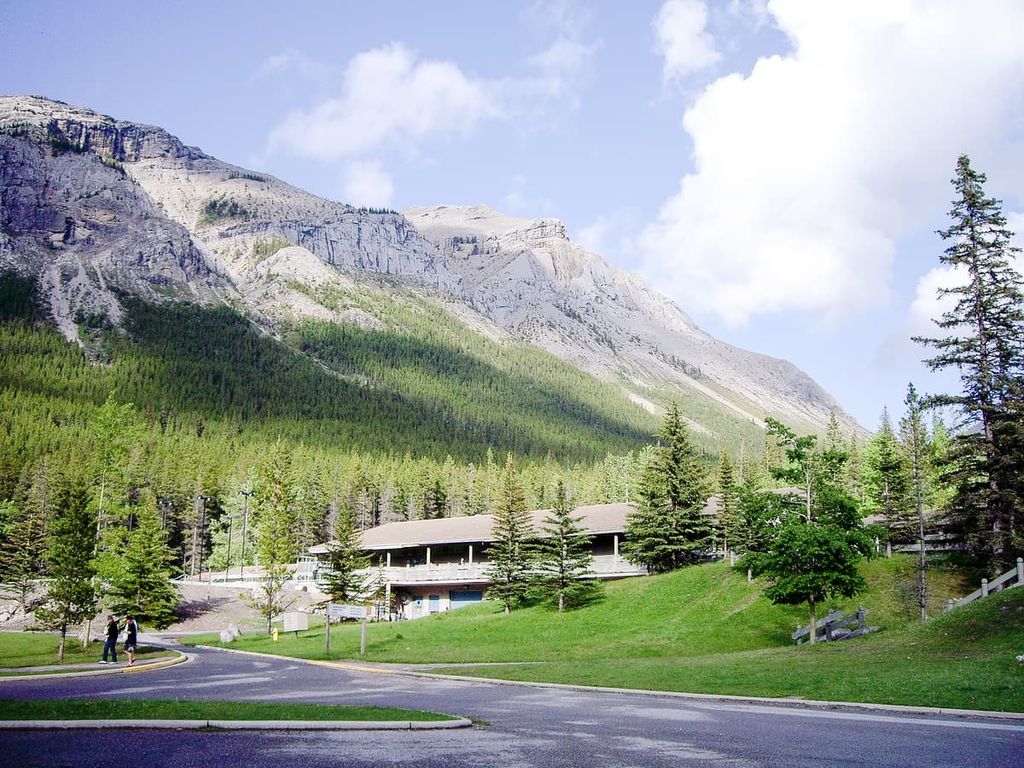
There is also a short interpretive trail from the hot springs that lead towards the source of the hot water. The trail, aptly named Source of the Springs Trail, is a casual walk where you can learn how the hot springs formed.
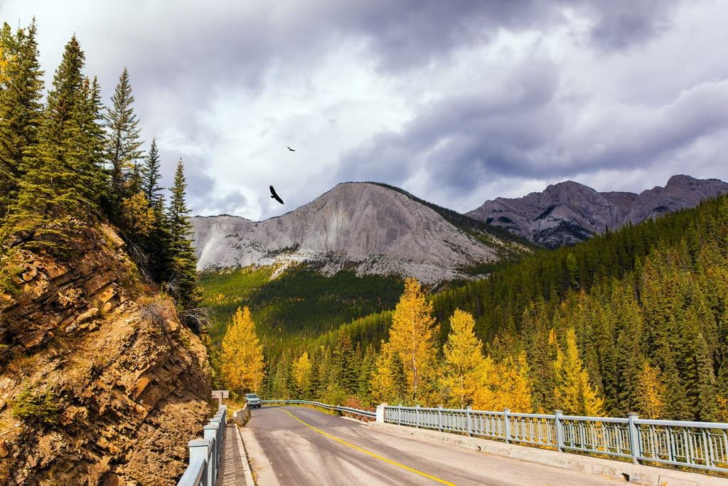
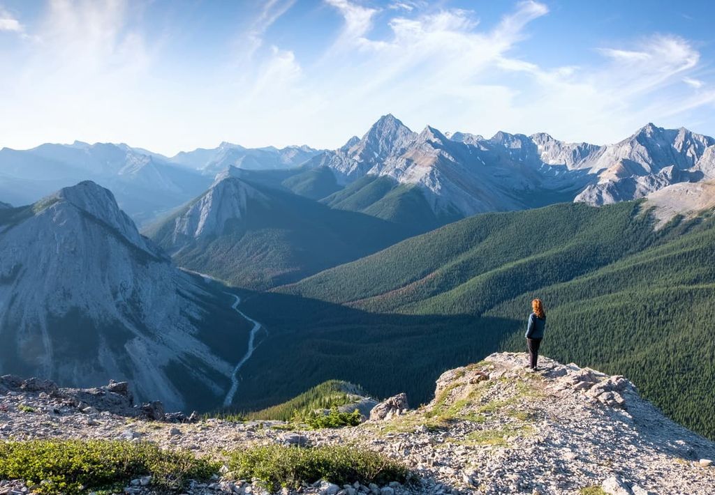
The Sulphur Skyline Trail starts from the Miette Hot springs and is an 8 km (5 mi) return trail that rises up 700 m (2,296 ft) to spectacular views of Jasper National Park. The trail starts with a small incline that steadily gets steeper as you approach the high point. From the summit you’ll have clear views of Capitol Mountain, Utopia Mountain, and Mount O’Hagan to the west as well as the Fiddle River Valley.
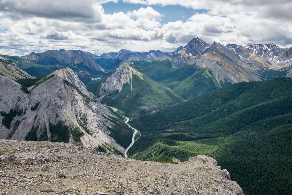
The Fiddle River Trail can be hiked point to point between Whitehorse Creek in Whitehorse Wildland Provincial Park and Miette Hot Springs in Jasper National Park. The trail is 36.5 km (22 mi) long with 1,269 m (4,162 ft) of elevation gain. It is usually done as a multi day expedition and there are campsites along the route.
The views are spectacular from Fiddle Pass and the pass itself is often covered with wildflowers. The trails are well marked and, while it is a long hike with significant elevation gain, there are no significant obstacles to overcome. The trail is good for both experienced hikers and new hikers that are wanting to test their stamina.
The Nikanassin Range is a stunningly beautiful range to visit and explore. The following are some nearby towns that offer accommodations for visits to the range.
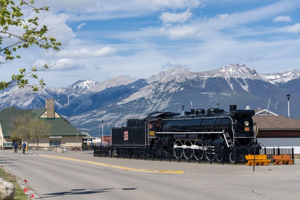
Originally a trading post named Jasper House, the original fort was built in 1813. In 1907, Jasper National Park was established and the town of Jasper was created near the original fort site to be the commercial center for the newly established park. The town of Jasper is located about 40 km (24 mi) to the west of the Nikanassin Range.
Some of the most popular hikes from Jasper are the hike to Sunwapta Peak, the Sulphur Skyline Trail, and the Maligne Canyon Hike. Jasper National Park is considered to have some of the most stunning landscapes and beautiful scenery in Canada.
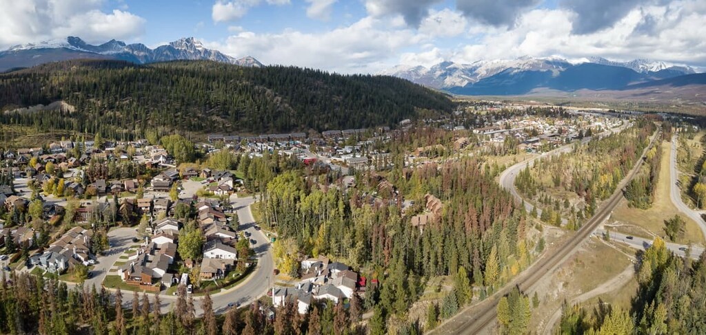
Located about 25 km (15 mi) to the east of the Nikanassin Range, the town of Hinton was founded in 1911 when the Grand Trunk Railway built a station house at the current Hinton townsite. The town has experienced a coal boom and bust and was revived in the 1950s when a pulp mill was built in the town.
Hinton is home to the Wild Mountain Music Fest and is a popular staging area for expeditions into the Willmore Wilderness Park, which is located to the north of the town. While in the town, visitors can walk the 3 km (2 mi) Beaver Boardwalk to view the beavers and other local wildlife. Hinton is also situated near the eastern entrance of Jasper National Park, which has countless incredible trails to hike.