
Scan the QR code and open PeakVisor on your phone
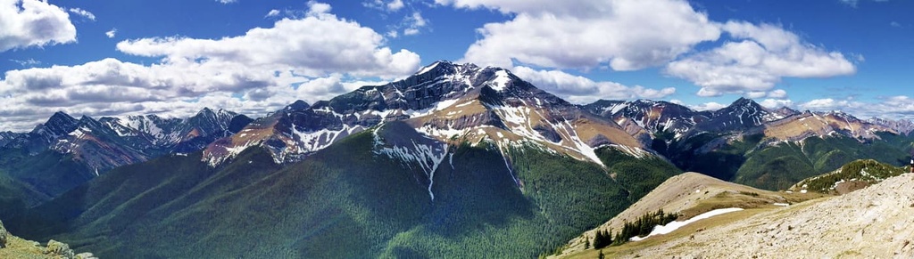
The Miette Range is a chain of peaks located within central Alberta, Canada in the Front Range of the Canadian Rockies. The range has 5 named peaks, the highest of which is Utopia Mountain at 2,563 m (8,410 ft) in elevation. Mount O’Hagan and Roche Miette are other notable peaks in the range.
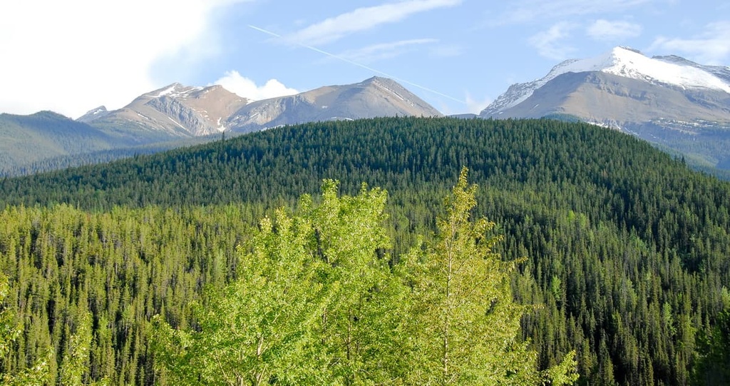
The Front Ranges span the eastern edge of the Canadian Rockies in Alberta, Canada and include the Miette Range, which is located on the eastern side of Jasper National Park.
Most of the Canadian Rockies are protected as part of national and provincial parks. Some of the major national and provincial parks situated near the Miette Range are:
The Jacques, Colin, and Maligne ranges are all located to the west of the Miette Range. Meanwhile, the Bosche Range is situated to the north of the Miette Range and the Nikanassin Range is located to the south. The Rocky Mountain Foothills are also located to the east of the Miette Range and they extend towards the boreal forests and prairie grasslands.
The Miette Range was formed in the same manner and from generally the same rocks as the rest of the Canadian Rockies. The Canadian Rockies formed primarily during the Laramide orogeny, which is a mountain building event that began about 75 million years ago and lasted until about 45 million years ago.
Before the Laramide orogeny, the west coast of Canada had expanded significantly as exotic land terranes, in the form of microcontinents and volcanic island arcs were accreted, or stuck, to the west coast of Canada. These accreted terranes created most of modern British Columbia.
The new terranes were added from the tectonic plates beneath the Pacific plate, which subducted beneath North America. The islands were skimmed from their plate and added to what is now western Canada.
While the Laramide orogeny only started about 75 million years ago, tectonic collisions had been occurring for many millions of years and had already created the Columbia, Interior, Coast, and Insular Mountains of British Columbia. The Rocky Mountains were among the final mountains to form as part of the Western Cordillera.
During the Laramide orogeny, this tectonic collision caused the Pacific plate to push against the ancient continental margin, which was roughly along the Alberta – British Columbia border. Subsequently, the ancient continental margin was covered in layers of marine sediment that had formed during the Paleozoic. It was then covered by layers of Cretaceous silt, mud, and sand that had been eroded from the continent.
The ancient seafloor was put under immense pressure, which caused the layers of rock to heat up, so much so that the layers of rock became pliable. The heated layers of rock bent, folded, broke, and were eventually thrust up to stack upon the rock layers to the northeast.
As a Front Range, the Miette Range was one of the final ranges to form. After the formation of the Front Ranges, the energy of the tectonic collision had dissipated significantly. While the plates under the Pacific still pushed against the continent, to the east of the Rockies, there was only enough force to separate and lift the Cretaceous sandstone, shale, and mudstone, all of which are now the basis of the foothills.
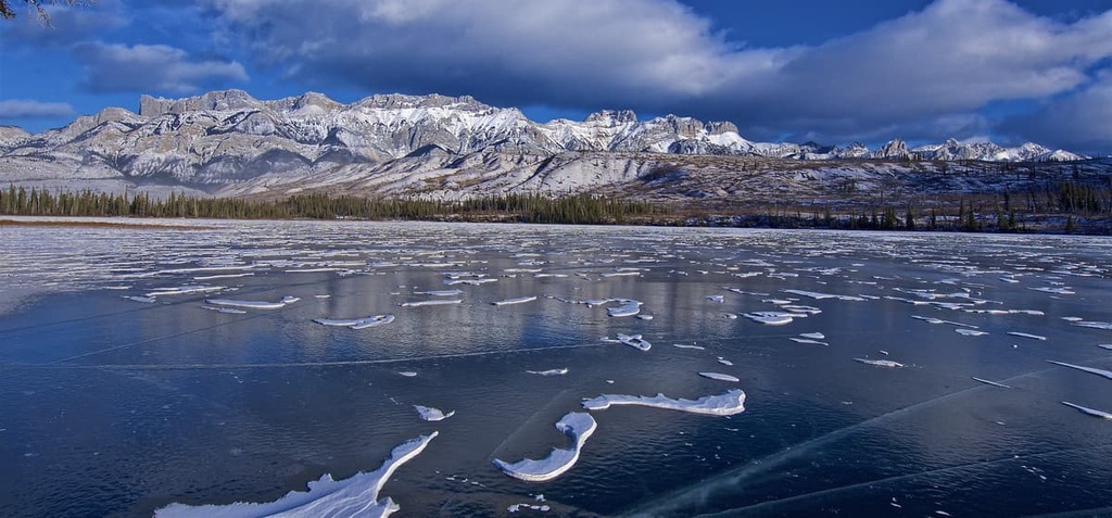
While erosion from rain, water, and wind were constant throughout the formation of the Rockies and the Miette Range, the glaciers of the Pleistocene were forceful enough to clear previous topography and leave the range with new features.
The glaciers, which stood many kilometers thick, covered the Miette Range on and off for millions of years. During the Pleistocene, there were several glacial maximums; however, only the effects of the latest glaciation are visible throughout the range. These glaciers were responsible for creating the U-shaped valleys, cirques, aretes, and horned peaks that we see today.
As the glaciers retreated, they left behind formations of glacial till. Some of the till formations to look for are moraines, kames, drumlins, and eskers. About 12,000 years ago, the ice had finally melted from the Miette Range enough to allow for flora to grow and create a viable ecosystem for the ancient fauna that inhabited the region.
The peaks of the Miette Range are part of the Alpine subregion of the Rocky Mountain Natural Region, while the slopes are representative of the Subalpine, and the valley bottoms are home to Montane habitats. The Rocky Mountain Natural Region contains a wide variety of flora and fauna that are unique to the region.
The Alpine subregion of the Miette Range is the coldest, and it receives the most precipitation of any of the subregions in the range. Here, the winters are long and cold and the growing season is short. While the trees in the Alpine try to grow as high in elevation as they can, the harsh winter winds stunt the growth of the trees into gnarled stands of krummholz. The peaks in the range are rocky, though they feature communities of sedge and heath growing above the treeline.
White-tailed ptarmigan and the American pipit are among the few birds that inhabit the alpine, along with mountain goats and mountain sheep. Marmots, pika, and ground squirrels live in rocky burrows along the tree line, feeding off the alpine heath, while being preyed upon by eagles, foxes, and other predators. Deer and elk may spend part of their year in the alpine; however, most animals seek refuge in the subalpine forests during the winter months.
Engelmann spruce and subalpine fir are the typical subalpine trees of the Miette Range. There are also dense forests of lodgepole pine that have grown along the base of the mountains and into the valleys. The ridges are home to larch trees and stands of aspen that are scattered throughout the range. Willow and poplar tend to grow only in the valleys where there is significant moisture, along streams and creeks.
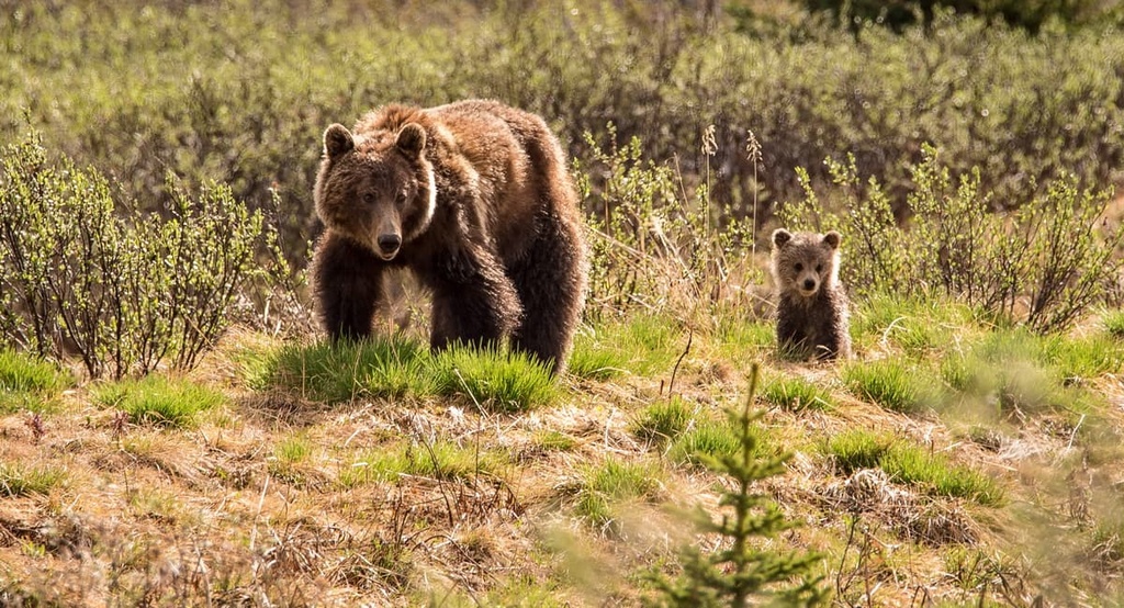
The forests of the Miette Range contain a wide variety of animals, such as grizzly bears, moose, elk, black bears, wolves, deer, cougars, and foxes. There are many opportunities to look for the mountain goats and bighorn sheep that inhabit the rocky peaks of the range.
Additionally, while trekking in the range, you’ll likely hear the whistle of the marmots and see them scurry among the cover of the alpine rocks. There are also many birds to watch for, such as warblers, bald eagles, finches, and pipits.
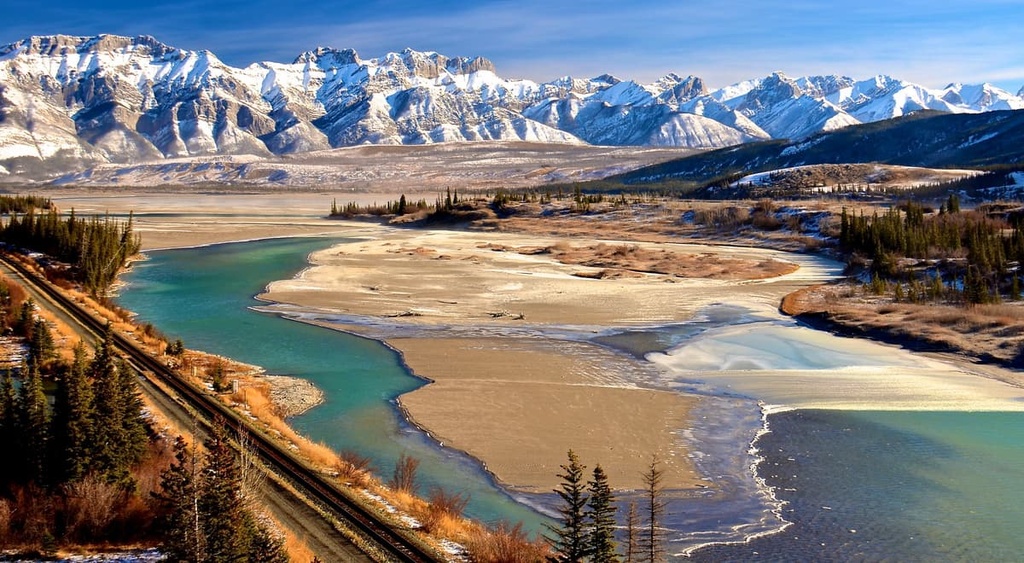
Toward the end of the Pleistocene, as the glaciers and continental ice sheet melted, an ice-free corridor opened along the eastern ranges and slopes of the Canadian Rockies. The Miette Range and the eastern slopes and foothills of the Rockies from Yukon and Alaska, through Alberta to Montana, are part of the ancient ice-free corridor that formed during this time.
While the timeline is disputed, it is believed that the ice-free corridor was one of the routes through which North America was originally populated by humans. The ice-free corridor was likely open for thousands of years during the Pleistocene during several distinct periods.
The corridor along the eastern slopes was most recently closed from about 20,000 years ago to 13,000 years ago, at which time it opened permanently, allowing vegetation to take hold and flourish. The archeological evidence suggests that the glaciers receded first in the south, at the southern end of the Rockies and in Kananaskis Country, and then gradually opened towards the north.
The contemporary First Nations that claim the Miette Range as part of their traditional territory are the Ktunaxa, Tsut T’ina, Stoney Nakoda, and Cree, as well as the Métis Nation. The range was the eastern extent of the Ktunaxa territory, which traditionally included the land between Columbia River Valley in the Regional District of Central Kootenay and the eastern slopes of the Rockies.
The Tsuu T’ina were originally part of the Dane-zaa (Beaver) Nation, though they eventually moved further south. They traditionally inhabited the regions around what are now Jasper and Edmonton until conflict with the Cree drove them further south to near what is now Calgary.
The Stoney Nakoda are related to the Sioux First Nations of the Great Plains of what is now North Dakota and the surrounding area. The Cree are Algonquin-speaking First Nations from the Great Lakes region in the east.
Both the Stoney Nakoda and Cree migrated west under pressure from the westward settlement of people of European descent. The Cree and Stoney Nakoda often worked as guides for European fur traders and as intermediaries in the fur trade between other First Nations and Europeans.
The fur trade was responsible for early European settlement near the Miette Range, which primarily occurred at Jasper House and what is now the town of Jasper in Jasper National Park. As the fur trade declined, mining became a major economic driver as vast ore deposits were discovered along the eastern slopes in the late nineteenth and early twentieth centuries.
The Miette range is located in Jasper National Park, which was established 1907. With the establishment of the park, the Jasper Exodus occurred where homesteaders in the Athabasca Valley were evicted from the new park boundaries. Many of the inhabitants were Cree and they moved north to what is now Grande Cache.
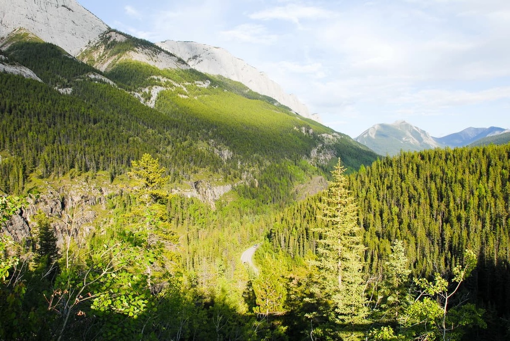
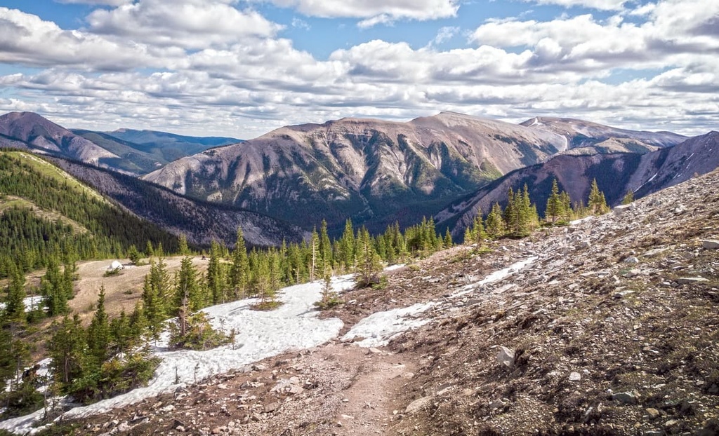
Located within Jasper National Park, the Miette Range is host to spectacular scenery and a variety of wildlife. The following are some of the major trails and attractions that are found in the Miette Range of the Canadian Rockies.
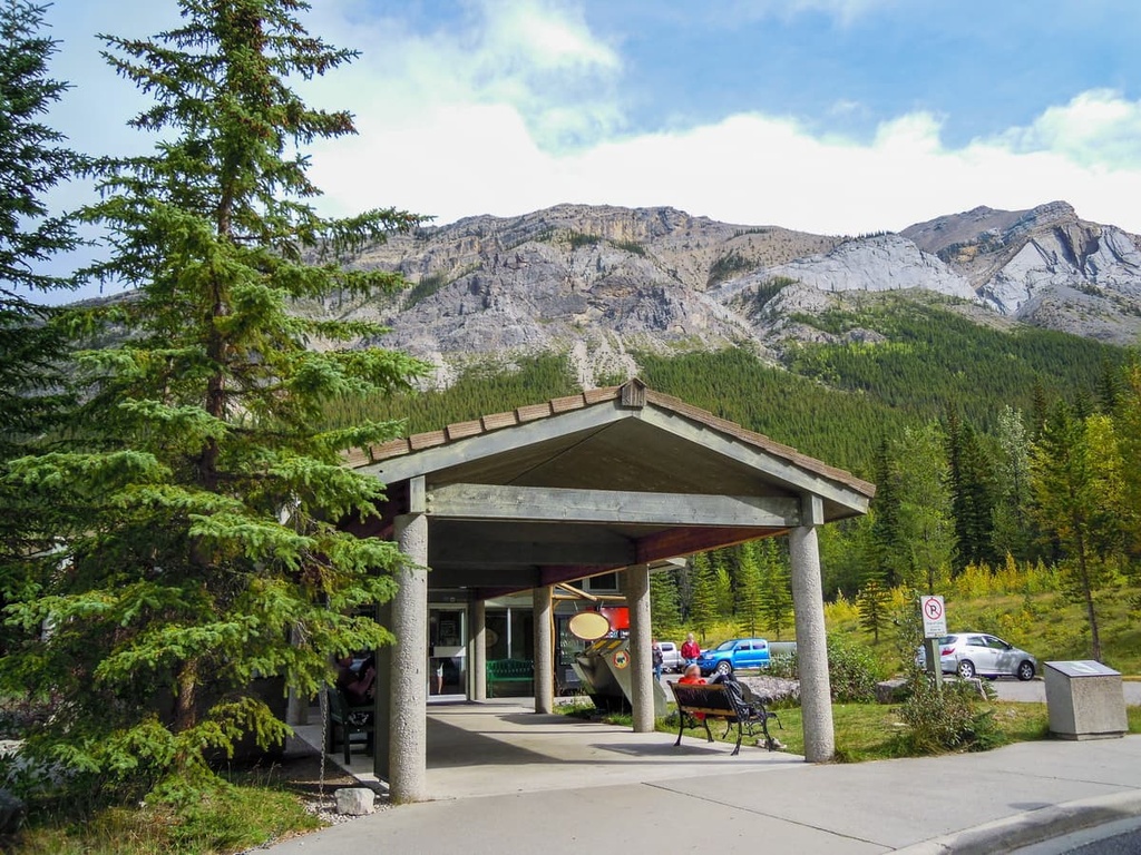
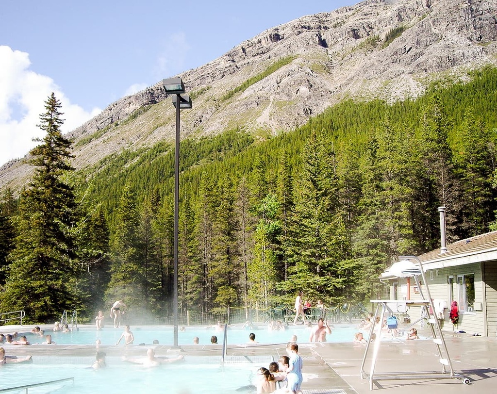
With water temperatures averaging 40°C (104°F), the Miette Hot Springs are a commercially developed hot spring that’s located in Jasper National Park. Located about 60 km (37 mi) to the east of the Jasper townsite, the pool is filled 100 percent with natural mineral water. The amenities at the hot springs include change rooms, a gift shop, and a café at the hot springs.
A short interpretive trail from the hot springs leads toward the source of the hot water. The trail, aptly named Source of the Springs Trail, is a casual walk where you can learn about the geological processes that create the hot springs.
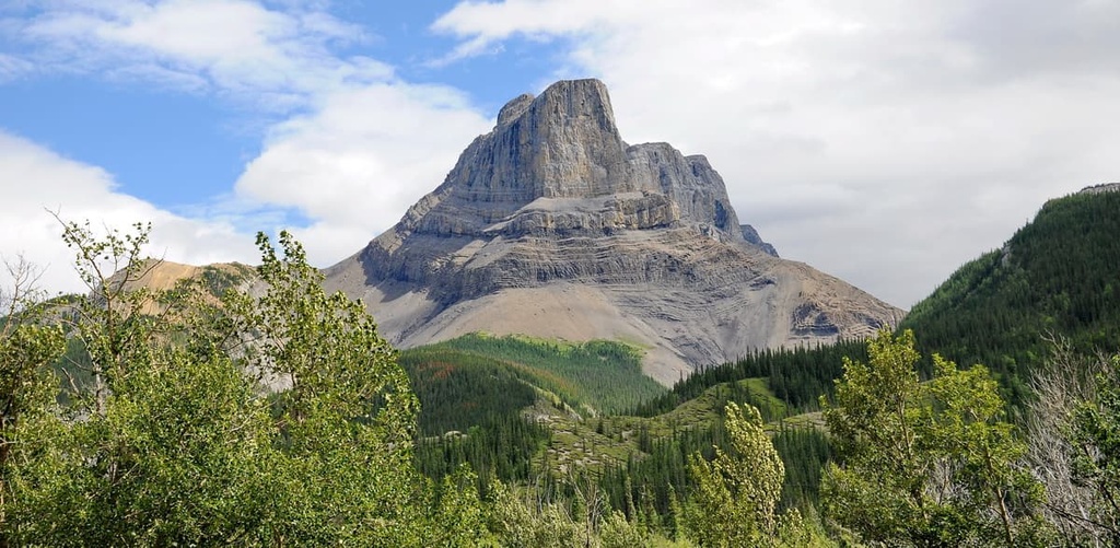
Roche Miette is a stunning peak located at the northern tip of the Miette Range. The distinctive peak is a prominent feature along Highway 16 while traveling to the Jasper townsite. While the peak appears as an impenetrable fortress, folklore says that Bonhomme Miette, a French Canadian voyageur, made the first documented ascent of the mountain.
Miette climbed the south side of the daunting peak and was prominent enough in the region that the range was named after him. Additionally, it was said that Miette, who was an accomplished fiddler, was the inspiration behind the names of the Fiddle River and the Fiddle Range.
However, other accounts state that the Fiddle Range was named for the sound that resonated when wind would blow through the range. By this account, the name is an adaptation of the Cree word used to describe the range, ke-too-che-gun.
The summit of Roche Miette is attainable via a 5 km (3 mi) scramble that starts from the side of Highway 16. The scramble ascends over 1,200 m (4,000 ft) to the summit of Roche de Miette and is considered difficult. While scrambling in the Rockies, ensure that you are prepared for inclement weather, as the weather in the mountains can change very quickly.
The trail to the top of Utopia Mountain starts from the Miette Hot Springs and is a 10 km (6 mi) out-and-back trail. The trail has spectacular views of the surrounding mountains as you ascend over 1,200 m (4,000 ft) to reach the summit.
The trail is difficult to follow at times and route-finding experience would be helpful. The final push to the summit is an exposed scramble and should only be attempted if you are confident in your ability and the weather has cooperated. Additionally, this route leads through grizzly bear territory and care should be taken to avoid wildlife interactions.
The Miette Range is situated along Highway 16 as you travel into and through Jasper National Park. The range has several notable features that are popular for locals and visitors. The following are some of the nearby cities and towns from which you can start your adventures in the range or stock up on supplies:
Originally established in 1813 as a trading post named Jasper House, the town of Jasper was established in 1907 as the commercial center for the newly created Jasper National Park. The town of Jasper is located about 60 km (36 mi) to the west of the Miette Range, in the heart of the national park.
Jasper National Park is considered to have some of the most stunning landscapes and beautiful scenery in Canada. Some of the most popular hikes from Jasper are the hike to Sunwapta Peak, the Sulphur Skyline Trail, and the Maligne Canyon Hike.
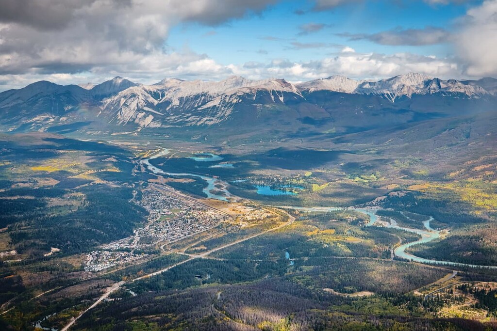
Other attractions include the Miette Hot Springs and the boat ride across Maligne Lake. The scenery of the park is spectacular, with the lush forests at the base of the rugged limestone peaks. Glaciers creep along the alpine heights and the wildlife is abundant, with visitors regularly sighting grizzly bears, moose, elk, black bears, and countless species of birds.
The town of Hinton was founded in 1911 when the Grand Trunk Railway built a station house at the current Hinton townsite. The town is located about 25 km (15 mi) to the east of the Miette Range and has experienced a coal boom and bust. It was revived in the 1950s when a pulp mill was built in the town.
Hinton is home to the Wild Mountain Music Fest and is a popular staging area for expeditions into the Willmore Wilderness Park, which is located to the north of the town. Hinton is also a gateway to the incredible wilderness of central Alberta and the Rocky Mountains.
While in the town, visitors can walk the 3 km (2 mi) Beaver Boardwalk to view the beavers and other local wildlife. Hinton is also situated near the eastern entrance of Jasper National Park, which contains countless incredible trails to hike.


