Scan the QR code and open PeakVisor on your phone
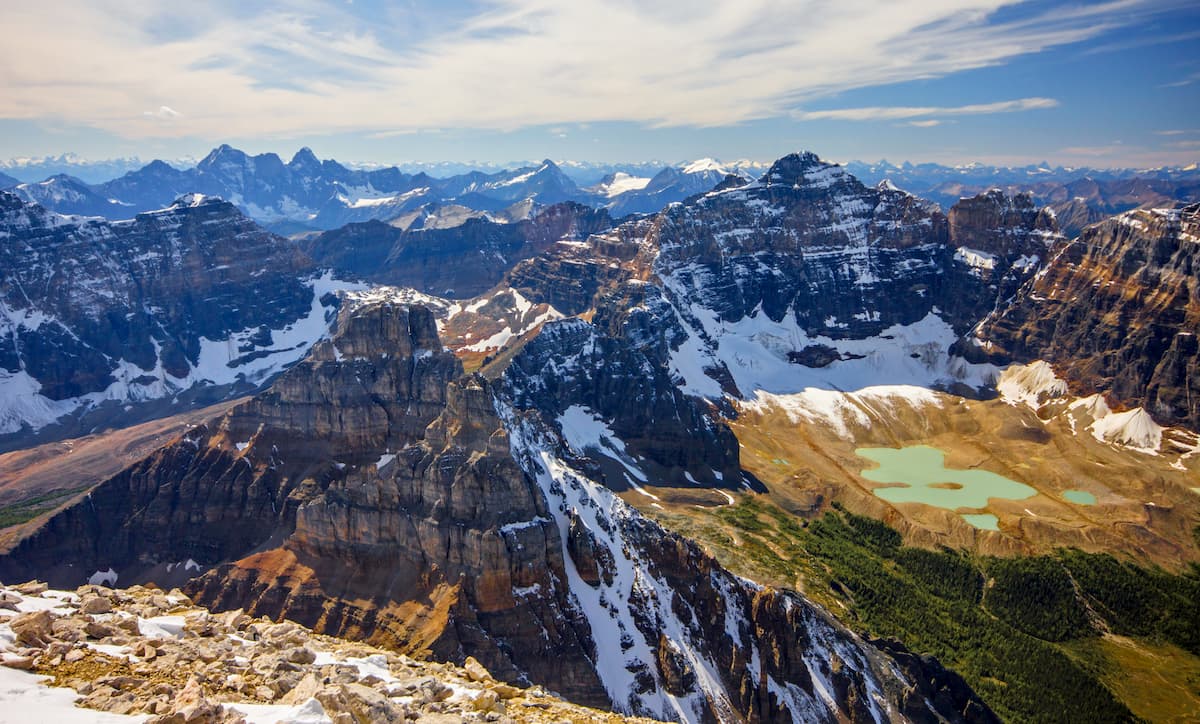
The Bosche Range is one of the Front Ranges of the Rocky Mountains in Alberta, Canada. The range is one of the many that are part of Jasper National Park and Mount Aeolus (2,643 m/8,671 ft) is the tallest and most prominent of the range’s five named peaks.
Located along the eastern edge of the Rockies in central Alberta, Canada, the Bosche Range has 6 named peaks and is part of the Canadian Rockies. The range runs southeast to northwest and is situated north of Highway 16 between the municipality of Jasper and the community of Hinton.
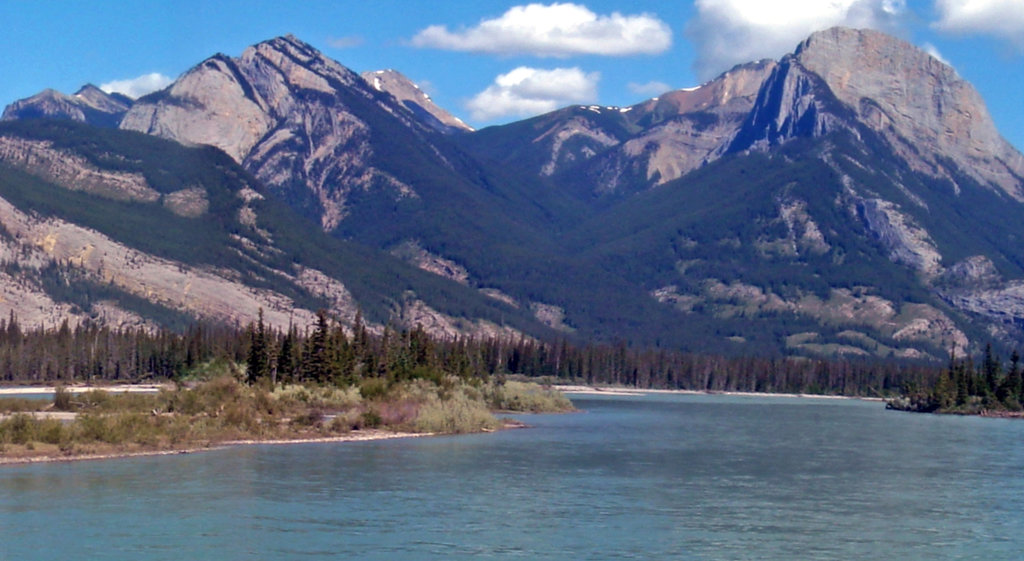
The Bosche Range is in Jasper National Park and is typically accessible via the Celestine Lake Road that runs along the north side of the Athabasca River. Mount Aeolus is the tallest and most prominent peak in the Bosche Range rising 2,643 m (8,671 ft) above sea level and 1,204 m (3,950 ft) above the adjacent valleys.
Some of the other nearby ranges are the Boule Range which is east of the Bosche Range and the De Smet Range is located just to the west. The Starlight Range, Persimmon, Berland Range, and Hoff Range are located north of the Bosche Range. South of the Bosche Range, across the Athabasca River are the Colin Range, Jacques Range, Miette Range, and the Fiddle Range.
As part of Jasper National Park, the Bosche Range is part of a protected wilderness area that preserves the local environment and recreational values. The following are some of the nearby parks and public areas that have been created to preserve the environment or to create areas for wilderness recreation:
The geological process that formed the Bosche Range started over 300 million years ago as sediment was collecting off the west coast of ancient North America. The marine sediment collected for millions of years during the Paleozoic and as more sediment collected the weight compressed the sediment into thick layers of limestone.
Starting about 160 million years ago tectonic plates under the Pacific Ocean began colliding with and subducting beneath the west coast of North America. It should be mentioned that the ancient west coast of Canada was roughly where the Canadian Rockies now sit.
As oceanic plates subducted beneath the continent, their micro continents and island arcs were skimmed off and accreted to Canada. Most of British Columbia is composed of these exotic terranes that formed elsewhere and were later added to Canada.
As these exotic terranes were accreting to the coast, the force of the tectonic collision compressed the new terrane into the mountain ranges of the Canadian Cordillera. The major ranges of the cordillera are the Columbia Mountains which were the first to form and are located west of the Rockies.
In order of formation, following the Columbia Mountains are the mountains of Interior British Columbia, the Coast Mountains, and then the Insular Mountains which form most of the islands off the coast of British Columbia.
Following the formation of the Insular Mountains was the formation of the Canadian Rockies. The Rockies are unique in that they formed far inland of the major tectonic activity that was driving their creation.
The Rockies formed roughly between 75 and 45 million years ago during an event called the Laramide orogeny. As the oceanic tectonic plates continued to push against and subduct beneath the west coast of North America, it is speculated that the Rockies formed because the land to the west was already compressed from the previous orogenic events.
As such, the force of the tectonic collision started to compress the layers of Paleozoic limestone that had accumulated along the ancient continental margin. The compression heated the layers of rock and made them malleable such that intense folding is visible throughout the mountain range.
Furthermore, the force of the collision finally started to crack the layers of rock to create faults. It is along these faults that the layers of Paleozoic limestone and Cretaceous sandstone and shales were pushed up, in a process called thrust faulting.
The Bosche Range is made up of thrust-blocks that successively overlay blocks from the southwest to the north east. The Front Ranges, of which the Bosche Range is part of, tower over the foothills to the east and were among the final mountain ranges to form during the Laramide orogeny.
During their formation and following the formation of the mountains, the Bosche Range was subjected to intense erosion. While rain and wind are certainly powerful erosive forces, the glaciers and ice sheet of the Pleistocene are credited with creating the current topography of the range.
During the Pleistocene glaciers formed among the peaks and flowed down the valleys, scouring the softer sandstones and shales, leaving behind the durable layers of Paleozoic limestone. During the glacial maximums, the Bosche Range was covered in an ice sheet that was over two kilometers thick.
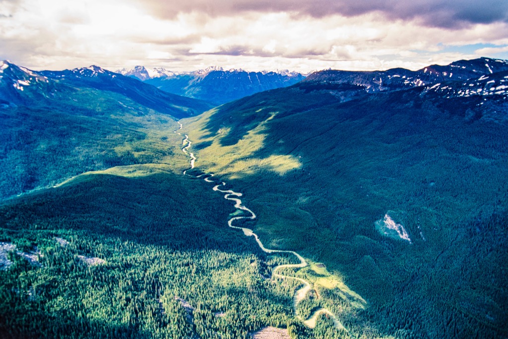
The Bosche Range is part of the Rocky Mountain Natural Region of Alberta and includes the alpine, subalpine, and montane subregions. The mountains have a short, cool summer season and a long cold winter. The alpine areas receive the most precipitation which typically falls as snow.
The valleys adjacent to the mountains are generally the warmest areas and have the greatest diversity and abundance of plants and animals. Poplar and willow generally only grow in the valleys, adjacent to the creeks and streams.
The valleys are also filled with forests of lodgepole pine and Engelmann spruce. Lodgepole pine is one of the first trees to grow in areas affected by wildfires.
As the forests rise up the slopes, they are typically composed of aspen, white spruce, Engelmann spruce and alpine fir. Only Engelmann spruce is found at the highest elevations where the fierce winter winds and cold stunt their growth and twist their forms, at which point the gnarled trees are known as krummholz.
The subalpine transitions to the barren alpine as a parkland-like mosaic of tree-stands and meadows. The alpine meadows are filled with sedge and beautiful wildflowers are seen during the summer.
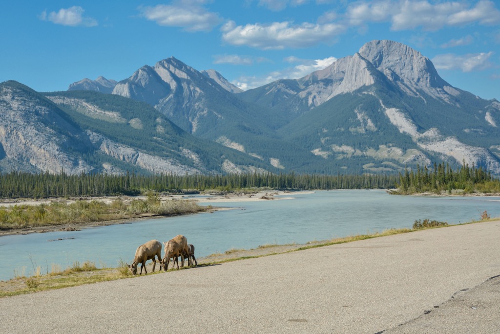
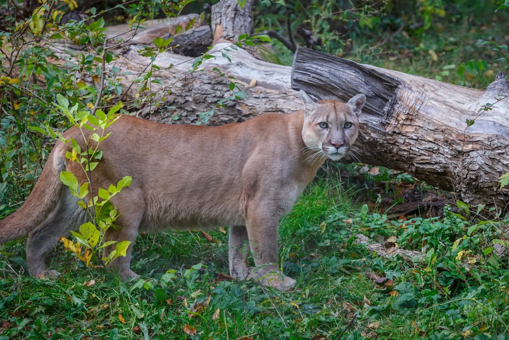
Grizzly bears, black bears, moose, elk, wolves, deer, cougars, mountain goats, and bighorn sheep are some of the majestic animals that inhabit the Bosche Range and surrounding valleys. Marmots, pika, and ground squirrels are found in the alpine, living in rocky burrows and feeding on the alpine heath.
The peaks of the Bosche Range are important habitats for mountain goats and bighorn sheep. Since the climate is relatively dry, grass grows better than trees and bighorn sheep are grazers while mountain goats graze and browse (eat grass as well as the leaves of shrubs and wildflowers).
The range is quite windy, especially during the winter, strong southwest winds help keep the slopes practically snow-free, making it easier for the goats and sheep to find food year-round. The steep cliffs and rugged terrain also help protect the goats and sheep being preyed upon by cougars, wolves, and coyotes.
Finally, the Bosche Range has a source of sulphur which is an essential element for goats and sheep. Sulphur is required by the goats and sheep to make the protein of their hair. Since both species annually grow and shed a significant coat, the animals get the sulphur by licking the pyrite that is found in the black shale.
The ice sheet receded from the lower Athabasca Valley, east of the front range about 15,000 years ago. Around 11,000 years ago the valleys around the Bosche Range were ice free and most of the Athabasca Valley was ice free by 8,000 years ago. The environment was certainly a factor in how quickly people began to use the resources and inhabit around the Bosche Range.
Sheep, caribou, and other ungulates were more than likely present around the Bosche Range 10,000 years ago. It is also likely that the nearby foothills and prairies were inhabited by the prehistoric animals that once wandered the region, such as the ancient bison, American mastodon, and the wooly mammoth.
Some of the first evidence of human use of the region is found in a nearby archaeological site that contains projectile points that are similar to others that date back to about 8,000 years ago. These points are the type used on throwing and stabbing spears and are relatively common throughout the northern Rockies, the adjacent plains, and the Kootenay region.
Starting about 5,500 years ago the appearance of the atlatl or spear thrower began a technological advance that culminated in the appearance of the bow and arrow by 400 CE. The presence of technology and artifacts that originated in British Columbia and other regions of Alberta indicate that many distinct groups visited this area and traded with the inhabitants.
The first people to utilize the resources around the Bosche Range were likely culturally related to other groups from the Far Northern Rockies. However, by about 5,000 BCE, with the changing climatic conditions people from the Northern Boreal/ Cordillera regions were better adapted to the conditions around the Bosche Range.
It is widely accepted that the Bosche Range was traditional territory of the Tsuu T’ina, Tse’khene, Dunneza, and the Secwepemc. These nations hunted, gathered, and traveled the valleys around the Bosche Range before our written history of the region began.
Our history of the region begins with the arrival of David Thompson in the winter of 1810 and his crossing of the Athabasca Pass. His work for the Northwest Company brought the fur trade which changed the lives of most of the people in the Athabasca Valley.
While the establishment of Jasper House and other colonial and settlement infrastructure, the arrival of the fur trade caused immense displacement of the inhabitants of the region. The Cree and Stoney were moving west, in front of the fur trade, often warring with and pushing out the traditional inhabitants. The Iroquois were traditionally accompanying traders, acting as guides and liaisons with other First Nations.
These intrusive groups displaced the Athapascans from the eastern slopes, who had lived in the region for countless generations. This created a domino effect that also displaced the Secwepemc from their traditional territory around the Columbia Lakes.
Furthermore, there are groups known as the “Snaring Indians” and the “Snake Indians” which were written about in early literature of the area. The Snakes were supposedly exterminated by the Stoney; however, their fate is unknown as they are not found in other historical accounts. It is possible these were legendary or mythical groups or simply another name for one of the known First Nations.
Following the introduction of the fur trade and new people to the region, the Métis also came to inhabit the region around the Bosche Range.
Most of the archaeologically significant sites around the Bosche Range are around the Snake Indian-Glacier Pass and throughout the river valleys east of the Bosche Range. Some of the sites include prehistoric workshops or evidence of hunting camps while some of the more recent sites are teepee circles and evidence of burials.
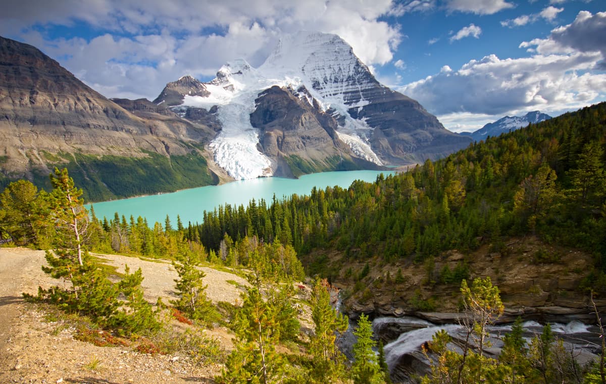
Likely one of the most important prehistoric sites in Jasper is found in the Bosche Range. At the time of its discovery, the Devona Cave was the only low-level cave known in the Canadian Rockies with considerable signs of human use. The major feature of the cave are the orange ochre pictographs drawn near the cave entrance.
The Bosche Range is currently part of Jasper National Park, which was established near the turn of the twentieth century. As part of the national park system, the wilderness is preserved for future generations to appreciate and the historical sites have been surveyed and protected when possible.
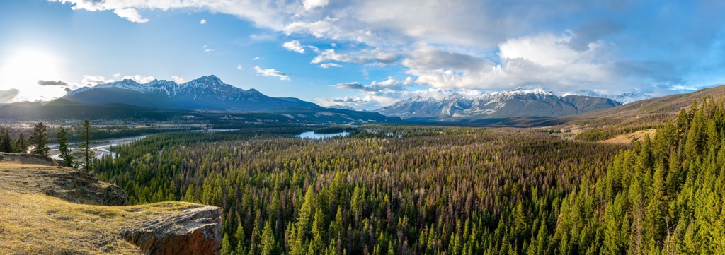
Millions of people come from across the world to relax and adventure in the beautiful wilderness of Jasper National Park. The Jasper townsite is only about 40 km (14 mi) west of the Bosch Range, and that is where most visitors to the park stay.
The Bosche Range is a beautiful range in Jasper National Park. The following are some of the major trails in and around the range.
The trail Celestine Lake is about 7 km (4.2 mi) and is a moderate hike up from the trailhead at the end of the Celestine Lake Road. The trail is straightforward, and it is enjoyed by hikers and mountain bikes, with a stunning lake at the end of the trail for pictures or a picnic. It should be noted that the Celestine Lake Road has seasonal closures and other timing restrictions that should be verified before traveling.
The trail to the Devona Lookout is only 2.5 km (1.5 mi) from Celestine Lake and is considered an easy addition to the Celestine Lake Trail. The trail ends at a lookout that gives stunning views of the Snake-Indian Valley, Jasper Lake, and the Athabasca Valley.
This 17 km (10.2) mi trail follows along the western slopes of the Bosche Range to reach the site of the Shalebanks Warden Cabin. This route is popular for backpacking and is considered moderately challenging as it has over 550 m (1,800 ft) of elevation gain.
The North Boundary Trail is a nearly 175 km (105 mi) trail that starts along the western slopes of the Bosche Range. The trail is usually used by backpackers and it is considered quite challenging for the long distance and nearly 4 km (2.4 mi) of elevation gain across the trail.
It takes most groups at least 5 to seven days to complete the trail that ends in British Columbia’s Mount Robson Provincial Park. The trail starts in the Snake-Indian River Valley between the De Smet Range and the Bosche Range, just north of the Athabasca River.
The trail skirts the Starlight Range and passes through the ranges of the northern tip of Jasper National Park. While difficult, finishing this trail is an incredible accomplishment and hikers will be surrounded by the stunning wilderness throughout their adventure.
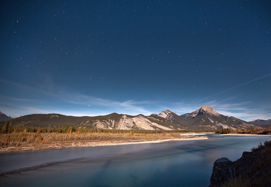
The Bosche Range overlooks the Snake River and Athabasca River in Jasper National Park. The range is rugged and beautiful and there are many opportunities for hiking. The following are the closest communities to the range.
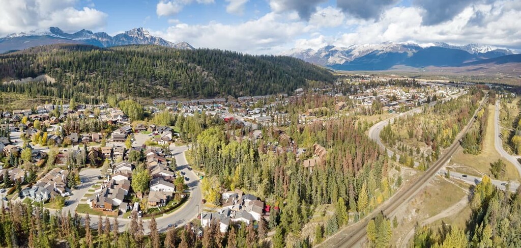
Situated along the banks of the Athabasca River, the municipality of Jasper is about 40 km (24 mi) west of the Bosche Range. There are many activities in the town and surrounding wilderness for visitors, any time of the year.
Winter is an incredible time to visit Jasper and the surrounding national park. Some of the popular local activities during the winter are ice climbing, snowshoeing, skiing, fat biking, and dogsled tours. While hiking, mountain biking, climbing, and canoeing are some of the activities that visitors can enjoy outdoors during the summer.
The town has a lovely main street to walk along, where visitors will be treated to the tempting smells of the local restaurants. There are also many accommodations in town, ranging from hostels to luxury hotels. Regardless of the season, the scenery around Jasper is stunning and I personally love the vibrant fall colors upon the rugged slopes.
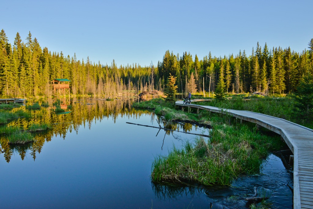
Considered the gateway to Jasper National Park, Hinton is a fantastic basecamp for adventures into the adjacent wilderness areas. The community is about 40 km (24 mi) east of the Bosche Range. The community has wilderness areas and local trails along the boardwalk and the Athabasca River that visitors are sure to enjoy.
However, despite the local attractions, most visitors come to Hinton to enjoy the surrounding wilderness. Some of the popular hiking and recreation areas are around the lakes and river of William A. Switzer Provincial Park and the historical area of the Coal Branch Public Land Use Zone.
Most people pass through Hinton with Jasper National Park as their destination, but there are other wilderness areas such as Willmore Wilderness Park, and Rock Lake – Solomon Creek Wildland Provincial Park that are also worthwhile, and less crowded destinations.