Scan the QR code and open PeakVisor on your phone
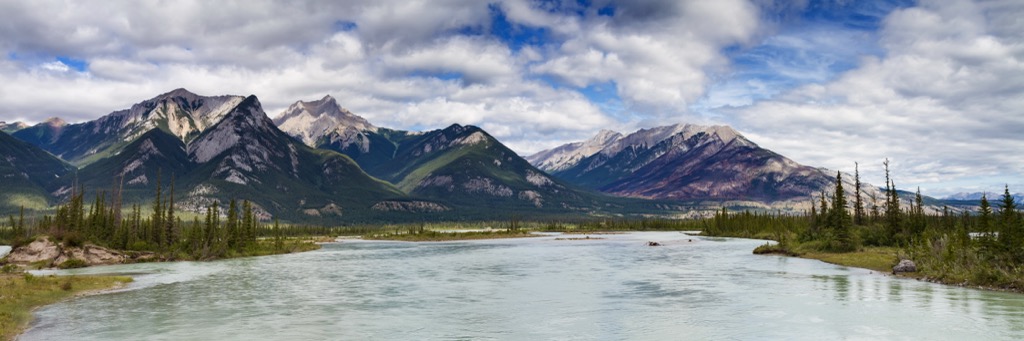
The De Smet Range is one of the Front Ranges of the Canadian Rockies and it is in Jasper National Park, Alberta, Canada. There are 20 named peaks in the range, of which Mount Sassenach (2,900m/9,514 ft) is the tallest and Roche de Smet (2,539 m/8,330 ft) is the most prominent with 816 m (2,677 ft) of prominence.
Located north of Jasper Lake, in Jasper National Park, Alberta, Canada, the De Smet Range is one of the Front Ranges of the Canadian Rockies. Mount Sassenach (2,900m/9,514 ft) is the tallest of the range’s 20 named peaks the range’s namesake, Roche de Smet (2,539 m/8,330 ft), is the most prominent with 816 m (2,677 ft) of prominence.
The range was named after the prominent Roche De Smet, which was named in honor of Pierre-Jean de Smet. Pierre-Jean de Smet was a Belgian missionary who worked among the indigenous population of western Canada in the 1840s and it is believed that indigenous who were working in the fur trade in the region, named the peak in his honor.
The De Smet Range is one of the many ranges that are encompassed within Jasper National Park. The Bosche Range and the Boule Range are east of the De Smet Range, while the Victoria Cross Ranges are located to the west.
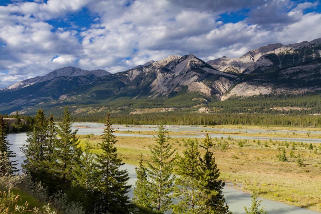
Across the Athabasca River lie the Fiddle Range, Jacques Range, Colin Range, and the Maligne Range. All of these ranges are often referred to as part of the Front Ranges or Park Ranges of the Canadian Rockies.
The De Smet Range is in Jasper National Park and the following are some of the other nearby parks and wilderness areas:
The De Smet Range is part of the Canadian Rocky Mountains. Many of the limestone rocks of the range started forming over 350 million years ago as layers of marine sediment upon the continental shelf of western North America.
The Rockies were the final mountain range to form in what is known as the Canadian Cordillera, which includes the Columbia Mountains, BC’s Interior Mountains, the Cassiar and Omineca Mountains, the Coast Mountains, and the Insular Mountains, which make up the coastal islands along the west coast.
The Rockies and other mountain ranges of the cordillera formed because oceanic tectonic plates collided and subducted beneath the west coast, accreting exotic terranes, and compressing the coast to uplift the mountain ranges. While many of the other ranges in the cordillera have at least some rocks of volcanic origin, the Rockies are formed from layers of Paleozoic and Cretaceous aged sedimentary rocks.
About 80 million years ago, the tectonic collision began to compress the layers of rocks along the ancient continental margin. The compression of the rock layers heated them up so that they started to bend and fold. Finally, the pressure started making cracks in the earth’s crust, which reached down, through the layers of Paleozoic aged limestone, creating what we know as fault lines.
After the faults formed, the continued tectonic subduction squeezed the layers of rock until they started to rise up and stack upon the layers of rock to the east. The process that formed the Rockies is referred to as fault thrusting.
The Rockies continued to rise for about 40 million years, starting with the subranges in the southwest and finishing with the front ranges in the northeast. After the front ranges rose up, there was no longer enough force to crack and thrust the deep layers of Paleozoic limestone. However, there was enough force transferred through the continent to crack and raise up layers of sandstone and shale, to create the foothills.
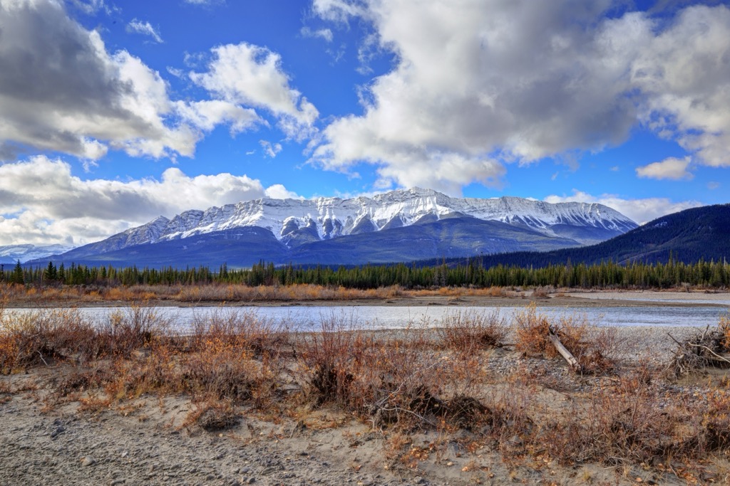
Starting about 2 million years ago, glaciers started forming in the Rockies, which persisted and grew into a massive ice sheet that covered the entire cordillera. During the glacial maximums of the Pleistocene, the De Smet Range was likely covered in over 2 km (1.25 mi) of ice.
The alpine glaciers carved alpine valleys and cirques throughout the de Smet Range. Furthermore, the glaciers carved the U-shaped valleys between the ranges. During the glacial maximums, the Cordilleran ice sheet flowed east of the Rockies and merged with the continental, or Laurentide, ice sheet. As the two ice sheets coalesced, they transported the glacial debris south, along the eastern slopes.
While some of the glacial debris was deposited in mounds, called moraines or kames, some of the debris were large rocks that were transported a long way and deposited upon the prairies, as glacial erratics. The glacial erratics near Okotoks, in southern Alberta originated from a large rockslide about 30,000 years ago in what is now Jasper National Park.
About 30,000 years ago a rockslide crashed onto the surface of a glacier in the Athabasca River valley, leaving massive rocks upon the glacier’s surface. The rocks, including Big Rock, were carried hundreds of kilometers south, from their point of origin. Big Rock is an extreme example of the power of glaciers, as it is about 16,500 metric tons, and is the largest known glacial erratic.
The ecosystems of the De Smet Range extend from the alpine zone that dominates the peaks, the subalpine zone which encompasses the slopes and finally the montane zone which covers the valley bottoms and circumference of the range. These ecosystems are described as part of the Rocky Mountain Natural Region which contains a wide variety of unique flora and fauna.
The alpine zone is the coldest and receives the most precipitation of any of the subregions in the range. The winters are long and cold, and the growing season is short upon the mountain peaks. Most of the precipitation falls as snow.
While generally rocky, there are communities of sedge and heath growing above the treeline. The trees try to grow as high in elevation as they can; however, the harsh winter winds stunt the growth of the trees into gnarled stands of krummholz.
Marmots, pika, and ground squirrels are the most common animals in the alpine and they live in rocky burrows along the tree line, feeding off the alpine heath. During nesting season, white-tailed ptarmigan and the American pipit use the barren alpine as a defense against predators.
If you are lucky, you may see some of the mountain goats and bighorn sheep, which are the largest mammals that continuously inhabit the alpine terrain. During the summer, deer and elk may inhabit the alpine; however, most animals seek refuge in the subalpine forests during the winter months.
Along the treeline, the rocky alpine transitions to a parkland like mosaic of trees and meadows and finally to dense forests of Engelmann spruce and subalpine fir along the slopes. Lodgepole pine is also common in the range, especially where wildfires have occurred.
Poplar trees and willows typically only grow in the valleys where there is significant moisture, along streams and creeks. Beautiful larch trees can be seen along subalpine ridges and stands of aspen are scattered throughout the range.
There are a wide variety of animals that are typical to the Canadian Rockies that inhabit the De Smet Range. Grizzly bears, moose, elk, black bears, wolves, deer, cougars, mountain goats, bighorn sheep and foxes are among the most majestic animals that inhabit the area. There are also many birds to watch for, such as warblers, bald eagles, finches, and pipits.
The De Smet Range is in the traditional territory of the Ktunaxa, Tsuu T’ina, Stoney Nakoda, Cree, and the Métis Nation. The region has seen significant upheaval and a change of inhabitants since the first people came to the slopes of the De Smet Range.
The range was the eastern extent of the Ktunaxa territory, which traditionally included the land between Columbia River Valley in the Regional District of Central Kootenay and the eastern slopes of the Rockies. It is possible that the ancestors of the modern Ktunaxa were among the first people to visit the De Smet Range.
Contemporary with the Ktunaxa, the Tsuu T’ina broke away from their original ancestors, who were part of the Dane-zaa (Beaver) Nation, to move from the northern forests and begin to inhabit central Alberta. Originally inhabiting the regions around what are now Jasper and Edmonton, conflict with the Cree forced them to migrate south, near to what is now Calgary.
The Cree are Algonquin-speaking First Nations that migrated west ahead of and with the westward expansion of the fur trade. from the Great Lakes region in the east. Additionally, the Stoney Nakoda, who are related to the Sioux First Nations of the Great Plains of what is now North Dakota, the Stoney Nakoda, like the Cree, often worked with the fur traders and they migrated west along with their trade.
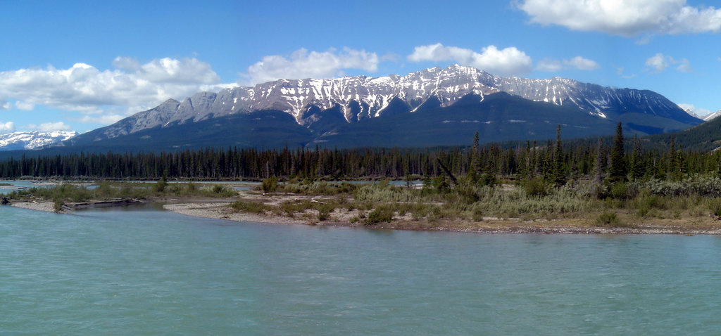
The Athabasca River valley was among the most fertile areas in the region and there was a relative abundance of wildlife in the forests and fish in the river to sustain the semi-nomadic groups that first inhabited the region. It also made sense that after the construction of Jasper House, that homesteaders also settled in the fertile Athabasca Valley.
Jasper House, a North West Company outpost, facilitated early European settlement near the De Smet Range. First constructed in 1814, Jasper House historically stood near the base of the De Smet Range.
While the fort was eventually abandoned and the building materials repurposed, Jasper House was the historic beginnings of the Municipality of Jasper and Jasper National Park. Jasper National Park was established 1907 and encompassed a significant part of the Athabasca River valley and the surrounding ranges.
The Athabasca River valley has many significant archeological and cultural sites pertaining to the ancient people that first inhabited the region. There are historic and prehistoric remains scattered around the De Smet Range.
Historically, there were several homesteads that were built along the southern slopes of the De Smet Range. These cabins were abandoned during the Jasper Exodus, where homesteaders in the Athabasca Valley were evicted from the new park boundaries.
There are also many prehistoric sites that include base camps, seasonal camps, lookouts, workshops, and caves. Many of the prehistoric sites are on the north shore of the Athabasca River, along southern slopes of the De Smet Range. There are also many significant sites in the Snake Indian River valley, and they are especially abundant in the valley between the De Smet Range, Bosche Range, and the Starlight Range.
Among the peaks and valleys, the following are some of the mazing places and trails in and around the De Smet Range in Jasper National Park:
Snake River Falls is a stunning waterfall along the Snake River, which runs through the valley between the De Smet Range and the Bosche Range. The trail is about 26 km (16 mi) from the trailhead near Celestine Lake to the falls and is typically hiked over at least three days.
The trail has nearly 1,500 m (5,000 ft) of elevation gain and can be considered quite challenging. For the most part the trail winds through the forested valley and there are few viewpoints aside from the falls; however, the view of the falls is worth the effort of three days of hiking.
The valley is a major wildlife corridor within Jasper National Park and most visitors have some sort of wildlife viewing or encounter. Elk, black bears, and grizzly bears are commonly seen along this trail.
This trail is also a popular mountain bike route and it is also the beginning section of a nearly 200 km (120 mi) trail that traverses the northern tip of Jasper National Park. Referred to as the North Boundary Trail, this trail follows the Snake Indian River around the northeast side of the De Smet Range and then between the northern ranges of the park to finally finish in Mount Robson Provincial Park.
Esplanade Mountain overlooks Moberley Flats and Athabasca Island, which is in the middle of the Athabasca River. The difficult trail to the summit is about 8 km (5 mi) out-and-back, with over 1,200 m (4,000 ft) of elevation gain to reach the summit at 2,301 m (7,549 ft) above sea level. The trail is very steep and difficult; however, the views of the river valley and surrounding ranges are incredible.
Mount Greenock is the eastern peak on the ridge of Roche de Smet. The trailhead is located along the southwest slope of the ridge, off of Celestine Lake Road. It is a loop of over 7 km (4 mi) and over a kilometer (0.6 mi) of elevation gain, that takes hikers to the incredible viewpoint upon Mount Greenock. The steep grade makes this a difficult hike and best suited to seasoned hikers.
Starting from the Vine Creek Trailhead along the Celestine Lake Road, adventurers can hike towards and scramble to the peaks of Roche de Smet or Mount Cumnock. The typical route to these peaks follows the valley and then ascends the western face of the ridge; however, it is possible to traverse the ridge from Mount Greenock to the summit of Roche de Smet.
Reaching the summits of Mount Cumnock and Roche de Smet requires scrambling, which is more difficult and dangerous than simply hiking. The hike into Mount Cumnock is quite long and the hike along the ridge to the summit of Roche de Smet has some sections of significant exposure. Obtaining these peaks should only be attempted by experienced hikers, scramblers, or mountaineers.
For those with the appropriate experience and stamina, there are incredible views from Roche de Smet or Mount Cumnock. With clear skies, you can see all the way to Mount Edith Cavell, which is east of the Jasper townsite, and some of the nearby peaks to see are Gargoyle Mountain, Redan Mountain, Roche a Bosche, Cinquefoil Mountain, and many more.
Overlooking the Athabasca and Snake Indian Rivers, the De Smet Range is along the east side of Jasper National Park. The following are the communities and cities closest to the park and the range.
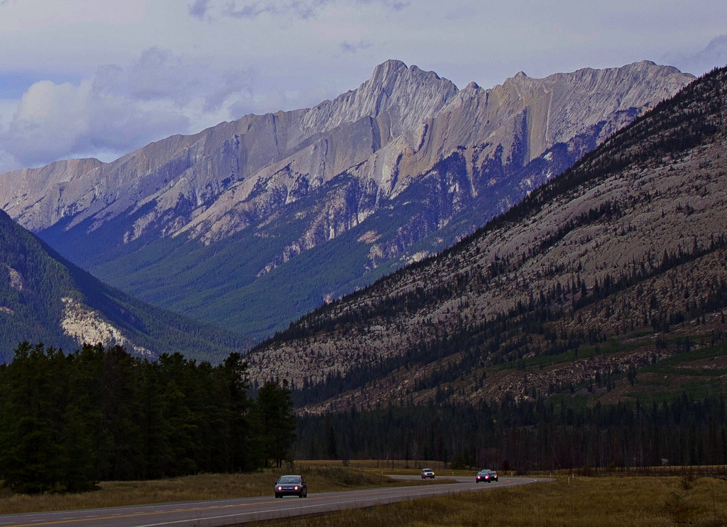
Situated alongside the Athabasca River, the municipality of Jasper is about 10 km (6 mi) west of the De Smet Range. In the town and in the wilderness, there are many different adventures and activities to do.
Ice climbing, snowshoeing, skiing, fat biking, and dogsled tours are some of the many outdoor activities that visitors can enjoy during the winter. Hiking, mountain biking, climbing, and canoeing are some of the activities that visitors can enjoy outdoors during the summer.
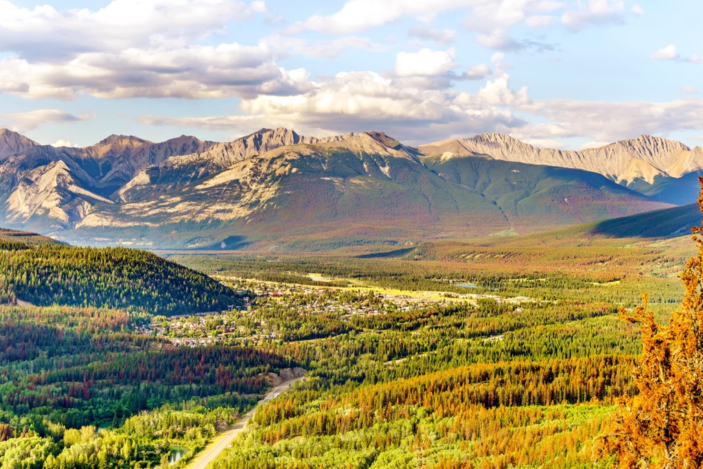
There are many delicious restaurants to sample and there are many types of accommodations from hostels to luxury hotels. Regardless of the season, the scenery around Jasper is stunning; however, I have a personal preference for the beautiful fall colors.
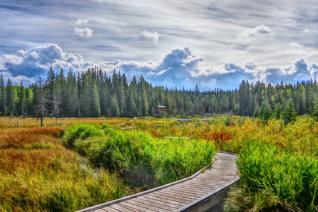
Situated at the edge of Jasper National Park, Hinton is a wonderful launchpad for wilderness adventures. There are local trails along the boardwalk and along the Athabasca River, and there are many fantastic places nearby
Locals like visiting Gregg River Falls where they can play in the river and picnic along the bank. Other popular places are the lakes and river of William A. Switzer Provincial Park and the historical area of the Coal Branch Public Land Use Zone. As mentioned, Hinton is at the border of Jasper National Park, and the wilderness areas of Willmore Wilderness Park, and Rock Lake – Solomon Creek Wildland Provincial Park.