
Scan the QR code and open PeakVisor on your phone
Coal Branch Public Land Use Zone has 24 named peaks. The highest is Ruby Mountain at 2,900 m. Other notable peaks include Thistle Mountain, Mount McBeath and GMMC Mountain.
The Coal Branch Public Land Use Zone (Coal Branch PLUZ) is located in central Alberta, Canada along the eastern slopes of the Rocky Mountains. The public land use zone is about 571 square kilometers (220 square miles) of protected area that has 24 named mountains. The tallest mountain in Coal Branch PLUZ is Ruby Mountain (2,900 m / 9,512 ft) and the most prominent mountain is Fiddle Peak (2,243 m /7,359 ft).
The Coal Branch PLUZ is located in central Alberta, south of Highway 16 and north of Highway 11. Additionally, Highway 40 runs parallel to the mountains, giving access to the PLUZ. Luscar, Cadomin, and Mercoal are several of the mining towns located to the east of the PLUZ along the Coal Branch of the Grand Trunk Railway, from which the PLUZ gets its name.
Coal Branch PLUZ is situated along the eastern slopes of the Nikanassin Range and Fiddle Range. Jasper National Park and Whitehorse Wildland Provincial Park are located east of the PLUZ, too, alongside many other protected areas, such as Rock Lake-Solomon Creek Wildland Provincial Park, Brule Lake PLUZ, Athabasca Ranch PLUZ.
Furthermore, there are a number of protected areas located to the south of Coal Branch PLUZ, including Brazeau Canyon Wildland Provincial Park and Blackstone-Wapiabi PLUZ. The Blackstone-Wapiabi PLUZ is part of a collection of public lands referred to as Bighorn Country.
As the tectonic plates under the Pacific Ocean moved west and collided with North America 140 million years ago, their subduction caused the western section of the ancient North American continent to sink. As the western edge of the continent sank, the coast, which was located where Alberta currently sits today, became a basin that quickly filled with water.
As the water filled the basin, sediments quickly covered the Jurassic swamps, wetlands, and peat bogs that had previously been in the region. These conditions allowed for the transformation of organic material into coal and other similar fossil fuels.
During the Cretaceous, the Rocky Mountains started to form. This process helped displace seawater from the basin, allowing for the coal to harden into the deposits that were mined during the twentieth century. As the tectonic plates continued pushing from the west and subducting under the continent, the Rocky Mountains continued to form through a series of fault thrusts.
Fault thrusts would occur as the layers of rock broke along a fault line. Then, these blocks were thrust up and on top of the layers to the northeast. The fault thrusts continued as bursts for over 30 million years, creating the Rocky Mountains and the foothills in the process.
Coal Branch PLUZ is part of the Fiddle Range and Nikanassin Range, which are some of the front ranges of the Canadian Rockies. These ranges are composed of limestone and dolomite and are underlain with layers of coal.
Major peaks in the Coal Branch PLUZ include Ruby Mountain, Thistle Mountain, Mount McBeath, GMMC Mountain, Mount La Grace, Fiddle Peak, and Folding Mountain.
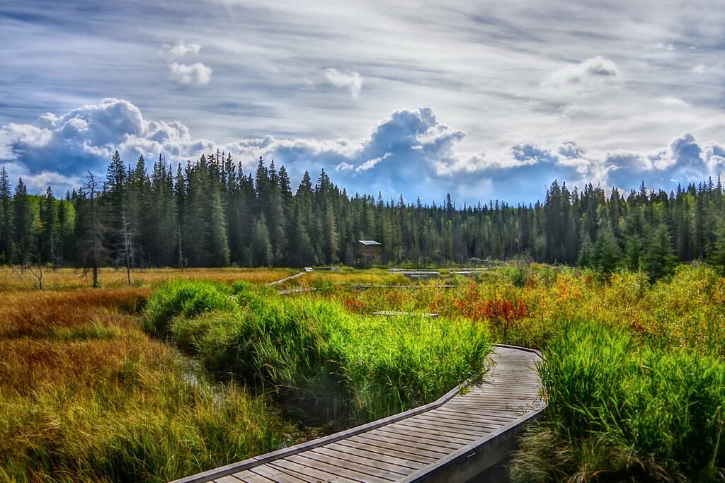
The land within the Coal Branch PLUZ is considered to be a part of the Rocky Mountain Natural Region. The PLUZ has areas representative of the three subregions of alpine, subalpine, and montane; however, the PLUZ is predominantly considered part of the montane ecosystem.
The montane ecosystem is found along the eastern slopes of the Rocky Mountains and within wide, low elevation valleys in the range. The montane ecosystem is the warmest of the Rocky Mountain Natural Regions, though all three subregions receive significant precipitation. However, the alpine receives the most snow in the Rockies.
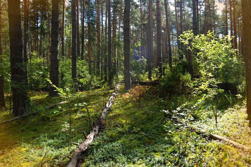
A mosaic of forest and meadows are characteristic of the Coal Branch PLUZ with forest of lodgepole pine, Douglas fir, Engelmann spruce, white spruce, and jack pine. Willow and balsam poplar grow well along the damp creek banks while aspen prefers dry sites and larch tend to grow along ridges.
There are many large mammals that inhabit the PLUZ, including grizzly and black bears, moose, elk, deer, wolves, and cougars. Mountain goats and bighorn sheep prefer to inhabit the region’s alpine areas, as do hoary marmots and pika, all of which make their burrows under the alpine rocks and feed from the scant alpine vegetation.
There are many bird species that live in their preferred habitats of the PLUZ. The hermit thrush, white-crowned sparrow, and Brewer’s sparrow are often found just below the alpine subregion. Aspen stands are preferred by MacGillivray’s warbler, warbling vireo, and the lazuli bunting. Meanwhile, the white-tailed ptarmigan, gray-crowned rosy finch, and the horned lark prefer the barren alpine during nesting season.
Coal Branch PLUZ, along with the eastern slopes of the Rocky Mountains is part of the ancient ice-free corridor that once connected what is now Alaska and Yukon to the southern half of North America. The corridor was covered with ice from about 20,000 years ago until about 14,000 years ago when the Cordilleran and Laurentide ice sheets began to recede.
As the ice receded from the slopes and plains, many animals such as the giant bison, camels, horses, and mastodons began to graze on the newly developing vegetation. Along with these animals, came predators, such as large lion-like cats and humans. It’s believed that Indigenous cultures moved north as the corridor slowly opened and the land subsequently became habitable.
The region that is now the Coal Branch PLUZ is the traditional territory of several First Nations, including Cree, Métis, Tsuu T’ina, Stoney, and Ktunaxa. The Cree and Stoney migrated west with the fur trade in the seventeenth and the eighteenth centuries where they encountered the Tsuu T’ina and the Ktunaxa.
Previous to the major expansion of the fur trade into the west, the Tsuu T’ina were a group that broke off from the Dane-zaa that lived in the boreal forests to the north. The Tsuu T’ina originally settled near Edmonton, in central Alberta; however, increasing conflict with the Cree upon their arrival with the fur traders forced the Tsuu T’ina to migrate south, where they finally settled near the current city of Calgary.
The Ktunaxa originated west of the Rocky Mountains in the Columbia and Kootenay River Valleys. The eastern slopes were the eastern edge of their territory where they would traditionally come to hunt bison in the foothills. The advancing of the Stoney and Blackfoot Confederacy forced the Ktunaxa to withdraw from the eastern slopes to the west of the Rockies.
There are no major settlements in the Coal Branch Public Land Use Zone; however, there are reclaimed mine sites. There are many towns east of the Rockies that were settled as mining towns for the many mines that were built in the region.
The region was named the Coal Branch after the branch of the Grand Trunk Railway that serviced all the mining towns in the region. South of Edson, the Coal Branch of the Grand Trunk Railway formed an inverted “Y” shape. Here, mining camps also tended to grow to the size of towns and then shrink to nothing when the mines shut down, which is one of the regions where there are no major settlements left in the PLUZ.
There are many areas of Coal Branch PLUZ that are worth exploring. The following are recommended hikes in the region.
The Devona Lookout Trail is a mild 5 km (3 mi) out-and-back trail with only 150 m (492 ft) of elevation gain. While the trail is not maintained, it is well traveled and easy to follow. Near the top of this short hike, you are treated to panoramic views of the nearby mountains and valleys.
The Fiddle Peak Loop is a 26 km (15.5 mi) loop that starts from Highway 16 and summits Roche á Perdrix, Fiddle Peak, and Folding Mountain. The trail is considered difficult and it should be attempted only by experienced hikers and backpackers.
There is nearly 2,000 m (6,560 ft) of elevation gain throughout the hike; however, most of the climb occurs in the first 5 km (3 mi). The hike takes place along ridges connecting the mountains and the terrain is difficult to navigate and the trail is significantly obscured in many places.
There are parts of the trail that are considered a scramble, where ascending and descending will likely require the use of your hand to maintain balance. While the trail is difficult, seasoned adventurers will be rewarded with bagging three peaks, the accompanying views, and that wonderful feeling of accomplishment.
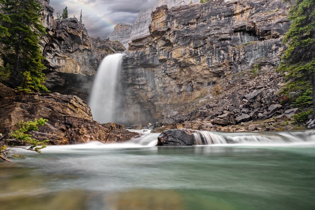
Mystery Lake is on the west side of Coal Branch PLUZ, near Jasper National Park. There is a trail which starts from Miette Hot Springs that goes to the lake; however, there is also a trail from the east, with a trailhead near Highway 40. The trail is nearly 10 km (6 mi) long to get to the lake and while the trail is open for OHV use, it is in rough shape and not heavily used by OHVs.
Do note, however, that Mystery Lake is seasonal and the water level in the lake will fluctuate throughout the year. So, you may encounter a large lake or a dry lakebed on your visit. There is a trapper’s cabin that was built on the shores of the lake that you can visit while you are up there. Mystery Lake is a destination for hikers that want to avoid the crowds, see amazing scenery, and go to new places.
Named for the Coal Branch of the Grand Trunk Railroad, there are many small mining towns near the Coal Branch PLUZ; however, most are hamlets without services. The following are some towns that will have accommodations and services that you may need before or after your adventures in the PLUZ.
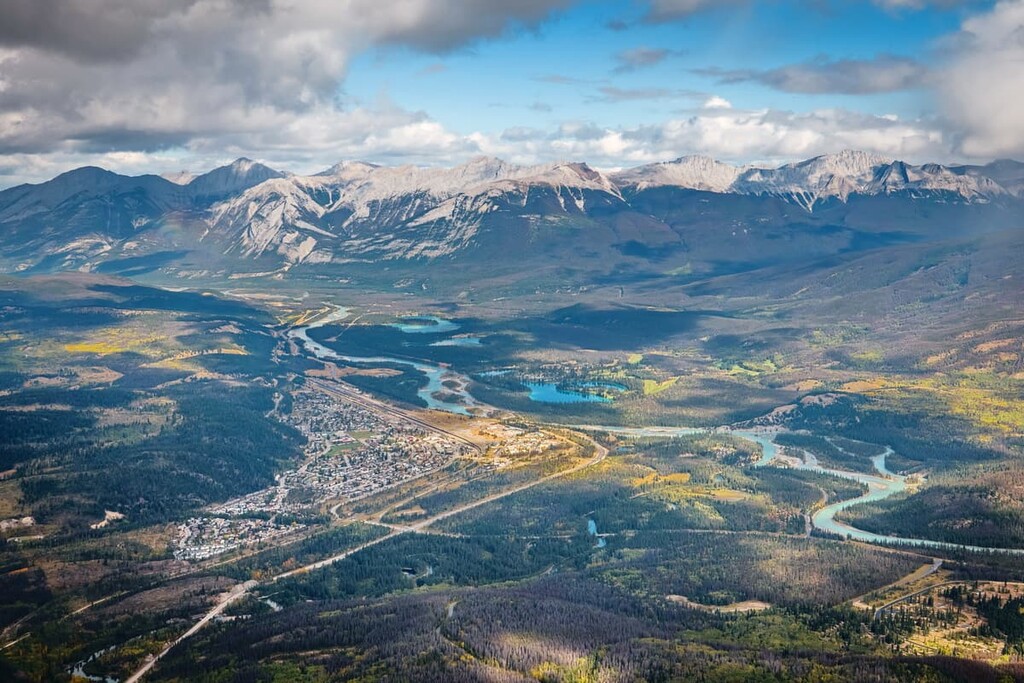
Located to the north of the Coal Branch PLUZ on Highway 16, the town of Hinton is surrounded by rugged wilderness. The town has you covered for accommodation and services that you may need for any outdoor recreation. Hinton is nearly at the eastern gate of Jasper National Park and the town is often used for staging excursions to the Willmore Wilderness Park to the north.
Located on the west side of the Nikanassin Range, the town of Jasper is the commercial center for Jasper National Park. First established as a trading post for the North West Company and then the Hudson’s Bay Company, Jasper is a major part of the history of the fur trade in the west.
The town has a range of accommodation options and is located in one of the most beautiful areas of Canada. Some of the hikes near Jasper that you may enjoy are the panoramic views from the Signal Mountain Fire Lookout, a strenuous hike to the summit of Pyramid Mountain, or perhaps an easy stroll around the beautiful Edith Lake.


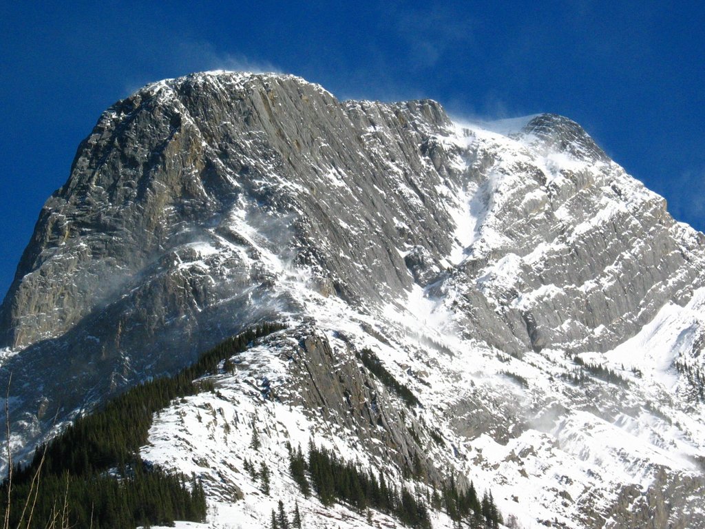
The highest peak in Coal Branch Public Land Use Zone is Ruby Mountain, at 2,900 m.
Notable peaks in Coal Branch Public Land Use Zone include Ruby Mountain, Thistle Mountain, Mount McBeath, GMMC Mountain and Mount La Grace.


