
Scan the QR code and open PeakVisor on your phone
The Blackstone/Wapiabi Public Land Use Zone (PLUZ) is a protected area located in the Bighorn Backcountry of central Alberta, Canada. The PLUZ encompasses the foothills of the Rocky Mountains and the Bighorn Range to the east of Banff and Jasper National Parks. There are 2 named peaks in the PLUZ, the highest and most prominent of which is Largehorn Peak (2,601 m/8,533 ft).
The Blackstone/Wapiabi Public Land Use Zone (PLUZ) is one of many public land use zones that make up the Bighorn Backcountry in Alberta, Canada. The Bighorn Backcountry is an area of public land situated to the east of Jasper and Banff national parks that has been set aside for recreational purposes.
Some of the other areas in and around the Bighorn Backcountry that have been set aside for recreational and environmental protection purposes include:
Blackstone/Wapiabi PLUZ encompasses 486 sq. km (188 sq. mi) of terrain in the foothills of the Rocky Mountains and the Bighorn Range. It was established to create an area for a network of hiking and equestrian trails.
The area has two named peaks, both of which are located in the Bighorn Range. Of these mountains, Largehorn Peak is the tallest and most prominent, with 2,601 m (8,533 ft) of elevation and 693 m (2,274 ft) of prominence. Kidd Peak is the other mountain in the area. It is 2,555 m (8,383 ft) tall and it has 376 m (1,234 ft) of prominence.
The Blackstone/Wapiabi PLUZ encompasses part of the foothills of the Rocky Mountains and a section of the Bighorn Range.
This PLUZ is located in an area that was once the ancient coastline of North America. The foothills, mountains, and the underlying rocks in this region accumulated on an ancient sea floor and started to rise and form the Rocky Mountains and foothills about 75 million years ago.
The formation event of the Rockies is called the Laramide orogeny, and it occurred roughly 75 and 40 million years ago. The Laramide orogeny was initiated by the subduction of tectonic plates under the western edge of North America.
The subduction of a tectonic plate is a violent, albeit slow, event that typically compresses, folds, breaks, and raises up layers of rocks to form mountains. During the formation of the Rockies, layers of Paleozoic limestone were compressed and squeezed until they cracked and were thrust up and above the surface of the Earth.
The Laramide orogeny came to a close as the Pacific plates started to move more to the north as opposed to the east, which resulted in the end of the orogeny’s mountain building phase. To the west of the Blackstone/Wapiabi PLUZ, you can find the First Range and Ram Range, which were formed during the final stages of the Laramide orogeny.
In fact, the foothills of Blackstone/Wapiabi PLUZ are the result of the diminished eastward momentum of the tectonic plates that created the Rockies. By the time these hills were built, there was no longer enough force to lift the Paleozoic layers of limestone into proper mountains. Instead, there was only enough force left to push up the younger layers of cretaceous sandstone into the hills that we see today.
The Bighorn Range, which is located partially in the Blackstone/Wapiabi PLUZ, is a fascinating outlier range of the Rocky Mountains.
Located around 10 km (6 mi) to the east of the front ranges, the Bighorn Range rises from the region’s foothills to form peaks that are over 2,500 m (8,000 ft) tall. It appears that one final eastward push of the Pacific plates against the continent was enough to force the Paleozoic limestone in the region to become the Bighorn Range.
In the millions of years following the Laramide orogeny, wind and water have sculpted and eroded the peaks and foothills in the region. During the Pleistocene, glaciers formed and coalesced into continent-wide ice sheets that carved out the topography of the region and the Blackstone/Wapiabi PLUZ into what we see today.
As you move eastward across the Blackstone/Wapiabi PLUZ, dense forests begin to cover the steep slopes of the region’s foothills until they reach their limit near the Bighorn Range. The subalpine transition zone between the region’s foothills and the alpine is filled with krummholz and heath. Here, shrubby trees and sedge fill hollows and small areas that are protected from the region’s fierce storms and winds.
The PLUZ has representations of the Upper Foothills and Rocky Mountain natural regions. The flora and fauna of both regions are influenced by the area’s short, wet summers and snowy, cold winters. Here, thick forests of lodgepole pine, black spruce, and white spruce cover the foothills and rise up the slopes of the Bighorn Range.
Along the slopes of the Bighorn Range, the forests thin out into a parkland-like mosaic of tree stands and meadows until the trees have reached their upper limit. Above the treeline, heather and sedge communities cling in hollows and along the edges of persistent snowpack. Meanwhile, the peaks of the Bighorn Range are barren and rocky.
Wolves, black bears, grizzly bears, moose, elk, cougars, white-tailed deer, and mule deer inhabit the Blackstone/Wapiabi PLUZ. While many PLUZs permit OHVs, their absence in Blackstone/Wapiabi helps maintain an environment that is conducive to animals who want to peacefully inhabit their natural wilderness areas.
The Blackstone/Wapiabi PLUZ is the traditional territory of the Cree, Ktunaxa, Stoney, Tsuu T’ina, and Blackfoot First Nations as well as the Métis Nation.
David Thompson was likely one of the first Europeans to make contact with the First Nations in the area when he came to the region in the early nineteenth century. Later, in 1858, John Palliser and his crew traveled throughout the region, surveying the peaks and creating maps.
While there are likely coal seams beneath the PLUZ, the area has remained relatively undeveloped over the decades. The area is currently used for recreational purposes, so travel in the PLUZ is limited to hiking and horseback riding. As a result, the ecosystems of the PLUZ have remained largely intact since the end of the Pleistocene.
The eastern slopes and foothills of the Rocky Mountains, which includes the area that is now the Balckstone/Wapiabi PLUZ, is an area of archeological interest.
The interest in the area stems from the fact that it was once part of an expanding ice-free corridor that opened along the slopes of the Rockies during the last glacial maximum. This ice-free corridor helped to connect Yukon and Alaska to the southern half of North America when the continent was otherwise covered in ice.
Starting as early as about 12,000 years ago, the ancestors of today’s First Nations migrated from the south to hunt and gather resources from the growing ice-free plains along the eastern slopes of the Rockies. Archaeologists have even uncovered evidence of a hunting camp in Banff National Park on the slopes of Mount Edith to the southwest of Blackstone/Wapiabi that is over 10,000 years old.
There are likely culturally significant sites in Blackstone/Wapiabi PLUZ; however, most archeological discoveries in the region occur by accident or during road construction. Since there are no roads in the PLUZ, any possible cultural sites that might be located within it are mostly unknown to researchers.
Nowadays, the PLUZ is also part of what is called the Bighorn Backcountry. The Bighorn Backcountry is a collection of public land use zones that’s located along the eastern slopes of the Rocky Mountains near the North Saskatchewan River. This area is very popular with outdoor enthusiasts, especially those that like to use OHVs and snowmobiles.
The public lands in Alberta are an incredible natural resource that the provincial government has set aside for the recreational use of Albertans and visitors. Many of the PLUZs in Alberta allow OHVs and snowmobiles; however, Blackstone/Wapiabi PLUZ permits only hiking and horseback riding.
The following are some of the main trails and hiking destinations in Blackstone/Wapiabi PLUZ:
The Bighorn Backcountry draws visitors from across the province, often for weeks at a time. There are many options for activities in the Bighorn Backcountry from hiking and fishing to hunting, snowmobiling, OHV use, horseback riding, and canoeing.
The following are some of the closest communities to Bighorn Backcountry and the Blackstone/Wapiabi PLUZ that you can check out during your next trip to the region.
Named for the historic trading post that was built on the shores of the North Saskatchewan River, the community of Rocky Mountain House offers visitors seemingly endless opportunities to experience the incredible wilderness area that is the Bighorn Backcountry. Rocky Mountain House is located about 70 km (42 mi) to the east of Blackstone/Wapiabi PLUZ, so it’s a nice starting point for any trip to the region.
Within the town, the main attraction is the Rocky Mountain House Historic Site. The site gives visitors glimpses into the fur trade that once dominated the region’s economy as well as the early history of Canada. Additionally, the historic site offers visitors the opportunity to immerse themselves in the stories of the First Nations with ancestral ties to this region.
Furthermore, the historic site is home to the archeological foundations of four forts. There are interpreters available at the historic site to teach guests more about these important archeological findings. Around the site and its adjacent campground, there are also many nice hiking and biking trails for visitors to enjoy.
Rocky Mountain House is located on the edge of the incredible wilderness that is the foothills of the Rocky Mountains. Near the town, you can find many great places to visit, hike, and camp, such as Crimson Lake Provincial Park, Cow Lake Natural Area, and the Bighorn Backcountry.
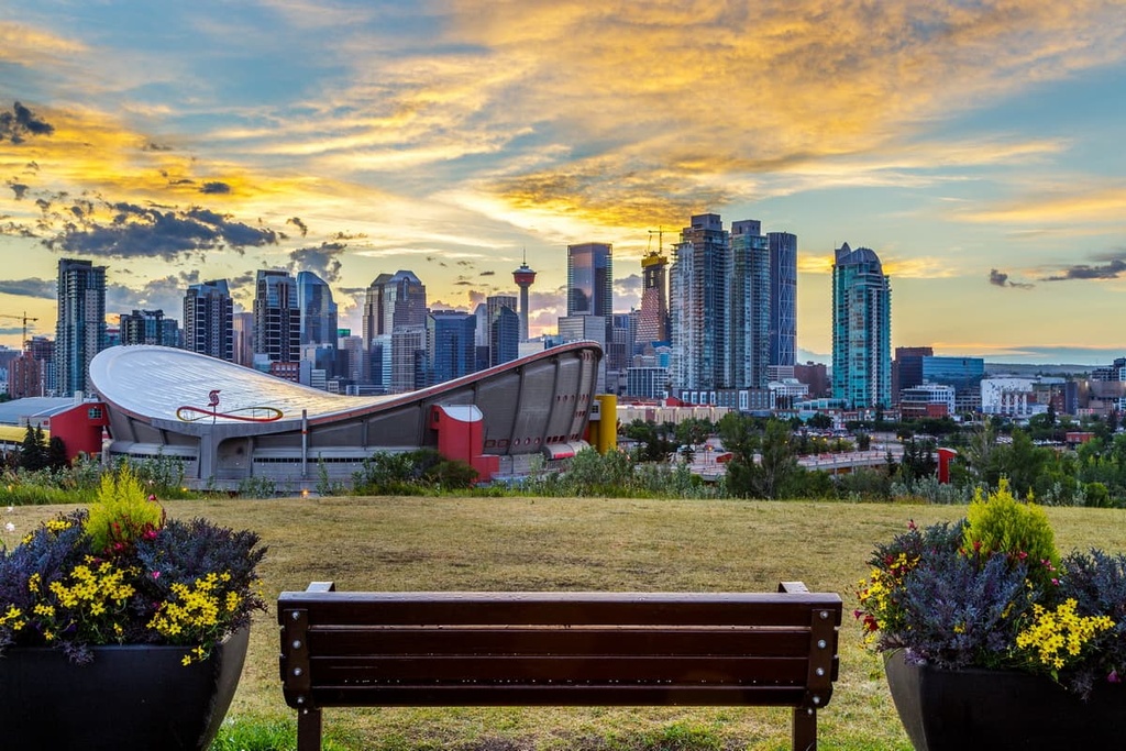
Located 350 km (210 mi) to the south of Blackstone/Wapiabi PLUZ, Calgary is a major city with a vibrant western and mountain culture. Many of the locals in Calgary actually spend their weekends traveling to the nearby Rocky Mountains for hiking, biking, kayaking, or skiing; however, there is a lot to do in the city, too.
Some of the most popular locations to hike and explore if you’re based in Calgary are Kananaskis Country, Banff National Park, Ghost PLUZ, and the Bighorn Backcountry. In fact, the opportunities for backcountry fun near Calgary are nearly limitless.
Within the city, there are hundreds of kilometers of trails connecting all the region’s major green spaces, such as Nose Hill, the Glenmore Reservoir, and the popular Fish Creek Provincial Park.
There are many attractions in Calgary itself, such as Fort Calgary, the Glenbow Museum, and The National Music Centre – Studio Bell, among many others. Music and performing arts festivals are held in Calgary throughout the year, especially during the summer months.
The city also hosts the annual Calgary Stampede, which is a 10-day long event of raucous western fun, rodeo, concerts, as well as a midway and other performances and exhibits.


