Scan the QR code and open PeakVisor on your phone
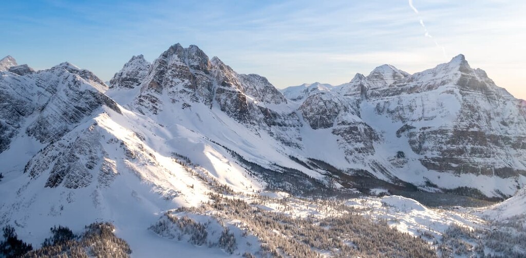
The Ghost Public Land Use Zone (Ghost PLUZ) is 1500 square kilometers (579 square miles) of mixed-use recreation area located to the northwest of the city of Calgary, in Alberta, Canada. There are five notable peaks in the area, the tallest of which is Zombie Peak (2778m/9,114ft).
Ghost Public Land Use Zone (PLUZ) is located within the Municipal District of Bighorn on the eastern edge of the Rocky Mountains, about 140 km (84 mi) to the northwest of Calgary, Alberta. The nearest town with commercial services is Cochrane, which is about 40 km (24 mi) southeast of Ghost PLUZ.
The main access to the area is by Highway 40, also referred to as the Forestry Trunk Road on maps, which is accessible west of Cochrane and Highway 579, west of Water Valley.
The public land use zone borders Banff National Park, Kananaskis Country, and the Dormer-Sheep PLUZ. There are several provincial recreation areas (PRA) within the zone, including Burnt Timber PRA, Fallen Timber PRA, Ghost Airstrip PRA, and Waiparous Creek PRA.
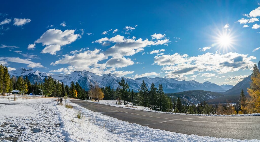
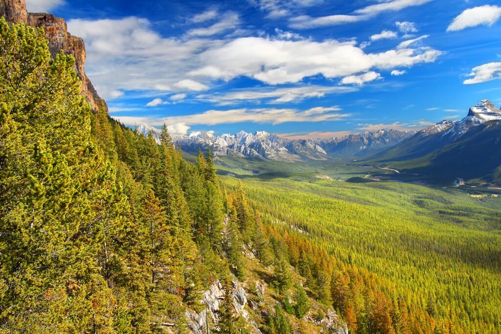
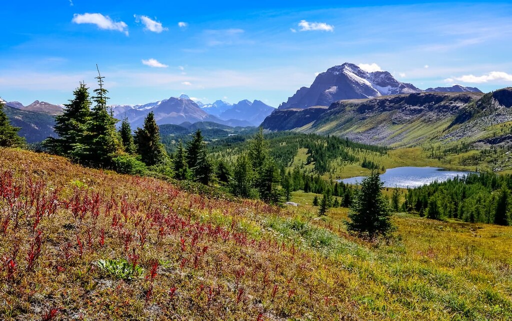
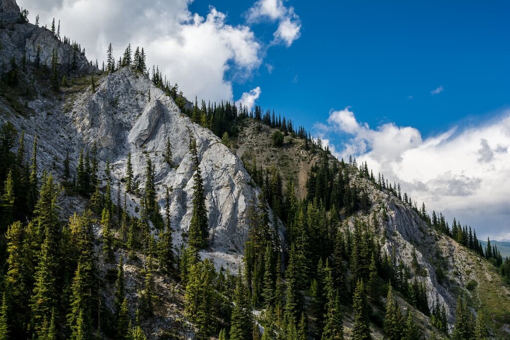
The Ghost PLUZ transitions from the foothills into the front ranges of the central Canadian Rockies. Moving west into the PLUZ, the hills start to rise from the otherwise flat prairies, becoming both taller and steeper as you move further to the west.
Many of the ridge tops in the Ghost PLUZ are crested with an upturned edge of sandstone that has resisted the erosion that removed the surrounding shales. These ridges are said to look like the backbone of a skinny hog, and as such, geologists refer to these ridges as hogbacks. The ridges and hogbacks typically run with the grain of the Rocky Mountains, from southeast to northwest.
The Rocky Mountains started forming first and the foothills formed at the end of the orogeny. An orogeny is a mountain forming event and the Rocky Mountains formed during the Laramide orogeny. The formation started about 75 million years ago as the tectonic plates under the Pacific Ocean started pushing into the North American plate from the southwest.
The Paleozoic sedimentary layers of limestone and dolomite started stacking upon the younger Cretaceous aged stones. The force of the collision would repeatedly break and then stack the layers of stone, and the mountains would continue to be built further inland. As the force of the collision dissipated through mountain formation, the final bursts created the foothills in the east.
The foothills were formed as layers of sedimentary stone broke along thrust faults and stacked like shingles on a roof. The northeastern slopes in the Ghost PLUZ tend to be the steepest and the hills taper to the southwest.
Other peaks in the Ghost PLUZ include Zombie Peak, Salter Ridge, Olson Ridge, Kolbassa Tower, and Red 90’s Tower.
The ecology of the Ghost PLUZ can be divided into three distinct ecoregions. These include the montane subregion of the Rocky Mountain Natural Region and the upper and lower foothills subregions of the Foothills Natural Region. While similar, each of these regions contains distinct habitats for plants and wildlife.
Found at the lowest elevations of the slopes and valleys of the Rocky Mountains, the montane natural region is the warmest and driest of the Rocky Mountain ecological zones. The montane regions are associated with the warm air masses that move through the mountain passes, which are called Chinooks.
Chinooks are a local name for the föhn winds which are created as moisture laden air moves east from the Pacific Ocean over the mountains. As the air rises it cools and the moisture in the air condenses. As this moisture condenses, it often falls as snow in the alpine region. The now dry air flows over the Rocky Mountains and warms up from the compressive forces of losing altitude.
Chinooks and local topography create a highly varied collection of plant communities within the Ghost PLUZ. However, generally, the region is characterized by a mixture of forests and grasslands with the grasslands occurring on dry and exposed sites.
Stands of lodgepole pine and aspen occur at lower elevations, while closed forests of white spruce, aspen, Douglas fir, and lodgepole pine occur at higher elevations. The grasslands are filled with oat grasses, fescue, wheat grass, and June grass.
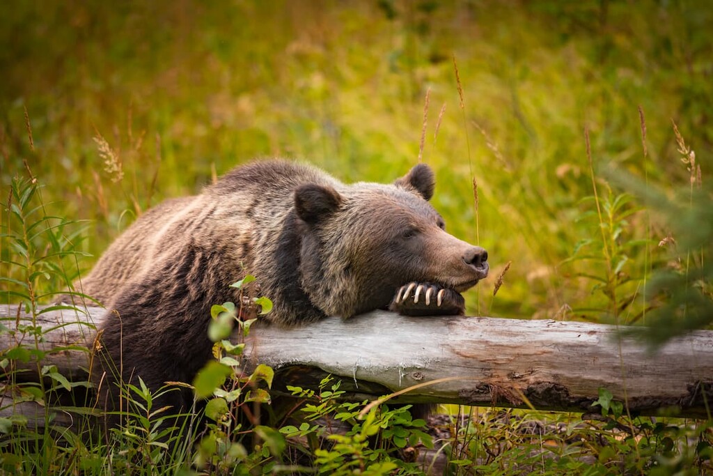
The montane region has the largest variety of animal species of the Rocky Mountain natural regions. The forests provide shelter to moose, deer, elk, and many bird species. The area is habitat for grizzly bears as well as black bears, cougars, wolves, and many smaller predators. The streamside shrubbery and wet meadows provide habitat for small mammals, including voles and lemmings, and various amphibians.
The Foothill Natural Region is the transition between the Rocky Mountains, and the prairies and boreal forests. While this region does not have particularly unique plants or animals, as the transition space between two regions, it contains more variety of species than the bordering regions.
There are significant wetlands within the lower foothills, along with rangeland and thick forests throughout. The foothills are among the most productive regions in Alberta for timber production.
Forests in the foothills are the most diverse in the province with aspen, white birch, lodgepole pine, balsam poplar, black spruce, white spruce, balsam fir, and tamarack. There is also a large variety of birds, mammals, and fish.
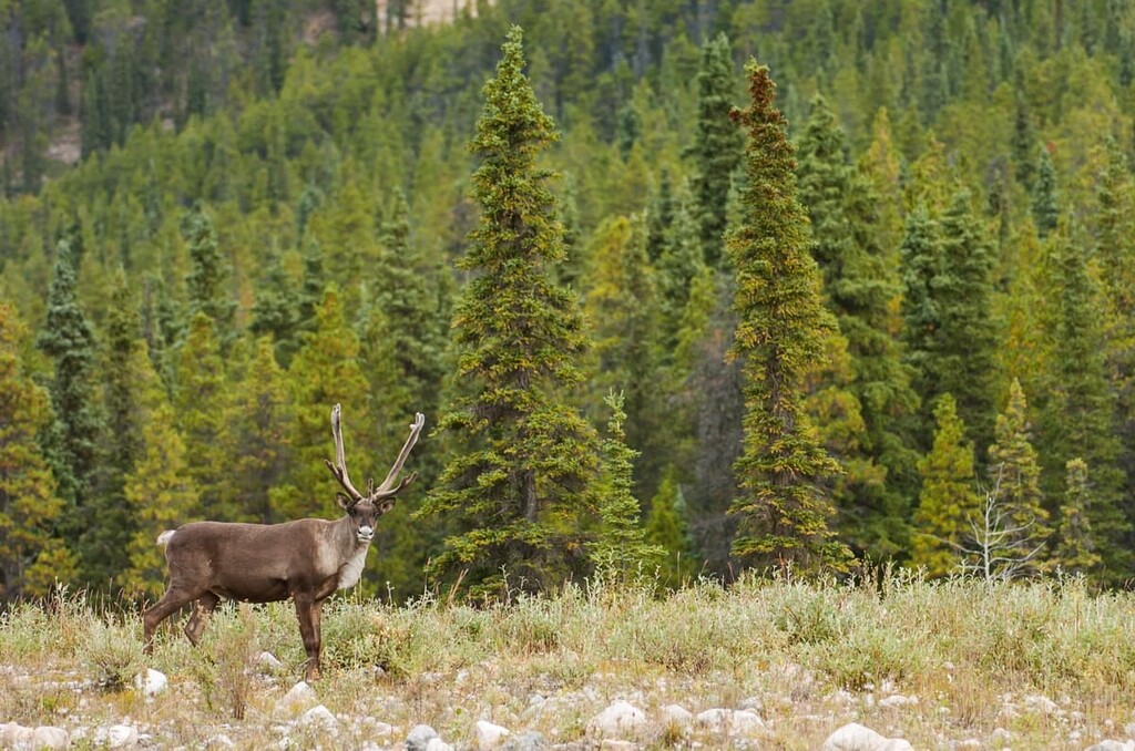
Of particular note, beavers play an important role in habitat creation for other animals in the foothills. The foothills are also critical habitat for the woodland caribou.
The Ghost PLUZ is located near the southern end of the ancient ice-free corridor that connected what is now Alaska and Yukon to the southern half of North America. About 12,500 years ago, groups of people migrated south through the corridor to inhabit the warmer regions with more abundant wildlife.
There are many pre-European contact archaeological sites in the surrounding areas including a hunting camp on the slopes of Mount Edith in Banff National Park that is over 10,000 years old. Most of the archaeological discoveries occurred while highway construction or oil and gas development was underway, so it is believed that there are many undiscovered culturally significant sites in the area.
Ghost PLUZ is the traditional territory of the Metis, Ktunaxa, Stoney, Tsuu T’ina, and Blackfoot. There is currently a Stoney Nakoda Nation reserve south of the PLUZ that encompasses the hamlet of Morley.
The Simpson expedition of 1841 and the Palliser expedition of 1858 were the first Europeans to make contact with the First Nations and map the area. For the past 120 years, the land has been used by ranchers, homesteaders, and the Eau Claire Lumber Company which harvested trees for their mill. In the 1940s oil and gas companies started using seismic lines to survey the area, creating 1600 km (1000 mi) of seismic trails.
While the area was growing in popularity for OHV (off highway vehicle) users since the 1960s, OHV use in the Ghost area surged in 1978, when Kananaskis Country was created preventing further OHV use in the popular area. In 2006, Ghost PLUZ was created to address the growing demand for OHV recreation and to manage potential conflicts with other resource values and stakeholders.
With hundreds of campsites, and the freedom to do random camping in the zone, the Ghost PLUZ receives over 90,000 unique visitors per year. While hiking, snowshoeing, fat biking and ski touring are ways to enjoy the area year-round, the newer OHV styles and tires are making it possible for OHV users to enjoy the area year-round too.
Ghost PLUZ is a haven for OHV enthusiasts; however, there are so many other ways to adventure in the PLUZ. One can backpack for days, camping almost wherever you want while exploring and climbing ridges and peaks. There are over 1600 km (1000 mi) of seismic trails to hike, cycle, or ski too. However, you want to enjoy the wilderness, Ghost PLUZ allows you a lot of freedom to do so. Here are some places to check out while you’re there.
The Mockingbird Fire Lookout was built in the early 1950s to replace the aging Black Rock Lookout. A 3.2 km (2 mi) hike with 370 m (1,215 ft) of elevation gain on a forestry access road makes for a simple day trip. After about 40 minutes of hiking, you’re at the top of Mockingbird Hill, taking in the panoramic views of the Rockies, foothills and prairies.
If you enjoyed learning about the geology of the area, then the view from the top will help you see the parallel rows of hills created from the thrust faults, the hogbacks, and the differential erosion between the front ranges and the foothills.
The Black Rock Lookout on Black Rock Mountain is accessible from the Ghost PLUZ, but sits in Don Getty Wildland Provincial Park. A little longer at 9 km (5.6 mi) and a little higher with 923 m (3,025 ft) of elevation gain than Mockingbird Lookout, this lookout will allow you to see further onto the prairies and foothills.
At the top of Black Rock Mountain is a moderately sized wooden structure that once served as the fire lookout from 1928 until 1950. From the outset, the high elevation was prone to high winds and low visibility from storms, so when part of the trail collapsed, it was decided to build Mockingbird Lookout, which provided the much-needed view without the problems found elsewhere.
The Back 40 is an area of the Ghost PLUZ that is leased by the Ghost-Waiparous Trails Association, which constructed some lovely hiking trails. There are several kilometers of connected trails that follow a creek and lead through the forest as well, with benches along the way for a rest.
The trails are maintained by a volunteer group and is an ideal place for day hikes in the area because OHV use is prohibited on the leased land. The Back 40 is located on the W1/2 and SE1/4 of section 12, Township 27, Range 7, W5M.
This loop is a 14 km (8.4 mi) loop that takes you up and along a ridge to lookout over the area and towards Zombie Peak to the northwest. The hike trail can easily be part of a backpacking trip through the region, or the north part of the loop can be used to access the scramble up Zombie Peak.
If following the loop clockwise, the descent after the ridge walk is quite steep and the final part of the trail, which follows a creek, requires several crossings. The hike is quite remote; therefore, it shouldn’t be too busy if you decide to go. The hike is rated difficult; however, it is a great place to walk up to the base of the Rocky Mountains.
In addition to the scenic mountain terrain and 1600 km (1,000 mi) of trails, the proximity to Calgary, Alberta is what makes Ghost PLUZ so popular. While the PLUZ is an easy day trip for locals from the Calgary area, there are some accommodation options for visitors too.
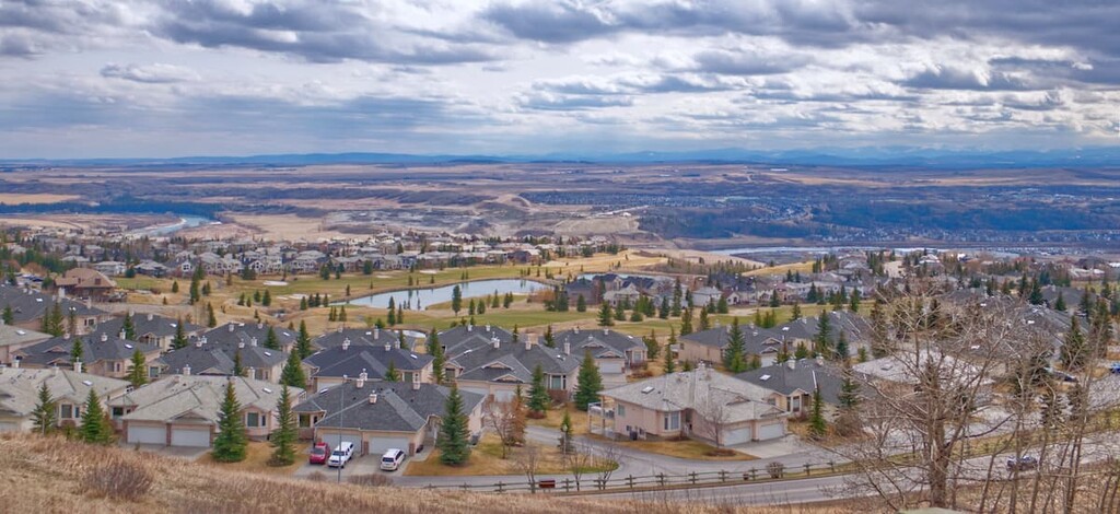
Calgary is less than 100 km (60 mi) east of Ghost PLUZ and as the largest city in Alberta, it is also the largest city near the PLUZ. Calgary offers a range of accommodations for visitors as well as some great local attractions.
For the days where you’re not on the mountain trails, there are hundreds of kilometers of trails that connect most of the parks and greenspaces around Calgary. The largest natural areas in the city are Nose Hill Park in the north of Calgary, and Fish Creek Provincial Park, in the south of the city. Other nice places for a walk or cycle are around the Glenmore Reservoir and by the Bow River at the Inglewood Bird Sanctuary.
The most famous event in Calgary is the annual Calgary Stampede, the self-proclaimed “Greatest Outdoor Show on Earth”. Running for 10 days every July, the Stampede has a midway, shows, concerts, rodeo, chuckwagon races, and the nightly Grandstand Show and fireworks.
Calgary is full of lovely parks to visit, as well as museums, the Calgary Zoo, opera, symphony, theater, and countless other attractions to fill your time when you’re not out west in the mountains.

Cochrane is about 60 km (100 mi) to the east of Ghost PLUZ, and it’s the largest town in Alberta. The town offers accommodations, restaurants, stores and the lovely smell of fresh cut lumber wafting through the town, from the local sawmill. If you decide to spend some time here, there is the Spray Lakes Rec Centre to visit, which has pools, soccer fields, climbing walls, a splash park, and much more.
Along the river there are pathways and playgrounds to visit, as well as a disc golf course. Cochrane is conveniently located near Ghost PLUZ if you need to resupply on food or fuel, or if your equipment has a mechanical breakdown or failure that requires fixing.
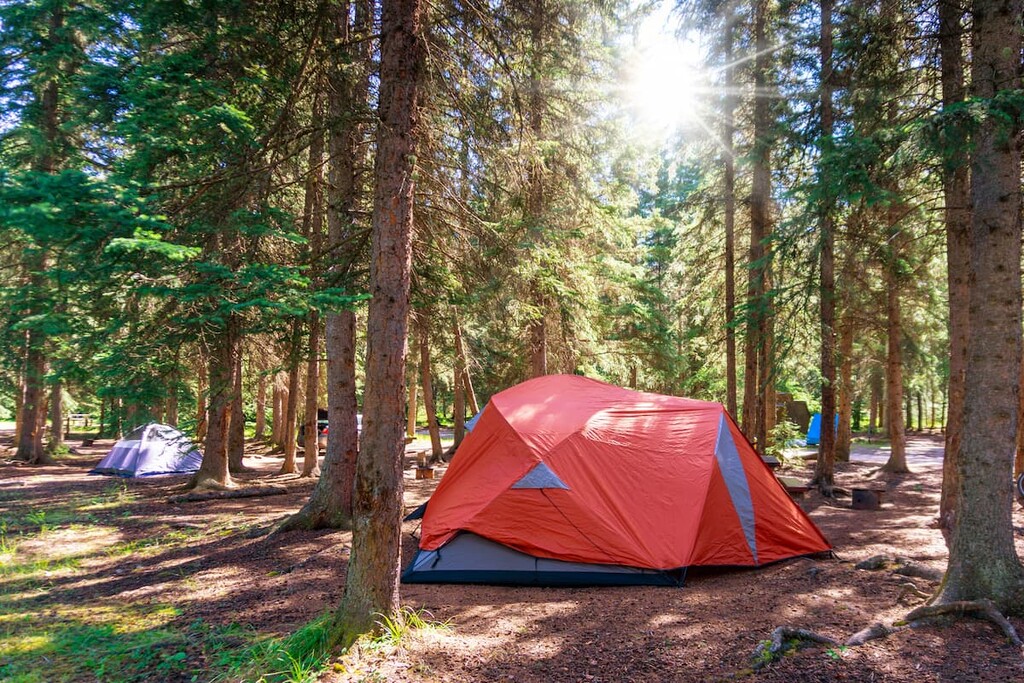
There are over 300 designated campsites spread across five of the provincial recreation areas within the zone. Additionally, random camping is allowed so long as you’re 1 kilometer (0.6 mi) from any of the provincial recreation areas. Random camping is how locals refer to camping in the wilderness, outside of designated sites. The camping can be with a vehicle and trailer or backcountry hiking.
The designated campsites within the provincial recreation areas have facilities; however, while random camping you must be totally self-sufficient and adhere to the leave-no-trace guidelines. Cochrane is the nearest town with commercial facilities if you need something while camping.