
Scan the QR code and open PeakVisor on your phone
Dormer/Sheep Public Land Use Zone has 4 named peaks. The highest is Zombie Peak at 2,778 m. Other notable peaks include Otuskwan Peak, Winchester North and Winchester Peak.
The Dormer/Sheep Public Land Use Zone (PLUZ) is located in southern Alberta, Canada along the eastern slopes of the Canadian Rockies, and it’s part of the Bighorn Backcountry. The highest and most prominent of the 4 named mountains in the PLUZ is Zombie Peak, which is 2,778 m (9,114 ft) tall and has 406 m (1,332 ft) of prominence.
As part of Bighorn Backcountry, Dormer/Sheep PLUZ is a section of a large network of six Public Land Use Zones that are located in central Alberta, Canada that allow visitors the opportunity to travel and experience the wilderness with relatively few restrictions. The other areas that are part of Bighorn Backcountry are:
These public land use zones are designated for public use and they don’t have the typical restrictions of other designated wilderness areas.
Some examples of the activities that visitors can enjoy in most public land use zones are hunting, OHV and snowmobile use, gun shooting and target practice, random camping (boondocking), and other activities such as horse riding, hiking, mountain biking, and backcountry camping.
While Dormer/Sheep PLUZ is part of the connected Bighorn Backcountry, there are also many nearby parks with higher levels of conservation and protection. Some of the other protected areas that are located near the Dormer/Sheep PLUZ include:
Primary access to the park is via the Forestry Trunk Road, which runs along the east side of the PLUZ. Additional entrance into the park can be found via forestry and hydro access roads in Panther Corners PLUZ.
The Dormer/Sheep PLUZ lays along the eastern slopes of the Canadian Rockies and includes the transitional area through the foothills. The PLUZ is part of the Ghost River area of mountains and foothills and is bordered by the Bare Range to the north, the Palliser Range to the west, and the Fairholme Range to the south.
Many of the ridge tops in the PLUZ are crested with an upturned edge of sandstone that has resisted the erosion that removed the surrounding shales. These ridges are said to look like the backbone of a skinny hog, and as such, geologists refer to these ridges as hogbacks. The ridges and hogbacks typically run with the grain of the Rocky Mountains from southeast to northwest.
The peaks in the west of the zone are part of the Rocky Mountains, which started forming about 75 million years ago. The main formation event that created the Rockies, called the Laramide orogeny, occurred when tectonic plates under the Pacific Ocean started pushing into the North American plate from the southwest.
The force of the collision compressed and pushed Paleozoic sedimentary layers of limestone and dolomite, forcing them to stack upon the younger Cretaceous stones. The mountains in the range are the result of these upturned layers of limestone, which have resisted erosion and are typically rugged and jagged.
Throughout this orogeny, the force of this tectonic collision would repeatedly break and then stack the layers of rock in the area, and the mountains would continue to be built further inland. As the force of the collision dissipated through mountain formation, the final bursts created the foothills in the eastern part of the Rockies.
The Dormer/Sheep PLUZ contains diverse habitats that range from the jagged rocky peaks of the steep alpine to the rolling foothills that are covered in dense forests. There are many different plants and animal species that inhabit the alpine and subalpine ecologies of the Dormer/Sheep PLUZ.
Lichen-covered rocks, grassy meadows, mat vegetation, shrubs, and krummholz are all common vegetation in the alpine. The rugged mountain tops do not hold much soil for plants to grow in, and when combined with the fierce winter storms and the large, persistent snowpack found in the area, large plants have a hard time growing at high elevations in the PLUZ.
Mountain goats and bighorn sheep are some of the mammals that are commonly seen inhabiting the alpine of the PLUZ. The goats and sheep have adapted to use their agility among the rocky outcrops and along the steep cliff to avoid predators during the summer months.
There are some birds that nest in the alpine to keep their young safe from most predators. Some alpine nesting birds found in the PLUZ include white-tailed ptarmigan, gray-crowned rosy finch, horned lark, and the American pipit. Some small mammals such as hoary marmots, the Columbian ground squirrel, and pika also nest in the alpine rocks for protection from predation.
The subalpine valleys and foothills of Dormer/Sheep PLUZ have slopes and valleys that are full of lodgepole pine, alpine fir, and Engelmann spruce/white spruce hybrids. Grasses, willows, creeping juniper, and aspens all fill the meadows around many of the valley creeks and rivers in the PLUZ.
Large predators such as grizzly bears, black bears, cougars, and wolves make their home in the area. Ungulates such as elk, mule deer, white-tailed deer, mountain goats, and mountain sheep are also common to the range.
The eastern slopes of the Rockies are part of an ancient ice-free corridor that connected the areas that are now called Alaska and Yukon to the southern half of North America. About 12,000 years ago, groups of people traveled into this expanding ice-free corridor to follow the migrating animals that they hunted. They eventually came to inhabit the region of southern Alberta and the area along the Rocky Mountains.
The Dormer/Sheep PLUZ is the traditional territory of the Métis Nation and the Ktunaxa, Stoney, Tsuu T’ina, and Blackfoot First Nations. Peter Pond traveled through the eastern slopes of the region during the late eighteenth century and was followed shortly by David Thompson, both of whom encountered and made first contact with several First Nations.
Later in the nineteenth century, the Simpson expedition of 1841 and the Palliser expedition of 1858 came to the Rocky Mountains. These expeditions led settlers further west and mapped the region for the future railways and for national interests.
The PLUZ is currently located within the area of the ancient ice-free corridor and it also includes the transitional area between the mountains and the foothills. Both of these areas are of significant interest to archeologists. It is believed that the area is home to many sites of cultural and archeological significance; however, relatively few scientific studies have investigated the peaks and valleys of the Dormer/Sheep PLUZ in recent years.
The following are several of the major trails that travel to the peaks and ridges of the Dormer/Sheep PLUZ that you can check out during your next visit to the area.
The trail to the summit of Mount Balfour is a difficult 16 km (9.6 mi) round trip hike that starts at a trailhead located off of the Forestry Trunk Road.
There are several routes of ascent and descent for Mount Balfour, which will change the noted distance; however, regardless of the route that you choose, you'll need to ascend over 1,200 m (3,900 ft) to reach the summit and experience its panoramic views.
Wigwam Ridge is a moderate 11.7 km (7 mi) out-and-back trail that leads to the summit point of Wigwam Ridge.
The trail follows through forests and meadows, and you’ll see plenty of wildflowers if they are in season. The trail is unmarked and unmaintained and has a minimal elevation gain of about 640 m (2,100 ft).
The trail to the summit of Zombie Peak is a difficult hike that requires scrambling and route-finding experience. The nearly 23 km (14 mi) long out-and-back trail has over 1,700 m (5,575 ft) of elevation gain and is a trail that’s designed specifically for experienced hikers who are comfortable following unmarked and unmaintained routes.
The following are some of the closest cities and towns to the Dormer/Sheep PLUZ where you’ll reliably find food, lodging, and supplies for any adventures that you have planned.
Calgary is located about 150 km (90 mi) to the southeast of Dormer/Sheep PLUZ. It is the largest city in Alberta, and it offers a range of accommodations for visitors as well as some great local attractions. For the days where you’re not on the mountain trails, there are hundreds of kilometers of trails that connect most of the parks and greenspaces around Calgary.

The largest natural areas in the city are Nose Hill Park in the north of Calgary and Fish Creek Provincial Park in the south of the city. Other nice places for a walk or cycle in the city include around the Glenmore Reservoir and by the Bow River at the Inglewood Bird Sanctuary.
The most famous event in Calgary is the annual Calgary Stampede, the self-proclaimed “Greatest Outdoor Show on Earth.” Running for 10 days every July, the Stampede has a midway, shows, concerts, rodeo, chuckwagon races, and the nightly Grandstand Show and fireworks.
Calgary is full of lovely parks to visit, as well as museums, the Calgary Zoo, opera, symphony, theater, and countless other attractions to fill your time when you’re not out west adventuring in the mountains. To the west of the city, you’ll encounter Kananaskis Country, Banff National Park, Bragg Creek Provincial Park, and many other beautiful wilderness areas and great trails to hike.
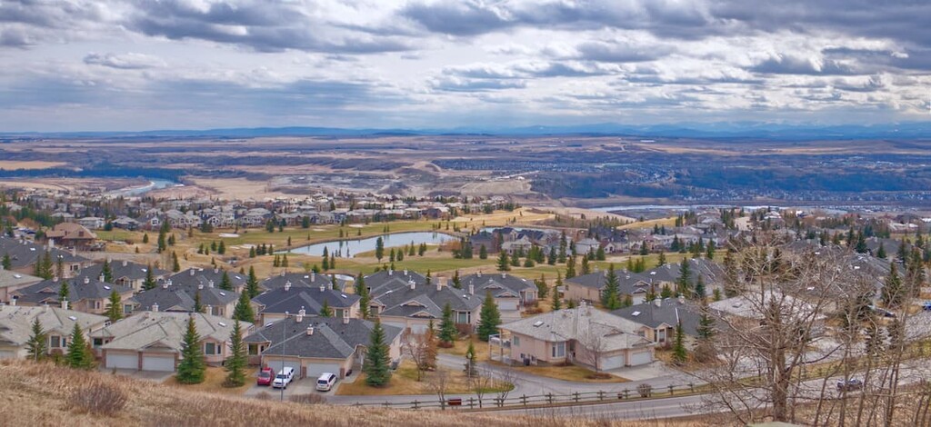
Cochrane is situated about 90 km (54 mi) to the south of Dormer/Sheep PLUZ. The town offers accommodations, restaurants, stores, and the lovely smell of fresh cut lumber that wafts through the area from the local sawmill.
Along the river, there are pathways and playgrounds to visit, as well as a disc golf course. Cochrane is also conveniently located near Ghost PLUZ if you need to resupply on food or fuel during your travels, or if your equipment has a mechanical breakdown or failure that requires fixing.
Nearby hiking areas around Cochrane include Banff National Park, Bragg Creek Provincial Park, Bow Valley Provincial Park, Bow Valley Wildland Provincial Park, as well as the rest of the parks in Kananaskis Country.

The highest peak in Dormer/Sheep Public Land Use Zone is Zombie Peak, at 2,778 m.
Notable peaks in Dormer/Sheep Public Land Use Zone include Zombie Peak, Otuskwan Peak, Winchester North and Winchester Peak.


