
Scan the QR code and open PeakVisor on your phone
The Bare Range include 13 named peaks. The highest is Barrier Mountain at 2,957 m. Other notable peaks include Panther Mountain, Gable Mountain and Melanin Peak.
As part of the central front ranges of the Canadian Rockies, the Bare Range has stunning limestone peaks that tower over the forested foothills and rolling prairies of central Alberta, Canada. Of the 13 peaks in the range, Barrier Mountain is the tallest and the most prominent, with 2,957 m (9,701 ft) of elevation and 836 m (2,743 ft) of prominence.
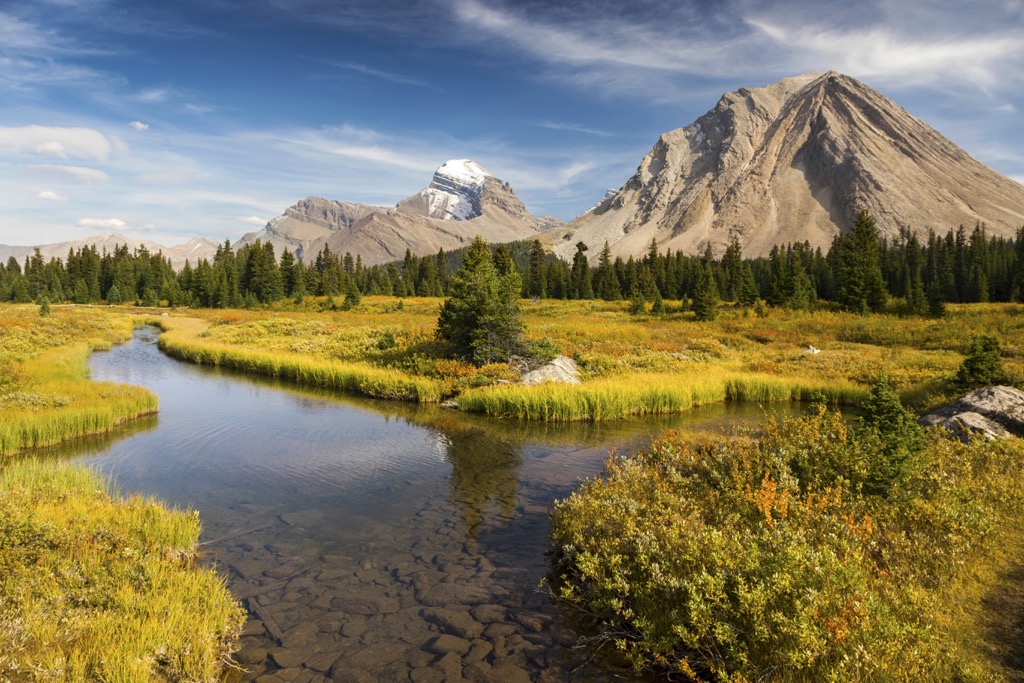
The Bare Range is one of the central front ranges of the Canadian Rockies, which are in central Alberta, Canada. The front ranges are also often referred to as the eastern slopes, as they are the easternmost peaks of the Rockies. The massive limestone slabs rise precipitously from the foothills to create an imposing start of the mountain range.
Most of the Canadian Rockies are part of a protected area, including the Bare Range. The western half of the Bare Range is in Banff National Park while the eastern half of the range extends through Panther Corners Public Land Use Zone (PLUZ) and Dormer – Sheep PLUZ. Other protected areas and parks that are near and adjacent to the Bare Range are:
Bare Range is a true Front Range that borders the foothills; however, the adjacent Vermillion and Sawback Ranges which are located to the west are also part of the Front Ranges. The Palliser Range is located to the south of the Bare Range, and it also borders the foothills as a true Front Range.
The peaks of the Bare Range rise dramatically from the foothills to create a very imposing barrier to the west. While the peaks of the range don’t reach 3,000 m (10,000 ft), they are still quite tall, and their prominence offers hikers and scramblers a challenge. The tallest and most prominent of the 12 peaks of the Bare Range is Barrier Mountain (2,957 m/9,701 ft) which has (836 m/2,743 ft) of prominence.
About 75 million years ago, the Farallon tectonic plate, under the Pacific Ocean, was colliding with the west coast of North America. As the Kula Plate collided with the more buoyant continental plate, it subducted beneath the continent.
However, the subduction of the tectonic plate was not a smooth or quiet event. The subduction of the Kula plate 75 million years ago is what started the Laramide orogeny, which was the formation event for the Canadian Rockies.
South of the border, in the USA, the subduction of the Farallon plate was shallow and caused immense uplift of the underlying bedrock. In Canada, the Kula plate angled steeply beneath the continent exerting pressure against the continent as opposed to just uplifting the edge.
The pressure of the tectonic collision started to compress the crustal layers that were along the ancient continental margin, which aligns with the southern end of the Alberta-British Columbia border. The pressure exerted on the layers of Paleozoic limestone and Cretaceous sandstone heated them up and allowed them to start distorting and even folding.
While gazing upon the mountains of the Bare Range and the rest of the Rockies, you can see the folds in the layers of limestone. The folds are referred to as synclines and anticlines and were initially created because the layers of rock became malleable when the pressure of the tectonic collision heated them. Some of the folds of the limestone are quite tight, while others are more open.
When the layers of rock could no longer withstand the pressure, they would crack, creating fault lines. However, just because the rock had folded and cracked, it didn’t mean that the tectonic collision had stopped. The continued pressure along the fault lines thrust the Paleozoic/Cenozoic layers of rock up and onto the surface.
Since the Kula plate was pushing from the southwest, the layers of rock were pushed towards the northeast. Faults kept forming over the 45 million year long orogeny and layers continued to be thrust upon the layers to the northeast. This form of mountain building that took place during the Laramide orogeny is referred to as thrust faulting, when older layers are pushed above younger layers of rock.
During the Laramide orogeny, about 400 km (240 mi) of the ancient continental margin was compressed into the 200 km (120 mi) wide Canadian Rockies. There are two major events that define the final years of the Laramide orogeny. One event was the uplift of the front ranges, which is the easternmost extent of the limestone peaks that makeup the Rockies.
The foothills, which are east of the Rockies, were formed from the final heaves of the Kula plate against North America. However, the force of the thrust was only sufficient to crack and lift the upper layer of Cretaceous sandstone, shale, and slate.
The second event that helps define the end of the Laramide orogeny was the creation of the Rocky Mountain Trench. As the trajectory of the Kula plate changed causing the force of the collision to wane, some continental slipping occurred along the west side of the Rockies.
A massive valley opened between the Rockies and Columbia Mountains as the fault rifted. Known as the Rocky Mountain Trench, the valley extends along the west side of the Canadian Rockies.
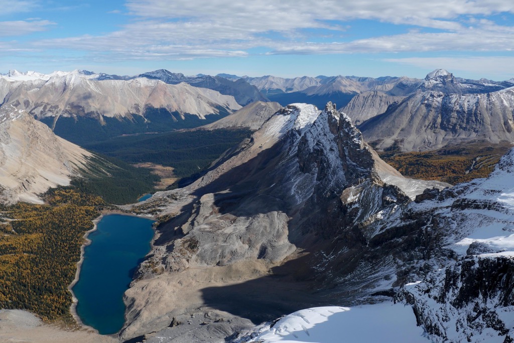
The Laramide orogeny caused the placement of the limestone layers; however, the current topography of the Rockies and the Bare Range is owed to the erosive ice sheet that covered the landscape during the Pleistocene.
During the Pleistocene glaciers formed, flowed, and receded, all of which leave a mark on the underlying rocks. The softer Cretaceous layers were scoured from between the limestone, and the limestone was eroded into the precipitous peaks that are left today.
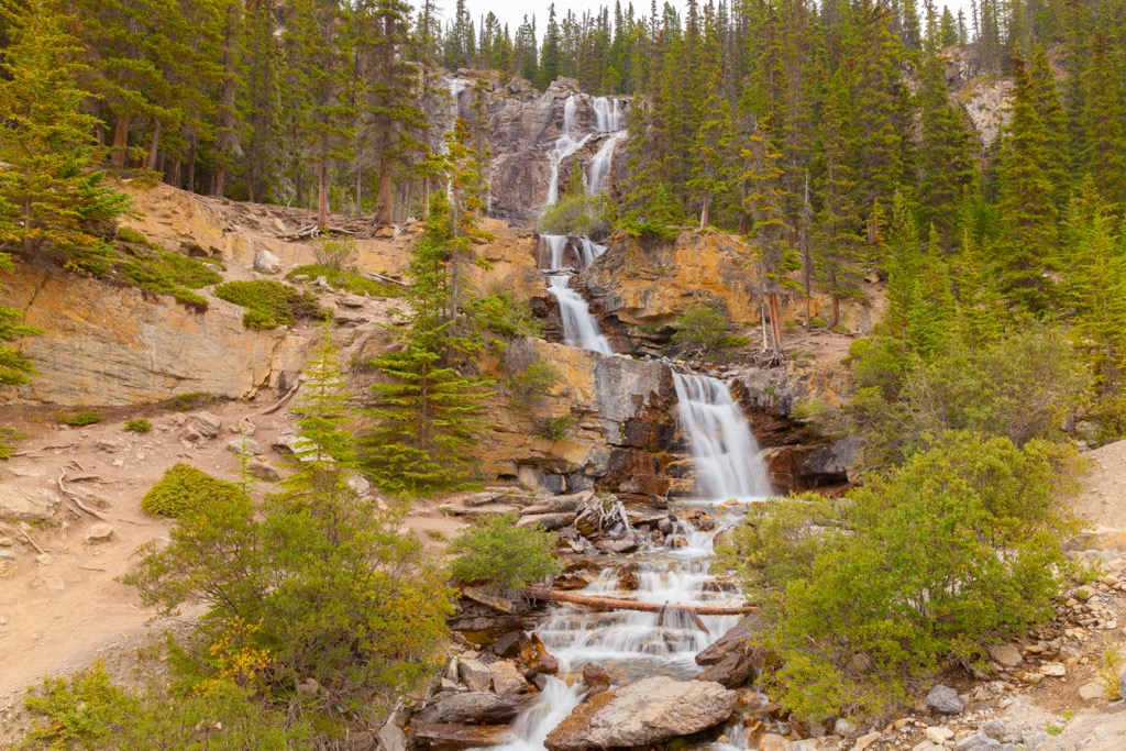
As the glaciers advanced, they created U-shaped valleys and sometimes these valleys would intersect at different elevations, creating hanging valleys and stunning waterfalls. Furthermore, the glaciers transported massive amounts of till and debris, depositing it across the landscape as the ice melted.
Moraines are piles of glacial debris that were deposited at the end and sides of glaciers. A kame is a steep sided mound of glacially deposited sand and gravel, and eskers are a sinuous ridge of gravel. The sinuous shape of eskers is made as subglacial rivers deposit till along their curving path.
The Bare Range has the typical ecology of the Rocky Mountains which consists of the alpine, subalpine, and montane sub-regions of the Rocky Mountain Natural Region. The wind-swept alpine region is the coldest part of the range and the cold, fierce winter storms prevent most plants from growing upon the peaks.
However, there are several hardy plants that grow among the rocks, settling along the edge of snow fields and on the lee side of boulders. Robust communities of sedges, and low-growing shrubs can grow in the alpine area in addition to lichen.
Some mammals, such as the Columbian ground squirrel, pika, hoary marmot, mountain goat, and bighorn sheep inhabit the alpine area, using it as a refuge from predatory animals. The small animals hide among the rocks while the goats and sheep escape along steep cliffs and narrow ledges.
There are also several bird species, such as the American pipit and white-tailed ptarmigan that nest among the alpine rocks. However, most other bird species nest in and inhabit the forests and meadows.
The upper slopes of the subalpine are generally covered with forests of Engelmann spruce and subalpine fir, while lodgepole pine forests cover the lower slopes. Larch loves to grow along the subalpine cliffs and aspen will grow in interspersed stands.
The herb-rich meadows make a mosaic with the forests of larch, spruce, and fir. The subalpine region provides important habitat to large mammals such as grizzly bears, black bears, and cougars.
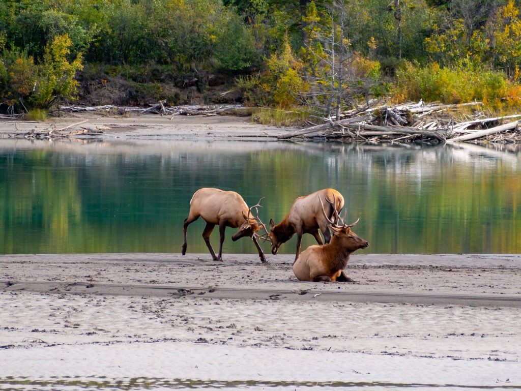
The lower slopes and valleys of the Bare Range are part of the montane ecosection and have the greatest diversity of flora and fauna out of all the Rocky Mountain Natural Regions. Moose, elk, deer, and bighorn sheep will use the valleys around the Bare Range like a highway as they migrate through the ranges.
The montane forests are dominated by lodgepole pine, Douglas fir, aspen, and white spruce. The Chinooks that flow through the valleys make the montane region one of the warmest ecological zones in Alberta. As such, the relatively warm climate allows for the greatest diversity of flora and fauna in the Rockies as well as suitable habitat for many rare plant and animal species to thrive there.
The earliest evidence of human occupation and habitation near the Bare Range and Banff National Park is located on the northern shores of Lake Minnewanka, which is just south of the Bare Range. The remains of a suspected hunting camp were discovered from which archeologists believe that these ancient people came through the Front Ranges hunting bison and mammoth with stabbing spears.
The Front Ranges of the Canadian Rockies, including the eastern slopes and foothills are part of the ancient ice-free corridor that connected Alaska and the Yukon to the southern half of North America. There are several theories as to how the ice-free corridor was used as an ancient migratory path that brought people from Asia to North America.
There were several periods during the Pleistocene in which the corridor along the eastern slopes was free of ice and people may have migrated from the north. However, as the most recent glacial maximum was ending, the ice sheets and glaciers first melted from the slopes and valleys of the southern Canadian Rockies. Furthermore, archeological evidence shows a general northward migration that flowed into the newly habitable areas.
As mentioned, the first cultures that came to the Bare Range were hunter/gatherers that followed the migration of mammoth and bison. Their primary tool was a spear that they would use to stab the large beasts. During the following thousands of years, the technology in the region advanced and the hunters began using the atlatl (or throwing spear).
The atlatl allowed hunters greater success in striking faster moving animals, such as caribou and mountain sheep. While the atlatl technology was generally used and successful for thousands of years, about 400 CE, the bow and arrow were introduced to the region.
The most intensive occupation of Banff National Park and the adjacent region was by the culture that had the bow and arrow. Indeed, the Bow River, which is the major river that flows from the southern Rockies, was supposedly named by the Cree in reference to the excellent bow-making wood along the banks.
The Bare Range is part of the traditional territory of many First Nations, including Metis, Ktunaxa, Stoney, Tsuu T’ina, and Blackfoot. The Stoney have a reserve that is located just east of the Rockies, along the Bow River.
The Canadian Pacific Railway played a large role in opening and developing the Rocky Mountains into the tourist destinations that we know and love today. The origins of Banff National Park, in which the Bare Range lies, date back to 1883, when railway workers came upon the Cave and Basin hot springs.
Initially a reserve was created around the hot springs in 1885; however, in 1887, Rocky Mountains Park was established as the first national park in Canada. Over the following fifty years land was added to the park, facilities and accommodations were constructed, and road access to the area was increased. Rocky Mountains Park was renamed Banff National Park in 1930, and the boundaries are relatively the same now as they were at that time.
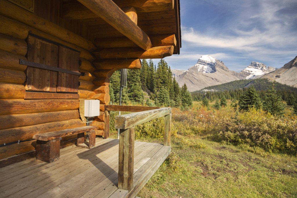
There are extensive trails leading through the backcountry of the Bare Range. The following are some of the major trails:
The Panther River Trail follows the Panther River through the middle of the Bare Range between Panther Corners PLUZ and the backcountry of Banff National Park. A typical place to enter the trail is at Panther Forest Recreation Area and either hike or ride a horse into Banff National Park.
There are several backcountry campgrounds along the trail and Panther Falls are along the trail, near the junction with Snow Creek Trail. Just north of Panther Mountain, the trail divides. The Snow Creek Trail leads to the north and the Upper Cascade Valley Trail follows Wigmore Creek around the west side of Panther Mountain.
The Cascade Valley / Red Deer River Trail follows the Red Deer River along the north end of the Bare Range. The trail leads between Banff National Park and Panther Corners PLUZ. Some of the mountains that you’ll pass along your route are Gable Mountain, Mount Tyrell, and Mount White.
Several trails lead between the Red Deer River Trail and the Panther River Trail, such as the Snow Creek Trail and the Elkhorn Summit Trail. With enough time and ambition, hikers can follow the river to its headwaters at Red Deer Lakes and then continue west and hike to Lake Louise.
The Elkhorn Summit Trail follows a north-south valley through the middle of the Bare Range, connecting the Panther River and Red Deer River Trails. The major features are Gable Mountain on the east side of the trail and Mount White on the west side of the Trail. Panther Mountain is south of the junction with the Panther River Trail.
This trail can be hiked as a part of a multi-day expedition through the backcountry of Banff National Park or as part of a long day hike. There are many opportunities along the trail to enjoy the grandeur of the Rockies as well as relative solitude in the wilderness.
The proximity of the Bare Range and the eastern slopes of the Rockies to several cities and towns make it a popular backcountry destination. The following are some of the major tourist destinations near the Bare Range:
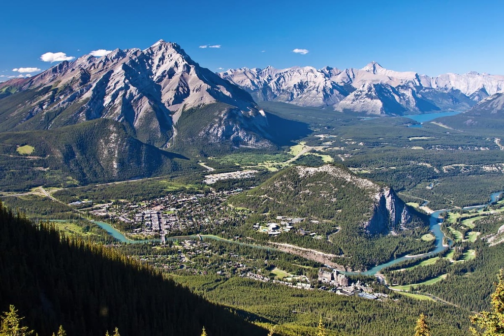
The municipality of Banff is the major commercial and service center for Banff National Park and is located about 40 km (24 mi) south of the Bare Range. The town is one of Canada’s most popular tourist destinations and millions of visitors come annually from around the world to the small mountain community.
The town of Banff grew from Siding 29 (Banff Station) which was one of the many sidings along the Canadian Pacific Railway. The area rose in popularity and world renown after a couple of railway workers discovered the Cave and Basin hot springs in 1883. Bath houses were soon erected for the public, as the commercial value of the springs was immediately recognizable.
However, an ownership dispute brought the hot springs to the attention of the railway and the federal government. By 1885, the area was under the protection of the federal government and within a few more years, Rocky Mountains Park (now Banff National Park) was established as the first national park in Canada, and one of many throughout the Canadian Rockies.
The town is home to the famous Banff Springs Hotel, which is a majestic castle constructed by the Canadian Pacific Railway (CPR) that overlooks the Bow Valley. Initially the town drew tourists primarily during the summer; however, by 1910, the CPR began advertising the area as a winter resort as well.
The town is known for its pleasant mountain architecture, good food, luxury accommodations, and its proximity to the many attractions of Banff National Park.
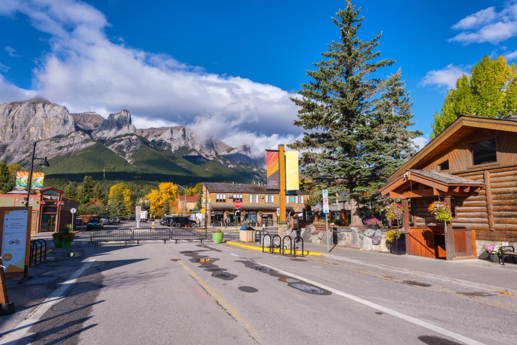
Canmore is located about 50 km (30 mi) southeast of the Bare Range, at the eastern border of Banff National Park. Like many of the towns in the Bow Valley, Canmore started as a mining community that supported the nearby coal mines.
Some of the great trails around Canmore include the Three Sisters, Chester Lake, Grotto Canyon, and Ha Ling Peak. Once known by a slightly more racist name, Ha Ling Peak has an interesting story that goes back to the times when it was a small mining community.
As the story goes, a Chinese man, working as a cook at the Oskaloosa Hotel, known as Ha Ling, was bet $50 that he couldn’t summit a nearby peak in less than 10 hours. Soon after, Ha Ling set out at 7am one morning with a small flag to set on the summit, and he returned shortly after noon.
Much to the dismay of those that made the bet, nobody believed that Ha Ling had made the trek as he claimed. So, the following day, Ha Ling set out with the disbelievers to hike to the summit. As they reached the summit, they were all availed to the spectacular view of their surroundings and little flag that Ha Ling had pinned beneath some rocks the day before.
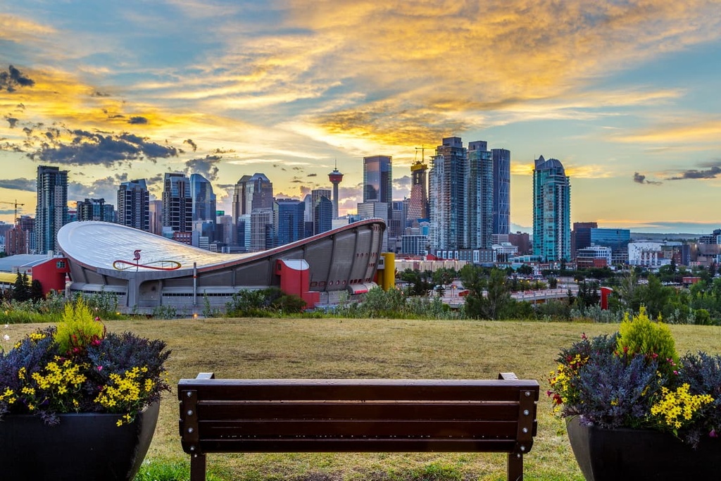
Often cited as the gateway to the Rockies, Calgary is the largest city in Alberta and is situated along the Bow River, about 150 km (90 mi) southeast of the Bare Range. Typical access to the Bare Range from Calgary is via the Trans-Canada Highway through Banff National Park or the Cowboy Trail (Highway 22) and the public lands along the eastern slopes.
Calgary sits in the foothills, with the Rockies dominating the western skyline and the prairies stretching eastward to the horizon. With the mountains only a short drive away, many of the residents regularly hike, mountain bike, climb, or ski throughout the year.
While there are many great places to walk and hike in the city, such as Fish Creek Provincial Park or Nose Hill Park, the looming mountains are one of the main attractions. One of the popular local destinations is Kananaskis Country, which is a mixed-used area with an assortment of public lands, provincial parks, and recreation areas.
Many people will claim that the nearby Banff National Park has the best scenery and trails near Calgary; however, I believe that Kananaskis Country is the most beautiful place in the world. The hikes of Peter Lougheed Provincial Park have long been some of my favorites, such as the hike around Upper Kananaskis Lake, the summit of Mount Indefatigable, or the route from Alberta into British Columbia through the Kananaskis Passes.


The highest peak in the Bare Range is Barrier Mountain, at 2,957 m.
The Bare Range have 13 named peaks.


