Scan the QR code and open PeakVisor on your phone
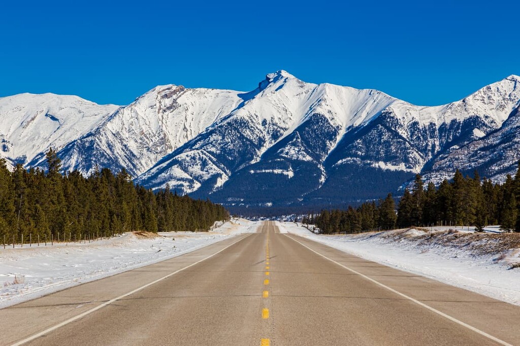
The Upper Clearwater/Ram Public Land Use Zone is 1,908 square kilometers (740 sq. mi) of mixed-use recreation area located to the northwest of Calgary, in Alberta, Canada to the east of Red Deer. There are over 41 peaks in the area, the tallest of which is Mamen Peak with an elevation of 3,228 m (10,588 ft) and the most prominent of which is Mount William Booth with a prominence of 777 m (2,549 ft).
Upper Clearwater/Ram Public Land Use Zone (PLUZ) is a 310 km (186 mi) drive to the northwest of Calgary, Alberta. The PLUZ is located within Clearwater County and it is also part of an area called Bighorn Backcountry, which is a multi use recreation area consisting of the following:
Rocky Mountain House, which is about 120 km (75 mi) to the east of the Upper Clearwater/Ram PLUZ on Highway 11, is the nearest town with services. Most trails leading into the Upper Clearwater/Ram PLUZ pass through the Kiska/Willson PLUZ and the trailheads are found off of the Forestry Trunk Road (Highway 734).
Banff National Park and the Siffleur Wilderness Area are located to the west of Upper Clearwater/Ram PLUZ. Panthers Corner PLUZ is located to the south, while Kiska/Willson PLUZ is located to the east and west. Furthermore, the lands east of Bighorn Backcountry are a Forestry Management Area that is harvested by Sundre Forest Products.
The mountains of the Upper Clearwater/Ram PLUZ are made from slabs of limestone and dolomite that were pushed above sea level about 100 million years ago. The Rocky Mountains were the last of the Canadian Cordillera to form, which consist of the Coast Mountains, Columbia Mountains, and the Rocky Mountains.
For about 40 million years, thick slabs of Paleozoic limestone buckled and broke and were thrust over the younger layers of Cretaceous sandstone and shale. Alternating layers of durable limestone and soft sandstone were upthrust across the landscape.
Erosion started working to tear down the mountains as soon as they began to form. The first major erosive event was the displacement of the sea that once covered the area of the Rocky Mountains. A massive volume of water was displaced as the Continental Divide formed, forcing a lot of water to drain east, taking with it massive amounts of sediment from the forming mountains.
Between the Laramide orogeny (the event that formed the Rocky Mountains) and the Pleistocene glaciation, wind and rain eroded away at these mountains. However, the topography that is visible today is mainly from the most recent glacial maximum which ended about 12,000 years ago. Glaciers tend to carve away at the topography of the landscape, creating geological features and wiping away evidence of human habitation.
The glaciers scoured the softer Cretaceous rocks to create the major valleys we see today. Meanwhile, the durable limestone remained as rugged peaks. The glaciers left remnants of their passing as glacial till formations, which include sinuous eskers, kames, and moraines. Tarns and kettle lakes are the water bodies formed by glaciers, and cirques and hanging valleys are further scars on the mountains that show the force of glacial erosion.
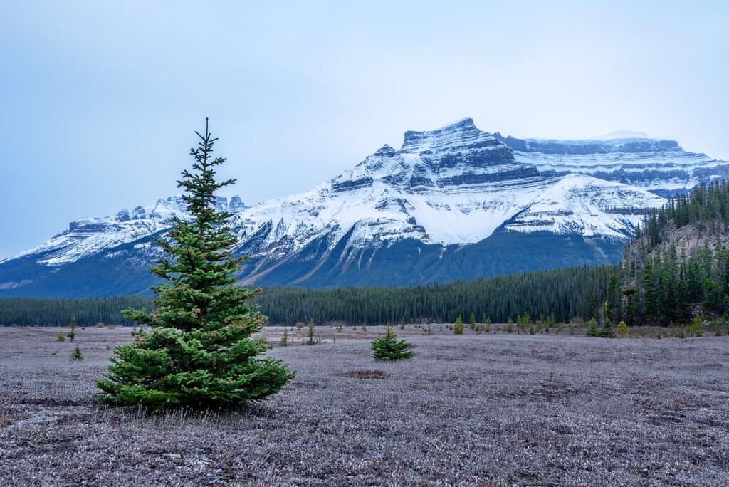
The Upper Clearwater/Ram PLUZ is a part of the Rocky Mountain Natural Region. The PLUZ is dominated by the alpine landscape which consists of a stark rocky landscape. At the lowest elevations the growing season is long enough to support the trees of the subalpine ecoregion.
The alpine is a stark and barren landscape where only the strongest and most hardy plants will survive. Additionally, there are several animals that have adapted their survival to the rocky alpine.
Alpine plants consist mainly of lichen-covered rocks, grassy meadows, mat vegetation, shrubs, and krummholz. Mountain avens grow between the rocks and add a bit of colour to the landscape. Sedges, grasses, and mountain heaths cling to the edges of snowbeds while grouseberry and snow willow grow in protected areas.
Stunted subalpine fir and Engelmann spruce grow in short, tangled masses. Lengthy snow cover, cold temperatures, and fierce winds prevent most flora from thriving among the peaks.
Birds are the only animals known to regularly inhabit the alpine areas of the PLUZ. White-tailed ptarmigan, gray-crowned rosy finch, horned lark, and the American pipit are found in the area during nesting season.
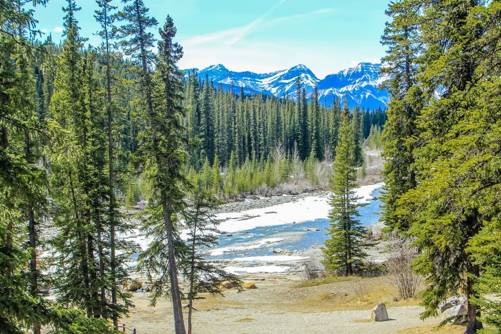
The subalpine region of the Upper Clearwater/Ram PLUZ is contained to the valley floors. The valleys are full of lodgepole pine, alpine fir, and Engelmann spruce/white spruce hybrids. Grasses, willows, creeping juniper, and aspens fill the meadows around many of the valley creeks and rivers.
Large predators such as grizzly bears, black bears, cougars, and wolves make their home in the PLUZ. Also ungulates, such as elk, mule deer, white-tailed deer, mountain goats, and mountain sheep are common to the area. Marmots scream from the rocks, while pika and ground squirrels run along the boundary between valleys and rocky slopes, with an occasional chirp.
The Upper Clearwater/Ram PLUZ is the traditional territory of the Métis, Ktunaxa, Stoney, Tsuu T’ina, and Blackfoot. The PLUZ lies within the boundaries of the ancient ice-free corridor that connected Alaska and the Yukon to the southern half of North America. Findings suggest that the southern part of North America was already inhabited at the end of the last glacial maximum and that people traveled northward starting around 12,000 years ago.
The ancestors of the contemporary Ktunaxa Nation are the first known people to have occupied the lands of the Upper Clearwater/Ram PLUZ. The Ktunaxa originated in the Columbia Valley, west of the Rocky Mountains and traveled east, over the Rockies, to hunt bison on the prairies. The Ktunaxa likely occupied the southern Rockies for thousands of years.
By the time the Stoney and Cree had migrated west along with the expanding fur trade of Hudson’s Bay Company, the Blackfoot and Tsuu T’ina were established on the eastern slopes of the Rockies and in the prairies.
The Blackfoot Confederacy initially struggled to maintain their territory; however, with the introduction of horses to the Blackfoot in the mid-1700s, they quickly took control of large swaths of land on the prairies, and expanded their territory at the expense of neighboring nations.
For the past 120 years, the land has seen minimal use by ranchers and homesteaders; however, oil and gas surveys as well as logging has occurred. Currently the area east of Bighorn Backcountry is a managed forestry zone.
The Upper Clearwater/Ram PLUZ is currently maintained as a public land use zone that permits most activities; however, OHV use is limited to current trails as well as seasonal restrictions. There are advocacy groups working to create legislation to prevent any future developments within Bighorn Backcountry to preserve the wilderness in its natural state.
There are many exciting trails and mountains to explore in the Upper Clearwater/Ram PLUZ. Whether on foot, bike, horse, or OHV, the following are some trails and attractions to look out for.
The trail along Canary Creek is about 10 km (6 mi) long and it follows Canary Creek along forested trails. The elevation gain is about 413 m (1,355 ft) as you make your way up the trail. Trails such as the Canary Creek Trail are excellent trails to combine into a multi-day backpacking trip. Since there are so many trails and options for places to explore, backpacking is a great way to adventure in the Upper Clearwater/Ram PLUZ.
While there are some fantastic hiking trails to be found in the Upper Clearwater/Ram PLUZ, there are certainly many more adventures if you’re willing and able to go off trail. There are many mountains in the PLUZ that are too difficult as hikes; however, they can make for an amazing adventure if you’re comfortable with scrambling.
Some of the mountains to scramble in this PLUZ are Whelk Peak, Canary Peak, Mount Peskett, and Wapiti Mountain, among others. Scrambling requires a skill set more akin to mountaineering than hiking; however, there are lots of places nearby to practice and gain the skills and knowledge to scramble safely.
The Ya Ha Tinda Ranch is over 100 years old and is located at the south end of the Upper Clearwater/Ram PLUZ. There is a campground, hiking trails, and a massive amount of Rocky Mountain history at the ranch,
The ranch is the only horse ranch owned by Parks Canada and the Government of Canada, and the ranch is used to raise the horses that are used in the national parks. The history of the area goes back nearly 10,000 years with evidence of prehistoric habitation, while in modern times the Brewsters ranched the land and then, finally, Parks Canada started using the ranch to raise horses.
The Ya Ha Tinda Ranch is a unique historic site located at the base of the Rocky Mountains. There are incredible trails to explore and a beautiful landscape to visit.
The Upper Clearwater/Ram Public Land Use Zone is filled with trails and places to explore on foot, bike, horse, and OHV. It is a remote wilderness area that is part of Bighorn Backcountry in Clearwater County, Alberta. The following are a few places from which to stage your adventure into the wilderness.
The Upper Clearwater/Ram PLUZ is part of Bighorn Backcountry and is a remote and isolated wilderness area. The nearest town with services is Rocky Mountain House, which is 120 km (72 mi) east of the PLUZ.
Rocky Mountain House will likely be the last major town you pass through on your way to Upper Clearwater/Ram PLUZ and it is a good place to ensure that you have everything you’ll need for your backcountry adventure.
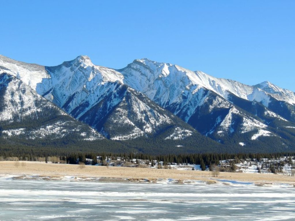
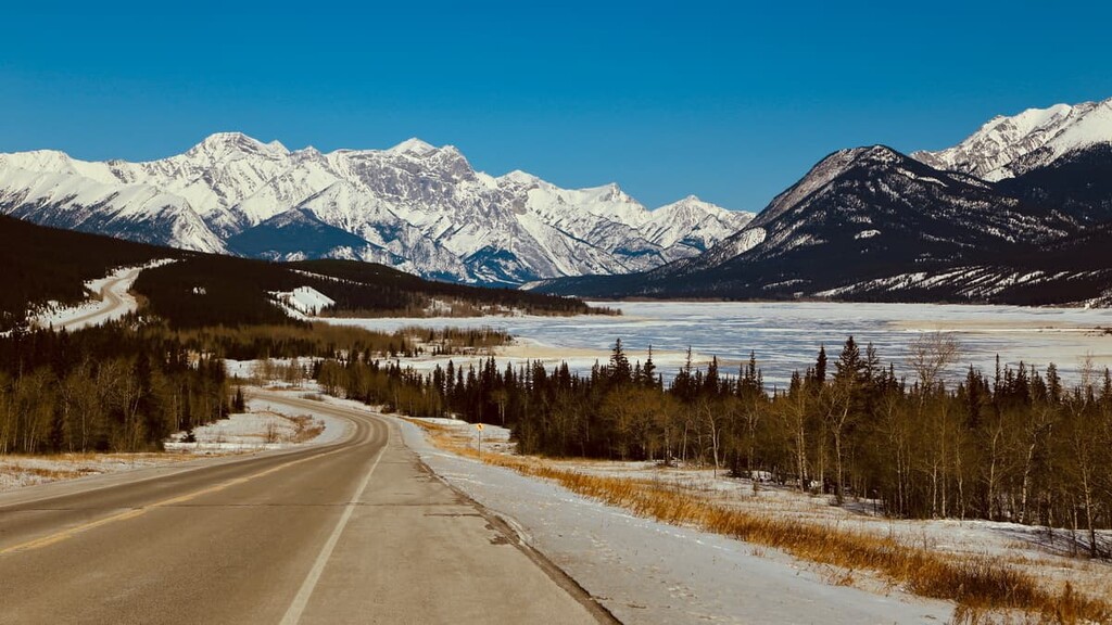
A popular way to explore the Upper Clearwater/Ram PLUZ is by camping in the area for a couple of weeks and spending the daytime exploring and the evenings around a campfire. This area is camping along Abraham Lake and taking more time to explore the trails through the mountains.
Random camping in the PLUZ is permitted and is growing in popularity as people want an escape from city life. It is important to follow the principles of Leave No Trace while camping in the backcountry so that the area is enjoyable for the next visitors. Whether backpacking, using an OHV, or just driving off the road, random camping is an exciting way to visit the PLUZ.
About 200 km (120 mi) north of the Upper Clearwater/Ram PLUZ is the town of Jasper, Alberta. Jasper House was established in 1813 as a trading outpost, shortly after David Thompson had established Athabasca Pass for the fur trade. The town was relocated to its current site in 1913 to become the commercial center for Jasper National Park.
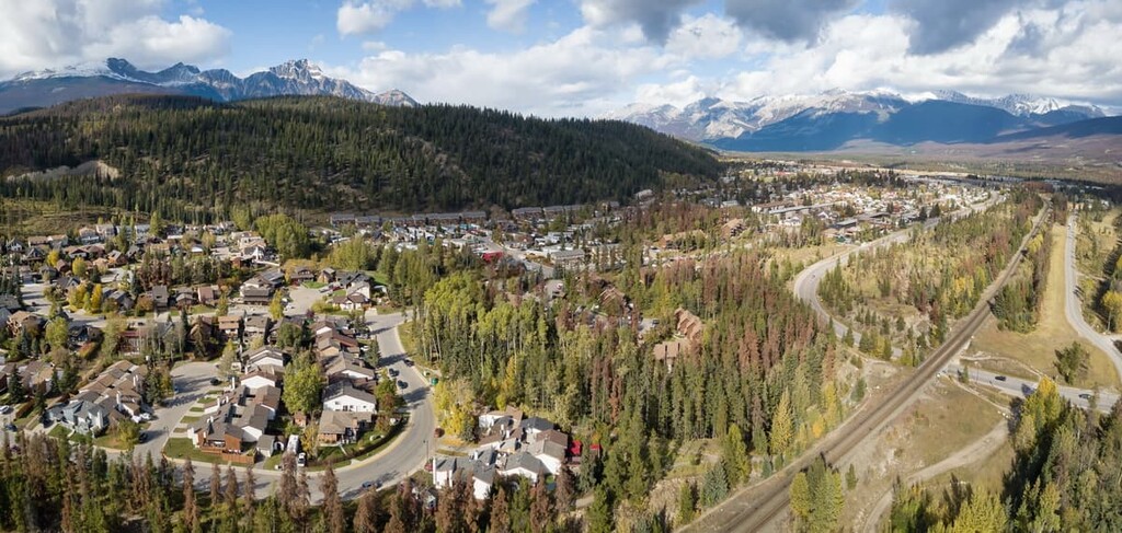
Jasper is a beautiful mountain town that was built to cater to tourists. There are many incredible hikes and attractions around Jasper. Some of the popular destinations from the town include the beautiful Maligne Lake, the Columbia Icefield, the stunning Athabasca Falls, as well as countless hikes and trails around the town.
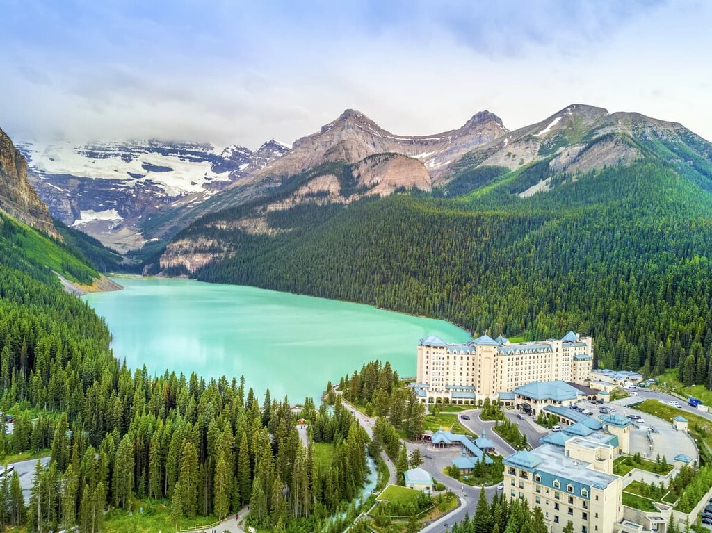
Lake Louise is located about 130 km (78 mi) to the west of the Upper Clearwater/Ram PLUZ and about 100 km (60 mi) north of the Banff townsite in Banff National Park. Lake Louise is a beautiful lake with the Victoria Glacier on one end and the Chateau Lake Louise on the other.
The area is beautiful and has hikes along the lake as well as trails up to the tea houses that were built to cater to the mountaineering tourists of the 1900s. Some of the most iconic pictures of the Rocky Mountains are taken from Lake Louise and the surrounding mountains.