
Scan the QR code and open PeakVisor on your phone
Clearwater County is home to 149 named mountains. The highest is Mount Cline at 3,361 m.
Clearwater County is a rural community and municipal district in western Alberta, Canada that is home to the Bighorn Backcountry. The county is located 240 km (144 mi) to the northwest of Calgary and 160 km (100 mi) to the west of Red Deer. The county stretches from the town of Rocky Mountain House to the borders of Banff and Jasper National Parks in the Rocky Mountains. There are 149 named mountains in the county, the tallest of which is Mount Cline with an elevation of 3,361 m (11,027 ft).
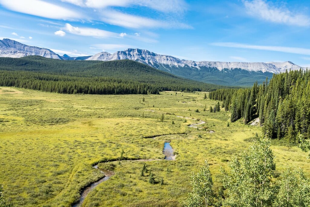
Clearwater County covers 18,692 square kilometers (7,217 square miles) of foothills, forests, mountains, and rivers in central Alberta, to the east of Banff and Jasper National Parks. The town of Rocky Mountain House is the largest municipality in the county and is located 213 km (128 mi) to the north of Calgary and 215 km (129 mi) to the south of Edmonton, Alberta.
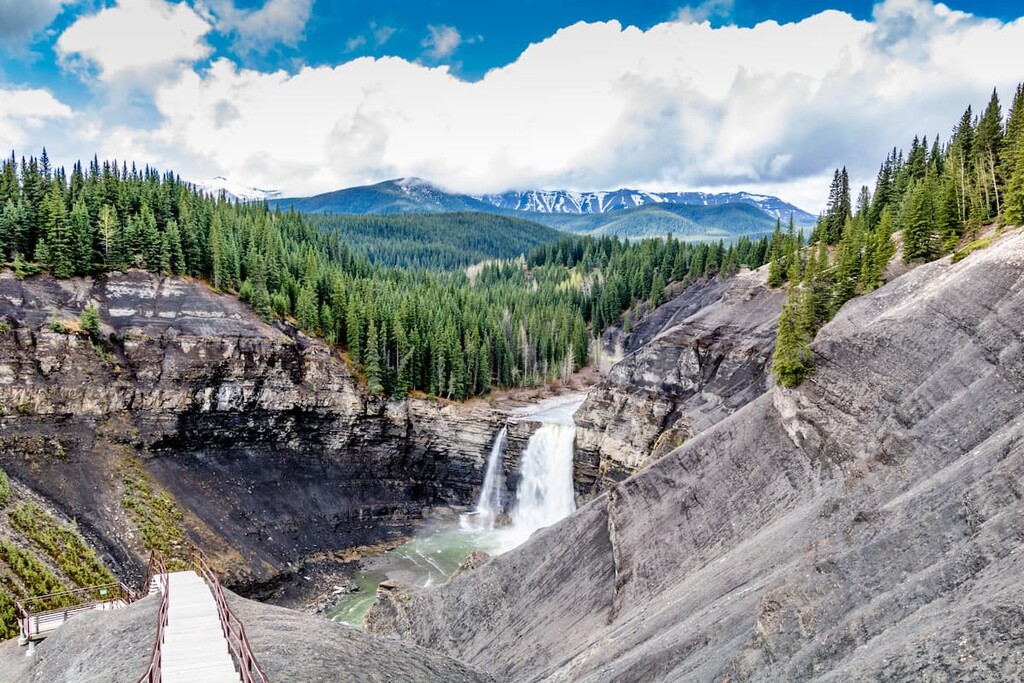
Crimson Lake Provincial Park and Ram Falls Provincial Parks are found within Clearwater County as are the rugged wilderness of White Goat and Siffleur wilderness areas. The county is home to several natural areas, and provincial recreation areas, as well as the Bighorn Backcountry, the latter of which consists of the following areas:
There are also two sites of national significance within Clearwater County. The significant sites are Rocky Mountain House National Historic Site, which preserves the history of the fur trade in the country, and Ya Ha Tinda Ranch, which is owned by Parks Canada and is the only federally operated working horse ranch in Canada.
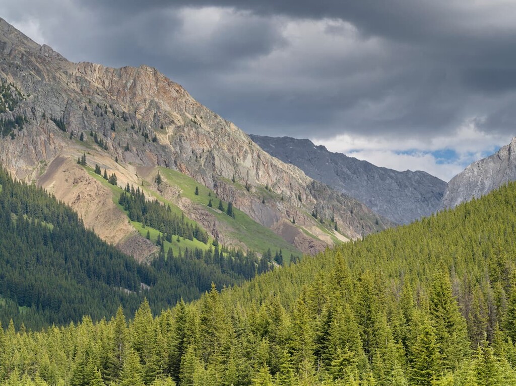
The geology of Clearwater County encompasses the physiographic regions of the Canadian Rockies, Foothills, and the Alberta High Plains. There are 152 named mountains and six mountain ranges in Clearwater County, Alberta. The mountain ranges in the county are the Bighorn Range, First Range, Cline Range, Brazeau Range, Ram Range, and the Cloister Mountains.
Over 500 million years ago, the western shores of Canada were located somewhere in western Alberta while a vast shallow sea stretched to the west. Over millions of years, layers of marine sediment from cyanobacteria and other organisms settled to the bottom of the sea, with the calcite cementing the sediment together into layers which were many kilometers thick.
About 100 million years ago, the Rocky Mountains started to rise above sea level, likely no faster than 30 cm (12 in) a century. The mountains started to rise because North America was colliding with the tectonic plates beneath the Pacific Ocean and the collision compressed and bent the layers of rock until they broke and were displaced up and over younger layers of rock.
The process that built the Rocky Mountains is referred to as thrust faulting, where the layers of rock are broken along fault lines and thrust (pushed) over younger layers of rock. The Rocky Mountains which are on the west side of the county consist mainly of Paleozoic limestone that was pushed on top of Mesozoic sandstones and shales.
The foothills, which are located to the east of the mountains, are mainly made of Cretaceous shale and sandstone. The foothills were made towards the end of the Laramide orogeny, when the force of the continental collision was waning. When there was no longer sufficient force to displace the limestone layer, the shale and sandstone layers buckled, broke, and slid up and west looking like rows of shingles on a roof.
Most of the topography of the region was created from the final major glacial maximum of the Pleistocene, which ended about 12,000 years ago. The pre-glacial valleys were buried in sand and gravel from at least four ice sheets of the Pleistocene.
The area of Clearwater County where the continental and cordilleran ice sheets met is delineated by a zone of mixed glacial till. Debris to the east is only from the Canadian Shield and debris found west of the area originated in the Rocky Mountains.
The glaciers deposited sand, gravel, and rocks across the county as kames, moraines, and eskers. Kames are hills or mounds of eroded material that collected in the depression of a retreating glacier while moraines describe any accumulation of unconsolidated glacial till. Eskers are sinuous ridges of sand or gravel that collected in channels as meltwater flowed on, through, or under a glacier.
Furthermore, in Clearwater County there are deposits of sand from massive, ancient glacial lakes that covered parts of the county. Sand that was deposited by the continental, Laurentide ice sheet formed dunes across the eastern part of the county. These dunes may be several meters deep and some are found in Crimson Lake Provincial Park.
Clearwater County spans three major ecological zones. From west to east the zones of the county are the Rocky Mountain Natural Region, Foothills Natural Region, and the Boreal Forest Natural Region.
The Rocky Mountain Natural Region is characterized by mountains, high foothills, and deep valleys. The region has the highest annual precipitation and the snowiest winters in the province with its long, cold winters and short, cool summers. The climate gets warmer in the lower elevations of the Foothills and Boreal Forest Natural Regions.
The richest habitats of the county are found at the lower elevations while the alpine peaks are dominated by rocky expanses and low growing heath and sedge.
The short growing season and fierce winds of the alpine make it difficult for most plants to grow. When plants and trees do manage to grow in the alpine, they are usually short and stunted. The tangled nests of windblown trees in the alpine are called krummholz.
Below the alpine, forests grow upon the slopes of the mountains and create a mosaic with herb and grass filled meadows. The forests of the upper elevations usually consist of Engelmann spruce, subalpine fir, and subalpine larch, while extensive lodgepole pine forests dominate the lower elevations.
The lodgepole pine forests of the Rocky Mountains flow out and cover the higher elevations of the foothills. The valleys between the foothills in Clearwater County are often filled with aspen, poplar, and white spruce, which continue out into the undulating plains of the Dry Mixedwood subregion of the Boreal Forest Natural Region. The county has vast tracts of land that are currently used for logging.
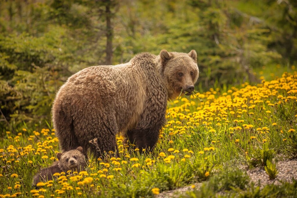
The characteristic animals of Clearwater County are some of Canada’s famous predators and ungulates. Grizzly and black bears inhabit the county, as do cougars, wolves, foxes, coyotes, and wolverines. White-tailed and mule deer, moose, elk, caribou, bighorn sheep, and mountain goats are the common ungulates of the county.
The Foothills Natural Region contains the greatest diversity of both flora and fauna because it is a transitional area between the mountains and the plains. The animals that you are most likely to see while visiting Clearwater County are Columbian ground squirrels, grey jays, deer, and crows.
Stretching from the Rocky Mountains to the plains, Clearwater County is a fascinating area, thanks to its plethora of cultural sites and rich human history. The county is found along the path of the Pleistocene ice-free corridor from Alaska and Yukon through Alberta to Idaho and Montana.
The ice-free corridor was among the first parts of Canada to become ice-free when the cordilleran and Laurentide ice sheets began their final retreat about 15,000 years ago. As the land became habitable, animals such as mastodons, horses, camels, and giant bison migrated into Alberta.
Groups of people followed the migrating animals and started to inhabit Alberta and a pocket of British Columbia, starting in the south. Clearwater County is part of the traditional territory of the Ktunaxa, Blackfoot, Tsuu T’ina, Cree, Stoney Nakoda, and Métis nations.
The first known people to inhabit Clearwater County were from the Ktunaxa Nation that currently lives in the Columbia River Valley, west of the Rockies. The Ktunaxa lived and camped in the valleys of the mountains, likely hunting the bison that were wintering in the wide valleys of Kootenay Plains Ecological Reserve.
The nations that formed the Blackfoot Confederacy possibly started migrating west from the Great Lakes region as early as the thirteenth century. The Blackfoot would eventually become a powerful group with territory from the eastern slopes of the Rockies to 400 km (240 mi) east into the prairies.
By the beginning of the eighteenth century, the Tsuu T’ina had emigrated from the northern forests onto the plains and at first inhabited the area around Edmonton, Alberta. As fur traders ventured west during the eighteenth and nineteenth centuries, their Cree and Stoney guides expanded their territory west as well.
The plains and forests of Kootenay Plains Ecological Reserve are culturally important to the many First Nations of the region as the area has been used for generations to collect herbs and to hold spiritual ceremonies, such as the Sun Dance.
The end of the eighteenth century saw the establishment of Rocky Mountain House as a trading fort for the Quebec-based North West Company. The fort at Rocky Mountain House was closed and opened many times over the following century, until 1876 when the fort was permanently closed. The Rocky Mountain House National Historic Site is now present at the site of the former fort with exhibits featuring the history of the First Nations and the fur trade in the region.
The end of the nineteenth century saw the decline of the fur trade in the region and an increase of settlers coming for mining, forestry, farming, and ranching opportunities. Canada’s first national park was established in Banff, and subsequently Banff and Jasper National Parks grew to their current size to the west of Clearwater County.
In 1917, Parks Canada took control of a prime grazing area known as Ya Ha Tinda and created the Ya Ha Tinda Ranch as a winter range, breeding, and training facility for park horses. In addition to ranching, the major economic activities of the county are forestry, mining, oil and gas, and hydroelectric generation.
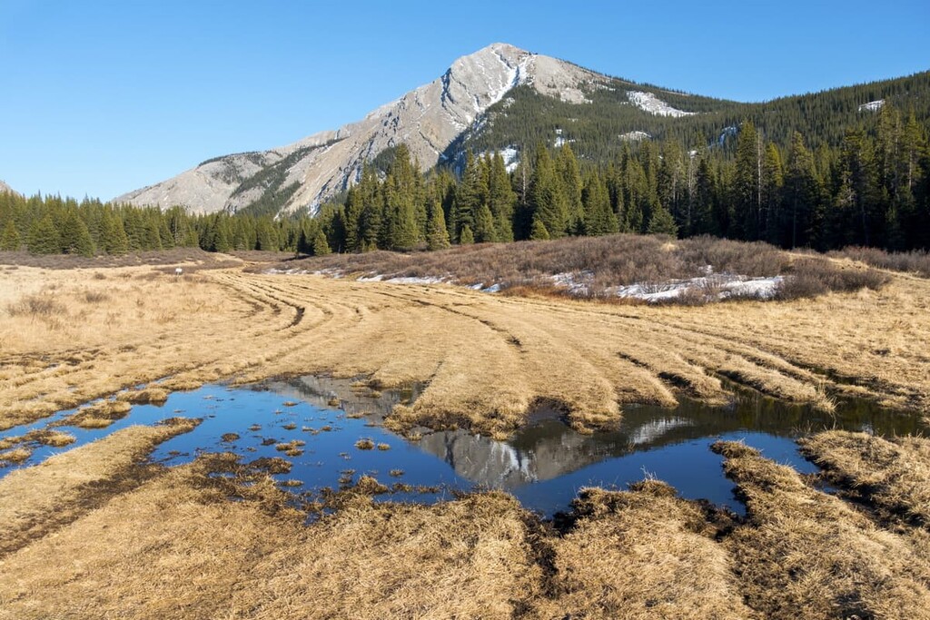
Clearwater County has some incredible areas of rugged wilderness. The county has become very popular with Albertans as a place to camp and explore with minimal rules and regulations. The following are some of the attractions and hikes within the county.
In 1799, the North West Company established Rocky Mountain House at the confluence of the Clearwater and North Saskatchewan Rivers in hopes of attracting trade with the Ktunaxa Nation across the Rockies. Over the years, four different forts were built on the site as circumstances changed the relevancy of the fort.
It was from Rocky Mountain House that David Thompson set out and established Howse and Athabasca Passes for European use through the Canadian Rockies in hopes of expanding trade routes to the Pacific and to China. The forts played host to many travelers, missionaries, and artists during the nineteenth century. The site currently houses exhibits relevant to its place in First Nations and Canadian history.
Nordegg is a hamlet in the middle of Clearwater County near the junction of Highway 11 and the Forestry Trunk Road (Highway 40). Founded in 1914 from the coal mining camp of the Brazeau Collieries Ltd. mining company, Nordegg grew and prospered until 1955 with the shuttering of the Brazeau Collieries, when coal prices declined as railways started favoring diesel locomotives over coal.
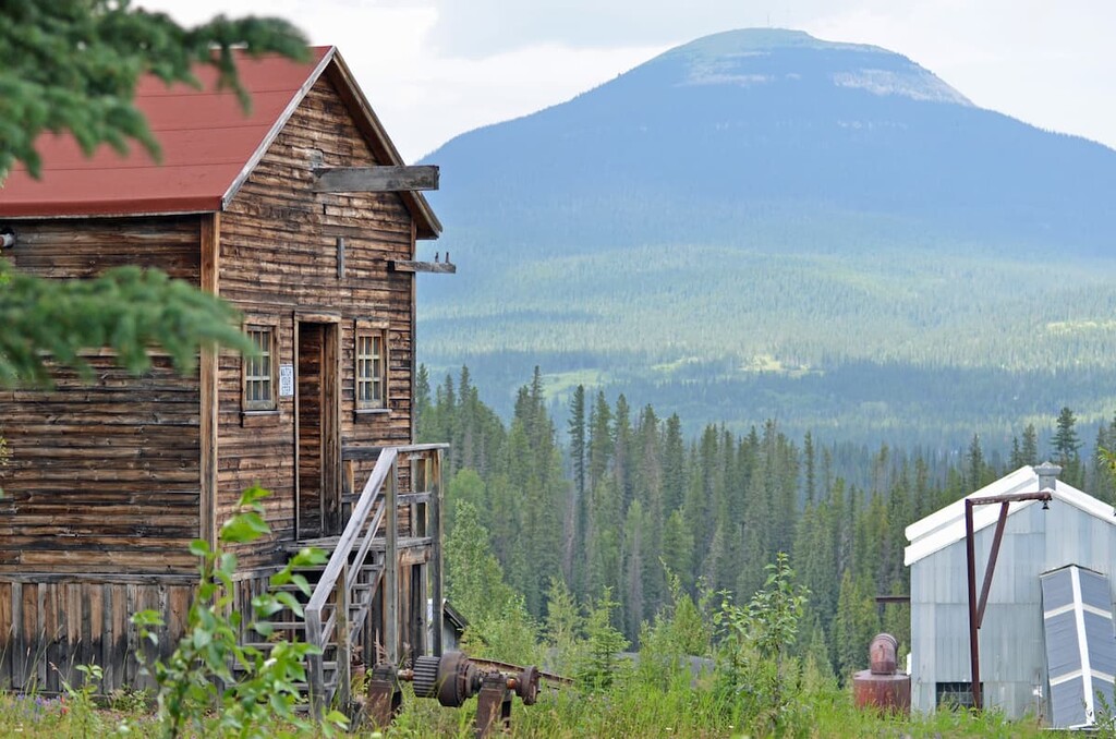
The town was named for Martin Nordegg, who, as a non-geologist, while fishing in the area in 1910 discovered coal. The discovery impressed geologists, who named the coal beds ‘The Nordegg Coal Basin.’ Nordegg created a mining company which started mining the coal deposits in 1912.
The town is considered to be the most complete site in Canada that represents the history of coal mining in the nation. The town is full of buildings and machinery, and at one point had over 250 miners’ cottages, as well as churches, hotels, clubs, the huge Big Horn Trading Company store, and a hospital that was once considered to be the most modern in Alberta.
In the 1960s, the town became the site of a provincial minimum-security prison. The inmates worked and moved freely about the town and lived in the miners’ boarding house, which still stands. While most of the homes are gone, there are still many structures relating to the mining operations and towns for fans of history and ghost towns.
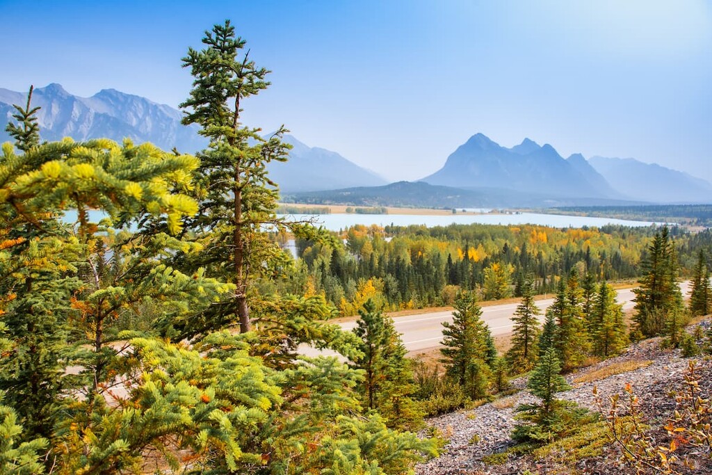
The Bighorn Backcountry is more than 5,000 square kilometers (1,930 square miles) of public lands covering the eastern slopes of the Rockies, east of Banff and Jasper National Parks. There are six separate public land use zones with their own rules to the permitted activities. The PLUZs are Blackstone/Wapiabi PLUZ, Kiska/Willson PLUZ, Job/Cline PLUZ, Upper Clearwater/Ram PLUZ, Panther Corners PLUZ , and Dormer/Sheep PLUZ.
There are countless kilometers of wilderness trails for hiking, equestrian, mountain biking, and OHV use. There are several popular areas which are designated for snowmobile use. Hunting, fishing, and random camping are all permitted within this backcountry area. Crown land (random) camping is a popular activity for Albertans and this is one of the most popular areas in the province to do so.
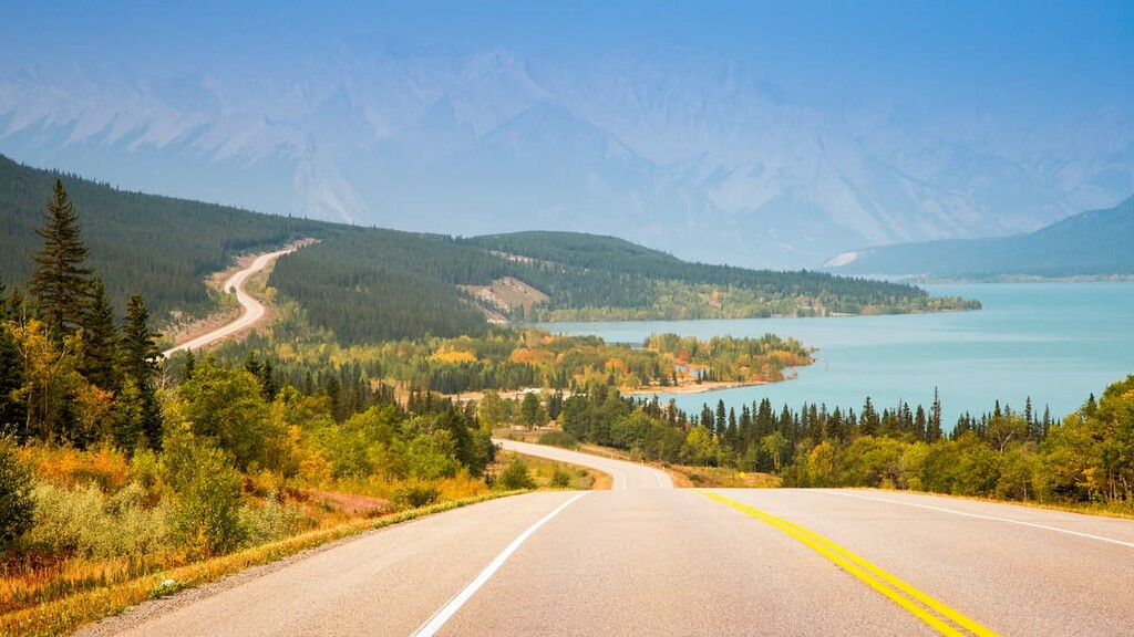
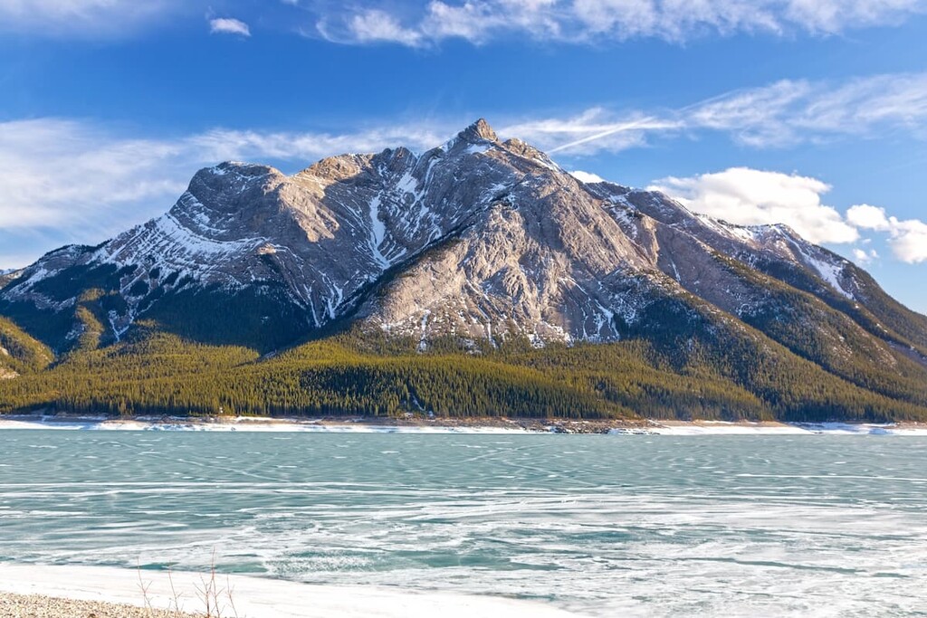
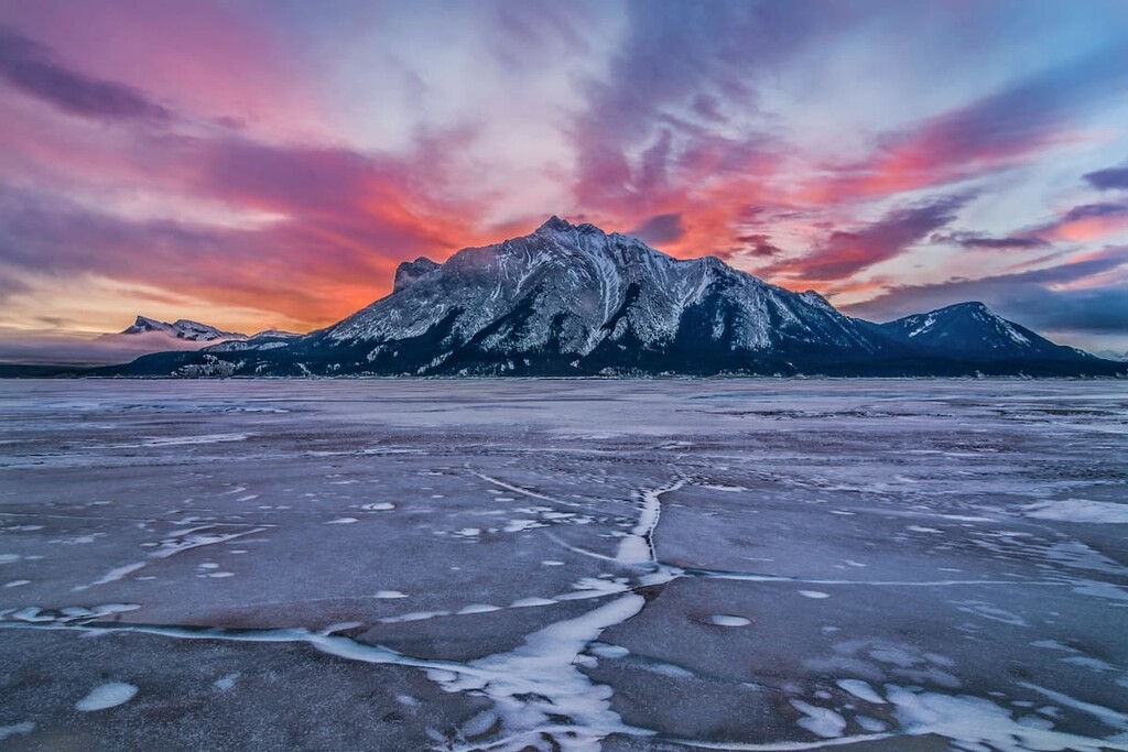
Abraham Lake was created in the 1970 when TransAlta built the Bighorn Dam to harness the power of the North Saskatchewan River. The lake has become a popular destination for locals to camp and explore in the summer and winter.
During the summer, the shores can get quite busy with people searching for the perfect camping spot, especially in anticipation of long-weekends. There are many trails near the lake that lead up into the surrounding mountains, valleys, and wilderness.
The winter is special at Abraham Lake, too. While there are some amazing areas that become dedicated snowmobile zones, the lake transforms into a magical landscape. The decomposition of organic material under the lake releases methane bubbles throughout the year; however, during the winter, as the lake freezes, the bubbles become trapped in the ice and create a unique and beautiful sight.
Ya Ha Tinda means “mountain prairie” in Stoney. It was an area that was introduced to the Brewster brothers at the beginning of the twentieth century for grazing their horses. However, the area has evidence of human use for over 9,400 years. There are ancient camps, tipi rings, artifacts, as well as the remains of ancient bison to be encountered at the ranch.
While owned by Parks Canada, Ya Ha Tinda Ranch is not a national park, but a working ranch that provides the horses needed for patrolling within the region’s national parks. However, there is a campground at Ya Ha Tinda, and most of the 3,945 hectares (9,744 acres) of the ranch are open to the public for trail riding and hiking.
Rocky Mountain House is the largest municipality in Clearwater County and it is the region’s only town. The following are a couple places in and near Clearwater County that provide accommodation and services for outdoor pursuits.
Rocky Mountain House is the largest municipality in Clearwater County. It is home to the municipal offices and the Rocky Mountain House National Historic Site. The town is located on the east side of the county, just over 200 km (120 mi) north of Calgary and 82 km (49 mi) west of Red Deer, Alberta.
When visiting the provincial parks, public land use zones, or other wilderness areas of Clearwater County, Rocky Mountain House is usually the final outpost of civilization before you enter the wilderness. The town has accommodations and stores that will supply you with all you need for your upcoming adventure.
Located 213 km (128 mi) south of Rocky Mountain House and Clearwater County, Calgary has a vibrant western and mountain culture. Many of the locals spend their weekends traveling to the Rocky Mountains for hiking, biking, kayaking, or skiing; however, there is a lot to do in the city too.

Within the city there are hundreds of kilometers of trails connecting all the major green spaces and parks in the city from Nose Hill in the north, through the parks around the Glenmore Reservoir, and down to Fish Creek Provincial Park in the south.
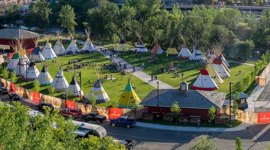
There are many attractions, such as Fort Calgary, the Glenbow Museum, The National Music Centre – Studio Bell, and many more. Music and performing arts festivals are held throughout the year, especially during the summer. The city also hosts the annual Calgary Stampede, which is 10 days of raucous western fun, rodeo, concerts, as well as a midway and other performances and exhibits.

Yes. Clearwater County has 149 named mountains. The highest is Mount Cline at 3,361 m.
The highest mountain in Clearwater County is Mount Cline, at 3,361 m.
Clearwater County has 149 named mountains.


