Scan the QR code and open PeakVisor on your phone
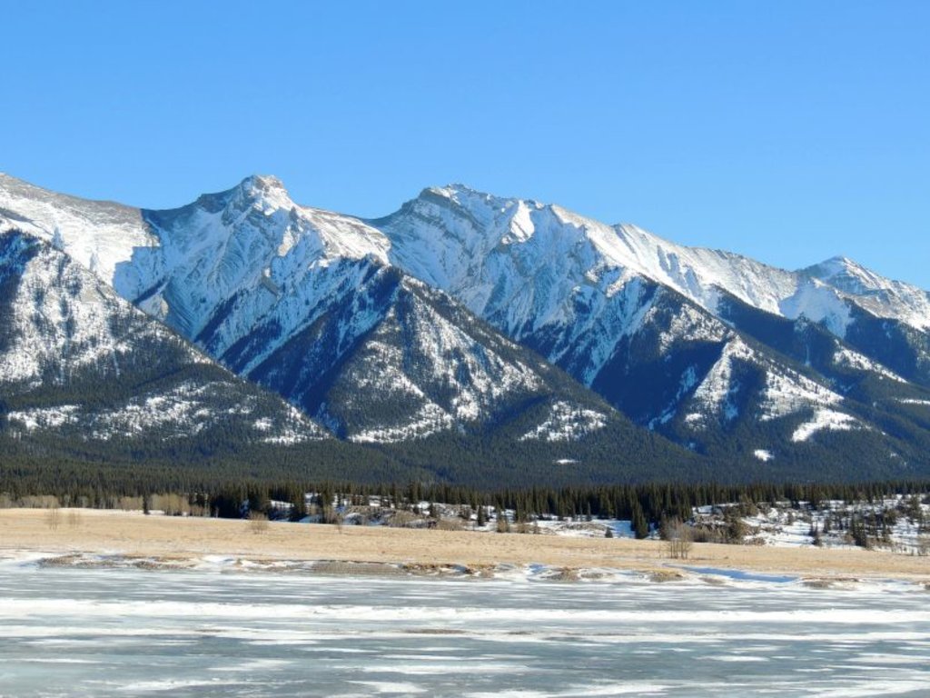
The Ram Range is a mountain range located within an area known as the Bighorn Backcountry in central Alberta, Canada. The range has 8 peaks, the highest of which is Canary Peak with 2,844 m (9,331 ft) of elevation. Mount William Booth only stands 2,728 m (8,950 ft) tall; however, it is the most prominent peak in the range with 777 m (2,549 ft) of prominence.
Located in Clearwater County of central Alberta, Canada, the Ram Range is a collection of peaks situated within the Upper Clearwater/ Ram Public Land Use Zone (PLUZ). The Upper Clearwater / Ram PLUZ is part of the Bighorn Backcountry which also includes the following protected areas:
Bighorn Backcountry borders the south side of Jasper National Park and the east side of Banff National Park. The south end of Bighorn Backcountry is bordered by the Ghost PLUZ.
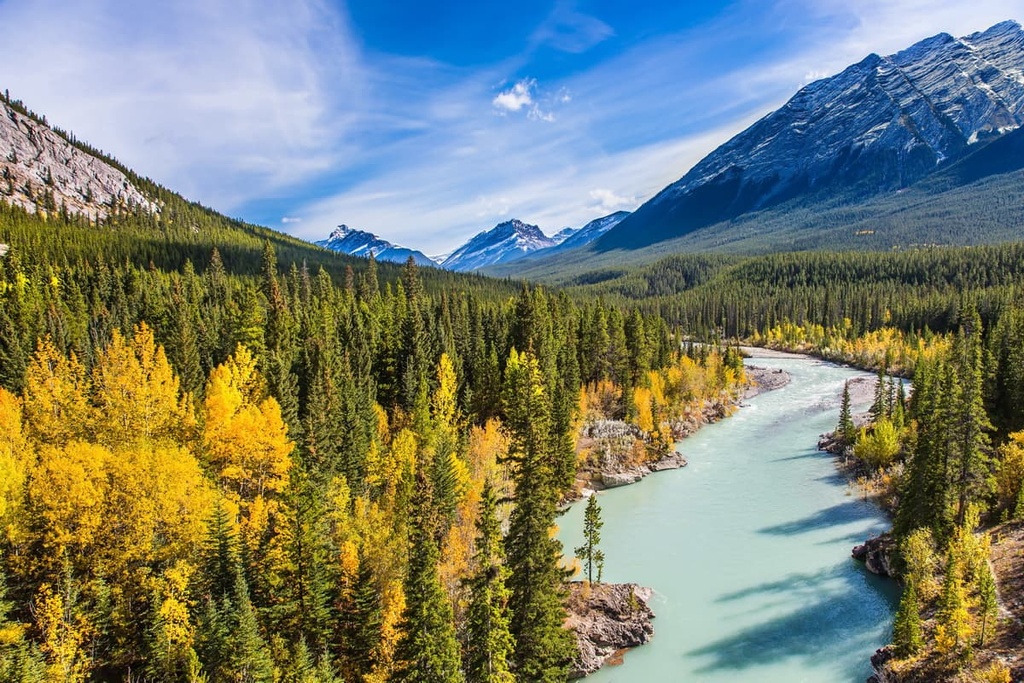
The Ram Range extends to the south from Abraham Lake to the Ram River. Whiterabbit Creek also borders the southwestern side of the range. The Ram Range is one of the Front Ranges of the Canadian Rockies, and, as such, it borders the foothills of the Rockies, which are situated to the east.
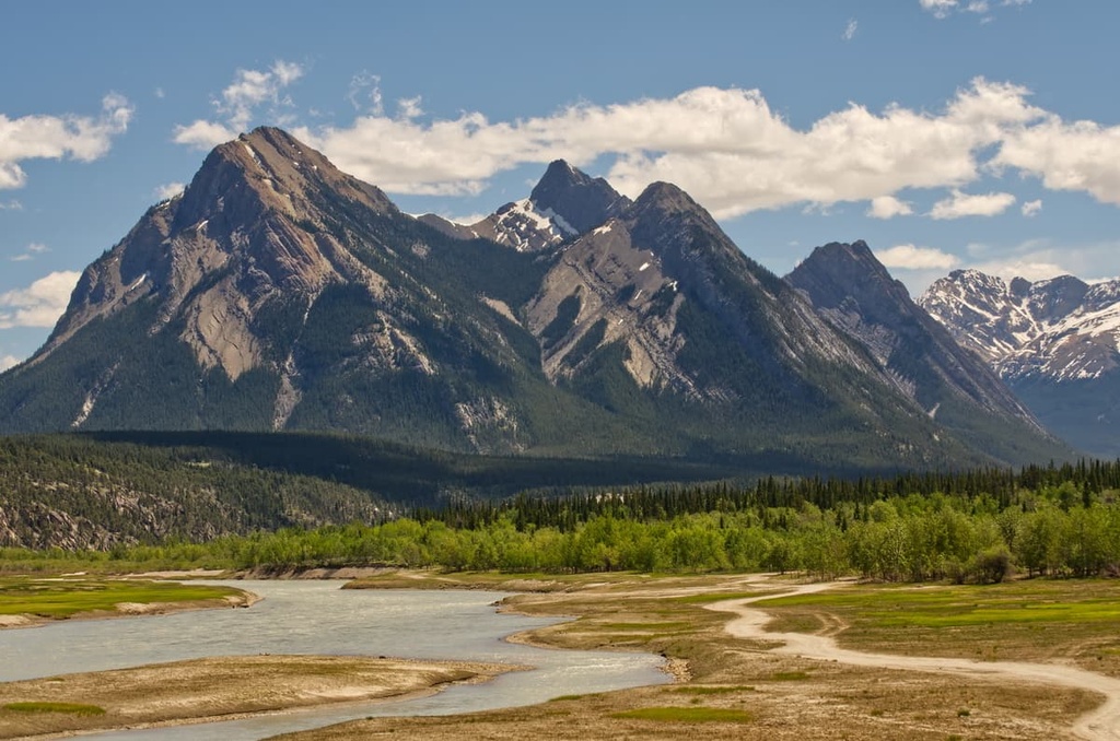
The Cloister Mountains, Cline Range, First Range, and Bighorn Range are located to the north of the Ram Range on the northern side of the North Saskatchewan River. The Brazeau Ranges are situated to the east of the Ram Ranges and stand out among the foothills of the region. The Clearwater Ranges are also located to the south of the Ram River and the Ram Range.
The Rocky Mountains were formed as a result of collisions between the North American Plate and the underlying plates of the Pacific Ocean. The most intense tectonic activity along the west coast occurred between 140 and 45 million years ago.
During this time, layers of sedimentary rock were pushed together, causing them to bend, fold, break and pile up to create the mountainous landscape of western Canada. The force of the collision broke the Paleozoic and younger layers from the Precambrian bedrock, pushing the flat-lying sedimentary rocks to the northwest, as far as 300 km (180 mi) from their origin.
These layers slid northwest up and over one another to form the Rocky Mountains. It was about 80 million years ago that the differences between the American and Canadian Rockies started to develop.
While both ranges were originally similar regions of folded sedimentary rocks, the way the oceanic plates subducted beneath the continent geologically changed the ranges located to the south of the border.
The oceanic plate subducted at a shallow angle under the west coast of the USA, which caused the basement rock to be broken and pushed up. However, the oceanic plate subducted at a steep angle under Canada’s west coast, leaving the limestone peaks and sandstone valleys of the Canadian Rockies relatively undisturbed from their original formation.
After the formation of the Rockies, the American Rockies and their upthrust sedimentary peaks were heavily eroded, exposing the granitic basement rocks of the North American plate. Meanwhile, in Canada, the Rockies maintain their precipitous limestone peaks, with very few areas eroded down to bedrock.
The Ram Range was one of the final ranges formed during the formation of the Rocky Mountains, and it is currently considered to be one of the Front Ranges. Situated to the east of the Ram Range are the foothills; however, the foothills are punctuated by the Brazeau Range, which was formed by the Brazeau thrust fault, whereas the Front Ranges are typically part of the McConnell Thrust Fault.
During the Pleistocene, intense glaciation of the Canadian Rockies further changed their appearance, creating a young landscape of wide U-shaped valleys, cirques, arêtes, and horn peaks. Furthermore, the glaciation left behind moraines, kames, eskers, and other glacial landforms through the Rockies and in the Ram Range.
The Ram Range is part of the Rocky Mountain Natural Region, which consists of three ecological subregions: the alpine, the subalpine, and the montane.
The ecology of the Ram Range is representative of only the alpine and subalpine ecologies. The alpine is found in the highest elevation of the mountains above the treeline. Meanwhile, the subalpine includes everything below the treeline in the Ram Range.
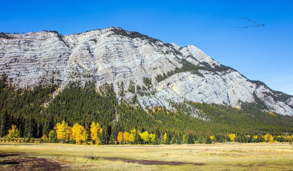
Plants and animals are sparse in the alpine, which consists mainly of lichen-covered rocks, grassy meadows, mat vegetation, shrubs, and krummholz. The Alpine Natural Region of the Rocky Mountains is generally barren, rocky ground, with minimal vegetation.
However, grouseberry grows in protected areas while sedges and heathers cling to the edges of snowbeds. Subalpine fir and Engelmann spruce in this region are stunted and twisted from the freezing winter winds. Lengthy snow cover and cold temperatures prevent most flora from thriving in the area.
Several bird species are found in the alpine during nesting season, such as white-tailed ptarmigan, gray-crowned rosy finch, horned lark, and the American pipit. Marmots and Columbian ground squirrels make their burrows along the treeline, under the alpine rocks, while bighorn sheep and mountain goats are the only large mammals to spend most of the year among the peaks.
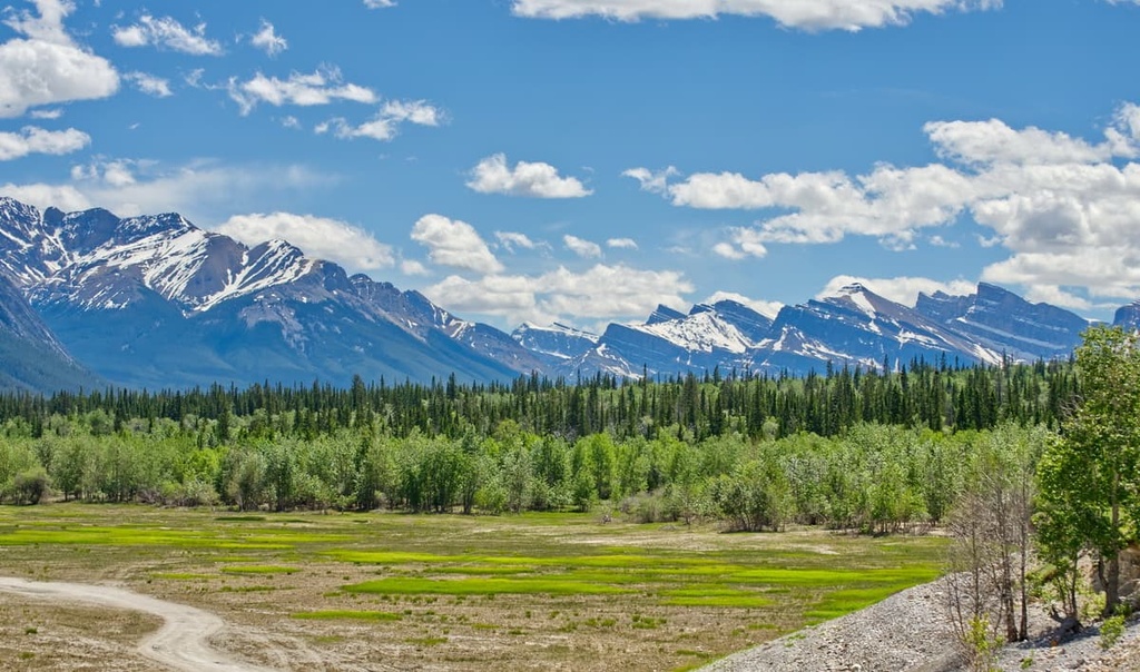
The lower elevations of the subalpine are warmer and less windy than the alpine region, which allows the subalpine to support significantly more flora and fauna when compared to the alpine. Forests of lodgepole pine dominate the lower slopes of the range, while subalpine fir, Engelman spruce, and larch are dominant at higher elevations and along ridges.
There are many recognizable predators that inhabit the Ram Range, such as grizzly bears, black bears, cougars, and wolves who make their home in the area. Additionally, ungulates such as elk, mule deer, white-tailed deer, and mountain sheep are also common in the range.
The Ram Range is located along the eastern slopes of the Canadian Rockies, which are synonymous with the ancient ice-free corridor that once connected what is now Alaska and Yukon to the southern half of North America.
As the Pleistocene ended, the ice that once embraced much of northern North America was losing its grip. By about 12,000 years ago, the eastern slopes and Front Ranges were mostly ice-free.
After the cordilleran glaciers and the continental ice sheet retreated, grasses, sedge, and shrubs filled in the terrain, creating a steppe-like environment that attracted ancient megafauna. As animals such as mastodons, camels, giant bison, and horses began to occupy the slopes and valleys of the region, humans soon followed.
Pre-European contact archeological sites of note are found in the national parks to the west of the Ram Range. There are many cultural sites located along the Athabasca River in Jasper National Park and a hunting camp in Banff National Park on the slopes of Mount Edith, the latter of which is over 10,000 years old.
Most archeological discoveries in Bighorn Country, which includes the Ram Range, are discovered during the surveys for highway construction or oil and gas development. So, it’s reasonable to assume that there are uncovered culturally significant sites in the area.
The eastern slopes of the Canadian Rockies are of particular interest to archeologists because the region was a likely corridor for migration into North America as well as the first area inhabited after the Pleistocene. The Ram Range borders the plains, and as such, it contains a potentially rich history due to the distinct physiographic and cultural areas in the regino.
The Ram Range is the traditional territory of the Cree, Métis, Ktunaxa, Stoney, Tsuu T’ina, and Blackfoot. Among the first Europeans to the area were David Thompson in the early nineteenth century and the Palliser Expedition of 1858.
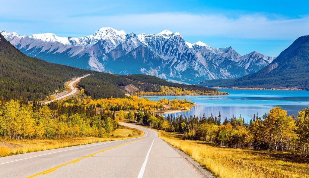
The range has remained relatively undeveloped, with forestry and mining to have been the only significant industry to have occurred in and around the range. The north end of the range borders Abraham Lake, which has become a popular destination for random wilderness camping and OHV use.
Located on the south side of Abraham Lake, the Ram Range is more difficult to access and is therefore not as popular as the Cline Range and the First Range, which are on the north side of the lake.
However, the relative isolation of the Ram Range allows for some longer hikes without the foot traffic found in other nearby popular areas. The following are a couple of the popular trails in the Ram Range.
The Canary Creek Trail is a 19.3 km (11.6 mi) long out-and-back trail that leads along the creek and through the forest towards Canary Peak.
The trail is popular for hiking and mountain biking and is rated as moderate and has only 413 m (1,354 ft) of elevation gain. Note that there are many creek crossings along this trail and only a couple of bridges. It’s possible to backcountry camp along the trail and take multiple days to explore the area.
Located near Nordegg, Alberta, the Onion Lake Trail follows the east side of the Ram Range to reach Onion Lake. The 28 km (17 mi) trail has 562 m (1,843 ft) of elevation gain and is considered only moderately difficult.
The lake gets its name from the wild onions that grow along the shore and in the valley. The beautiful area is good for a long day hike or an overnight backpacking trip.
While the Ram Range is a reasonable destination for a day trip, one of the more popular ways to explore this area is by camping along Abraham Lake.
Whether camping in one of the designated camping areas or random backcountry camping, camping in the area allows for more time to explore the trails through the mountains, along the lake, and in the valleys that were once prime bison hunting grounds for the Ktunaxa.
Random camping is how locals refer to camping in the wilderness, outside of designated sites, either with a vehicle or hiking.
While backcountry camping, care should certainly be taken to leave no trace and to leave the wilderness in the same or better condition than your arrival. Random backcountry camping while hiking can be an exciting way to spend time in this remote wilderness area.
Some designated campsites in the region have facilities while others are rustic campgrounds.
Despite the popularity of the area and that there are some facilities, it is important to be able to be totally self-sufficient and adhere to Leave No Trace guidelines while random camping in the region. Rocky Mountain House is the nearest town with commercial facilities if you need something while camping in the Ram Range.
The Ram Range is one of the Front Ranges of the Canadian Rockies and has stunning scenery, wildlife, and lots of opportunities for off-the-beaten-path adventures. The following are some of the communities and cities located near the range that serve as a good starting or resupply point for your adventures.
Rocky Mountain House is typically the last major community visitors pass through on their way to Bighorn Backcountry and the Ram Range. The town is located about 130 km (78 mi) to the east of the PLUZ and has stores and accommodations for visitors to enjoy.
In Rocky Mountain House, you will be able to find any food and gear that you may need for your adventure. There are also shops that can repair almost any piece of gear or equipment that you might break while adventuring, from OHVs to trucks and trailers.
Rocky Mountain House was established as a fur trading post in 1799 and plays a significant role in the opening of the west to settlers and the fur trade. Explorers, such as David Thompson during his search for passage to the Pacific Ocean, used Rocky Mountain House as their launching point for adventures to the west.
Calgary is a city that’s located about 350 km (210 mi) to the southeast of the Ram Range. It is the largest city in Alberta.
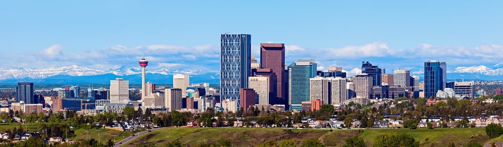
The most famous event in Calgary is the annual Calgary Stampede, the self-proclaimed “Greatest Outdoor Show on Earth.” Running for 10 days every July, the Stampede has a midway, shows, concerts, rodeo, chuckwagon races, as well as the nightly Grandstand Show and fireworks.
Calgary offers a range of accommodations for visitors, fantastic local attractions, and easy access to the incredible wilderness of the Rocky Mountains. Some of the best local attractions include the Calgary Zoo, the Calgary Tower, and the Glenbow Museum. A visit to the historic Fort Calgary or Heritage Park will transport you back in time to the founding of Calgary and the European settlement of the region.
The city has hundreds of kilometers of trails that connect most of the parks and greenspaces around Calgary. The largest natural areas in the city are Nose Hill Park in the north of Calgary and Fish Creek Provincial Park in the south of the city. Other nice places for a walk or cycle are located around the Glenmore Reservoir and by the Bow River at the Inglewood Bird Sanctuary.
The city offers easy access to the mountains and parks to the west, such as Kananaskis Country, and Banff National Park. Located to the south of the city is the Castle Area, which includes the stunning wilderness areas of Castle Provincial Park and Castle Wildland Provincial Park.