
Scan the QR code and open PeakVisor on your phone
Kiska/Willson Public Land Use Zone has 8 named peaks. The highest is Mount Ernest Ross at 2,454 m. Other notable peaks include Maze Peak, Shunda Mountain and Coliseum Mountain.
The Kiska-Willson Public Land Use Zone (PLUZ) is an outdoor recreation area that’s located in the Rocky Mountains of southwestern Alberta, Canada. The PLUZ is part of Clearwater County, which borders Banff and Jasper National Parks. The area has 8 named peaks, of which Mount Ernest Ross (2,454 m/8,051 ft) is the tallest and Maze Peak (2,391 m/7,844 ft) is the most prominent.
Located along the eastern slopes of the Rocky Mountains in Alberta, Canada, Kiska-Willson PLUZ is a wilderness recreational area with minimal regulations on land-based activities.
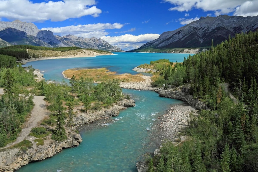
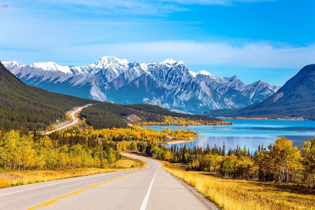
The main access to the park is via Highway 2, which takes you into central Alberta. From there, you can access the PLUZ by taking Highway 11 toward the western part of the province. The PLUZ covers the shores of Abraham Lake as well as the eastern slopes and foothills of the Rockies.
As part of the Bighorn Backcountry, Kiska-Willson PLUZ is one of several wilderness and public land use zones that are preserved as backcountry areas. As a result, there are few, if any, visitor facilities in the area. The following outdoor recreation areas are also part of Bighorn Backcountry:
Additionally, Jasper National Park shares the northwestern border of the Bighorn Backcountry, while Banff National Park is located along its southern borders. The area is among some of the most spectacular mountain scenery in Canada and it is a treat to explore this backcountry wilderness.
The geology of the Kiska-Willson PLUZ shares a similar story as the rest of the Canadian Rockies. The layers of limestone rocks that compose most of the Canadian Rockies started accumulating several hundred million years ago off the ancient west coast of North America.
In the past, when supercontinents like Rodinia and then Pangaea existed, the west coast of what is now Canada was roughly located along the current border between Alberta and British Columbia. From the shores of the continent, a massive continental shelf stretched into the Pacific whereupon layers of marine sediment accumulated for millions of years.
During this period of marine sediment accumulation, there were several events that changed some of the layers of rock in the region. Some of these events were caused by the breaking apart of the supercontinents and undersea landslides that created layers of conglomerate rocks as opposed to just layers of silt.
About 75 million years ago, the Farallon plate was moving and breaking apart along the west coast of North America. The Kula plate, which resided along the west coast of Canada, broke off from a larger tectonic plate and subducted under what is now North America.
The force of the collision and angle of subduction uplifted the rock that had accumulated along the continental margin. Several thousand meters of Paleozoic and Mesozoic sediment were deformed into uplifts and basins. The newly created basins were then filled with as much as 5,000 m (16,000 ft) of Cretaceous and Cenozoic sediments.
During the Laramide orogeny, the forming mountains were much closer to sea level. This helped to create vast wetlands, lakes, and swamps in the region. The gradual uplift of the mountains continued for millions of years until recently as 20 million years ago.
The Laramide orogeny, which created the Rockies, is believed to have continued for about 45 million years. Following the orogeny, the glaciations and ice sheets of the Pleistocene helped to create the topography that is present in the region to this day.
At the end of the Pliocene, as the Earth started to cool, snowfall in the mountains and in the Arctic didn’t completely melt every summer. Year after year, the Arctic and mountains would gain a thicker layer of snow, which would compress under the additional snowfall.
After sufficient accumulation, the accumulated ice was pressing down with enough pressure that the glaciers started flowing from the Arctic and out of the mountains. In some places in the Rockies, the ice sheet was several kilometers thick and their mass helped them grind against the surrounding rocks.
The softer sandstones and shales were scoured away by the ice while the harder limestone was scoured and shaped. Additionally, U-shaped valleys were carved by these growing glaciers and the alpine glaciers cut cirques into the mountains, leaving behind horn-shaped peaks.
Also, as the glaciers moved, they picked up the rocks and debris that they scoured from the area. Once these glaciers melted, this debris was left behind to tell the story of the glaciers and their movement.
Moraines that are found in the area to this day show where glaciers reached while drumlins show which direction the glaciers may have flowed. Additionally, the eskers that you can see in the region show the serpentine routes of the massive rivers that formed under these glaciers as they melted.
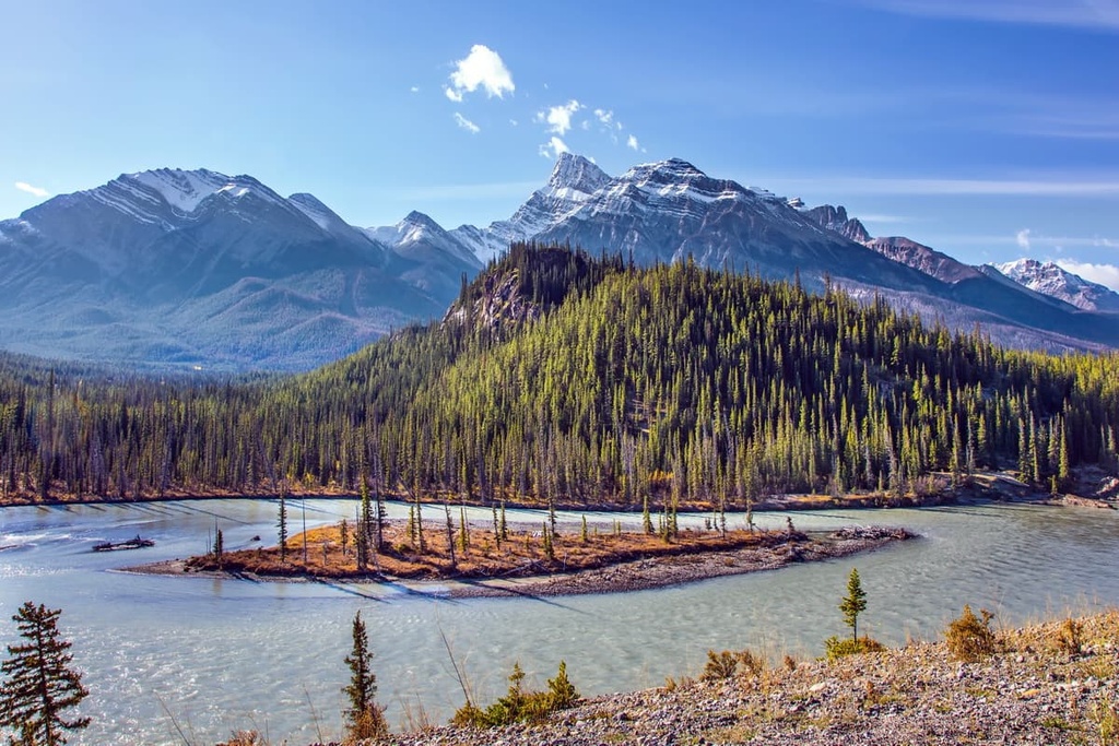
The Kiska-Willson PLUZ spans two major ecological zones: the Rocky Mountain Natural Region and the Foothills Natural Region.
The Rocky Mountain Natural Region is characterized by mountains, high foothills, and deep valleys. The region has the highest annual precipitation and the snowiest winters in the province as it features long, cold winters and short, cool summers.
The peaks are typically rocky and barren. They feature communities of sedge, heather, wildflowers, and shrubs that grow closer to the treeline. The short growing season and fierce winds of the alpine make it difficult for most plants to grow. When plants and trees do manage to grow in the alpine, they are usually short and stunted. The tangled nests of windblown trees in the alpine are called krummholz.
Below the alpine, forests grow upon the slopes of the mountains and create a mosaic with herb and grass filled meadows. The forests of the upper elevations usually consist of Engelmann spruce, subalpine fir, and subalpine larch, while extensive lodgepole pine forests dominate the lower elevations.
The lodgepole pine forests of the Rocky Mountains flow out and cover the higher elevations of the foothills in the PLUZ. The eastern slopes of the PLUZ that transition to the foothills are filled with forests of aspen, poplar, and white spruce.
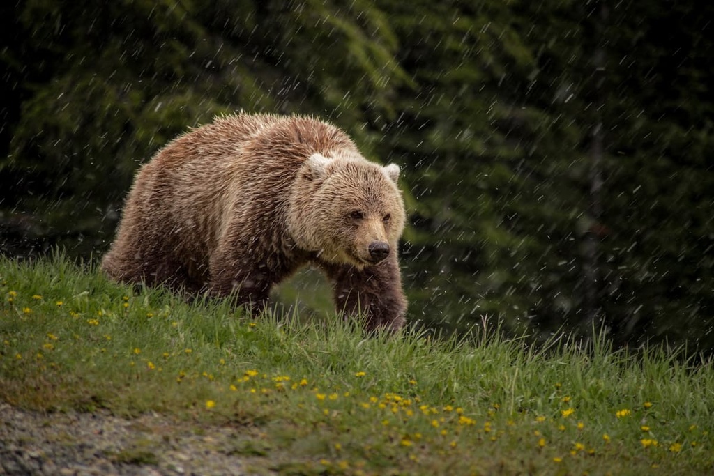
Some of Canada’s most famous predators and ungulates inhabit the PLUZ, including grizzly and black bears, cougars, wolves, foxes, coyotes, and wolverines. White-tailed and mule deer, moose, elk, caribou, bighorn sheep, and mountain goats are the most common ungulates found in the PLUZ.
The Foothills Natural Region, which is found along the eastern edge of the park, contains the greatest diversity of both flora and fauna because it is a transitional area between the mountains and the plains. While there are many beautiful animal species that inhabit the region, the animals that you are most likely to see while visiting include Columbian ground squirrels, grey jays, deer, and crows.
With respect to the pre-European contact history of Alberta and North America, the region around and including Kiska-Willson PLUZ contains important pieces of the archeological puzzle that professionals are still trying to piece together. In fact, the PLUZ is located along what was once a major ice-free corridor that aided migration into and throughout North America.
During the Pleistocene, when what is now Canada was generally encased in ice, the massive cordilleran ice sheet flowed from the mountains while the Laurentide ice sheet flowed from the northeast. Along the eastern slopes of the Rockies, there was a corridor that would periodically open between the glaciers and that would have permitted travel between the north and the south.
At times, the corridor extended from what is now Alaska and Yukon through Alberta to the northern United States. It is still unclear if this ice-free corridor was the migration route for early humans who first inhabited North America; however, it is clear that as the corridor opened at the end of the Pleistocene, groups of people migrated north along the corridor to inhabit the newly thawed northern territories.
Bighorn Backcountry and Kiska-Willson PLUZ are home to important cultural locations for many Indigenous communities in the region.
The plains and valleys along Abraham Lake and in the foothills were traditionally a prime hunting location for bison. The Ktunaxa, whose more recent historical territory is now more centered around Columbia Mountains to the west of the Rockies traditionally hunted bison and other game near Abraham Lake and along the foothills and plains before their western migration.
However, pressure from other Indigenous groups pushed the Ktunaxa to the west across the Rockies. Some of the pressure came from the Tsuutʼina Nation who originally migrated from the northern forests and eventually settled to the west of what is now Calgary, Alberta.
Additionally, the Blackfoot Confederacy had been slowly migrating west since the thirteenth century. Eventually, the Blackfoot Confederacy became one of the most powerful tribal coalitions on the prairies. Their growing power and influence in the region eventually led other tribes, such as the Ktunaxa, to leave the area.
As European settlers arrived on the prairies and onto the eastern slopes, they found forests from where they could harvest an abundance of lumber and many coal deposits. This led to a small population boom of settlers during the late nineteenth and early twentieth centuries.
Some of the areas in and around Kiska-Willson hold cultural and spiritual significance for many local First Nations, who traditionally collected herbs from the Kootenay Plains to the west end of Abraham Lake. A number of First Nations also traditionally hold spiritual Sun Dance ceremonies in the area.
The area is currently protected as a Public Land Use Zone, a designation that it received in 2002. This means that it has been set aside for the enjoyment of the public. While there are some regulations on the use of the land, most activities are permitted in the PLUZs.
As a PLUZ, the visitors to Kiska-Willson PLUZ have more choices on how they would like to enjoy the wilderness when compared to a provincial or national park. The public land use zones in the region were created for locals to be able to enjoy the wilderness more freely.
Some of the popular activities in the Kiska-Willson PLUZ are backpacking, hiking, horseback riding, OHV use, boating, fishing, and random camping. The following are some of the major attractions for visitors who travel to the area.
There are a dozen great trails for hiking in the Kiska-Willson PLUZ that lead to the tops of peaks, along ridges, and to spectacular waterfalls. The following is a short list of the top-rated hikes in the PLUZ:
Abraham Lake was created in 1972 when the local power company built the Bighorn Dam along the North Saskatchewan River. Since its construction, the lake has become a popular attraction for nearby residents.
The area is now known as a beautiful location where visitors can practice random camping, which means that you can camp anywhere in the park without a specific permit for a site. The rules of the public land allow for random backpacking as well as car and RV camping.
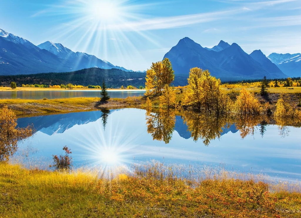
There are many peaks, trails, waterfalls, and other attractions to check out while visiting Abraham Lake.
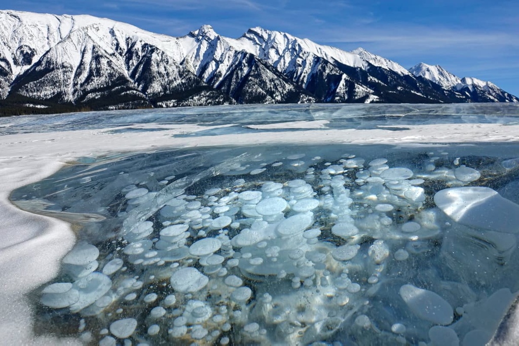
One of the main winter attractions is to see the bubbles frozen in the lake. The bubbles are formed from methane rising from decaying organic material on the lakebed. The stunning visual of the bubbles combined with its gorgeous blue color make Abraham Lake a worthwhile place to visit in the winter months.
Kiska-Willson PLUZ is part of a stunning backcountry wilderness. What makes this part of the wilderness more exciting for many visitors is that they can use their snowmobiles and OHVs in many areas of the park.
The northeast section of the zone is filled with many great trails that can challenge riders, so they are a good way to explore the wilderness area. However, note that there are seasonal restrictions to some trails that limit when motorized vehicles are permitted.
Kiska-Willson PLUZ encompasses the beautiful Abraham Lake and the eastern slopes of the Rockies. The following are some of the cities near the PLUZ that are worth visiting during your trip to the area.
Rocky Mountain House is the largest municipality in Clearwater County. It is home to the municipal offices and the Rocky Mountain House National Historic Site. The town is located on the eastern side of the county and is situated about 130 km (78 mi) to the east of Kiska-Willson PLUZ.
When visiting the provincial parks, public land use zones, or other wilderness areas of Bighorn Backcountry, Rocky Mountain House is usually the final outpost of civilization before you enter the wilderness. The town has accommodations and stores that can supply you with all you need for your upcoming adventure.
Located 300 km (180 mi) to the south of Kiska-Willson PLUZ, Calgary has a vibrant western and mountain culture. While there are many attractions in the city, many locals spend their weekends traveling to the Rocky Mountains for hiking, biking, kayaking, or skiing.

Within the city, hundreds of kilometers of trails connect all the major green spaces and parks from Nose Hill Park in the north, through the parks around the Glenmore Reservoir and down to Fish Creek Provincial Park in the south.
There are many attractions, such as Fort Calgary, the Glenbow Museum, and The National Music Centre – Studio Bell to check out in Calgary. Music and performing arts festivals are held throughout the year in the city, especially during the summer.
The city also hosts the annual Calgary Stampede, which is 10 days of raucous western fun, rodeo, concerts, and a midway with other performances and exhibits.


The highest peak in Kiska/Willson Public Land Use Zone is Mount Ernest Ross, at 2,454 m.
Notable peaks in Kiska/Willson Public Land Use Zone include Mount Ernest Ross, Maze Peak, Shunda Mountain, Coliseum Mountain and Windy Point Ridge Lookout.


