Scan the QR code and open PeakVisor on your phone
The First Range is located in Clearwater County in Alberta, Canada. The range is located about 310 km (186 mi) to the northwest of Calgary, and directly to the east of Banff and Jasper National Parks. There are 29 named mountains in the range, of which Obstruction Mountain (3,205 m/10,515 ft) is the tallest and Night Rider Peak (3,180 m/10,433 ft) is the most prominent.
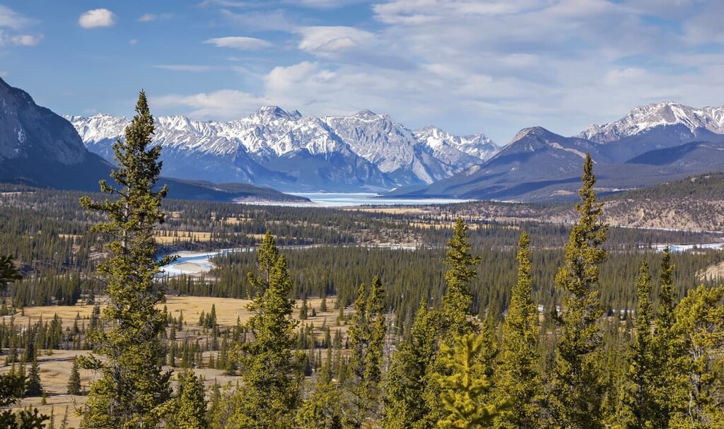
First Range is part of the front ranges of the Rocky Mountains. It is located to the east of Banff and Jasper National Parks, near Abraham Lake. The range covers 1,551 sq. km (582 sq. mi) of terrain and runs roughly northwest in direction from Abraham Lake and the South Saskatchewan River in the south to the Brazeau River in the north.
The range is mainly located in the Job/Cline Public Land Use Zone (Job/Cline PLUZ); however, the western slopes, which form part of the McDonald Creek watershed, are part of White Goat Wilderness. The base of the peaks at the south end of the range, which border Abraham Lake, as well as the southeast corner of the First Range, are part of Kiska/Willson PLUZ.
The First Range is located in Clearwater County, Alberta and is mostly located within the Bighorn Backcountry. Much of the region surrounding and including the First Range are part of a major conservation area that includes the following:
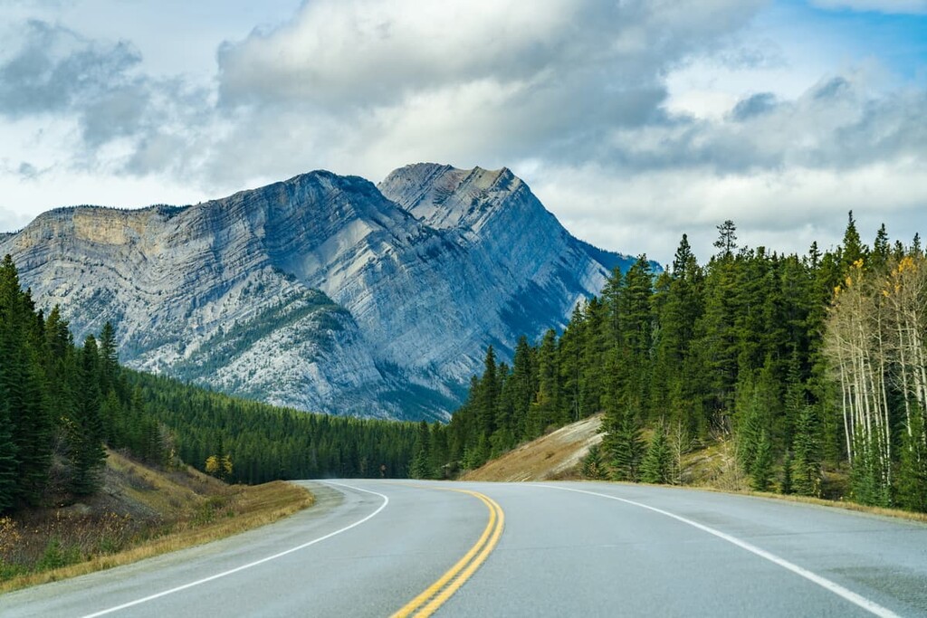
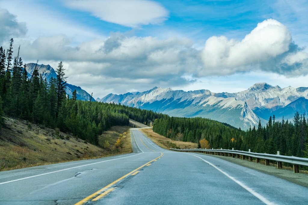
The primary access to the First Range is from the David Thompson Highway (Highway 11). Highway 11 runs east to west and is accessed in the west from Highway 93 (Icefields Parkway) at Saskatchewan River Crossing in the northern end of Banff National Park. From the east, most people access Highway 11 from Highway 2 near Red Deer, Alberta.
The First Range is part of the front ranges of the central Canadian Rocky Mountains. The rocks that make up the range were created 500 million years ago in the shallow sea that once covered the vast area that is now Alberta and British Columbia.
The Rocky Mountains started forming about 75 million years ago and continued to rise over the course of about 45 million years. During the formation of the Rockies, a period called the Laramide orogeny, layers of ancient sediment were compressed and heaved upward. In the Canadian Rockies, layers of durable limestones were stacked in alternating layers with softer sandstones and shales.
These layers of rock experienced differential erosion where some rock layers erode faster than others. This process was one of the many geologic events that created the mountain ranges and valleys in the Rockies. Differential erosion is also partly responsible for the dramatic difference of elevation between the front ranges and the foothills.
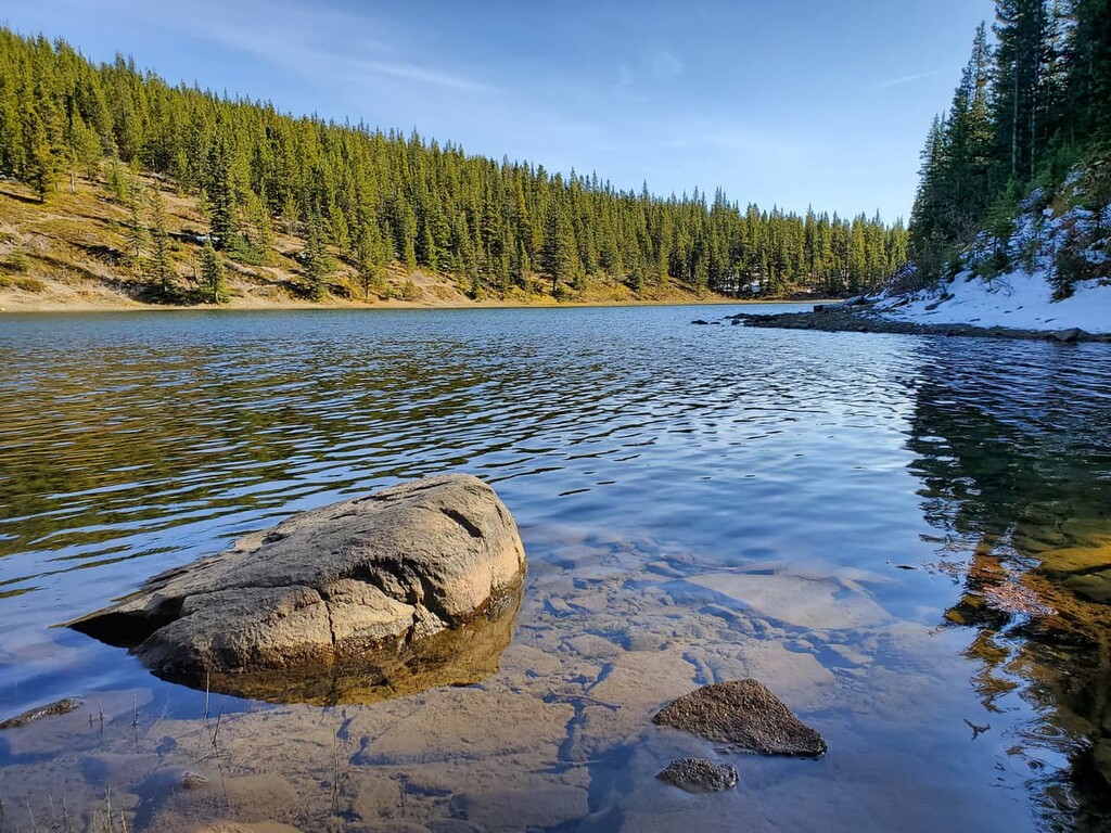
We owe much of the current topography of the First Range to the most recent glacial maximum, which occurred about 25,000 years ago. During the Pleistocene, much of North America was covered in ice sheets and glaciers that were up to 3 km (1.9 mi) thick in some places. The glaciers scoured the landscape, removing massive amounts of rock and creating many topographical features in the process.
When glaciers recede from the slopes of a mountain, they often leave behind a bowl-like depression that is called a cirque. Lakes, called tarns, will sometimes form in a cirque, too. Additionally, glaciers left evidence of their passing in the region in the form of distinct piles of glacial till. Moraines, eskers, and kames are all formations found in the First Range that were created as glaciers deposited the rocks and rubble that they had eroded from the mountains.
The First Range is characterized by two ecologies of the Rocky Mountain Natural Region: the Alpine and Subalpine Natural Regions. The alpine is found in the highest elevations of the mountains, which are above the treeline, and the subalpine is found below the treeline.
The alpine of the First Range is barren, rocky ground. Plants and animals are sparse and consist mainly of lichen covered rocks, grassy meadows, mat vegetation, shrubs, and krummholz. Grouseberry grows in protected areas while sedges and heathers cling to the edges of snowbeds.
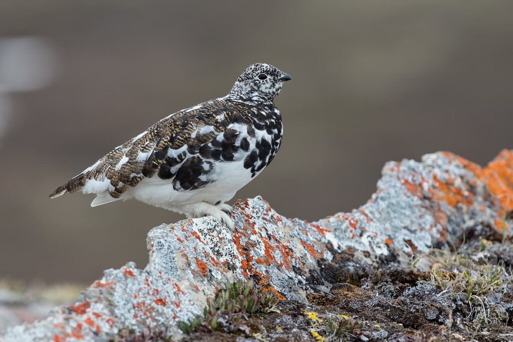
Some birds inhabit the alpine of First Range, including white-tailed ptarmigan, gray-crowned rosy finch, and the horned lark, as well as the American pipit during nesting season. Bighorn sheep and mountain goats are the only large mammals that inhabit the alpine, alongside some smaller mammals that nest in the rocks, such as the hoary marmot and Columbian ground squirrel.
Forests of lodgepole pine dominate the lowest elevations of the PLUZ while subalpine fir, Engelman spruce, and larch are also found at higher elevations and along ridges. The lower elevations are generally a little warmer and they protect the trees from the fierce alpine winds. This allows the trees to grow taller than they would in the alpine.
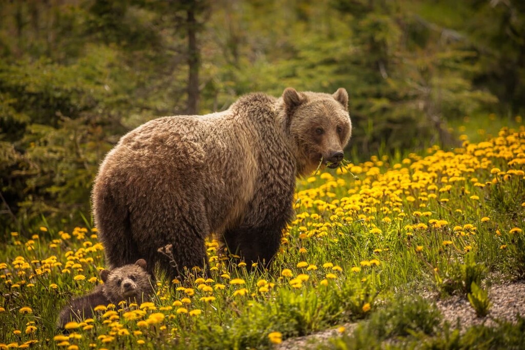
There are many recognizable animals that inhabit the subalpine of the First Range. This includes large predators, such as grizzly bears, black bears, cougars, and wolves. Additionally, ungulates, such as elk, mule deer, white-tailed deer, and mountain sheep, are common in the region.
The First Range is located in the area of an ancient ice-free corridor that once connected what is now Alaska and Yukon to the southern half of North America. About 12,000 years ago, as the region was being released from the glacial ice that had covered it for millennia, groups of people migrated into the area in pursuit of animals such as mastodons, camels, and giant bison.
To the south of the First Range, just across the South Saskatchewan River, the Kootenay Plains Ecological Reserve has remnants of ancient camps as well as sundance lodges that were used by First Nations. To the west in Banff National Park, a 10,000 year old hunting camp was found on the slopes of Mount Edith. There are also culturally significant archaeological sites in the Athabasca Valley in Jasper National Park.
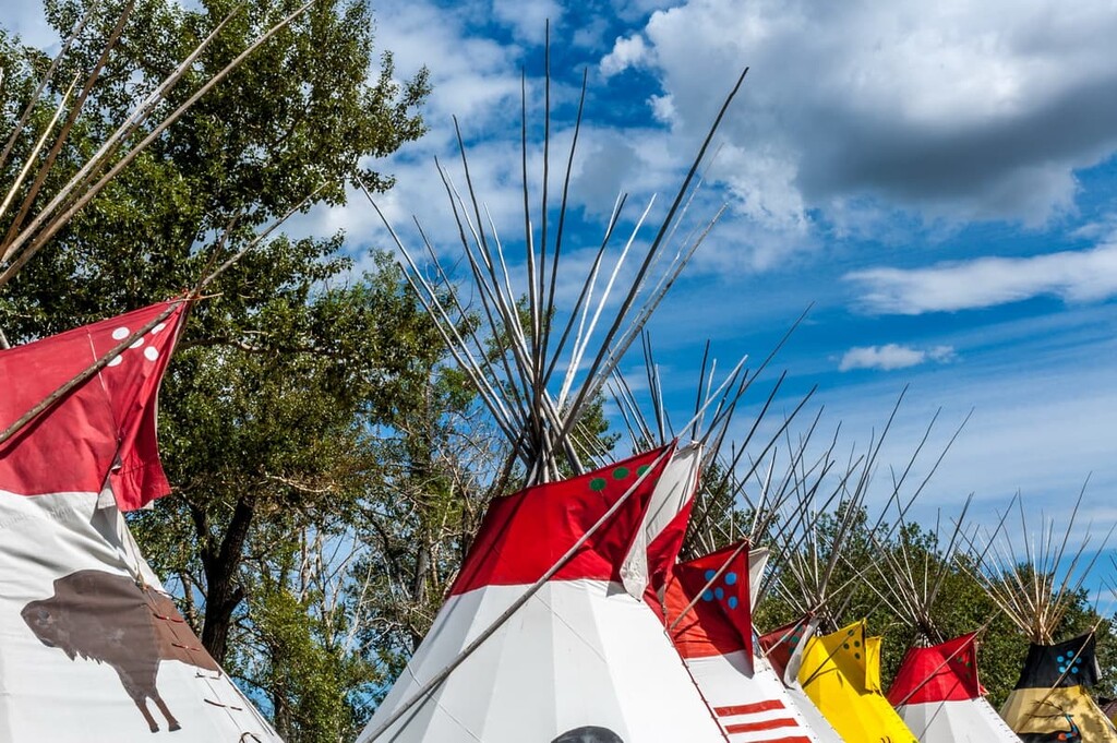
The First Range is the traditional territory of the Cree, Métis, Ktunaxa, Stoney, Tsuu T’ina, and Blackfoot. Among the first Europeans to the area were David Thompson in the early nineteenth century and the Palliser Expedition of 1858.
The land in the range has remained relatively undeveloped over the last hundred years. There are conservation groups working with the public and the government trying to preserve the natural state of the First Range.
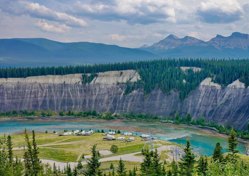
Abraham Lake is located to the south of the range and it has become a popular destination for random wilderness camping and OHV use. In fact, it is the primary attraction for visitors to the range.
With over 1,500 square kilometers (580 square miles) of mountainous wilderness, the First Range has many activities and many interesting and unique areas for visitors to enjoy. Some of the activities in the park include hiking, skiing, equestrian, hunting, fishing, and OHV use. The following are several noteworthy trails and attractions to check out:
The trek to Littlehorn Meadows is a 33.5 km (20 mi) hike that is best done as a backpacking trip over two or more days. The trail is considered difficult and there is elevation gain of 1,887 m (6,189 ft) over the course of the trail.
Most trails in the Job/Cline PLUZ are unmaintained and this one is no exception; however, the adventure of this route is worthwhile. Along the route there are incredible views to behold of the surrounding peaks as well as a meadow at the end of the trail. This trail rewards the brave with an amazing adventure; however, it is a tough trek with overgrown paths, loose rock, and many creek crossings.
The simple 2.6 km (1.5 mi) hike to Whitegoat Falls is good for hikers of most skill levels. There is a moderate elevation gain of only 135 m (442 ft) that leads you to a lookout over the aforementioned falls. There are alternate routes in this area that can take you along the creek if you are feeling adventurous and want to cross the creek on fallen logs.
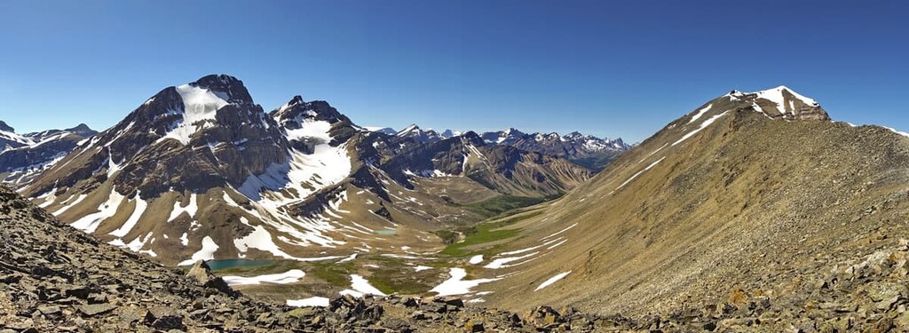
The trail to Allstones Lake and Allstones Ridge is a 10 km (6 mi) out and back trail with 843 (2,765 ft) of elevation gain. Many hikers consider this a difficult trail because it is steep in many sections. Your efforts are rewarded with a visit to Allstones Lake and the opportunity to scramble the final ridge to the top of Allstones Peak. Here, you can enjoy a panoramic view of First Range and the surrounding valleys.
Mount Stelfox has some exciting options for people looking for new ways to explore the First Range.
First, there is a scramble that leads to the summit of Mount Stelfox. The route is about 25 km (15.5 mi) long, requires creek crossings and route finding, and has about 1,450 m (4,756 ft) of elevation gain.
Second, there is a via ferrata route that was installed by local ACMG mountain guides. Guided tours are available and ACMG certified guides can provide instruction on how to ascend the via ferrata. They also provide the necessary safety equipment and lead you up the climb.
“The Fox” via ferrata was the first via ferrata in Alberta’s Rocky Mountains, and it provides spectacular views of Abraham Lake the whole way up. The route is considered to be intermediate in difficulty and a guide is strongly encouraged if you’ve never climbed via ferrata.
The First Range is filled with scenic mountain terrain and hundreds of kilometers of backcountry trails. The range is popular with residents of central Alberta; however, visitors travel great distances to spend some time camping along the shores of the beautiful Abraham Lake. The following are some options for accommodation or the best places to get supplies while on the road.
While visiting the First Range, Rocky Mountain House will likely be the last major town you pass through on your way to the backcountry. The town is located about 130 km (78 mi) to the east of First Range and has stores and accommodations. The town will have any food and gear that you may need for your adventure.
Calgary is located about 350 km (210 mi) southeast of the First Range and it is the largest city in Alberta. Calgary offers a range of accommodations for visitors to choose from, as well as some great local attractions.

One way to enjoy the city is to follow the hundreds of kilometers of paved paths around town, whether along the Bow or Elbow Rivers or to Nose Hill, the Glenmore Reservoir, or Fish Creek Provincial Park. Other nice places for a walk or cycle are at Prince’s Island Park, Bowness Park, and the Inglewood Bird Sanctuary.
While Calgary hosts many festivals and has many cultural attractions, the most famous event is the annual Calgary Stampede, the self-proclaimed “Greatest Outdoor Show on Earth.” Running for 10 days every July, the Stampede has a midway, shows, concerts, rodeo, chuckwagon races, as well as the nightly Grandstand Show and fireworks.
A popular way to visit the First Range for several days or weeks is to pull up and park in the wilderness or to park your car and just start hiking. There is no need for reservations; however, a Public Lands Camping Pass is required and carries a minimal annual fee.
There are many beautiful places along Abraham Lake to camp, which is located at the southern end of the First Range along Highway 11. If you want the convenience of rustic amenities or you’re not confident you’ll find a good camping spot, there are several campgrounds situated on the shores of Abraham Lake for you to choose from.
Random or “Crown Land” camping is a popular pastime of locals, and it’s one of the ways in which we connect with our wilderness spaces. Random camping is how locals refer to camping in the wilderness outside of designated sites, either with a vehicle or hiking.
While random camping, care should certainly be taken to leave no trace and to leave the wilderness in the same or better condition than your arrival. Nevertheless, random backcountry camping while hiking is an exciting way to spend time in this remote wilderness area.