
Scan the QR code and open PeakVisor on your phone
The Municipal District of Bighorn is located northwest of Calgary, in the province of Alberta, Canada. The municipal district contains several hamlets within a vast area of foothills and front ranges of the Canadian Rockies. There are 75 named mountains in the Municipal District of Bighorn, of which, Mount Aylmer (3162m/10,371ft) is the tallest and most prominent.
The Municipal District of Bighorn (MD of Bighorn) is an administrative region that is located between Calgary and Canmore, in the province of Alberta, Canada.
As a municipal district, Bighorn is a large rural area where at least 1,000 people live either in hamlets, farms, or in other unincorporated communities. In Alberta, some municipal districts label themselves as counties, though the terms are officially synonymous in the province. However, municipal districts are distinct from improvement districts, which are much more sparsely populated.
The MD of Bighorn stretches from the Bow River in the south to the Red Deer River in the north, covering the front ranges and foothills. In particular, the MD of Bighorn is located to the south of Clearwater County, and to the west of Mountain View and Rocky View counties. It is also located to the east of the Kananaskis Improvement District and Improvement District No. 9 (Banff).
Banff National Park borders the MD of Bighorn to the west and Kananaskis Country lies south of the Bow River.
The MD of Bighorn also fully encloses Ghost River Wilderness Area and Ghost Public Land Use Zone as regional conservation areas. Additionally, Bighorn contains part of Bow Valley Provincial Park, Bow Valley Wildland Provincial Park, Don Getty Wildland Provincial Park, and several small management zones.
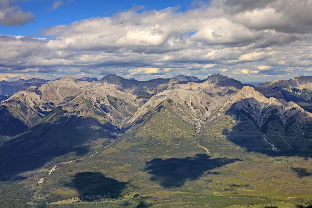
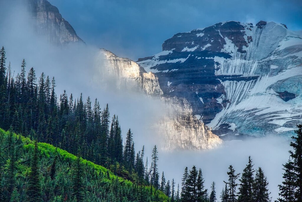
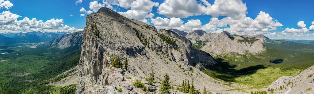
The MD of Bighorn includes several of the front ranges of the Canadian Rockies and their foothills. The McConnell Thrust separates the front ranges from the foothills, running from south of the Bow River to the Athabasca River in the north. Mount Yamnuska, in the Fairholme Range, shows the typical nature of the front ranges with their near vertical slabs of limestone, alternating with shale and sandstone valleys.
Around 75 million years ago, the tectonic plates under the Pacific Ocean collided with the North American plate starting the formation of the Rocky Mountains. The front ranges are the furthest advancement of the Paleozoic limestone throughout the 30 million years it took to create the Rocky Mountains, in a period called the Laramide orogeny.
Possibly due to the friction along the leading edge, the limestone slab was thrust nearly vertical in a repeated process of thrusting up and breaking along thrust faults, creating the vertical faces of the front ranges, such as Mount Yamnuska. In the foothills, the layers of sandstone and shale stacked like shingles on a roof, creating parallel rows of hills extending from the mountains.
The stark contrast of elevation between the front ranges and the foothills is a product of differential erosion. The tough limestone of the mountains was eroded slower than the soft shales and sandstone of the foothills and valleys. Significant erosion was caused by glaciers, with an estimated four glacial maximums covering the mountains with over a kilometer of ice and subsequently eroding the stone.
The front ranges likely advanced several kilometers further west and were possibly more than 1000m (3300ft) taller when originally formed. Only the features from the most recent glacial maximum during the Pleistocene epoch, which ended about 11,000 years ago, are visible today.
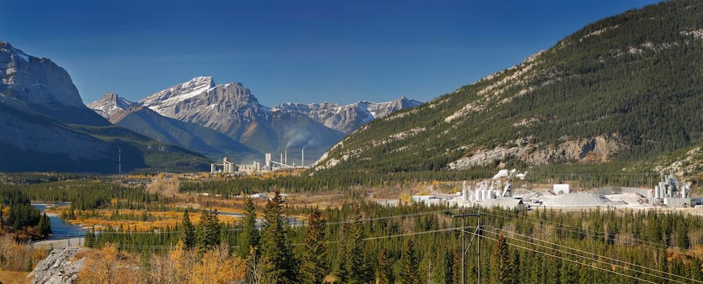
Mining and processing operations for lime, limestone products, magnesite, and magnesium compounds have been taking place in the MD of Bighorn for over 100 years. These operations have been centralized around the Hamlet of Exshaw.
Major peaks in the municipal district include Mount Aylmer, Revenant Mountain, Apparition Mountain, Devil’s Head, and Mount Costigan.
The MD of Bighorn contains two major ecological regions: the Rocky Mountains Natural Region and the Foothills Natural Region. The following is a brief introduction to the ecology of each of these regions.
Consisting of the alpine, subalpine, and montane sub-regions, the Rocky Mountain Natural Region extends from the valleys to the mountain peaks. The alpine region is the cold and seemingly barren rocks and peaks above the tree line. Typically, only small, hardy plants, such as lichens, sedges, and low-growing shrubs can grow in the alpine area.
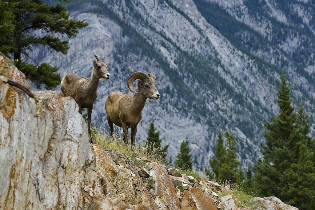
Several bird species nest in the rocky peaks, while some mammals such as the Columbian ground squirrel, pika, hoary marmot, mountain goat, and bighorn sheep will use habitat in the alpine and subalpine.
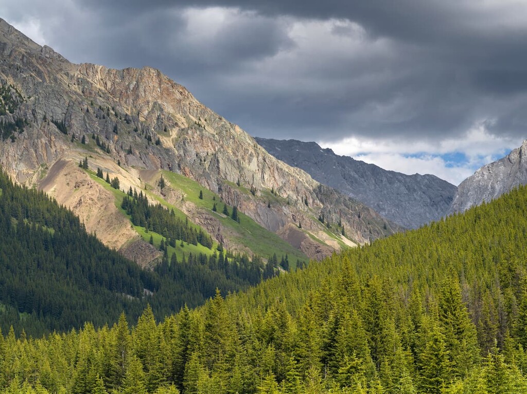
The subalpine region consists of the forests and meadows on the mountain slopes. The upper slopes are generally covered with forests of Engelmann spruce and subalpine fir, while lodgepole pine forests cover the lower slopes. Herb-rich meadows are interspersed with larch forests, and mixed spruce and fir forests at the higher altitudes. The subalpine region provides important habitat to large mammals such as grizzly bears, black bears, and cougars.
The montane region covers the lowest slopes and the mountain valleys and has the greatest diversity of flora and fauna out of all the Rocky Mountain Natural Regions. Ungulates, such as moose, elk, deer, and bighorn sheep will use this region like a highway to migrate through the ranges, and, naturally, predators follow.
Forests in this region are filled with lodgepole pine, Douglas fir, aspen, and white spruce. The montane region is among the warmest ecological zones in Alberta, making it possible for many rare plant and animal species to thrive there.
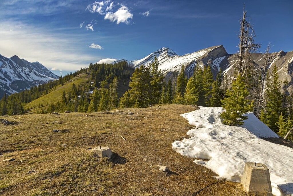
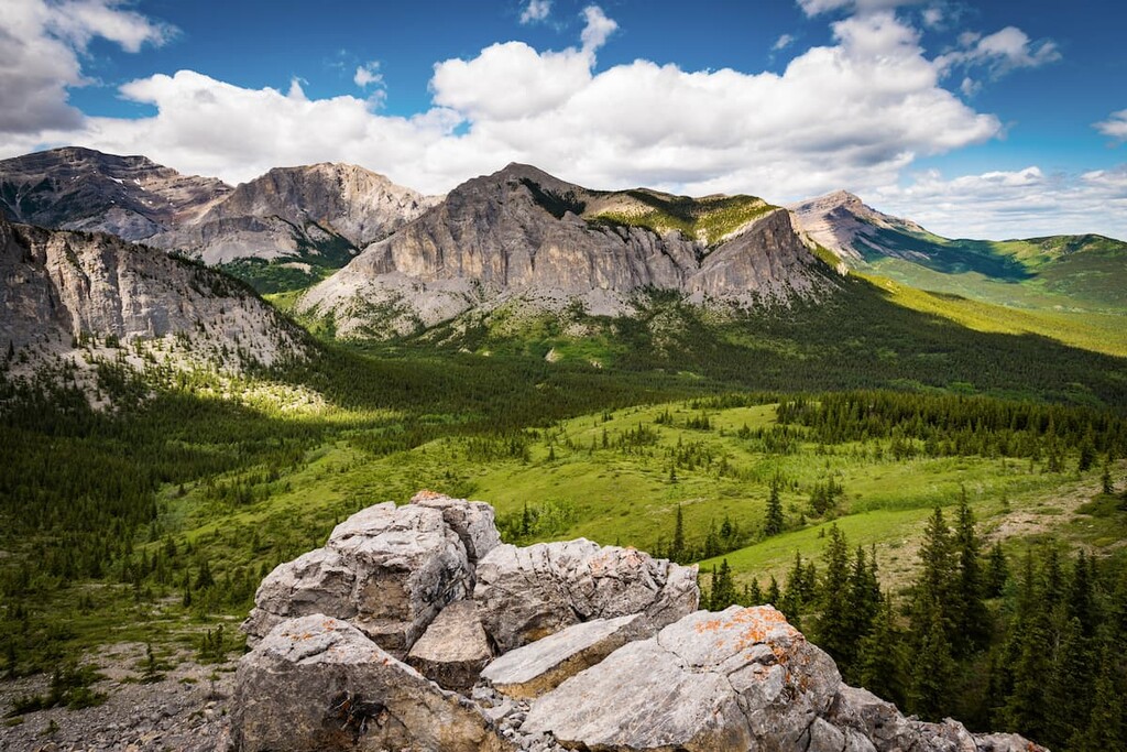
In the MD of Bighorn, the Foothills Natural Region is the transition area from mountain peaks to rolling prairie grasslands. Forests of aspen, lodgepole pine, white and black spruce, and balsam poplar cover steep hills to provide shelter to animals and create the most productive logging of the area.
The animals from the bordering montane and subalpine regions also inhabit the foothills region, with deer, elk and caribou grazing the native rangeland.
Beavers play an important role in the foothills region creating dams and ponds. The Barrow’s goldeneye and trumpeter swan are specific beneficiaries of the beaver-made habitats, and a large variety of songbirds and mammals are found in the meadows and wetlands around the beaver ponds.
Evidence of human use and habitation of the area dates back over 8,000 years. Archaeological studies indicate that the area has been continuously inhabited for the past 7,000 years. The MD of Bighorn is traditional territory of the Tsuu T’ina, Stoney, Ktunaxa amakis, and Blackfoot/Niisitapi nations. There is currently a Stoney Nakoda Nation reserve that borders the district.
A myth outlined in Book of the Hopi by Frank Waters, describes how a clan from the Hopi Tribe of Arizona travelled north to a land of ice and rock. Between 500 and 1300 CE, petroglyphs were drawn on the canyon walls of Grotto Canyon, including an image of the “flute player”, Kokapelli from Hopi culture. Dr. Marty Magne, an archeologist with Parks Canada suggests that the petroglyphs found in Grotto Canyon are evidence that the Hopi clan travelled at least as far as Grotto Canyon and left this depiction of their travels and culture.
The first Europeans to enter the area were possibly the explorer David Thompson accompanied by Duncan MacGillivray, for whom Mount McGillivray was given its English-langauge name. Their records indicate that they entered what is now the Hamlet of Exshaw on November 30, 1800. It took about a hundred years after Europeans first entered the valley for major industrialization to begin.
The Brewster family immigrated from Ireland and started homesteading in the late 1800s. The family formed Banff’s first dairy, and their ranch was used for cattle when they had to remove them from Banff National Park during winter.
By the 1920s, their homestead had evolved into a guest ranch and at times, it housed over 600 horses to service their outfitting and carriage services. The ranch is currently known as Brewsters Kananaskis Ranch and Guesthouse, and it has both a golf course and facilities that make it a popular wedding location.
Western Canada Cement and Coal Company opened along the Bow River in 1906 and the site is now occupied by the LaFarge cement plant. Further mining operations by Graymont for lime and limestone products, and Baymag opened a magnesium oxide plant importing ore from their mines in the Blue Range in British Columbia and other locations. Industry has not spread through the district and has remained concentrated near Exshaw for over 100 years.
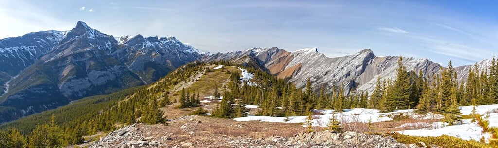
The MD of Bighorn covers a large area of the front mountain ranges as well as foothills. There are many popular hiking trails as well as areas for off-highway vehicle use. The following are some trails and areas that let you explore the history of the region.
The trail follows Jura Creek between Exshaw Mountain and Door Jamb Mountain for about 3.5 km (2 mi) to the “false fault”, a prominent black shale outcrop initially believed to be of Jurassic age of the Mesozoic. The creek was named after the Jurassic stone; however, the formation was later identified as late Devonian and Carboniferous/ Mississippian from the Paleozoic era.
Despite the misnomer, the trail can be exciting and educational to hike. With options to scramble along the creek or follow trails along the ridge, the hike can be done year-round. The trail through the canyon has you crossing deep pools by traversing fallen logs, trying to stay dry and out of the stream. Once at the “false fault”, you will see the black shale outcrop from the Devonian.
At the “false fault”, geologists have discovered bone fragments from arthrodires, a type of 10 m (33 ft) long armored fish. A layer of ash from the Mount Mazama eruption in what is now Oregon is located about 1 meter (3 ft) above the black shale.
Further along the trail there are bathtub-like pools that the water flows through and traces of orthocone cephalopod fossils throughout the canyon. The trail continues through the end of the canyon to the flat creek bed and accesses further hiking trails and scrambles
The trail to Mockingbird Lookout is 3 km (1.8 mi) up a fire road, with an elevation gain of 354 m (1,160 ft). From the summit, you get a 360 degree view of the surrounding foothills and into the Fairholme Range.
Mockingbird Hill was named in the 1950s by the crew that was surveying the area for a new fire lookout to replace the aging one on Black Rock Mountain. Speculation has it that the song “Mockin’ Bird Hill” was playing on the radio during the survey, leading the men to name the hill after the song.
The trail itself is rather unremarkable; however, 360-degree panoramic view from the top, berry bushes along the trail, relative ease of the hike, and close proximity to Calgary make it a solid family hike.
Standing as a sentinel over the entrance to the Bow Valley, Mount Yamnuska (Mount John Laurie) is one of the more recognizable mountains in the area. The Stoney aptly named the mountain “Iyamnathka,” which can translate to “flat mountain”.
The mountain was officially renamed Mount John Laurie in 1961 at the request of the Stoney Nakoda First Nation, for Laurie’s work promoting the causes of First Nations people. Locally, it is referred to as Mount Yamnuska.
There are several hikes that lead up the mountain, including a scramble that will take you across the ridge. The popular day hike up the mountain ends on the east side, called Raven’s End. There are many hikes in the meadows, around the lakes at the base of the mountain, and a trail that leads completely around the base of Mount Yamnuska to access the valley behind the mountain and other trails that lead north.
In addition to the traditional hiking trails and the scramble across the ridge, Mount Yamnuska has over 130 published climbing routes. The climbing routes are rated at 5.8 and up, including an 8 pitch, 5.13a called Yamabushi which Will Gadd spent seven years completing. Among the peaks and meadows, or up the wall, there are sights to be seen and adventures to be had.
Due to its proximity to Calgary and Canmore, the trails on Mount Yamnuska are very accessible and quite popular. There are many different trails in the area including easy meadow walks, scrambles, and sport climbing. However, many seemingly innocuous dangers, like scree slopes and exposure are dangerous, and visitors are reminded and strongly encouraged to only hike, scramble, and climb within their abilities. Improper equipment, risk assessment, and navigation have played parts in recent tragedies on the mountain.
Looking for a place to stay during your trip to the Municipal District of Bighorn? Here are some of the best places to stay both within the district and in the general region:
Located along the Bow River, Calgary is just a 50 minute drive from the MD of Bighorn. Calgary is often viewed as a gateway city into the Rocky Mountains, and a popular place to start mountain adventures.
WIth an international airport, many visitors are shuttled straight out to Canmore and Banff, missing all of what Calgary has to offer. Calgary hosts rock and pop concerts, musicals, opera, plays, and the symphony in venues across the city. Cultural celebrations take place throughout the year and other popular events include Shakespeare in the Park, Spruce Meadows equine events, and the world famous Calgary Stampede.
Calgary shares a mixed mountain and cowboy culture with many facilities and services that cater to mountain and cowboy adventures. Winsport offers skiing in the winter, and mountain biking and downhill go-karts in the summer. Outfitting and trail ride companies that will lead you by horse through the mountains or prairies. Rock climbing gyms are located across the city, and there is one gym that has a large outdoor climbing wall that’s visible from Highway 1 as you head in from the mountains.

Cyclists and hikers can enjoy the large nature parks of Fish Creek Provincial Park and Nose Hill Park within the city limits. There is also a network of paved trails that connect and access nearly every city park and natural area. Calgary has a lot to offer; however, its proximity to the Canadian Rockies is appreciated and a highlight for many residents.
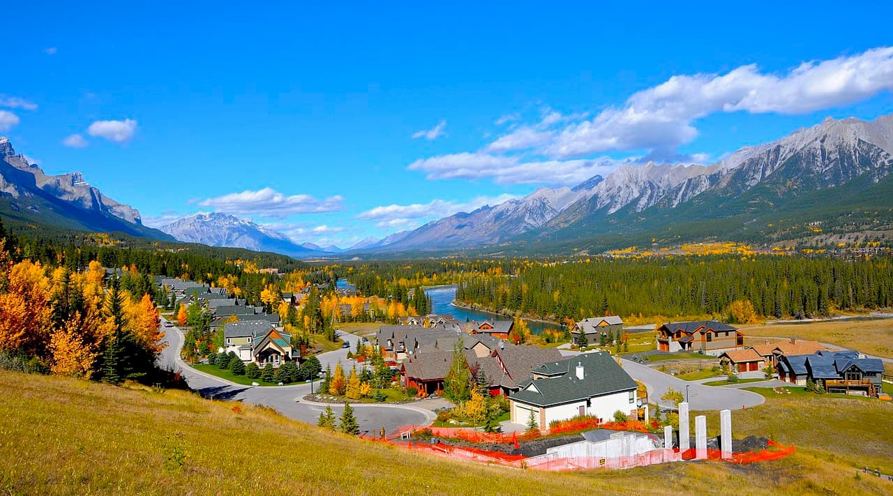
The only major town within the MD of Bighorn, Canmore has grown from the banks of the Bow River up the mountain slopes. What started as a coal mining settlement in the 1800s, Canmore is now a popular resort town with easy access to mountain parks and recreation areas.
Canmore is home to the Alpine Club of Canada and there are many popular trailheads on the edge of town. A popular scramble starts near the Alpine Club and goes up Grotto Mountain to a spectacular view of Canmore and the Bow Valley.
The snow-filled months are typically the busiest months in Canmore, as it is a wonderful tourist town for the surrounding ski resorts, such as Sunshine and Lake Louise, and cross-country skiing at Canmore Nordic Center Provincial Park. However, there are many opportunities for adventure near Canmore the rest of the year hiking, biking, scrambling, climbing, wildlife viewing, bird watching, kayaking, canoeing, and mountaineering.
Located west of Bighorn, in Banff National Park, Banff is famous for majestic mountain views and the Cave and Basin Hot Springs. Banff was originally settled along the Canadian Pacific Railway line as a tourist destination catering to the early mountaineers and alpine explorers.
Canadian Pacific Railway built the castle-like Fairmont Banff Springs Hotel as well as Chateau Lake Louise, at nearby Lake Louise. Banff has remained a popular destination for over a century catering to mountain adventures, and offering luxurious accommodations and amenities.
While Banff is certainly popular as a ski resort in the winter, most tourists visit the town during summer. Spring is a beautiful time to visit too; however, my personal favorite time to visit is during the fall. This is when the mountains are covered in hues of red, orange, and gold, and the larch trees stand as beacons along the ridges.


