
Scan the QR code and open PeakVisor on your phone
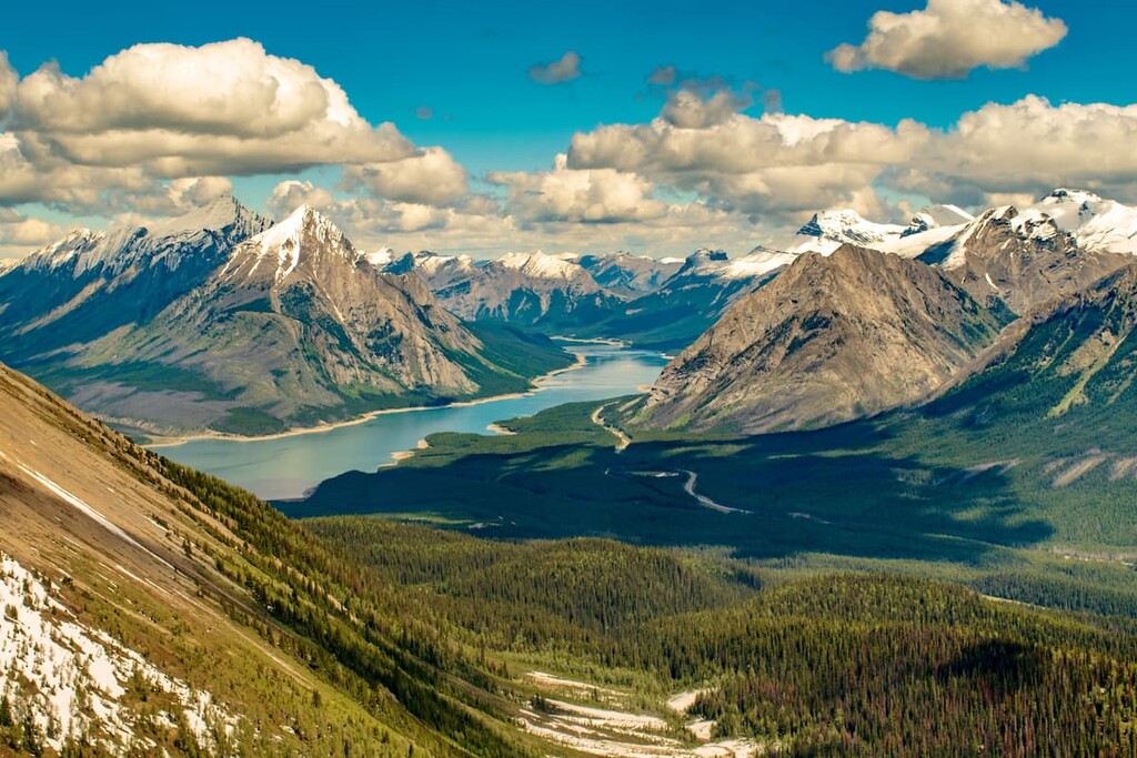
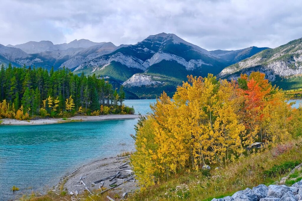
The Blue Range is a remote mountain range located at the southern tip of Banff National Park. The range straddles both the continental divide and the Alberta–British Columbia border in Canada, offering exceptional backcountry hiking and extended backpacking opportunities. It contains 11 named peaks, the tallest of which is Mount Alcantara (3029m/9938ft).
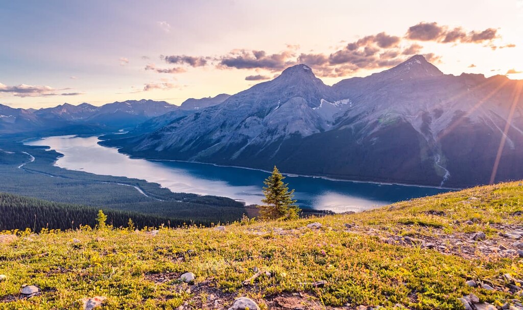
The Blue Range is located south of Mount Assiniboine Provincial Park and east of Radium Hot Springs. It is partially located in Banff National Park.
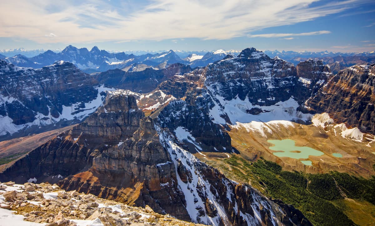
Within the range, there are 11 named peaks lying roughly in a west to east orientation. The eastern mountains of the range are in the southern tip of Banff National Park, while the western mountains are in the Regional District of East Kootenay.
The closest towns are Radium Hot Springs and Canmore. Two trails access the range from the west out of British Columbia: the White Man Pass Trail and the Marvel Pass Trail, both of which are accessible east of Radium Hot Springs and Highway 93.
To enter the Blue Range from the west, the closest access point is from Canmore to the southern tip of the Spray Lakes off Highway 742 (the Smith-Dorrien / Spray Trail Road), located in Spray Valley Provincial Park. The trail leads west from the Mount Shark trailhead and meets up with the Palliser Pass Trail and the Bryant Creek Trail. These trails can meet up with the aforementioned White Man Pass Trail and Marvel Pass Trail to give you access to the range.
The Blue Range is surrounded by protected areas, including Mount Assiniboine Provincial Park and Banff National Park to the north. To the south of the Blue Range are Height of the Rockies Provincial Park and Peter Lougheed Provincial Park. Furthermore, Spray Valley Provincial Park is located to the east.
Interestingly, precipitation in the range flows into two different oceans. In particular, precipitation that falls to west of the Alberta–British Columbia border flows to the Pacific Ocean via the Mackenzie River Basin. Precipitation that falls to the east of the border, on the other hand flows to Hudson Bay via the Saskatchewan River Basin.
The Blue Range of mountains sits between the Vermillion Range and Sundance Range to the north, and the Kananaskis Range and Spray Mountains to the south. They lie on the western edge of the Rocky Mountains along the Rocky Mountain Trench. The creation of this range is typical of the rest of Canadian Rocky Mountains.
This range is formed from layers of sedimentary rock that were laid down during the Precambrian and Jurassic periods. Between 80 and 35 million years ago the sedimentary rock was pushed east over younger rocks during what is called the Laramide orogeny. This orogeny was the millions of years long event that created the Rocky Mountains.
Most of the rocks are limestone, shale, and dolomite. Within the Blue Range there are exceptional bands of purple and red shale. Red Man Mountain is named for the large amounts of red shale present and in a juxtaposition to the nearby, paler, White Man Mountain.

Much of the topography and features of the range were influenced by the retreating glaciers during the Pleistocene Epoch. The glaciers moved massive amounts of rock, carving away mountainsides, to then leave the debris in ridges and mounds as the glaciers retreated.
Magnesite is mined and extracted from Mount Brussilof, located on the western side of the range. Through metamorphism, magnesium-rich rock and carbonate rocks were altered to form magnesite, which is used as a gem and in industry. The current operation uses open-pit mining to extract the magnesite.
Major peaks in the range include Mount Alcantara, Mount Brussilof, Mount Byng, Red Man Mountain, Mount Currie, and Marvel Peak.
The Blue Range is part of the Alpine and Subalpine Natural Regions of the Canadian Rocky Mountains. These regions are defined by mountains, high foothills, and deep glacial valleys. They have short, cool summers and cold, snowy winters. The areas above the tree line are considered part of the alpine region, while the subalpine region is located below the tree line.
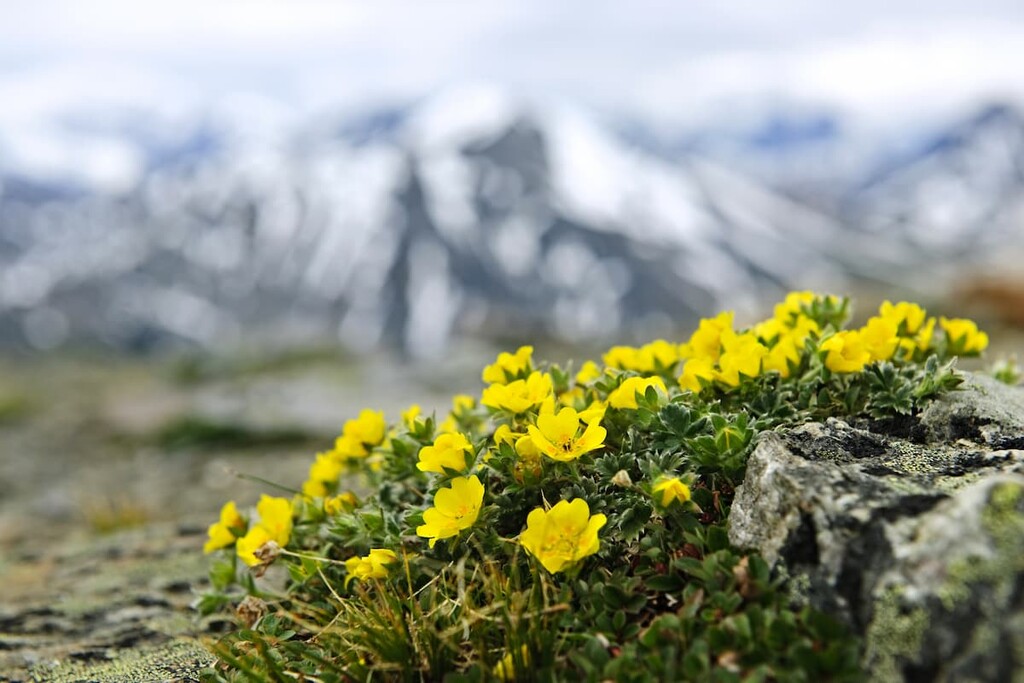
Plant life is sparse in the alpine region, but what does grow there is tenacious and hardy. Sedge communities will cling around snowbeds while heathers, mountain heather, and grouseberry will grow in protected areas. Small patches of Alaska harebell can even be found along windswept ridges and the steepest slopes.
Where tree cover exists at these altitudes, it is usually stunted and sparse and consists primarily of subalpine fir and Engelman spruce. Large mammals may cross alpine regions as part of their migration; however, they don’t typically linger. The white-tailed ptarmigan, gray-crowned rosy finch, horned lark, and American pipit are found only in alpine habitats during nesting season but have a broader range the rest of the year.
Below the tree line there is expectedly more flora and fauna. Engelmann spruce and subalpine fir grow in open stands upon the mountains. Dense lodgepole pine forests inhabit the lower altitudes. Whitebark pine can occasionally be found at high elevations and subalpine larch will crest the tree line.
Buffalo-berry, grouseberry, and five-leaved bramble are common undergrowth in the subalpine forests. Stands of dwarf birch and willow are common to moister sites.
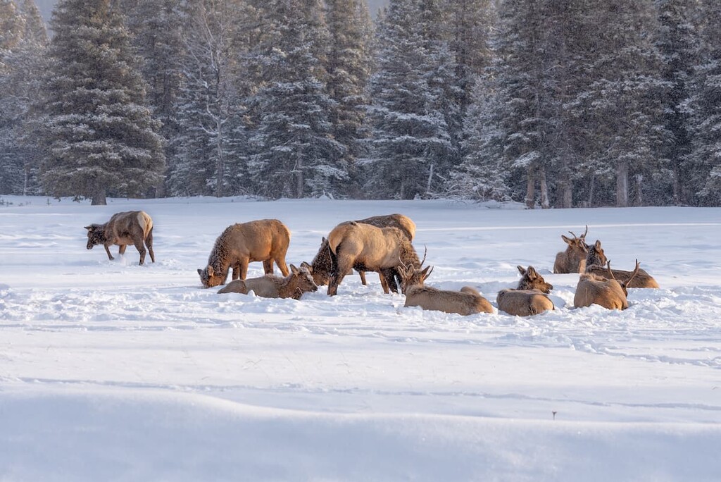
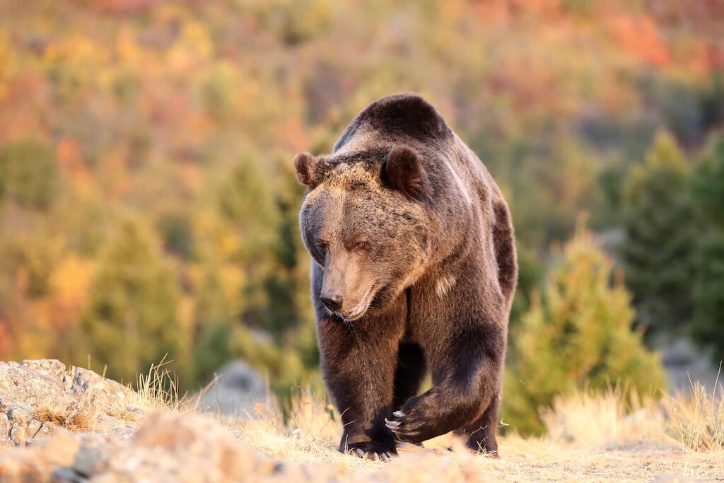
The forests and meadows of the subalpine natural region are home to many large animals, including; elk, grizzly bears, black bears, deer, mountain goats, mountain sheep, wolves, and cougars. Wet meadows and streamside shrubbery provide habitat to small mammals such as; long-tailed vole, northern bog lemming, and heather vole.
Human use and habitation of the area began thousands of years ago. The park is part of the traditional territory of the Tsuu T’ina, Stoney, Ktunaxa Amakis, and Blackfoot/Niisitapi nations. These nations used the Blue Range for hunting and many nations had trade routes that crossed the range.
Mapping of the prairies and southern Canadian Rocky Mountains by people of European descent was led by Captain John Palliser. The Palliser Expedition sent men to map Waterton, the Bow Valley, Kicking Horse Pass, and the North Saskatchewan and Athabasca River regions from 1857 to 1860.
It was Palliser himself who travelled to the headwaters of the Kananaskis River and then down the Palliser River to the Kootenay River. His expeditions produced some of the first European-made maps of these mountain areas and named many of the mountains and features as well. Though not the first European to travel the Blue Range, he is credited with producing some high-quality early maps of the region.
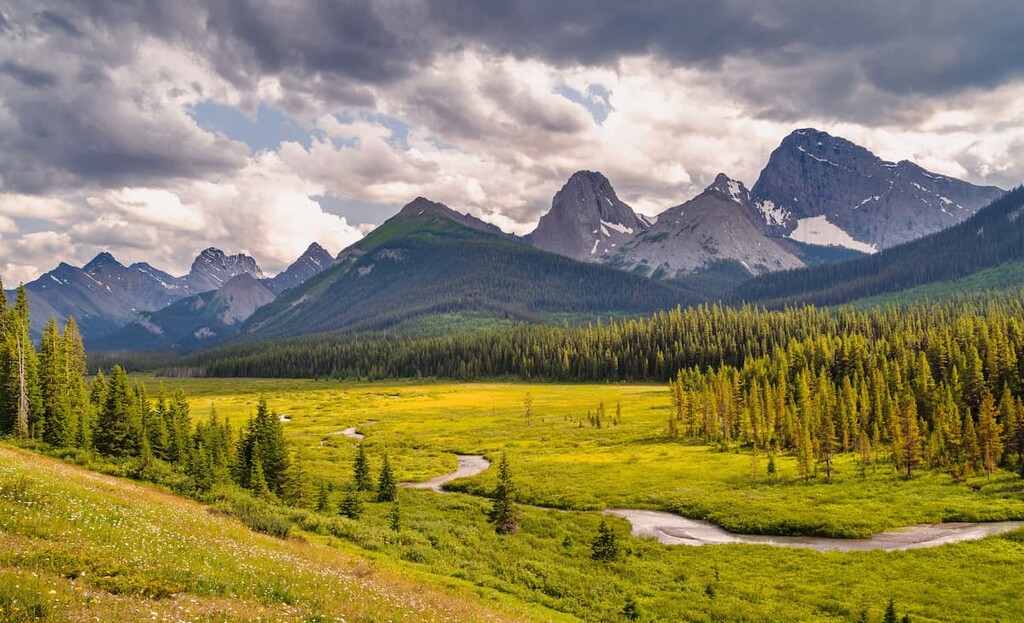
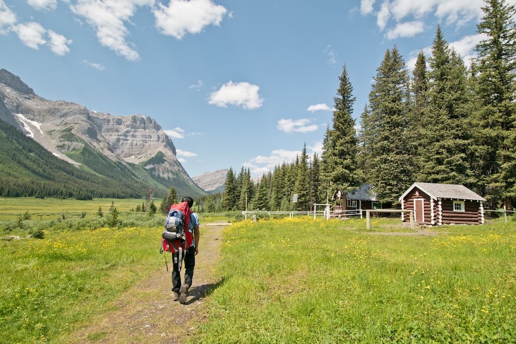
The Blue Range offers many opportunities for hiking and camping. This remote area offers unique wilderness experiences. The following are the main trails that access this range.
White Man Pass (2149 m / 7050 ft) was given its English-language name by Captain Palliser in 1858. Palliser named it White Man Pass after conversing with a member of a local First Nation who described how years earlier, Europeans, or “white man” had come that way for the first time. This could have been a reference to either James Sinclair and his group of Red River immigrants who were led through this pass in 1841, or Father Jean de Smet who used this pass in 1845.
This pass is also known as Cross Pass, because in 1845 when Father Jean de Smet crossed this pass, he built a “Cross of Peace” at the summit of the pass where the waters run west to the Cross River and east to the Spray River. Though the cross can no longer be found, the Stoney language word for the Cross River, Tsha-kooap-te-wap-ta, alludes to the cross erected near the river.
From the west, the current trail is well developed and leads along the scenic Upper Cross River into Banff National Park. The pass is 5.5 km (3.4 mi) from the trailhead on the north side of the river. There is an elevation gain of 580 m (1,905 ft) before arriving at the pass.
From there you can see across Banff National Park and into the Spray River Valley, or look back towards the Kootenay Region. Red Man Mountain rises to the north of the pass and White Man Mountain to the south.
White Man Pass Trail will take you across the continental divide and into another province. It connects to some incredible trails in Banff National Park. There is some significant elevation gain; however the relatively untouched landscape that you can experience from following this trail and the relative seclusion and the remoteness makes for amazing expedition potential.
Like many mountains in Kananaskis Country, Marvel Peak and its similarly named Marvel Pass were named after a ship involved in the Battle of Jutland, the only major sea battle of the First World War. In 1917, the peak was named after the destroyer, HMS Marvel. An alternative view, like Wonder Peak, to the north, is that the name is descriptive. With that in mind, this trail will not disappoint.
Marvel Pass Trail is a gateway to some spectacular destinations in the Rockies. At 6.7 km (4.2 mi) and 770 m (2,526 ft) of elevation gain, Marvel Pass will take some effort, but that effort will be rewarded. From the pass you have access to the Mount Assiniboine Provincial Park, Lake Magog, and Wonder Pass. However, the Marvel Pass Trail holds its own as a fantastic hike.
With incredible views before you even reach the trailhead, the views continue to expand and change as you work your way up the valley to the pass. Entering the forest and crossing the Aurora Creek several times by bridge, you get to enjoy the sweet smells, sights, and sounds of a wonderful hike.
As you continue up the valley, the trail will split and you stay to the right and continue through the larch forest. When the trail becomes difficult to follow, look for the cairns to guide you. As you leave the forest and enter the first of the meadows, you’ll see Mount Alcantara (the tallest mountain in the Blue Range) to the southwest and Eon Mountain to the northwest.
Pick up the trail at the end of the meadow and follow the cairns to help guide you. Continue on to the next meadow, where you will discover a stream and seasonal wildflowers. From there you can climb up to a small lake at Marvel Pass and another 4.4 km (2.7 mi) will take you to the headwaters of Marvel Creek and down to Marvel Lake.
The pass sits upon the continental divide and you can see Marvel Peak, standing rather alone in the middle of the valleys. If you choose to descend, you will enter Alberta as well as prime grizzly bear habitat.
Though Palliser Pass Trail doesn’t actually go through the Blue Range, it’s worth mentioning because it’s one of the few ways to enter or leave the range to the west. The Palliser Pass Trail follows the Spray River valley from Trail Center Junction in the north to Burstall Pass in the south.
If you’ve taken the White Man Pass trail over the continental divide, the trails come to a junction south of Mount Currie. Once on the Palliser Pass Trail, your shortest option to return to civilization is to head north to the Spray Lakes.
If you’re not ready to return home, the Palliser Pass Trail provides many options for day hikes. One could spend days and weeks exploring this incredible backcountry trail. The views are stunning, and the wildlife is close.
Like the Palliser Pass Trail, the Bryant Creek Trail doesn’t go through the Blue Range; however, if you went through Marvel Pass into Alberta, it’s the Bryant Creek Trail that will take you out of the backcountry.
Known for being the most direct access to Mount Assiniboine Provincial Park, the Bryant Creek Trail offers some wonders of its own. The shelters and campgrounds located in the valley give you easy access to Owl and Marvel Lake. Wonder Pass, Assiniboine Pass and Allenby Pass are all accessible from the camps.
Bryant Creek Trail offers access to some of the most notable views in the national and provincial parks. It’s one of the few ways to actually access some of these spectacular backcountry experiences.
The Blue Range is fairly isolated from major cities and towns. While Radium Hot Springs is close enough to allow day trips into the range, access from the Alberta side requires more hiking. Here’s what you need to know:
Located in Banff National Park and home to the famous Cave and Basin Hot Springs, Banff offers plenty of lodging and a unique mountain lifestyle experience. With amazing mountain views from the streets, like the iconic East End of Rundle (EEOR), and sites like the world class Fairmont Banff Springs Hotel, Banff offers a first class mountain experience.
From Banff, mountain trails, peaks, and phenomenal views are easily accessible on a day trip. After your trip, you can return to your luxurious lodging and end your day in one of the many spas, where you can enjoy a relaxing massage.
Being an amazing town to visit and see, it does get busy in the summer and winter seasons. Spring and fall offer a time when the trails and sidewalks are less busy, and fall is the time when you can witness the incredible changing colors of the larch trees along the mountain ridges.

Since the town is situated within a national park, wildlife sightings are to be expected. It isn’t uncommon to see elk roam the townsite.
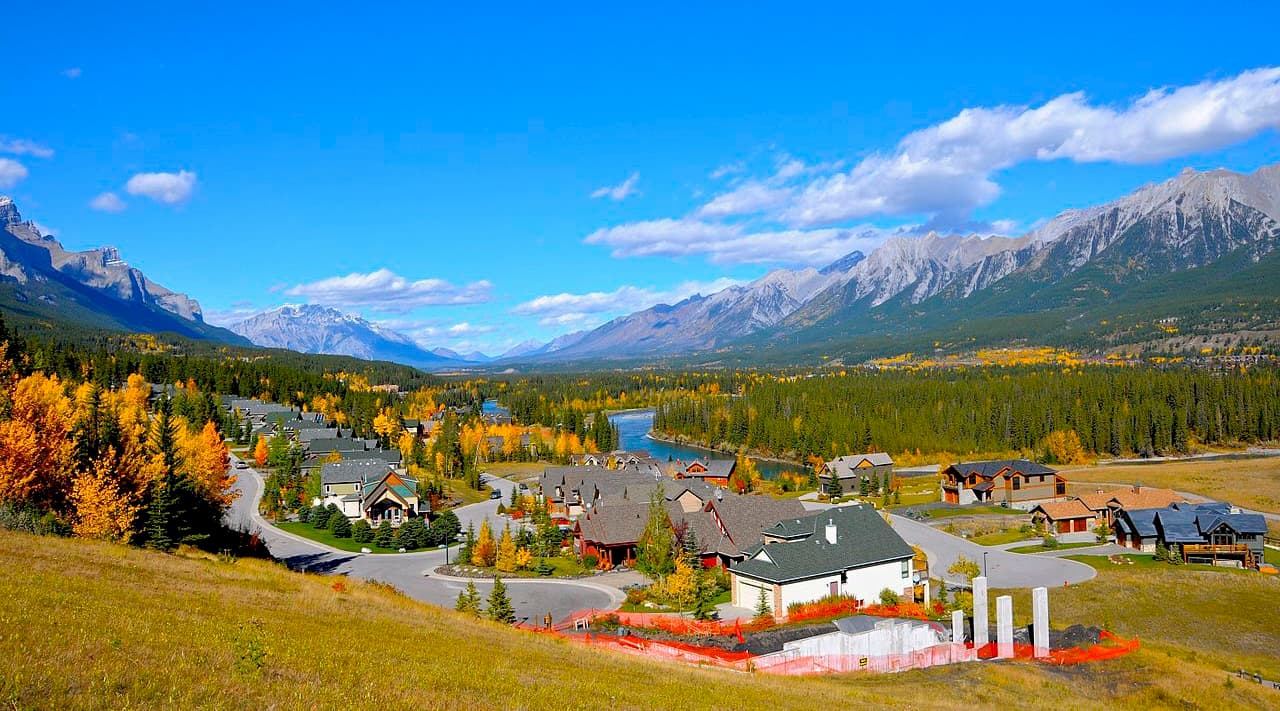
Nestled in the heart of the Bow Valley, Canmore, like many towns along the mountain railway, started as a coal mining settlement. It is located near the western edge of Banff National Park, so it’s a nice place to visit if you’re interested in checking out alternative fun destinations in the region.
Canmore provides easy access to hiking trails like Ha Ling Peak, Chester Lake and Grotto Canyon. In addition to hiking, Canmore offers ample opportunity for road and mountain biking. The snow-filled months are typically the busiest months in Canmore, as it is a wonderful tourist town for the surrounding ski resorts, such as Sunshine and Lake Louise.
Found at the junction of Highway 93 and Highway 95 in British Columbia, Radium Hot Springs is a small village named after the nearby springs in Kootenay National Park.
Located just south of Kootenay National Park, Radium Hot Springs is located in the geological formation known as the Rocky Mountain Trench. This valley, which is visible from space, separates the Rocky Mountains in the east from the Columbia Mountains to the west. The trench is also known as the Valley of a Thousand Peaks.
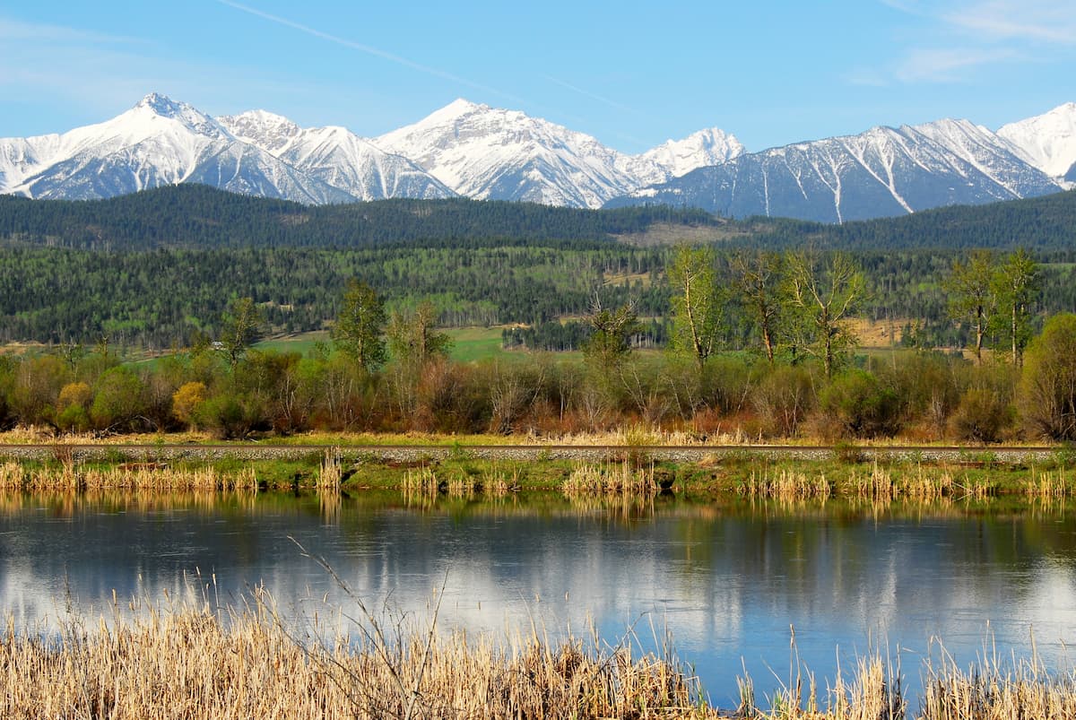
Situated in this valley, Radium Hot Springs has doorstep access to incredible mountain scenery, wildlife, and excursions. Some of the notable hikes in the area include Kootenay National Park, The Old Coach Trail, and Sinclair Canyon Trails.
Located 26 km (16 mi) south of Highway 1 on Highway 40, Kananaskis Village is an unincorporated community in the heart of Kananaskis Country. Accommodations in the community range from modest hostels to the more luxurious Kananaskis Lodge.
In Kananaskis Village, there are stores to buy supplies, food, and rent equipment. Kananaskis Village is also located at the base of the Nakiska Ski Hill, which is a great place to visit during the winter months.
Kananaskis Village offers hikes right outside your door, such as Ribbon Lake and Troll Falls. It is a starting point for many groomed cross-country ski trails in the winter and it is the closest lodging to much of the backcountry ski destinations in Peter Lougheed Provincial Park to the south.
The Kananaskis Country Golf Course is also located just south of Kananaskis Village. It was recently rebuilt after the 2013 floods that changed the face of much of Kananaskis Country. Since the fairways create enticing meadows, wildlife sightings are common. So, carry bear spray when golfing. Either way, whether you’re interested in golfing or wildlife sightings, it’s well worth a visit.


