
Scan the QR code and open PeakVisor on your phone
Spanning the border of Alberta and British Columbia in western Canada, the Spray Mountains are one of the southern continental ranges of the Canadian Rocky Mountains. The range has 47 named mountains, of which the highest and most prominent is Mount Sir Douglas (3406m / 11,171ft). Other notable mountains in the range include Mount Jellico, Mount Lyautey, and Mount Indefatigable.
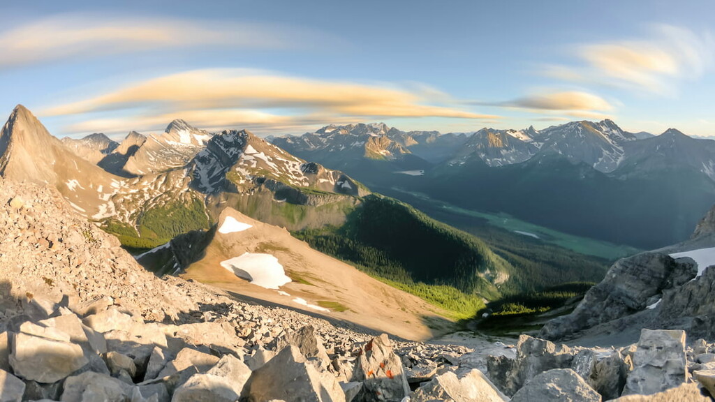
The Spray Mountains run from the Spray Lakes reservoir in the north to the western shores of the Kananaskis Lakes in the south. The range spans three provincial parks, Spray Valley Provincial Park and Peter Lougheed Provincial Park in Alberta, and Height of the Rockies Provincial Park in British Columbia.
Many of the mountains in the southwestern part of the range lay on the continental divide. These include Mount Sir Douglas, Mount Robertson, Mount Maude, Mount Beatty, Mount Worthington, Mount Northover, and Waka Nambe.
Highway 742 (Smith Dorrien Trail) from Canmore, Alberta, runs parallel along the eastern edge of this range and connects to many of the trailheads that access the range. The southern end of the range is also accessible via Highway 40 through Peter Lougheed Provincial Park. There is no direct access to the range from British Columbia in the west.
The Spray Mountains sit in the middle of five other ranges. From north to south, the Kananaskis Range, Opal Range, and the High Rock Range border the Spray Mountains to the west. Meanwhile, the Blue Range is located to the northwest of the range, and the Elk Range lies to the south of the Spray Mountains.
Starting during the Late Cretaceous, approximately 70 to 80 million years ago, tectonic plates from the west slid under the North American plate, forming the Rocky Mountains. Called the Laramide orogeny, the mountain building event that created the Rocky Mountains took place over a period of 15 to 45 million years.
Previously covered by a shallow sea, the ground was thrust upward during the Laramide orogeny to create the Spray Mountains. The composition of the range is primarily limestone made from fossilized sea creatures that lived hundreds of millions of years ago. Fossilized coral reefs, oyster beds, and shark teeth are found across the range.
A 1964 geological survey discovered gypsum on the eastern slopes of Mount Invincible. The gypsum in the range likely formed as prehistoric lagoons went through cycles of evaporation and filling with calcium and sulfate rich waters. The resulting accumulation of calcium and sulfate formed thick deposits of gypsum between the other layers of sediment.
A mine was built and subsequently closed in the region after one load of the mineral was removed because the gypsum was deemed poor quality and not worth extracting.
During the Pleistocene Epoch, 2.6 million years ago until about 11,700 years ago, kilometer-thick glaciers formed and covered the Spray Mountains. By the end of this period the glaciers had mostly melted to reveal the jagged peaks and u-shaped valleys of the range. The original mountains were much taller than the post-glacial peaks.
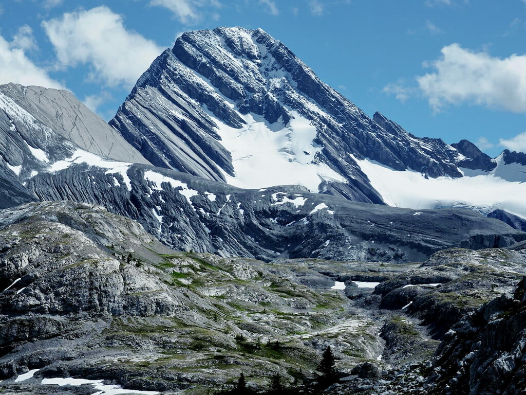
There are several notable remnants of the last glacial maximum in the middle of the range. The Haig Glacier, Robertson Glacier, and French Glacier are connected and flow between the peaks of Mount Jellicoe, Mount Robertson, and Mount French. The Lyautey Glacier is in the southern end of the range on the slopes of Mount Lyautey.
The Spray Mountains consist of alpine and subalpine regions. The climate of the range is characterized by short, cool summers and long, cold winters. Precipitation falls heaviest in the peaks and snow can persist well into summer.
The rocky alpine terrain above the tree line in the Spray Mountains hosts a delicate ecology of hardy plants and few animals. Lichens will cover rocks, sedges and heather will grow around persistent snow fields, and stunted Engelman spruce and subalpine fir will grow among the rocky outcrops. Pika and marmots will skirt the boundary between the alpine and subalpine areas, leaving only a few species of birds such as the white-tailed ptarmigan and American pipit to inhabit the peaks.
The subalpine region hosts a much greater variety of life. Dense lodgepole pine, spruce and fir forests cover the mountain slopes and valleys. Meadows covered in fescue and oat grasses are matrixed with the forests. Larch and aspen can be found along terraces and ridges, while willow and birch prefer the moist soil along the creeks. Bearberry and creeping juniper are shrubs that span the range as ground cover.
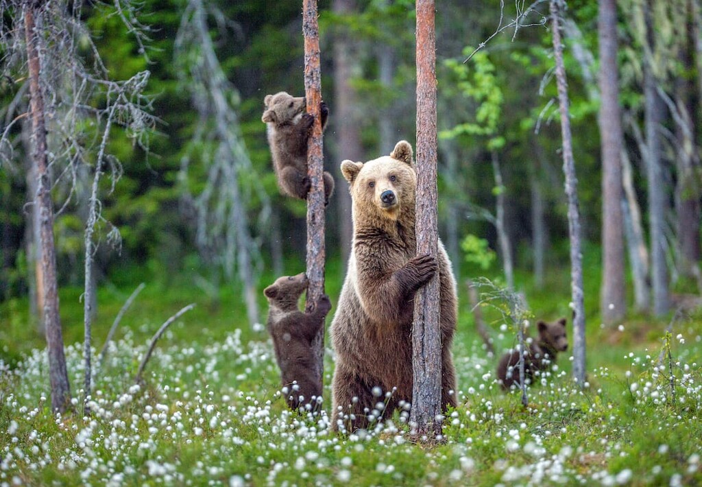
Large mammals, including grizzly bears, black bears, elk, mountain sheep, mountain goats, white-tail and mule deer, wolves, and cougars inhabit the Spray Mountains below the tree line.
The trails that used to lead to the summit of Mount Indefatigable were decommissioned in 2005 to protect the prime grizzly habitat along those mountain slopes. Grizzly and black bears migrate out of the mountains in the spring to roam and forage the valleys for food. Prime bear encounter season is when the berries are ripe in late summer.
Human habitation and use of the Spray Mountains began over 8,000 years ago. Archaeological evidence shows continuous habitation and use of the area for the last 7,000 years by the Stoney-Nakoda, Siksika, Tsuu T’ina, Kootenai, and Kainai nations.
European influence in the area grew after the Palliser Expedition charted the area between 1857 and 1861. Further development of the area increased as the transcontinental railroad was constructed from 1871 to 1885.
The year 1885 saw the beginnings of the first Canadian national park further north centered around the discovery of the Cave and Basin Hot Springs near Banff, Alberta. In short time this area was expanded and designated as Rocky Mountain National Park (now Banff National Park) and by 1902, that park was expanded again to include the Spray Mountains and surrounding areas.
Pressure from ranchers increased, and by 1911, the Spray Mountains and surrounding areas were removed from the national park so they could be used for cattle grazing. The land was turned over to the Alberta government in 1930.
The 1960s and 1970s saw an increase of people from nearby Calgary heading into the wilderness for camping and hiking. It became apparent that a wilderness area for tourism and recreation activities on the eastern slopes was needed to divert the pressure from the surrounding ranchlands. In 1972, the Alberta Wilderness Association proposed an area in the Elbow, Sheep and Kananaskis valleys as a designated wilderness area.
In 1978, Premier Peter Lougheed officially dedicated the Spray Mountains and their surrounding regions as Kananaskis Country and Kananaskis Provincial Park (now Peter Lougheed Provincial Park). Spray Valley Provincial Park contains the northern end of the range and was created in 1998 to increase the environmental protection of the area.
The current infrastructure in the Spray Mountains includes car accessible campgrounds, backcountry campgrounds, and hiking trails. There is also the Beckie Scott High Performance Training Centre located on the Haig Glacier for summertime cross-country ski training. The area has been preserved from industry to conserve the watershed, animal habitat, and tourism and recreation opportunities.
With 47 named peaks, several glaciers, three large reservoirs, and many smaller lakes, the Spray Mountains are beautiful and full of activities. Hiking trails in the Spray Mountains can range from a flat, easy stroll to very difficult with a lot of elevation gain. The following are some of the hikes and attractions in the range:
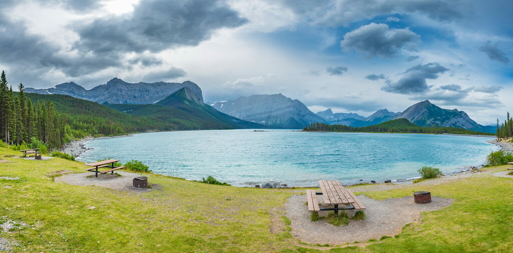
Mount Indefatigable dominates the northern shore of the Upper Kananaskis Lake, with Mount Invincible tucked in behind. Named after HMS Indefatigable and HMS Invincible in 1917, like many of the mountains in this region, they were named after ships which took part in the Battle of Jutland during World War I in 1916.
The battleships were part of the 2nd Battle Cruiser Squadron during the Battle of Jutland. HMS Indefatigable was hit by five shells from the German battleship Vonder Tann and subsequently exploded leaving two survivors of the 1,015 crew aboard the ship. The HMS Invincible met a worse fate in which there were no survivors of her destruction.
In an effort to reduce interactions with wildlife, the main trail to the three peaks of Mount Indefatigable was decommissioned in 2005 because it travels through prime grizzly bear habitat. The risk of bear encounters in this area is real and hikers and park users should always hike in groups and carry bear spray. With so many other trails in the area, hikers are strongly encouraged to explore alternate trails
Although decommissioned, the trail is still visible. It leads up the southeastern ridges to alpine meadows leading to the Outlier Peak. You can continue, with a bit of a scramble, up to the taller North Peak and loop across the western ridge to the South Peak before descending.
Upon the eastern slopes of Mount Invincible lies a road up to an abandoned gypsum mine. The trail and mine offer gorgeous views of the valley and the imposing Mount Indefatigable. It serves as an alternate trail to view the area without using the decommissioned Mount Indefatigable trail.
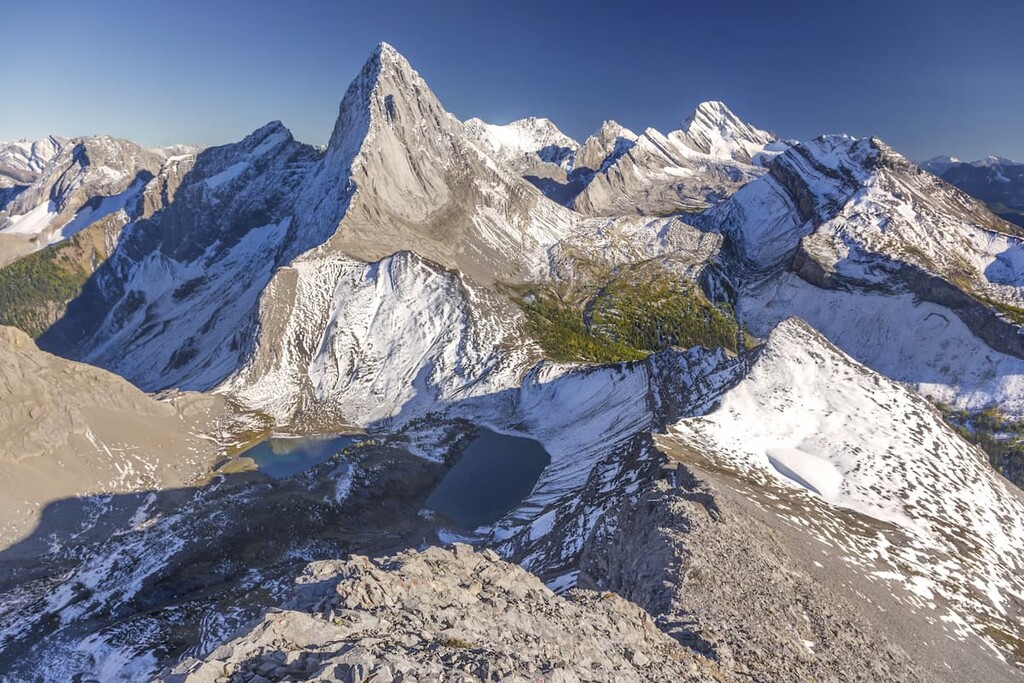
The North Kananaskis Pass and the South Kananaskis Pass flank Mount Beatty along the continental divide. The specific history regarding the discovery and the first crossings of these passes is not clear; however, they were likely used by tribal nations, such as the Kootenai, when they traveled east to hunt buffalo on the plains, and possibly by settlers as they were crossing the mountains to settle the west coast.
The loop that takes in both passes is about 50 km (31 mi) with five backcountry campgrounds along the way. Starting at one of the trailheads on the North Kananaskis Lake, you make your way around to the back of the lake past Point Campground and towards Forks Campground. At Forks, as the name implies, there is a split in the trail and creeks come together to feed the river. Heading north will take you past Turbine Canyon and its campground, while south will lead you up to Three Isle Lake and its campground.
Just beyond Turbine Canyon is the North Kananaskis Pass and just past Three Isle Lake is the South Kananaskis Pass. Both passes lead into Height of the Rockies Provincial Park in British Columbia and down in the Palliser River valley. From this valley, optional trails lead north towards Mount Assiniboine Provincial Park or further south into the Elk Range.
Whether travelling from the north or the south, the trail leads around Mount Beatty to the other pass. Near the South Kananaskis Pass, several kilometers past Three Isle Lake campground is Beatty Lake which sits at the base of a cliff in a beautiful meadow. BC Parks has built a user-maintained campsite here to contain the random camping and site degradation that was previously happening.
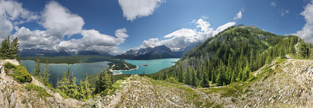
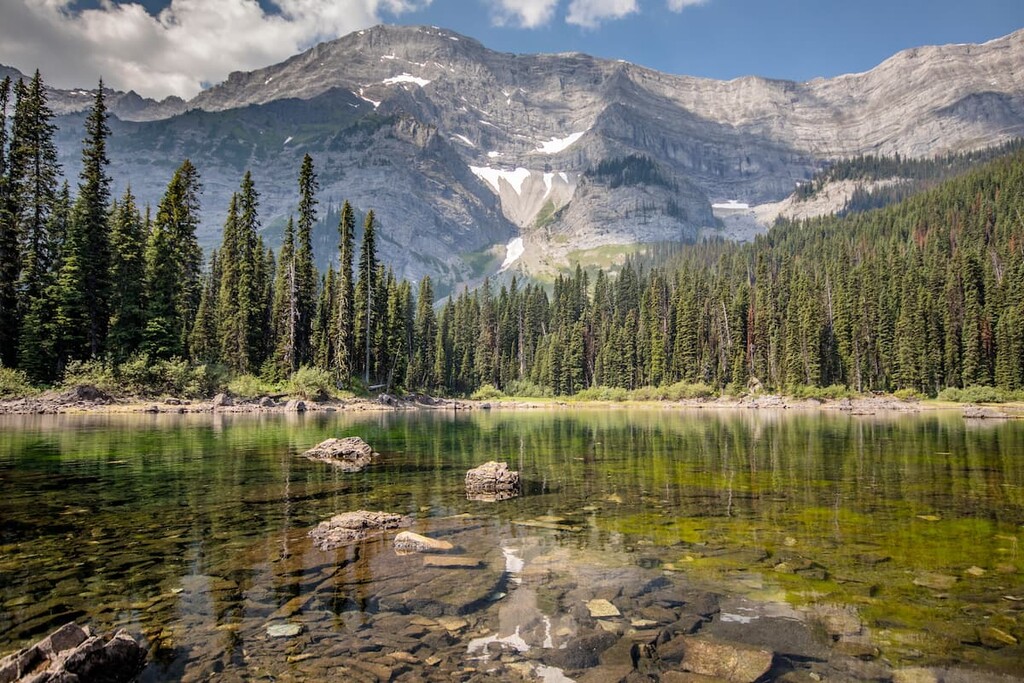
The views and experiences along this trail are countless, but here are some of them: vast mountain landscapes as you peer down river valleys, a thundering canyon waterfall, emerald and clear blue lakes that reflect the mountains and clouds, and peaceful meadows full of wildflowers. This trail can be covered in one long day of trail running or spread casually hiking over a long weekend, using the many camping options.
Located at 2,700 m (8,858 ft) and 22 km (13.7 mi) from the nearest road, the Beckie Scott Training High Performance Training Centre is a world away upon the Haig Glacier. Built in 1989, “The Haig” features dorms and a cook area which look like they belong on a lunar or martian landscape, including a rover. Virtually every elite Canadian cross-country skier and biathlete has spent at least one summer on the glacier since the High Performance Training Centre’s inception.
Staff from the center will groom various cross-country ski trails on the glacier twice a day during training season, creating loops that can measure 2 to 5 kilometers (1.2 to 3.1 mi) in length. The skiers can then ski for an hour or two in the morning before the track gets slushy and then ski again in the evening.
Teams, clubs, and groups can book through WinSport in Calgary, who runs the facility. The Beckie Scott High Performance Training Centre offers a totally unique opportunity in the mountains.
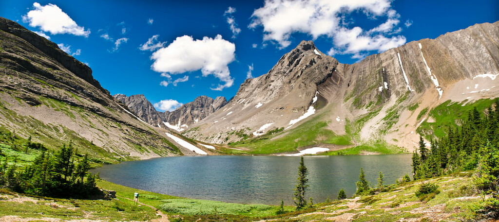
Not all of the trails in the Spray Mountains require high levels of athleticism or endurance. There are many hikes that allow you into some incredible places and are very accessible. The Mount Black Prince Cirque trail is a 4.8 km (3 mi) loop that takes you to Warspite Lake, with a view of the Black Prince Cirque. With only 178 m (584 m) of elevation gain throughout, this hike is an easy way to witness first-hand the effects of glaciation.
Starting from the trailhead off of Highway 742, this trail starts as a gentle walk along a creek through the forest and up a hill. Soon you’ll reach the interpretive loop that will take you past Warspite Lake and in view of the Black Prince Cirque. You then finish the loop and join the initial trail down the hill and to the trailhead. It is a great hike for families as there is plenty to see and great rest spots along the way.
The Spray Mountains are among the most accessible mountains in Alberta. With dozens of car accessible campgrounds nearby and many backcountry campgrounds, there are plenty of places to stay in or beside the range. Furthermore, nearby towns like Canmore and Banff offer a range of accommodation options, as does Kananaskis Village which is located right in Kananaskis Country.
Located 26 km (16 mi) south of Highway 1 on Highway 40, Kananaskis Village is an unincorporated community in Evan-Thomas PRA in the heart of Kananaskis Country. Accommodations range from a modest hostel to the more luxurious Kananaskis Lodge.
In Kananaskis Village, there are stores to buy supplies, food, and rent equipment. The village is also located at the base of the Nakiska Ski Hill and resort, which is a great winter destination.
Kananaskis Village offers hikes beginning right outside your door, such as Ribbon Lake and Troll Falls. It is a starting point for many groomed cross-country ski trails in the winter and it is the closest lodging to much of the backcountry skiing offered further south in Peter Lougheed Provincial Park.
The Kananaskis Country Golf Course is also located just south of Kananaskis Village. It was recently rebuilt after the 2013 floods which changed the face of much of Kananaskis Country. Since the fairways create enticing meadows, wildlife sightings are common and bear spray is recommended. It’s well worth a visit.
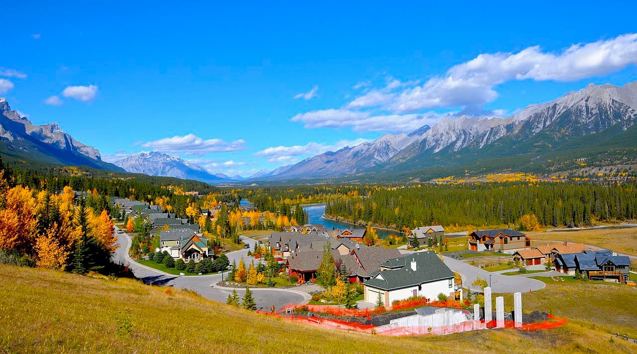
Nestled in the heart of the Bow Valley, Canmore, like many towns along the mountain railway, started as a coal mining settlement. It is located near the western edge of Banff National Park so it’s a good place to stay if you’re interested in exploring fun destinations and activities in the region.
Canmore provides easy access to hiking trails like Ha Ling Peak, Chester Lake and Grotto Canyon. In addition to hiking, Canmore offers ample opportunity for road and mountain biking.
The snow-filled months are typically the busiest months in Canmore, as it is a wonderful tourist town for the surrounding ski resorts, such as Sunshine and Lake Louise.
Located in Banff National Park and home to the famous Cave and Basin Hot Springs, Banff offers plenty of lodging and a unique mountain lifestyle experience. With amazing mountain views from the streets, such as the iconic East End of Rundle (EEOR), and the world famous Fairmont Banff Springs Hotel, Banff offers a first-class mountain experience.
From Banff, mountain trails, peaks, and phenomenal views are easily accessible on a day trip. You can then return to your luxurious lodging and end your day in one of the many spas, where you can enjoy a relaxing massage.
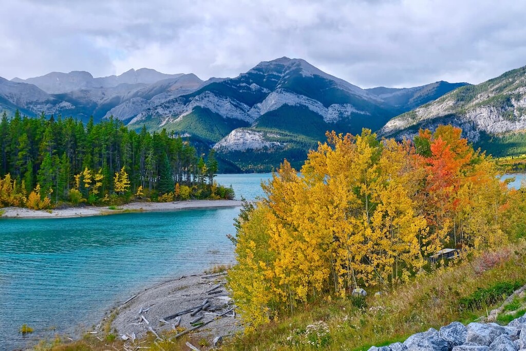
This amazing town does get busy in the summer and winter seasons. Spring and fall offer a time when the trails and sidewalks are less busy, and fall is the time when you can witness the incredible changing colors of the larch trees along the mountain ridges.
Since the town is situated within a national park, wildlife sightings are to be expected. It isn’t uncommon to see elk roam the townsite.


